
Why Pilón Lajas Biosphere Reserve and Indigenous Community Land stands out
Pilón Lajas is best known for the convergence of two exceptional qualities in a single Bolivian landscape: an unusually rich Andean-Amazonian flora and a strong, formally recognized model of indigenous co-governance over a biosphere reserve. Its mountain ridges and the Quiquibey river valley host one of the highest concentrations of vascular plant species recorded anywhere in the Beni department, with estimates suggesting the reserve could hold up to several thousand species and represent roughly 17 percent of Bolivia's known flora. Several species are endemic to Pilón Lajas itself, and neighboring highlands such as the Serranía de Pilón have been designated an Important Bird Area. The area also stands out as a refuge for large mammals that depend on extensive, connected forest, including the jucumari (Andean bear), jaguar, giant otter, and black-faced spider monkey, all benefiting from its link with Madidi.
Pilón Lajas Biosphere Reserve and Indigenous Community Land history and protected-area timeline
Pilón Lajas has a layered history of international recognition, national protection, and indigenous territorial titling that distinguishes it from most Bolivian protected areas. In 1977, UNESCO's Man and the Biosphere Programme (MAB) designated the area as a biosphere reserve, placing it among the earliest such sites in the country and giving it an international conservation framework long before national legislation codified the category in Bolivia.
The Bolivian state formally established the current reserve on April 9, 1992, through Supreme Decree 23110, creating the Reserva de Biosfera y Territorio Indígena Pilón Lajas. Five years later, in April 1997, the area was titled as a Tierra Comunitaria de Origen under the INRA Law, giving the resident indigenous communities collective property rights over a substantial share of the reserve's territory. Active administration of the reserve began in 1995, initially led by the General Directorate of Biodiversity; this was followed in 1996 by a participatory management agreement between the Ministry of Sustainable Development and the Environment, the NGO Veterinarians Without Borders, and local community organizations.
Between 1997 and the early 2000s, the reserve worked through multiple iterations of its management plan amid internal governance disputes and questions about representation on the management committee. During the same period, the reserve became a focal point for legal action against illegal logging operations within its boundaries. After administrative problems, management was transferred to the National Service of Protected Areas (SERNAP), and a renewed era of joint governance with the Tsimán-Mosetén Regional Council was consolidated.
The reserve's recent history also includes emerging mineral-extraction pressures. In 2021, official records from Bolivia's mining authority showed that the company Coboldrom SRL had acquired mining rights over 65 grid cells, equivalent to roughly 1,625 hectares, inside the reserve. Indigenous leaders publicly rejected the entry of the company, signaling an ongoing tension between extractive industries and the area's combined conservation and indigenous mandate.
Pilón Lajas Biosphere Reserve and Indigenous Community Land landscape and geographic character
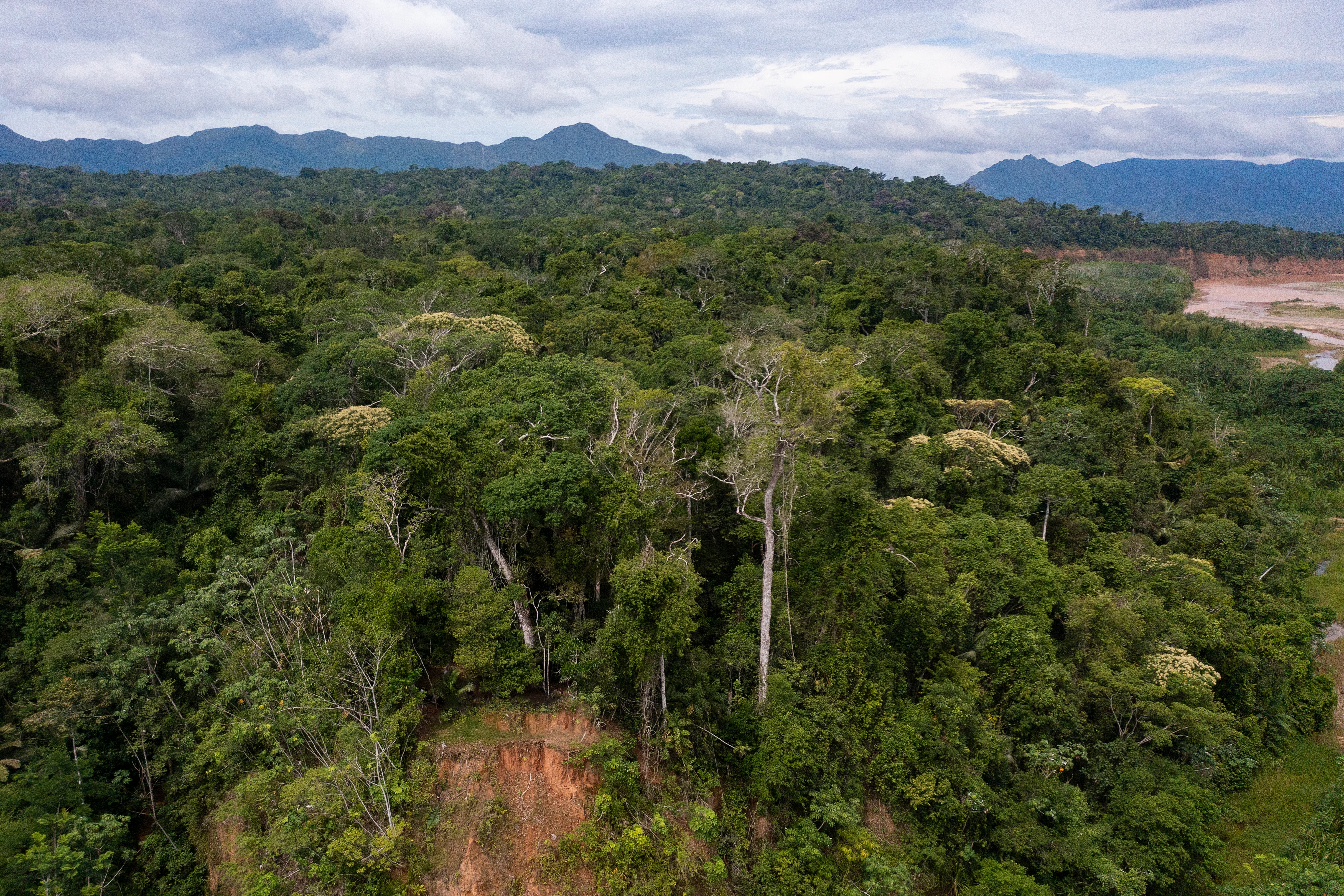
Pilón Lajas occupies one of the most physically complex protected landscapes in Bolivia, defined by the meeting of the Andes with the Amazon. The reserve runs through the sub-Andean physiographic province, where parallel mountain ranges such as the Serranías de Beu, Chepite, Eva Eva, Mosetenes, and Pilón line up along the eastern face of the Andes and reach elevations above 1,800 to 2,000 meters. Their eastern flanks descend through the sub-Andean thrust front into the floodplains of the Moxos, the vast savanna region of lowland Beni.
Geologically, the reserve is a collage of intrusive rocks, sandstones, and shales spanning the Devonian, Carboniferous, Permian, and Cretaceous, with younger deposits filling synclines in the highlands and Quaternary alluvial and colluvial sediments shaping the lowlands. Gley-type soils associated with ancient sandstones, slates, and intrusive rocks are found in parts of the lowlands, while quartzite substrates support the area's unusual montane savanna patches. The contrast between rugged ridges, deeply incised river valleys, and broad floodplains gives the reserve a strong vertical and horizontal ecological gradient within a compact footprint.
The river systems are central to the landscape character. The Quiquibey, more than 125 kilometers long, follows a sinuous course that produces meanders and oxbow lakes near its outlet into the Beni and creates the broad alluvial valley that anchors the reserve. To the south, the Alto Beni and Maniqui basins carry white, sediment-rich Andean waters toward the Beni, while the Yacuma basin drains hundreds of smaller streams into the Llanos de Moxos. Together, these waters carve the dramatic landforms, shape microclimates through persistent fog in the higher serranías, and sustain both ecological diversity and human settlement in the reserve.
Pilón Lajas Biosphere Reserve and Indigenous Community Land ecosystems, habitats, and plant life
The ecology of Pilón Lajas is shaped above all by the rise of the Andes, which intercepts humid trade winds from the northeast and produces an unusually steep gradient of vegetation within a relatively compact area. High serranías receive persistent moisture and host humid forests with abundant mosses, lichens, and epiphytes, while lower ridges support drier, more seasonal formations. The interplay of altitude, topography, geology, and soils generates one of the highest degrees of beta diversity in Bolivia, producing a finely fragmented and ecologically fragile vegetation mosaic whose long-term conservation depends on maintaining altitudinal and latitudinal connectivity.
Below roughly 700 meters, the reserve gives way to the Amazonian lowlands, where tall evergreen terra firme forests and seasonally flooded várzea forests line the Beni and Quiquibey rivers. Along the sub-Andean slopes between about 700 and 2,000 meters, the Yungas formation takes over, combining Amazonian and Andean floristic elements and supporting cloud forests rich in tree species, palms, and arborescent ferns. The mountains also harbor relict montane savanna patches that are restricted in extent but very distinctive, as well as localized palm-dominated communities.
Pilón Lajas is recognized as a floristically exceptional site: studies suggest the reserve may hold between 2,000 and 3,000 vascular plant species, potentially representing around 17 percent of Bolivia's total flora, and several species are believed to be strictly endemic to the reserve. The Serrañía de Pilón stands out even within the area as one of the most diverse montane forest sites recorded in the country.
Pilón Lajas Biosphere Reserve and Indigenous Community Land wildlife and species highlights
Pilón Lajas sits at the intersection of Amazonian and Andean faunas, and its large, connected habitat blocks allow it to support species that need extensive home ranges.
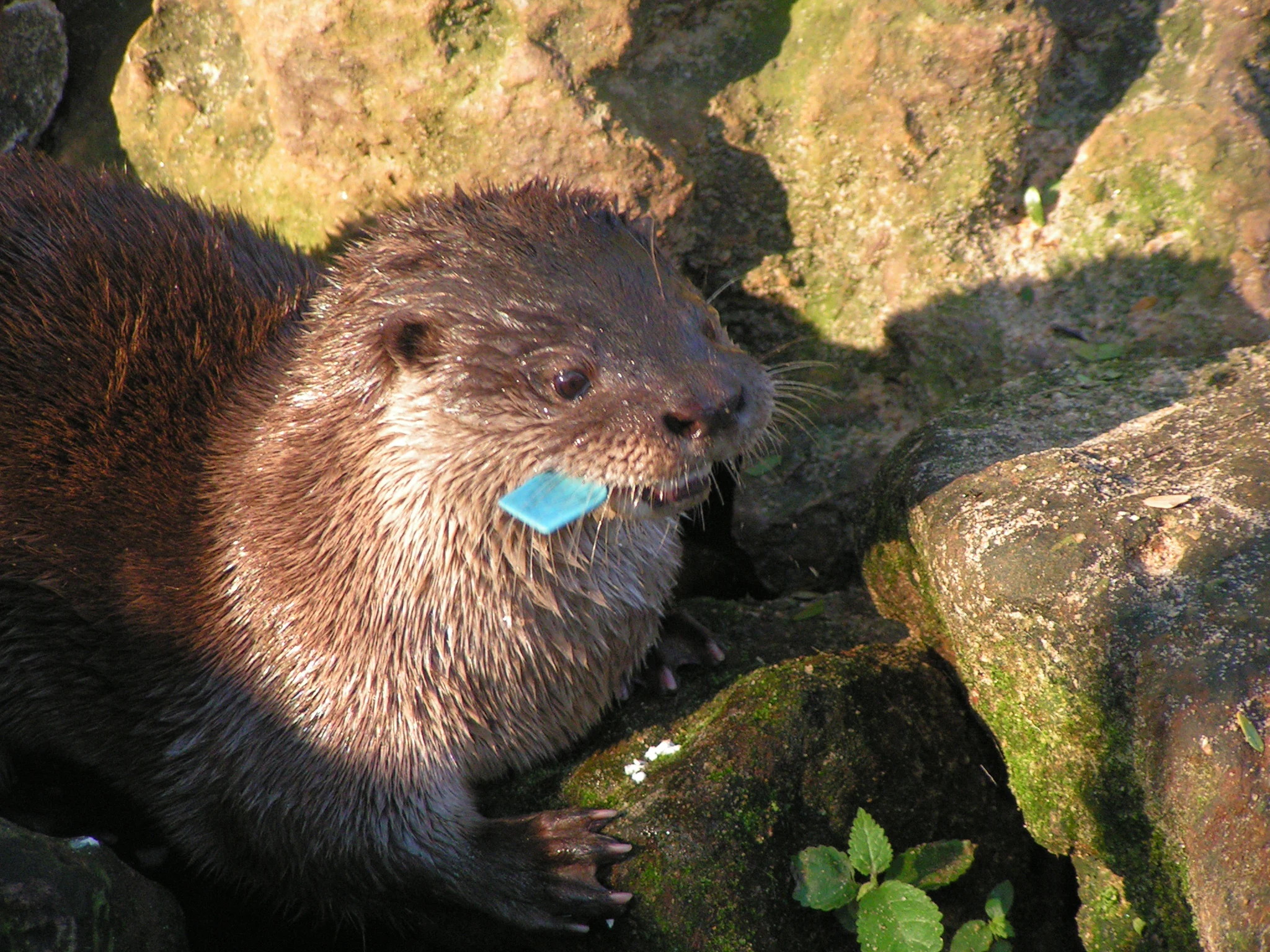
The reserve has documented roughly 749 vertebrate species, with estimates suggesting the true total could approach 1,273. Birds are by far the best-known group, with about 531 species confirmed to date, representing roughly 36 percent of Bolivia's avifauna. The Serranía de Pilón has been designated an Important Bird Area because of its exceptional richness and endemism. Mammals include at least 85 species; notable among them are threatened or hunting-sensitive species such as the giant otter, neotropical otter (or lobito de río), tapir, and black-faced spider monkey, alongside a high diversity of bats. The reserve's connection with Madidi is critical for wide-ranging carnivores such as the jaguar and for the Andean bear (jucumari), whose seasonal movements span Andean forests and adjacent lowlands.
Aquatic wildlife is also an important component of the reserve's character. More than 100 fish species have been recorded in its rivers and streams, combining clear-water Andean forms with lowland Moxos species, several of which sustain subsistence and small-scale commercial fishing. Confirmed amphibians include around 35 species, several of which remain scientifically underrepresented, while reptiles number roughly 60 species and include vulnerable turtles such as the river peta and the yellow-footed tortoise, both of which face pressure from traditional hunting and egg collection.
Pilón Lajas Biosphere Reserve and Indigenous Community Land conservation status and protection priorities
Pilón Lajas is significant from a conservation perspective because it occupies a strategic position in a trans-Andean biological corridor linking Peru, Bolivia's Yungas, and the Amazon basin. Its direct contiguity with Madidi National Park and the Beni Biosphere Reserve means that protecting Pilón Lajas effectively extends a vast block of interconnected habitat that is essential for species requiring large, intact forests.
The reserve protects watersheds that originate in the eastern serranías and feed the Beni, Mamoré, Quiquibey, Maniqui, and Yacuma river systems, contributing to both hydrological regulation and flood control downstream. Vegetation in the area is unusually rich and fragile, depending on altitudinal connectivity; protecting this connectivity is central to maintaining its floristic diversity. IUCN and UNESCO designations have reinforced its international profile, and the park's status as both a national protected area and a Tierra Comunitaria de Origen gives it unusually strong legal protection against logging, colonization, and extractive activities within its core.
Conservation effectiveness in Pilón Lajas, however, depends on continual management. Illegal logging and unplanned colonization roads during the 1990s penetrated fragile foothill areas; the 2021 award of mining rights to Coboldrom SRL inside the reserve showed that extractive pressure remains an active threat. The participation of the Tsimán-Mosetén Regional Council in co-management is widely considered a critical element in defending the reserve against these pressures and keeping its core objectives, established as the conservation of biological diversity and the improvement of living conditions for the resident indigenous communities, on track.
Pilón Lajas Biosphere Reserve and Indigenous Community Land cultural meaning and human context
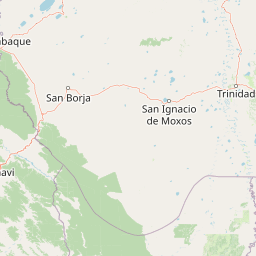
Pilón Lajas is the ancestral homeland of several Amazonian and sub-Andean peoples, most prominently the T'simán, Mosetén, and Tacana, along with smaller communities of Leco, Quechua-Apolo, and Esse Eja descendants. Family-based indigenous settlements are dispersed across about 25 communities, with most located along the piedmont road, a handful in the central Quiquibey valley, and a smaller number on the Beni river.
The reserve also hosts a growing colonist population, including migrant highland families and organized farming settlements in eight colonization centers along the Yucumo-Rurrenabaque road, a key access corridor where population pressure on the surrounding landscape is highest. Cultural continuity is embedded in the reserve's institutional structure: the indigenous land title, granted under the INRA framework as a Tierra Comunitaria de Origen, gives the Tsimán-Mosetén Regional Council the legal standing to represent communities in co-management decisions.
Archaeological sites across the area reveal a long human presence, including rock paintings, petroglyphs, ceramic fragments, lithic material, and funerary deposits, particularly along the Beni river and in the Quiquibey watershed. Local oral tradition, especially around Laguna Azul, adds another intangible layer to the cultural identity of the landscape.
Top sights and standout views in Pilón Lajas Biosphere Reserve and Indigenous Community Land
Pilón Lajas stands out as one of the few Bolivian reserves that combine UNESCO biosphere status, indigenous territorial ownership, and integration into a major Andean-Amazonian biological corridor. Its most striking features include more than 530 documented bird species, one of the highest floristic diversities recorded in the Beni department, sub-Andean cloud forests with rich epiphytic communities, and the deep, meandering Quiquibey valley with associated oxbow lakes.
Equally distinctive is its co-governance model: shared administration between Bolivia's national park service and the indigenous Tsimán-Mosetén Council is positioned as a model for conservation that links biodiversity protection with the rights and livelihoods of resident peoples. The reserve also preserves important archaeological evidence of pre-Hispanic occupation and continues to be defended by indigenous communities against emerging mining and logging pressure.
Best time to visit Pilón Lajas Biosphere Reserve and Indigenous Community Land
Pilón Lajas lies in a region with a tropical climate that is consistently warm, with average annual temperatures around 24 to 25 degrees Celsius and high humidity throughout much of the year. Rainfall averages near 2,440 mm annually, with the heaviest precipitation likely between late spring and autumn and the shortest dry period falling around June and July. The valley of the Quiquibey and the rivers draining the eastern serranías can rise and fall rapidly with rainfall events, a pattern worth keeping in mind for any river-based visit.
For visitors, the window between June and July typically offers the least rain, lower water levels, and easier river navigation, while also making it easier to access the road that borders the reserve along the Yucumo-Rurrenabaque axis. Higher elevations in the serranías, including the trails around Laguna Azul and the road toward Charal, are very often shrouded in cloud and fog regardless of season, so visitors should be prepared for cool, wet conditions above 1,500 meters at any time of year.