
Why Área Natural de Manejo Integrado Apolobamba stands out
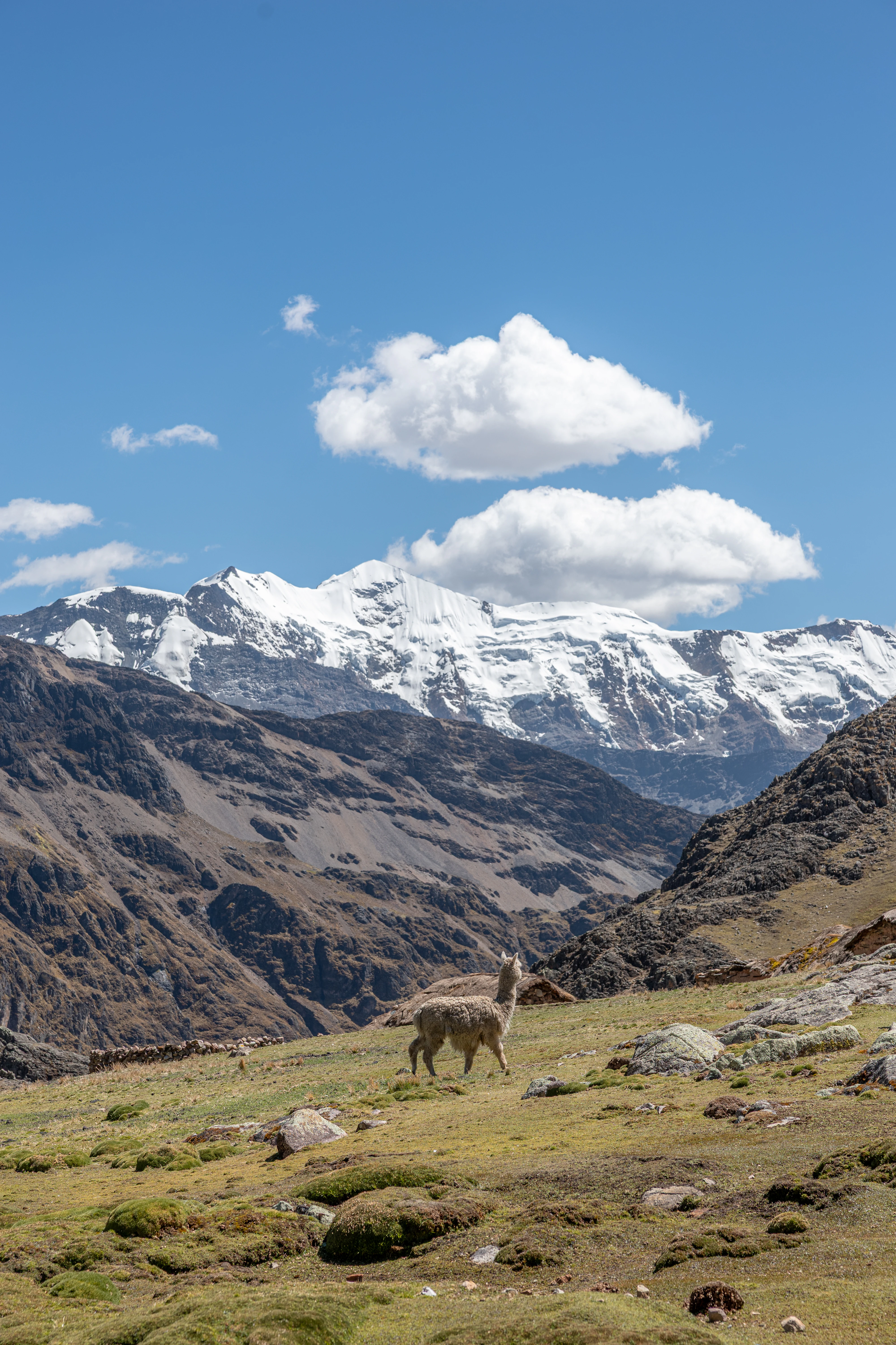
Apolobamba is best known for protecting one of the most important vicuña populations in Bolivia and for being a major stronghold of high-Andean puna, glacial landscapes, and Andean camelid conservation, tracing its conservation lineage from the historic Ulla Ulla reserve. The area equally stands out for the abrupt meeting of high cordillera and Yungas cloud forests, producing a striking landscape transition within a single protected area. Beyond large camelids, Apolobamba is recognized for its extraordinary biodiversity, particularly its avifauna, with more than 500 recorded bird species distributed across altitudinal zones from the semi-humid high Andes to lower subtropical montane forests. The park is also notable as a transition zone where Andean, Yungas, and Amazonian faunas overlap, creating an unusually rich biogeographic contact area between major South American ecological regions.
Área Natural de Manejo Integrado Apolobamba history and protected-area timeline
The history of Apolobamba as a protected area begins in 1972, when an early protected designation was established to safeguard high-Andean ecosystems and vicuña populations. That initial designation, focused on the Ulla Ulla highlands and surrounding puna, eventually evolved into the present-day Área Natural de Manejo Integrado Apolobamba. The current protected area was formally created through Supreme Decree 25652, issued on 14 January 2000 under the government of Hugo Bánzer Suárez, substantially expanding the original reserve footprint to encompass close to 4,837 square kilometers.
This expansion effectively converted the original Ulla Ulla Faunal Reserve into a much larger integrated management area that links the high Andean puna with the eastern Andean slopes and Yungas forests. The recategorization allowed for a more flexible management model that recognizes both strict conservation of fragile ecosystems and the sustainable use of areas traditionally inhabited and used by local communities. The history of Apolobamba is thus closely intertwined with the legacy of Ulla Ulla as a pioneering Bolivian reserve for vicuña conservation, and with broader shifts in Bolivian protected-area policy toward integrated management categories during the late 1990s and early 2000s.
Área Natural de Manejo Integrado Apolobamba landscape and geographic character
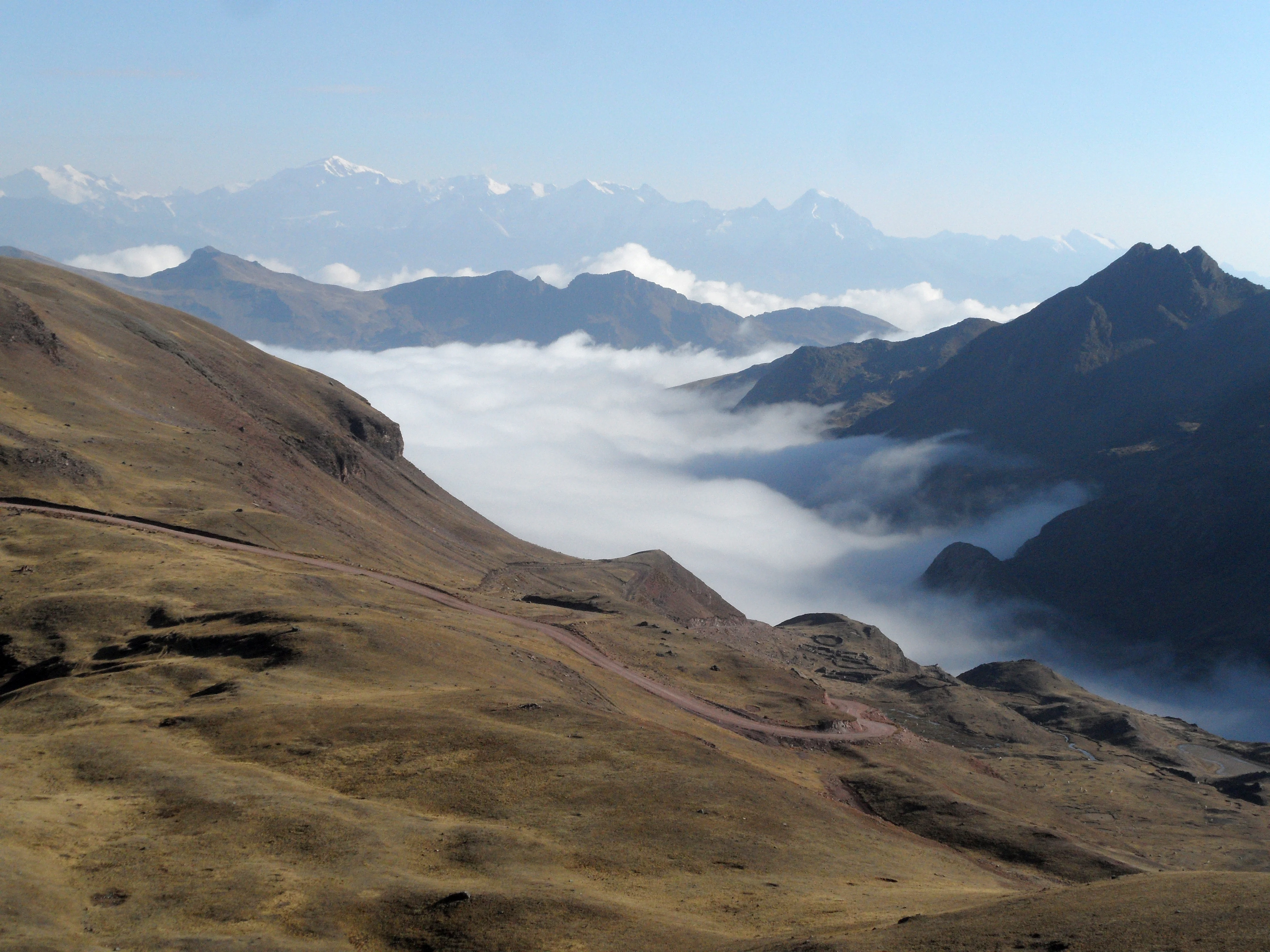
The landscape of Apolobamba is defined by an extremely steep and rugged relief that compresses a wide range of Andean environments into a relatively compact geographic space. Elevations ascend from about 1,000 meters in the eastern Yungas valleys to peaks above 5,400 meters in the Cordillera de Akamani and the broader Cordillera de Apolobamba. Much of the protected area lies above 2,500 meters, and most of its terrain is shaped by strong slopes, deep dissection, and the combined influence of tectonic uplift, Quaternary glaciation, and ongoing river erosion.
Four broad physiographic zones can be recognized within the area. The Andean Zone runs as an elongated belt of high summits, volcanic massifs, snow-covered peaks, and steep eastern slopes plunging toward the Amazon basin. The Sub-Andean Zone consists of folded and eroded ancient sedimentary rocks that produce irregular hills and narrow valleys. The Andean Piedmont features extensive alluvial fans and dejection cones that descend gradually toward the lowlands, while the Alluvial-Lacustrine Plain includes low terraces, paleo-channels, and marshy surfaces tied to the complex fluvial dynamics of the area.
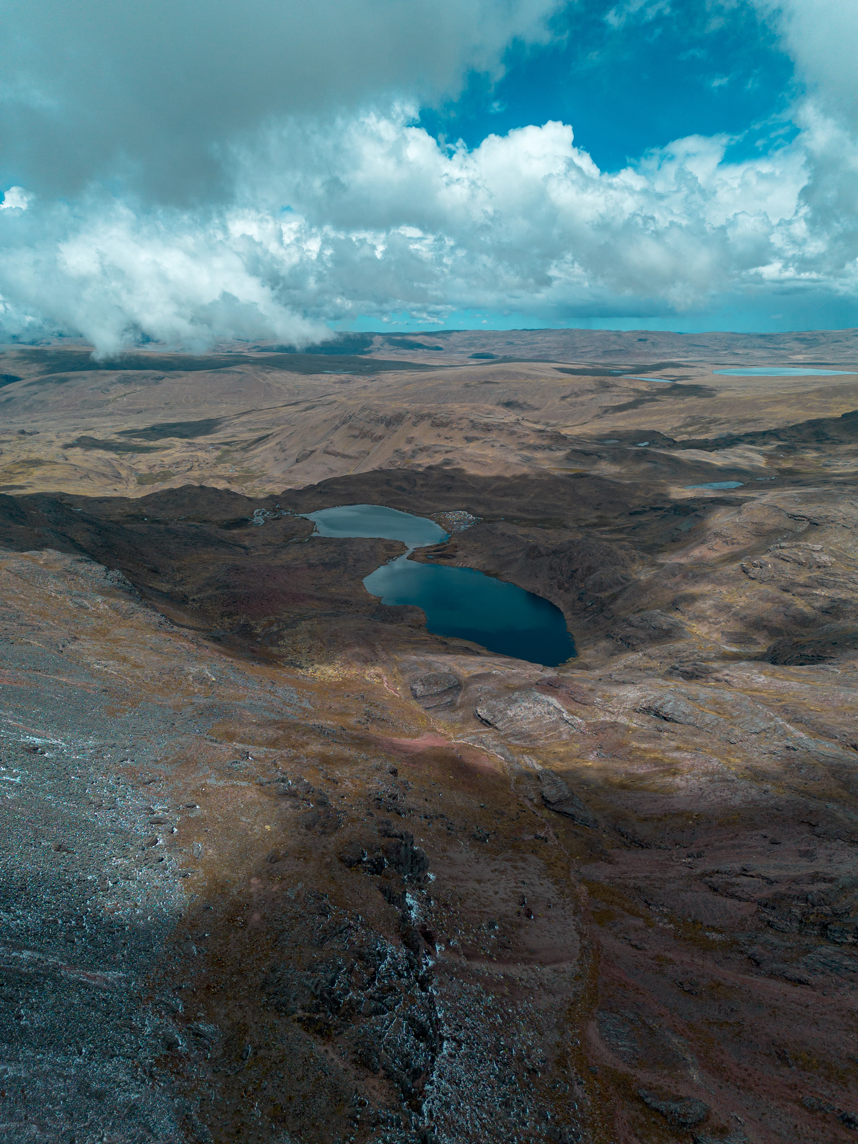
Geomorphologically, the Cordillera de Apolobamba itself is dominated by glacial and periglacial landforms, with U-shaped valleys, lateral and frontal moraines, pronounced escarpments, and slopes frequently steeper than 30 degrees. To the west lies the Ulla Ulla Altiplano, characterized by glacial and fluvio-glacial deposits, moraines, dejection cones, peatlands, and high-altitude lagoons. In areas such as Charazani, Tolacota, and Putina, the landscape mixes peri-glacial mountain forms, detrital deposits, cultivated terraces, and active glacial erosion. The result is a mosaic of structural, denudational, fluvial, glacial, fluvio-glacial, and even biologically originated landforms, among which the high-altitude bofedales (peatlands) form a distinctive feature on flat surfaces where the water table approaches the surface.
Área Natural de Manejo Integrado Apolobamba ecosystems, habitats, and plant life
Apolobamba supports an exceptionally rich and complex ecological profile, owing to its steep altitudinal gradient and the convergence of Andean and Yungas biogeographic influences. The area falls mainly within the Yungas and Northern Puna ecoregions, with smaller contributions from the Inter-Andean Dry Forests ecoregion. Within this framework, the vegetation transitions from high Andean and subnival formations, through puna grasslands, bofedales, and Yungas páramo, down to inter-Andean dry valleys, Polylepis woodlands, montane cloud forests, humid montane forests at multiple elevational belts, dry montane forests, mountain savannas, and riparian woodlands along rivers and streams.
Botanical studies, intensified after the 2000 recategorization of the protected area, have recorded roughly 1,701 species of vascular plants distributed across about 735 genera and 180 families, a figure that significantly exceeds earlier inventories. The humid montane forests and the Yungas páramo host the highest concentrations of species, while Polylepis woodlands and high-Andean grasslands add further ecological distinctiveness. The flora also includes new records for science, narrowly endemic taxa, and at least 12 species classified under some threat category by the IUCN or under CITES, particularly tree ferns, forest species, and cacti.
Ecological pressures within the park are significant. Overgrazing, recurrent burning, agricultural expansion, extraction of firewood and timber, and mining activities all affect the vegetation, with impacts especially visible in Polylepis woodlands, puna grasslands, and montane forests. At the same time, the altitudinal and biogeographic complexity of Apolobamba produces habitat heterogeneity that supports exceptionally rich fauna, making the park a key conservation reference for the northwestern Andean-Yungas transition in Bolivia.
Área Natural de Manejo Integrado Apolobamba wildlife and species highlights
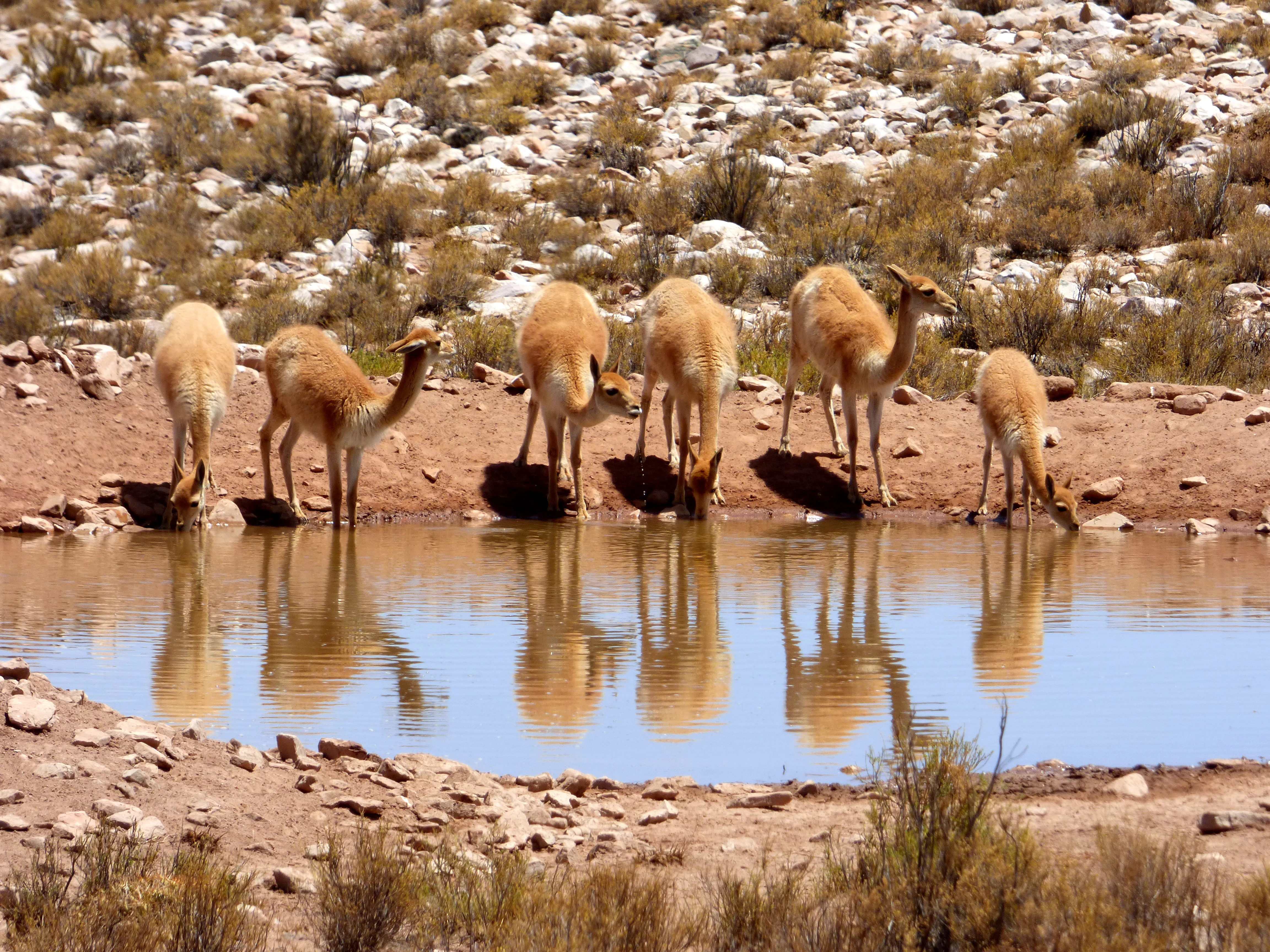
Apolobamba functions as a major biogeographic crossroads where Andean, Yungas, and Amazonian faunas overlap, producing high species diversity and numerous distribution limits within a single protected area. Mammal studies have documented close to 90 species, including conservation-priority species such as the taruca (Andean deer), puma, jaguar, vicuña, and spectacled bear (jucumari), alongside notable records of the Andean white-tailed deer and the mountain paca. The high-Andean portion of the park serves as an important refuge for species that are poorly represented or in poor conservation status in other Bolivian protected areas.
The avifauna is particularly rich, with around 508 recorded species distributed across three main ornithological zones: the semi-humid high-Andean belt, the montane forest of the eastern slope, and the lower subtropical montane forest. Species richness increases toward lower elevations, with the lower humid montane forests hosting the highest diversity, while Polylepis woodlands and Yungas páramo support a smaller but ecologically distinctive set of species. The area harbors range-restricted and globally noteworthy birds such as the Royal Cinclodes, a high-Andean passerine of strong conservation interest.
Herpetofauna in Apolobamba is less well studied but includes amphibians from families such as Bufonidae, Dendrobatidae, Hylidae, and Leptodactylidae, as well as reptiles from the orders Sauria and Ophidia, comprising lizards and snakes typical of high-Andean and transitional environments. The ichthyofauna is split between two major systems: native species such as Orestias agassii and Trichomycterus inhabit the Lake Titicaca basin on the Suches side, while the eastern slope supports fish adapted to steep Andean rivers. Uncontrolled introduction of rainbow trout into multiple water bodies has negatively affected native fish populations and stands out as one of the main conservation concerns for the park's aquatic ecosystems.
Área Natural de Manejo Integrado Apolobamba conservation status and protection priorities
Conserving Apolobamba matters because the area protects an unusually complete altitudinal gradient of Andean and Yungas ecosystems, including habitats that are otherwise under strong pressure elsewhere in Bolivia. The park safeguards large extensions of high-Andean puna, bofedales, Polylepis woodlands, montane cloud forests, and humid lower montane forests, all within a continuous landscape that connects with the Madidi complex to the north. This makes Apolobamba a critical node in one of the most important conservation corridors in the Tropical Andes.
At the species level, the park is especially significant for the conservation of the vicuña, hosting one of Bolivia's most important populations inherited from the former Ulla Ulla reserve. It is also a refuge for threatened mammals such as the taruca, the Andean white-tailed bear (jucumari), the Andean white-tailed deer, and wide-ranging carnivores like the puma and jaguar, whose persistence requires extensive connected habitats. The avifauna includes range-restricted species such as the Royal Cinclodes, while the flora includes at least 12 species under threat assessments from the IUCN and CITES, including tree ferns, forest trees, and cacti.
The area's conservation challenges are substantial. Overgrazing, recurrent burning, agricultural expansion, extraction of firewood and timber, and mining activities place pressure on Polylepis woodlands, puna grasslands, and montane forests, while the introduction of rainbow trout into Andean lakes and rivers threatens native fish faunas. As an Integrated Management Natural Area, Apolobamba explicitly aims to reconcile strict ecological protection with the sustainable use of landscapes and species, including traditional camelid grazing and regulated vicuña management, making conservation outcomes closely tied to the well-being of local high-Andean communities.
Área Natural de Manejo Integrado Apolobamba cultural meaning and human context
Apolobamba is deeply intertwined with high-Andean cultural traditions rooted in camelid herding and mountain agriculture. Communities in the highland municipalities such as Pelechuco, Charazani, and surrounding areas have long relied on the puna grasslands and bofedales for grazing llamas, alpacas, and sheep, with vicuña management adding an additional layer of cultural and economic significance inherited from the historic Ulla Ulla reserve. The park's western sector reflects this Andean highland identity with gently undulating plains, glacially influenced deposits, and traditional land-use patterns, while its eastern sector represents a more abrupt Andean landscape with steep valleys and younger topography.
The protected area's status as an Integrated Management Natural Area explicitly acknowledges the presence of these communities and the importance of maintaining sustainable traditional land uses alongside strict ecological protection. Local livelihoods are tightly connected to the seasonal dynamics of the puna, the health of bofedales, and the availability of high-altitude pastures, making the cultural landscape inseparable from the ecological one. Apolobamba thus represents not only a major natural reserve but also a living high-Andean cultural landscape where traditional knowledge and biodiversity conservation intersect.
Top sights and standout views in Área Natural de Manejo Integrado Apolobamba
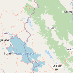
Apolobamba stands out for combining extreme altitudinal diversity, from Yungas forests around 1,000 meters to peaks above 5,400 meters, with the protection of one of Bolivia's most important vicuña populations. Its position adjoining Madidi makes it a key anchor of a large Andean-to-Amazon conservation corridor, while its geography spans the divide between the Titicaca endorheic system and the Amazon basin via the Beni River watershed.
The area is also distinguished by exceptional plant and bird diversity, with roughly 1,700 vascular plant species and over 500 bird species documented across altitudinal gradients that meet Andean, Yungas, and Amazonian influences. From glacial U-shaped valleys and moraines in the Cordillera de Apolobamba to bofedales, Polylepis woodlands, cloud forests, and dry inter-Andean valleys below, Apolobamba packs an unusually broad spectrum of Andean habitat types into a single, strongly contrasting landscape.
Best time to visit Área Natural de Manejo Integrado Apolobamba
Seasonal conditions in Apolobamba strongly shape both landscape character and ecological experience. Most rainfall in the area concentrates during the austral summer, roughly December through March, when the southward shift of the Intertropical Convergence Zone brings wetter, more vegetated conditions to the Yungas slopes and intensifies flows in rivers such as the Mapiri and Tuichi. During these months, lower montane forests appear lush and waterfalls and river discharges are at their highest, while higher Andean areas may become cloudier and access more challenging.
The austral winter, broadly May through August, brings a marked decrease in atmospheric moisture and precipitation. Glacial and high-altitude landscapes become more visible under clearer skies, and high-altitude bofedales and pastures retain water supplied by glacial melt and slow hydrological responses, particularly in the Suches basin. For visitors interested in stable conditions, clearer mountain views, and Andean highland landscapes, the drier season tends to provide more accessible conditions, while those focused on the Yungas forests and river dynamics may find the wet season more rewarding.