Mori Atlas logo
National parkCerros de Amotape National Park

Discover the mapped boundaries and diverse terrain of this critical Pacific tropical forest remnant.

Cerros de Amotape National Park: Peru's Protected Landscape and Geographic Atlas

(Parque Nacional Cerros de Amotape)

Cerros de Amotape National Park represents a vital protected landscape in northern Peru, safeguarding the unique Tumbes-Piura dry forests and Pacific tropical forest ecosystems. Spanning the Cordillera de los Amotapes, the park's terrain ranges from river valleys to mountain peaks, offering a rich geographic context. This page serves as an atlas entry for the park, detailing its mapped boundaries and the diverse natural features that define this important conservation area.

National ParkPeruTumbes-Piura Dry ForestsPacific Tropical ForestCordillera de los AmotapesTumbes River

Cerros de Amotape National Park

National park

Park overview

Structured park overview, official facts, and landscape profile for Cerros de Amotape National Park

Cerros de Amotape National Park park facts, protected area profile, and essential visitor context
Review the core facts for Cerros de Amotape National Park, including designation, size, terrain, visitor scale, habitats, and operating context in one park-focused overview.

About Cerros de Amotape National Park

Cerros de Amotape National Park represents one of the most significant protected areas in northern Peru's coastal region, preserving a unique blend of dry forest and tropical forest ecosystems that have been largely transformed elsewhere in the country. The park's location at the northern tip of Peru places it at the convergence of multiple ecological zones, creating a biodiversity-rich environment that supports species more commonly associated with Central American and western Amazonian habitats. The Cordillera de los Amotapes, the mountain range that forms the park's core, rises from the coastal lowlands to elevations exceeding 1,500 meters, creating diverse microclimates and habitat niches. This topographic complexity, combined with the presence of the Tumbes River, makes the park a critical refuge for wildlife in a region where agricultural expansion has dramatically reduced natural habitat. The park is managed by SERNANP, Peru's national protected areas service, and functions not only as a biodiversity sanctuary but also as a living laboratory for ecological research and environmental education. Visitors can explore the park through hiking trails in the buffer zone, with the option to rent mules for longer treks into the interior, while the Tumbes River offers canoeing opportunities for those seeking to experience the park's aquatic environments.

Quick facts and research context for Cerros de Amotape National Park

Cerros de Amotape National Park covers 151,561 hectares along the border between Piura and Tumbes regions in northern Peru. The park protects the Cordillera de Amotapes mountain range and the Tumbes River, the only navigable river on the Peruvian coast. Established in 1975, the park sits at elevations between 120 and 1,538 meters, with a rainy season from December through April and mean annual temperatures ranging from 23 to 26 degrees Celsius. The protected area spans the transition between the Tumbes-Piura dry forests ecoregion and the southern reaches of the Pacific Tropical Forest, supporting remarkable biodiversity in both terrestrial and aquatic habitats.

Park context

Deeper park guide and search-rich context for Cerros de Amotape National Park

Cerros de Amotape National Park history, landscape, wildlife, and travel context
Explore Cerros de Amotape National Park through its history, landscape character, ecosystems, wildlife, conservation priorities, cultural context, and seasonal travel timing in a structured park guide built for atlas discovery and search intent.

Why Cerros de Amotape National Park stands out

Cerros de Amotape National Park is best known for protecting some of the most intact remnants of the Tumbes-Piura dry forests and Pacific tropical forests in Peru. The park preserves critical habitat for jaguar and ocelot populations in the northern coastal region, as well as the endangered American crocodile in its river systems. The park's location at the southern end of the Pacific Tropical Forest ecoregion makes it a biodiversity hotspot, with 111 documented bird species including the grey-backed hawk and grey-cheeked parakeet. The Tumbes River, unique as the only navigable river on Peru's Pacific coast, flows through the park and supports both the American crocodile and neotropical otter populations.

Cerros de Amotape National Park history and protected-area timeline

Cerros de Amotape National Park was officially established on July 22, 1975, making it one of the older national parks in Peru's modern protected areas system. The creation of the park reflected growing recognition in the 1970s of the need to preserve the unique dry forest ecosystems of northern Peru, which had been subject to increasing pressure from agricultural development and logging. The park was designated as an IUCN Category II protected area, reflecting its primary purpose of protecting natural ecosystems while allowing for sustainable use in designated zones. Since its establishment, the park has served as a cornerstone of Peru's efforts to conserve the Tumbes-Piura dry forests, an ecoregion that extends across the border into Ecuador and represents the southernmost extent of the Pacific Tropical Forest. The park's establishment also acknowledged the ecological significance of the Tumbes River, the only navigable river on Peru's Pacific coast, which provides critical habitat for aquatic species including the endangered American crocodile.

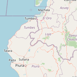
Cerros de Amotape National Park landscape and geographic character

The landscape of Cerros de Amotape National Park is defined by the Cordillera de los Amotapes, a mountain range that rises steeply from the coastal plains of northern Peru. The terrain ranges from flat river valleys at around 120 meters elevation to mountain peaks reaching 1,538 meters, creating a varied topography of ridges, valleys, and steep slopes. The Tumbes River, the only navigable river on Peru's Pacific coast, traverses the park and provides a verdant corridor of riparian habitat through the otherwise dry landscape. The park spans a transition zone between the coastal desert and the tropical forest belt, resulting in a mosaic of habitat types. In the lower elevations, the landscape features tropical dry forest with scattered trees and seasonally dry streams, while higher elevations support more humid conditions with denser forest cover. The park's position in the southern portion of the Pacific Tropical Forest means that the landscape receives seasonal rainfall between December and April, with the southern and western areas of the park receiving less precipitation than the northern sections.

Cerros de Amotape National Park ecosystems, habitats, and plant life

The ecological character of Cerros de Amotape National Park is defined by its position at the southern edge of two major ecoregions: the Tumbes-Piura dry forests and the Pacific Tropical Forest. The tropical dry forest zone, receiving approximately 500 millimeters of annual precipitation, features deciduous and semi-deciduous tree species adapted to seasonal drought, while the Pacific tropical forest zone receives higher rainfall of around 1,450 millimeters annually and supports more dense, evergreen vegetation. The park's elevational gradient creates additional ecological zonation, with different species assemblages found at various altitudes. The Tumbes River and its tributaries provide aquatic habitats that support species more typical of tropical river systems, including the endangered American crocodile. The forest composition includes notable tree species such as Ceiba trischistandra with its distinctive swollen trunk, Prosopis pallida adapted to dry conditions, and valuable timber species in the genus Cedrela. The park's biodiversity significance is amplified by its location at a biogeographic crossroads where species from Central America, the Amazon, and the Andes meet.

Cerros de Amotape National Park wildlife and species highlights

Cerros de Amotape National Park supports a remarkable diversity of wildlife despite its relatively small size compared to other Peruvian protected areas. The mammal community includes several species of significant conservation concern, with the jaguar and ocelot representing the apex predators in the park's terrestrial ecosystems. The park also supports populations of mantled howler monkeys and white-fronted capuchins, which move through the forest canopy and serve as indicators of forest health. Smaller mammals include the red brocket, white-tailed deer, Guayaquil squirrel, and the semi-aquatic neotropical otter, which along the Tumbes River represents an important population in the northern Peru region. The bird fauna is particularly diverse, with 111 species documented including the grey-backed hawk, grey-cheeked parakeet, blackish-headed spinetail, and slaty becard. The park is perhaps most notable for its population of American crocodiles, an endangered species that finds critical habitat in the Tumbes River. This combination of large carnivores, primates, and crocodiles makes the park a priority site for conservation in the Pacific coastal region of South America.

Cerros de Amotape National Park conservation status and protection priorities

Cerros de Amotape National Park plays a critical role in the conservation of Peru's Pacific coastal ecosystems, protecting what remains of the historically extensive Tumbes-Piura dry forests and Pacific tropical forests. The park's designation as an IUCN Category II protected area recognizes its primary function of preserving natural ecosystems, though it also allows for sustainable activities such as hiking, research, and nature observation. The park faces significant conservation challenges, including pressure from livestock grazing within the protected area, illegal wood extraction for construction and charcoal production, hunting of wildlife, and overfishing in the Tumbes River. Additional threats include pollution from agricultural runoff, litter left by visitors, and the introduction of invasive plant species that can alter native ecosystem dynamics. Conservation efforts focus on managing these threats while maintaining the park's ecological integrity and supporting scientific research that can inform adaptive management strategies.

Cerros de Amotape National Park cultural meaning and human context

While Cerros de Amotape National Park is primarily valued for its ecological significance, the protected area exists within a region of human activity and historical land use. The Tumbes Region has a complex history involving pre-Columbian cultures and later Spanish colonization, though the park itself does not contain major archaeological sites of documented significance. Local communities in the surrounding areas maintain traditional land use practices, including small-scale agriculture and livestock keeping, which have shaped the landscape surrounding the protected area. The park's buffer zones and Checkpoints provide opportunities for visitors to experience the natural environment while respecting the park's conservation mandate, and the research facilities at El Caucho allow for scientific collaboration and environmental education.

Top sights and standout views in Cerros de Amotape National Park

The defining features of Cerros de Amotape National Park include its unique position protecting the southernmost Pacific tropical forests in Peru, the presence of the Tumbes River as the only navigable river on the Peruvian Pacific coast, and populations of jaguar and American crocodile that represent significant conservation achievements. The park's elevational range from 120 to 1,538 meters creates diverse habitats within a relatively compact area, supporting both dry forest and tropical forest ecosystems in close proximity. The Cordillera de los Amotapes provides scenic mountain landscapes, while the river corridors offer opportunities for canoeing and wildlife observation. With 111 documented bird species and notable mammal diversity including multiple primate species, the park offers exceptional wildlife viewing potential for visitors interested in the unique biodiversity of northern Peru's coastal region.

Best time to visit Cerros de Amotape National Park

The optimal time to visit Cerros de Amotape National Park aligns with the dry season, which runs from May through November and offers more predictable weather conditions for outdoor activities. During this period, rainfall is minimal and trail conditions are generally favorable for hiking and exploration. The rainy season from December to April brings more challenging conditions, though the forest becomes more lush and bird activity can increase during and after rainfall events. Mean annual temperatures range from 23 to 26 degrees Celsius, meaning the climate remains warm year-round, though the cooler months from June to September may offer more comfortable conditions for physical activities. Visitors interested in wildlife viewing should note that the dry season can make animals more concentrated around water sources, while the wet season may provide richer vegetation but more difficult access to remote areas of the park.

Park location guide

Geography guide, regional context, and park location map for Cerros de Amotape National Park

Cerros de Amotape National Park park geography, regions, and map view in Peru
Understand where Cerros de Amotape National Park sits in Peru through a broader geographic reading of the surrounding landscape, nearby location context, and its mapped position within the national park landscape.

How Cerros de Amotape National Park fits into Peru

Peru is a megadiverse country in western South America with a population of over 34 million. It spans three distinct geographic regions: the Pacific coastal desert in the west, the Andes mountains running north to south, and the Amazon rainforest in the east. The country has one of the longest histories of civilization in the world, tracing back to the Caral-Supe civilization of the 10th millennium BCE, and was home to the Inca Empire before Spanish colonization in the 16th century.

Wider geography shaping Cerros de Amotape National Park in Peru

Peru is located in western South America along the Pacific coast. The country encompasses three major geographic regions: the coastal desert plains along the Pacific, the Andes mountain range extending from north to southeast, and the Amazon basin rainforest in the eastern interior. It shares borders with Ecuador and Colombia to the north, Brazil to the east, Bolivia to the southeast, and Chile to the south.

Map view of Cerros de Amotape National Park

Use this park location map to pinpoint Cerros de Amotape National Park in Peru, understand its exact geographic position, and read its mapped placement within the surrounding landscape more clearly.

Pigeon | © OpenStreetMap contributors

Location context for Cerros de Amotape National Park

Piura RegionTumbes Region
Park atlas

Trace the mapped geography, comparing surrounding protected areas and diverse conservation landscapes across northern Peru's unique ecosystems.

Explore Related National Parks and Protected Areas Near Cerros de Amotape National Park
Continue your atlas exploration beyond Cerros de Amotape National Park by discovering other national parks and protected areas across northern Peru's diverse dry forest and tropical ecosystems. Compare their unique mapped geography and conservation landscapes to understand regional biodiversity and the interconnected protected-area systems in this vital ecoregion.
National parkZamora Chinchipe

Yacurí National Park: Protected Andean Lakes and Volcanic Landscape in Zamora Chinchipe

Discover highland geography and the ancient Inca Trail.

Yacurí National Park is a key protected landscape in Ecuador's southern Andes, celebrated for its remarkable collection of over 46 high-altitude lakes set within dramatic volcanic terrain. Situated in Zamora Chinchipe province, the park preserves a vital stretch of the Inca Trail, complete with archaeological sites. This national park offers a rich exploration of Andean geography, páramo ecosystems, and significant cultural heritage, making it a cornerstone of the region's protected areas.

Area
431 km²
Established
2009
IUCN
II
National parkEcuador

Podocarpus National Park: Ecuador's Diverse National Park and Protected Landscape

Discover elfin forests, paramo, and over 100 lagoons.

Podocarpus National Park, situated in southeastern Ecuador, stands as a prime example of a protected natural area at a unique biogeographic crossroads. This national park spans dramatic elevational zones, from montane rain forests to high-elevation paramo ecosystems dotted with more than 100 lagoons, offering rich mapped landscape exploration. Its significance lies in the convergence of four distinct ecological systems, contributing to exceptional biodiversity and a rich tapestry of natural terrain.

Area
1,462.8 km²
Established
1982
IUCN
II
National parkCajamarca Region

Cutervo National Park: Peru's Oldest National Park Atlas and Protected Landscape

Andean Montane Forests and Mapped Geography of a Pioneering Protected Area

As Peru's oldest national park, established in 1961, Cutervo National Park offers a unique glimpse into the protected geography of the northern Peruvian Andes. Located in the Cajamarca Region, it preserves diverse Andean montane forests and páramo grasslands across a significant elevation gradient from 1,550 to 3,500 meters. This page details the park's landscape, including its role as a headwater conservation area and its position within a critical South American ecoregion, providing rich context for geographic and protected-area exploration.

Area
82.14 km²
Established
1961
IUCN
II
National parkEcuador

Sumaco Napo-Galeras National Park: Ecuador's Volcanic National Park Landscape

Explore protected areas and biodiversity in the Andean-Amazon transition.

Sumaco Napo-Galeras National Park protects a dramatic volcanic landscape in Ecuador, showcasing a significant elevation gradient that supports diverse cloud forest and Amazonian rainforest habitats. This national park is recognized for its endemic species and rich avifauna, offering a compelling case study for understanding protected land geography and ecological transitions within South America.

Area
2,067.49 km²
Established
1994
IUCN
II
Protected areaNariño

La Corota Island Flora Sanctuary: A Unique Protected Area within Colombia's Nariño Region

Explore its Andean cloud forest landscape and mapped island geography.

La Corota Island Flora Sanctuary is a critical protected area in Nariño, Colombia, celebrated for its distinctive status as the country's only lake island ecosystem supporting old-growth Andean cloud forest. This compact sanctuary provides a unique landscape context, safeguarding endemic plant species and diverse birdlife within its mapped boundaries. Its presence within Laguna de la Cocha highlights a special convergence of wetland and forest geography, offering insights for atlas exploration of protected lands.

Area
0.152 km²
Established
1977
IUCN
II
National parkPeru

Güeppi-Sekime National Park: Protected National Park Atlas in Peru

Mapped landscape and regional geography of this Amazonian protected area.

Güeppi-Sekime National Park is a prominent protected area in Peru, recognized as a national park safeguarding a substantial expanse of tropical forest. Its landscape is characterized by diverse terrain, including rolling hills and seasonally inundated lowlands, vital for a rich tapestry of flora and fauna. The park's strategic location on the Ecuador border underscores its importance for transboundary conservation and ecological connectivity within the western Amazon basin. This page offers detailed information on its protected area identity, geographic context, and the mapped natural features that define this significant conservation landscape.

Area
2,036 km²
Established
2012
IUCN
II
National parkPeru

Sierra del Divisor National Park: Peru's Sacred Amazonian Protected Landmark

Explore dramatic mountain terrain and protected lowland rainforest.

Sierra del Divisor National Park in Peru is a vital protected area conserving over 1.35 million hectares of Amazon rainforest. Characterized by the unique Sierra del Divisor mountain range and the sacred pyramid peak of Cerro El Cono, the park offers a distinct landscape within the broader Amazon basin. As one of Peru's newer national parks, it represents a significant commitment to preserving critical biodiversity corridors and understanding the geographic context of protected lands in a region facing environmental pressures.

Area
13,544.8 km²
Established
2015
IUCN
II
National parkPasco Region

Yanachaga, Chemillén National Park: Protected Area in Pasco Region, Peru

Mapped terrain, Pleistocene refuge, and rich biodiversity.

Yanachaga, Chemillén National Park, a national park situated in Peru's Pasco Region, preserves over 122,000 hectares of mountainous cloud forest and rainforest ecosystems. Its landscape is characterized by dramatic canyons and steep forested slopes, creating significant altitudinal variation from 460 to 3,643 meters. Recognized as a Pleistocene refuge, the park shelters ancient forest remnants and harbors exceptional biodiversity, including hundreds of bird species and iconic mammals, offering rich context for geographic and protected-area exploration.

Area
1,220 km²
Established
1986
IUCN
II

Common questions about visiting, size, designation, and location context for Cerros de Amotape National Park

Cerros de Amotape National Park FAQs for park facts, access, geography, and protected area context
Find quick answers about Cerros de Amotape National Park, including protected-area facts, park geography, trail and visitor context, and how the park fits into its surrounding country and regional landscape.
MoriAtlas Explorer

Continue Your Protected Areas Search Across the Global Atlas

Deepen your exploration by continuing the structured search for national parks and protected areas worldwide. Utilize the comprehensive filtering capabilities to compare different conservation landscapes and refine your understanding of global park geography. Discover more about the distribution and characteristics of protected natural areas.

Global natural geography