Mori Atlas logo
National parkKora National Park

Discover the unique geography, mapped boundaries, and remote wilderness of this significant national park.

Kora National Park: Inselberg-Studded Protected Landscape in Kenya's Tana River County

Kora National Park, situated in Kenya's Tana River County, offers a unique protected landscape defined by dramatic granite inselbergs rising from vast semi-arid plains. This expansive national park, covering approximately 1,788 square kilometers, features a distinctive geography along the Tana River, supporting a rich diversity of wildlife and riparian forests. Explore its mapped terrain and learn about its protected-area identity, providing essential context for atlas-driven geographic discovery.

KenyaEastern AfricaNational ParkSemi-arid WildernessInselberg LandscapeTana River

Kora National Park

National park

Park overview

Structured park overview, official facts, and landscape profile for Kora National Park

Kora National Park park facts, protected area profile, and essential visitor context
Review the core facts for Kora National Park, including designation, size, terrain, visitor scale, habitats, and operating context in one park-focused overview.

About Kora National Park

Kora National Park occupies a unique position in Kenya's protected area network as a vast expanse of semi-arid wilderness in the country's eastern region. The park's geography is dominated by a gently sloping peneplain that descends from approximately 490 meters elevation in the southwest to around 270 meters in the northeast, with the terrain interrupted by spectacular granite inselbergs that protrude dramatically above the surrounding landscape. These rocky outcrops, particularly Mansumbi, Kumbulanwa, and Kora Rock, have developed unique ecological niches as their crevices have accumulated soil over time, supporting herbs, shrubs, and wind-blown trees that contrast sharply with the surrounding acacia bushland. The Tana River, Kenya's longest river, marks roughly 65 kilometers of the park's northern boundary with Meru National Park, creating a vital riparian corridor that sustains much of the park's biodiversity. The river's flow is punctuated by Adamson's Falls, Grand Falls, and the Kora rapids, features that hold both ecological and historical significance. The park's eastern boundary follows the Mwitamvisi River, while several seasonal rivers traverse the interior, providing crucial water sources during wet periods. Despite its relative remoteness and challenging access, Kora offers visitors an authentic wilderness experience characterized by expansive views, dramatic rock formations, and the opportunity to observe wildlife in a landscape that remains largely unmodified by tourism infrastructure.

Quick facts and research context for Kora National Park

Kora National Park covers 1,788 square kilometers in Tana River County, Kenya, located approximately 125 kilometers east of Mount Kenya. The park was established as a national park in 1989, having previously functioned as a nature reserve since 1973. The landscape ranges from 490 meters elevation in the southwest to approximately 270 meters in the northeast, featuring a central peneplain with prominent inselbergs including Mansumbi (488m), Kumbulanwa (450m), and Kora Rock (442m). The Tana River flows along the northern boundary, creating riparian habitat with doum palm and poplar forests. The park is managed by the Kenya Wildlife Service and contains significant populations of African bush elephants, lions, leopards, hyenas, and various antelope species.

Park context

Deeper park guide and search-rich context for Kora National Park

Kora National Park history, landscape, wildlife, and travel context
Explore Kora National Park through its history, landscape character, ecosystems, wildlife, conservation priorities, cultural context, and seasonal travel timing in a structured park guide built for atlas discovery and search intent.

Why Kora National Park stands out

Kora National Park is particularly known for its dramatic inselberg-studded landscape, where massive domed rock formations rise from the surrounding flat terrain, creating a distinctive visual character unlike most other Kenyan protected areas. The park holds profound significance in conservation history as the final resting place of George Adamson, the legendary lion conservationist whose work with orphaned lion cubs inspired the film Born Free. The Tana River corridor, with its waterfalls including Adamson's Falls and Grand Falls, provides critical habitat within an otherwise arid regional context. The park also represents an important stronghold for desert-adapted wildlife species in Kenya's eastern lowlands, with populations of caracals, servals, and both spotted and striped hyenas persisting in this challenging environment.

Kora National Park history and protected-area timeline

Kora National Park's conservation history began in 1973 when the area was gazetted as a nature reserve, establishing initial protection for the region's wildlife and landscapes. The transition to full national park status came in 1989, a year that proved tragic for both the park and global conservation. George Adamson, the famed British lion conservationist known internationally for his work raising and releasing orphaned lion cubs including Elsa from the Born Free story, was murdered by poachers within the park along with two of his assistants. Adamson's death sent shockwaves through the conservation community and highlighted the dangerous reality facing wildlife protectors in Africa's protected areas. He was buried in the park alongside three lions he had released, creating a memorial that continues to define the park's identity. The 1980s and 1990s brought severe challenges as poaching run unchecked through Kora, decimating wildlife populations and undermining conservation efforts. In 2012, efforts to revitalize the park gained international attention when British actor Martin Clunes filmed the introduction of an orphaned lion cub named Mugie to the park, representing the first lion release in 22 years. Tragically, Mugie died after being attacked by hyenas, illustrating the ongoing challenges facing wildlife in this difficult environment. The park remains under management of the Kenya Wildlife Service while continuing to rebuild its wildlife populations and infrastructure.

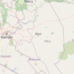
Kora National Park landscape and geographic character

The landscape of Kora National Park presents a striking combination of flat semi-arid plains and dramatic rocky highlands that define the park's visual character. The central peneplain forms the core of the park's terrain, a broad undulating surface that slopes gently from the higher southern elevations toward the lower-lying northeastern sections. Rising from this expanse are numerous granite inselbergs, steep-sided domed hills that represent ancient geological features whose surrounding softer rock has eroded away over millions of years. The most prominent of these include Mansumbi, which reaches 488 meters above sea level and stands as the highest point within the park, Kumbulanwa at 450 meters, and the eponymous Kora Rock at 442 meters. These inselbergs create microhabitats where soil accumulates in cracks and crevices, supporting vegetation that differs substantially from the surrounding bushland. The Tana River corridor provides the most dramatic hydrological feature, flowing along the northern boundary and creating a linear oasis of riverine forest amid the otherwise dry savanna. The river drops over Adamson's Falls and Grand Falls as it passes through the park, with additional rapids marking the Kora section of its course. Several seasonal rivers drain the interior, carrying water only during rainy periods and creating networks of shallow watercourses that interrupt the otherwise continuous acacia-dominated terrain.

Kora National Park ecosystems, habitats, and plant life

The ecological character of Kora National Park reflects its position in Kenya's eastern lowlands, where semi-arid conditions shape vegetation communities adapted to seasonal drought and variable rainfall. The dominant vegetation type is acacia bushland, an open savanna woodland where various acacia species form the primary tree layer interspersed with numerous shrub species. This habitat type covers the majority of the park's extent and supports the bulk of its wildlife populations. The Tana River corridor supports a fundamentally different environment, with riverine forests dominated by doum palm and Tana River poplar creating a dense green belt that contrasts sharply with the surrounding brown bushland. These riparian forests provide critical refuge for wildlife during dry periods and serve as movement corridors for species moving between different habitat types. The inselbergs support unique plant communities adapted to rocky substrates, with herbs, shrubs, and small trees establishing in the soil-filled crevices of the granite domes. The park's location east of Mount Kenya places it in a transition zone between highland and lowland ecosystems, contributing to its biological diversity despite the relatively harsh environmental conditions.

Kora National Park wildlife and species highlights

Kora National Park supports a diverse mammalian fauna adapted to the semi-arid bushland environment, with the acacia savanna providing habitat for numerous species. Large mammals include the African bush elephant, which uses the Tana River corridor as a primary movement route, hippopotamus in the riverine sections, and various antelope species including several types not specifically named in the source material. Predators are well represented, with African lions maintaining populations in the park, African leopards prowling the rocky inselberg areas, and both spotted and striped hyenas present throughout the terrain. Smaller predators include the caracal, a distinctive cat species adapted to arid environments, the serval with its elongated legs for hunting in tall grass, and the wildcat. The carnivore assemblage also includes the Tanzanian cheetah, representing a subspecies or population distinct from other East African cheetahs. The park supports populations of genets, arboreal carnivores related to mongooses that utilize both forest and bushland habitats. The diverse predator community reflects a functioning ecosystem with complete trophic structure, while the presence of multiple cat species indicates suitable habitat for each. Birdlife, while not detailed in the source, would be expected to include numerous savanna species plus those associated with the riverine habitats.

Kora National Park conservation status and protection priorities

Kora National Park holds significant conservation importance despite its challenging history and the difficulties it has faced in maintaining wildlife populations. The park protects a representative sample of Kenya's eastern lowland ecosystems, preserving both the acacia bushland and the critical Tana River corridor that provides habitat connectivity to Meru National Park. The inselberg formations represent unique geological features that support specialized plant communities not found elsewhere in the region. Kora's conservation significance is amplified by its connection to George Adamson's legacy, as the park contains his grave and serves as a monument to the sacrifices made by conservationists protecting wildlife. The murder of Adamson and his assistants in 1989 drew international attention to the poaching crisis affecting Kenyan protected areas and contributed to improved anti-poaching efforts nationally. The park functions as an important elephant corridor, connecting populations in the broader Tana River basin and supporting genetic exchange between isolated groups. Efforts to rebuild wildlife populations continue under Kenya Wildlife Service management, with the 2012 lion reintroduction attempt representing ongoing commitment to restoring the park's ecological integrity despite the setbacks encountered.

Kora National Park cultural meaning and human context

Kora National Park carries profound cultural significance through its connection to George Adamson, one of the most influential figures in modern wildlife conservation. Adamson's work in Kenya, particularly his pioneering work hand-rearing orphaned lion cubs and releasing them into the wild, captured global public imagination and fundamentally changed attitudes toward wildlife conservation. The film Born Free, documenting his work with lioness Elsa, became a cultural touchstone and established conservation messaging in mainstream entertainment. Adamson's murder in Kora in 1989, along with his assistants, transformed the park from a relatively obscure protected area into a site of international conservation significance. He is buried within the park alongside three lions he released, creating a memorial that combines human sacrifice and wildlife protection in a powerful narrative. The park thus serves as both a wildlife sanctuary and a memorial to the conservation movement's pioneers, representing the ongoing challenges and dangers faced by those working to protect野生动物. The Tana River also holds cultural importance for local communities whose lives and traditional practices are intertwined with the river's seasonal rhythms.

Top sights and standout views in Kora National Park

Kora National Park's standout features include the dramatic granite inselbergs that dominate the landscape, particularly Mansumbi, Kumbulanwa, and Kora Rock, which offer spectacular views and unique climbing opportunities. The Tana River with its waterfalls, including Adamson's Falls and Grand Falls, provides the park's most dramatic hydrological features and supports the lush riverine forest corridor. The park's historical significance as George Adamson's final resting place gives it unique cultural weight among Kenyan protected areas, with his grave serving as a point of reflection for visitors. The diverse predator community, including lions, leopards, caracals, servals, and cheetahs, makes Kora an exceptional destination for wildlife viewing in a relatively uncrowded environment. The combination of semi-arid savanna and riparian forest creates a landscape of stark contrasts, with the green river corridor cutting through brown bushland. The park's remote location ensures a wilderness experience far from more heavily touristed Kenyan parks, offering solitude and authentic immersion in African nature.

Best time to visit Kora National Park

Kora National Park is best visited during Kenya's dry seasons, typically from June through October and again from December through March, when wildlife concentrates around remaining water sources and vegetation is less dense, improving visibility. The wet seasons from April to May and November to December can make some roads impassable and reduce wildlife viewing opportunities, though the landscape becomes greener and birdlife increases. The hottest months tend to be January and February, while June and July bring cooler temperatures. Visiting during the dry season provides the most reliable wildlife sightings, particularly along the Tana River where animals gather to drink. Early morning game drives offer the best chances to observe predators including lions and leopards as they remain active in the cooler temperatures. The park's remote location means that visitor facilities are limited, so self-sufficiency and advance preparation are essential for any visit.

Park location guide

Geography guide, regional context, and park location map for Kora National Park

Kora National Park park geography, regions, and map view in Kenya
Understand where Kora National Park sits in Kenya through a broader geographic reading of the surrounding landscape, nearby location context, and its mapped position within the national park landscape.

How Kora National Park fits into Kenya

Kenya is a presidential republic in East Africa and the seventh-most populous country on the continent. Its capital is Nairobi, and it borders five countries and the Indian Ocean. The country features significant geographic diversity including Mount Kenya, the Rift Valley, and coastal regions.

Wider geography shaping Kora National Park in Kenya

Kenya is located in East Africa, bordering South Sudan to the northwest, Ethiopia to the north, Somalia to the east, Tanzania to the southwest, and Uganda and Lake Victoria to the west. The southeastern border meets the Indian Ocean. The geography includes the Rift Valley highlands with Mount Kenya, coastal plains, and northern arid regions.

Map view of Kora National Park

Use this park location map to pinpoint Kora National Park in Kenya, understand its exact geographic position, and read its mapped placement within the surrounding landscape more clearly.

Pigeon | © OpenStreetMap contributors

Location context for Kora National Park

Tana River County
Park atlas

Discover other unique inselberg landscapes and Tana River protected areas in Eastern Kenya

Explore National Parks and Protected Areas Near Kora National Park, Kenya
After exploring Kora National Park, continue your geographic discovery by browsing other national parks and protected areas across Eastern Kenya. Compare diverse landscapes, riverine ecosystems, and semi-arid wilderness zones to trace the regional spread of conservation efforts.
National parkKenya

Mount Kenya National Park: Mapped Volcanic Landscape & Protected Area Geography

Kenya's high-altitude Afro-alpine ecosystems and mapped park boundaries.

Mount Kenya National Park safeguards a globally significant volcanic landscape and vital water resources for Kenya. This protected area above 3,000 meters features dramatic peaks, glaciers, and distinctive Afro-alpine flora. Explore its comprehensive mapped boundaries, understand its regional geographic importance, and discover the unique ecosystems that define this exceptional national park through detailed atlas context.

Area
715 km²
Established
1949
IUCN
II
National parkKenya

Nairobi National Park: Detailed Geographic Overview and Protected Landscape Atlas

Explore the mapped boundaries and regional context of this Kenyan national park.

Nairobi National Park represents a significant protected national park entity within Kenya. This MoriAtlas entry provides detailed insight into its geographic placement and mapped landscape characteristics. Users can delve into the park's specific location, its protected boundaries, and its contribution to the regional geography of East Africa, facilitating structured map-based exploration and understanding of this vital conservation area.

Area
117 km²
Established
1946
IUCN
II
Relief
Mixed relief
National parkTanzania

Mkomazi National Park: Tanzania's Vast Protected Savanna Landscape and Wildlife Geography

Explore its mapped terrain and conservation significance within East Africa.

Mkomazi National Park is a critical protected landscape in Tanzania, spanning over 3,200 square kilometers of classic East African semi-arid savanna woodland. This national park offers a unique atlas-style view into conservation success, particularly for its black rhinoceros sanctuary and African wild dog programs. Its landscape is characterized by rolling terrain and Acacia-Commiphora vegetation, forming a vital transboundary conservation area with Kenya that supports significant wildlife migration corridors and provides a distinct geographic context within the broader regional atlas.

Area
3,234 km²
Established
2006
IUCN
II
National parkArusha Region

Lake Manyara National Park: Protected Landscape & Rift Valley Geography in Arusha Region

Unique habitats from groundwater forests to alkaline lake shores.

Lake Manyara National Park is a distinct protected landscape situated within the Great Rift Valley of Tanzania's Arusha Region. The park's geography is shaped by the imposing escarpment wall and the alkaline Lake Manyara, creating a mosaic of habitats including rare groundwater forests, acacia woodlands, and saline grasslands. Its unique environment supports diverse wildlife and offers a prime example of regional landscape context and protected area dynamics.

Area
648 km²
Established
1960
IUCN
II
Visitors
178.5K annual
National parkUganda

Mount Elgon National Park: Uganda's Transboundary Volcano and Mapped Protected Area

Explore volcanic terrain, unique cave systems, and diverse montane landscapes.

Mount Elgon National Park offers a rich tapestry of protected landscapes, centered on a dormant shield volcano straddling the Uganda-Kenya border. This park is recognized for its extraordinary botanical diversity and spectacular cave systems, such as Kitum Cave, where wildlife congregates to lick salt. The elevation gradient supports distinct vegetation zones, from dense montane forests to high-altitude heath and moorland, providing crucial habitat and watershed protection. Understanding Mount Elgon National Park through its mapped boundaries and geographic context reveals a unique protected area in East Africa.

Area
1,279 km²
Established
1968
IUCN
II
National parkKenya

Kisite-Mpunguti Marine National Park: Kenya's Coastal Protected Marine Landscape

Mapped coral reefs and diverse marine ecosystems.

As Kenya's foremost marine national park, Kisite-Mpunguti Marine National Park presents an unparalleled opportunity to explore a thriving underwater world. Its protected boundaries encompass remarkable coral formations and a rich tapestry of marine species, including diverse fish populations, sea turtles, and dolphins. This park is a cornerstone of coastal conservation, offering valuable insights into marine geography and ecosystem health for those seeking detailed landscape context.

Area
39 km²
Established
1973
IUCN
II
National parkMara Region

Serengeti National Park: National Park Atlas and Protected Landscape Discovery

Explore savanna grasslands, regional geography, and mapped park boundaries.

Serengeti National Park, a significant national park within Tanzania's Mara Region, offers an unparalleled view into a vast protected landscape. This page provides access to the park's geographic identity, its defining savanna ecosystem, and its role as a critical component of the regional atlas. Understand the mapped extent of its protected boundaries and the unique natural context that supports its renowned wildlife.

Area
14,763 km²
Established
1940
IUCN
II
National parkMandera County

Malka Mari National Park: Remote Frontier Protected Landscape and Dawa River Ecosystem

Explore the semi-arid bushland and riparian woodland geography.

Malka Mari National Park offers a profound wilderness experience as Kenya's most remote national park, situated along the Dawa River in Mandera County. This protected area features striking contrasts between arid bushland and verdant riparian woodlands, supporting unique plant species and wildlife adapted to the semi-arid environment. Its vast, undeveloped character makes it a significant site for frontier conservation and a unique destination for atlas-style landscape exploration.

Area
1,500 km²
Established
1989
IUCN
II

Common questions about visiting, size, designation, and location context for Kora National Park

Kora National Park FAQs for park facts, access, geography, and protected area context
Find quick answers about Kora National Park, including protected-area facts, park geography, trail and visitor context, and how the park fits into its surrounding country and regional landscape.
MoriAtlas Explorer

Continue Your Protected Areas Search Across the Global Atlas

Deepen your exploration by continuing the structured search for national parks and protected areas worldwide. Utilize the comprehensive filtering capabilities to compare different conservation landscapes and refine your understanding of global park geography. Discover more about the distribution and characteristics of protected natural areas.

Global natural geography