Mori Atlas logo
National parkLake Manyara National Park

Explore the unique geography of groundwater forests, alkaline lake, and rift escarpment.

Lake Manyara National Park: Protected Area & Rift Valley Landscape Atlas in Arusha Region

Lake Manyara National Park in Tanzania's Arusha Region presents a remarkable protected landscape, defined by the dramatic Great Rift Valley escarpment and the shallow, alkaline waters of Lake Manyara. This national park offers a unique opportunity to explore diverse habitats, from groundwater forests sustained by springs to acacia woodlands and saline grasslands, all within a compact geographic area. Understand the park's mapped boundaries and its place within the surrounding regional geography.

Rift Valley landscapesAlkaline lake ecosystemsGroundwater forestsBirdwatching hotspotsFlamingo congregationsWetland habitats

Lake Manyara National Park

National park

Park overview

Structured park overview, official facts, and landscape profile for Lake Manyara National Park

Lake Manyara National Park park facts, protected area profile, and essential visitor context
Review the core facts for Lake Manyara National Park, including designation, size, terrain, visitor scale, habitats, and operating context in one park-focused overview.

About Lake Manyara National Park

Lake Manyara National Park occupies a remarkable position within the Great Rift Valley system, where the geological forces that created the valley have produced a landscape of extraordinary ecological diversity. The park's core identity centers on Lake Manyara itself, a shallow alkaline lake that fills a depression in the rift floor. This lake is remarkable for the extreme fluctuations in its size and depth; at maximum extent it stretches 40 kilometers by 15 kilometers with a depth of up to 3.7 meters, while in dry periods it can shrink dramatically or even dry up completely. The 2010 bathymetry survey recorded an average depth of only 0.81 meters, illustrating the dynamic nature of this aquatic system. The park protects only the northwestern quadrant of the lake, with the remainder lying outside protected boundaries, though the entire lake and surrounding lands are incorporated into the broader biosphere reserve. The groundwater forests represent one of the park's most distinctive ecological features, existing in a narrow zone where perennial springs emerge from the base of the rift wall. These forests are dominated by evergreen species that depend on the steady water supply, creating a lush, almost tropical environment that contrasts sharply with the surrounding savanna and arid landscapes. Above the forest, the rift wall rises dramatically, with large African baobab trees punctuating the rocky slopes. The park also contains two hot springs, one near the center and another at the southern edge, with the Maji Moto springs on the western shore reaching temperatures of approximately 60 degrees Celsius, generated by geothermal heating from volcanic rocks deep beneath the rift floor.

Quick facts and research context for Lake Manyara National Park

Lake Manyara National Park lies in the Arusha and Manyara Regions of northern Tanzania, approximately 126 kilometers southwest of Arusha city. The park occupies a narrow corridor of land between the western rift escarpment and the eastern lake shoreline, with the escarpment rising sharply to elevations between 1,219 and 1,829 meters. The lake itself sits at an altitude of 960 meters and represents a closed basin with no surface outflow, being fed by underground springs and streams draining from the adjacent Ngorongoro Highlands. The park supports more than 390 documented bird species and over 670 flowering plant species, making it one of the more biodiverse protected areas in Tanzania's northern circuit. Visitor numbers reached approximately 178,000 in 2012, making it one of the more frequented parks in the region while still maintaining its ecological integrity.

Park context

Deeper park guide and search-rich context for Lake Manyara National Park

Lake Manyara National Park history, landscape, wildlife, and travel context
Explore Lake Manyara National Park through its history, landscape character, ecosystems, wildlife, conservation priorities, cultural context, and seasonal travel timing in a structured park guide built for atlas discovery and search intent.

Why Lake Manyara National Park stands out

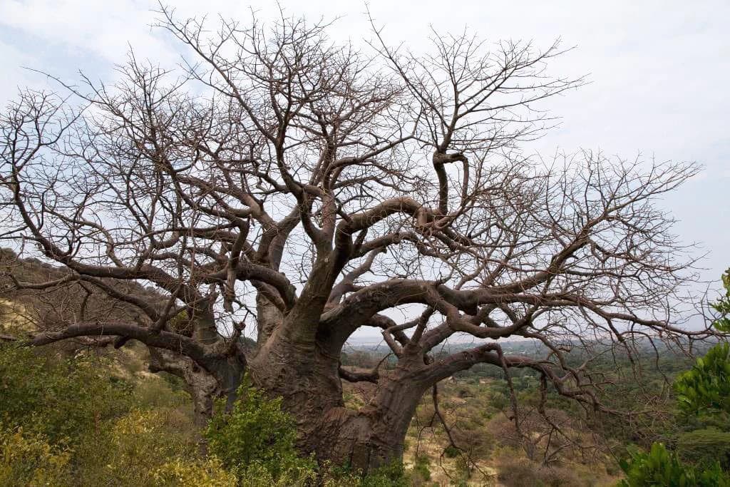
Lake Manyara National Park is most famously associated with the spectacular congregations of flamingos that gather along the lake's alkaline shoreline during the wet season, creating a vivid pink ribbon of thousands of birds. The park is also renowned for its groundwater forests, a rare habitat type in the region where tall evergreen trees including Trichilia roka, sycamore fig, and quinine trees are sustained by perennial springs emerging at the base of the rift wall. The juxtaposition of this dense forest against the open savanna and the lake's shimmering waters creates one of the most photographed landscapes in Tanzania. Additionally, the park is known for its significant populations of hippos wallowing in the northern pool area and the distinctive baobab trees scattered across the escarpment slopes. The tree-climbing lions that sometimes shelter in the acacia woodlands have also become a notable attraction for visitors.

Southern ground hornbill, Lake Manyara National Park
Southern Ground Hornbill (Bucorvus leadbeateri) in Lake Manyara National Park.

Lake Manyara National Park history and protected-area timeline

The area comprising Lake Manyara National Park has a relatively modern conservation history that reflects the broader evolution of wildlife protection in Tanzania during the mid-twentieth century. Prior to formal protection, the lake and surrounding lands were used for sports hunting throughout the 1920s, a period when much of East Africa's wildlife populations faced mounting pressure from recreational hunting. The establishment of a game reserve in 1957 marked the first institutional recognition of the area's ecological significance, creating a framework for managing wildlife populations and limiting hunting activities. In 1960, the area was elevated to national park status, formalizing its protection under the Tanzania National Parks Authority and dedicating it specifically for conservation and public enjoyment. A significant boundary adjustment occurred in 1974 when approximately 550 hectares were added to the southern end of the park, expanding the protected area. The creation of the Lake Manyara Biosphere Reserve in 1981 under UNESCO's Man and the Biosphere Programme represented an important international recognition of the site's ecological value and established a framework for balancing conservation with sustainable development in the surrounding region. The park's inclusion in a larger biosphere reserve reflected an understanding that effective conservation required consideration of the landscape beyond strict protected area boundaries, incorporating buffer zones and areas of multiple use.

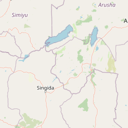
Lake Manyara National Park landscape and geographic character

The physical landscape of Lake Manyara National Park is defined by the geological structure of the Great Rift Valley and the hydrological dynamics of the closed-basin lake. The western boundary is marked by the steep, rocky face of the Gregory Rift wall, which rises abruptly from the valley floor to elevations between 1,219 and 1,829 meters. This escarpment is composed of volcanic rock and is characterized by steep cliffs, rocky outcrops, and steeply sloping terrain that supports a distinct vegetation community dominated by baobab trees and the Ruellia megachlamys shrub. The valley floor between the escarpment and the lake consists of a mix of habitats that change with distance from the water. Near the base of the rift wall, where springs emerge, groundwater forests develop in a relatively narrow band. Moving eastward, the vegetation transitions to acacia woodland dominated by Acacia tortilis with its distinctive flat-topped canopy, interspersed with Commiphora species. As the land approaches the lake, the soils become increasingly alkaline, supporting specialized grasslands adapted to saline conditions. The lake itself occupies the eastern portion of the park, a shallow, saucer-like depression that varies dramatically in extent with rainfall patterns. When full, the lake covers approximately two-thirds of the park area, but in dry periods the water retreats to reveal extensive saline flats. The northern end of the lake contains permanent papyrus swamps where the Simba River and its tributaries enter the lake, while smaller swamps occur wherever streams emerge from the rift wall.

Lilac-breasted roller, Lake Manyara National Park
Lilac-breasted Roller (Coracias caudatus) in Lake Manyara National Park.

Lake Manyara National Park ecosystems, habitats, and plant life

The ecological character of Lake Manyara National Park is defined by the convergence of multiple distinct habitat types within a relatively limited area, creating exceptional biodiversity within the park boundaries. The groundwater forests represent the most distinctive terrestrial habitat, supported by perennial springs that emerge at the base of the rift wall and sustain tall evergreen trees throughout the year. These forests are dominated by Trichilia roka, a large canopy tree that forms the primary structure of the woodland, accompanied by broad-leaved Croton, sycamore fig, quinine tree, and forest toad-tree. The densest concentrations of trees occur in gorges, along stream margins, and where springs emerge at the surface. At the forest margins, dense stands of yellow fever trees (Vachellia xanthophloea) and wild date palms (Phoenix reclinata) create distinctive golden-green canopies. The acacia woodlands on the western lake shore develop where groundwater remains accessible but soils are less saturated, with Acacia tortilis forming an open canopy at around 10 meters height. The understory in these woodlands is patchy but diverse, containing numerous shrub species. The wetlands at the northern end of the lake, where rivers from the escarpment converge, support extensive papyrus and cattail marshes that provide important habitat for waterbirds and aquatic species. The alkaline grasslands that fringe the lake bear specialized vegetation adapted to saline conditions, with Sporobolus grasses dominating the lake flats and expanding dramatically when water levels fall to expose new shoreline.

Lake Manyara Wildlife.jpg
Zebras and other wildlife at Lake Manyara National Park, Tanzania.

Lake Manyara National Park wildlife and species highlights

Lake Manyara National Park supports remarkable wildlife populations that reflect the diversity of habitats within its boundaries. The bird life is particularly spectacular, with more than 390 species documented within the park. The most famous avian residents are the flamingos, with an estimated 1.9 million lesser flamingos and 40,000 greater flamingos present during peak periods, creating one of the largest concentrations of these distinctive birds in East Africa. Great white pelicans also gather in impressive numbers, with estimates of around 200,000 individuals present in favorable conditions. The groundwater forest to the north of the lake serves as a critical breeding site for thousands of pink-backed pelicans, yellow-billed storks, marabou storks, and grey herons, creating one of the most significant bird colonies in the region. Over 40 species of birds of prey have been recorded, including palm-nut vultures and Ayres hawk eagles. Large mammals include African bush elephants, though populations have fluctuated dramatically due to poaching pressure, hippos concentrated in the northern pool, and common plains species including zebras, wildebeest, Thomson's and Grant's gazelles, impala, and cape buffalo. Giraffes are commonly observed browsing on acacia canopies, while lions and leopards maintain predator populations. The park historically supported significant populations of black rhinoceros, though surveys indicate they have been locally extirpated.

Fever acacia, Lake Manyara NP
Fever acacia tree in Lake Manyara National Park

Lake Manyara National Park conservation status and protection priorities

Lake Manyara National Park serves as a core protected area within the Lake Manyara Biosphere Reserve, a UNESCO-designated landscape that encompasses the lake and surrounding lands in a framework designed to balance conservation with sustainable human use. The park's conservation significance derives from its role in protecting the lake ecosystem, which provides critical habitat for flamingos and pelicans, along with the diverse terrestrial habitats that support resident and migratory wildlife. The groundwater forests, though limited in extent, represent a rare habitat type that supports species found nowhere else in the region. The park is connected to Tarangire National Park to the southeast through the Kwa Kuchinja Wildlife Migration corridor, allowing seasonal movements of wildebeest, zebras, and other migratory species between the protected areas. This connectivity is essential for maintaining the ecological processes that sustain these populations. Conservation challenges include managing the tension between tourism and wildlife disturbance, addressing poaching pressure that has dramatically reduced elephant and rhinoceros populations, and working to maintain habitat connectivity in the face of agricultural expansion in surrounding lands. The Manyara Ranch, a former livestock operation now managed by the Tanzania Land Conservation Trust, plays an important role in maintaining wildlife movement between Tarangire and Lake Manyara.

Lake Manyara National Park cultural meaning and human context

Lake Manyara National Park exists within a landscape shaped by human communities whose activities and settlements influence the park's ecological dynamics. The Kwa Kuchinja Wildlife Migration corridor that connects the park to Tarangire passes through several villages, creating ongoing challenges and opportunities for human-wildlife coexistence. Local communities practice agriculture in the lands surrounding the park, with cultivation extending to the edges of protected boundaries in some areas. The town of Mto wa Mbu, located near the park's main access point, serves as a gateway community for visitors and supports a tourism-dependent economy. The broader Manyara Region, with its administrative center at Babati, includes communities whose traditional land use practices have shaped the landscape over generations. While the park itself is managed strictly for conservation, the biosphere reserve framework recognizes the importance of involving local communities in conservation and sustainable development. Historical human use of the area before formal protection included hunting, which contributed to changes in wildlife populations, and pastoralism in the surrounding highlands.

Top sights and standout views in Lake Manyara National Park

The groundwater forest walk near the park entrance offers one of the most distinctive safari experiences in Tanzania, where dense evergreen woodland thrives in the shadow of the rift escarpment. The hippo pool at the lake's northern end provides reliable close-range viewing of these large aquatic mammals as they rest and graze underwater. The dramatic change in landscape character as one moves from the lush forest through woodland to the open alkaline flats and shimmering lake creates a remarkable visual journey. Flamingo viewing, particularly during the wet season when thousands of birds congregate along the shoreline, remains the park's most iconic wildlife spectacle. The baobab trees on the escarpment slopes provide striking subjects for photography and illustrate the park's geological heritage. The hot springs on the western shore represent an unusual geological feature within the park, with their geothermal waters offering a distinctive contrast to the otherwise surface-based hydrology. The bird colonies in the groundwater forest constitute one of the most significant breeding concentrations in eastern Africa.

Best time to visit Lake Manyara National Park

The optimal time to experience Lake Manyara depends on what visitors hope to see, as the park offers distinct attractions across different seasons. The wet season from March through May brings the most dramatic transformations in landscape character, with the lake filling to its maximum extent and the surrounding grasslands turning green. This period coincides with the arrival of migrant birds and is when flamingo congregations are typically most spectacular, as the abundant food resources support larger populations. The short rains from November to December also bring increased water levels and renewed bird activity. The dry season from June through October offers different advantages, with lower visitor numbers, reduced vegetation that makes wildlife easier to spot, and the spectacle of wildebeest grazing on the alkaline grasslands around the lake perimeter. However, during the driest months of July, August, and September, the lake may shrink considerably and flamingo populations decline as feeding conditions deteriorate. The period around December through February offers a middle ground with reasonable wildlife viewing, moderate crowds, and pleasant temperatures, though the exact conditions vary from year to year depending on rainfall patterns.

Park location guide

Geography guide, regional context, and park location map for Lake Manyara National Park

Lake Manyara National Park park geography, regions, and map view in Tanzania
Understand where Lake Manyara National Park sits in Tanzania through a broader geographic reading of the surrounding landscape, nearby location context, and its mapped position within the national park landscape.

How Lake Manyara National Park fits into Tanzania

Tanzania, officially the United Republic of Tanzania, is a presidential republic in East Africa within the African Great Lakes region. It was formed in 1964 through the unification of Tanganyika and Zanzibar. The country is known for its diverse wildlife, national parks including Serengeti and Ngorongoro, and significant archaeological sites with important hominid fossils.

Wider geography shaping Lake Manyara National Park in Tanzania

Tanzania is located in East Africa within the African Great Lakes region. It is bordered by Uganda to the northwest, Kenya to the northeast, the Indian Ocean to the east, Mozambique and Malawi to the south, Zambia to the southwest, and Rwanda, Burundi, and the Democratic Republic of the Congo to the west. The country includes the mainland and the Zanzibar Archipelago.

Map view of Lake Manyara National Park

Use this park location map to pinpoint Lake Manyara National Park in Tanzania, understand its exact geographic position, and read its mapped placement within the surrounding landscape more clearly.

Pigeon | © OpenStreetMap contributors

Location context for Lake Manyara National Park

Arusha RegionManyara Region

Explore the Diverse Scenery and Protected-Area Character of Lake Manyara, from Groundwater Forests to Alkaline Lake Shores

Lake Manyara National Park Photos: Visualizing Tanzania's Rift Valley Landscapes
Browse Lake Manyara National Park photos to visually grasp its unique Rift Valley landscapes, including lush groundwater forests, expansive acacia woodlands, and the shimmering alkaline lake. These images provide essential visual context for understanding the park's diverse habitats, iconic wildlife environments, and overall protected-area scenery.

Southern ground hornbill, Lake Manyara National Park

Lake Manyara NP viewpoint

Lilac-breasted roller, Lake Manyara National Park

Lake Manyara Wildlife.jpg

Fever acacia, Lake Manyara NP

African baobab in Lake Manyara NP

Park atlas

Discover adjacent Rift Valley landscapes and diverse protected ecosystems across northern Tanzania.

Explore More National Parks and Protected Areas Near Lake Manyara, Tanzania
Compare Lake Manyara National Park with other protected areas in northern Tanzania, mapping their distinct Rift Valley ecosystems and shared conservation landscapes. Delve into the regional spread of national parks and reserves, gaining deeper geographic context and understanding the interconnected natural habitats.
National parkMara Region

Serengeti National Park: National Park Atlas and Protected Landscape Discovery

Explore savanna grasslands, regional geography, and mapped park boundaries.

Serengeti National Park, a significant national park within Tanzania's Mara Region, offers an unparalleled view into a vast protected landscape. This page provides access to the park's geographic identity, its defining savanna ecosystem, and its role as a critical component of the regional atlas. Understand the mapped extent of its protected boundaries and the unique natural context that supports its renowned wildlife.

Area
14,763 km²
Established
1940
IUCN
II
National parkKenya

Nairobi National Park: Detailed Geographic Overview and Protected Landscape Atlas

Explore the mapped boundaries and regional context of this Kenyan national park.

Nairobi National Park represents a significant protected national park entity within Kenya. This MoriAtlas entry provides detailed insight into its geographic placement and mapped landscape characteristics. Users can delve into the park's specific location, its protected boundaries, and its contribution to the regional geography of East Africa, facilitating structured map-based exploration and understanding of this vital conservation area.

Area
117 km²
Established
1946
IUCN
II
Relief
Mixed relief
National parkTanzania

Mkomazi National Park: Tanzania's Vast Protected Savanna Landscape and Wildlife Geography

Explore its mapped terrain and conservation significance within East Africa.

Mkomazi National Park is a critical protected landscape in Tanzania, spanning over 3,200 square kilometers of classic East African semi-arid savanna woodland. This national park offers a unique atlas-style view into conservation success, particularly for its black rhinoceros sanctuary and African wild dog programs. Its landscape is characterized by rolling terrain and Acacia-Commiphora vegetation, forming a vital transboundary conservation area with Kenya that supports significant wildlife migration corridors and provides a distinct geographic context within the broader regional atlas.

Area
3,234 km²
Established
2006
IUCN
II
National parkKenya

Kisite-Mpunguti Marine National Park: Kenya's Coastal Protected Marine Landscape

Mapped coral reefs and diverse marine ecosystems.

As Kenya's foremost marine national park, Kisite-Mpunguti Marine National Park presents an unparalleled opportunity to explore a thriving underwater world. Its protected boundaries encompass remarkable coral formations and a rich tapestry of marine species, including diverse fish populations, sea turtles, and dolphins. This park is a cornerstone of coastal conservation, offering valuable insights into marine geography and ecosystem health for those seeking detailed landscape context.

Area
39 km²
Established
1973
IUCN
II
National parkKenya

Mount Kenya National Park: Mapped Volcanic Landscape & Protected Area Geography

Kenya's high-altitude Afro-alpine ecosystems and mapped park boundaries.

Mount Kenya National Park safeguards a globally significant volcanic landscape and vital water resources for Kenya. This protected area above 3,000 meters features dramatic peaks, glaciers, and distinctive Afro-alpine flora. Explore its comprehensive mapped boundaries, understand its regional geographic importance, and discover the unique ecosystems that define this exceptional national park through detailed atlas context.

Area
715 km²
Established
1949
IUCN
II
National parkMorogoro Region

Mikumi National Park: East African Savannah Protected Landscape in Morogoro Region

Mapped boundaries and regional geography for a key Tanzanian national park.

Mikumi National Park, a vital protected area in Tanzania's Morogoro Region, offers a classic savannah experience with iconic baobab trees and diverse wildlife populations. This national park is distinguished by its extensive alluvial plains, shaped by the Mkata River basin, and its significant role as a wilderness corridor connecting with the larger Selous Game Reserve. The park's terrain includes Malundwe Mountain and views of the Uluguru Mountains, providing a rich geographic backdrop for understanding East African protected lands and their atlas-style distribution.

Area
3,230 km²
Established
1964
IUCN
II
National parkTana River County

Kora National Park: A Unique Protected Landscape in Tana River County, Kenya

Explore its inselberg geography and mapped natural terrain.

Kora National Park represents a remarkable protected area characterized by its striking inselberg topography and semi-arid bushland, set against the backdrop of the Tana River. This national park in Tana River County offers a unique geographic profile, featuring massive granite formations that punctuate the expansive terrain. Discover the mapped boundaries and the distinctive landscape that make Kora National Park a significant entity for regional atlas exploration and understanding protected lands in eastern Africa.

Area
1,788 km²
Established
1989
IUCN
II
National parkUganda

Mount Elgon National Park: Uganda's Transboundary Volcano and Mapped Protected Area

Explore volcanic terrain, unique cave systems, and diverse montane landscapes.

Mount Elgon National Park offers a rich tapestry of protected landscapes, centered on a dormant shield volcano straddling the Uganda-Kenya border. This park is recognized for its extraordinary botanical diversity and spectacular cave systems, such as Kitum Cave, where wildlife congregates to lick salt. The elevation gradient supports distinct vegetation zones, from dense montane forests to high-altitude heath and moorland, providing crucial habitat and watershed protection. Understanding Mount Elgon National Park through its mapped boundaries and geographic context reveals a unique protected area in East Africa.

Area
1,279 km²
Established
1968
IUCN
II

Common questions about visiting, size, designation, and location context for Lake Manyara National Park

Lake Manyara National Park FAQs for park facts, access, geography, and protected area context
Find quick answers about Lake Manyara National Park, including protected-area facts, park geography, trail and visitor context, and how the park fits into its surrounding country and regional landscape.
MoriAtlas Explorer

Continue Your Protected Areas Search Across the Global Atlas

Deepen your exploration by continuing the structured search for national parks and protected areas worldwide. Utilize the comprehensive filtering capabilities to compare different conservation landscapes and refine your understanding of global park geography. Discover more about the distribution and characteristics of protected natural areas.

Global natural geography