
Why Langtang National Park stands out
Langtang National Park is best known as Nepal's first Himalayan national park and one of the most accessible high-altitude protected areas in the country. The Langtang Valley offers trekkers a rare opportunity to experience dramatic glaciated terrain, alpine meadows, and traditional Tamang villages against a backdrop of towering peaks. The park contains exceptional biodiversity across 14 vegetation types ranging from subtropical forests to alpine scrub and permanent ice fields. Gosainkunda Lake, a high-altitude sacred site, draws religious pilgrims who regard its waters as holy. The combination of spectacular mountain scenery, cultural richness, and relative accessibility has made this one of Nepal's most popular trekking destinations.

Langtang National Park history and protected-area timeline
The creation of Langtang National Park emerged from growing recognition in the late 1960s and early 1970s of the need to protect Nepal's Himalayan ecosystems. Royal approval in 1970 designated Langtang as the country's first Himalayan protected area, and the national park was formally gazetted in 1976, becoming Nepal's fourth protected area overall. In 1998, the park was expanded with a buffer zone covering approximately 420 square kilometers, providing additional protection for the core area and supporting sustainable use by local communities. The park has experienced significant tragedy that has shaped its recent history. On July 31, 1992, Thai Airways International Flight 311 crashed into the park while on approach to Kathmandu, resulting in the deaths of all 113 people aboard. Perhaps more significantly, on April 25, 2015, the devastating Nepal earthquake triggered a massive avalanche that destroyed the village of Langtang within the park, killing at least 215 people. The International Astronomical Union honored this lost community in 2016 by naming a 9.8-kilometer-wide crater on Mars after the village.
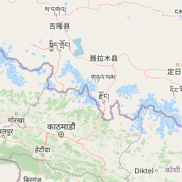
Langtang National Park landscape and geographic character
The physical landscape of Langtang National Park is defined by its position along the Himalayan frontier, where massive mountain ranges rise abruptly from deep river valleys. The park's terrain is bisected from west to east by the Dorje Lakpa range, whose peaks reach 6,988 meters and create a dramatic backbone across the protected area. The highest summit within the park is Langtang Lirung at 7,245 meters, its permanently snow-capped peak visible from the valley floor far below. The landscape is carved by two major river systems: the Bhote Koshi forms the eastern boundary while the Trishuli River marks the western edge. Between these river valleys, the terrain rises steeply through a sequence of ecological zones, from forested mid-height slopes through alpine meadows and rocky terrain to permanent snow and ice. The Gosainkunda lake sits at 4,300 meters elevation within a basin surrounded by alpine terrain, its sacred waters reflecting the surrounding peaks.

Langtang National Park ecosystems, habitats, and plant life
Langtang National Park supports remarkable ecological diversity across an extraordinary altitudinal range that produces 14 distinct vegetation types within 18 different ecosystem types. Below approximately 1,000 meters, the park contains upper tropical forests characterized by broadleaf species adapted to the warm, humid conditions of the Himalayan foothills. As elevation increases, the forest transitions through subtropical and temperate zones before giving way to alpine vegetation communities. The park's higher elevations feature alpine scrub and perennial ice, with vegetation limited to hardy species capable of surviving extreme conditions. This gradient of habitats creates exceptional biodiversity, supporting both lowland and high-altitude species within a single protected area. The park forms part of the Sacred Himalayan Landscape, a conservation initiative that recognizes the interconnectedness of ecosystems across national boundaries.
Langtang National Park wildlife and species highlights
The diverse habitats within Langtang National Park support a range of notable wildlife species. The forested lower slopes provide habitat for various mammal species adapted to the Himalayan environment, while the higher terrain offers suitable habitat for species characteristic of alpine zones. The protected area's position along a major mountain corridor creates conditions favorable for birdlife, with both resident species and migratory visitors using the various elevation zones. The presence of intact forest habitat and protected status contributes to the park's significance as a refuge for wildlife in the heavily populated Himalayan region. While specific species details vary across the altitudinal range, the park's ecological diversity creates conditions supporting both common and regionally significant species.
Langtang National Park conservation status and protection priorities
Langtang National Park represents Nepal's pioneering effort to protect Himalayan ecosystems and remains one of the country's most important protected areas. As the first Himalayan national park in Nepal, it established a model for mountain conservation in the country and demonstrated the feasibility of protecting high-altitude environments while accommodating local communities. The 1998 addition of a 420-square-kilometer buffer zone expanded the conservation framework to include sustainable use areas that support local livelihoods while reducing pressure on the core protected area. The park's inclusion in the Sacred Himalayan Landscape initiative connects it to broader transboundary conservation efforts spanning Nepal and Tibet. The protected status helps preserve both the exceptional biodiversity across the park's multiple vegetation zones and the traditional management practices of the resident Tamang communities whose relationship with this landscape predates formal protection.
Langtang National Park cultural meaning and human context
Langtang National Park is home to approximately 26 village communities, predominantly of Tamang ethnic heritage, whose culture is deeply intertwined with the landscape they inhabit. The Tamang people maintain Buddhist traditions and a traditional way of life that includes pastoral activities and cultivation adapted to the high-altitude environment. The Langtang Valley has historically served as a trade route between Nepal and Tibet, creating a cultural corridor where Buddhist practices and traditions have flourished for centuries. Within the park, the Gosainkunda lake holds particular religious significance, visited by Hindu and Buddhist pilgrims who regard its waters as sacred. The 2015 earthquake and avalanche that destroyed the village of Langtang represented not merely a natural disaster but a profound loss of a cultural community that had shaped and been shaped by this mountain landscape for generations. The resilience of the surviving communities and the ongoing cultural practices within the park represent the enduring human dimension of this protected area.
Top sights and standout views in Langtang National Park
Langtang National Park offers trekking opportunities through one of Nepal's most spectacular mountain valleys, with views of snow-capped peaks including Langtang Lirung rising above alpine meadows and traditional villages. The sacred Gosainkunda lake at 4,300 meters provides both a spiritual destination and a spectacular high-altitude landscape feature. The park's diversity of ecosystems, from subtropical forests to glacial terrain, creates remarkable ecological variety within a single protected area. As Nepal's first Himalayan national park, it provides accessible introduction to high-altitude mountain environments while maintaining strong conservation values. The cultural heritage of the Tamang communities, visible in village architecture, Buddhist practices, and traditional land use, adds depth to the wilderness experience.
Best time to visit Langtang National Park
The most favorable time to visit Langtang National Park corresponds with the pre-monsoon and post-monsoon seasons when weather conditions are most stable for trekking. The period from March through May brings spring conditions with pleasant temperatures at lower elevations and rhododendron blooms adding color to the landscape, though higher passes may still hold snow. October and November offer clear skies and stable weather following the monsoon retreat, providing excellent mountain visibility and comfortable trekking conditions. The summer monsoon season from June through September brings heavy precipitation to the region, creating challenging trail conditions and reduced visibility. Winter months bring cold temperatures and significant snowfall that closes higher routes, though lower valley areas may still be accessible. The extreme elevation variation within the park means that weather conditions can change rapidly and differ substantially between valley floors and alpine passes.