Mori Atlas logo
National parkUpemba National Park

Discover the mapped boundaries and diverse ecosystems of this vast protected area.

Upemba National Park: Protected Landscape and Geographic Atlas in the Democratic Republic of the Congo

(Parc national d'Upemba)

Upemba National Park represents a significant protected wilderness within the Democratic Republic of the Congo, renowned for its extraordinary ecological diversity. This park is an essential geographic anchor, featuring a dramatic transition from the extensive wetland systems and lake ecosystems of the Upemba Depression to the drier, mountainous terrain of the Kibara Plateau. Its protected landscape offers a unique lens through which to explore central African geography and the mapped context of vital natural habitats.

wetlandsmiombo woodlandsmontane grasslandslake ecosystemsbirdwatchinglarge mammal conservation

Upemba National Park

National park

Park overview

Structured park overview, official facts, and landscape profile for Upemba National Park

Upemba National Park park facts, protected area profile, and essential visitor context
Review the core facts for Upemba National Park, including designation, size, terrain, visitor scale, habitats, and operating context in one park-focused overview.

About Upemba National Park

Upemba National Park represents one of the most important protected wilderness areas in the Democratic Republic of Congo and indeed across central Africa. Spanning approximately 10,000 square kilometers of core territory plus an additional annex area of around 3,000 square kilometers, the park encompasses an extraordinary range of geographic and ecological zones. The lower elevations lie within the Upemba Depression, a vast hydrological basin containing numerous lakes, marshes, and wetlands that form a complex interconnected water system centered around the eponymous Lake Upemba. This wetland chain, fed by seasonal water fluctuations from March through June, supports extensive papyrus swamps and floating vegetation communities including water caltrop and Nile lettuce. Rising above the depression, the Kibara Plateau introduces a dramatically different character, with drier montane conditions supporting Afromontane grasslands and forest patches in the higher elevations. The park's position at the transition between these distinct ecological zones creates remarkable biodiversity, with the park home to roughly 1,800 documented species including recent discoveries as late as 2003. The park's size and remote location have historically provided relative protection, though contemporary challenges including poaching, political instability, and human encroachment pose ongoing threats to its ecological integrity.

Quick facts and research context for Upemba National Park

Upemba National Park occupies a strategic position in southeastern DRC, protecting a complex landscape where the Kibara Mountains descend into the extensive Upemba Depression. The park was established in 1939 and remains the country's largest protected area, encompassing montane grasslands, woodland savanna, tropical forest, and extensive wetland systems centered on Lake Upemba. The park serves as a critical refuge for wildlife including the country's last remaining zebra population and the last elephants in the southern DRC region. Governance is handled by the Institut Congolais pour la Conservation de la Nature in partnership with the NGO Forgotten Parks, following a 2017 collaborative agreement. The area contains remarkable biodiversity with approximately 1,800 documented species, including several discovered as recently as 2003.

Park context

Deeper park guide and search-rich context for Upemba National Park

Upemba National Park history, landscape, wildlife, and travel context
Explore Upemba National Park through its history, landscape character, ecosystems, wildlife, conservation priorities, cultural context, and seasonal travel timing in a structured park guide built for atlas discovery and search intent.

Why Upemba National Park stands out

Upemba National Park is best known for its exceptional ecological diversity, protecting one of the last significant wilderness areas in the southern Democratic Republic of Congo. The park contains the country's last surviving zebra herd and the final elephant populations in the southern region, making it critically important for large mammal conservation. Its chain of lakes and wetlands, particularly Lake Upemba, supports extraordinary aquatic biodiversity including over 30 species of Cyprinidae and the unusual Mormyridae freshwater elephant fish. The park also provides crucial habitat for threatened bird species including the shoebill, wattled crane, and spotted ground-thrush. Additionally, the Schmidt's snouted frog is known only from this park, highlighting its global significance for endemic species.

Upemba National Park

Upemba National Park history and protected-area timeline

Upemba National Park was established on May 15, 1939, becoming immediately notable as the largest national park in Africa at the time of its creation, with an original area of 17,730 square kilometers. This early recognition of the region's ecological significance reflected the extraordinary biodiversity and wilderness character that the area encompassed. Over subsequent decades, the park boundaries were revised, with significant changes occurring in July 1975 when the integral protected area was reduced to approximately 10,000 square kilometers with an additional annex zone of roughly 3,000 square kilometers. The park has faced significant security challenges in recent decades, with ongoing threats from poachers, local militias, and refugee populations impacting both wildlife and park personnel. In May 2004, Mai Mai militia attacked the park headquarters at Lusinga, resulting in deaths of wardens and their families and destruction of facilities. The Frankfurt Zoological Society, previously involved in park management, withdrew from the partnership, leading to the establishment of the NGO Forgotten Parks, which signed a fifteen-year agreement in 2017 to collaborate with the Institut Congolais pour la Conservation de la Nature in managing the park. Security operations have continued, including a 2023 military offensive against Mai Mai Kata Katanga rebels who had been using the park as refuge. The park has continued to experience losses, including the killing of rangers and community trackers in 2024 and a deadly raid in March 2026 that resulted in seven fatalities.

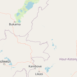
Upemba National Park landscape and geographic character

The physical landscape of Upemba National Park is defined by a dramatic transition from lowland wetland systems to elevated mountainous terrain. The Upemba Depression forms the southern portion of the park, comprising a vast alluvial plain characterized by a chain of interconnected lakes, marshes, and wetlands. Lake Upemba, the largest water body in this system, is a relatively shallow lake with a maximum depth of only about 3.2 meters, supporting extensive algae growth and a complex aquatic ecosystem. The lake system is fed by seasonal water fluctuations, with water levels reaching their peak from March through June and declining to their lowest from October through January. The surrounding wetlands feature extensive papyrus swamps and floating vegetation communities. Rising to the north and west, the Kibara Plateau introduces a fundamentally different landscape character, with the Kibara Mountains (also referred to as Kibara Plateau) forming elevated terrain that experiences drier conditions than the wetlands below. This altitudinal gradient, combined with the interaction between the Lualaba River system and the plateau margins, creates a diverse mosaic of landforms including steep mountain slopes, rolling upland terrain, and the transitional zones between wetland and terrestrial environments.

Upemba National Park ecosystems, habitats, and plant life

The ecological character of Upemba National Park is defined by a remarkable gradient of habitats spanning multiple distinct ecosystem types. At higher elevations in the Kibara Mountains, Afromontane grasslands and forests dominate, representing unique montane vegetation communities adapted to the cooler, drier conditions of elevated terrain. Moving downslope, the park transitions through Miombo woodlands, the characteristic dry forest ecosystem of central Africa dominated by Brachystegia species, which in turn gives way to patches of tropical rainforest in the more humid valley bottoms and riparian zones. The lower elevations within the Upemba Depression represent the most distinct ecological zone, comprising an extensive system of marshes, wetlands, lakes, and streams with well-developed riparian vegetation. Lake Upemba's shallow depth and nutrient-rich waters support intense primary productivity, with the lake and its associated wetlands forming a critical ecological unit within the park. The water bodies throughout the depression exhibit seasonal fluctuations that drive the ecological dynamics of the wetland system, creating a dynamic landscape where aquatic and terrestrial habitats interpenetrate in complex patterns. This habitat diversity supports extraordinary biodiversity, with approximately 1,800 species documented within the park boundaries, including discoveries as recent as 2003 indicating that significant biodiversity remains to be documented.

Upemba National Park wildlife and species highlights

Upemba National Park supports significant wildlife populations, including several species of critical conservation importance. The park contains the last remaining herd of zebras in the Democratic Republic of Congo, representing a significant population of this iconic species at the southern edge of the species' African range. Similarly, the park harbors what are believed to be the last elephants in the southern DRC region, making it critically important for the survival of these populations. The aquatic systems within the park support exceptional fish diversity, with over 30 species of Cyprinidae documented along with Mormyridae (freshwater elephant fish), Barbus species, Alestidae, Mochokidae, and Cichlidae. Bird communities include several globally threatened species, most notably the shoebill, a large and distinctive wetland bird that relies on the papyrus swamps and shallow waters of the Upemba Depression. The wattled crane and spotted ground-thrush also occur within the park, both species facing significant population pressures across their ranges. The park has also yielded significant herpetological discoveries, with Schmidt's snouted frog known only from this protected area, underscoring its importance as a center of endemism.

Upemba National Park conservation status and protection priorities

Upemba National Park holds significant conservation importance as one of the largest and most ecologically diverse protected areas in the Democratic Republic of Congo and central Africa. The park protects critical populations of species that have been largely eliminated from surrounding regions, including the country's last zebra herd and the remaining elephants in southern DRC, representing last-refuge conservation value for these iconic species. The wetland systems centered on Lake Upemba provide essential ecosystem services and habitat for globally threatened bird species including the shoebill and wattled crane, while also supporting extraordinary aquatic biodiversity. The presence of endemic species such as Schmidt's snouted frog highlights the park's significance for biodiversity conservation at the global scale. Management challenges are substantial, with the park experiencing ongoing pressure from poaching, illegal wildlife trade, and human encroachment. The partnership between the Institut Congolais pour la Conservation de la Nature and Forgotten Parks represents an attempt to strengthen protection, though security conditions continue to pose significant challenges to effective conservation. The park's status as an IUCN Category II protected area reflects its formal recognition as a national park with primary protection objectives.

Upemba National Park cultural meaning and human context

Upemba National Park contains several villages within its boundaries, representing human communities whose lives are intertwined with the park's landscapes and resources. These settlements have existed within the area prior to and following the park's establishment in 1939, creating a complex relationship between local communities and conservation objectives. The region has experienced significant political turbulence, including the Katanga secession period and subsequent conflicts that have periodically disrupted park management and intensified pressure on natural resources. Refugee populations and armed militia groups have at various times entered the park area, creating additional conservation challenges and security concerns for both wildlife and park personnel. The local communities maintain connections to the land and its resources, and effective park management increasingly recognizes the importance of community engagement and sustainable relationships between conservation objectives and local livelihoods. Recent management efforts through the Forgotten Parks partnership have emphasized building positive relationships with surrounding communities as part of a broader strategy to address illegal activities that threaten the park.

Top sights and standout views in Upemba National Park

Upemba National Park stands as the Democratic Republic of Congo's largest protected wilderness area, encompassing an extraordinary diversity of ecosystems from Afromontane grasslands and Miombo woodlands to extensive papyrus wetlands and a chain of shallow equatorial lakes. The park protects the country's last zebra population and remaining elephants in southern DRC, providing critical refuge for these iconic species. Lake Upemba and its associated wetlands support remarkable aquatic biodiversity including over 30 fish species and provide essential habitat for the endangered shoebill and wattled crane. The Schmidt's snouted frog is found nowhere else on Earth, underscoring the park's global significance for endemic species. The dramatic landscape transition from the lush Upemba Depression to the drier Kibara Plateau creates a unique ecological gradient that supports approximately 1,800 documented species, with new discoveries continuing to emerge from this biodiverse wilderness.

Best time to visit Upemba National Park

The optimal time to experience Upemba National Park is influenced by the seasonal hydrological patterns that define the park's wetland ecosystems. The period from March through June corresponds to the wet season when water levels in Lake Upemba and the surrounding wetlands reach their peak, creating expansive aquatic environments that provide excellent wildlife viewing opportunities, particularly for waterbirds and aquatic species. The dry season from October through January sees water levels decline, concentrating wildlife around remaining water sources and potentially offering easier access to certain areas. However, it is important to note that the park's accessibility and security conditions can vary significantly based on broader political and security situations in the region, and prospective visitors should carefully evaluate current conditions. The park's remote location and limited infrastructure mean that visits require significant planning and coordination with park authorities or specialized operators familiar with the area.

Park location guide

Geography guide, regional context, and park location map for Upemba National Park

Upemba National Park park geography, regions, and map view in Democratic Republic of the Congo
Understand where Upemba National Park sits in Democratic Republic of the Congo through a broader geographic reading of the surrounding landscape, nearby location context, and its mapped position within the national park landscape.

How Upemba National Park fits into Democratic Republic of the Congo

The Democratic Republic of the Congo is a Central African country bordered by the Republic of the Congo, Angola, Zambia, Tanzania, Uganda, Rwanda, Burundi, and the Central African Republic, with a small Atlantic coastline. It occupies the Congo Basin, one of the world's largest tropical rainforest regions. French is the official language, though over 200 indigenous languages are spoken. Kinshasa is the capital and largest city.

Wider geography shaping Upemba National Park in Democratic Republic of the Congo

The DRC occupies a central position in Central Africa, bordering the Republic of the Congo and the South Atlantic Ocean to the west, the Central African Republic and South Sudan to the north, Uganda, Rwanda, Burundi, and Tanzania to the east (across Lake Tanganyika), and Zambia and Angola to the south. The country's terrain is dominated by the Congo Basin, a vast lowland plain covered in equatorial rainforest, while the eastern and southeastern regions feature highlands and mountains including the Albertine Rift.

Map view of Upemba National Park

Use this park location map to pinpoint Upemba National Park in Democratic Republic of the Congo, understand its exact geographic position, and read its mapped placement within the surrounding landscape more clearly.

Pigeon | © OpenStreetMap contributors

Location context for Upemba National Park

Haut-Katanga ProvinceHaut-LomamiLualaba Province

Visually explore the diverse protected environments, from vast wetlands of the Upemba Depression to the high Kibara Plateau terrain.

Upemba National Park: Photos and Landscapes of a Central African Wilderness
Gain a deeper visual understanding of Upemba National Park's exceptional ecological diversity and dramatic terrain through detailed imagery. These protected-area photographs illustrate the transition from expansive wetlands and shallow lakes to distinct Miombo woodlands and Afromontane grasslands, revealing its critical conservation value.

Upemba National Park

Park atlas

Compare adjacent protected landscapes and trace the regional park geography around Upemba National Park.

Discover Other National Parks and Protected Areas Surrounding Upemba National Park
Continue your journey through central African protected areas by browsing other national parks and protected landscapes within the regional geography surrounding Upemba National Park. Compare their unique ecosystems, from wetlands to montane plateaus, and understand the broader conservation efforts across the Democratic Republic of Congo's diverse natural reserves.
National parkHaut-Katanga Province

Kundelungu National Park National Park: Central Africa's Protected Savanna Landscape

Explore the mapped terrain and dramatic geography of this Haut-Katanga Province protected area.

Kundelungu National Park stands as a significant protected area within the Haut-Katanga Province, offering a deep dive into Central Africa's expansive savanna ecosystems and unique natural landmarks. This national park is defined by its rolling grasslands, dotted with characteristic forest galleries that trace the region's water systems, alongside the awe-inspiring Lofoi Falls. Understanding Kundelungu National Park through its mapped boundaries and geographic context reveals its importance as a protected landscape and a key component of regional conservation efforts within the DRC.

Area
7,600 km²
Established
1970
IUCN
II
National parkZambia

Nsumbu National Park: Zambia's Lakeside Protected Landscape, Map Atlas, and Geographic Context

Mapped terrain and unique shoreline geography.

Nsumbu National Park stands as a vital protected landscape in Zambia, defined by its prominent position on Lake Tanganyika. The park's approximately 2,026 square kilometers showcase a dramatic geographic interplay between terrestrial environments, including miombo woodlands and rare Itigi-Sumbu thicket, and the vast aquatic expanse of the lake. Users exploring this atlas entry will find detailed information on the park's mapped boundaries, distinctive shoreline features like rocky cliffs and sandy beaches, and its overall role in the regional geography of Southern Africa.

Area
2,026 km²
Established
1985
IUCN
II
Relief
Lowland
National parkNorth Western Province

West Lunga National Park: Protected Evergreen Forest in Zambia's North Western Province

Mapped boundaries of rare Zambezian Cryptosepalum dry forests

West Lunga National Park stands as a testament to Zambia's unique ecological treasures, recognized as its sole national park predominantly covered by dense evergreen forest. This protected area is a vital sanctuary for the rare Zambezian Cryptosepalum dry forests, representing the largest contiguous forest of its kind outside equatorial Africa. Exploring this park reveals a landscape defined by the dense canopy of mukwe trees, sandy terrain, and a profound sense of remote wilderness, offering distinct atlas and geographic discovery.

Area
1,700 km²
IUCN
II
National parkUvinza District

Mahale Mountains National Park: Tanzania's Remote Mountain Forest & Lake Tanganyika Landscape

Explore unique primate habitats and dramatic protected terrain.

Mahale Mountains National Park stands as a testament to unique ecological convergence, where the Mahale Mountains' dense forests dramatically meet the vast expanse of Lake Tanganyika. This protected area is globally recognized for harboring the largest wild population of eastern chimpanzees, offering a rare glimpse into their behavior within a pristine wilderness. The park's landscape is defined by steep mountain slopes, diverse woodland, and aquatic environments, creating a distinctive geographic context that sets it apart from typical savanna protected areas in Tanzania.

Area
1,650 km²
Established
1985
IUCN
II
National parkKatavi Region

Katavi National Park: A Vast Protected Landscape in Tanzania's Katavi Region

Explore its unique floodplains, seasonal wetlands, and wildlife spectacles.

Katavi National Park is a significant national park located in the Katavi Region of Tanzania, spanning over 4,471 square kilometers. This remote protected area is characterized by extensive floodplains, the vital Katuma River system, and seasonal lakes like Lake Katavi and Lake Chada, which undergo dramatic changes throughout the year. The park's geography supports a dynamic ecosystem renowned for its large wildlife populations, including spectacular hippo gatherings during dry periods and vast herds of buffaloes and elephants roaming its uncrowded savannas. Katavi offers an unparalleled glimpse into a wild, untamed African landscape.

Area
4,471 km²
Established
1974
IUCN
II
National parkMoxico Leste Province

Cameia National Park: Unique Zambezi Basin Wetlands and Miombo Woodlands in Angola

Explore the mapped geography of Angola's sole Zambezi basin ecological sample.

Cameia National Park is a significant protected area in Moxico Leste Province, Angola, distinguished by its status as the country's only representation of Zambezi River basin ecosystems. The park features extensive seasonally inundated plains and characteristic miombo woodlands, offering a unique mosaic of wetland and forest landscapes. Understanding its geographic setting, hydrological connections to the Chifumage, Lumege, and Luena rivers, and its position within the broader Zambezi drainage system provides essential context for this irreplaceable protected territory.

Area
1,445 km²
Established
1938
IUCN
II
Relief
Lowland
National parkSouth Africa

Blue Lagoon National Park: National Park Atlas and Mapped Wetland Geography

Discover the protected landscape and fauna of Zambia's Kafue Flats.

Blue Lagoon National Park is a critical protected area recognized for its unique wetland and floodplain environment within South Africa's extensive Kafue Flats system. Established in 1976, this national park offers significant opportunities for atlas-driven exploration of its mapped geography and protected landscape. Visitors can learn about the park's ecological significance, its characteristic terrain of lagoons and marshes, and its importance as a sanctuary for endemic wildlife and diverse bird species, contributing valuable context to the broader regional atlas.

Area
500 km²
Established
1976
IUCN
II
National parkLusaka Province

Lusaka National Park: Protected Woodland Habitat and Geographic Context in Lusaka Province

Zambia's smallest national park, mapping natural terrain near the capital.

Lusaka National Park, Zambia's newest national park, offers a contained yet representative example of the woodland ecosystems found on the Lusaka plateau. This protected landscape, covering 6,715 hectares, is entirely fenced, creating a distinct conservation area within Lusaka Province. Its establishment over a former forest reserve highlights a unique approach to upgrading protected lands. Explore the park's mapped terrain and understand its significance as an accessible natural enclave amid regional development, providing a focused view of central Zambian woodland environments.

Area
67.15 km²
Established
2011
IUCN
II

Common questions about visiting, size, designation, and location context for Upemba National Park

Upemba National Park FAQs for park facts, access, geography, and protected area context
Find quick answers about Upemba National Park, including protected-area facts, park geography, trail and visitor context, and how the park fits into its surrounding country and regional landscape.
MoriAtlas Explorer

Continue Your Protected Areas Search Across the Global Atlas

Deepen your exploration by continuing the structured search for national parks and protected areas worldwide. Utilize the comprehensive filtering capabilities to compare different conservation landscapes and refine your understanding of global park geography. Discover more about the distribution and characteristics of protected natural areas.

Global natural geography