Mori Atlas logo
National parkMahale Mountains National Park

Discover the unique geography where Mahale Mountains meet Lake Tanganyika's shores.

Mahale Mountains National Park: A Remote Tanzanian Protected Landscape and Chimpanzee Habitat

(Hifadhi ya Taifa ya Milima ya Mahale)

Mahale Mountains National Park represents a significant protected landscape on the eastern shores of Lake Tanganyika in Tanzania. This remote national park is characterized by the striking Mahale Mountains range, a dramatic chain of forested peaks that descend sharply to meet the crystal-clear waters of the lake. Established to conserve its critical ecosystems and remarkable wildlife, the park offers a unique window into primate conservation and the geographic intersection of mountain forests and great African lakes.

chimpanzee sanctuaryLake Tanganyikamountain foresteastern chimpanzeesprimate conservationGreat Lakes Africa

Mahale Mountains National Park

National park

Park overview

Structured park overview, official facts, and landscape profile for Mahale Mountains National Park

Mahale Mountains National Park park facts, protected area profile, and essential visitor context
Review the core facts for Mahale Mountains National Park, including designation, size, terrain, visitor scale, habitats, and operating context in one park-focused overview.

About Mahale Mountains National Park

Mahale Mountains National Park occupies a distinctive position among Tanzania's protected areas, combining exceptional biodiversity with remarkable geographical setting. The park sits on the eastern shore of Lake Tanganyika, the world's second-deepest freshwater lake, where the Mahale Mountains rise dramatically from the lakeshore to elevations exceeding 2,000 meters. This creates a complex mosaic of habitats ranging from lakeside beaches and miombo woodland on the lower slopes to montane forest and rocky alpine zones at higher elevations. The park's isolation has proven advantageous for conservation, as the absence of roads has limited human disturbance and preserved natural ecological processes. The chimpanzees of Mahale have been studied continuously since the late 1970s, making this one of the longest-running chimpanzee research programs in Africa. The park's management emphasizes low-impact tourism, with visitors transported by boat and guided on foot through the wilderness, ensuring that the park retains its wild character while generating revenue for conservation and local communities.

Quick facts and research context for Mahale Mountains National Park

Mahale Mountains National Park covers 1,650 square kilometers along Lake Tanganyika's eastern shore in Tanzania's Kigoma Region. The park was established in 1985 and is managed by the Tanzania National Parks Authority. It contains one of the world's largest populations of eastern chimpanzees, estimated at around 1,000 individuals. The only access to the park is by boat across Lake Tanganyika, with internal exploration conducted entirely on foot due to the absence of any road infrastructure. The park is part of a chain of protected areas along Africa's Great Lakes, with Gombe Stream National Park located nearby to the north.

Park context

Deeper park guide and search-rich context for Mahale Mountains National Park

Mahale Mountains National Park history, landscape, wildlife, and travel context
Explore Mahale Mountains National Park through its history, landscape character, ecosystems, wildlife, conservation priorities, cultural context, and seasonal travel timing in a structured park guide built for atlas discovery and search intent.

Why Mahale Mountains National Park stands out

Mahale Mountains National Park is best known for its remarkable chimpanzee population, which represents the largest and possibly most genetically diverse community of eastern chimpanzees remaining in the wild. The park's chimpanzees have been the subject of long-term research since the establishment of the Mahale Mountains Wildlife Research Center in 1979, providing crucial insights into chimpanzee behavior, social structures, and ecology. The park is also notable for the dramatic scenery where the Mahale Mountains rise abruptly from Lake Tanganyika's crystal-clear waters, creating a backdrop of forested slopes and rocky outcrops. Additionally, Mahale is one of the few places in Africa where wild chimpanzees and lions coexist, an unusual ecological phenomenon that adds to the park's scientific and conservation significance.

Mahale Mountains National Park history and protected-area timeline

The formal protection history of Mahale Mountains began with the establishment of the Mahale Mountains Wildlife Research Center in 1979, which marked the beginning of systematic study of the local chimpanzee population. Prior to the park's creation, the Mahale Mountains were traditionally inhabited by the Batongwe and Holoholo peoples, with population estimates of 22,000 and 12,500 respectively in 1987. These communities had maintained a relationship with the landscape for generations, though the creation of the protected area required their relocation from the mountain regions. Mahale Mountains National Park was officially established in 1985, becoming one of Tanzania's newer national parks. The park was designated as an IUCN Category II protected area, recognizing its national park status and conservation mandate. Research efforts have continued to build understanding of the chimpanzee communities, with the population estimated at approximately 1,000 individuals, making it the largest protected chimpanzee population in Africa.

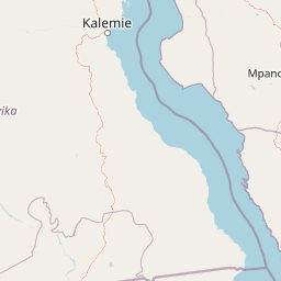
Mahale Mountains National Park landscape and geographic character

The landscape of Mahale Mountains National Park is defined by the dramatic encounter between the Mahale Mountains and Lake Tanganyika. The mountains rise steeply from the lakeshore, creating a backdrop of forested peaks that extend inland from the water's edge. The terrain is characterized by rocky ridges, deep valleys, and cascading streams that flow down from the higher elevations toward the lake. The lower slopes feature miombo woodland dominated by Brachystegia trees, while higher elevations support montane forest with species adapted to cooler, more humid conditions. The lakeshore itself offers sandy beaches and rocky outcrops where the forest meets the water, creating scenic viewpoints and natural harbors used by the park's boat-based access system. The combination of aquatic and terrestrial environments, combined with the mountain's vertical relief, produces a visually striking landscape that distinguishes Mahale from the more rolling savanna parks that characterize much of Tanzania's protected area network.

Mahale Mountains National Park ecosystems, habitats, and plant life

The ecological character of Mahale Mountains National Park reflects its position at the intersection of multiple habitat types. The park contains a gradient of environments from lakefront to mountain summit, supporting diverse plant communities including lowland forest, montane forest, bamboo thickets, and grassland patches. The chimpanzee population represents the park's most significant ecological asset, occupying territories throughout the forested slopes and contributing to seed dispersal and forest dynamics through their feeding and movement patterns. Beyond chimpanzees, the park supports populations of other primates including baboons and colobus monkeys, while the forest floors harbor diverse small mammal communities. The lake itself contains important fish populations and provides habitat for waterbird species, though the primary ecological focus remains the terrestrial forest ecosystems. The park's status as one of Tanzania's two chimpanzee protected areas, along with Gombe Stream to the north, underlines its importance for primate conservation in East Africa.

Mahale Mountains National Park wildlife and species highlights

The wildlife of Mahale Mountains National Park is most famous for its chimpanzee population, which represents the largest known community of eastern chimpanzees in the world. These apes have been studied extensively since the 1970s, revealing complex social structures, tool-use behaviors, and territorial dynamics that mirror human social organization in many respects. The park is one of the few African protected areas where wild chimpanzees and lions share the landscape, an unusual coexistence that researchers have studied with interest. Other notable mammals include baboons, which form large troops that travel through the forest, red colobus monkeys, and various small carnivore species. The avian fauna includes forest bird species adapted to the dense canopy, while the lakeshore provides habitat for waterfowl and fish-eating birds. The combination of forest and aquatic environments creates a diverse wildlife community, though the chimpanzees remain the park's signature species and primary draw for visitors and researchers alike.

Mahale Mountains National Park conservation status and protection priorities

Mahale Mountains National Park holds significant conservation importance as a stronghold for eastern chimpanzees, a subspecies that faces considerable pressure from habitat loss, hunting, and disease across its range. The park's population of approximately 1,000 individuals represents a substantial portion of the global population and benefits from the protection afforded by national park status and the park's relative remoteness. The absence of roads within the park boundaries has helped maintain habitat integrity and reduced edge effects that impact many more accessible protected areas. Conservation challenges include managing the interface between human communities and wildlife, addressing the potential for disease transmission from humans to chimpanzees, and maintaining funding for patrol and monitoring activities in a remote location. The park works in conjunction with ongoing research programs to monitor chimpanzee population trends and develop management strategies that balance conservation with sustainable tourism. The park's inclusion in Tanzania's protected area network contributes to broader regional conservation goals for the Great Lakes region.

Mahale Mountains National Park cultural meaning and human context

The Mahale Mountains region was historically home to the Batongwe and Holoholo peoples, who maintained traditional lifestyles connected to the land and Lake Tanganyika for generations. These communities possessed detailed knowledge of local wildlife, plant resources, and seasonal patterns, living in close association with the forest environment. The establishment of the research center and subsequent creation of the national park required the relocation of these communities from the mountain areas they had inhabited. This displacement remains a complex aspect of the park's history, reflecting broader tensions between conservation objectives and indigenous land rights that have played out across African protected areas. The park's name derives from the Mahale Mountains themselves, and the Swahili designation Hifadhi ya Taifa ya Milima ya Mahale translates to National Park of the Mahale Mountains, connecting the protected area to its geographical and cultural origins.

Top sights and standout views in Mahale Mountains National Park

The defining highlights of Mahale Mountains National Park include the opportunity to observe wild chimpanzees in their natural forest habitat, guided by experienced trackers who understand the apes' movements and behavior. The park's scenery offers a distinctive alternative to Tanzania's more famous savanna parks, with the combination of forest-covered mountains rising from a great lake creating photogenic vistas and memorable wilderness experiences. The boat-based access across Lake Tanganyika provides a unique arrival experience, while foot exploration through the forest offers immersion in a true wilderness landscape where vehicle noise is absent. The presence of lions roaming the same forests as chimpanzees adds a distinctive wildlife dimension not found in most other African parks. The park's research legacy, building on decades of chimpanzee observation, provides visitors with context and insight into the lives of these intelligent primates.

Best time to visit Mahale Mountains National Park

The optimal time to visit Mahale Mountains National Park corresponds to the dry seasons in Tanzania, typically from June through October and again from December through February. During these periods, forest trails are more manageable and wildlife viewing conditions improve as animals concentrate around water sources. The dry season also corresponds with lower lake levels that may affect boat access points along the shoreline. The wet seasons bring increased vegetation density that can make chimpanzee observation more challenging, though the lush forest environment has its own appeal. Visitors should be prepared for the park's basic infrastructure and the need to travel by boat, with access dependent on weather conditions on Lake Tanganyika. The park's remote location and limited visitor numbers mean that advance planning is essential, with most visits arranged through specialized operators who coordinate with the Tanzania National Parks Authority.

Park location guide

Geography guide, regional context, and park location map for Mahale Mountains National Park

Mahale Mountains National Park park geography, regions, and map view in Tanzania
Understand where Mahale Mountains National Park sits in Tanzania through a broader geographic reading of the surrounding landscape, nearby location context, and its mapped position within the national park landscape.

How Mahale Mountains National Park fits into Tanzania

Tanzania, officially the United Republic of Tanzania, is a presidential republic in East Africa within the African Great Lakes region. It was formed in 1964 through the unification of Tanganyika and Zanzibar. The country is known for its diverse wildlife, national parks including Serengeti and Ngorongoro, and significant archaeological sites with important hominid fossils.

Wider geography shaping Mahale Mountains National Park in Tanzania

Tanzania is located in East Africa within the African Great Lakes region. It is bordered by Uganda to the northwest, Kenya to the northeast, the Indian Ocean to the east, Mozambique and Malawi to the south, Zambia to the southwest, and Rwanda, Burundi, and the Democratic Republic of the Congo to the west. The country includes the mainland and the Zanzibar Archipelago.

Map view of Mahale Mountains National Park

Use this park location map to pinpoint Mahale Mountains National Park in Tanzania, understand its exact geographic position, and read its mapped placement within the surrounding landscape more clearly.

Pigeon | © OpenStreetMap contributors

Location context for Mahale Mountains National Park

Kigoma RegionUvinza District
Park atlas

Explore similar protected landscapes and trace regional park geography in Tanzania and Great Lakes Africa.

Discover Other National Parks and Protected Areas Near Mahale Mountains National Park
Continue your exploration of Mahale Mountains National Park by browsing other national parks and protected areas across its surrounding regional geography, comparing unique conservation landscapes in Tanzania and the wider Great Lakes Africa region. Map diverse terrain, from mountain forests to other significant natural areas, to understand their geographic spread and ecological connections.
National parkKatavi Region

Katavi National Park: A Vast Protected Landscape in Tanzania's Katavi Region

Explore its unique floodplains, seasonal wetlands, and wildlife spectacles.

Katavi National Park is a significant national park located in the Katavi Region of Tanzania, spanning over 4,471 square kilometers. This remote protected area is characterized by extensive floodplains, the vital Katuma River system, and seasonal lakes like Lake Katavi and Lake Chada, which undergo dramatic changes throughout the year. The park's geography supports a dynamic ecosystem renowned for its large wildlife populations, including spectacular hippo gatherings during dry periods and vast herds of buffaloes and elephants roaming its uncrowded savannas. Katavi offers an unparalleled glimpse into a wild, untamed African landscape.

Area
4,471 km²
Established
1974
IUCN
II
Visitors
1.5K annual
National parkTabora Region

Ugalla River National Park: A Tanzania National Park for Geographic Discovery

Explore protected area boundaries and regional landscape context.

Ugalla River National Park serves as a key protected area within Tanzania, specifically situated in the Tabora Region. This page provides essential geographic context, detailing its mapped boundaries and its significance as a national park. It’s designed for users seeking structured information about protected landscapes and their placement within regional geography, offering a factual basis for atlas exploration.

Area
3,865 km²
Established
2019
IUCN
II
Relief
Upland
National parkZambia

Nsumbu National Park: Zambia's Lakeside Protected Landscape, Map Atlas, and Geographic Context

Mapped terrain and unique shoreline geography.

Nsumbu National Park stands as a vital protected landscape in Zambia, defined by its prominent position on Lake Tanganyika. The park's approximately 2,026 square kilometers showcase a dramatic geographic interplay between terrestrial environments, including miombo woodlands and rare Itigi-Sumbu thicket, and the vast aquatic expanse of the lake. Users exploring this atlas entry will find detailed information on the park's mapped boundaries, distinctive shoreline features like rocky cliffs and sandy beaches, and its overall role in the regional geography of Southern Africa.

Area
2,026 km²
Established
1985
IUCN
II
Relief
Lowland
Nature reserveTanzania

Kigosi National Park Nature Reserve: Mapped Boundaries and Geographic Identity in Tanzania

Explore the protected landscape and regional context of this Tanzanian reserve.

Kigosi National Park in Tanzania is a designated nature reserve, offering a key point for exploring protected landscapes and their geographic placement. This entry details the park's identity as a conservation area, focusing on its mapped boundaries and how it fits within the regional geography of Tanzania. For users interested in atlas exploration, this provides essential context on the park's natural terrain and its standing as a protected natural area.

Area
8,265 km²
Established
2024
IUCN
II
Relief
Lowland
National parkBurundi

Rusizi National Park: National Park in Burundi's Geographic Landscape Context

Explore mapped protected area boundaries and regional geography.

Rusizi National Park stands as a significant protected area within Burundi, contributing to the nation's conservation atlas. This national park offers a distinct geographic profile, showcasing its specific landscape and terrain features within the East African context. Users can delve into the mapped boundaries of Rusizi National Park to understand its protected status and its role in the regional geography, facilitating detailed geographic discovery.

Area
90 km²
Established
1980
IUCN
II
Climate
Tropical
National parkBurundi

Ruvubu National Park: A National Park in Burundi Focused on Protected Landscape Geography

Explore the mapped boundaries and regional context of Ruvubu.

Investigate Ruvubu National Park, a protected natural area in Burundi, and understand its geographic significance. This page serves as a detailed atlas entry, highlighting the park's mapped extent and its contribution to the regional landscape of East Africa. Explore the protected-area context and geographical features that define Ruvubu National Park for discovery and analysis.

Area
508 km²
Established
1980
IUCN
II
Relief
Mixed relief
National parkLuapula Province

Lusenga Plain National Park: Zambia National Park Geographic Atlas

Mapped park boundaries and regional landscape context.

Gain a structured understanding of Lusenga Plain National Park, a dedicated national park situated in Zambia's Luapula Province. This resource details the park's geographic dimensions and its placement within the regional landscape, providing essential context for atlas exploration and a mapped view of protected lands.

Area
800 km²
Established
1972
IUCN
II
Relief
Lowland
National parkBurundi

Kibira National Park: Burundi's Protected National Park Landscape and Geography

Mapped protected area within the Great Rift Valley region.

Kibira National Park represents a vital protected national park entity within Burundi's diverse geography. As part of the Great Rift Valley's expanse, its mapped boundaries and landscape identity offer a focal point for understanding regional protected areas. This park's presence in Burundi contributes essential data to a structured atlas of natural landscapes and conservation lands across East Africa.

Area
400 km²
IUCN
II
Relief
Mountain
Climate
Tropical

Common questions about visiting, size, designation, and location context for Mahale Mountains National Park

Mahale Mountains National Park FAQs for park facts, access, geography, and protected area context
Find quick answers about Mahale Mountains National Park, including protected-area facts, park geography, trail and visitor context, and how the park fits into its surrounding country and regional landscape.
MoriAtlas Explorer

Continue Your Protected Areas Search Across the Global Atlas

Deepen your exploration by continuing the structured search for national parks and protected areas worldwide. Utilize the comprehensive filtering capabilities to compare different conservation landscapes and refine your understanding of global park geography. Discover more about the distribution and characteristics of protected natural areas.

Global natural geography