Mori Atlas logo
National parkChaelundi National Park

Discover the mapped boundaries and geographic significance of this vital Australian national park.

Chaelundi National Park: Protected Old-Growth Forest Landscape in the Northern Tablelands

Chaelundi National Park represents a significant protected area within the rugged terrain of New South Wales' Northern Tablelands. Established following landmark environmental legal cases, this national park safeguards extensive old-growth forest ecosystems and declared wilderness areas. Its preservation offers critical insights into forest conservation values and the regional geography of eastern Australia, making it a key destination for understanding protected natural landscapes.

Old-growth forestWilderness areaNorthern TablelandsNational parkForest conservationProtected area

Chaelundi National Park

National park

Park overview

Structured park overview, official facts, and landscape profile for Chaelundi National Park

Chaelundi National Park park facts, protected area profile, and essential visitor context
Review the core facts for Chaelundi National Park, including designation, size, terrain, visitor scale, habitats, and operating context in one park-focused overview.

About Chaelundi National Park

Chaelundi National Park occupies a significant position in New South Wales's protected area network as a conservation reserve on the Northern Tablelands. The park's terrain consists of undulating tableland country typical of this part of eastern Australia, with elevations supporting diverse forest communities. The combination of old-growth forest and wilderness designation makes the park important for maintaining forest ecosystem integrity in a region that had historically been subject to extensive logging pressure. The park was created through a process that involved substantial public advocacy and legal intervention, reflecting the broader environmental movement's growing influence on land management in New South Wales during the 1990s.

Quick facts and research context for Chaelundi National Park

Chaelundi National Park is situated in the Northern Tablelands district of New South Wales, lying north-west of both Dorrigo and Grafton. The park covers 19,174 hectares and comprises approximately 7,500 hectares of old-growth forest along with 11,000 hectares designated as wilderness. According to wildlife surveys, the park supports 187 species of fauna. The area was protected following a series of landmark legal cases in the NSW Land and Environment Court during 1989 to 1991, which established important precedents for forest habitat protection.

Park context

Deeper park guide and search-rich context for Chaelundi National Park

Chaelundi National Park history, landscape, wildlife, and travel context
Explore Chaelundi National Park through its history, landscape character, ecosystems, wildlife, conservation priorities, cultural context, and seasonal travel timing in a structured park guide built for atlas discovery and search intent.

Why Chaelundi National Park stands out

Chaelundi National Park is best known for its extensive old-growth forest ecosystems and the legal history surrounding its protection. The park contains approximately 7,500 hectares of old-growth forest characterized by large hollow-bearing trees that provide critical habitat for numerous species. The legal cases brought by the North East Forest Alliance in the early 1990s, particularly the landmark Corkill v Forestry Commission ruling, drew national attention to the area's ecological significance. Justice Paul Stein famously described the old-growth forest as a "veritable forest dependent zoo" due to its exceptional habitat values, and the court established that the term "take" in environmental legislation could encompass indirect harm through habitat modification.

Chaelundi National Park history and protected-area timeline

Chaelundi National Park was formally proclaimed in January 1997, representing the culmination of nearly a decade of conservation advocacy and legal action. The land had previously been managed as a State-owned production forest, and the transition to national park status came after significant conflict over logging activities in the area. Between 1989 and 1991, members of the North East Forest Alliance brought a series of cases to the NSW Land and Environment Court seeking to protect the forest near Dorrigo from continued logging. The key litigation centered on the interpretation of section 99 of the National Parks and Wildlife Act 1974, which prohibited taking or killing endangered fauna. In the case of Corkill v Forestry Commission, Justice Paul Stein delivered a significant ruling recognizing the forest's exceptional habitat values and establishing that indirect harm through habitat destruction constituted a prohibited "take" under the legislation. This decision was upheld on appeal to the Court of Appeal. The legal victories were complemented by on-site protest activities including blockades and demonstrations that drew widespread public attention to the campaign.

Chaelundi National Park landscape and geographic character

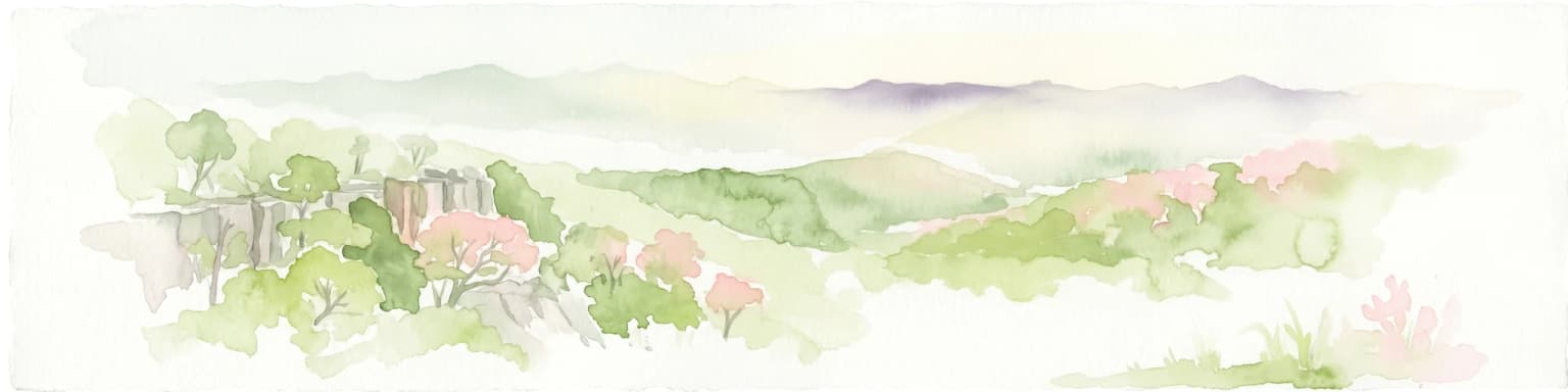
Chaelundi National Park is located in the Northern Tablelands of New South Wales, a region characterized by elevated, undulating terrain with elevations typically ranging above 1,000 metres above sea level. The park encompasses a landscape dominated by forested ridges and valleys, with the old-growth forest communities representing some of the most visually and ecologically significant features. The declared wilderness area within the park covers approximately 11,000 hectares, providing a remote and largely unmodified landscape character typical of high-conservation-value forest areas in this part of eastern Australia.

Chaelundi National Park ecosystems, habitats, and plant life

The park's ecological significance is centered on its old-growth forest communities, which represent mature forest ecosystems with complex structure, large hollow-bearing trees, and diverse flora assemblages. These forests provide critical habitat for numerous species and function as important components of the broader forest ecosystem network in the Northern Tablelands region. The habitat complexity of the old-growth areas supports a range of ecological relationships and provides resources for species that depend on attributes found only in mature forest environments.

Chaelundi National Park wildlife and species highlights

According to records from the Atlas of NSW Wildlife, Chaelundi National Park supports 187 species of fauna, encompassing both indigenous and non-indigenous species. The old-growth forest habitats with their large hollow-bearing trees provide essential resources for wildlife including various bird species, arboreal mammals, and other forest-dwelling animals. The park's designation as wilderness across a substantial portion of its area helps maintain the natural conditions that support this wildlife population.

Chaelundi National Park conservation status and protection priorities

The establishment of Chaelundi National Park represents an important conservation outcome for forest protection in New South Wales. The park protects old-growth forest ecosystems that had been under threat from logging activities prior to its declaration. The legal precedent established through the Corkill v Forestry Commission case contributed significantly to forest conservation policy in Australia by clarifying the scope of habitat protection legislation. The combination of old-growth forest protection and wilderness designation provides durable conservation security for the park's natural values.

Top sights and standout views in Chaelundi National Park

Chaelundi National Park's significance stems from its combination of old-growth forest protection and wilderness preservation on the Northern Tablelands. The park was created following landmark legal cases that helped establish important precedents for forest habitat protection in Australian environmental law. The old-growth forest areas, described by the courts as a "veritable forest dependent zoo," represent some of the most significant forest conservation values in the region.

Park location guide

Geography guide, regional context, and park location map for Chaelundi National Park

Chaelundi National Park park geography, regions, and map view in Australia
Understand where Chaelundi National Park sits in Australia through a broader geographic reading of the surrounding landscape, nearby location context, and its mapped position within the national park landscape.

How Chaelundi National Park fits into Australia

Australia is a constitutional monarchy and federal parliamentary democracy comprising six states and ten territories. With a population of nearly 28 million, it is one of the world's most urbanised countries, with most people concentrated on the eastern seaboard. The country has a high Human Development Index and is known for its cultural diversity, ancient Aboriginal heritage, and unique wildlife.

Wider geography shaping Chaelundi National Park in Australia

Australia occupies the entire Australian continent, the island of Tasmania, and numerous smaller islands. It is the world's flattest and driest inhabited continent, featuring vast deserts in the interior (the Outback), tropical rainforests along the eastern coast, and a coastline bordering the Indian and Pacific Oceans.

Map view of Chaelundi National Park

Use this park location map to pinpoint Chaelundi National Park in Australia, understand its exact geographic position, and read its mapped placement within the surrounding landscape more clearly.

Pigeon | © OpenStreetMap contributors

Location context for Chaelundi National Park

Northern Tablelands
Park atlas

Discover the regional spread of protected areas in the Northern Tablelands, comparing diverse forest and wilderness landscapes.

Explore Nearby National Parks and Protected Landscapes Around Chaelundi National Park
Continue your exploration from Chaelundi National Park to browse additional national parks and protected areas within the Northern Tablelands of New South Wales. Compare varied forest ecosystems, wilderness areas, and rugged tableland terrain, gaining deeper geographic context and understanding the broader conservation landscape.
National parkNew South Wales

Yabbra National Park: A Protected Natural Landscape within New South Wales' Northern Rivers Region

Explore mapped terrain and regional park geography.

Gain insight into Yabbra National Park, a conservation area covering 88.9 square kilometers of undulating terrain in New South Wales. This protected landscape provides a detailed look at regional Australian geography, focusing on its mapped boundaries and natural features. Understand its role as a national park within the Northern Rivers region, offering a foundation for structured geographic discovery and landscape context.

Area
88.9 km²
Established
1999
IUCN
II
Climate
Temperate
Watercolor illustration of rolling hills, green forests, and pink flowering trees
National parkNew South Wales

Guy Fawkes River National Park: National Park Geographic Context and Mapped Boundaries

Explore the protected landscape and regional geography of this New South Wales national park.

Gain a structured understanding of Guy Fawkes River National Park, a key national park in New South Wales, Australia. This entry provides detailed insights into its mapped geographic boundaries, its role as a protected landscape, and its contribution to the broader regional context for atlas exploration. Examine the park's place within the natural terrain of New South Wales for a clearer picture of conservation lands.

Area
1,005.9 km²
Established
1972
IUCN
Ib
Relief
Highland
National parkNew South Wales

Nymboi-Binderay National Park: Protected Landscape in New South Wales

Explore its mapped boundaries and regional natural geography.

Nymboi-Binderay National Park stands as a protected natural landscape within New South Wales, Australia, offering valuable geographic context for atlas explorers. This entry focuses on its identity as a national park, providing insights into its mapped protected area and its position within the broader regional geography of New South Wales, enabling structured discovery of its natural landscape features.

Area
172.43 km²
Established
1997
IUCN
II
Relief
Upland
National parkNew South Wales

Ramornie National Park: National Park Discovery and Geographic Mapping in New South Wales

Explore its mapped boundaries and regional protected landscape identity.

Ramornie National Park stands as a distinct national park within New South Wales, offering users a focal point for understanding protected area geography. This page provides essential atlas-level context, detailing the park's mapped outlines and its placement within the broader regional landscape of Australia. Engage with the core geographic identity of Ramornie National Park, designed for structured discovery and landscape analysis without any operational details.

Area
31.6 km²
Established
1999
IUCN
II
Relief
Lowland
National parkNew South Wales

Nymboida National Park: A Protected National Park in New South Wales with Mapped Geographic Context

Explore its protected landscape and regional park geography

Nymboida National Park is a key protected area within the state of New South Wales, Australia. This page provides essential details for atlas exploration, focusing on its mapped boundaries and the geographic context it occupies. Understand the park's identity as a national park and its contribution to the protected landscape of the region, offering insights into its natural terrain and regional distribution.

Area
316 km²
Established
1980
IUCN
Ib
Relief
Mountain
National parkNew South Wales

Barool National Park: National Park Discovery and Geographic Context

Mapped protected area within New South Wales.

Barool National Park is identified as a protected national park, contributing to the rich tapestry of natural landscapes across New South Wales. Understanding its specific location and mapped boundaries is essential for appreciating its role within the regional geography of Australia. This entry provides a factual basis for exploring the park's identity as a defined protected area, offering a unique point of reference for geographic discovery.

Area
112.44 km²
Established
1999
IUCN
II
Climate
Temperate
National parkNew South Wales

Junuy Juluum National Park: New South Wales Protected Forest Remnant Exploration

Discover rare warm temperate rainforest and unique Australian birdlife.

Junuy Juluum National Park offers a vital glimpse into a rare warm temperate rainforest habitat within New South Wales. Situated on Campion Mountain, this protected area showcases a distinct forest ecosystem, contrasting sharply with the surrounding eucalypt woodlands and cleared agricultural lands. Its mapped geography and status as a protected forest remnant make it significant for understanding regional conservation landscapes and unique Australian birdlife.

Area
9 km²
Established
1999
IUCN
II
Relief
Mountain
National parkNew South Wales

Cascade National Park: National Park in New South Wales with Mapped Protected Boundaries

Explore the unique geography and landscape context of this protected area.

Delve into Cascade National Park, a protected national park located in New South Wales, Australia. This entity is crucial for understanding the mapped geographic extent and specific landscape characteristics of one of Australia's protected natural areas. Its inclusion within the atlas provides a grounded point for examining regional conservation lands and their spatial distribution.

Area
36 km²
Established
1999
IUCN
II
Climate
Temperate

Common questions about visiting, size, designation, and location context for Chaelundi National Park

Chaelundi National Park FAQs for park facts, access, geography, and protected area context
Find quick answers about Chaelundi National Park, including protected-area facts, park geography, trail and visitor context, and how the park fits into its surrounding country and regional landscape.
MoriAtlas Explorer

Continue Your Protected Areas Search Across the Global Atlas

Deepen your exploration by continuing the structured search for national parks and protected areas worldwide. Utilize the comprehensive filtering capabilities to compare different conservation landscapes and refine your understanding of global park geography. Discover more about the distribution and characteristics of protected natural areas.

Global natural geography