Mori Atlas logo
National parkBeelu National Park

Discover the jarrah-marri forest terrain and mapped natural context of this Western Australia national park.

Beelu National Park: Protected Landscape & Geographic Atlas in Western Australia

Beelu National Park represents a significant protected area within the Darling Range, east of Perth, Western Australia. This national park preserves rolling hills and the Helena River valley, characterized by extensive old-growth jarrah-marri forest ecosystems. Its geographic setting makes it a vital ecological corridor, offering a unique mapped landscape for exploration and understanding regional natural heritage. Discover the park's protected boundaries and its role in Western Australia's conservation network.

National ParkWestern AustraliaJarrah ForestDarling RangeNoongar HeritageOld Growth Forest

Beelu National Park

National park

Park overview

Structured park overview, official facts, and landscape profile for Beelu National Park

Beelu National Park park facts, protected area profile, and essential visitor context
Review the core facts for Beelu National Park, including designation, size, terrain, visitor scale, habitats, and operating context in one park-focused overview.

About Beelu National Park

Beelu National Park occupies a significant position in Western Australia's conservation estate as part of the Parks of the Darling Range. The park's establishment in 1995 represented a commitment to preserving remaining old-growth forest in the Perth hills region, forming a chain of protected areas that help maintain biodiversity connectivity between the Swan Coastal Plain and the forested uplands of the Darling Scarp. The landscape consists of undulating hillsides and valleys carved by the Helena River, with the vegetation reflecting the jarrah forest ecosystem characteristic of the southwest of Western Australia. This forest type supports distinctive understory plants and provides habitat for numerous species, though the park is primarily valued for its forest preservation and watershed protection functions. The park lies adjacent to the Mundaring Weir, a historic water supply reservoir for Perth that adds to the area's regional significance.

Quick facts and research context for Beelu National Park

Beelu National Park is located in Western Australia, roughly 40 kilometres east of Perth's central business district, near the town of Mundaring. The park encompasses the Helena River valley and surrounding hillsides, featuring typical Southwest Australian forest ecosystems dominated by jarrah and marri trees. The area holds deep cultural significance as traditional Noongar country, with the Beelu people historically inhabiting the district bounded by the Helena, Swan, and Canning Rivers. The park offers visitor facilities including the Perth Hills National Parks Centre, hiking and mountain biking trails, picnic areas, and viewpoints overlooking Mundaring Weir.

Park context

Deeper park guide and search-rich context for Beelu National Park

Beelu National Park history, landscape, wildlife, and travel context
Explore Beelu National Park through its history, landscape character, ecosystems, wildlife, conservation priorities, cultural context, and seasonal travel timing in a structured park guide built for atlas discovery and search intent.

Why Beelu National Park stands out

Beelu National Park is best known for its role in protecting old-growth jarrah-marri forest in the Darling Range and its connection to Noongar cultural heritage. The park preserves significant stands of native vegetation including jarrah, marri, Zamia, bull Banksia, sheoak, and grass tree species. The South Ledge lookout provides panoramic views over Mundaring Weir and Lake CY O'Connor, while Fred Jacoby Park within the park contains the largest oak tree in Western Australia. The park serves as a recreational escape for Perth residents, offering trails through relatively intact forest ecosystems relatively close to the city.

Beelu National Park history and protected-area timeline

Beelu National Park was originally established in 1995 as Mundaring National Park, created under the state government's Protecting Our Old Growth Forests policy. This policy initiative marked a significant expansion of national park protection in Western Australia during the 1990s, aimed at preserving remaining old-growth forest across the state's Southwest Australia biodiversity hotspot. In 2008, the park was officially renamed Beelu National Park as an acknowledgement of the traditional owners of the land. The word Beelu comes from the Noongar language and means river or stream, reflecting the presence of the Helena River that flows through the park. The Beelu were the original Aboriginal people of the district, whose traditional territory was bounded by the Helena, Swan, and Canning Rivers. This renaming recognized both the cultural significance of the area and the park's commitment to acknowledging Noongar heritage.

Beelu National Park landscape and geographic character

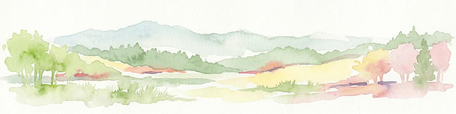
The terrain of Beelu National Park consists of rolling hills and valleys characteristic of the Darling Range, with elevations ranging across the Helena River catchment area. The Helena River valley forms a central feature of the park, with waterways and tributaries flowing through forested catchments. The landscape supports open jarrah-marri forest on the slopes, with diverse understory vegetation adapted to the Mediterranean climate of Southwest Australia. The park lies west of Mundaring Weir Road and south of the town of Mundaring, forming a contiguous block of forest that helps define the eastern edge of the Perth metropolitan area. Ridgelines within the park offer views across the reservoir and the wider hills landscape.

Beelu National Park ecosystems, habitats, and plant life

The park preserves representative examples of jarrah forest ecosystem, one of the most distinctive and biodiverse vegetation types in Southwest Australia. The canopy is dominated by jarrah and marri, two large forest trees that form the structural foundation of the ecosystem. Understory species include the cycad Zamia, bull Banksia with its distinctive large flower spikes, sheoak trees, and grass trees with their characteristic blackened trunk and flowering spike. This forest type occurs on lateritic soils derived from ancient weathering of the Darling Plateau, and the park protects examples of this ecosystem that have survived clearing for agriculture and urban development in the Perth hills. The forest provides habitat for numerous species adapted to the seasonal Mediterranean climate and the nutrient-poor soils of the region.

Beelu National Park wildlife and species highlights

While the source material focuses primarily on flora, the jarrah-marri forest ecosystem of Beelu National Park supports a range of animal species typical of Southwest Australian forests. The park's location in the Perth hills and its connection to other conservation areas provides habitat for forest-dwelling birds, reptiles, and marsupials. The protected forest areas serve as corridors enabling wildlife movement between larger conservation blocks in the Darling Range. The preservation of old-growth forest elements is particularly important for species that depend on hollow-bearing trees for nesting and shelter.

Beelu National Park conservation status and protection priorities

Beelu National Park contributes to the conservation of Southwest Australia's globally significant biodiversity hotspot. The park protects old-growth jarrah forest that was largely cleared from the Perth hills region during the twentieth century for agriculture, mining, and urban expansion. As part of the Parks of the Darling Range network, the park helps maintain ecological connectivity in a landscape increasingly fragmented by human development. The area also serves important watershed functions, protecting water quality in the Helena River catchment that flows into reservoirs serving the Perth region. The 2008 renaming to acknowledge traditional owners also reflects evolving approaches to integrating Indigenous knowledge and values into park management.

Beelu National Park cultural meaning and human context

The park lies within the traditional Country of the Beelu people, an Aboriginal clan of the Noongar nation whose territory historically encompassed the Helena, Swan, and Canning River catchments. The Noongar people have lived in Southwest Australia for tens of thousands of years, with the Beelu district representing an area of continuous Aboriginal connection to Country. The naming of the park in 2008 using the Noongar word for river or stream acknowledges this ongoing cultural heritage. The landscape holds traditional significance beyond its biodiversity values, representing a place where Indigenous cultural practices and relationships with Country continue to be recognized within contemporary park management.

Top sights and standout views in Beelu National Park

Beelu National Park provides a accessible forest escape from Perth, with the Perth Hills National Parks Centre serving as a visitor gateway. The South Ledge lookout offers sweeping views over Mundaring Weir and Lake CY O'Connor, while the network of hiking and mountain biking trails allows exploration of the jarrah-marri forest. Fred Jacoby Park contains a notable specimen, the largest oak tree in Western Australia, demonstrating the adaptation of Northern Hemisphere species to local conditions. The presence of two campgrounds enables overnight stays in the forest, while the variety of trails and facilities make the park suitable for families and day visitors seeking recreation in a protected natural area relatively close to the city.

Best time to visit Beelu National Park

The park can be visited year-round, though the Southwest Australian climate means conditions vary significantly across seasons. Autumn and winter bring cooler temperatures and occasional rainfall, creating pleasant conditions for walking through the forest. Spring offers the opportunity to observe wildflower blooms as the understory plants flower following winter rains. Summer months are typically warm and dry, and fire risk may affect access during this period. The park's proximity to Perth makes it suitable for day visits throughout the year, while the campgrounds provide options for longer stays during cooler months.

Park location guide

Geography guide, regional context, and park location map for Beelu National Park

Beelu National Park park geography, regions, and map view in Australia
Understand where Beelu National Park sits in Australia through a broader geographic reading of the surrounding landscape, nearby location context, and its mapped position within the national park landscape.

How Beelu National Park fits into Australia

Australia is a constitutional monarchy and federal parliamentary democracy comprising six states and ten territories. With a population of nearly 28 million, it is one of the world's most urbanised countries, with most people concentrated on the eastern seaboard. The country has a high Human Development Index and is known for its cultural diversity, ancient Aboriginal heritage, and unique wildlife.

Wider geography shaping Beelu National Park in Australia

Australia occupies the entire Australian continent, the island of Tasmania, and numerous smaller islands. It is the world's flattest and driest inhabited continent, featuring vast deserts in the interior (the Outback), tropical rainforests along the eastern coast, and a coastline bordering the Indian and Pacific Oceans.

Map view of Beelu National Park

Use this park location map to pinpoint Beelu National Park in Australia, understand its exact geographic position, and read its mapped placement within the surrounding landscape more clearly.

Pigeon | © OpenStreetMap contributors

Location context for Beelu National Park

Western Australia
Park atlas

Compare similar forest reserves and diverse protected landscapes, mapping the regional spread of conservation areas surrounding Perth Hills.

Discover Other National Parks Near Beelu National Park and the Darling Range Region
After exploring Beelu National Park, continue your geographic discovery by browsing other national parks, state forest reserves, and protected areas situated in Western Australia's Darling Range. This broader regional context allows you to compare diverse forest ecosystems, mapped terrain, and the spread of conservation efforts across the Perth metropolitan region's eastern edge.
National parkWestern Australia

Kalamunda National Park: Explore Darling Scarp Woodland & Western Australia's Natural Terrain

A protected national park with distinct mapped landscape features.

Kalamunda National Park is an essential protected area located on the western slopes of the Darling Scarp, offering a clear representation of southwestern Australia's characteristic eucalypt woodland ecosystems. Its geography is defined by the escarpment's terrain, supporting tall marri, jarrah, and wandoo forests with a diverse understorey. As a national park, it provides critical habitat and contributes to the regional landscape context within Western Australia, making it a valuable point for atlas-driven discovery of protected natural areas.

Area
3.75 km²
Established
1964
IUCN
II
National parkWestern Australia

Korung National Park: Protected Landscape and Map Context in Western Australia

Discover its unique dual bioregion geography.

Korung National Park is a protected national park in Western Australia, noted for its position along the Darling Scarp overlooking the Swan Coastal Plain. This reserve provides accessible natural experiences and showcases the ecological transition between two major southwest Australian bioregions. Its mapped landscapes offer a clear example of regional protected area planning and its importance for biodiversity conservation in the Perth metropolitan area.

Area
63.54 km²
Established
2004
IUCN
II
National parkPerth metropolitan region

Midgegooroo National Park: Jarrah Forest Protected Landscape and Regional Geography

Explore its mapped boundaries and terrain near Perth.

Midgegooroo National Park offers a distinct protected landscape characterized by its expansive jarrah forest terrain within the Perth metropolitan region. This national park provides valuable context for understanding regional geography, mapped natural features, and the distribution of protected lands. Explore the park's unique topography and conservation boundaries, vital for comprehensive atlas-based geographic discovery.

Area
24.92 km²
Established
2004
IUCN
II
National parkWestern Australia

Serpentine National Park: Waterfall & Wildflower Protected Landscape in Western Australia

Mapped geography, waterfall terrain, and spring bloom discovery.

Serpentine National Park is a protected national park located in Western Australia, approximately 55 kilometers southeast of Perth. It is celebrated for its prominent Serpentine Falls, a multi-tiered cascade that forms a popular natural pool, and its stunning spring wildflower season. The park showcases the undulating terrain of the Darling Scarp, featuring jarrah and marri woodlands. This park offers a distinct opportunity for atlas-based exploration of protected landscapes, with a focus on its unique waterfall features and vibrant botanical displays.

Area
43.87 km²
Established
1957
IUCN
II
National parkWestern Australia

Yanchep National Park: Explore Its Unique Limestone Caves and Protected Bushland Geography

Discover the subterranean formations and coastal plain landscapes.

Yanchep National Park offers a singular opportunity for atlas-driven exploration of Western Australia's natural and cultural heritage. Situated on the Swan Coastal Plain, this national park is celebrated for its extensive network of limestone caves, including the notable Crystal Cave, providing a rare glimpse into subterranean geological processes. Beyond its underground wonders, the park encompasses diverse native bushland, supporting iconic koala colonies and offering insights into the region's ecological distinctiveness. Its deep Nyoongar heritage further enriches the understanding of this mapped protected landscape.

Area
28.76 km²
Established
1957
IUCN
II
National parkWestern Australia

Wellington National Park: Protected Jarrah Forest & Collie River Landscape

Explore the mapped boundaries and regional geography.

Wellington National Park offers a deep dive into Western Australia's protected landscapes, characterized by extensive old-growth jarrah forests and the scenic Collie River valley. This national park provides a vital study of the region's unique geography, mapped terrain, and ecological significance within the Yilgarn craton. Understand the park's protected area identity and its place in the wider natural context of Western Australia through its detailed landscape features.

Area
170 km²
Established
2000
IUCN
II
National parkSouth West

Yelverton National Park: South West Australia's Biodiversity Conservation Area

Mapped protected lands and regional landscape context.

Yelverton National Park offers a focused look at a protected area in Western Australia's South West, distinguished by its commitment to rare species and varied vegetation. Established from former timber reserve lands, it serves as a crucial habitat refuge. The park's geography exemplifies the ecological richness of the South-West Australian forest region, providing valuable context for understanding protected landscape distribution and conservation efforts within the mapped terrain.

Area
7.29 km²
Established
2004
IUCN
II
National parkSouth West

Wiltshire-Butler National Park: Protected Jarrah Forest Landscape in Western Australia

Mapping the protected area and its regional geographic context.

Wiltshire-Butler National Park is a designated National Park in Western Australia's South West region, established in 2004 to protect significant jarrah forest ecosystems. This Class A reserve offers a clear example of protected landscape conservation, with its mapped boundaries defining a vital area within the Jarrah Forest bioregion. Users exploring this park can understand its role in the regional geography and appreciate the characteristics of its temperate forest terrain, contributing to a broader atlas of natural heritage.

Area
116.45 km²
Established
2004
IUCN
II
Relief
Highland

Common questions about visiting, size, designation, and location context for Beelu National Park

Beelu National Park FAQs for park facts, access, geography, and protected area context
Find quick answers about Beelu National Park, including protected-area facts, park geography, trail and visitor context, and how the park fits into its surrounding country and regional landscape.
MoriAtlas Explorer

Continue Your Protected Areas Search Across the Global Atlas

Deepen your exploration by continuing the structured search for national parks and protected areas worldwide. Utilize the comprehensive filtering capabilities to compare different conservation landscapes and refine your understanding of global park geography. Discover more about the distribution and characteristics of protected natural areas.

Global natural geography