

Mori Atlas logo
National parkYanchep National Park

Discover the subterranean world of its limestone caves and native bushland character.

Yanchep National Park: Explore Its Mapped Boundaries and Unique Protected Landscape in Western Australia

Yanchep National Park stands as a distinctive protected landscape on Western Australia's Swan Coastal Plain, approximately 42 kilometers north of Perth. This national park preserves over 28 square kilometers of unique terrain, highlighted by an extensive limestone cave system carved by underground streams and significant native bushland supporting notable koala populations. Its establishment in 1957 built upon thousands of years of Indigenous Nyoongar significance, making it a vital site for understanding both natural and cultural heritage through its mapped geography and protected features.

Limestone cavesKoala coloniesCoastal plain ecosystemsNyoongar heritageWestern Australian natureWalking trails

Yanchep National Park

National park

Park overview

Structured park overview, official facts, and landscape profile for Yanchep National Park

Yanchep National Park park facts, protected area profile, and essential visitor context

Review the core facts for Yanchep National Park, including designation, size, terrain, visitor scale, habitats, and operating context in one park-focused overview.

About Yanchep National Park

Yanchep National Park represents a significant protected area on the Swan Coastal Plain of Western Australia, situated just 42 kilometres north of Perth. The park's landscape features a diverse mixture of woodlands, wetlands, and limestone formations that create a unique ecological environment. Over 570 caves punctuate the park's limestone substrate, formed by underground streams flowing westward from the Gnangara Mound through the Tamala Limestone formation. These cave systems, some of which have been known to Indigenous peoples for millennia, constitute one of the park's most remarkable geological features. The park also encompasses several lakes and wetlands that historically supported dense stands of bulrush reeds, from which the park's name derives. The area has been a place of significance for the Nyoongar people for thousands of years, with the tribal name Nyanyi-Yandjip reflecting the landscape's cultural importance. Beyond its natural features, the park offers comprehensive visitor facilities including picnic areas, walking trails ranging from 500 metres to 46.2 kilometres, and cultural interpretation programs developed in partnership with local Nyoongar communities.

Quick facts and research context for Yanchep National Park

Yanchep National Park occupies 28.76 square kilometres of the northern Swan Coastal Plain in Western Australia, located 42 kilometres north of Perth. The park features over 570 limestone caves, with Crystal Cave being the only tourist cave in the Perth region. It is home to populations of koalas, western grey kangaroos, quendas, and black-glove wallabies, and lies within the Northern Swan Coastal Plain Important Bird Area recognized by BirdLife International. The park is managed by the Department of Parks and Wildlife and was designated a State Registered Heritage Place in 2006. The park name derives from the Nyoongar word Yandjip or Yanget, referring to the bulrush reeds that fringe the local lakes.

Protection and recognition

Official designation timeline and terrestrial conservation framework established in 2006.

Yanchep National Park Protection Status and Terrestrial Designation

Researchers can verify the official designation history and terrestrial management boundaries recorded for Yanchep National Park. Detailed geographic data provides clear insights into the spatial limits and formal protection status established during the 2006 designation.

Protection details

Protection scope
Terrestrial
Designated year
2006
Transboundary protection
No
Park context

Deeper park guide and search-rich context for Yanchep National Park

Yanchep National Park history, landscape, wildlife, and travel context

Explore Yanchep National Park through its history, landscape character, ecosystems, wildlife, conservation priorities, cultural context, and seasonal travel timing in a structured park guide built for atlas discovery and search intent.

Why Yanchep National Park stands out

Yanchep National Park is best known for its remarkable limestone cave system, which includes Crystal Cave, Yonderup Cave, and Cabaret Cave. Crystal Cave is the only tourist cave accessible in the Perth metropolitan area and offers guided tours four times daily. The park is also renowned for its thriving koala colonies, which visitors can observe from a 140-metre-long boardwalk. The combination of ancient cave formations, native Australian bushland, and cultural heritage programs makes this park a distinctive natural and historical destination in Western Australia's protected area network.

Yanchep National Park history and protected-area timeline

The Yanchep area has been inhabited by Indigenous Australians for thousands of years, serving as a noted hunting site prior to European arrival. The Nyoongar tribal name for the area, Nyanyi-Yandjip, references the reeds and lakes that dominate the landscape, believed to resemble the hairy mane of the dreamtime creature the Wagyl. The word Yanchep itself comes from Yandjip or Yanget, the aboriginal name for the bulrush reeds found fringing the area's lakes. European interest in the region began in 1834 when farmer John Butler arrived searching for lost cattle and documented the lakes, wetlands, and plentiful game. He was greeted by men of the Yellagonga peoples who inhabited the area. Lieutenant George Grey traversed the region in 1838 and recorded his observations of the remarkable caves. Surveyor John Septimus Roe and Governor John Hutt visited the caves in 1841. A road survey near Loch McNess occurred in 1862, followed by construction of a stock route in 1865 used by drovers. The first permanent European settler, Henry White, arrived in 1901, building his home near Yonderup Lake and later serving as caretaker and guide from 1903. Crystal Cave was discovered by Henry White in 1903 and remains the only tourist cave in the Perth area.

Yanchep National Park landscape and geographic character

Yanchep National Park sits on the northern Swan Coastal Plain, characterised by a landscape of gentle sandplains, limestone formations, and wetland systems. The Tamala Limestone underlies much of the park, creating the foundation for its extensive cave network. Underground streams flowing from the Gnangara Mound have carved over 570 caves through this limestone, with passages and chambers forming complex subterranean systems. The park contains several lakes, including Loch McNess and Yonderup Lake, which are fringed by wetlands supporting dense vegetation. The surface landscape features woodlands dominated by stunted jarrah, banksias, paperbark, tuart, marri, and she-oak trees. The coastal plain setting places the park within a transition zone between Perth's metropolitan area and the more remote northern landscapes, creating a landscape of natural bushland adjacent to urban development.

Yanchep National Park ecosystems, habitats, and plant life

The park supports a diverse range of native Australian ecosystems across its coastal plain setting. The woodland areas contain a mix of tree species including banksias, paperbark, tuart, marri, she-oak, and stunted jarrah, creating layered habitats of varying density. Wetland areas around the lakes support bulrush reeds and other aquatic vegetation. The park lies within the Northern Swan Coastal Plain Important Bird Area, recognised by BirdLife International for its significance in supporting bird populations, particularly several thousand short-billed black cockatoos during the non-breeding season. Wildflower displays are a notable seasonal feature, with species including parrot bush, yanchep rose, catspaw, and kangaroo paw adding colour to the landscape, particularly in spring.

Yanchep National Park wildlife and species highlights

Yanchep National Park provides habitat for several species of native Australian mammals. The park is perhaps best known for its koala colonies, which are viewable from a dedicated boardwalk and supported by the eucalypt and woodland habitats throughout the park. Western grey kangaroos are common throughout the park's open areas, while black-glove wallabies inhabit denser vegetation zones. The quenda, a small native marsupial, also resides in the park. The birdlife is particularly significant due to the park's classification within the Northern Swan Coastal Plain Important Bird Area, with populations of short-billed black cockatoos using the area during non-breeding seasons. The diverse plant communities support this variety of wildlife, creating interconnected habitats across the park's woodland, wetland, and cave environments.

Yanchep National Park conservation status and protection priorities

Yanchep National Park is protected under IUCN Category II as a national park, reflecting its significance for both natural and cultural heritage conservation. The park's cave systems represent unique geological formations requiring protection from disturbance, with only three of the over 570 caves currently accessible to visitors. The wetland systems, including the lakes and their fringing reeds, provide important habitat for waterbirds and contribute to broader coastal plain ecosystem health. The park's inclusion within the Northern Swan Coastal Plain Important Bird Area identifies it as nationally important for bird conservation. Cultural heritage conservation is also significant, with the park holding a registered place on the Western Australia State Register of Heritage Places since 2006, recognising both its natural and Indigenous cultural values. Management by the Department of Parks and Wildlife balances visitor access with conservation objectives through designated trails, managed cave access, and cultural interpretation programs.

Yanchep National Park cultural meaning and human context

The Yanchep area holds profound significance for the Nyoongar people, the Traditional Custodians of the south-west of Western Australia. The tribal name Nyanyi-Yandjip reflects the landscape's cultural meaning, referencing the reeds and lakes that feature prominently in local dreaming stories. The area was a hunting and gathering site for thousands of years prior to European settlement, with the Yellagonga peoples among the groups who inhabited the region. The dreamtime creature Wagyl, also known as the Waugul, is central to the cultural understanding of the landscape and is referenced in the traditional place name. Contemporary cultural preservation is supported through the Wangi Mia Aboriginal Experience, a public tour operating on Sundays and public holidays that provides opportunities to learn about local Noongar culture. This partnership between the park management and local Nyoongar communities represents an ongoing commitment to recognising and sharing Indigenous heritage.

Top sights and standout views in Yanchep National Park

Yanchep National Park offers a distinctive combination of geological, ecological, and cultural attractions within easy reach of Perth. The cave system, particularly Crystal Cave with its guided tours, provides a rare opportunity to explore underground limestone formations in the Perth region. The koala colony, observable from the dedicated boardwalk with daily interpretive talks, allows close encounters with one of Australia's most iconic marsupials. The park's nine walking trails showcase the biodiversity of the northern Swan Coastal Plain, ranging from easy family-friendly walks to challenging trails over 46 kilometres in length. Cultural programming through the Wangi Mia experience provides genuine engagement with Nyoongar heritage, while the historic development of Cabaret Cave as an underground function venue represents a unique aspect of Australian park history.

Best time to visit Yanchep National Park

Yanchep National Park is open year-round, allowing visitors to experience the park in different seasons. Spring and early summer, particularly from September to November, bring wildflower displays throughout the park, with species like kangaroo paw and parrot bush adding colour to the bushland. The cooler months from May to September offer comfortable conditions for walking and cave exploration, with mild daytime temperatures suitable for outdoor activities. Summer months can be warm, though the shaded woodland areas and cave environments provide some respite. The koalas are generally visible throughout the year, though they may be more active during cooler periods. Visitors interested in birdwatching should note that the short-billed black cockatoos are present during the non-breeding season, typically outside of the warmer summer months.
Monthly climate preview

Explore long term temperature profiles and monthly precipitation trends in Western Australia

Climate Normals and Average Monthly Weather in Yanchep National Park

Average measurements at a representative park coordinate reveal a distinct dry cycle with warm peak temperatures alongside a cooler, wetter period of increased precipitation. Accessing the complete climatology provides detailed data comparing monthly highs, lows, and precipitation averages over a thirty year period.
Annual mean19 °C
15 °C24 °C
Jan24°
Feb24°
Mar23°
Apr21°
May18°
Jun16°
Jul15°
Aug15°
Sep15°
Oct17°
Nov20°
Dec22°
Warmest month
February

24.5 °C

Coolest month
July

14.6 °C

Wettest month
July

3.7 mm/day

Driest month
December

0.3 mm/day

Park location guide

Geography guide, regional context, and park location map for Yanchep National Park

Yanchep National Park park geography, regions, and map view in Australia

Understand where Yanchep National Park sits in Australia through a broader geographic reading of the surrounding landscape, nearby location context, and its mapped position within the national park landscape.

How Yanchep National Park fits into Australia

Australia is a constitutional monarchy and federal parliamentary democracy comprising six states and ten territories. With a population of nearly 28 million, it is one of the world's most urbanised countries, with most people concentrated on the eastern seaboard. The country has a high Human Development Index and is known for its cultural diversity, ancient Aboriginal heritage, and unique wildlife.

Wider geography shaping Yanchep National Park in Australia

Australia occupies the entire Australian continent, the island of Tasmania, and numerous smaller islands. It is the world's flattest and driest inhabited continent, featuring vast deserts in the interior (the Outback), tropical rainforests along the eastern coast, and a coastline bordering the Indian and Pacific Oceans.

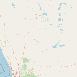
Map view of Yanchep National Park

Use this park location map to pinpoint Yanchep National Park in Australia, understand its exact geographic position, and read its mapped placement within the surrounding landscape more clearly.

Pigeon | © OpenStreetMap contributors

Location context for Yanchep National Park

Western Australia
Recorded earthquake history

Examine the Recorded Earthquake History for Yanchep National Park

Browse the historical seismic records associated with the geography of Yanchep National Park. MoriAtlas provides a clear catalogue of event magnitudes and locations to support geographic exploration of the area's geological context.

Yanchep National Park Earthquake History

Catalogued events

1 event

Strongest magnitude

Magnitude 4.6

Most recent event

Dec 8, 1980

This history includes earthquakes recorded inside the park or within 50 km of its borders

Park atlas

Trace the mapped geography of protected areas and national parks across Western Australia's coastal plain, expanding your discovery.

Explore Nearby National Parks and Protected Areas Surrounding Yanchep National Park

Continue your park discovery by exploring other national parks and protected areas found near Yanchep National Park, spanning Western Australia's distinctive coastal plain. Compare these conservation landscapes to gain insights into regional geological features, diverse ecosystems, and the broader protected area network across the state.
National parkWestern Australia
3.7 km away#1 closest

South

Neerabup National Park: Discover its Protected Landscape and Geographic Identity in Western Australia

Explore mapped boundaries and regional context.

Neerabup National Park represents a crucial protected landscape within Western Australia, offering a distinct geographic identity for atlas-based discovery. This page focuses on its role as a national park, detailing its mapped boundaries and situating it within the rich regional geography of Western Australia. Users can explore the park's unique natural terrain and understand its contribution to the state's protected areas.

Area
9.43 km²
Established
1965
IUCN
II
Relief
Lowland
National parkWestern Australia
35 km away#2 closest

Southeast

Walyunga National Park: National Park Discovery in Western Australia's Geographic Landscape

Mapped boundaries and regional protected area context.

Walyunga National Park serves as a key protected area within the expansive geography of Western Australia. This detailed view focuses on its identity as a national park, offering insights into its mapped landscape and its specific role within the state's conservation network. Users can explore its protected boundaries and understand its place in the regional geography, contributing to a structured atlas of natural areas.

Area
18.14 km²
Established
1970
IUCN
II
Relief
Mixed relief
National parkWestern Australia
38 km away#3 closest

North

Moore River National Park: National Park Protected Landscape and Geographic Context

Mapped boundaries and natural terrain in Western Australia.

Investigate Moore River National Park, a distinct national park located in Western Australia. This detailed view provides insight into the park's protected landscape character, its unique geography, and its role within the regional context. Understand the mapped boundaries and natural terrain that define this significant protected area for atlas and geographic exploration.

Area
172.54 km²
Established
1969
IUCN
II
Relief
Lowland
National parkWestern Australia
44 km away#4 closest

East

Avon Valley National Park: Protected National Park Discovery in Western Australia

Explore mapped boundaries and regional landscape context.

Delve into Avon Valley National Park, a designated national park offering rich opportunities for protected-area and landscape discovery. This page serves as an atlas-style entry point, detailing the park's mapped geography and its role within the diverse natural terrain of Western Australia. Understand its specific protected landscape identity and how it contributes to the broader conservation map.

Area
43.66 km²
Established
1970
IUCN
II
Relief
Mixed relief
National parkWestern Australia
44 km away#5 closest

Southeast

John Forrest National Park: National Park Atlas and Western Australia Protected Landscape

Mapped boundaries and regional geographic context.

Delve into the atlas-level details of John Forrest National Park, a protected area situated in Western Australia. This park's designation as a national park provides a focal point for understanding its specific geographic features and mapped extent. Users can explore its place within the broader regional geography of Western Australia, gaining structured insight into the protected landscape.

Area
26.78 km²
Established
1900
IUCN
II
Relief
Upland
National parkWestern Australia
49 km away#6 closest

Southeast

Greenmount National Park: Western Australia National Park Landscape and Geography Atlas

Explore its protected boundaries and regional landscape context.

Greenmount National Park represents a distinct protected landscape within the diverse geography of Western Australia. As a National Park, its mapped boundaries are integral to understanding its regional context and offering users a point of detailed geographic discovery. This entry provides essential data on its protected status and geographic setting, supporting exploration of Australia's significant natural areas through an atlas-driven lens.

Area
2.02 km²
Established
1970
IUCN
II
Relief
Upland
National parkWestern Australia
50 km away#7 closest

Southeast

Beelu National Park: Exploring Western Australia's Protected Jarrah-Marri Forest Landscape

Mapped Geographic Context & Natural Terrain Discovery

Beelu National Park, situated in Western Australia's Darling Range, offers an immersive experience within old-growth jarrah-marri forests. This protected area provides a vital glimpse into the region's natural landscapes, characterized by rolling hills and the Helena River valley. Users can explore the park's geographic setting, its mapped boundaries, and the unique ecological context it preserves. It stands as a significant natural reserve contributing to the understanding of Western Australia's conservation efforts and diverse terrain.

Area
46.17 km²
Established
1995
IUCN
II
Relief
Highland
National parkWestern Australia
51 km away#8 closest

Southeast

Gooseberry Hill National Park: A Protected Landscape in Western Australia's Geography

Explore mapped boundaries and regional park context.

Gooseberry Hill National Park is a significant protected area designated as a national park within the diverse geography of Western Australia. This entry provides detailed insights into its specific location, mapped boundaries, and role as a conservation landscape. Understand how Gooseberry Hill National Park contributes to the broader atlas of protected lands in Western Australia, offering a foundational view for geographic exploration and landscape context.

Area
0.33 km²
Established
1970
IUCN
II
Relief
Highland

Common questions about visiting, size, designation, and location context for Yanchep National Park

Yanchep National Park FAQs for park facts, access, geography, and protected area context

Find quick answers about Yanchep National Park, including protected-area facts, park geography, trail and visitor context, and how the park fits into its surrounding country and regional landscape.
MoriAtlas Explorer

Continue Your Protected Areas Search Across the Global Atlas

Deepen your exploration by continuing the structured search for national parks and protected areas worldwide. Utilize the comprehensive filtering capabilities to compare different conservation landscapes and refine your understanding of global park geography. Discover more about the distribution and characteristics of protected natural areas.

Global natural geography