Mori Atlas logo
National parkCape Arid National Park

Mapping the dramatic coastlines, ancient ranges, and diverse habitats of this Western Australian national park.

Cape Arid National Park: Protected Landscape and Geographic Atlas in Western Australia

Cape Arid National Park in Western Australia represents a vital protected landscape, defined by its rugged southern coastline, expansive sandy beaches, and the prominent Russell Range. Situated along the Southern Ocean, this national park offers a unique geographic context, showcasing a remarkable blend of coastal heath ecosystems, ancient granite headlands, and low hills rising to jagged peaks. Its mapped boundaries encompass a significant area, crucial for understanding the regional distribution of protected lands and their ecological significance within the Western Australian atlas.

Coastal national parksWestern AustraliaBird conservationGranite landscapesHeathland ecosystemsRemote wilderness

Cape Arid National Park

National park

Park overview

Structured park overview, official facts, and landscape profile for Cape Arid National Park

Cape Arid National Park park facts, protected area profile, and essential visitor context
Review the core facts for Cape Arid National Park, including designation, size, terrain, visitor scale, habitats, and operating context in one park-focused overview.

About Cape Arid National Park

Cape Arid National Park occupies a significant stretch of Western Australia's southern coastline, protecting a remote and ecologically diverse landscape that spans roughly 2,794 square kilometres. The park sits approximately 731 kilometres southeast of Perth and about 120 kilometres east of the coastal town of Esperance, placing it among the more remote national parks in the state's southwest. The park's geography is defined by its coastal setting, with sandy beaches and rocky headlands forming the southern boundary while low granite hills extend northward toward the rugged Russell Range. Tower Peak, the park's highest point at 594 metres, rises within this ancient quartzite range that dates back to the pre-Cambrian period. The landscape surrounding the hill systems consists of nutrient-rich sandplains supporting dense coastal heath communities, creating a stark yet ecologically vital backdrop against the more exposed coastal zones. The park's coastline extends from Duke of Orleans Bay in the west to Israelite Bay in the east, a remote stretch that includes the prominent headlands of Cape Arid and Cape Pasley separated by the sheltered waters of Sandy Bight. This coastal configuration, together with the offshore islands of the Recherche Archipelago, creates a mosaic of marine and terrestrial environments that support remarkable biodiversity. The park's western boundary meets Nuytsland Nature Reserve, forming a continuous protected landscape along this isolated section of coast, while the Ngadju Indigenous Protected Area adjoins the park to the north, reflecting the broader cultural landscape in which the park sits.

Quick facts and research context for Cape Arid National Park

Cape Arid National Park covers 2,794.46 square kilometres along the south coast of Western Australia, making it one of the larger coastal national parks in the state. The park was established in 1969 and is managed by the Department of Environment and Conservation. Its highest point is Tower Peak at 594 metres within the Russell Range, which consists primarily of pre-Cambrian quartzite. The park shares its eastern boundary with Nuytsland Nature Reserve and is bordered to the north by Ngadju Indigenous Protected Area. The coastline features Cape Arid, Sandy Bight, and Cape Pasley, with the area supporting significant biodiversity across its coastal heath, sandplain, and granite hill ecosystems.

Park context

Deeper park guide and search-rich context for Cape Arid National Park

Cape Arid National Park history, landscape, wildlife, and travel context
Explore Cape Arid National Park through its history, landscape character, ecosystems, wildlife, conservation priorities, cultural context, and seasonal travel timing in a structured park guide built for atlas discovery and search intent.

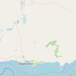
Why Cape Arid National Park stands out

Cape Arid National Park is best known for its critical role in protecting one of Australia's most endangered birds, the western ground parrot. The park is also renowned for its diverse coastal landscapes combining sandy beaches with dramatic granite headlands, and for supporting an exceptional diversity of birdlife with over 160 species recorded, including several endangered and geographically restricted species. The park's isolation and the rugged nature of its Russell Range mountains make it a distinctive wilderness destination within Western Australia's protected area network.

Cape Arid National Park history and protected-area timeline

The European discovery of the Cape Arid area began with French Admiral Bruni D'Entrecasteaux in 1792, who first charted the coastline and named the prominent headland Cap Aride. Nearly a decade later, in 1802, the English explorer Matthew Flinders anglicized this name to Cape Arid, and the feature would eventually lend its name to the national park established nearly two centuries later. European settlement of the region began in the 1870s when pioneer graziers moved into the area, establishing pastoral operations that would leave lasting traces across the landscape. The remnants of their homesteads, dams, and outbuildings can still be found near Pine Hill, while historical gravesites and the site of Thomas Fishery provide tangible connections to this pioneering period. The marine resources of the coast also supported commercial activities during the nineteenth century, with bay whaling operations conducted at Barrier Anchorage by Thomas Sherratt during the 1870s and earlier by John Thomas at Thomas's Fishery during the 1860s. The park was officially established in 1969, formalising the protection of this remote coastal landscape. A significant modern challenge came with the 2015 Esperance bushfires, which devastated an estimated 90 percent of the remaining habitat for the critically endangered western ground parrot within the park. Prior to these fires, the entire wild population was estimated at only 140 individuals, and the fires reduced this to between 30 and 40 birds, raising fears that the species could become the first bird to go extinct in Western Australia in at least 200 years. Two parrots were rescued and taken to Perth Zoo for a captive breeding program, but both subsequently died in captivity.

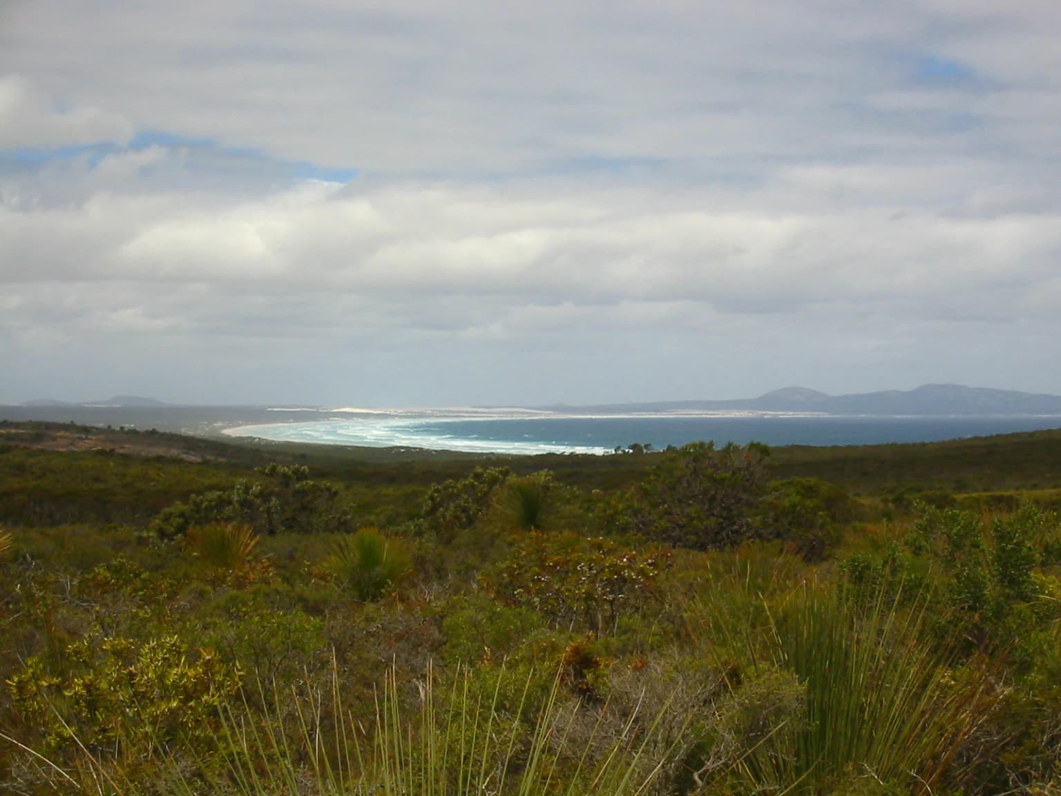
Cape Arid National Park landscape and geographic character

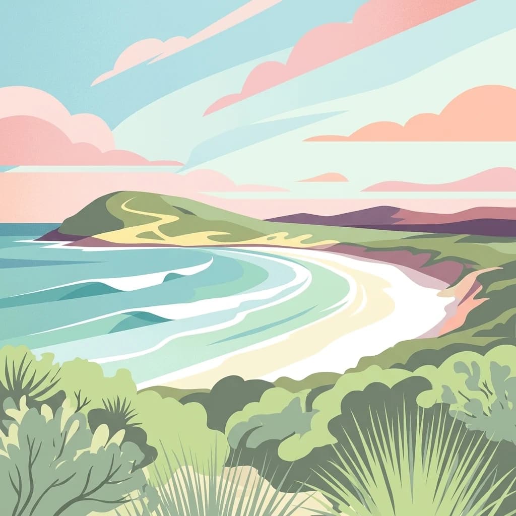
The landscape of Cape Arid National Park presents a striking contrast between its exposed southern coastline and the more sheltered northern hill systems. The coastal zone is characterized by long sandy beaches interrupted by dramatic granite headlands that jut into the Southern Ocean, creating a rugged shoreline defined by Cape Arid, the sheltered curve of Sandy Bight, and the eastern point of Cape Pasley. These rocky promontories provide dramatic viewpoints and shelter pockets along an otherwise exposed coast. Moving inland from the coast, the terrain gradually rises through undulating sandplains covered in dense coastal heath before encountering the low granite hills that form the foothills of the Russell Range. The Russell Range itself consists of ancient, jagged quartzite peaks that represent some of the oldest rock formations in Western Australia, dating back to the pre-Cambrian era. Tower Peak, reaching 594 metres, stands as the highest point in the park and provides spectacular views across the surrounding coastal plain and out toward the Recherche Archipelago offshore. The sandplains that surround these hill systems are ecologically important, supporting diverse heath communities that thrive on the nutrient-poor but botanically rich soils.

Cape Arid National Park ecosystems, habitats, and plant life

The ecological character of Cape Arid National Park is defined by a mosaic of habitats that support exceptional biodiversity, particularly for birds. The park's vegetation is predominantly coastal heath established on young dune systems, with this dense scrub covering much of the park's extent and providing critical habitat for ground-dwelling species. Scattered throughout this heathland are pockets of more diverse vegetation including stands of yate, banksia, paperbark, and mallee eucalyptus, which provide structural variation and additional habitat resources. Near Mount Ragged, the park supports particularly notable plant communities including populations of orchids and ferns, as well as a small population of the sticky-tail flower, a species with restricted distribution in this region. The sandplain heath communities are floristically rich, with numerous endemic species adapted to the nutrient-poor soils and seasonal conditions of the south coast. The park also adjoins the Ngadju Indigenous Protected Area to the north, acknowledging the broader ecological and cultural landscape that extends beyond the park's formal boundaries.

Cape Arid National Park wildlife and species highlights

Cape Arid National Park supports remarkable wildlife diversity, with particular significance attached to its bird fauna. Over 160 bird species have been recorded within the park, representing one of the most diverse avifaunal communities in Western Australia's national parks. Several of these species are endangered or have restricted distributions that make the park critically important for their conservation. The western ground parrot is the park's most significant conservation priority, a ground-dwelling parrot species that was already critically endangered before the devastating 2015 bushfires destroyed most of its remaining habitat. Other notable bird species include the Australasian bittern, a cryptic marsh bird that inhabits the wetland areas within the park, Carnaby's cockatoo, one of Australia's endangered black cockatoo species, and the Cape Barren goose, a large and distinctive goose species found in coastal grasslands and heath. The mammal fauna includes the western brush wallaby and quenda, both common in the southwest but dependent on the dense ground cover provided by the coastal heath. The southern bush rat occupies the forest and heath floor, while various small marsupial predators help regulate ecosystem dynamics. Reptiles and amphibians are well-represented, and the park is notable for supporting a rare and primitive ant species of the genus Nothomyrmecia, often considered one of the most primitive living ant species.

Cape Arid National Park conservation status and protection priorities

Cape Arid National Park plays a crucial conservation role in Western Australia's protected area network, safeguarding a significant stretch of the state's southern coastline and the diverse ecosystems it contains. The park is classified as an IUCN Category II protected area, reflecting its national park status and primary objective of protecting natural ecosystems while allowing for compatible public enjoyment. The park's significance is particularly acute for bird conservation, with over 160 species recorded including several of conservation concern. The western ground parrot represents the park's most pressing conservation challenge, with the 2015 bushfires pushing this already critically endangered species to the brink of extinction in the wild. The park's coastal heath and sandplain habitats are ecologically important but also fire-prone and vulnerable to climate change, making long-term conservation of the parrot and other ground-dwelling species increasingly challenging. The park also connects with adjacent protected areas including Nuytsland Nature Reserve and the Ngadju Indigenous Protected Area, creating a broader conservation landscape that facilitates wildlife movement and ecosystem resilience.

Cape Arid National Park cultural meaning and human context

The Cape Arid region has been home to Aboriginal peoples for thousands of years, though the park's establishment as a protected area formally began with European naming and exploration. The adjacent Ngadju Indigenous Protected Area acknowledges the ongoing cultural connection that Aboriginal people maintain with this landscape, with Ngadju country extending across a significant portion of south-central Western Australia. The European history of the area is relatively recent, beginning with French exploration in the late eighteenth century followed by British settlement. The pioneering period of the 1870s saw graziers establish pastoral operations in the area, leaving physical remnants including homestead foundations and gravesites that provide historical context to the human use of this landscape. The maritime history of the coast is also noteworthy, with bay whaling operations conducted at Barrier Anchorage and Thomas's Fishery during the nineteenth century representing early commercial exploitation of the region's marine resources. The locality of Cape Arid shares nearly identical boundaries with the national park, with the exception of roads that pass through the area but remain part of the locality rather than the protected area.

Top sights and standout views in Cape Arid National Park

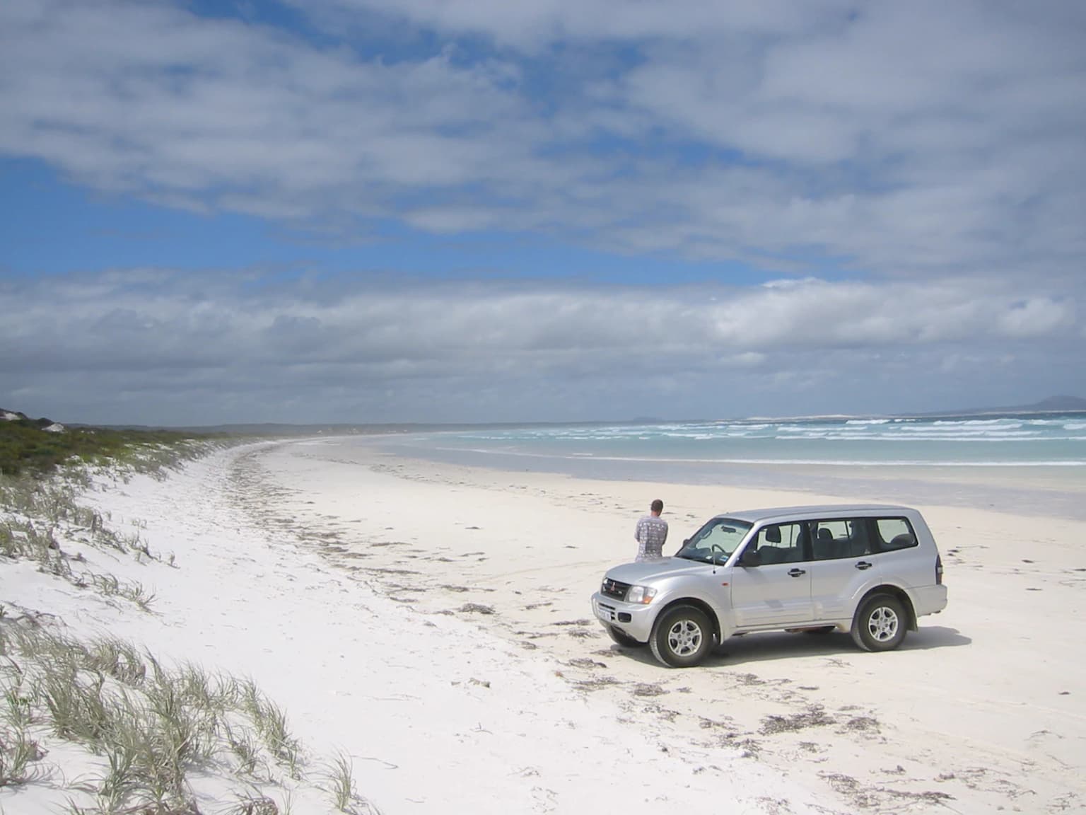
The highlights of Cape Arid National Park include its dramatic coastal scenery combining sandy beaches with rugged granite headlands, the opportunity to explore the ancient Russell Range with views from Tower Peak, and the chance to observe over 160 bird species in their natural habitat. The park offers several walking trails including the Len Otte Nature Trail, Tagon Coastal Trail, and walks to the summits of Mount Ragged and Mount Arid, providing varied experiences from gentle nature walks to more challenging climbs. The park's significance as a last stronghold for the critically endangered western ground parrot gives it special importance for those interested in threatened species conservation. The Thomas River campsite provides accessible camping with conventional vehicle access, while more remote campsites at Mount Ragged, Poison Creek and Deal Creek offer wilderness experiences for those with four-wheel drive vehicles. The park's isolation and the relative lack of development ensure a wilderness character that distinguishes it from more accessible coastal parks nearer to population centres.

Best time to visit Cape Arid National Park

The best time to visit Cape Arid National Park is during the warmer months from late spring through summer, from November to March, when the weather is generally more stable and temperatures suitable for camping and outdoor activities. During this period, the park's coastal heath is often in flower, providing attractive scenery and good conditions for wildlife observation. However, visitors should be aware that summer conditions can include strong winds and that bushfire risk is significant in this part of Western Australia. Winter and early spring bring cooler temperatures and more frequent rainfall, which can make some tracks impassable and camping less comfortable, though this period supports different natural values including birdlife activity around water sources. The remote nature of the park means that access roads, particularly those leading to more remote campsites, may be affected by seasonal conditions, and visitors should check current road status before planning their trip. Regardless of season, the park's exposed coastal location means that weather can change rapidly, and visitors should come prepared for variable conditions.

Park location guide

Geography guide, regional context, and park location map for Cape Arid National Park

Cape Arid National Park park geography, regions, and map view in Australia
Understand where Cape Arid National Park sits in Australia through a broader geographic reading of the surrounding landscape, nearby location context, and its mapped position within the national park landscape.

How Cape Arid National Park fits into Australia

Australia is a constitutional monarchy and federal parliamentary democracy comprising six states and ten territories. With a population of nearly 28 million, it is one of the world's most urbanised countries, with most people concentrated on the eastern seaboard. The country has a high Human Development Index and is known for its cultural diversity, ancient Aboriginal heritage, and unique wildlife.

Wider geography shaping Cape Arid National Park in Australia

Australia occupies the entire Australian continent, the island of Tasmania, and numerous smaller islands. It is the world's flattest and driest inhabited continent, featuring vast deserts in the interior (the Outback), tropical rainforests along the eastern coast, and a coastline bordering the Indian and Pacific Oceans.

Map view of Cape Arid National Park

Use this park location map to pinpoint Cape Arid National Park in Australia, understand its exact geographic position, and read its mapped placement within the surrounding landscape more clearly.

Pigeon | © OpenStreetMap contributors

Location context for Cape Arid National Park

Western Australia
Park atlas

Trace the regional spread of protected areas and compare coastal landscapes adjacent to Cape Arid National Park in Western Australia.

Explore Other National Parks and Protected Areas Near Cape Arid National Park in Western Australia
Discover other national parks and protected areas in Western Australia's coastal region, continuing your exploration beyond Cape Arid National Park. Comparing these nearby protected areas offers valuable context for understanding the broader environmental mosaic and the regional spread of conservation efforts across Australia's remote Southern Ocean coast.
National parkWestern Australia

Fitzgerald River National Park: A Western Australian Protected Landscape of Global Botanical Importance

Discover its mapped terrain, endemic flora, and UNESCO Biosphere Reserve status.

Fitzgerald River National Park stands as a protected landscape of immense ecological value in Western Australia. This national park is celebrated for its extraordinary botanical diversity, featuring more endemic plant species than any other conservation reserve in Australia. Its varied terrain, from rugged mountain ranges to coastal cliffs, provides a rich tapestry of natural habitats. As a designated UNESCO Biosphere Reserve, it offers a unique opportunity to explore mapped geographic features and understand the critical role of protected areas in conserving rare flora and distinct Mediterranean ecosystems.

Area
2,972.11 km²
Established
1973
IUCN
II
Visitors
40K annual
National parkWestern Australia

Porongurup National Park: Ancient Granite Peaks and Karri Forest Protected Landscape

Mapped terrain and geologic history in Western Australia.

Delve into Porongurup National Park, a protected landscape in Western Australia characterized by its ancient, billion-year-old granite peaks and a rare outlier of towering karri forest. This national park offers a unique geographic perspective, showcasing dramatic mountain terrain that has stood for eons. Explore the mapped boundaries and the distinct ecosystems that thrive within this ancient mountain system, providing rich context for regional atlas discovery and understanding the park's geological significance.

Area
26.21 km²
Established
1971
IUCN
II
National parkWestern Australia

West Cape Howe National Park: Western Australia's Southernmost Coastal Protected Landscape

Explore dramatic sea cliffs, ancient karri forests, and Torbay Head.

West Cape Howe National Park offers a distinct protected landscape experience in Western Australia, highlighted by its position at mainland Australia's southernmost point, Torbay Head. This park showcases a rugged 23-kilometer stretch of the Southern Ocean coastline, featuring towering sea cliffs that descend to pristine beaches and rocky shores. Inland, visitors find ancient karri forests and diverse vegetation types, contributing to a rich mosaic of protected habitats. Its geographic significance and unique coastal terrain make it a key destination for understanding regional protected area geography.

Area
36.05 km²
Established
1985
IUCN
II
Relief
Lowland
National parkWestern Australia

Eucla National Park: Remote Coastal Protected Landscape in Western Australia

Explore limestone cliffs, sand dunes, and historic sites.

Eucla National Park showcases the dramatic interface of the Great Australian Bight with Western Australia's coastline. This protected area features striking limestone cliffs, vast migrating sand dune systems like the Delisser sandhills, and undulating mallee scrub. Discover the atmospheric ruins of the historic Eucla Telegraph Station, partially engulfed by dunes, and understand the unique geographic context and protected landscape identity of this remote national park.

Area
35.6 km²
IUCN
II
National parkWestern Australia

Mount Frankland National Park: Explore Western Australia's Old-Growth Forested Landscape

Granite peaks and unique regional geography within a protected wilderness area.

Mount Frankland National Park in Western Australia is a protected area renowned for its exceptional old-growth karri and red tingle forests, some of the world's tallest tree species. The park's landscape is shaped by low granite hills and dramatic peaks, including the 411-meter Mount Frankland, offering expansive views across the wilderness. As a key component of the Walpole Wilderness Area, this national park provides a rich geographical context for understanding conservation and mapped natural landscapes in Southwest Australia.

Area
373.59 km²
Established
1988
IUCN
II
National parkWestern Australia

Lake Muir National Park: A Ramsar-Listed Wetland National Park in Western Australia

Explore mapped boundaries and the unique paperbark woodland landscapes.

Lake Muir National Park protects a significant portion of the Muir-Byenup System, a Ramsar-designated wetland complex in Western Australia's south-west. This national park serves as a vital habitat for waterbirds and features characteristic paperbark woodlands surrounding the large inland Lake Muir. Understanding its protected area status and mapped geographic features provides crucial insight into the region's ecological importance.

Area
96.36 km²
Established
2004
IUCN
II
National parkSouth West

Jane National Park: Old-Growth Forest Protected Landscape and Regional Geography

Mapped terrain and ancient ecosystems of Western Australia.

Jane National Park stands as a vital protected area safeguarding some of Western Australia's last remaining old-growth forests. Located in the South West region, this national park preserves centuries-old karri trees and rich forest ecosystems within the Warren bioregion. Its mapped expanse offers insights into the region's natural terrain and the importance of conserving these rare, undisturbed landscapes for future exploration and understanding.

Area
68.63 km²
Established
2004
IUCN
II
National parkWestern Australia

Wellington National Park: Protected Jarrah Forest & Collie River Landscape

Explore the mapped boundaries and regional geography.

Wellington National Park offers a deep dive into Western Australia's protected landscapes, characterized by extensive old-growth jarrah forests and the scenic Collie River valley. This national park provides a vital study of the region's unique geography, mapped terrain, and ecological significance within the Yilgarn craton. Understand the park's protected area identity and its place in the wider natural context of Western Australia through its detailed landscape features.

Area
170 km²
Established
2000
IUCN
II

Common questions about visiting, size, designation, and location context for Cape Arid National Park

Cape Arid National Park FAQs for park facts, access, geography, and protected area context
Find quick answers about Cape Arid National Park, including protected-area facts, park geography, trail and visitor context, and how the park fits into its surrounding country and regional landscape.
MoriAtlas Explorer

Continue Your Protected Areas Search Across the Global Atlas

Deepen your exploration by continuing the structured search for national parks and protected areas worldwide. Utilize the comprehensive filtering capabilities to compare different conservation landscapes and refine your understanding of global park geography. Discover more about the distribution and characteristics of protected natural areas.

Global natural geography