Mori Atlas logo
National parkClyde River National Park

Discover the mapped boundaries and ecological significance of this vital national park.

Clyde River National Park: Protected Riverine Landscape and Swift Parrot Habitat in Australia

Clyde River National Park represents a significant protected riverine ecosystem along the south coast of New South Wales, Australia. Encompassing nine kilometers of Clyde River frontage, this national park is established to safeguard vital habitat for the endangered swift parrot, a species endemic to southeastern Australia. Its landscape comprises riverine forest and wet eucalyptus woodlands, forming a crucial ecological corridor within the broader regional geography.

National ParkRiverine ForestSwift Parrot HabitatImportant Bird AreaSouth Coast NSWRiparian Ecosystem

Clyde River National Park

National park

Park overview

Structured park overview, official facts, and landscape profile for Clyde River National Park

Clyde River National Park park facts, protected area profile, and essential visitor context
Review the core facts for Clyde River National Park, including designation, size, terrain, visitor scale, habitats, and operating context in one park-focused overview.

About Clyde River National Park

Clyde River National Park represents a significant addition to New South Wales's protected area network, established in 2000 to preserve a stretch of intact riverine environment along the Clyde River in the state's south-eastern corner. The park sits between two well-known South Coast communities, Batemans Bay to the east and the smaller settlement of Nelligen to the north, with the Kings Highway marking its north-eastern boundary. The Clyde River itself forms the dominant geographic feature, with the park protecting nearly nine kilometres of river frontage that includes both the river channel and the riparian vegetation that lines its banks.

The landscape within the park reflects the transitional nature of the south coast region, where coastal plains give way to the foothills of the Great Dividing Range. The river corridor is flanked by forests that vary from dense wet sclerophyll in the gullies to more open woodland on the ridges, creating a diverse environmental character within a relatively compact area. These forests provide the nectar resources that make the park so important for swift parrots, while the river itself supports its own suite of aquatic and riparian species.

The establishment of the park in 2000 marked the culmination of a process that saw land formerly part of Benandarah State Forest transferred to national park status, reflecting a broader shift in Australian land management toward reservation of ecologically significant forest areas. This relatively recent creation means the park is still developing its visitor infrastructure and management regime, with the NSW National Parks and Wildlife Service overseeing its ongoing development as both a conservation reserve and a potential destination for nature-based recreation.

Quick facts and research context for Clyde River National Park

Clyde River National Park is located in south-eastern New South Wales, approximately 15 kilometres inland from Batemans Bay along the Kings Highway. The park covers 10.91 square kilometres and was established in 2000 when land was excised from Benandarah State Forest to create the new protected area. The park features nine kilometres of frontage to the Clyde River, which forms the western and southern boundaries. The park is managed by the NSW National Parks and Wildlife Service and forms part of a larger Important Bird Area recognised for swift parrot conservation.

Park context

Deeper park guide and search-rich context for Clyde River National Park

Clyde River National Park history, landscape, wildlife, and travel context
Explore Clyde River National Park through its history, landscape character, ecosystems, wildlife, conservation priorities, cultural context, and seasonal travel timing in a structured park guide built for atlas discovery and search intent.

Why Clyde River National Park stands out

Clyde River National Park is best known for its critical role in protecting habitat for the endangered swift parrot, a species endemic to south-eastern Australia that breeds in Tasmania and migrates to the mainland during autumn and winter. The park's nine-kilometre river frontage provides important foraging grounds for this nectar-feeding parrot, which feeds on the blossoms of various eucalyptus and other native trees throughout the protected area. The combination of riverine forest, wet sclerophyll woodland, and the park's position along a major migratory corridor makes it a vital refuge for this threatened bird species within the broader Ulladulla to Merimbula Important Bird Area.

Clyde River National Park history and protected-area timeline

Clyde River National Park was established in the year 2000 when the New South Wales government excised approximately 10.91 square kilometres from the former Benandarah State Forest to create a new protected area. This action represented a continuation of the state's program to identify and reserve ecologically significant forest lands as national parks, a practice that accelerated throughout the late twentieth century as awareness grew about the importance of protecting Australia's unique biodiversity.

The conversion of State Forest land to national park status carries particular significance in the Australian context, as it reflects a formal acknowledgment that certain areas warrant protection beyond what multiple-use forestry management can provide. The decision to create Clyde River National Park was influenced by the region's ecological values, particularly the identification of the Clyde River corridor as important habitat for migratory species including the swift parrot.

Prior to European settlement, the land within the park and the surrounding region was the territory of the Walbunja people, an Aboriginal clan whose traditional country encompassed much of the Clyde River valley. The establishment of the national park in 2000 did not formally recognise these traditional connections through co-management arrangements, but the Walbunja people's historical association with the landscape remains an important part of the area's broader story.

Clyde River National Park landscape and geographic character

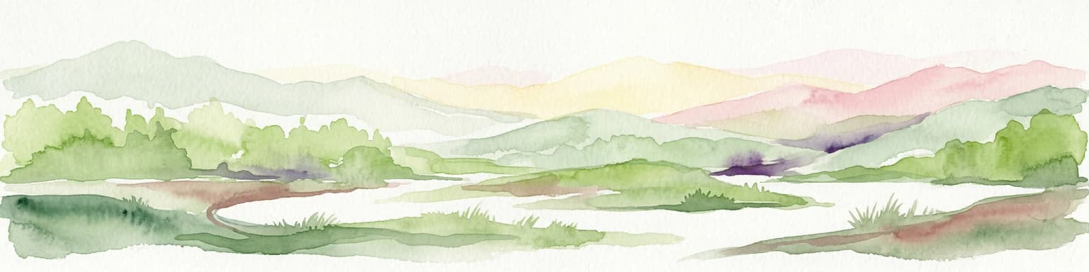
The landscape of Clyde River National Park is defined by its relationship with the Clyde River, which flows through the park along a roughly north-south axis before entering the Pacific Ocean near Batemans Bay. The river itself is a significant waterway on the south coast, with the park protecting a substantial section of its middle reaches where the channel is bounded by forested banks and the surrounding terrain undulates gently away from the water's edge.

The topography within the park reflects the transitional character of the south coast hinterland, where the river has carved a course through terrain that rises gradually from the coastal plain into the foothills of the adjacent ranges. The river frontage within the park encompasses both the main channel and the associated riparian zone, which supports dense vegetation including casuarinas, eucalypts, and various understory species adapted to the moist conditions near the water.

Beyond the immediate river corridor, the park's land rises to meet the Kings Highway along its north-eastern boundary. The forests that cover these slopes range from wet eucalyptus forest in the sheltered gullies to more open woodland on the exposed ridges, creating visual and ecological diversity across the relatively small area. The combination of river, riparian forest, and surrounding woodland creates a coherent landscape unit that supports the ecological values for which the park was established.

Clyde River National Park ecosystems, habitats, and plant life

The natural environment of Clyde River National Park centres on the riverine ecosystems that dominate the protected area, combined with the surrounding eucalypt forests that provide the structural foundation for the park's ecological character. The Clyde River itself supports aquatic habitats including deep pools, riffles, and shaded stretches that each provide different conditions for aquatic organisms, while the riparian vegetation along its banks creates a corridor of moist, shaded habitat that contrasts with the drier forests on the surrounding slopes.

The park's significance within the Ulladulla to Merimbula Important Bird Area reflects the concentration of birdlife that occurs in this part of the south coast, particularly during the autumn and winter months when migratory species arrive from Tasmania. The swift parrot, an endangered species that breeds in Tasmania and migrates to the mainland for the non-breeding season, relies heavily on the nectar-producing trees within the park and adjacent areas. This dependency on specific habitat features makes the protected area a critical component of the species' mainland range.

The forest types present within the park include wet sclerophyll woodland characterised by tall eucalypts with dense understoreys, transitioning to more open forest types on the ridge crests. These vegetation communities support a range of mammal, reptile, and invertebrate species typical of the south coast region, while the river provides habitat for fish species and supports birds that feed along the water's edge.

Clyde River National Park wildlife and species highlights

The wildlife of Clyde River National Park is most notably characterised by the presence of the endangered swift parrot, which visits the park during its annual migration from Tasmania to the Australian mainland. These birds arrive in autumn and feed on the nectar of various eucalypt species throughout the winter months, making the park's flowering trees a critical food resource for their survival. The park's protection of these feeding grounds contributes directly to the conservation of a species that faces significant threats from habitat loss and fragmentation across its range.

Beyond the swift parrot, the park supports a diverse bird community that includes both resident species and migratory visitors. The riparian environment along the Clyde River provides habitat for waterbirds and birds that forage in the vegetation along the water's edge, while the forested areas support a range of woodland birds including honeyeaters, parrots, and cockatoos. The park's position within the Important Bird Area recognises this broader bird diversity, not just the presence of the flagship swift parrot species.

The river itself supports fish species including Australian bass and various native fish that move through the Clyde River system, while the surrounding forests contain arboreal mammals, reptiles, and the invertebrate species that form the base of the forest food web. Though detailed species lists are limited in available sources, the park's intact forest and riverine environments provide suitable habitat for many species typical of the south coast region.

Clyde River National Park conservation status and protection priorities

Clyde River National Park's conservation significance is grounded primarily in its designation as part of the Ulladulla to Merimbula Important Bird Area, a recognition granted by BirdLife International that identifies the area as having exceptional importance for birds, particularly the endangered swift parrot. This international recognition acknowledges that the park's forests provide essential habitat that supports the survival of a species whose global population is in decline due to habitat loss, particularly the clearance of flowering eucalypts on the Australian mainland.

The park's protection of a significant section of the Clyde River also contributes to broader catchment health, as protected river frontage helps maintain water quality, prevent bank erosion, and preserve the aquatic and riparian ecosystems that depend on relatively unmodified river conditions. The nine kilometres of river frontage within the park represents a substantial commitment to preserving the ecological integrity of this waterway.

The establishment of the park in 2000 from former State Forest land also represents a conservation outcome, transitioning the area from multiple-use forestry to full protected area status with its primary purpose being the preservation of natural values. This change in tenure provides the highest level of protection available under Australian law, ensuring that the park's ecosystems and species are managed primarily for conservation rather than extractive uses.

Clyde River National Park cultural meaning and human context

The land within Clyde River National Park is the traditional country of the Walbunja people, an Aboriginal clan whose cultural connections to the Clyde River valley extend far beyond the relatively recent establishment of the protected area. The Walbunja are one of the Aboriginal groups of the Yuin nation, whose territories encompassed much of the south coast of New South Wales. The Clyde River and its surrounds would have provided traditional food resources, sacred sites, and travel routes for the Walbunja over thousands of years.

The south coast region contains numerous Aboriginal archaeological and cultural sites, though specific details about places within Clyde River National Park are not extensively documented in available sources. The river itself would have held particular significance as a source of food including fish, eels, and waterbirds, while the surrounding forests provided access to plant foods, materials for tools and weapons, and other resources essential to traditional Aboriginal life.

The formal recognition of the Walbunja as the traditional custodians of this land adds an important cultural dimension to the park's identity, acknowledging that the landscape has been shaped by Indigenous land management over millennia and that Aboriginal people maintain ongoing connections to country even where formal native title recognition may not exist.

Top sights and standout views in Clyde River National Park

The defining highlight of Clyde River National Park is its role as a vital refuge for the endangered swift parrot, providing protected feeding grounds within a landscape that supports the nectar-producing trees this migratory species requires. The park's nine kilometres of Clyde River frontage offers a scenic and peaceful environment for visitors interested in riverine landscapes, with opportunities to observe the river from the water or from the surrounding forests. The relatively compact size of the park makes it accessible for shorter visits while still providing a genuine wilderness experience away from the more heavily visited coastal destinations further east.

The park's location between Batemans Bay and Nelligen places it within a region that offers additional attractions including coastal beaches, marine environments, and other protected areas, making it a potential component of a broader south coast exploration. The Kings Highway provides convenient access to the park, while the proximity to Batemans Bay means that visitor facilities and services are available within a short drive.

Best time to visit Clyde River National Park

The optimal time to visit Clyde River National Park aligns with the presence of swift parrots, which arrive on the mainland from Tasmania during the autumn months and remain through winter into early spring. This period, roughly from March through September, offers the best chance of observing these endangered birds as they feed on flowering eucalypts throughout the park. The winter months provide pleasant conditions for walking in the forests, with mild temperatures and relatively low visitor numbers compared to the summer holiday season.

Summer months in the south coast region bring warmer weather and school holiday crowds, but the park's inland location and forest shading provide some relief from coastal heat. This season offers different natural experiences, with wildflowers in the understorey and the opportunity to enjoy the river environment in warmer conditions. The shoulder seasons of spring and autumn each offer their own advantages, from the flowering of different tree species to the arrival and departure of migratory bird species.

Park location guide

Geography guide, regional context, and park location map for Clyde River National Park

Clyde River National Park park geography, regions, and map view in Australia
Understand where Clyde River National Park sits in Australia through a broader geographic reading of the surrounding landscape, nearby location context, and its mapped position within the national park landscape.

How Clyde River National Park fits into Australia

Australia is a constitutional monarchy and federal parliamentary democracy comprising six states and ten territories. With a population of nearly 28 million, it is one of the world's most urbanised countries, with most people concentrated on the eastern seaboard. The country has a high Human Development Index and is known for its cultural diversity, ancient Aboriginal heritage, and unique wildlife.

Wider geography shaping Clyde River National Park in Australia

Australia occupies the entire Australian continent, the island of Tasmania, and numerous smaller islands. It is the world's flattest and driest inhabited continent, featuring vast deserts in the interior (the Outback), tropical rainforests along the eastern coast, and a coastline bordering the Indian and Pacific Oceans.

Map view of Clyde River National Park

Use this park location map to pinpoint Clyde River National Park in Australia, understand its exact geographic position, and read its mapped placement within the surrounding landscape more clearly.

Pigeon | © OpenStreetMap contributors

Location context for Clyde River National Park

New South Wales
Park atlas

Discover the Surrounding Riverine Ecosystems and Coastal Protected Landscapes of South-Eastern New South Wales

Explore Related National Parks and Protected Areas Near Clyde River National Park in NSW
Continue your protected area discovery from Clyde River National Park by exploring other national parks and protected landscapes across the South Coast of New South Wales, Australia. Compare various riverine forests, coastal reserves, and eucalypt woodlands to understand the regional spread of conservation efforts and diverse natural habitats in this mapped geography.
National parkNew South Wales

Budawang National Park: Wilderness Area and Rugged Terrain Map

Discover New South Wales protected landscape geography.

Budawang National Park is recognized for its exceptional wilderness character, defined by the steep topography of the southern Budawang Range. This protected national park features extensive cool temperate rainforests clothing its middle and upper slopes, creating a visually striking and ecologically rich mountain environment. Its rugged terrain, with deep valleys and rocky outcrops, distinguishes it as a remote natural landscape within New South Wales, offering unique habitat pockets and contributing to the region's protected area atlas.

Area
237 km²
Established
1977
IUCN
Ib
National parkNew South Wales

Eurobodalla National Park: New South Wales Coastal Protected Landscape and Geographic Atlas

Explore its mapped protected boundaries and unique estuarine wetland habitats.

Eurobodalla National Park represents a critical segment of the New South Wales coastline, distinguished by its designation as a national park. The park's geography is characterized by a mosaic of coastal terrains, including sandy shores, river estuaries, and vegetated headlands, which collectively form essential protected landscapes. It is particularly recognized for its role in supporting migratory bird populations and serves as a key site for understanding coastal ecology and conservation efforts within Australia. Through its mapped protected areas, Eurobodalla National Park provides valuable insights into the regional geography and the distribution of vital natural habitats.

Area
29.13 km²
Established
1995
IUCN
II
National parkNew South Wales

Morton National Park: A Protected Landscape of Waterfalls and Dissected Plateaus in New South Wales

Explore its mapped boundaries and regional geographic context.

Morton National Park is a nationally recognized protected area within New South Wales, Australia, celebrated for its striking natural features and geographic significance. The park's landscape is characterized by a dramatic dissected plateau, giving rise to impressive waterfall systems such as Fitzroy Falls and Belmore Falls that cascade into deep gorges. As a key component of the Southern Highlands' natural heritage, Morton National Park provides a rich subject for atlas exploration, offering insights into regional terrain, protected land distribution, and the unique interplay of natural elements within this Australian national park.

Area
1,997.45 km²
Established
1967
IUCN
II
National parkNew South Wales

Kooraban National Park: Protected Area Map and Landscape Geography in New South Wales

Explore critical marsupial habitat and transitional terrain.

Kooraban National Park in New South Wales is a protected national park recognized for its role in conserving vulnerable marsupial species and its distinctive transitional landscape. Spanning over 11,500 hectares, the park connects inland tableland environments with coastal ecosystems, defined by the Narira Creek valley and Tuross River system. Its geography supports four distinct vegetation communities, making it a vital area for endangered animal habitats and broader conservation efforts within southeastern Australia. This park provides essential context for understanding regional geography and protected-area networks.

Area
116.26 km²
Established
2001
IUCN
II
National parkNew South Wales

Biamanga National Park: Protected National Park with Volcanic Landscape & Regional Geography

Discover mapped terrain and natural park boundaries.

Biamanga National Park is a significant protected area in New South Wales, Australia, notable for its volcanic mountain landscape dominated by Mumbulla Mountain. This national park provides valuable context for understanding regional geography, offering insights into its unique terrain, granite formations, and creek systems. Explore its protected boundaries and the ecological significance of this distinct natural landscape.

Area
137.49 km²
Established
1994
IUCN
II
Relief
Mountain
National parkAustralia

Bugong National Park: Protected Landscape Identity and Geographic Context in Australia

Discover unique biodiversity, forest habitats, and regional terrain.

Bugong National Park stands as a vital strict nature reserve within Australia's protected lands. Its distinct geography features a plateau below the Cambewarra range and steeply sloping valleys carved by waterways like Bugong Creek and the Shoalhaven River. This protected area is crucial for conserving significant biodiversity, including endemic and threatened species, across its diverse wet and dry forest habitats. For those interested in atlas exploration, Bugong National Park offers a clear example of landscape conservation and protected area geography within New South Wales.

Area
10.22 km²
Established
2001
IUCN
Ia
National parkNew South Wales

Wadbilliga National Park: Exploring New South Wales' Rugged Protected Landscape

Discover its mapped terrain and diverse ecosystem geography.

Wadbilliga National Park in New South Wales is a prime example of a large, remote protected area characterized by its rugged natural terrain and diverse ecosystems. Spanning approximately 985 square kilometres, the park features dramatic geographic contrasts, from deep gorges carved by rivers like the Tuross to expansive plateaus and sheltered gullies supporting varied vegetation communities. Its designation as a national park underscores its importance for conservation and provides a unique opportunity for understanding the mapped landscape context of southeastern Australia.

Area
985.3 km²
Established
1979
IUCN
Ib
National parkNew South Wales

Seven Mile Beach National Park: New South Wales National Park, Coastal Delta & Bird Habitat Exploration

Explore the mapped terrain and protected landscapes of this significant Australian coastal park.

Seven Mile Beach National Park offers a fascinating case study in coastal geography and protected area management, situated within New South Wales, Australia. The park's landscape is defined by the Shoalhaven River delta, showcasing a unique environment of tidal flats, islands, and a substantial sand barrier. This ecosystem supports significant populations of migratory waders and seabirds, making it a noteworthy site for ornithological interest and broader conservation studies. Understanding this park's atlas representation reveals its distinct littoral rainforest and its role within the regional protected land network.

Area
8.981 km²
Established
1971
IUCN
II

Common questions about visiting, size, designation, and location context for Clyde River National Park

Clyde River National Park FAQs for park facts, access, geography, and protected area context
Find quick answers about Clyde River National Park, including protected-area facts, park geography, trail and visitor context, and how the park fits into its surrounding country and regional landscape.
MoriAtlas Explorer

Continue Your Protected Areas Search Across the Global Atlas

Deepen your exploration by continuing the structured search for national parks and protected areas worldwide. Utilize the comprehensive filtering capabilities to compare different conservation landscapes and refine your understanding of global park geography. Discover more about the distribution and characteristics of protected natural areas.

Global natural geography