Mori Atlas logo
National parkBiamanga National Park

Explore the mapped geography and natural features of this significant national park.

Biamanga National Park: Protected Landscape and Volcanic Terrain in New South Wales

Biamanga National Park represents a key protected area in the landscape of New South Wales, Australia, offering a unique insight into volcanic geology and regional geography. This national park is centered around the prominent Mumbulla Mountain, a significant landmark that shapes its terrain and ecosystems. Discover its mapped boundaries, diverse natural features, and its role as a vital habitat within the southern Australian landscape through structured atlas exploration.

Aboriginal cultural heritageSouth Coast New South WalesVolcanic landscapeImportant Bird AreaJoint managementEndangered species

Biamanga National Park

National park

Park overview

Structured park overview, official facts, and landscape profile for Biamanga National Park

Biamanga National Park park facts, protected area profile, and essential visitor context
Review the core facts for Biamanga National Park, including designation, size, terrain, visitor scale, habitats, and operating context in one park-focused overview.

About Biamanga National Park

Biamanga National Park occupies a significant position on the South Coast of New South Wales, spanning approximately 13,617 hectares of coastal and escarpment terrain. The park's central feature, Mumbulla Mountain, rises as a distinctive basalt peak visible from across the Bega Valley, serving as both a geographic landmark and a deeply sacred cultural site for the Yuin people. The mountain was named after King Jack Mumbulla, a Yuin elder whose tribal name was Biamanga, and who would use the summit to communicate with his people through smoke signals. In November 2021, Mumbulla Mountain was officially ascribed the dual name of Biamanga, recognizing its Aboriginal heritage. The park is viewed by traditional owners as part of an interconnected cultural landscape that extends to Gulaga National Park and several coastal islands including Merriman Island, Montague Island, and Pigeon House Mountain. This cultural connection reflects the holistic Yuin understanding of country, where mountains, islands, and waterways form a continuous network of sacred and ceremonial sites.

Quick facts and research context for Biamanga National Park

Biamanga National Park covers 13,617 hectares along the South Coast of New South Wales, centered on the culturally significant Mumbulla Mountain. The mountain is the remnant of an ancient shield volcano, with granite formations visible along Mumbulla Creek. The park forms part of a broader cultural landscape that traditional Yuin owners connect with Gulaga National Park, Merriman Island, Montague Island, and Pigeon House Mountain. Joint management arrangements with the Merrimans and Bega Local Aboriginal Land Councils began in 2006, representing a pioneering model for Indigenous co-management of protected areas in New South Wales.

Park context

Deeper park guide and search-rich context for Biamanga National Park

Biamanga National Park history, landscape, wildlife, and travel context
Explore Biamanga National Park through its history, landscape character, ecosystems, wildlife, conservation priorities, cultural context, and seasonal travel timing in a structured park guide built for atlas discovery and search intent.

Why Biamanga National Park stands out

Biamanga National Park is best known for Mumbulla Mountain, a prominent volcanic peak that serves as a sacred Aboriginal site for the Yuin people. The mountain, also known by its dual name Biamanga, holds profound cultural significance as a ceremonial and men's law mountain where initiation ceremonies were conducted until 1918. The park is also recognized for its importance to the endangered swift parrot, which migrates through the area and forms part of the internationally significant Ulladulla to Merimbula Important Bird Area. The combination of cultural heritage, volcanic landscape, and biodiversity makes this park a distinctive protected area on Australia's southern coastline.

Mumbulla Mountain from Princes Highway
Mumbulla Mountain photographed from the Princes Highway, Australia

Biamanga National Park history and protected-area timeline

The history of Biamanga National Park reflects both ancient Indigenous occupation and more recent conservation movements. The Yuin people have inhabited these lands for thousands of years, with the mountain serving as a major ceremonial center where initiation ceremonies were conducted, the last recorded one taking place in 1918. During the twentieth century, the area experienced extensive logging that continued into the 1970s. In 1967, rock was blasted with dynamite to improve television reception, and a transmitter tower was constructed on the mountain. Local community concerns about forest destruction led to government action, and in 1977 an advisory committee was established to investigate the woodchipping industry. That same year, Yuin elder Guboo Ted Thomas led a significant protest against the destruction of forests on Mumbulla Mountain. On July 15, 1980, the NSW Government declared approximately 7,540 hectares an Aboriginal place and Protected Archaeological Area under the National Parks and Wildlife Act 1974. The national park was officially proclaimed in 1994 and expanded in 1997. Further protests against logging occurred in 2010, demonstrating the ongoing community commitment to protecting this culturally and environmentally significant landscape.

Biamanga National Park landscape and geographic character

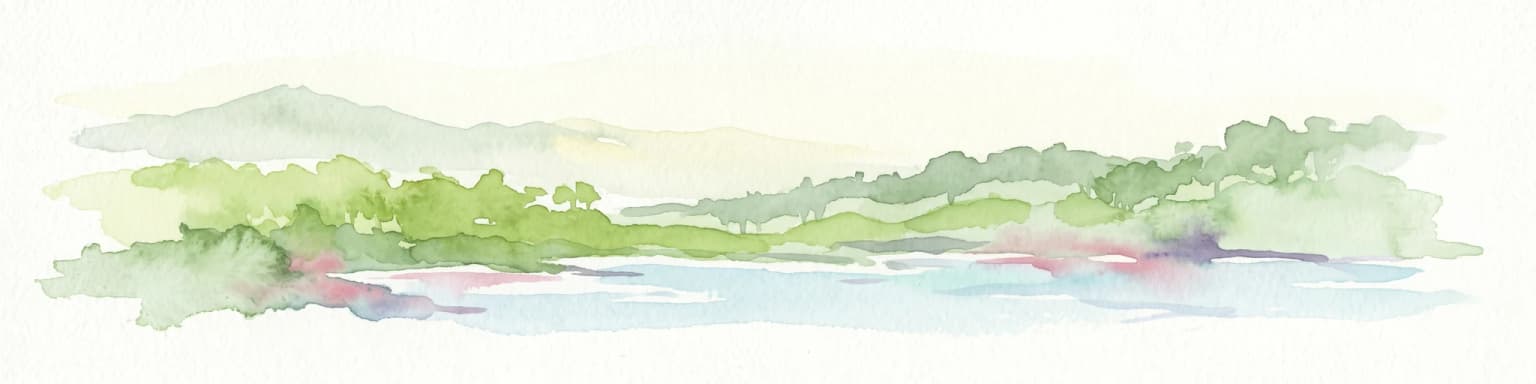
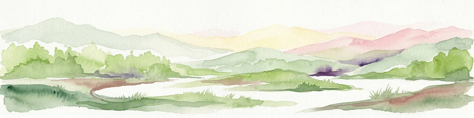
The landscape of Biamanga National Park is defined by Mumbulla Mountain, the remnant of an ancient shield volcano that rises prominently above the surrounding Bega Valley. The mountain's volcanic origins are evident in the basalt formations that characterize its slopes and summits. Granite rock formations and boulder fields are visible along the course of Mumbulla Creek, which drains the mountain's slopes. The terrain encompasses a range of elevations from valley floors through moist gullies to exposed ridgelines, creating diverse microhabitats throughout the park. The prominent peak can be seen from considerable distances across the South Coast region, making it a navigational and cultural landmark. The creek systems support riparian vegetation communities featuring monkey gums and ribbon gums, while the surrounding slopes support diverse forested habitats.

Biamanga National Park ecosystems, habitats, and plant life

Biamanga National Park supports several distinct ecological communities and habitat types. Along the watercourses, monkey gums and ribbon gums form distinctive riparian corridors, while the park is home to Chef's Cap Correa, an endangered plant species. The park forms part of the Ulladulla to Merimbula Important Bird Area, identified by BirdLife International as internationally significant for its populations of swift parrots. This migratory parrot species depends on the forest habitats of the South Coast region during its seasonal movements. The park's diverse habitats support a range of bird species including azure kingfishers and superb fairywrens, which are commonly observed along the creek systems and in the forested areas. The combination of volcanic soils, moisture from creek systems, and varied topography creates conditions supporting botanical diversity.

Biamanga National Park wildlife and species highlights

The wildlife of Biamanga National Park reflects the South Coast's diverse ecological character. The park is particularly significant for birdlife, most notably the swift parrot, which migrates through the area and depends on the region's forested habitats. The park forms part of a formally designated Important Bird Area due to this species significance. Azure kingfishers can be observed along the creek systems, where they hunt fish and invertebrates in the shallow waters. Superb fairywrens inhabit the understory and riparian zones throughout the park. The endangered Chef's Cap Correa plant provides important habitat for various invertebrates and small vertebrates. The forested slopes and creek corridors provide shelter and foraging resources for various mammal and reptile species typical of South Coast forests.

Biamanga National Park conservation status and protection priorities

Biamanga National Park represents an important conservation outcome achieved through the intersection of Aboriginal cultural protection and biodiversity preservation. The park's designation as an Important Bird Area by BirdLife International acknowledges its international significance for the endangered swift parrot, a species that migrates along Australia's east coast. The presence of Chef's Cap Correa, listed as an endangered species, adds particular botanical conservation significance to the park. The joint management arrangement between traditional Yuin owners and the NSW National Parks and Wildlife Service, established in 2006, represents a pioneering model for Indigenous participation in protected area management. This arrangement recognizes the Merrimans and Bega Local Aboriginal Land Councils as traditional custodians who own the land and lease it back to the government for national park purposes.

Biamanga National Park cultural meaning and human context

Biamanga National Park holds extraordinary cultural significance for the Yuin people of the South Coast of New South Wales. Mumbulla Mountain, also known as Biamanga, is one of the most important Aboriginal sacred sites in the region, functioning as a ceremonial and men's law mountain where initiation ceremonies were conducted for generations, with the last recorded ceremony occurring in 1918. The mountain was named after King Jack Mumbulla, a Yuin leader who would climb to the highest peak to commune with ancestor spirits and send smoke signals to his people below. The site achieved formal legal recognition in 1980 when it was declared an Aboriginal place and Protected Archaeological Area under NSW legislation. The Biamanga protest site represents broader significance for Indigenous Australian land rights and self-determination movements, symbolizing the successful resistance to environmental destruction and the recovery of cultural connection to Country. Traditional owners view the park as part of a single cultural landscape connected to Gulaga National Park, Merriman Island, Montague Island, and Pigeon House Mountain.

Top sights and standout views in Biamanga National Park

Mumbulla Mountain stands as the defining feature of Biamanga National Park, offering both cultural significance and scenic views across the Bega Valley. The volcanic landscape provides distinctive geological features including basalt formations and granite boulder fields along Mumbulla Creek. The park's importance for swift parrots makes it a significant destination for birdwatching and nature observation, particularly during migration seasons. The dual naming of Mumbulla Mountain as Biamanga in 2021 represents the ongoing recognition of Aboriginal heritage within the protected area. Joint management arrangements with Yuin traditional owners offer a model for collaborative conservation that integrates Indigenous knowledge and cultural values.

Best time to visit Biamanga National Park

The best time to visit Biamanga National Park depends on seasonal conditions and visitor interests. Autumn and winter months typically offer clear visibility for appreciating the mountain's prominent silhouette and panoramic views across the Bega Valley. Spring brings milder temperatures and increased bird activity, with swift parrots potentially observable during their migration period. Summer visits should account for higher temperatures and reduced water availability in some creek systems. Visitors interested in cultural interpretation may benefit from contacting the NSW National Parks and Wildlife Service for information about access arrangements and any cultural heritage considerations.

Park location guide

Geography guide, regional context, and park location map for Biamanga National Park

Biamanga National Park park geography, regions, and map view in Australia
Understand where Biamanga National Park sits in Australia through a broader geographic reading of the surrounding landscape, nearby location context, and its mapped position within the national park landscape.

How Biamanga National Park fits into Australia

Australia is a constitutional monarchy and federal parliamentary democracy comprising six states and ten territories. With a population of nearly 28 million, it is one of the world's most urbanised countries, with most people concentrated on the eastern seaboard. The country has a high Human Development Index and is known for its cultural diversity, ancient Aboriginal heritage, and unique wildlife.

Wider geography shaping Biamanga National Park in Australia

Australia occupies the entire Australian continent, the island of Tasmania, and numerous smaller islands. It is the world's flattest and driest inhabited continent, featuring vast deserts in the interior (the Outback), tropical rainforests along the eastern coast, and a coastline bordering the Indian and Pacific Oceans.

Map view of Biamanga National Park

Use this park location map to pinpoint Biamanga National Park in Australia, understand its exact geographic position, and read its mapped placement within the surrounding landscape more clearly.

Pigeon | © OpenStreetMap contributors

Location context for Biamanga National Park

New South Wales

Discover the visual essence of Biamanga National Park, showcasing its volcanic geology, distinct forest habitats, and cultural landscape character.

Visual Exploration of Biamanga National Park: Landscapes, Habitats, and Sacred Mumbulla Mountain Scenery
Visually explore Biamanga National Park's diverse landforms, rich ecological zones, and prominent geological features, including sacred Mumbulla Mountain. Gain a clear understanding of the protected area's unique identity through images of ancient volcanic basalt formations, granite boulder fields, and lush creek systems.

Mumbulla Mountain from Princes Highway

Park atlas

Compare mapped geography and protected landscapes in the South Coast New South Wales region.

Discover Other National Parks and Protected Areas Near Biamanga National Park
Browse national parks and protected areas geographically close to Biamanga National Park, tracing the surrounding landscapes of the South Coast New South Wales region. This atlas view facilitates comparison of diverse conservation areas, from volcanic terrain to important bird habitats, providing valuable regional context for exploration.
National parkNew South Wales

Kooraban National Park: Protected Area Map and Landscape Geography in New South Wales

Explore critical marsupial habitat and transitional terrain.

Kooraban National Park in New South Wales is a protected national park recognized for its role in conserving vulnerable marsupial species and its distinctive transitional landscape. Spanning over 11,500 hectares, the park connects inland tableland environments with coastal ecosystems, defined by the Narira Creek valley and Tuross River system. Its geography supports four distinct vegetation communities, making it a vital area for endangered animal habitats and broader conservation efforts within southeastern Australia. This park provides essential context for understanding regional geography and protected-area networks.

Area
116.26 km²
Established
2001
IUCN
II
National parkNew South Wales

Mimosa Rocks National Park: Coastal Protected Area Atlas and Geographic Discovery

New South Wales National Park with Mapped Coastal Terrain

Mimosa Rocks National Park offers a compelling glimpse into Australia's protected coastal geography. This national park showcases a dynamic landscape where rocky outcrops and sweeping beaches define the Sapphire Coastline within New South Wales. Engage with its mapped boundaries and understand its role as a vital part of the regional protected area network, perfect for detailed atlas exploration and appreciating natural landscape context.

Area
57 km²
Established
1973
IUCN
II
National parkNew South Wales

Wadbilliga National Park: Exploring New South Wales' Rugged Protected Landscape

Discover its mapped terrain and diverse ecosystem geography.

Wadbilliga National Park in New South Wales is a prime example of a large, remote protected area characterized by its rugged natural terrain and diverse ecosystems. Spanning approximately 985 square kilometres, the park features dramatic geographic contrasts, from deep gorges carved by rivers like the Tuross to expansive plateaus and sheltered gullies supporting varied vegetation communities. Its designation as a national park underscores its importance for conservation and provides a unique opportunity for understanding the mapped landscape context of southeastern Australia.

Area
985.3 km²
Established
1979
IUCN
Ib
National parkNew South Wales

Eurobodalla National Park: New South Wales Coastal Protected Landscape and Geographic Atlas

Explore its mapped protected boundaries and unique estuarine wetland habitats.

Eurobodalla National Park represents a critical segment of the New South Wales coastline, distinguished by its designation as a national park. The park's geography is characterized by a mosaic of coastal terrains, including sandy shores, river estuaries, and vegetated headlands, which collectively form essential protected landscapes. It is particularly recognized for its role in supporting migratory bird populations and serves as a key site for understanding coastal ecology and conservation efforts within Australia. Through its mapped protected areas, Eurobodalla National Park provides valuable insights into the regional geography and the distribution of vital natural habitats.

Area
29.13 km²
Established
1995
IUCN
II
National parkNew South Wales

Beowa National Park: Protected Landscape and Coastal Geography in New South Wales

Mapped terrain and unique erosion sites within this national park.

Delve into the protected landscape of Beowa National Park, situated in the coastal region of New South Wales. This national park showcases a varied terrain, from heathland headlands to eucalypt woodlands, with the visually dramatic Pinnacles erosion gully as a key highlight. Its geographic setting within Twofold Bay provides a compelling focus for atlas exploration of Australia's protected natural areas.

Area
104.86 km²
Established
1971
IUCN
II
National parkAustralia

Clyde River National Park: Australia's Protected Riverine Landscape and Swift Parrot Sanctuary

Discover its vital role in conservation and mapped geography.

Clyde River National Park is a critical protected area in Australia, safeguarding nine kilometers of river frontage along the Clyde River. Established for its ecological importance, particularly as a sanctuary for the endangered swift parrot, the park's landscape is characterized by riverine forests and eucalyptus woodlands. This designation highlights its role in preserving key habitats and contributing to the regional map of protected lands vital for biodiversity.

Area
10.91 km²
Established
2000
IUCN
II
Scope
Terrestrial
National parkNew South Wales

Budawang National Park: Wilderness Area and Rugged Terrain Map

Discover New South Wales protected landscape geography.

Budawang National Park is recognized for its exceptional wilderness character, defined by the steep topography of the southern Budawang Range. This protected national park features extensive cool temperate rainforests clothing its middle and upper slopes, creating a visually striking and ecologically rich mountain environment. Its rugged terrain, with deep valleys and rocky outcrops, distinguishes it as a remote natural landscape within New South Wales, offering unique habitat pockets and contributing to the region's protected area atlas.

Area
237 km²
Established
1977
IUCN
Ib
Marine protected areaVictoria

Cape Howe Marine National Park: Victoria's Dramatic Southern Ocean Marine Protected Area

Rugged coastlines and marine ecosystem discovery in East Gippsland.

Delve into Cape Howe Marine National Park, a protected marine area anchoring Victoria's eastern coastline. This park protects a stretch of the Southern Ocean meeting dramatic rocky headlands and exposed shores. Its location at the far eastern tip of Victoria, adjacent to national parks, highlights a significant continuum of protected natural landscapes. Explore the mapped marine geography and the powerful coastal environment that defines this remote protected area.

Area
40.5 km²
Established
2002
IUCN
II

Common questions about visiting, size, designation, and location context for Biamanga National Park

Biamanga National Park FAQs for park facts, access, geography, and protected area context
Find quick answers about Biamanga National Park, including protected-area facts, park geography, trail and visitor context, and how the park fits into its surrounding country and regional landscape.
MoriAtlas Explorer

Continue Your Protected Areas Search Across the Global Atlas

Deepen your exploration by continuing the structured search for national parks and protected areas worldwide. Utilize the comprehensive filtering capabilities to compare different conservation landscapes and refine your understanding of global park geography. Discover more about the distribution and characteristics of protected natural areas.

Global natural geography