Mori Atlas logo
National parkWadbilliga National Park

Discover the rugged terrain, diverse ecosystems, and remote wilderness character of this national park.

Wadbilliga National Park: New South Wales Protected Landscape and Mapped Geography

Wadbilliga National Park, situated in the high country of southeastern New South Wales, represents a significant protected landscape across approximately 985 square kilometres. This national park showcases a dramatic geography of steep gorges, undulating plateaus, and sheltered gullies, defined by elevations ranging from low river valleys to peaks exceeding 1,300 metres. The park’s near-pristine natural terrain offers a rich context for exploring mapped boundaries, diverse ecological zones from rainforest to alpine forests, and the unique character of Australia’s protected areas.

Wilderness AreaNational ParkNew South WalesRugged GorgesBirdwatchingEucalyptus Forest

Wadbilliga National Park

National park

Park overview

Structured park overview, official facts, and landscape profile for Wadbilliga National Park

Wadbilliga National Park park facts, protected area profile, and essential visitor context
Review the core facts for Wadbilliga National Park, including designation, size, terrain, visitor scale, habitats, and operating context in one park-focused overview.

About Wadbilliga National Park

Wadbilliga National Park occupies a distinctive position in the protected area network of southeastern Australia as a large wilderness area that has remained relatively untouched by human activity. The park encompasses a remarkable variety of landscapes within its 985-square-kilometre boundary, from deep river gorges carved by the Tuross River to exposed heathland plateaus and sheltered rainforest pockets. Unlike many Australian national parks that show clear signs of pastoral modification or historical logging, much of Wadbilliga remains in a near-pristine state, a characteristic that earned it IUCN Category Ib protection as a wilderness area. The park's location straddling the Monaro highlands and the South Coast creates an ecological transition zone where species from different climatic and environmental regimes overlap. Visitors drawn to Wadbilliga typically seek wilderness experiences, with the terrain suited only to those with strong experience in outdoor navigation and self-sufficiency. The park offers opportunities for overnight camping and extended wilderness walks, though the rugged nature of the terrain demands careful preparation. Notable features including Tuross Falls and the dramatic Tuross River Gorge provide focal points for exploration, while the Wadbilliga Track itself serves as a scenic route through the park's varied environments.

Quick facts and research context for Wadbilliga National Park

Wadbilliga National Park covers 985.3 square kilometres of protected wilderness in southeastern New South Wales. The park is classified as an IUCN Category Ib wilderness area, reflecting its near-pristine condition and minimal human disturbance since European settlement. Elevation ranges from 15 metres in valley bottoms to 1,335 metres at higher points. Summer temperatures range from 8°C to 23°C, while winter brings conditions between -3°C and 10°C. The park is managed by the NSW National Parks and Wildlife Service, with the Wadbilliga Track providing scenic four-wheel-drive access across the escarpment from east to west.

Park context

Deeper park guide and search-rich context for Wadbilliga National Park

Wadbilliga National Park history, landscape, wildlife, and travel context
Explore Wadbilliga National Park through its history, landscape character, ecosystems, wildlife, conservation priorities, cultural context, and seasonal travel timing in a structured park guide built for atlas discovery and search intent.

Why Wadbilliga National Park stands out

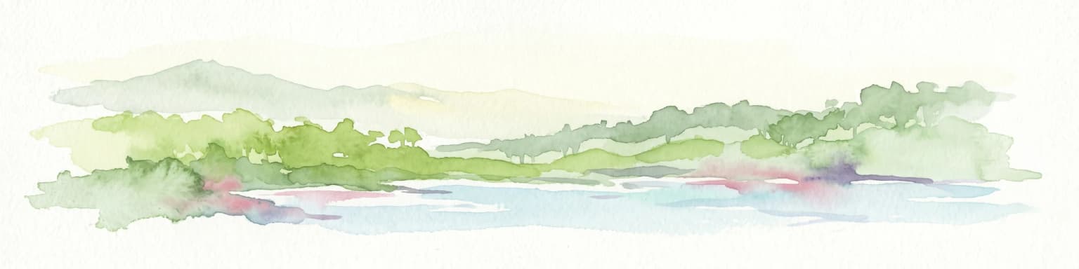
Wadbilliga is best known as a remote wilderness area offering rugged, near-pristine natural landscapes in southeastern Australia. The park is renowned for its dramatic gorges and gullies, with the Tuross River Gorge and Tuross Falls being notable geological features. Its ecological diversity is remarkable for a relatively compact area, encompassing pinkwood rainforests in sheltered fire-free gullies, diverse eucalyptus forests ranging from snow gum woodlands at high altitudes to box gum forests in lower valleys, plus bogs, heaths, and riverside environments. The park supports over 122 recorded native bird species, making it particularly significant for avian diversity. The Wadbilliga Track provides access through varied landscapes, while theBrogo Wilderness Area offers additional protected terrain within the broader park complex.

Wadbilliga National Park history and protected-area timeline

Wadbilliga National Park was formally established on 30 March 1979, designated under the National Parks and Wildlife Act of New South Wales. The park's creation reflected growing recognition during the 1970s of the need to preserve Australia's remaining wilderness areas, a period that saw significant expansion of the national park system in New South Wales. Unlike many protected areas that emerged from former pastoral leases or timber reserves, Wadbilliga's relative remoteness meant it had experienced limited European modification, allowing its protection as a wilderness area with minimal require for extensive restoration. The classification as an IUCN Category Ib wilderness area places Wadbilliga among the most strictly protected landscapes in Australia, where development is minimal and the natural environment is maintained with minimal active management intervention. The park falls under the administration of the NSW National Parks and Wildlife Service, which manages it as part of the state's wilderness estate. Brogo Wilderness Area is included within the broader protected area complex surrounding Wadbilliga.

Wadbilliga National Park landscape and geographic character

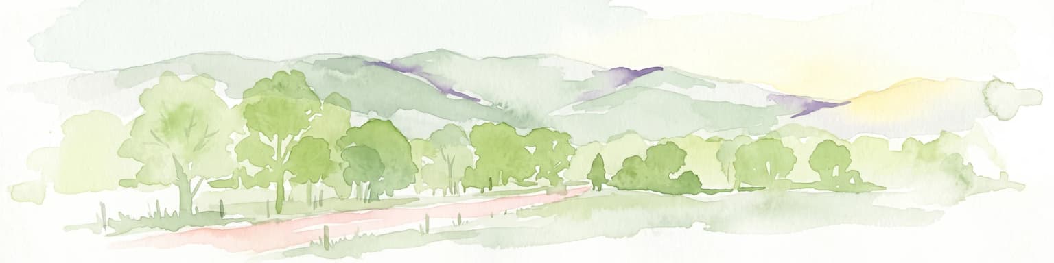
The landscape of Wadbilliga National Park presents a dramatic contrast between exposed high country and deeply sheltered valleys. The undulating plateaus of the Monaro region give way to steep gullies and river gorges as the terrain descends toward the South Coast. The Tuross River has carved a particularly notable gorge through the park, with Tuross Falls marking a significant waterfall where the river drops over resistant rock formations. Elevations within the park range from approximately 15 metres above sea level in the lower valley areas to 1,335 metres at the highest points, creating substantial variation in exposure, temperature, and vegetation communities across short distances. The underlying geology supports diverse terrain, with exposed rock outcrops on steeper slopes, deep soils in valley bottoms, and moisture-retaining substrates in the sheltered gullies that allow rainforest communities to persist. The Wadbilliga Track traverses this landscape, climbing from the eastern approaches near Cobargo up onto the plateaus and descending toward Cooma on the western side.

Wadbilliga National Park ecosystems, habitats, and plant life

The ecological character of Wadbilliga National Park is defined by the interplay between elevation, aspect, moisture availability, and fire regime across the park's varied terrain. The sheltered gullies that indent the plateau support pinkwood rainforests, a relatively rare community dominated by Eucryphia moorei that persists in areas protected from fire and maintained by consistent moisture. At higher altitudes, snow gums dominate the exposed ridges and plateaus, their twisted forms shaped by exposure to strong winds and seasonal cold. The mid-altitude zones feature mixed eucalyptus forests including black ash, monkey gum, messmate, and white ash in various combinations depending on soil depth and moisture. Lower elevations support yellow box, manna gum, and forest red gum forests that represent some of the most productive pastoral landscapes in the region, though within the park these communities remain in relatively natural condition. Beyond the forested areas, the park encompasses significant areas of heathland on exposed plateaus, bogs and swamps in drainage depressions, and riverside forest along watercourses. The rare deua gum and Kunzea badjaensis are documented within the park, representing botanical values of conservation significance.

Wadbilliga National Park wildlife and species highlights

Wadbilliga National Park supports remarkable wildlife diversity, with over 122 native bird species recorded within its boundaries. The relatively undisturbed nature of the landscape has allowed native animal communities to persist with minimal disruption from introduced species or habitat modification. Mammals common throughout the park include wombats, which frequent the grassy areas and forest edges, eastern grey kangaroos that graze in more open areas, and various wallaby species. Several possum species inhabit the forested areas, while the rivers support platypus populations in the deeper pools. Echidnas are encountered across the park, particularly in forested sections and along the track corridors. The birdlife is particularly diverse, with both forest-dwelling species and open-country birds represented across the park's varied habitats. The combination of rainforest, eucalyptus forest, heath, and riparian environments creates a mosaic that supports different ecological communities throughout the year.

Wadbilliga National Park conservation status and protection priorities

Wadbilliga National Park is designated as an IUCN Category Ib wilderness area, placing it among the most strictly protected category of protected areas in Australia. This classification reflects the park's near-pristine condition and its representation of a landscape that has remained substantially unmodified by European settlement activities. The protection of this large contiguous area of wilderness conserves both the ecological values of the diverse habitats present and the natural processes that maintain them, including fire regimes, hydrological cycles, and species interactions. The park's position across an ecological transition zone adds significance by protecting communities from both cool-temperate high country and warmer coastal influences. Conservation management within a wilderness area typically emphasizes maintaining natural conditions rather than active intervention, allowing ecological processes to continue with minimal human interference. The rare plant species documented within the park, including deua gum and Kunzea badjaensis, represent specific conservation values that benefit from the broader protection framework.

Wadbilliga National Park cultural meaning and human context

The Wadbilliga area lies within the traditional country of Aboriginal peoples, though specific details of Indigenous connection to this landscape are not extensively documented in the available source material. The park's remote character and rugged terrain would have provided both resources and challenges for Aboriginal communities, with the river valleys likely serving as corridors for movement and access to water and food resources. European settlement of the Monaro and South Coast regions proceeded from the early nineteenth century, though the steep terrain and limited agricultural potential of much of the Wadbilliga area meant it remained largely undeveloped compared with surrounding pastoral lands. This relative neglect proved beneficial for conservation, as the area retained its natural character through periods when much of the surrounding landscape was modified for grazing and agriculture. The park's establishment in 1979 reflected a broader shift in Australian environmental thinking that recognized the value of preserving wilderness areas for their intrinsic natural importance.

Top sights and standout views in Wadbilliga National Park

Wadbilliga National Park offers a rare combination of wilderness solitude, geological drama, and ecological diversity in southeastern Australia. The Tuross River Gorge and Tuross Falls represent the park's most visually striking natural features, where water cascades over rock formations in a setting of relative remoteness. The diversity of vegetation communities, from pinkwood rainforest in fire-sheltered gullies to snow gum woodlands on exposed ridges, creates a remarkable visual and ecological mosaic within a relatively compact area. The park supports exceptional birdlife with over 122 species recorded, making it a significant destination for birdwatching in the region. The Wadbilliga Track provides vehicle-based access through varied terrain, while the wilderness areas offer opportunities for extended walks for those with appropriate skills and preparation. The near-pristine condition of much of the park distinguishes it from many other Australian protected areas that show clear evidence of historical modification.

Best time to visit Wadbilliga National Park

Wadbilliga can be visited throughout the year, though each season offers distinctly different experiences shaped by the park's elevation range and wilderness character. Summer months from December to February bring warm conditions in the valleys with temperatures reaching into the low twenties, while higher elevations remain cooler and more comfortable for walking. This season offers the longest daylight hours and is generally preferred for extended wilderness trips, though afternoon thunderstorms can occur in the mountain areas. Autumn from March to May typically brings stable weather and excellent visibility, with clear skies and moderate temperatures ideal for exploring the park's various environments. Winter transforms the higher country, with snow possible on the plateau areas and minimum temperatures dropping below freezing, while the lower valleys remain more accessible. Spring from September to November sees the landscape green with new growth and wildflower displays, though weather can be variable. The park's remote nature means visitors must be self-sufficient regardless of season, with appropriate equipment for changing conditions.

Park location guide

Geography guide, regional context, and park location map for Wadbilliga National Park

Wadbilliga National Park park geography, regions, and map view in Australia
Understand where Wadbilliga National Park sits in Australia through a broader geographic reading of the surrounding landscape, nearby location context, and its mapped position within the national park landscape.

How Wadbilliga National Park fits into Australia

Australia is a constitutional monarchy and federal parliamentary democracy comprising six states and ten territories. With a population of nearly 28 million, it is one of the world's most urbanised countries, with most people concentrated on the eastern seaboard. The country has a high Human Development Index and is known for its cultural diversity, ancient Aboriginal heritage, and unique wildlife.

Wider geography shaping Wadbilliga National Park in Australia

Australia occupies the entire Australian continent, the island of Tasmania, and numerous smaller islands. It is the world's flattest and driest inhabited continent, featuring vast deserts in the interior (the Outback), tropical rainforests along the eastern coast, and a coastline bordering the Indian and Pacific Oceans.

Map view of Wadbilliga National Park

Use this park location map to pinpoint Wadbilliga National Park in Australia, understand its exact geographic position, and read its mapped placement within the surrounding landscape more clearly.

Pigeon | © OpenStreetMap contributors

Location context for Wadbilliga National Park

New South Wales
Park atlas

Compare the regional spread of diverse protected areas and connected landscapes across southeastern New South Wales.

Explore Protected Areas and National Parks Near Wadbilliga National Park
After exploring Wadbilliga National Park, expand your geographic understanding by browsing other national parks and protected areas in the surrounding Monaro and South Coast regions of New South Wales. Compare their unique terrains, ecological features, and conservation values to gain a richer atlas perspective on Australia's diverse protected landscapes.
National parkNew South Wales

Biamanga National Park: Protected National Park with Volcanic Landscape & Regional Geography

Discover mapped terrain and natural park boundaries.

Biamanga National Park is a significant protected area in New South Wales, Australia, notable for its volcanic mountain landscape dominated by Mumbulla Mountain. This national park provides valuable context for understanding regional geography, offering insights into its unique terrain, granite formations, and creek systems. Explore its protected boundaries and the ecological significance of this distinct natural landscape.

Area
137.49 km²
Established
1994
IUCN
II
Relief
Mountain
National parkNew South Wales

Kooraban National Park: Protected Area Map and Landscape Geography in New South Wales

Explore critical marsupial habitat and transitional terrain.

Kooraban National Park in New South Wales is a protected national park recognized for its role in conserving vulnerable marsupial species and its distinctive transitional landscape. Spanning over 11,500 hectares, the park connects inland tableland environments with coastal ecosystems, defined by the Narira Creek valley and Tuross River system. Its geography supports four distinct vegetation communities, making it a vital area for endangered animal habitats and broader conservation efforts within southeastern Australia. This park provides essential context for understanding regional geography and protected-area networks.

Area
116.26 km²
Established
2001
IUCN
II
National parkNew South Wales

Mimosa Rocks National Park: Coastal Protected Area Atlas and Geographic Discovery

New South Wales National Park with Mapped Coastal Terrain

Mimosa Rocks National Park offers a compelling glimpse into Australia's protected coastal geography. This national park showcases a dynamic landscape where rocky outcrops and sweeping beaches define the Sapphire Coastline within New South Wales. Engage with its mapped boundaries and understand its role as a vital part of the regional protected area network, perfect for detailed atlas exploration and appreciating natural landscape context.

Area
57 km²
Established
1973
IUCN
II
National parkNew South Wales

Eurobodalla National Park: New South Wales Coastal Protected Landscape and Geographic Atlas

Explore its mapped protected boundaries and unique estuarine wetland habitats.

Eurobodalla National Park represents a critical segment of the New South Wales coastline, distinguished by its designation as a national park. The park's geography is characterized by a mosaic of coastal terrains, including sandy shores, river estuaries, and vegetated headlands, which collectively form essential protected landscapes. It is particularly recognized for its role in supporting migratory bird populations and serves as a key site for understanding coastal ecology and conservation efforts within Australia. Through its mapped protected areas, Eurobodalla National Park provides valuable insights into the regional geography and the distribution of vital natural habitats.

Area
29.13 km²
Established
1995
IUCN
II
National parkNew South Wales

Beowa National Park: Protected Landscape and Coastal Geography in New South Wales

Mapped terrain and unique erosion sites within this national park.

Delve into the protected landscape of Beowa National Park, situated in the coastal region of New South Wales. This national park showcases a varied terrain, from heathland headlands to eucalypt woodlands, with the visually dramatic Pinnacles erosion gully as a key highlight. Its geographic setting within Twofold Bay provides a compelling focus for atlas exploration of Australia's protected natural areas.

Area
104.86 km²
Established
1971
IUCN
II
National parkAustralia

Clyde River National Park: Australia's Protected Riverine Landscape and Swift Parrot Sanctuary

Discover its vital role in conservation and mapped geography.

Clyde River National Park is a critical protected area in Australia, safeguarding nine kilometers of river frontage along the Clyde River. Established for its ecological importance, particularly as a sanctuary for the endangered swift parrot, the park's landscape is characterized by riverine forests and eucalyptus woodlands. This designation highlights its role in preserving key habitats and contributing to the regional map of protected lands vital for biodiversity.

Area
10.91 km²
Established
2000
IUCN
II
Scope
Terrestrial
National parkNew South Wales

Kosciuszko National Park: Australia's Highest Alpine Terrain and Mapped Protected Landscape

Discover unique glacial landscapes and geographic context in New South Wales.

Kosciuszko National Park represents the pinnacle of Australia's alpine geography, preserving the continent's only true alpine ecosystems. This extensive national park in New South Wales features dramatic glacial landforms, including its namesake Mount Kosciuszko, Australia's highest peak. Users can explore the park's mapped boundaries, surrounding natural terrain, and unique landscape features for a comprehensive understanding of this significant protected area.

Area
6,900 km²
Established
1944
IUCN
II
Visitors
3.3M annual
Marine protected areaVictoria

Cape Howe Marine National Park: Victoria's Dramatic Southern Ocean Marine Protected Area

Rugged coastlines and marine ecosystem discovery in East Gippsland.

Delve into Cape Howe Marine National Park, a protected marine area anchoring Victoria's eastern coastline. This park protects a stretch of the Southern Ocean meeting dramatic rocky headlands and exposed shores. Its location at the far eastern tip of Victoria, adjacent to national parks, highlights a significant continuum of protected natural landscapes. Explore the mapped marine geography and the powerful coastal environment that defines this remote protected area.

Area
40.5 km²
Established
2002
IUCN
II

Common questions about visiting, size, designation, and location context for Wadbilliga National Park

Wadbilliga National Park FAQs for park facts, access, geography, and protected area context
Find quick answers about Wadbilliga National Park, including protected-area facts, park geography, trail and visitor context, and how the park fits into its surrounding country and regional landscape.
MoriAtlas Explorer

Continue Your Protected Areas Search Across the Global Atlas

Deepen your exploration by continuing the structured search for national parks and protected areas worldwide. Utilize the comprehensive filtering capabilities to compare different conservation landscapes and refine your understanding of global park geography. Discover more about the distribution and characteristics of protected natural areas.

Global natural geography