Mori Atlas logo
National parkMimosa Rocks National Park

Discover mapped park boundaries and the unique terrain of this New South Wales national park.

Mimosa Rocks National Park: Coastal Protected Landscape and Geographic Atlas Context

Mimosa Rocks National Park stands as a vital protected area along the scenic Sapphire Coast of New South Wales, Australia. This national park offers a distinctive atlas exploration experience, showcasing a rugged coastal terrain where dramatic headlands meet sandy beaches along the Pacific Ocean. Understand its geographic position within New South Wales and its role as a significant natural and cultural landscape, providing rich context for regional geography and protected-area discovery.

coastal national parkNew South WalesSapphire Coastbeach campingImportant Bird Areaswift parrot habitat

Mimosa Rocks National Park

National park

Park overview

Structured park overview, official facts, and landscape profile for Mimosa Rocks National Park

Mimosa Rocks National Park park facts, protected area profile, and essential visitor context
Review the core facts for Mimosa Rocks National Park, including designation, size, terrain, visitor scale, habitats, and operating context in one park-focused overview.

About Mimosa Rocks National Park

Mimosa Rocks National Park occupies a notable position in the coastal protected area network of New South Wales, safeguarding a diverse landscape where the Pacific Ocean meets rugged southeastern Australian terrain. The park's location along the Sapphire Coast reflects the region's reputation for scenic beauty, with its combination of golden beaches, rocky headlands, and clear waters creating a distinctive coastal character. The park's establishment in 1973 reflected growing recognition of the need to protect representative coastal ecosystems in the region, while subsequent expansions have strengthened conservation outcomes. The park's proximity to the towns of Tathra and Bermagui provides visitors with access to coastal communities while maintaining the natural integrity of the protected area. Four-wheel drive access and camping facilities allow visitors to experience the park's landscapes directly, with the park serving as both a conservation reserve and a recreational destination for beach camping and coastal exploration.

Quick facts and research context for Mimosa Rocks National Park

Mimosa Rocks National Park stretches for approximately 16 kilometers along the coast, beginning at the northern end of Tathra Beach and extending northward. The terrain features an average elevation of 69 meters above sea level, with five access roads connecting from the Tathra-Bermagui main road. The park was expanded in 1999 through the acquisition of 260 acres from the Murrah Gardens Estate, adding the coastline around Bunga Beach and Goalen Head. The Yuin people have traditional connections to this landscape, which is reflected in the park's cultural heritage walks. The park is managed by the National Parks and Wildlife Service of New South Wales and holds IUCN Category II designation as a national park.

Park context

Deeper park guide and search-rich context for Mimosa Rocks National Park

Mimosa Rocks National Park history, landscape, wildlife, and travel context
Explore Mimosa Rocks National Park through its history, landscape character, ecosystems, wildlife, conservation priorities, cultural context, and seasonal travel timing in a structured park guide built for atlas discovery and search intent.

Why Mimosa Rocks National Park stands out

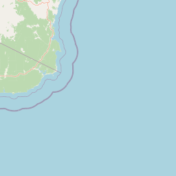
Mimosa Rocks National Park is best known for its dramatic coastal scenery along the Sapphire Coast, featuring prominent rock formations such as Mimosa Rock itself and the striking headlands of Goalen Head. The park protects a biologically significant stretch of coastline recognized as part of the Ulladulla to Merimbula Important Bird Area, making it particularly important for threatened bird species including the swift parrot. Its four accessible camping areas at Gillards, Middle Beach, Aragannu, and Picnic Point provide opportunities for beach camping amid pristine coastal bushland. The park represents a stretch of relatively undeveloped coastline that has retained its natural character despite surrounding development in the Tathra-Bermagui area.

Mimosa Rocks National Park history and protected-area timeline

Mimosa Rocks National Park was officially established on April 13, 1973, as part of New South Wales' expanding national park system during the 1970s period of protected area growth. The park was created to preserve the significant coastal landscapes and ecosystems of the Sapphire Coast region, representing a commitment to protecting representative samples of the state's coastal environments. A significant addition to the park occurred in 1999 when 260 acres of land from the Murrah Gardens Estate, owned by the Hammond family, was acquired and incorporated into the park. This expansion added valuable coastline including Bunga Beach and Goalen Head, strengthening the park's coastal protection and providing additional visitor access points. The park's management under the National Parks and Wildlife Service of New South Wales has ensured ongoing conservation of its natural and cultural values.

Mimosa Rocks National Park landscape and geographic character

Mimosa Rocks National Park presents a distinctive coastal landscape characterized by the interplay between rocky headlands and sandy beaches along the Pacific Ocean coastline. The park's terrain features relatively modest elevation, with an average height of 69 meters above sea level, creating an accessible coastal environment rather than dramatic mountainous terrain. Prominent features include Mimosa Rock, a notable geological formation that gives the park its name, and Goalen Head, a striking headland offering panoramic views along the coast. The park runs approximately 16 kilometers along the coastline, starting at the northern end of Tathra Beach and extending northward, with five access roads providing visitor entry from the Tathra-Bermagui road. The coastal landscape supports a mix of sandy beach areas suitable for swimming and camping, interspersed with rocky sections that create sheltered coves and interesting geological formations.

Mimosa Rocks National Park ecosystems, habitats, and plant life

The coastal environments within Mimosa Rocks National Park support a diverse array of habitats reflecting the transition between ocean and terrestrial ecosystems along the southeastern Australian coast. The park forms part of the Ulladulla to Merimbula Important Bird Area, an internationally recognized designation by BirdLife International acknowledging the area's significance for bird conservation. This designation particularly relates to the park's importance for the swift parrot, a threatened species that relies on coastal forests and woodland habitats. The vegetation communities within the park reflect the coastal setting, with typical Australian coastal bushland species adapted to the ocean-influenced climate. The park's position along a major coastal flyway also contributes to its significance for migratory bird species, making it an important location for bird observation throughout the year.

Mimosa Rocks National Park wildlife and species highlights

Mimosa Rocks National Park provides habitat for various wildlife species adapted to the coastal environments of southeastern New South Wales. The park's most significant wildlife recognition comes through its inclusion in the Ulladulla to Merimbula Important Bird Area, which specifically identifies the area's importance for the swift parrot, a threatened migratory parrot species that breeds in Tasmania and migrates to mainland Australia during the non-breeding season. The coastal position of the park supports bird species associated with shoreline and marine environments, while the surrounding bushland areas provide habitat for woodland birds and other terrestrial species. The combination of beach, headland, and woodland habitats creates a diverse environment supporting multiple wildlife communities, though detailed species lists are not extensively documented in available sources.

Mimosa Rocks National Park conservation status and protection priorities

Mimosa Rocks National Park contributes to conservation outcomes along the Sapphire Coast through its protected status and inclusion in the Ulladulla to Merimbula Important Bird Area, which recognizes the international significance of this coastal region for bird conservation. The park's IUCN Category II designation reflects its management as a national park focused on ecosystem conservation and protection of natural values. The 1999 expansion through acquisition of the Murrah Gardens Estate land demonstrated ongoing commitment to strengthening conservation outcomes by incorporating additional coastline and habitat into the protected area network. The park's protection of coastal ecosystems complements nearby Bournda National Park, creating a connected network of protected areas along this section of the New South Wales coast. Conservation management focuses on maintaining the natural character of the coastline while providing sustainable visitor access through designated camping areas and walking tracks.

Mimosa Rocks National Park cultural meaning and human context

Mimosa Rocks National Park lies within the traditional Country of the Yuin people, an Aboriginal nation with deep historical connections to the coastal landscapes of southeastern New South Wales. The park's recommended walking routes provide opportunities for visitors to learn about the rich cultural heritage of Aboriginal people in this region, acknowledging the long-standing relationship between the Yuin people and the coastal environment. The landscape features within the park, including headlands and beaches, would have held significance in traditional Aboriginal life and culture. The park's management incorporates recognition of Aboriginal cultural values alongside natural heritage protection, reflecting the integrated nature of cultural and natural landscape management in Australian protected areas.

Top sights and standout views in Mimosa Rocks National Park

The dramatic coastal scenery of Mimosa Rocks National Park, with its namesake rock formation and the impressive headland of Goalen Head, represents the park's most visually distinctive feature. The park offers beach camping experiences at four established campgrounds including Gillards, Middle Beach, Aragannu, and Picnic Point, each providing direct access to the coastline. The park's significance as part of the Important Bird Area for swift parrots distinguishes it as a location of particular conservation importance along Australia's east coast. The combination of relatively undeveloped coastline, accessible camping, and cultural heritage makes Mimosa Rocks a representative coastal protected area in the NSW national park system.

Best time to visit Mimosa Rocks National Park

The park can be visited throughout the year, with different seasons offering varying experiences for visitors to Mimosa Rocks National Park. Summer months typically see higher visitor numbers due to school holidays and the appeal of beach camping during warmer weather, though this period also brings the peak of the swift parrot migration season when visitors may observe this threatened species in the park. Autumn and spring offer more moderate conditions with fewer visitors, making these seasons suitable for those seeking a quieter experience. Winter provides a different coastal character with potentially rougher seas and cooler temperatures, though the park remains accessible for day visits. The park's location along the Sapphire Coast means weather patterns follow typical southeastern New South Wales seasonal patterns.

Park location guide

Geography guide, regional context, and park location map for Mimosa Rocks National Park

Mimosa Rocks National Park park geography, regions, and map view in Australia
Understand where Mimosa Rocks National Park sits in Australia through a broader geographic reading of the surrounding landscape, nearby location context, and its mapped position within the national park landscape.

How Mimosa Rocks National Park fits into Australia

Australia is a constitutional monarchy and federal parliamentary democracy comprising six states and ten territories. With a population of nearly 28 million, it is one of the world's most urbanised countries, with most people concentrated on the eastern seaboard. The country has a high Human Development Index and is known for its cultural diversity, ancient Aboriginal heritage, and unique wildlife.

Wider geography shaping Mimosa Rocks National Park in Australia

Australia occupies the entire Australian continent, the island of Tasmania, and numerous smaller islands. It is the world's flattest and driest inhabited continent, featuring vast deserts in the interior (the Outback), tropical rainforests along the eastern coast, and a coastline bordering the Indian and Pacific Oceans.

Map view of Mimosa Rocks National Park

Use this park location map to pinpoint Mimosa Rocks National Park in Australia, understand its exact geographic position, and read its mapped placement within the surrounding landscape more clearly.

Pigeon | © OpenStreetMap contributors

Location context for Mimosa Rocks National Park

New South Wales
Park atlas

Uncover Coastal Protected Landscapes and Regional Parks Surrounding Mimosa Rocks National Park

Explore National Parks and Protected Areas Near Mimosa Rocks National Park
Continue your exploration from Mimosa Rocks National Park by browsing other national parks and protected areas across New South Wales' Sapphire Coast region. Compare diverse coastal terrain, unique rock formations, and significant bird habitats within a broader geographic context, gaining a deeper understanding of Australia's protected landscapes.
National parkNew South Wales

Biamanga National Park: Protected National Park with Volcanic Landscape & Regional Geography

Discover mapped terrain and natural park boundaries.

Biamanga National Park is a significant protected area in New South Wales, Australia, notable for its volcanic mountain landscape dominated by Mumbulla Mountain. This national park provides valuable context for understanding regional geography, offering insights into its unique terrain, granite formations, and creek systems. Explore its protected boundaries and the ecological significance of this distinct natural landscape.

Area
137.49 km²
Established
1994
IUCN
II
Relief
Mountain
National parkNew South Wales

Wadbilliga National Park: Exploring New South Wales' Rugged Protected Landscape

Discover its mapped terrain and diverse ecosystem geography.

Wadbilliga National Park in New South Wales is a prime example of a large, remote protected area characterized by its rugged natural terrain and diverse ecosystems. Spanning approximately 985 square kilometres, the park features dramatic geographic contrasts, from deep gorges carved by rivers like the Tuross to expansive plateaus and sheltered gullies supporting varied vegetation communities. Its designation as a national park underscores its importance for conservation and provides a unique opportunity for understanding the mapped landscape context of southeastern Australia.

Area
985.3 km²
Established
1979
IUCN
Ib
National parkNew South Wales

Kooraban National Park: Protected Area Map and Landscape Geography in New South Wales

Explore critical marsupial habitat and transitional terrain.

Kooraban National Park in New South Wales is a protected national park recognized for its role in conserving vulnerable marsupial species and its distinctive transitional landscape. Spanning over 11,500 hectares, the park connects inland tableland environments with coastal ecosystems, defined by the Narira Creek valley and Tuross River system. Its geography supports four distinct vegetation communities, making it a vital area for endangered animal habitats and broader conservation efforts within southeastern Australia. This park provides essential context for understanding regional geography and protected-area networks.

Area
116.26 km²
Established
2001
IUCN
II
National parkNew South Wales

Beowa National Park: Protected Landscape and Coastal Geography in New South Wales

Mapped terrain and unique erosion sites within this national park.

Delve into the protected landscape of Beowa National Park, situated in the coastal region of New South Wales. This national park showcases a varied terrain, from heathland headlands to eucalypt woodlands, with the visually dramatic Pinnacles erosion gully as a key highlight. Its geographic setting within Twofold Bay provides a compelling focus for atlas exploration of Australia's protected natural areas.

Area
104.86 km²
Established
1971
IUCN
II
National parkNew South Wales

Eurobodalla National Park: New South Wales Coastal Protected Landscape and Geographic Atlas

Explore its mapped protected boundaries and unique estuarine wetland habitats.

Eurobodalla National Park represents a critical segment of the New South Wales coastline, distinguished by its designation as a national park. The park's geography is characterized by a mosaic of coastal terrains, including sandy shores, river estuaries, and vegetated headlands, which collectively form essential protected landscapes. It is particularly recognized for its role in supporting migratory bird populations and serves as a key site for understanding coastal ecology and conservation efforts within Australia. Through its mapped protected areas, Eurobodalla National Park provides valuable insights into the regional geography and the distribution of vital natural habitats.

Area
29.13 km²
Established
1995
IUCN
II
Marine protected areaVictoria

Cape Howe Marine National Park: Victoria's Dramatic Southern Ocean Marine Protected Area

Rugged coastlines and marine ecosystem discovery in East Gippsland.

Delve into Cape Howe Marine National Park, a protected marine area anchoring Victoria's eastern coastline. This park protects a stretch of the Southern Ocean meeting dramatic rocky headlands and exposed shores. Its location at the far eastern tip of Victoria, adjacent to national parks, highlights a significant continuum of protected natural landscapes. Explore the mapped marine geography and the powerful coastal environment that defines this remote protected area.

Area
40.5 km²
Established
2002
IUCN
II
National parkAustralia

Clyde River National Park: Australia's Protected Riverine Landscape and Swift Parrot Sanctuary

Discover its vital role in conservation and mapped geography.

Clyde River National Park is a critical protected area in Australia, safeguarding nine kilometers of river frontage along the Clyde River. Established for its ecological importance, particularly as a sanctuary for the endangered swift parrot, the park's landscape is characterized by riverine forests and eucalyptus woodlands. This designation highlights its role in preserving key habitats and contributing to the regional map of protected lands vital for biodiversity.

Area
10.91 km²
Established
2000
IUCN
II
Scope
Terrestrial
National parkVictoria

Lind National Park: A Historic National Park Protecting East Gippsland Forest Landscapes

Mapped Protected Area with Early Conservation Significance in Victoria

Lind National Park, designated in 1925, is a notable protected area situated in Victoria's East Gippsland region. Covering 1,370 hectares, it safeguards representative forested terrain characterized by eucalypt woodlands, typical of the area's undulating topography. Its historical status as one of Victoria's earliest national parks underscores its importance for understanding the evolution of conservation in Eastern Australia. The park's accessible location along the Princes Highway provides a straightforward opportunity to experience its natural environment and regional geography.

Area
13.7 km²
Established
1925
IUCN
II

Common questions about visiting, size, designation, and location context for Mimosa Rocks National Park

Mimosa Rocks National Park FAQs for park facts, access, geography, and protected area context
Find quick answers about Mimosa Rocks National Park, including protected-area facts, park geography, trail and visitor context, and how the park fits into its surrounding country and regional landscape.
MoriAtlas Explorer

Continue Your Protected Areas Search Across the Global Atlas

Deepen your exploration by continuing the structured search for national parks and protected areas worldwide. Utilize the comprehensive filtering capabilities to compare different conservation landscapes and refine your understanding of global park geography. Discover more about the distribution and characteristics of protected natural areas.

Global natural geography