Mori Atlas logo
National parkDharmapur National Park

Discover the mapped boundaries and regional geography of this vital northern Bangladesh nature reserve.

Dharmapur National Park: A Protected Sal Forest Landscape in Dinajpur District, Bangladesh

Dharmapur National Park represents a crucial protected forest area within Dinajpur District, northern Bangladesh, encompassing 704.70 hectares of dense Sal forest. This national park is ecologically significant for its distinctive hardwood canopy, supporting over fifty species of birds and various mammals within its semi-deciduous terrain. Its landscape is shaped by the Bijra and Nona rivers, providing riparian diversity across relatively flat alluvial plains, offering a unique natural backdrop for atlas exploration. The park’s designation underscores a commitment to conserving these vital ecosystems and their surrounding communities within the broader context of Bangladesh's protected lands.

Sal forestProtected forestBirdwatchingNorthern BangladeshDeciduous forestWildlife habitat

Dharmapur National Park

National park

Park overview

Structured park overview, official facts, and landscape profile for Dharmapur National Park

Dharmapur National Park park facts, protected area profile, and essential visitor context
Review the core facts for Dharmapur National Park, including designation, size, terrain, visitor scale, habitats, and operating context in one park-focused overview.

About Dharmapur National Park

Dharmapur National Park represents a significant conservation achievement for Bangladesh, protecting what was once a much denser and wildlife-rich forest ecosystem in the country's northern reaches. The park is situated in a region characterized by agricultural landscapes and human settlements, making this protected forest patch particularly valuable as a green refuge and biodiversity corridor. The forest ecosystem is dominated by Sal trees, a commercially and ecologically important species in South Asia, but also contains numerous other tree species including Jamrul, Tarul, Shilkodai, Shimul, Minjiri, Segun, Gamar, Akashmoni, Ghoranim, Sonalu, Gutijam, Haritaki, Boyra, Amloki, Devdaru, Aparajita, Bet, Agar, and Khejur. The presence of bamboo and cane thickets throughout the forest adds structural diversity to the habitat. The park's establishment followed years of pressure from illegal logging and land grabbing that had reduced the forest's extent and diminished its wildlife populations. The designation as a national park has provided formal legal protection and created new frameworks for coordinated conservation efforts involving the Forest Department, local administration, and community stakeholders.

Quick facts and research context for Dharmapur National Park

Dharmapur National Park spans 704.70 hectares in Dinajpur District, northern Bangladesh, bordering India. The protected area encompasses the Dharmapur Sal Forest, one of the few remaining semi-natural forest patches in the region. Two rivers, the Bijra and the Nona River, flow through the park, adding ecological variety to the landscape. The park was formally designated as a national park in November 2021, though the forest area had been a recognized natural resource for decades prior. The area supports over fifty bird species and a range of mammalian wildlife, though large predators such as tigers have been extirpated from the region.

Park context

Deeper park guide and search-rich context for Dharmapur National Park

Dharmapur National Park history, landscape, wildlife, and travel context
Explore Dharmapur National Park through its history, landscape character, ecosystems, wildlife, conservation priorities, cultural context, and seasonal travel timing in a structured park guide built for atlas discovery and search intent.

Why Dharmapur National Park stands out

Dharmapur National Park is best known for its extensive Sal forests, which contain rows of old, dense Shorea robusta trees that create a distinctive canopy and forest character unique to this part of Bangladesh. The park is particularly celebrated for its avian diversity, with more than fifty bird species recorded within its boundaries, most notably the melodious calls of doves that echo through the forest. The peaceful atmosphere, winding paved roads through tree-lined corridors, and the overall scenic beauty make it a favorite destination for nature enthusiasts seeking a tranquil forest experience in northern Bangladesh.

Dharmapur Forest
Dharmapur Shalbagan (Dakbangla)

Dharmapur National Park history and protected-area timeline

Dharmapur National Park was officially declared a national park on 24 November 2021, representing the culmination of ongoing efforts to protect the remaining forest area in Dharmapur Union. Prior to national park status, the area had long been recognized as a valuable forest resource, though it faced significant degradation from logging, land encroachment, and illegal settlement. The transformation of the forest from a general protected area to formal national park status reflects a broader trend in Bangladesh of strengthening legal protections for critical ecosystems. Local residents have noted positive changes since the designation, including improved conservation outcomes and new economic opportunities through ecotourism. The park's establishment was accompanied by efforts to address historical losses and restore ecological integrity, with the COVID-19 pandemic period reportedly allowing some natural recovery of flora and fauna populations.

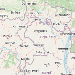
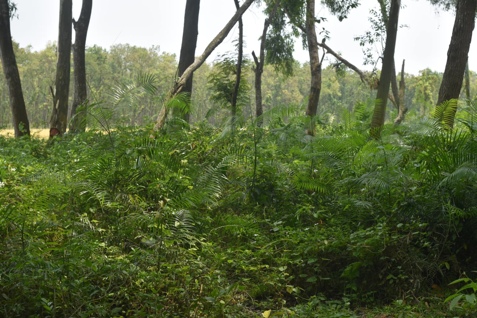
Dharmapur National Park landscape and geographic character

The physical landscape of Dharmapur National Park is characterized by semi-deciduous forest terrain with the Sal tree as the dominant species creating a relatively closed canopy in mature areas. The terrain is relatively flat, typical of the northeastern Indian subcontinent's alluvial plains, but is punctuated by the courses of the Bijra River and a 10-kilometer section of the Nona River that flow through the protected area. These water bodies add ecological diversity and create riparian corridors within the forest. The forest matrix includes both dense tree stands and more open areas with understory vegetation, bamboo clusters, and cane thickests. The landscape is bounded by agricultural land and human settlements, with the park encompassing 21 mouzas or revenue villages within its administrative boundary. The park's location just east of Kaliaganj Bazaar places it at a strategic position between major population centers and the border regions.

Dharmapur National Park ecosystems, habitats, and plant life

The ecological character of Dharmapur National Park is defined by its Sal forest ecosystem, which represents a distinct ecological community within Bangladesh's limited forest cover. The Sal trees create a habitat structure that supports diverse understory species and provides food and shelter for numerous wildlife species. Beyond the dominant Sal, the forest contains a rich mixture of tree species that collectively support a complex ecological community. The presence of two rivers within the park boundary adds aquatic and riparian habitats that complement the terrestrial forest environment. The biodiversity value of the area is evidenced by the presence of more than fifty bird species, making it an important avian habitat in a region where natural forest is increasingly scarce. The forest's structure also supports invertebrate communities and provides ecosystem services including watershed protection and carbon sequestration for the surrounding agricultural landscape.

Dharmapur National Park wildlife and species highlights

The wildlife community of Dharmapur National Park is highlighted by exceptional avian diversity, with more than fifty bird species recorded within the forest. The park is particularly noted for the melodic calls of doves that contribute to the forest's distinctive soundscape. Mammalian species present include jungle cats, jackals, mongooses, foxes, and rabbits, representing a modest but functional predator-prey community. The park also supports populations of snakes and vultures, the latter being of particular conservation interest given the global status of many vulture species. Historically, the forest supported larger wildlife including tigers, bears, and nilgai, but these species have been nearly extirpated from the area due to habitat loss and human pressure. The birdlife remains the park's most accessible wildlife attraction, with both resident and potentially migratory species present depending on season.

Dharmapur National Park conservation status and protection priorities

Dharmapur National Park was established in response to significant conservation challenges facing the Dharmapur Forest, including illegal logging, land grabbing, and gradual reduction of both forest extent and biodiversity. The formal national park designation provides legal framework for protecting the remaining forest ecosystem and its wildlife populations. Conservation activities are conducted through coordination between the Forest Department, local administration, and surrounding communities, reflecting an integrated approach to protected area management. The park serves multiple conservation functions: preserving the Sal forest ecosystem, protecting wildlife habitats, maintaining watershed services, and providing a reference area for ecological research. Local community members have noted that the national park designation has created new opportunities for biodiversity conservation while also providing alternative livelihood options through controlled ecotourism.

Dharmapur National Park cultural meaning and human context

The Dharmapur Forest and surrounding area have been part of the cultural landscape of Dinajpur District for generations, with the forest providing resources and services to local communities. The park encompasses 21 revenue villages within its administrative extent, meaning that surrounding agricultural communities have historical connections to the landscape. The forest is known locally as Dharmapur Sal Forest, reflecting the species that defines its character and its importance to regional identity. The transition to national park status has created new economic opportunities for local communities through tourism and related services, providing alternatives to forest resource extraction. The ongoing conservation activities involve community participation, recognizing that sustainable protection depends on the support and engagement of people who live adjacent to the protected area.

Top sights and standout views in Dharmapur National Park

Dharmapur National Park offers visitors an accessible forest experience in northern Bangladesh centered on the distinctive Sal tree forest ecosystem. The park's network of winding paved roads allows for easy exploration while the canopy of old Sal trees provides shade and atmosphere. The birdlife, particularly the diverse dove populations with their melodic calls, creates a distinctive auditory experience that many visitors find memorable. The rivers flowing through the forest add scenic variety and ecological interest to the landscape. As one of the most important forests in northern Bangladesh, the park represents both a conservation asset and an educational resource demonstrating the ecological value of protecting forest ecosystems in heavily agricultural regions.

Best time to visit Dharmapur National Park

The optimal time to visit Dharmapur National Park is during the cooler winter months from November through February, when temperatures are more comfortable for forest exploration and wildlife activity is often higher during daytime hours. The post-monsoon period in October and November brings lush vegetation following seasonal rains, though some areas may remain damp. Summer months from March through May can be quite hot, making midday visits uncomfortable and reducing wildlife visibility. The forest can be visited year-round, though early morning visits offer the best chances for bird observation and encountering active wildlife. The COVID-19 pandemic period demonstrated the forest's resilience, with natural recovery occurring when human pressure was reduced, suggesting that visiting during less crowded periods may offer both better experiences and less impact on the ecosystem.

Park location guide

Geography guide, regional context, and park location map for Dharmapur National Park

Dharmapur National Park park geography, regions, and map view in Dinajpur District
Understand where Dharmapur National Park sits in Dinajpur District through a broader geographic reading of the surrounding landscape, nearby location context, and its mapped position within the national park landscape.

Map view of Dharmapur National Park

Use this park location map to pinpoint Dharmapur National Park in Dinajpur District, understand its exact geographic position, and read its mapped placement within the surrounding landscape more clearly.

Pigeon | © OpenStreetMap contributors

Visually trace the unique Sal forest ecosystem, riparian corridors, and diverse habitats that define this protected area.

Dharmapur National Park Visuals: Explore Iconic Sal Forest Landscapes and Riverine Scenery
Explore a comprehensive collection of Dharmapur National Park photos, showcasing the unique character of its Sal forests, winding rivers, and rich avian habitats. These detailed images offer insight into the park's specific terrain and ecological features, providing a vital visual reference for understanding this important protected landscape in northern Bangladesh.

Dharmapur Forest

Park atlas

Map the regional protected landscapes and compare significant forest reserves in northern Bangladesh

Discover Other National Parks and Protected Areas Near Dharmapur National Park
Continue your exploration from Dharmapur National Park by browsing other national parks and protected areas, focusing on those within the surrounding regional geography of northern Bangladesh. This expanded geographic view provides valuable atlas context, allowing you to compare diverse protected landscapes and trace conservation efforts across the region.
National parkDinajpur District

Ramsagar National Park: National Park Protected Area & Geographic Discovery

Explore mapped boundaries and regional landscape context.

Understand Ramsagar National Park as a protected national park within Dinajpur District, Bangladesh. This detail entry provides essential geographic context, outlining the park's mapped protected boundaries and its significance within the regional landscape. It serves as a foundational point for exploring the park's specific natural terrain and its place in a global atlas of conservation lands.

Area
0.278 km²
Established
2001
IUCN
IV
Relief
Lowland
National parkDinajpur District

Birgonj National Park: Protected Sal Forest Landscape in Dinajpur District, Bangladesh

Explore mapped boundaries and regional geographic context.

Birgonj National Park, located in Dinajpur District, offers a focused exploration of a protected sal forest ecosystem. As a designated National Park in Bangladesh, it preserves a significant area of Shorea robusta forest, providing valuable insight into deciduous forest landscapes and their conservation. This park serves as a critical reference point for understanding protected areas within northern Bangladesh and their role in regional geographic context, making it an important destination for atlas-based discovery of natural landscapes.

Area
1.686 km²
Established
2011
IUCN
IV
Climate
Tropical
National parkBangladesh

Singra National Park: Bangladesh National Park Atlas and Protected Landscape Context

Mapped geographic identity of a protected national park.

Singra National Park is a significant protected area in Bangladesh, identified as a national park. This platform facilitates an atlas-style exploration of its geographic placement and protected landscape characteristics. Users can discover its mapped boundaries and understand its context within the regional geography of South Asia, contributing to a comprehensive understanding of national park significance.

Area
3.057 km²
Established
2010
Relief
Lowland
Climate
Tropical
National parkNaogaon District

Altadighi National Park: Bangladesh's Protected Wetland Reserve in Naogaon District

Explore its mapped terrain and unique wetland ecosystem.

Altadighi National Park in Naogaon District, Bangladesh, is a protected nature reserve notable for its significant reservoir and wetland environment. Designated as a national park, it plays a crucial role in conserving a distinctive ecosystem within the country's protected landscape network. The park's geography, centered around its large water body, provides vital habitat and offers a unique subject for geographic and atlas-based discovery in northern Bangladesh, distinguishing it from more terrestrial protected areas.

Area
2.641 km²
Established
2011
IUCN
IV
Relief
Lowland
National parkBangladesh

Nawabganj National Park: Bangladesh National Park Geographic Identity and Atlas Exploration

Mapped boundaries and protected landscape context.

Delve into the detailed geographic profile of Nawabganj National Park, a protected national park located in Bangladesh. This resource facilitates an atlas-style discovery of its specific mapped boundaries and its contribution to the region's natural landscape character. Understand how this protected area fits within the broader context of South Asian geography and conservation.

Area
5.176 km²
Established
2010
IUCN
IV
Access
Easy access
National parkJalpaiguri district

Gorumara National Park: India National Park Atlas and Protected Landscape Geography

Discover the mapped boundaries and regional terrain.

Gorumara National Park stands as a vital protected natural area within India's Jalpaiguri district. This entry provides detailed atlas-focused information, detailing the park's geographic identity and its position within the regional landscape context. Understand the mapped protected boundaries and explore the unique terrain that characterizes Gorumara National Park as a key national park entity. It serves as a foundational point for geographic discovery within India's network of protected lands.

Area
79.99 km²
Established
1992
IUCN
II
Relief
Mixed relief
National parkAlipurduar district

Jaldapara National Park: India's Premier Grassland and Rhino Conservation Landscape

Explore mapped boundaries and savanna terrain in Alipurduar district.

Jaldapara National Park is a protected national park in India's Alipurduar district, celebrated for its expansive rolling grasslands and significant population of Indian one-horned rhinoceros. This protected area showcases a distinctive savanna landscape, an unusual feature among Indian national parks, interspersed with riverine forests. Its elevation of 61 meters above sea level positions it at the edge of the Eastern Himalayas, offering a unique geographic setting for understanding regional biodiversity and conservation efforts.

Area
216.51 km²
Established
1941
IUCN
II
Relief
Lowland
National parkWest Garo Hills district

Nokrek National Park: Protected Mountain Landscape and Regional Geography

Explore its mapped boundaries and diverse natural terrain.

Nokrek National Park is a vital protected mountain wilderness situated in the West Garo Hills district, Meghalaya, India. Its rugged terrain, characterized by ancient geological formations and dense evergreen forests, supports remarkable biodiversity. As a key component of the Nokrek Biosphere Reserve, it offers a unique glimpse into the region's ecological significance, serving as an important source for major rivers and a sanctuary for diverse flora and fauna.

Area
47.48 km²
Established
1986
IUCN
II
Relief
Mountain

Common questions about visiting, size, designation, and location context for Dharmapur National Park

Dharmapur National Park FAQs for park facts, access, geography, and protected area context
Find quick answers about Dharmapur National Park, including protected-area facts, park geography, trail and visitor context, and how the park fits into its surrounding country and regional landscape.
MoriAtlas Explorer

Continue Your Protected Areas Search Across the Global Atlas

Deepen your exploration by continuing the structured search for national parks and protected areas worldwide. Utilize the comprehensive filtering capabilities to compare different conservation landscapes and refine your understanding of global park geography. Discover more about the distribution and characteristics of protected natural areas.

Global natural geography