Mori Atlas logo
National parkFowl Cays National Park

Explore the mapped boundaries and diverse marine ecosystems of this key Bahamian protected area.

Fowl Cays National Park: Bahamas National Park Atlas and Protected Marine Landscape

Fowl Cays National Park in the Bahamas represents a significant marine protected area dedicated to preserving vibrant coral reef systems and extensive seagrass meadows. Situated in the shallow coastal waters of the Abaco Islands chain, this park offers a unique glimpse into a thriving underwater landscape crucial for Caribbean marine biodiversity. Discover the park's geography, its vital role in reef conservation, and its context within the broader atlas of Bahamian protected lands.

marine protected areacoral reefsseagrass meadowsBahamas national parksCaribbean marine ecosystemsisland parks

Fowl Cays National Park

National park

Park overview

Structured park overview, official facts, and landscape profile for Fowl Cays National Park

Fowl Cays National Park park facts, protected area profile, and essential visitor context
Review the core facts for Fowl Cays National Park, including designation, size, terrain, visitor scale, habitats, and operating context in one park-focused overview.

About Fowl Cays National Park

Fowl Cays National Park occupies a strategic position in the Bahamian marine protected area network, protecting coral reef and seagrass ecosystems in the Central Abaco region. The park's location between two established island communities places it at the crossroads of both ecological and human activity in the Abaco Islands. As a national park designated in 2009, Fowl Cays represents the Bahamas' commitment to preserving marine biodiversity through protected area management. The Bahamas National Trust serves as the governing body, implementing conservation programs and monitoring the park's ecological health. The park's marine environment is characterized by clear tropical waters, reef crest formations, and seafloor areas dominated by seagrass communities. These habitats collectively support a fishery that holds both ecological and economic significance for the Abaco region. The park's protected status aims to maintain these ecosystems against the pressures of coastal development, tourism infrastructure, and other human activities that characterize much of the Bahamian archipelago.

Quick facts and research context for Fowl Cays National Park

Fowl Cays National Park lies in the central Bahamas archipelago, within the Abaco Islands region between Scotland Cay and Man-O-War Cay. The park was established in 2009 and covers roughly 2,335 acres of marine and coastal territory. It is managed by the Bahamas National Trust, the nonprofit organization responsible for managing the nation's protected areas. The park's ecosystems include coral reef formations and seagrass meadows that provide critical habitat for reef fish species. In 2017, the park became home to a staghorn coral nursery, reflecting ongoing conservation efforts to restore coral populations in Bahamian waters.

Park context

Deeper park guide and search-rich context for Fowl Cays National Park

Fowl Cays National Park history, landscape, wildlife, and travel context
Explore Fowl Cays National Park through its history, landscape character, ecosystems, wildlife, conservation priorities, cultural context, and seasonal travel timing in a structured park guide built for atlas discovery and search intent.

Why Fowl Cays National Park stands out

Fowl Cays National Park is best known for its thriving coral reef ecosystems and the marine biodiversity they support. The park protects some of the more intact reef systems in the Abaco region, with coral formations providing habitat for surgeonfish, grunts, and parrotfish. The presence of healthy seagrass meadows complements the reef ecosystems, creating a interconnected marine environment that supports both resident and migratory species. The establishment of a staghorn coral nursery in 2017 further solidified the park's role in coral conservation efforts in the Bahamas.

Fowl Cays National Park history and protected-area timeline

Fowl Cays National Park was established in 2009 as part of the Bahamas' expanding network of marine protected areas. The creation of the park reflected growing recognition among Bahamian conservation authorities of the ecological value present in the waters surrounding the Abaco Islands. The Bahamas National Trust, which manages the park, has historically focused on designating areas of significant biodiversity or ecological importance as national parks. The park's establishment followed scientific surveys documenting the extent and health of coral reef systems in the area. In 2017, the park became the site of a staghorn coral nursery, representing an active restoration initiative to combat declining coral populations across the Caribbean. The park has also faced environmental challenges, most notably in March 2024 when a barge and tugboat operated by subcontractors for the Bakers Bay Golf & Ocean Club ran aground on the reef crest within the protected marine zone. The incident resulted in significant damage to coral and seagrass habitat, and as of early 2025 the wreckage remained in place, prompting criticism from environmental organizations.

Fowl Cays National Park landscape and geographic character

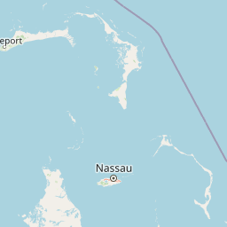
Fowl Cays National Park is defined by its marine landscape rather than terrestrial terrain. The protected area encompasses shallow coastal waters, reef formations, and seagrass meadows situated between the islands of the Abaco chain. The reef systems include both reef crest and deeper reef slope environments, with coral formations growing in the clear, warm waters typical of the tropical Atlantic. The seafloor around the cay features patches of sand interspersed with seagrass beds, creating a varied underwater topography. The above-water landscape includes the small islet known as Fowl Cay itself, a low-lying landform characteristic of the Bahamian cays. The surrounding waters are typical of the Bahamas, with turquoise to deep blue coloring depending on depth and bottom composition. The park's setting between Scotland Cay and Man-O-War Cay places it within a cluster of inhabited and uninhabited islands that collectively form the Abaco archipelago.

Fowl Cays National Park ecosystems, habitats, and plant life

The nature of Fowl Cays National Park centers on its marine ecosystems, which represent some of the more ecologically significant habitats in the Bahamas. Coral reef systems form the structural foundation of the park's marine environment, providing the three-dimensional complexity that supports high biodiversity. The reef communities are complemented by extensive seagrass meadows, primarily composed of species like Thalassia testudinum, which form dense underwater meadows across the park's seafloor. These seagrass beds serve multiple ecological functions, including providing shelter for juvenile fish, stabilizing sediments, and contributing to water quality through nutrient cycling. The combination of reef and seagrass habitats creates what marine ecologists term a seascape of interconnected ecosystems, where species move between habitats at different life stages. The park's waters maintain the warm temperatures and high salinity typical of Bahamian marine environments, supporting tropical species assemblages.

Fowl Cays National Park wildlife and species highlights

The wildlife of Fowl Cays National Park is dominated by reef-associated fish species that inhabit the coral formations and seagrass meadows. Surgeonfish, known for their characteristic dorsal spines, are commonly observed grazing on algae growing on reef surfaces. Grunts, a diverse family of reef fish, form schools around coral formations and in open water areas. Parrotfish are particularly notable for their role in coral ecosystem health, as they consume algae that would otherwise compete with coral for space on the reef. Beyond fish, the reef systems support invertebrates including sponges, sea urchins, and various crustaceans. The seagrass meadows provide habitat for sea turtles, which graze on the seagrass blades. The overall wildlife community reflects the park's position within the broader Caribbean marine biogeographic region, where species distributions have been shaped by ocean currents and the geological history of the Bahamas archipelago.

Fowl Cays National Park conservation status and protection priorities

Fowl Cays National Park represents an important component of the Bahamas' marine conservation framework, providing protected status to coral reef and seagrass ecosystems that face multiple threats across the Caribbean. The park's designation in 2009 reflected a broader movement in the Bahamas to establish marine protected areas that safeguard coastal and reef environments. The presence of a staghorn coral nursery within the park demonstrates active conservation work aimed at coral restoration, as staghorn coral has experienced significant population declines throughout the Caribbean due to disease, bleaching, and physical damage. The park's marine zone protects critical fish habitat, supporting both resident reef fish populations and migratory species. However, the 2024 grounding incident within the park's boundaries illustrates the ongoing challenges facing marine protected areas in the Bahamas, where development pressure and maritime traffic can compromise conservation objectives. The incident has drawn attention to the need for stronger enforcement and accountability mechanisms for activities within marine protected areas.

Fowl Cays National Park cultural meaning and human context

Fowl Cays National Park exists within the broader context of the Abaco Islands, a region with a long history of maritime activity and island community development. The park sits between Scotland Cay and Man-O-War Cay, two islands with distinct histories and characters within the Abaco chain. Man-O-War Cay has historically been known for its boat-building and maritime traditions, while the broader Abaco region has relied on fishing, marine trade, and more recently tourism as economic mainstays. The local communities have direct connections to the marine environment that surrounds the park, whether through commercial fishing, recreational boating, or dive tourism. The establishment of the national park reflects a balance between protecting ecological resources and acknowledging the human uses of these waters over generations. The 2024 environmental incident involving the grounding of a construction barge drew particular concern from local dive operators and conservationists who had previously warned about the risks of development-related marine traffic in sensitive areas.

Top sights and standout views in Fowl Cays National Park

Fowl Cays National Park stands out as a protected marine environment in the Abaco Islands with healthy coral reef systems and seagrass meadows that support diverse fish communities. The park's 2009 establishment marked a commitment to preserving Caribbean marine ecosystems within the Bahamas' protected area network. The staghorn coral nursery established in 2017 represents active coral restoration work in a region where coral populations have declined significantly. The park offers diving and snorkeling opportunities that showcase reef biodiversity, with encounters common for surgeonfish, grunts, and parrotfish. The marine protected area is managed by the Bahamas National Trust, which maintains conservation programs across the nation's park system.

Best time to visit Fowl Cays National Park

Fowl Cays National Park can be visited year-round given its marine rather than terrestrial focus. The park's waters remain accessible throughout the year, though conditions vary with seasonal weather patterns. The summer months from May through October bring warmer water temperatures but also carry the risk of tropical storms and hurricanes that can affect the Abaco region. Winter months from November through April typically offer more stable weather conditions and comfortable air temperatures, making this period popular for visitors. Water visibility tends to be best during the calmer winter and spring months when seas are typically quieter. Sea surface temperatures range from the mid-70s Fahrenheit in winter to the mid-80s in late summer. Visitors interested in coral reef viewing should be aware that water temperature extremes, particularly during late summer, can stress coral colonies and affect reef health.

Park location guide

Geography guide, regional context, and park location map for Fowl Cays National Park

Fowl Cays National Park park geography, regions, and map view in Bahamas
Understand where Fowl Cays National Park sits in Bahamas through a broader geographic reading of the surrounding landscape, nearby location context, and its mapped position within the national park landscape.

How Fowl Cays National Park fits into Bahamas

The Bahamas is an island nation in the Atlantic Ocean, forming part of the Lucayan Archipelago. It consists of more than 3,000 islands, cays and islets located north of Cuba, northwest of Hispaniola, and southeast of Florida. The country gained independence from Britain in 1973 and operates as a constitutional monarchy under King Charles III, with Nassau as its capital and largest city.

Wider geography shaping Fowl Cays National Park in Bahamas

The Bahamas occupies the Lucayan Archipelago in the Atlantic Ocean. The island chain is positioned north of Cuba, northwest of Hispaniola (shared by the Dominican Republic and Haiti), southeast of the US state of Florida, and east of the Florida Keys. The territory spans over 3,000 islands, cays and islets, with the total land area being 13,943 km². The Royal Bahamas Defence Force claims approximately 470,000 km² of surrounding ocean space.

Map view of Fowl Cays National Park

Use this park location map to pinpoint Fowl Cays National Park in Bahamas, understand its exact geographic position, and read its mapped placement within the surrounding landscape more clearly.

Pigeon | © OpenStreetMap contributors

Location context for Fowl Cays National Park

Central Abaco
Park atlas

Compare other Caribbean marine conservation landscapes and national parks across the Abaco Islands geography

Explore Nearby National Parks and Protected Marine Areas Beyond Fowl Cays National Park
From Fowl Cays National Park, trace the geography of other national parks and protected marine areas throughout the Abaco Islands, discovering a broader network of Bahamian conservation landscapes. Compare varied coastal ecosystems and reef systems, gaining regional context for marine conservation efforts beyond this specific protected area.
Nature reserveHope Town

Tilloo Cay National Reserve Nature Reserve: Coastal Habitat for White-Tailed Tropicbirds

Mapped protected area within the Hope Town region of the Abacos.

Tilloo Cay National Reserve, a protected nature reserve situated near Hope Town, represents a significant habitat for the white-tailed tropicbird, a species reliant on such island nesting sites. This 11-acre reserve showcases a characteristic Bahamian small island ecosystem, featuring coastal terrain and scrub vegetation. Its protected status under the Bahamas National Trust ensures the security of critical breeding grounds, making it a key focus for conservation within the Abaco Islands. The reserve offers a distinct example of targeted habitat preservation, contributing to the broader atlas of protected natural landscapes in the Caribbean.

Area
0.04 km²
Established
1990
IUCN
II
Relief
Lowland
National parkBahamas

Pelican Cays Land and Sea Park: Protected Marine Landscape in the Bahamas

Explore coral reefs, undersea caves, and vital sea turtle habitats.

Pelican Cays Land and Sea Park, a protected national park in the Bahamas, offers a rich marine atlas experience. Its landscape is defined by extensive coral reef formations and unique undersea cave systems, supporting remarkable biodiversity. This park highlights the importance of protected waters for species like sea turtles and provides exceptional opportunities for exploring submerged geography and vibrant coral ecosystems.

Area
8 km²
Established
1972
IUCN
II
National parkBahamas

Walker's Cay National Park: Bahamas National Park Featuring a Premier Barrier Reef Ecosystem

Explore mapped underwater geography and marine protected boundaries.

Walker's Cay National Park is a vital marine protected area located in the Bahamas, safeguarding approximately 3,840 acres of coastal and ocean waters. Its most distinguishing feature is the expansive barrier reef, a complex underwater geography teeming with diverse marine species that draws attention for diving and snorkeling. This park serves as a crucial element within the atlas of Bahamian protected lands, offering structured insights into marine conservation and the mapped distribution of critical reef habitats.

Area
16 km²
Established
2002
IUCN
II
National parkBahamas

Bonefish Pond National Park: Essential Bahamas Coastal Wetland & Marine Nursery

Mapped protected area, mangrove ecosystem, and habitat for key marine species.

Bonefish Pond National Park, a protected national park on New Providence island in The Bahamas, is essential for its role as a thriving marine nursery. The park's landscape features extensive red mangrove forests, tidal channels, and shallow lagoons crucial for juvenile bonefish, crawfish, and conch. This area highlights effective wetland restoration and conservation, offering valuable insights into Caribbean coastal protected landscapes and their geographic importance.

Area
5 km²
Established
2002
IUCN
II
National parkBahamas

West Side National Park National Park: Extensive Protected Landscape in the Bahamas

Mapped marine and mangrove ecosystems, plus pine forest terrain

Delve into the geographical identity of West Side National Park, a protected national park in the Bahamas renowned for its vast scale and diverse ecosystems. This landscape features significant Caribbean pine forests transitioning into extensive, intact mangrove systems along its coastlines, integrating directly with vital marine habitats. As one of the largest protected areas in the Caribbean, its ecological representation from land to sea offers a unique atlas perspective on Bahamian natural heritage and conservation.

Area
6,070 km²
Established
2002
IUCN
II
National parkMiami-Dade County

Biscayne National Park: Mapped Protected Area and Coastal Landscape

Explore its protected status and geographic setting in Miami-Dade County.

Biscayne National Park represents a significant protected area managed as a U.S. National Park, safeguarding extensive coastal and marine environments. This page offers detailed insight into the park's geographic placement within Miami-Dade County, Florida, focusing on its mapped boundaries and the unique landscape it encompasses. Understand its ecological importance and its distinct contribution to the atlas of protected lands.

Area
699.99 km²
Established
1980
IUCN
V
National parkFlorida

Everglades National Park: Protected Landscape Identity and Regional Geographic Context

Explore its unique natural terrain and mapped boundaries.

Understand Everglades National Park as a distinct protected landscape with significant geographic features within Florida. This page offers an atlas-driven view of its protected area, detailing its mapped boundaries and the surrounding regional natural terrain. Discover the core identity of this national park through its landscape and geographic setting, providing context for broader atlas exploration.

Area
6,106.61 km²
Established
1947
IUCN
II
National parkMonroe County

Dry Tortugas National Park: Mapped Boundaries and Geographic Context in Monroe County

Explore the protected landscape and regional geography.

Uncover the protected landscape of Dry Tortugas National Park, a significant U.S. National Park located in Monroe County. This atlas entry details its mapped boundaries and unique geographic features, providing essential context for understanding its place in regional geography. Discover the distinct natural terrain and protected area identity that define Dry Tortugas National Park, supporting deeper geographic exploration.

Area
261.84 km²
Established
1935
IUCN
II

Common questions about visiting, size, designation, and location context for Fowl Cays National Park

Fowl Cays National Park FAQs for park facts, access, geography, and protected area context
Find quick answers about Fowl Cays National Park, including protected-area facts, park geography, trail and visitor context, and how the park fits into its surrounding country and regional landscape.
MoriAtlas Explorer

Continue Your Protected Areas Search Across the Global Atlas

Deepen your exploration by continuing the structured search for national parks and protected areas worldwide. Utilize the comprehensive filtering capabilities to compare different conservation landscapes and refine your understanding of global park geography. Discover more about the distribution and characteristics of protected natural areas.

Global natural geography