Mori Atlas logo
National parkKwiambal National Park

Discover the dramatic confluence of the Severn and Macintyre Rivers at MacIntyre Falls.

Kwiambal National Park: Protected National Park in New South Wales with Granite Landscapes

Kwiambal National Park offers a distinct protected landscape within New South Wales, Australia, characterized by its striking granite formations and dynamic river systems. This national park is defined by the meeting point of the Severn and Macintyre Rivers, culminating in the impressive MacIntyre Falls. As a key protected area, Kwiambal National Park provides valuable insights into the regional geography and mapped natural features of northeastern New South Wales, making it a significant destination for atlas-based exploration.

National parksNew South WalesWaterfall parksGranite landscapesRiver parksEastern Australia

Kwiambal National Park

National park

Park overview

Structured park overview, official facts, and landscape profile for Kwiambal National Park

Kwiambal National Park park facts, protected area profile, and essential visitor context
Review the core facts for Kwiambal National Park, including designation, size, terrain, visitor scale, habitats, and operating context in one park-focused overview.

About Kwiambal National Park

Kwiambal National Park occupies a significant position in the protected area network of northern New South Wales, preserving a landscape of considerable scenic and ecological value. The park's defining geographical characteristic is the presence of two major river systems, the Severn River and Macintyre River, which flow through the reserve and join below MacIntyre Falls. This confluence creates a natural landmark that anchors the park's identity and provides a focal point for visitor appreciation. The underlying geology of the region is dominated by granite, which manifests as dramatic outcrops scattered throughout the park and contributes to the rugged character of the terrain. The park sits within the New England region, an area known for its transition between different landscape types and ecological communities. The Ashford Caves represent an important geological feature within the park, offering visitors the opportunity to explore natural cave formations. The park provides a range of visitor amenities and recreational opportunities, making it accessible for those seeking to experience the natural character of this part of New South Wales.

Quick facts and research context for Kwiambal National Park

Kwiambal National Park is located in the New England region of northern New South Wales, Australia, near the towns of Ashford and Inverell. The park features the convergence of the Severn River and Macintyre River below MacIntyre Falls, creating a significant natural landmark. Granite outcrops dominate the park's terrain, with the Ashford Caves providing additional geological interest. The park offers visitor facilities including accommodation, picnic areas, and opportunities for swimming, mountain biking, fishing, and birdwatching.

Park context

Deeper park guide and search-rich context for Kwiambal National Park

Kwiambal National Park history, landscape, wildlife, and travel context
Explore Kwiambal National Park through its history, landscape character, ecosystems, wildlife, conservation priorities, cultural context, and seasonal travel timing in a structured park guide built for atlas discovery and search intent.

Why Kwiambal National Park stands out

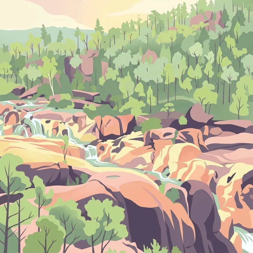
Kwiambal National Park is best known for its dramatic river scenery and the iconic MacIntyre Falls, where the Severn and Macintyre rivers converge. The park's exposed granite geology creates a distinctive visual landscape of weathered rock formations and boulder-strewn terrain. The Ashford Caves system adds speleological interest to the park's natural assets. These features combine to make the park a notable destination for nature-based recreation in the New England northwest.

MacIntyre Falls
Waterfalls in Kwiambal National Park

Kwiambal National Park history and protected-area timeline

Kwiambal National Park was officially gazetted on 10 May 2000, establishing the area as a protected national park under the management of the NSW National Parks and Wildlife Service. The initial declaration described the park as encompassing County Arrawatta, Parishes Ena, Limestone and Severn, with an original area of approximately 1,301 hectares. Subsequent vegetation survey work, notably a 2008 report by Dr John T. Hunter, documented the park's extent as approximately 6,517 hectares, indicating that the protected area encompasses a larger land area than initially recorded. The establishment of the park reflected growing recognition of the conservation value of the region's river systems, granite landscapes, and the need to protect the MacIntyre Falls area and surrounding natural environments.

Kwiambal National Park landscape and geographic character

The landscape of Kwiambal National Park is defined by its granite-dominated terrain, with exposed rock formations creating a backdrop of weathered boulders and steep ridges throughout the reserve. The river valleys of the Severn and Macintyre Rivers have carved pathways through this granite landscape, with the most dramatic feature being MacIntyre Falls where these watercourses converge. The terrain surrounding the river corridors features riffles, pools, and cascades that animate the landscape with flowing water. Between the river systems, the park contains areas of more gently undulating country, though granite outcrops remain a consistent visual element across the entire reserve. The combination of flowing water, rocky outcrops, and native vegetation creates a parkland character that is distinctive within the New England region.

Kwiambal National Park ecosystems, habitats, and plant life

The natural environment of Kwiambal National Park encompasses a mix of vegetation communities adapted to the granite-based soils and the riparian zones along the park's rivers. The park sits within a broader landscape transition zone, and while specific vegetation details are limited in the source material, the park supports typical New England biodiversity including woodland and forest communities in the more sheltered areas. The river systems provide important aquatic habitats and riparian corridors that support distinct plant assemblages adapted to regular water availability. The granite outcrops host specialized plant communities capable of surviving on shallow soils and exposed rock surfaces. These diverse habitat types contribute to the overall ecological value of the reserve.

Kwiambal National Park wildlife and species highlights

Kwiambal National Park supports wildlife populations typical of the New England region of New South Wales. The park's river systems provide habitat for various aquatic species and attract birdlife along the riparian corridors. Bird watching is identified as a visitor activity within the park, indicating the presence of diverse avian fauna. The mix of woodland habitats, river environments, and rocky outcrops supports a range of terrestrial species. The protected status of the area helps preserve wildlife habitats and movement corridors within the broader agricultural landscape of the region.

Kwiambal National Park conservation status and protection priorities

Kwiambal National Park contributes to the conservation estate in northern New South Wales by protecting a landscape of rivers, waterfalls, and granite terrain that might otherwise have been degraded by pastoral or agricultural development. The park's designation as an IUCN Category II protected area reflects its national significance and the intention to preserve its natural values. Protection of the Severn River and Macintyre River catchments within the park boundary helps maintain water quality and aquatic ecosystem health. The granite landscapes and associated habitats represent conservation values that benefit from formal protection within the national park system.

Kwiambal National Park cultural meaning and human context

The source material does not provide detailed information regarding indigenous cultural heritage or historical human use of the Kwiambal National Park area. The park sits within the broader New England region, which has indigenous associations, though specific cultural context for this particular protected area is not documented in the available information.

Top sights and standout views in Kwiambal National Park

The defining highlights of Kwiambal National Park include the spectacular MacIntyre Falls at the confluence of the Severn and Macintyre rivers, the pervasive granite outcrops that shape the park's visual character, and the Ashford Caves for those interested in geological formations. The park offers diverse recreational opportunities including swimming in the river pools, mountain biking along trails, fishing in the river systems, and bird watching along the riparian corridors. The availability of accommodation within or near the park makes it a practical destination for extended visits to explore the natural features of the New England northwest.

Best time to visit Kwiambal National Park

The best time to visit Kwiambal National Park would generally be during the cooler months of autumn and winter in the southern hemisphere, from approximately March through August, when temperatures are more comfortable for outdoor exploration and the landscape retains its green character. Summer months can bring high temperatures to the New England region, potentially making outdoor activities less comfortable. The park can be visited year-round, though visitors should be aware that river conditions and accessibility may vary with seasonal rainfall patterns. The falls and river pools are likely to be most impressive following periods of rainfall, while the drier months may result in reduced water flow.

Park location guide

Geography guide, regional context, and park location map for Kwiambal National Park

Kwiambal National Park park geography, regions, and map view in Australia
Understand where Kwiambal National Park sits in Australia through a broader geographic reading of the surrounding landscape, nearby location context, and its mapped position within the national park landscape.

How Kwiambal National Park fits into Australia

Australia is a constitutional monarchy and federal parliamentary democracy comprising six states and ten territories. With a population of nearly 28 million, it is one of the world's most urbanised countries, with most people concentrated on the eastern seaboard. The country has a high Human Development Index and is known for its cultural diversity, ancient Aboriginal heritage, and unique wildlife.

Wider geography shaping Kwiambal National Park in Australia

Australia occupies the entire Australian continent, the island of Tasmania, and numerous smaller islands. It is the world's flattest and driest inhabited continent, featuring vast deserts in the interior (the Outback), tropical rainforests along the eastern coast, and a coastline bordering the Indian and Pacific Oceans.

Map view of Kwiambal National Park

Use this park location map to pinpoint Kwiambal National Park in Australia, understand its exact geographic position, and read its mapped placement within the surrounding landscape more clearly.

Pigeon | © OpenStreetMap contributors

Location context for Kwiambal National Park

New South Wales

View detailed imagery of the protected area, tracing its distinctive river systems, dramatic granite formations, and diverse native habitats.

Explore Kwiambal National Park Photos: Visualizing Unique Granite Landscapes and MacIntyre Falls Scenery
Browse a comprehensive visual gallery of Kwiambal National Park to understand its defining landscapes, from the iconic MacIntyre Falls to the pervasive granite outcrops shaping its rugged terrain. Imagery provides essential context for exploring the park's unique river systems, native habitats, and overall protected-area environment within New South Wales.

MacIntyre Falls

Park atlas

Map regional park geography across New South Wales, exploring surrounding protected landscapes and river systems.

Discover Nearby National Parks and Protected Areas Beyond Kwiambal National Park
Continue your exploration by browsing national parks and protected areas located near Kwiambal National Park, revealing similar granite landscapes and significant river systems across northern New South Wales. Compare regional conservation efforts and discover the geographic spread of diverse natural reserves, from waterfall parks to other river-carved terrains, within the New England region.
National parkNew South Wales

Mount Kaputar National Park: New South Wales Volcanic National Park Atlas

Explore mapped volcanic terrain and ecological diversity.

Mount Kaputar National Park offers a compelling study in protected landscape geology and ecology. Situated in New South Wales, this national park preserves the significant geological features of ancient volcanic remnants, including prominent plugs and lava terraces. Its high-elevation position supports a variety of ecosystems, making it a critical area for understanding inland Australia's natural geography and protected land patterns. Browse its mapped boundaries and discover the unique character of this volcanic wilderness.

Area
502.25 km²
Established
1959
IUCN
II
National parkNew South Wales

Mount Pikapene National Park: Protected Area with Tall Moist Rainforests in New South Wales

Explore the mapped terrain and regional geography of this national park.

Mount Pikapene National Park is a key protected area in New South Wales, recognized for its distinctive tall moist rainforests, a rare ecological community within the Northern Tablelands. The park's landscape features hilly terrain, with Big Sugarloaf marking its highest point at 525 meters. As a national park managed by the National Parks and Wildlife Service, it safeguards significant forest ecosystems and offers valuable insights into the protected geography of eastern Australia's natural heritage.

Area
26.3 km²
Established
1999
IUCN
II
National parkNew South Wales

Koreelah National Park: Protected Landscape with Dramatic Gorges and Wildlife

Explore the mapped terrain and regional geography of this New South Wales national park.

Koreelah National Park is a protected national park located in northern New South Wales, Australia, celebrated for its rugged topography and significant natural features. The park's landscape is defined by spectacular gorges, sheer cliffs, and impressive waterfall systems, creating a remote wilderness experience. It serves as a vital protected area, offering refuge to diverse wildlife, including platypus and koalas, and is recognized for its importance within the Scenic Rim Important Bird Area. Discover its mapped boundaries and unique geographic context for a deeper understanding of Australian protected lands.

Area
53 km²
Established
1999
IUCN
II
National parkNorthern Tablelands

Chaelundi National Park: Landmark Old-Growth Forest Protection in the Northern Tablelands

Mapped protected area landscape and regional geography.

Chaelundi National Park stands as a vital component of protected natural landscapes on Australia's Northern Tablelands. This national park is celebrated for its extensive old-growth forest, a direct result of significant environmental legal battles that highlighted its ecological importance. With declared wilderness areas covering thousands of hectares, the park offers a substantial glimpse into the region's conservation values and the complex interplay between landscape, law, and protected land status, providing rich context for geographic exploration.

Area
191.74 km²
Established
1997
IUCN
II
National parkNew South Wales

Yabbra National Park: A Protected Natural Landscape within New South Wales' Northern Rivers Region

Explore mapped terrain and regional park geography.

Gain insight into Yabbra National Park, a conservation area covering 88.9 square kilometers of undulating terrain in New South Wales. This protected landscape provides a detailed look at regional Australian geography, focusing on its mapped boundaries and natural features. Understand its role as a national park within the Northern Rivers region, offering a foundation for structured geographic discovery and landscape context.

Area
88.9 km²
Established
1999
IUCN
II
National parkNew South Wales

Mount Clunie National Park: Protected Mountain Landscape and Gondwana Rainforest Geography

Explore its mapped boundaries and regional significance.

Mount Clunie National Park is a protected national park in New South Wales, Australia, characterized by its mountainous terrain and its status as part of the Gondwana Rainforests of Australia World Heritage Site. Situated in the Scenic Rim region, the park's elevated position and ancient ecosystems offer unique insights into Australia's natural heritage. Understanding its geographic context and protected landscape identity provides essential context for regional atlas exploration.

Area
14.26 km²
Established
1999
IUCN
II
National parkNew South Wales

Toonumbar National Park: Australia's Gondwanan Rainforest Heritage and Volcanic Geography

Explore the mapped protected landscape and ancient ecosystems of this New South Wales national park.

Toonumbar National Park represents a significant component of the Gondwana Rainforests of Australia World Heritage Site, offering a profound look into ancient forest ecosystems. Its landscape is sculpted by ancient volcanic activity, creating dramatic peaks and fertile terrain that supports remarkable biodiversity. This protected area in New South Wales provides critical habitat for numerous threatened species within its extensive subtropical and temperate rainforests, making it a key destination for understanding Australia's natural heritage and geographic context.

Area
149.1 km²
Established
1995
IUCN
II
National parkNew South Wales

Fortis Creek National Park: A Protected Valley Landscape in Northern New South Wales

Mapped protected area boundaries and regional geographic context.

Fortis Creek National Park preserves a significant valley and creek environment in northern New South Wales, Australia. Established in 1997, it serves as a protected area safeguarding representative riparian and valley ecosystems. The park's landscape, characterized by draining creek corridors toward the Clarence River basin, offers a glimpse into the natural terrain of eastern Australia, distinct from more commonly known coastal or alpine regions.

Area
78 km²
Established
1997
IUCN
II
Scope
Terrestrial

Common questions about visiting, size, designation, and location context for Kwiambal National Park

Kwiambal National Park FAQs for park facts, access, geography, and protected area context
Find quick answers about Kwiambal National Park, including protected-area facts, park geography, trail and visitor context, and how the park fits into its surrounding country and regional landscape.
MoriAtlas Explorer

Continue Your Protected Areas Search Across the Global Atlas

Deepen your exploration by continuing the structured search for national parks and protected areas worldwide. Utilize the comprehensive filtering capabilities to compare different conservation landscapes and refine your understanding of global park geography. Discover more about the distribution and characteristics of protected natural areas.

Global natural geography