Mori Atlas logo
National parkLake Torrens National Park

Discover the unique salt lake terrain and arid outback wilderness of this South Australian national park.

Lake Torrens National Park: Protected Landscape and Geography in South Australia

Lake Torrens National Park in South Australia presents an extraordinary inland salt lake environment, stretching over 250 kilometres and defining a stark, minimalist outback wilderness. This protected area showcases unique arid gibber plains and rocky outcrops framing the immense saltpan. Explore the dramatic geographic contrasts of this remote national park, understanding its role as a significant wetland habitat during rare rainfall events and a compelling site for geological study and landscape photography.

salt lakeoutback wildernessSouth Australiaarid landscapeIUCN Category VIwetland habitat

Lake Torrens National Park

National park

Park overview

Structured park overview, official facts, and landscape profile for Lake Torrens National Park

Lake Torrens National Park park facts, protected area profile, and essential visitor context
Review the core facts for Lake Torrens National Park, including designation, size, terrain, visitor scale, habitats, and operating context in one park-focused overview.

About Lake Torrens National Park

Lake Torrens National Park occupies a vast expanse of outback terrain in northern South Australia, centred around an enormous salt lake basin that represents one of the region's most geographically significant features. The park's establishment in December 1991 reflected growing recognition of the need to protect this unique inland saline environment and its surrounding arid landscapes. The lake itself remains dry for the vast majority of time, forming a flat, reflective salt crust that stretches across a massive depression in the terrain. When thunderstorms do occur in the catchment area, the resulting inflow can fill all or portions of the lake, transforming the stark salt flat into a shallow wetland that temporarily supports substantial populations of waterbirds. The park provides exceptional opportunities for photography, with the interplay of light across the salt surface and the distant horizon creating striking visual compositions. Geological interest is also a significant draw, as the lake's formation and the surrounding terrain offer insights into the region's geological history and ongoing landscape processes.

Quick facts and research context for Lake Torrens National Park

Lake Torrens National Park covers 5,676.68 square kilometres of semi-arid to arid terrain in northern South Australia. The park was established on 19 December 1991 and is managed by the South Australian Department for Environment and Water. The lake itself is typically a dry salt flat, with water only accumulating on rare occasions following substantial thunderstorms. The park is listed in the Directory of Important Wetlands in Australia under the name Inland Saline Lakes, acknowledging its ecological significance as a temporary wetland habitat. The nearest settlement is Woomera, located to the south of the park.

Park context

Deeper park guide and search-rich context for Lake Torrens National Park

Lake Torrens National Park history, landscape, wildlife, and travel context
Explore Lake Torrens National Park through its history, landscape character, ecosystems, wildlife, conservation priorities, cultural context, and seasonal travel timing in a structured park guide built for atlas discovery and search intent.

Why Lake Torrens National Park stands out

Lake Torrens National Park is best known for its extraordinary salt lake, one of the largest inland salt pans in Australia. The stark, minimalist landscape of the dry lake bed, stretching intermittently over 250 kilometres, creates a visually striking environment unlike typical desert scenery. The park's ecological significance is most pronounced when rare rainfall fills all or part of the lake, creating ephemeral wetland conditions that attract diverse birdlife. This combination of extreme aridity punctuated by dramatic water events defines the park's distinctive character and makes it a compelling destination for those seeking to experience Australia's remote outback wilderness.

Lake Torrens National Park history and protected-area timeline

Lake Torrens National Park was formally established on 19 December 1991, entering the system of protected areas in South Australia as a Category VI IUCN protected area. This classification acknowledges areas that protect ecosystems while allowing for sustainable use of natural resources. The creation of the park reflected growing environmental awareness in Australia during the late twentieth century regarding the importance of protecting unique inland ecosystems. The area had previously been part of broader pastoral lease holdings, and its transition to national park status marked a shift toward conservation-focused management. The park's inclusion in the Directory of Important Wetlands in Australia under the name Inland Saline Lakes further cemented its recognition as an ecologically significant site requiring protection.

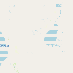
Lake Torrens National Park landscape and geographic character

The landscape of Lake Torrens National Park is dominated by the massive salt lake basin that gives the park its name. The dry lake bed presents as a flat, white to pale grey expanse of crystallized salt, stretching approximately 250 kilometres in length when conditions permit. The surrounding terrain consists of arid gibber plains, characterised by stony desert surfaces with sparse vegetation. Rocky ridges and low hills occasionally punctuate the flat terrain, providing visual anchors and varied topography. The overall impression is one of extreme openness and stark minimalism, with the distant horizon visible in all directions across the nearly treeless landscape. When water does fill portions of the lake, the surface transforms into a shallow, reflective sheet that dramatically changes the character of the park and creates entirely different visual and ecological conditions.

Lake Torrens National Park ecosystems, habitats, and plant life

The ecological character of Lake Torrens National Park is defined by its extreme aridity punctuated by brief periods of wetland conditions. The lake represents a saline inland lake system, with the Directory of Important Wetlands in Australia listing it under the Inland Saline Lakes classification. Under typical dry conditions, the lakebed supports minimal vegetation, with salt-tolerant species confined to the margins where moisture persists slightly longer. The true ecological significance emerges when rainfall events fill the lake, creating temporary wetland conditions that support diverse birdlife. These events are rare, occurring perhaps once in 150 years according to some accounts, but when they do happen, the sudden presence of water in this otherwise arid landscape triggers significant biological activity and attracts bird species from considerable distances.

Lake Torrens National Park wildlife and species highlights

When water accumulates in Lake Torrens following rare storm events, the area becomes a significant temporary habitat for waterbirds and other wildlife. The sudden availability of wetland habitat in the otherwise dry interior attracts a variety of bird species that exploit the productive conditions while they persist. The brief wetland period supports feeding, breeding, and resting opportunities for migratory and resident bird species. Even during dry periods, the park's margins and surrounding gibber plains support adapted arid-zone fauna, though the biodiversity is necessarily limited by the harsh conditions. The contrast between the empty, salt-crusted lake and the activity when water is present exemplifies the dynamic nature of this ecosystem.

Lake Torrens National Park conservation status and protection priorities

Lake Torrens National Park is recognized as an important conservation area within South Australia's outback, with its listing in the Directory of Important Wetlands in Australia highlighting its ecological significance as a saline lake system. The IUCN Category VI classification reflects a management approach that balances conservation with sustainable use, appropriate for this large, sparsely vegetated landscape. The park protects an entire lake ecosystem that would otherwise face pressures from pastoral activities and mineral extraction. The temporary nature of the wetland conditions makes the site particularly significant, as it represents a rare habitat type in the arid interior that provides critical ecological function during brief periods of water availability.

Lake Torrens National Park cultural meaning and human context

Lake Torrens holds significance in the cultural landscape of the Flinders Ranges region, though detailed indigenous cultural information is not prominently featured in the available source material. The broader region of outback South Australia contains Aboriginal heritage sites and cultural connections to the landscape, and Lake Torrens as a prominent geographical feature would have held importance for local peoples. The park's proximity to Woomera, a town established in connection with the Woomera Rocket Range, reflects the modern human geography of this sparsely populated region.

Top sights and standout views in Lake Torrens National Park

Lake Torrens National Park offers a rare opportunity to experience one of Australia's most distinctive inland landscapes, where a vast salt lake dominates a flat, open wilderness that stretches to the horizon. The park is particularly remarkable for its extreme changes in character between dry and wet conditions, transforming from an empty saltpan to a wetland teeming with birdlife. Photography opportunities are exceptional, with the stark geometry of the lake bed, the play of light across salt surfaces, and the distant lines of gibber plains creating compelling compositions. The geological interest of the site, including the lake's formation and the ongoing processes that shape its surface, adds scientific depth to the visitor experience.

Best time to visit Lake Torrens National Park

The optimal time to visit Lake Torrens National Park depends on what experience visitors seek. The park can be visited year-round, though the summer months bring extreme heat that limits outdoor activity during daylight hours. Winter months offer more moderate temperatures but the landscape remains stark, with the dry salt lake presenting its typical appearance. Those hoping to witness the rare phenomenon of water filling the lake cannot plan with certainty, as these events occur unpredictably following significant rainfall in the catchment. Visitors interested in birdlife should be prepared for the possibility that water may not be present during their visit, making the experience a gamble on seasonal conditions.

Park location guide

Geography guide, regional context, and park location map for Lake Torrens National Park

Lake Torrens National Park park geography, regions, and map view in Australia
Understand where Lake Torrens National Park sits in Australia through a broader geographic reading of the surrounding landscape, nearby location context, and its mapped position within the national park landscape.

How Lake Torrens National Park fits into Australia

Australia is a constitutional monarchy and federal parliamentary democracy comprising six states and ten territories. With a population of nearly 28 million, it is one of the world's most urbanised countries, with most people concentrated on the eastern seaboard. The country has a high Human Development Index and is known for its cultural diversity, ancient Aboriginal heritage, and unique wildlife.

Wider geography shaping Lake Torrens National Park in Australia

Australia occupies the entire Australian continent, the island of Tasmania, and numerous smaller islands. It is the world's flattest and driest inhabited continent, featuring vast deserts in the interior (the Outback), tropical rainforests along the eastern coast, and a coastline bordering the Indian and Pacific Oceans.

Map view of Lake Torrens National Park

Use this park location map to pinpoint Lake Torrens National Park in Australia, understand its exact geographic position, and read its mapped placement within the surrounding landscape more clearly.

Pigeon | © OpenStreetMap contributors

Location context for Lake Torrens National Park

South Australia
Park atlas

Explore nearby protected areas to compare diverse landscapes, from arid saltpans to remote outback wilderness across South Australia.

Discover Other National Parks Near Lake Torrens, South Australia's Unique Salt Lake Landscapes
Continue your geographic exploration beyond Lake Torrens National Park by browsing other protected areas and national parks situated within Australia's expansive arid interior. Compare diverse conservation landscapes, map their distribution across the continent, and understand the varied environmental protections within this remote region.
National parkNew South Wales

Mutawintji National Park: New South Wales Protected Area for Atlas Exploration

Mapping rugged outback terrain, gorges, and ancient rock art.

Mutawintji National Park in New South Wales offers a profound exploration of Australia's outback geography, significant Indigenous heritage, and protected landscapes. Discover the park's unique terrain, defined by the Byngnano Range, vibrant gorges, and river red gum-lined creeks, all rich with ancient Aboriginal rock art. This national park is a prime example of mapped protected area discovery, highlighting both natural beauty and critical conservation achievements.

Area
689.12 km²
Established
1998
IUCN
II
National parkSouth Australia

Murray River National Park: Protected Wetland Ecosystems in South Australia

Explore South Australia's unique river red gum floodplains.

Murray River National Park is a significant protected area in South Australia, renowned for its expansive wetland and floodplain environments situated along the Murray River. This national park preserves crucial habitats within the Murray-Darling Basin, characterized by river red gum woodlands, permanent water bodies, and dynamic seasonal floodplains. Its detailed maps and geographic context offer deep insights into one of Australia's most important riverine conservation landscapes.

Area
148.79 km²
Established
1991
IUCN
VI
National parkNew South Wales

Kinchega National Park: National Park Protected Area in New South Wales

Explore the mapped Darling River terrain and outback landscapes.

Kinchega National Park stands as a protected national park entity within New South Wales, Australia. Its geographic significance is deeply tied to the Darling River, which shapes its unique riparian ecosystems and contrasts with the surrounding semi-arid outback terrain. This park offers a valuable point for atlas-based discovery, allowing exploration of its mapped boundaries, landscape context, and the conservation of its distinct natural and cultural heritage within the regional geography.

Area
442.59 km²
Established
1967
IUCN
II
National parkSouth Australia

Deep Creek National Park: Protected Coastal Terrain and Geographic Context in South Australia

Discover South Australia's largest remaining natural vegetation area.

Deep Creek National Park offers a unique protected landscape on South Australia's Fleurieu Peninsula, extending 18 kilometers along the rugged coast. This national park is renowned for its rolling hills, gullies, and dramatic views across Backstairs Passage to Kangaroo Island. It serves as a crucial conservation area, preserving the largest continuous segment of natural vegetation in a region largely transformed by development, making its geography and protected status highly significant.

Area
44.96 km²
Established
1971
IUCN
II
National parkVictoria

Murray-Sunset National Park: Victoria's Iconic Pink Lakes and Mallee Woodland Protected Landscape

Explore the mapped geography and semi-arid wilderness of this significant Australian protected area.

Murray-Sunset National Park represents a significant portion of Victoria's semi-arid natural heritage, renowned for its striking Pink Lakes that bloom with vibrant color in late summer. This protected landscape encompasses vast mallee woodlands, ancient sand dunes, and extensive salt pans, offering a unique geographic context for atlas exploration. Discover the rich birdlife and distinctive terrain that make this large national park a crucial element of Australia's protected areas network.

Area
6,330 km²
Established
1991
IUCN
II
National parkQueensland

Munga-Thirri National Park: Queensland's Premier Desert Dune Protected Landscape

Explore the vast sand ridges and unique arid ecosystems of this national park.

Munga-Thirri National Park is Queensland's largest national park, preserving a spectacular desert landscape dominated by extensive parallel sand dunes. Situated in the remote central west, this protected area offers a unique lens into arid ecosystems, showcasing striking red dunes that define its geographic identity. Discover the mapped features and landscape context of this significant Australian protected land, offering a deep dive into the Simpson Desert's unique terrain and natural heritage.

Area
10,120 km²
Established
1967
IUCN
II
National parkQueensland

Currawinya National Park: Queensland's Ramsar Wetland and Mulga Lands National Park

Discover its arid landscape and protected area identity.

Currawinya National Park is a major protected area in Queensland, Australia, recognized for its significant Ramsar-listed wetland system, including Lakes Numalla and Wyara. These ephemeral lakes are vital drought refuges for waterbirds across inland Australia and represent a unique ecological feature within the park's expansive mulga lands landscape. The park also champions conservation initiatives, notably a large predator-exclusion enclosure for the greater bilby, showcasing its commitment to arid-zone biodiversity and landscape preservation.

Area
1,513 km²
Established
1991
IUCN
II
National parkQueensland

Lake Bindegolly National Park: A Mapped Protected Wetland Sanctuary in Queensland

Discover its rare flora and vital bird habitat in the Mulga Lands.

Lake Bindegolly National Park is a significant protected natural area situated in the Mulga Lands of Queensland, Australia. This national park preserves a unique three-lake system, essential for rare plant conservation and recognized internationally as an Important Bird Area. The transient wetlands within the park attract a remarkable diversity of bird species, especially waterfowl, making it a key destination for understanding inland Australian geography and the importance of protected landscapes.

Area
140 km²
Established
1991
IUCN
II
Relief
Lowland

Common questions about visiting, size, designation, and location context for Lake Torrens National Park

Lake Torrens National Park FAQs for park facts, access, geography, and protected area context
Find quick answers about Lake Torrens National Park, including protected-area facts, park geography, trail and visitor context, and how the park fits into its surrounding country and regional landscape.
MoriAtlas Explorer

Continue Your Protected Areas Search Across the Global Atlas

Deepen your exploration by continuing the structured search for national parks and protected areas worldwide. Utilize the comprehensive filtering capabilities to compare different conservation landscapes and refine your understanding of global park geography. Discover more about the distribution and characteristics of protected natural areas.

Global natural geography