Mori Atlas logo
National parkMurray River National Park

Discover the vast wetland and floodplain ecosystems along the Murray River.

Murray River National Park: South Australia's Premier Riverine National Park

Murray River National Park in South Australia offers an unparalleled exploration of Australia's most important riverine conservation landscape. This extensive national park, situated along the Murray River, preserves a critical network of permanent wetlands, seasonal floodplains, and dense river red gum woodlands. Discover the unique geography and protected land boundaries of this vital part of the Murray-Darling Basin, mapped in detail for comprehensive atlas-style exploration.

wetlandsriverine forestMurray-Darling BasinfloodplainsSouth Australiabirdwatching

Murray River National Park

National park

Park overview

Structured park overview, official facts, and landscape profile for Murray River National Park

Murray River National Park park facts, protected area profile, and essential visitor context
Review the core facts for Murray River National Park, including designation, size, terrain, visitor scale, habitats, and operating context in one park-focused overview.

About Murray River National Park

Murray River National Park occupies a significant stretch of the Murray River in South Australia's Riverland region, protecting a complex mosaic of wetlands, floodplains, and riverine woodlands that define this iconic Australian landscape. The park's six sections span from near Loxton in the southwest to near Renmark in the northeast, all adjoining the Murray River corridor. Katarapko, the largest section at 9,500 hectares, lies on the north side of the river between Loxton and Berri, featuring the park's namesake creek and extensive wetland systems. Lyrup Flats and Bulyong Island add further diversity to the protected area, while Paringa Paddock includes Goat Island between Renmark and Paringa. The park preserves habitats that are essential to the ecological health of the Murray-Darling Basin, one of Australia's most important and stressed river systems. Visitors can explore the park through walking trails, canoeing routes on the creeks, a self-guided drive trail, and designated camping areas with basic facilities. The landscape is characterized by river red gum forests, black box woodlands, and diverse wetland vegetation that changes dramatically with seasonal flooding patterns.

Quick facts and research context for Murray River National Park

Located in South Australia's Riverland region along the Murray River, this national park covers approximately 14,879 hectares across six sections extending from near Loxton in the southwest to Renmark in the northeast. The park was formally established on 20 June 1991 to conserve the state's floodplain environments, with the original three sections of Katarapko, Lyrup Flats, and Bulyong later expanded to include Paringa Paddock, Gurra Gurra, and Kingston-on-Murray. The park features important wetland systems including Katarapko Creek and Eckerts Creek, both significant habitats for native fish species. Managed by South Australia's Department for Environment and Water, the park provides recreational facilities including designated camping areas, walking trails, a self-guided drive trail, and bird observation hides.

Park context

Deeper park guide and search-rich context for Murray River National Park

Murray River National Park history, landscape, wildlife, and travel context
Explore Murray River National Park through its history, landscape character, ecosystems, wildlife, conservation priorities, cultural context, and seasonal travel timing in a structured park guide built for atlas discovery and search intent.

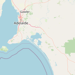
Why Murray River National Park stands out

Murray River National Park is best known for its extensive wetland and floodplain ecosystems along Australia's longest river. The park protects critical habitats within the Murray-Darling Basin, one of Australia's most significant river systems. Its river red gum woodlands, permanent wetlands, and seasonal floodplains support exceptional biodiversity, particularly waterbird populations and native fish species. The Ngak Indau Wetland trail with its bird hide provides outstanding birdwatching opportunities, while the Katfish Reach environmental rehabilitation project demonstrates active conservation work. The park's six sections, including the remote Bulyong Island accessible only by boat, preserve diverse riverine environments that represent some of South Australia's most important floodplain habitats.

Murray River National Park history and protected-area timeline

Murray River National Park was proclaimed as a national park on 20 June 1991 under the National Parks and Wildlife Act 1972, representing South Australia's commitment to preserving floodplain environments not adequately represented in other reserve systems. The park originally consisted of three sections: Katarapko, Lyrup Flats, and Bulyong. Three additional sections were later added to the protected area: Paringa Paddock, Gurra Gurra, and Kingston-on-Murray, expanding the park's coverage of the Murray River floodplain. The establishment of the park coincided with growing recognition of the need to protect wetland ecosystems within the Murray-Darling Basin, which had faced significant environmental pressures from water extraction, agricultural development, and altered flow regimes. The 2023 management plan for the park extended to adjacent conservation islands including Rilli Island, Media Island, and Kapunda Island, reflecting ongoing efforts to coordinate protection of riverine habitats across the region.

Murray River National Park landscape and geographic character

The landscape of Murray River National Park is defined by the Murray River's dynamic floodplain system, featuring winding river channels, permanent wetlands, seasonal floodplains, and dense riparian forests. The park's terrain is predominantly flat, with elevation changes occurring only subtly across the floodplain. River red gums dominate the riparian zones, their massive trunks and dense canopies creating the iconic Australian riverine forest appearance. Black box woodlands occur on slightly higher ground away from the river, while the wetland areas support diverse emergent vegetation including spikes, reeds, and rushes. The park's two significant watercourses, Katarapko Creek and Eckerts Creek, provide permanent water habitats that are essential for wildlife, particularly during dry periods when the main river's flow is reduced. The landscape transforms dramatically with seasonal flooding, when large areas of the floodplain become inundated, connecting the wetland systems and providing nutrients to the terrestrial environments.

Murray River National Park ecosystems, habitats, and plant life

The ecological character of Murray River National Park centers on its floodplain and wetland ecosystems within the Murray-Darling Basin. The park protects a diversity of habitats including river red gum forests, black box woodlands, permanent wetlands, ephemeral wetlands, and river channels. These environments support significant biodiversity, particularly for waterbirds, fish, and reptiles adapted to the seasonal flooding patterns. The wetland systems are internationally recognized for their importance to migratory birds, with species traveling from as far as Japan, China, and Siberia to utilize the habitat during the southern hemisphere summer. The park's creeks provide crucial refuge for native fish species including Murray cod, golden perch, and silver perch during dry periods. The vegetation communities reflect the interplay between water availability and elevation, creating a complex mosaic that supports different species at various elevations and hydrological conditions.

Murray River National Park wildlife and species highlights

Murray River National Park supports exceptional wildlife diversity, particularly for waterbirds and native fish within the Murray-Darling Basin system. The wetlands and floodplains provide critical habitat for numerous bird species, with the Ngak Indau Wetland trail and bird hide offering opportunities to observe colonial waterbird nesting colonies, including species such as straw-necked ibis, white-faced heron, and royal spoonbill. The park's permanent water bodies support populations of Murray cod, golden perch, and silver perch, species of conservation and recreational significance. River red gum hollows provide nesting habitat for parrots and owls, while the woodland areas support mammals including koalas, echidnas, and various marsupial species. The seasonal flooding events are particularly important for wildlife, connecting habitats and providing feeding grounds for waterbirds that gather in large numbers when wetlands fill. The park also supports reptile species including turtles and goannas that utilize both the aquatic and terrestrial environments.

Murray River National Park conservation status and protection priorities

Murray River National Park plays a crucial role in the conservation of South Australia's floodplain environments, representing ecosystems that were poorly represented in the protected area network at the time of the park's establishment. The park protects important wetland habitats within the Murray-Darling Basin, one of Australia's most ecologically significant but also stressed river systems. The Katfish Reach community environmental rehabilitation project demonstrates ongoing efforts to restore degraded habitat in the Katarapko and Eckert Creek area, addressing historical impacts and improving conditions for native fish and wildlife. The park's classification as an IUCN Category VI protected area reflects its management approach that balances conservation with sustainable use, allowing activities such as camping and canoeing while maintaining the ecological integrity of the floodplain systems. The inclusion of adjacent conservation islands in recent management planning shows the expanding approach to protecting interconnected riverine habitats.

Murray River National Park cultural meaning and human context

Murray River National Park exists within the traditional Country of Aboriginal peoples who have lived along the Murray River for thousands of years. The park's naming reflects this heritage, with Katarapko deriving from Katarapko Creek, an important waterway in the region. A significant contemporary cultural discussion involves Goat Island within Paringa Paddock, where a campaign began in 2021 to rename the island Ruby Hunter Island in honor of Aboriginal singer-songwriter Ruby Hunter, who was born on the island in 1955 when Aboriginal people were prohibited from giving birth in local hospitals. This renaming effort represents broader recognition of Aboriginal connections to the Riverland landscape. The park's location in South Australia's Riverland region places it within an area of ongoing Aboriginal cultural significance, where traditional and contemporary Indigenous connections to the river continue to be recognized and honored.

Top sights and standout views in Murray River National Park

The Murray River National Park stands out for its extensive floodplain wetland system along Australia's longest river, protecting critical habitats within the Murray-Darling Basin. The park's six sections preserve diverse riverine environments from the river channel itself to distant floodplains, with the largest section at Katarapko offering extensive walking trails and the Ngak Indau Wetland bird hide. Canoeing through Katarapko and Eckerts creeks provides intimate access to the park's aquatic environments and native fish habitats. The self-guided drive trail offers a convenient way to explore multiple sections of the park, while designated bush camping areas allow overnight stays in this remarkable riverine landscape. The remote Bulyong Island, accessible only by boat, offers a more adventurous experience of the park's wilderness character.

Best time to visit Murray River National Park

The best time to visit Murray River National Park depends on the experience sought, with each season offering distinct advantages. Autumn and spring typically provide comfortable temperatures for walking and outdoor activities, while the changing water levels create different wildlife viewing opportunities. Winter months often see the floodplain revert to drier conditions, concentrating wildlife around remaining water bodies and potentially offering clearer visibility for birdwatching. Summer brings the peak period for waterbird activity as migratory species arrive from the northern hemisphere, making it an excellent time for birdwatching but also the hottest period for outdoor activities. The timing of flooding events, which can occur in multiple seasons depending on upstream conditions and rainfall in the catchment, significantly affects the park's appearance and accessibility, with major flood events creating spectacular wetland displays but potentially affecting some trails and access routes.

Park location guide

Geography guide, regional context, and park location map for Murray River National Park

Murray River National Park park geography, regions, and map view in Australia
Understand where Murray River National Park sits in Australia through a broader geographic reading of the surrounding landscape, nearby location context, and its mapped position within the national park landscape.

How Murray River National Park fits into Australia

Australia is a constitutional monarchy and federal parliamentary democracy comprising six states and ten territories. With a population of nearly 28 million, it is one of the world's most urbanised countries, with most people concentrated on the eastern seaboard. The country has a high Human Development Index and is known for its cultural diversity, ancient Aboriginal heritage, and unique wildlife.

Wider geography shaping Murray River National Park in Australia

Australia occupies the entire Australian continent, the island of Tasmania, and numerous smaller islands. It is the world's flattest and driest inhabited continent, featuring vast deserts in the interior (the Outback), tropical rainforests along the eastern coast, and a coastline bordering the Indian and Pacific Oceans.

Map view of Murray River National Park

Use this park location map to pinpoint Murray River National Park in Australia, understand its exact geographic position, and read its mapped placement within the surrounding landscape more clearly.

Pigeon | © OpenStreetMap contributors

Location context for Murray River National Park

South Australia
Park atlas

Explore the broader park geography and connected protected landscapes across South Australia's Murray-Darling Basin region.

Discover Other Protected Areas and National Parks Near Murray River National Park
After exploring Murray River National Park's extensive wetland and floodplain ecosystems, continue your geographic discovery by comparing other protected areas in the surrounding South Australian region. Examine similar riverine conservation landscapes and trace the Murray-Darling Basin's connected habitats to understand the wider spread of protected land.
National parkVictoria

Murray-Sunset National Park: Victoria's Iconic Pink Lakes and Mallee Woodland Protected Landscape

Explore the mapped geography and semi-arid wilderness of this significant Australian protected area.

Murray-Sunset National Park represents a significant portion of Victoria's semi-arid natural heritage, renowned for its striking Pink Lakes that bloom with vibrant color in late summer. This protected landscape encompasses vast mallee woodlands, ancient sand dunes, and extensive salt pans, offering a unique geographic context for atlas exploration. Discover the rich birdlife and distinctive terrain that make this large national park a crucial element of Australia's protected areas network.

Area
6,330 km²
Established
1991
IUCN
II
National parkSouth Australia

Deep Creek National Park: Protected Coastal Terrain and Geographic Context in South Australia

Discover South Australia's largest remaining natural vegetation area.

Deep Creek National Park offers a unique protected landscape on South Australia's Fleurieu Peninsula, extending 18 kilometers along the rugged coast. This national park is renowned for its rolling hills, gullies, and dramatic views across Backstairs Passage to Kangaroo Island. It serves as a crucial conservation area, preserving the largest continuous segment of natural vegetation in a region largely transformed by development, making its geography and protected status highly significant.

Area
44.96 km²
Established
1971
IUCN
II
National parkNew South Wales

Kinchega National Park: National Park Protected Area in New South Wales

Explore the mapped Darling River terrain and outback landscapes.

Kinchega National Park stands as a protected national park entity within New South Wales, Australia. Its geographic significance is deeply tied to the Darling River, which shapes its unique riparian ecosystems and contrasts with the surrounding semi-arid outback terrain. This park offers a valuable point for atlas-based discovery, allowing exploration of its mapped boundaries, landscape context, and the conservation of its distinct natural and cultural heritage within the regional geography.

Area
442.59 km²
Established
1967
IUCN
II
National parkNew South Wales

Mutawintji National Park: New South Wales Protected Area for Atlas Exploration

Mapping rugged outback terrain, gorges, and ancient rock art.

Mutawintji National Park in New South Wales offers a profound exploration of Australia's outback geography, significant Indigenous heritage, and protected landscapes. Discover the park's unique terrain, defined by the Byngnano Range, vibrant gorges, and river red gum-lined creeks, all rich with ancient Aboriginal rock art. This national park is a prime example of mapped protected area discovery, highlighting both natural beauty and critical conservation achievements.

Area
689.12 km²
Established
1998
IUCN
II
National parkVictoria

Greater Bendigo National Park: Victoria's Box-Ironbark Forest Protected Landscape

Mapped terrain and vital woodland bird habitats.

Greater Bendigo National Park offers a prime example of Victoria's ecologically significant box-ironbark forests, recognized as a crucial refuge for biodiversity and notable bird species like the swift parrot. Situated near Bendigo, this national park's protected landscape provides essential insights into regional geography and woodland ecosystems. Its mapped boundaries encompass a vital area for understanding the distribution and character of this unique Australian forest type.

Area
170 km²
Established
2002
IUCN
II
National parkVictoria

Mount Richmond National Park: Victoria's Coastal Woodland Protected Landscape Identity

Mapped geography and regional context of this national park.

Mount Richmond National Park in Victoria, Australia, offers a distinct protected landscape identity characterized by its coastal woodland and heath environments. Established to preserve these remnants on the southwestern coast, the park's terrain reflects the region's volcanic geology and coastal positioning. Understanding Mount Richmond National Park through its mapped boundaries and regional geographic setting provides crucial insight into Victoria's protected areas and natural heritage.

Area
17.33 km²
Established
1960
IUCN
II
National parkSouth Australia

Lake Torrens National Park: Explore South Australia's Remarkable Inland Salt Lake Geography

A unique protected landscape of arid plains and expansive salt flats.

Lake Torrens National Park offers an unparalleled exploration of Australia's remote outback, centered around a vast, ancient salt lake basin. This national park in South Australia provides a canvas of stark, minimalist terrain, featuring shimmering saltpans, arid gibber plains, and rocky outcrops. Understand the park's unique geographic identity, its ecological significance as a temporary wetland habitat, and its dramatic visual appeal for landscape photography and geological interest. It is a key protected area showcasing the extreme environment of Australia's interior.

Area
5,676.68 km²
Established
1991
IUCN
VI
National parkVictoria

Lower Goulburn National Park: Mapping Victoria's River Red Gum Woodlands and Riparian Protected Area

Discover unique riverine forest and protected landscape context in Victoria

Lower Goulburn National Park represents a crucial protected corridor in Victoria, Australia, primarily safeguarding magnificent stands of river red gum woodlands along the Goulburn River. This national park offers a unique opportunity to explore a well-preserved riparian ecosystem within a modified agricultural region. Understand its linear geographic layout, the distinct arboreal character of its landscape, and its role in maintaining natural river processes and wildlife connectivity. The park's identity is deeply tied to the visual spectacle of its iconic eucalyptus canopy framing the waterway, providing valuable context for its protected status and ecological importance.

Area
93.1 km²
Established
2010
IUCN
II

Common questions about visiting, size, designation, and location context for Murray River National Park

Murray River National Park FAQs for park facts, access, geography, and protected area context
Find quick answers about Murray River National Park, including protected-area facts, park geography, trail and visitor context, and how the park fits into its surrounding country and regional landscape.
MoriAtlas Explorer

Continue Your Protected Areas Search Across the Global Atlas

Deepen your exploration by continuing the structured search for national parks and protected areas worldwide. Utilize the comprehensive filtering capabilities to compare different conservation landscapes and refine your understanding of global park geography. Discover more about the distribution and characteristics of protected natural areas.

Global natural geography