Mori Atlas logo
National parkMount Richmond National Park

Discover the mapped boundaries and regional geography of this significant protected area.

Mount Richmond National Park: Victoria's Protected Coastal Woodland & Landscape Atlas

Mount Richmond National Park represents a vital protected landscape within Victoria, Australia. Located in the state's far southwest near Portland, this national park preserves coastal woodland and heath environments set against the backdrop of Victoria's unique volcanic plains and coastal dune systems. Its existence as a national park highlights the importance of understanding its mapped boundaries and regional geographic context for conservation and atlas exploration, offering a glimpse into the remnant ecosystems of this coastal region.

national parkVictoriacoastal woodlandGreat South West WalkSouthwest Victoriaprotected area

Mount Richmond National Park

National park

Park overview

Structured park overview, official facts, and landscape profile for Mount Richmond National Park

Mount Richmond National Park park facts, protected area profile, and essential visitor context
Review the core facts for Mount Richmond National Park, including designation, size, terrain, visitor scale, habitats, and operating context in one park-focused overview.

About Mount Richmond National Park

Mount Richmond National Park occupies a coastal position in Victoria's far southwest, within the Barwon South West region of the state. The park preserves a landscape of coastal woodlands and heath communities that represent what remains of the original vegetation covering this section of the Victorian coast. The region around Mount Richmond has been shaped by geological processes including volcanic activity that contributed to the underlying terrain, overlaid with coastal dune systems and the soils and vegetation patterns they support. The park is situated near the transition between the more extensively cleared agricultural lands of the western Victorian plains and the coastal environments that extend toward the South Australian border. Management of the park falls to Parks Victoria, the agency responsible for Victoria's state-level protected areas. The park's inclusion as part of the Great South West Walk route gives it significance beyond its relatively modest size, connecting it to regional tourism and recreation networks that draw visitors to explore Victoria's southwestern coast.

Quick facts and research context for Mount Richmond National Park

Mount Richmond National Park spans 1,733 hectares (approximately 4,280 acres) along Victoria's western coastline. The park was officially established on 7 June 1960 and is managed by Parks Victoria. It lies within the Barwon South West region, situated roughly 18 kilometres west of Portland and about 313 kilometres from Melbourne. The Great South West Walk, a popular multi-day hiking route, traverses the park and provides visitor access to its coastal woodland landscapes. The park is classified as IUCN Category II, reflecting its national park designation within Australia's protected area framework.

Park context

Deeper park guide and search-rich context for Mount Richmond National Park

Mount Richmond National Park history, landscape, wildlife, and travel context
Explore Mount Richmond National Park through its history, landscape character, ecosystems, wildlife, conservation priorities, cultural context, and seasonal travel timing in a structured park guide built for atlas discovery and search intent.

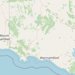
Why Mount Richmond National Park stands out

Mount Richmond National Park is best known for its coastal woodland landscapes and its role as a segment of the Great South West Walk, one of Victoria's notable long-distance hiking trails. The park protects remnant vegetation communities on Victoria's far southwestern coast, an area characterized by coastal heath, eucalyptus woodlands, and the transition between volcanic plain landscapes and the Southern Ocean coastline. The combination of relatively accessible natural environments and the trail corridor makes the park a destination for walkers and nature enthusiasts exploring Victoria's southwestern region.

Mount Richmond National Park history and protected-area timeline

Mount Richmond National Park was established on 7 June 1960, representing a mid-twentieth century addition to Victoria's system of national parks and protected areas. The park's creation reflected growing post-war interest in nature conservation and the recognition that Victoria's coastal environments required formal protection to preserve remnant vegetation communities and wildlife habitats. The establishment came during a period when Victoria was systematically expanding its protected area network, though the state's national park system was still relatively limited compared to later decades. The park was named for the geographic feature of Mount Richmond, a small elevation that provides the area with its distinguishing character and serves as a landmark within the otherwise relatively flat coastal terrain. Parks Victoria has administered the park since the creation of that agency, which consolidated management of Victoria's state parks and reserves under a single body.

Mount Richmond National Park landscape and geographic character

The landscape of Mount Richmond National Park consists of coastal woodland and heath environments set within the broader terrain of Victoria's far southwestern coast. The terrain is characterized by gentle topography typical of coastal plains, with the park's underlying geology influenced by ancient volcanic activity that produced the basalt formations visible across parts of western Victoria. Overlying these older rock formations are more recent coastal deposits including sands and sediments that form the basis for the heath and woodland communities growing throughout the park. The vegetation creates a landscape of moderate height, with eucalyptus species providing a woody canopy over diverse understory species. The proximity to the Southern Ocean influences the environmental character, with coastal winds and salt exposure shaping the vegetation structure and species composition.

Mount Richmond National Park ecosystems, habitats, and plant life

The nature of Mount Richmond National Park centers on coastal heath and woodland ecosystems that represent surviving examples of the original vegetation across this portion of Victoria's coast. The park protects plant communities adapted to the sandy soils, coastal exposure, and seasonal conditions of the far southwest. Eucalyptus species dominate the woodland canopy, while the understory contains diverse heath species characteristic of Australian coastal environments. These vegetation communities provide habitat for native wildlife, supporting bird species and small mammals that depend on the structure and food resources the woodlands and heath provide. The ecological significance of the park lies partly in its role as a remaining corridor of native vegetation in a landscape where surrounding lands have been largely cleared for agriculture, making the protected area an important refuge for native species.

Mount Richmond National Park conservation status and protection priorities

Mount Richmond National Park contributes to conservation outcomes in Victoria's far southwest by protecting a remnant coastal ecosystem that would otherwise face continued pressure from agricultural development and vegetation clearance. The park preserves genetic reservoirs of native plant species adapted to local conditions and maintains habitat connectivity for wildlife populations moving through the coastal corridor. As part of Victoria's national park system, the park receives institutional recognition and management attention that supports its long-term protection. The inclusion of the Great South West Walk within the park also creates an interface between recreation and conservation, with visitor use managed to minimize environmental impact while allowing public engagement with the natural values the park protects.

Top sights and standout views in Mount Richmond National Park

The coastal woodland landscapes of Mount Richmond National Park, combined with the Great South West Walk trail that passes through the park, represent its primary highlights for visitors. The park offers a relatively accessible natural environment in Victoria's far southwest, providing an opportunity to experience remnant coastal heath and eucalyptus woodland in a region where such environments have been significantly reduced by historical clearing. Walkers on the Great South West Walk can traverse the park while enjoying the surrounding landscape, with the trail offering views of the coastal environment and the characteristic vegetation of this portion of Victoria. The park's location near Portland also provides opportunities to combine a visit with exploration of the broader southwestern Victorian coast.

Best time to visit Mount Richmond National Park

The best time to visit Mount Richmond National Park is during the milder months of spring and autumn, when temperatures along Victoria's southwest coast are comfortable for hiking and outdoor activity. Summer months can bring warm conditions, though coastal breezes provide some moderation. Winter tends to be cooler and wetter, with increased rainfall typical of the southern Australian winter season. The Great South West Walk is popular among bushwalkers during the cooler months when long-distance hiking is more comfortable, though the trail can be accessed year-round subject to seasonal conditions. Visitors planning walks should check current conditions and any park alerts before traveling, as weather along the coast can change relatively quickly.

Park location guide

Geography guide, regional context, and park location map for Mount Richmond National Park

Mount Richmond National Park park geography, regions, and map view in Australia
Understand where Mount Richmond National Park sits in Australia through a broader geographic reading of the surrounding landscape, nearby location context, and its mapped position within the national park landscape.

How Mount Richmond National Park fits into Australia

Australia is a constitutional monarchy and federal parliamentary democracy comprising six states and ten territories. With a population of nearly 28 million, it is one of the world's most urbanised countries, with most people concentrated on the eastern seaboard. The country has a high Human Development Index and is known for its cultural diversity, ancient Aboriginal heritage, and unique wildlife.

Wider geography shaping Mount Richmond National Park in Australia

Australia occupies the entire Australian continent, the island of Tasmania, and numerous smaller islands. It is the world's flattest and driest inhabited continent, featuring vast deserts in the interior (the Outback), tropical rainforests along the eastern coast, and a coastline bordering the Indian and Pacific Oceans.

Map view of Mount Richmond National Park

Use this park location map to pinpoint Mount Richmond National Park in Australia, understand its exact geographic position, and read its mapped placement within the surrounding landscape more clearly.

Pigeon | © OpenStreetMap contributors

Location context for Mount Richmond National Park

Victoria
Park atlas

Trace Victoria's Southwestern Coast: Protected Landscapes and Connected Park Geography for Comparison

Explore Nearby Parks and Protected Areas Around Mount Richmond National Park
Browse national parks and protected areas near Mount Richmond National Park, tracing the coastal woodland, heath communities, and volcanic plains of South West Victoria. Compare these conservation landscapes and regional park geography to understand the broader network of natural areas along this section of the Southern Ocean coastline.
National parkVictoria

Point Addis Marine National Park: Victoria's Southern Ocean Coastal Protected Landscape

Mapped marine boundaries and diverse coastal geography.

Point Addis Marine National Park preserves a crucial section of Victoria's iconic Surf Coast, stretching from near Anglesea to Bells Beach. This national park encompasses vital marine environments, including rich rocky reef systems and productive kelp forests characteristic of the Southern Ocean. Its protected status safeguards a significant area of coastal waters, making it a key point of reference for understanding Australia's temperate marine geography and protected landscapes.

Area
46 km²
Established
2002
IUCN
II
National parkVictoria

Organ Pipes National Park: Victoria's National Park for Geological Atlas Exploration

Discover unique columnar basalt formations and mapped volcanic landscapes.

Organ Pipes National Park stands as a remarkable testament to Victoria's volcanic past, preserving some of the finest examples of columnar basalt jointing in Australia. Situated within the Keilor Plains, this national park showcases dramatic geological features, including the namesake Organ Pipes, alongside ancient Silurian marine sediments, offering a layered perspective on regional geography. Its protected status ensures the conservation of this unique landscape, making it an essential destination for understanding mapped terrain and geological heritage within the Australian atlas.

Area
1.21 km²
Established
1972
IUCN
III
National parkVictoria

Greater Bendigo National Park: Victoria's Box-Ironbark Forest Protected Landscape

Mapped terrain and vital woodland bird habitats.

Greater Bendigo National Park offers a prime example of Victoria's ecologically significant box-ironbark forests, recognized as a crucial refuge for biodiversity and notable bird species like the swift parrot. Situated near Bendigo, this national park's protected landscape provides essential insights into regional geography and woodland ecosystems. Its mapped boundaries encompass a vital area for understanding the distribution and character of this unique Australian forest type.

Area
170 km²
Established
2002
IUCN
II
National parkVictoria

Heathcote-Graytown National Park: Victoria's Key Box-Ironbark Forest Protected Area

Explore the mapped terrain and regional geography of this national park.

Heathcote-Graytown National Park stands as a critical protected area in Victoria, Australia, focused on conserving the rare box-ironbark forests that once dominated the region. Located within the Great Dividing Range, this national park provides essential habitat for woodland birds, notably the swift parrot, and offers a glimpse into the natural landscape that predates widespread agricultural development. Its inclusion in the park atlas highlights its ecological importance and contributes to a broader understanding of protected land distribution within Victoria's unique geography.

Area
128.33 km²
Established
2002
IUCN
II
Relief
Mountain
National parkVictoria

Murray-Sunset National Park: Victoria's Iconic Pink Lakes and Mallee Woodland Protected Landscape

Explore the mapped geography and semi-arid wilderness of this significant Australian protected area.

Murray-Sunset National Park represents a significant portion of Victoria's semi-arid natural heritage, renowned for its striking Pink Lakes that bloom with vibrant color in late summer. This protected landscape encompasses vast mallee woodlands, ancient sand dunes, and extensive salt pans, offering a unique geographic context for atlas exploration. Discover the rich birdlife and distinctive terrain that make this large national park a crucial element of Australia's protected areas network.

Area
6,330 km²
Established
1991
IUCN
II
National parkVictoria

Lower Goulburn National Park: Mapping Victoria's River Red Gum Woodlands and Riparian Protected Area

Discover unique riverine forest and protected landscape context in Victoria

Lower Goulburn National Park represents a crucial protected corridor in Victoria, Australia, primarily safeguarding magnificent stands of river red gum woodlands along the Goulburn River. This national park offers a unique opportunity to explore a well-preserved riparian ecosystem within a modified agricultural region. Understand its linear geographic layout, the distinct arboreal character of its landscape, and its role in maintaining natural river processes and wildlife connectivity. The park's identity is deeply tied to the visual spectacle of its iconic eucalyptus canopy framing the waterway, providing valuable context for its protected status and ecological importance.

Area
93.1 km²
Established
2010
IUCN
II
National parkVictoria

Yarra Ranges National Park: A Protected Landscape of Towering Forests and Regional Geography

Explore mapped boundaries and the vital water catchment geography of this Australian national park.

Discover Yarra Ranges National Park, a prominent national park in Victoria, Australia, celebrated for its world-record mountain ash forests and its critical role in safeguarding Melbourne's water supply. This protected landscape showcases the complex topography of the Great Dividing Range, from dense temperate rainforests to subalpine environments. Understanding its geography and protected area boundaries provides essential context for appreciating its ecological significance and its place within the regional atlas.

Area
760 km²
Established
1995
IUCN
II
National parkSouth Australia

Deep Creek National Park: Protected Coastal Terrain and Geographic Context in South Australia

Discover South Australia's largest remaining natural vegetation area.

Deep Creek National Park offers a unique protected landscape on South Australia's Fleurieu Peninsula, extending 18 kilometers along the rugged coast. This national park is renowned for its rolling hills, gullies, and dramatic views across Backstairs Passage to Kangaroo Island. It serves as a crucial conservation area, preserving the largest continuous segment of natural vegetation in a region largely transformed by development, making its geography and protected status highly significant.

Area
44.96 km²
Established
1971
IUCN
II

Common questions about visiting, size, designation, and location context for Mount Richmond National Park

Mount Richmond National Park FAQs for park facts, access, geography, and protected area context
Find quick answers about Mount Richmond National Park, including protected-area facts, park geography, trail and visitor context, and how the park fits into its surrounding country and regional landscape.
MoriAtlas Explorer

Continue Your Protected Areas Search Across the Global Atlas

Deepen your exploration by continuing the structured search for national parks and protected areas worldwide. Utilize the comprehensive filtering capabilities to compare different conservation landscapes and refine your understanding of global park geography. Discover more about the distribution and characteristics of protected natural areas.

Global natural geography