Mori Atlas logo
National parkLas Orquídeas National Natural Park

Discover the mapped terrain and ecosystem transitions of this vital national park.

Las Orquídeas National Natural Park: Colombia's Protected Andean Landscape Atlas

(Parque Nacional Natural Las Orquídeas)

Las Orquídeas National Natural Park represents a crucial protected landscape within Colombia's Cordillera Occidental, safeguarding an extraordinary elevational gradient. This national park spans from tropical rainforest origins near 300 meters to high Andean páramo terrain exceeding 3,450 meters, offering a unique opportunity to explore diverse ecosystems and their geographic distribution. Examine the mapped boundaries and rich biodiversity of this significant natural area.

Andean ecosystemsNational parkTropical rainforestPáramoBiodiversity hotspotProtected area

Las Orquídeas National Natural Park

National park

Park overview

Structured park overview, official facts, and landscape profile for Las Orquídeas National Natural Park

Las Orquídeas National Natural Park park facts, protected area profile, and essential visitor context
Review the core facts for Las Orquídeas National Natural Park, including designation, size, terrain, visitor scale, habitats, and operating context in one park-focused overview.

About Las Orquídeas National Natural Park

Las Orquídeas National Natural Park represents one of Colombia's most ecologically diverse protected areas, protecting a comprehensive cross-section of Andean ecosystems in a relatively compact territory. The park's location on the western slopes of the Cordillera Occidental places it at the intersection of multiple biogeographic influences, creating conditions that support exceptional species diversity. The western slopes of the Colombian Andes receive some of the highest rainfall in the country, and this moisture sustains lush forest ecosystems that climb from the lowest elevations up to the paramo grasslands near the mountain summits. The park's protection extends across this entire gradient, ensuring that the ecological connections between different elevation zones remain intact. This comprehensive protection is particularly important given the increasing pressure on Andean forests throughout Colombia from agricultural expansion, logging, and other land-use changes. The park serves as a critical corridor connecting lowland ecosystems of the Chocó region with high-elevation Andean habitats, supporting the movement of species across altitudinal zones and maintaining ecological processes that depend on connectivity.

Quick facts and research context for Las Orquídeas National Natural Park

Las Orquídeas National Natural Park is located in the department of Antioquia in western Colombia, occupying the western slopes of the Cordillera Occidental mountain range. The park was established in 1974 and is administered through Colombia's National System of Protected Areas (SINAP). Its elevational range of approximately 3,150 meters is unusual among protected areas, spanning from tropical lowland conditions to true alpine páramo grassland at the highest elevations. Annual rainfall varies from around 2,500 millimeters at the highest elevations to 4,000 millimeters in the middle elevations, with a generally humid climate throughout the year.

Park context

Deeper park guide and search-rich context for Las Orquídeas National Natural Park

Las Orquídeas National Natural Park history, landscape, wildlife, and travel context
Explore Las Orquídeas National Natural Park through its history, landscape character, ecosystems, wildlife, conservation priorities, cultural context, and seasonal travel timing in a structured park guide built for atlas discovery and search intent.

Why Las Orquídeas National Natural Park stands out

Las Orquídeas National Natural Park is best known for its extraordinary elevational gradient, which creates an unusual concentration of ecosystem types within a single protected area. The park protects critical habitat within the Chocó biogeographic region, one of the world's most species-rich and threatened biodiversity hotspots. Its significance extends to the preservation of Northwestern Andean montane forests and Northern Andean páramo ecosystems, both of which harbor numerous endemic species found nowhere else on Earth. The transition from lowland rainforest through premontane and montane forest to páramo grassland within such a compact area makes the park a living laboratory for understanding tropical mountain ecology.

Las Orquídeas National Natural Park history and protected-area timeline

Las Orquídeas National Natural Park was established in 1974 as part of Colombia's expanding national park system during a period when the country was actively working to protect its most significant natural areas. The creation of the park reflected growing recognition of the ecological importance of the Colombian Andes, which harbor extraordinary biodiversity across their elevational gradients. Colombia's national park system was developed through the National System of Protected Areas (SINAP), which continues to administer Las Orquídeas and coordinate conservation efforts across the country's protected territories. The establishment of the park provided formal legal protection to an area that had previously faced increasing pressure from human activities including logging, agriculture, and cattle ranching. Over the decades since its creation, the park has remained an important protected area in Colombia's conservation portfolio, though like many protected areas in the country, it faces ongoing challenges related to habitat fragmentation and encroachment in surrounding areas.

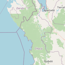
Las Orquídeas National Natural Park landscape and geographic character

The landscape of Las Orquídeas National Natural Park is defined by its dramatic topographic variation, with steep mountain slopes descending from the high peaks of the Cordillera Occidental toward lower-lying terrain to the west. The terrain rises from approximately 300 meters above sea level at the park's lowest points to 3,450 meters at its highest elevations, creating a landscape of extraordinary vertical relief. Throughout this elevational range, the topography varies from relatively gentle valleys where streams have cut through the mountains to steep, cliff-faced ridges and rocky outcrops typical of high-elevation Andean terrain. The park lies within a region of high rainfall, and this moisture has shaped the landscape through extensive erosion, the formation of numerous streams and small rivers, and the development of deep soils in lower elevations. At the highest elevations, the landscape transitions to the exposed, wind-swept terrain characteristic of páramo ecosystems, where vegetation is low and sparse compared to the dense forests found at lower elevations.

Las Orquídeas National Natural Park ecosystems, habitats, and plant life

The nature of Las Orquídeas National Natural Park is characterized by a series of distinct ecological zones that follow the elevational gradient from lowland rainforest to alpine páramo grassland. Below approximately 1,000 meters, the park supports lowland rainforest within the Chocó–Darién moist forests ecoregion, one of the most species-rich forest types in the world. As elevation increases, the vegetation transitions to premontane forest between 1,000 and 2,000 meters, and then to montane forest from 2,000 to 3,200 meters. At the highest elevations, above approximately 3,200 meters, the forest gives way to páramo grassland characterized by bunch grasses, shrubs, and other plants adapted to cool, wet conditions and seasonal frost. This elevational sequence creates remarkable ecological diversity within the park's boundaries, with each zone supporting distinct communities of plants and animals adapted to local conditions. The high rainfall throughout the park, ranging from 2,500 to 4,000 millimeters annually depending on elevation, sustains these diverse ecosystems and supports the high productivity of the forests.

Las Orquídeas National Natural Park wildlife and species highlights

Las Orquídeas National Natural Park supports rich wildlife communities across its multiple ecosystem types, with species compositions that vary significantly across the elevational gradient. The lowland rainforests at the park's lower elevations harbor diverse communities of tropical birds, mammals, reptiles, and amphibians, many of which are endemic to the Chocó region. As elevation increases, different species assemblages occupy the premontane and montane forests, with species adapted to cooler, more humid conditions becoming increasingly common. The páramo zone at the highest elevations supports distinctive high-altitude species that are specialized for life in the cool, windy conditions above the tree line. While specific species details are limited in the available source material, the park's location within one of the world's biodiversity hotspots and its protection of multiple ecosystem types suggests it supports significant wildlife diversity across its elevational range.

Las Orquídeas National Natural Park conservation status and protection priorities

Las Orquídeas National Natural Park plays an important role in Colombia's conservation strategy, protecting representative examples of ecosystems that have been significantly altered in surrounding areas. The park's location within the Chocó biogeographic region makes it particularly significant, as this region is recognized globally as a biodiversity hotspot with extremely high species endemism. The protection of the park's elevational gradient is especially valuable, as it preserves the ecological connections between lowland and high-elevation ecosystems that are essential for species migration, gene flow, and the maintenance of ecological processes. The park also contributes to watershed protection, with its forests capturing and regulating water that flows downslope to support communities in lower elevations. Colombia's national park system provides the legal framework for the park's protection, though effective conservation requires ongoing management and resources to address threats from surrounding land uses.

Las Orquídeas National Natural Park cultural meaning and human context

The territory encompassed by Las Orquídeas National Natural Park is situated within the traditional lands of indigenous communities in the Colombian Andes. The western slopes of the Cordillera Occidental have been inhabited for centuries, with communities maintaining connections to the land and its resources. While the park is managed as a strictly protected area, the broader region has a cultural history tied to the use and stewardship of mountain ecosystems. The establishment of the protected area represents a particular approach to conservation that emphasizes the preservation of natural ecosystems, though it operates within the context of ongoing discussions about the rights of indigenous communities and the integration of traditional ecological knowledge into protected area management.

Top sights and standout views in Las Orquídeas National Natural Park

The defining highlight of Las Orquídeas National Natural Park is its extraordinary elevational gradient, which compresses an remarkable diversity of ecosystems into a single protected area spanning roughly 3,150 meters from lowest to highest point. Visitors traveling through the park can experience the transition from tropical lowland rainforest through progressively cooler and more humid forest types to the windswept páramo grasslands of the high Andes. This ecological compression makes the park an exceptional destination for understanding tropical mountain ecosystems and the processes that shape species distributions across altitudinal zones. The park's protection of Chocó biogeographic region forests adds further significance, as these ecosystems are among the most biodiverse and also among the most threatened in the world.

Best time to visit Las Orquídeas National Natural Park

Las Orquídeas National Natural Park can be visited throughout the year, as the climate remains generally humid with rainfall occurring in all seasons. The wettest conditions typically occur at middle elevations, where annual rainfall can exceed 3,500 millimeters, while the highest elevations receive slightly less precipitation at around 2,500 millimeters annually. The period from December to March tends to be somewhat drier in many parts of the Colombian Andes, though visitors should expect frequent rain and high humidity throughout the year. The park's high-elevation areas can be particularly cool, especially at night, and conditions can change rapidly as clouds and mist move through the mountains.

Park location guide

Geography guide, regional context, and park location map for Las Orquídeas National Natural Park

Las Orquídeas National Natural Park park geography, regions, and map view in Colombia
Understand where Las Orquídeas National Natural Park sits in Colombia through a broader geographic reading of the surrounding landscape, nearby location context, and its mapped position within the national park landscape.

How Las Orquídeas National Natural Park fits into Colombia

Colombia is a presidential republic located in the northern part of South America. It spans approximately 1.14 million km² and has a population of around 52 million. The country features the Andes mountain range, extensive Amazon rainforest, and coastal regions on both the Caribbean and Pacific. Spanish is the official language, and Bogotá serves as the capital and largest city.

Wider geography shaping Las Orquídeas National Natural Park in Colombia

Colombia is located in the northwestern part of South America, bordering the Caribbean Sea to the north and the Pacific Ocean to the west. Its mainland neighbors are Venezuela to the east, Brazil to the southeast, Peru and Ecuador to the south and southwest, and Panama to the northwest. The terrain is diverse, featuring the Andes mountain range in the west, Amazon rainforest in the south and east, and coastal plains along both oceans.

Map view of Las Orquídeas National Natural Park

Use this park location map to pinpoint Las Orquídeas National Natural Park in Colombia, understand its exact geographic position, and read its mapped placement within the surrounding landscape more clearly.

Pigeon | © OpenStreetMap contributors
Park atlas

Map Colombia's diverse protected landscapes, comparing regional parks across Andean ecosystems and the Chocó biogeographic zone

Discover Related Protected Areas Near Las Orquídeas National Natural Park in Colombia's Andes
Browse additional national parks and protected areas near Las Orquídeas National Natural Park, exploring a continuum of Andean montane forests and Chocó biodiversity in Colombia. Comparing these sites offers deeper insight into Colombia's regional conservation efforts and the diverse elevational gradients across its protected landscapes.
National parkDarién Province

Darién National Park: Darién Province National Park Geographic and Map Exploration

Discover its protected landscape and regional geographic context.

Darién National Park serves as a key protected area within Darién Province, offering an essential focus for geographic and atlas-based discovery. This dedicated park detail page provides insights into its mapped boundaries and its significance as a national park. Users can explore the park's specific geographic footprint and its place within the regional landscape, facilitating a structured understanding of protected natural areas. Dive into the mapped terrain and conservation landscape context that defines Darién National Park for comprehensive atlas exploration.

Area
5,790 km²
Established
1980
IUCN
II
Natural monumentColombia

Los Estoraques Unique Natural Area: Colombian Natural Monument of Eroded Pillars

Geographic Context and Landscape Atlas

Los Estoraques Unique Natural Area stands as a distinctive protected landscape within Colombia's Norte de Santander Department. This natural monument is renowned for its striking geological formations of eroded brownstone columns and pedestals, a unique erosional terrain set within the Andean foothills. The area's mapped boundaries encompass a complex ecosystem, bridging dry forest and cloud forest zones, offering significant value for understanding regional geography and the distribution of protected lands in South America.

Area
562 km²
Established
1988
IUCN
III
National parkColombia

Rosario and San Bernardo Corals National Natural Park: Colombia's National Natural Park Protected Landscape

Explore the mapped geography and protected natural areas of this Colombian national park.

Delve into the geographical details and protected landscape identity of Rosario and San Bernardo Corals National Natural Park, a significant national park within Colombia. This resource provides a structured atlas view of its mapped boundaries and natural terrain, contributing essential context to the broader Colombian geography and its protected areas.

Area
1,200 km²
Established
1977
IUCN
II
National parkColón Province

Soberanía National Park: Panama National Park Atlas, Geography, and Protected Landscape Details

Explore the mapped boundaries and regional geography of this national park.

Investigate Soberanía National Park, a designated national park situated in Panama's Colón Province. This entry offers detailed geographic context, focusing on its mapped protected area, landscape character, and role within regional conservation. Understand the spatial distribution and atlas significance of this protected land, essential for a structured geographic discovery of Panama's natural heritage.

Area
220 km²
Established
1980
IUCN
II
National parkPanamá Oeste Province

Altos de Campana National Park: National Park Protected Landscape and Geographic Context

Mapped boundaries and regional geography in Panamá Oeste Province.

Gain a structured understanding of Altos de Campana National Park, a designated national park located in Panamá Oeste Province. This page details its identity as a protected landscape, offering insights into its geographic placement and mapped boundaries for comprehensive atlas-style exploration. Understand its regional context and its contribution to Panama's network of protected areas.

Area
48.16 km²
Established
1966
IUCN
II
National parkPanamá Province

Chagres National Park: National Park Protected Landscape Atlas

Discover geographic boundaries and natural terrain context.

Chagres National Park is a crucial protected area situated in Panamá Province, Panama. This page serves as an atlas-style gateway to understanding its specific geographic identity, mapped boundaries, and the surrounding natural terrain. It is designed for users seeking detailed insights into the park's protected landscape and its contribution to regional geography and conservation mapping efforts.

Area
1,290 km²
Established
1985
IUCN
II
National parkPanama

Cerro Hoya National Park: Panama's Protected Landscape with Mapped Geographic Detail

Explore the national park's mapped boundaries and regional atlas context.

Cerro Hoya National Park presents a unique opportunity for geographic discovery, focusing on its role as a protected landscape within Panama. This park detail page allows for an in-depth atlas-style exploration of its mapped boundaries and its contribution to the regional geography of Central America. Understand the protected-area identity and the natural context that defines this significant national park, providing valuable data for landscape analysis and map-based research.

Area
333.4 km²
Established
1984
IUCN
II
National parkMagdalena Department

Salamanca Island Road Park National Park: A UNESCO Biosphere Reserve of Coastal Wetlands and Mangroves

Explore its unique estuarine environment and abundant bird populations.

Salamanca Island Road Park, designated a National Park and UNESCO Biosphere Reserve, protects a crucial coastal wetland ecosystem in Colombia's Magdalena Department. Its landscape is defined by vast mangrove forests, tidal flats, and the unique meeting of the Magdalena River's fresh water with the Caribbean Sea's salinity. This park is a significant area for birdwatching, with hundreds of species inhabiting its estuarine environment, offering a key point of reference for understanding protected landscapes on the Caribbean coast.

Area
562 km²
Established
1964
IUCN
III

Common questions about visiting, size, designation, and location context for Las Orquídeas National Natural Park

Las Orquídeas National Natural Park FAQs for park facts, access, geography, and protected area context
Find quick answers about Las Orquídeas National Natural Park, including protected-area facts, park geography, trail and visitor context, and how the park fits into its surrounding country and regional landscape.
MoriAtlas Explorer

Continue Your Protected Areas Search Across the Global Atlas

Deepen your exploration by continuing the structured search for national parks and protected areas worldwide. Utilize the comprehensive filtering capabilities to compare different conservation landscapes and refine your understanding of global park geography. Discover more about the distribution and characteristics of protected natural areas.

Global natural geography