Mori Atlas logo
National parkDarién National Park

Discover the geographic context and mapped boundaries of this protected natural landscape.

Darién National Park: Darién Province National Park Protected Landscape Atlas

(Parque Nacional Darién)

Darién National Park represents a significant protected natural area within Darién Province, Panama. As a designated national park, its boundaries define a crucial region for understanding landscape context and geographic distribution. This page offers a detailed atlas-style exploration, focusing on the park's spatial presence and its role within the broader geography of Darién Province. Explore the mapped terrain and protected land characteristics essential for a structured understanding of this vital natural landscape.

Tropical RainforestUNESCO World Heritage SiteBird WatchingIndigenous CommunitiesContinental DivideTransboundary Conservation

Darién National Park

National park

Park overview

Structured park overview, official facts, and landscape profile for Darién National Park

Darién National Park park facts, protected area profile, and essential visitor context
Review the core facts for Darién National Park, including designation, size, terrain, visitor scale, habitats, and operating context in one park-focused overview.

About Darién National Park

Darién National Park represents a remarkable convergence of geographical, ecological, and cultural significance that distinguishes it from other Central American protected areas. As Panama's largest national park, it occupies a pivotal position at the interface between North and South America, creating a natural corridor that has shaped both biological migration patterns and human history. The park's territory encompasses diverse landscapes including rugged mountain terrain along the Serranía del Darién, extensive lowland forests, coastal ecosystems along the Pacific, and vast wetland systems. This topographical variety supports an exceptional range of habitats that together create one of the most biologically rich environments in the tropics. The park's inaccessibility, while challenging for visitors, has been instrumental in preserving its ecological integrity. Unlike most national parks, Darién maintains an active human presence with indigenous communities whose traditional ways of life remain intertwined with the park's landscapes. This living cultural dimension adds another layer of significance to the protected area, demonstrating how conservation can coexist with human habitation when properly managed. The park's designation as a UNESCO biosphere reserve in 1983 recognized not only its ecological value but also the importance of balancing protection with sustainable human use.

Quick facts and research context for Darién National Park

Darién National Park occupies a strategic position as the only land connection between North and South America, creating a biogeographical crossroads of immense significance. The park encompasses the Serranía del Darién mountain range and extends to the Pacific coast, with elevations ranging from sea level to over 1,800 meters. In 1983, an area of 859,333 hectares was designated a UNESCO biosphere reserve, complementing its World Heritage status. The park remains one of the few protected areas in the world where indigenous communities continue to reside, with two native tribes living within its boundaries. It forms a transboundary conservation complex with Los Katíos National Park in Colombia.

Park context

Deeper park guide and search-rich context for Darién National Park

Darién National Park history, landscape, wildlife, and travel context
Explore Darién National Park through its history, landscape character, ecosystems, wildlife, conservation priorities, cultural context, and seasonal travel timing in a structured park guide built for atlas discovery and search intent.

Why Darién National Park stands out

Darién National Park is best known as the location of the Darién Gap, the legendary break in the Pan-American Highway that spans from Argentina to Alaska. The park is also renowned as one of the world's premier bird watching destinations, with Santa Cruz de Cana frequently cited among the top ten birding locations globally. Its exceptional biodiversity includes numerous threatened species, and the park serves as a critical habitat for the harpy eagle, one of the largest and most powerful raptors in the Americas. The combination of its ecological significance, geographical uniqueness, and cultural richness makes Darién one of the most distinctive protected areas in the Western Hemisphere.

Darién National Park history and protected-area timeline

The protection of Darién's landscapes evolved through several distinct phases before achieving its current status as a national park and World Heritage Site. In 1972, an area of 700,000 hectares was established as the Alto Darién Protection Forest, representing the first formal recognition of the region's ecological importance. This initial protection was expanded significantly in 1980 when the area was declared a national park, elevating its conservation status and providing stronger legal framework for protection. The park's outstanding universal value was recognized internationally in 1981 when it was inscribed on the UNESCO World Heritage List, becoming one of the first natural sites in Central America to receive this distinction. Three years later, in 1983, an expanded area of 859,333 hectares was designated as a UNESCO biosphere reserve, acknowledging the park's role in maintaining ecological processes and biodiversity while also accommodating traditional human activities. The park's boundary was deliberately drawn to include the Darién Gap region, ensuring protection of this unique geographical feature that represents the only interruption in the continuous Pan-American Highway system.

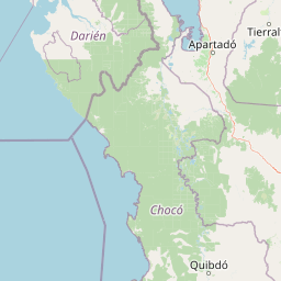
Darién National Park landscape and geographic character

The physical landscape of Darién National Park exhibits remarkable diversity shaped by its position at the continental junction and its varied topography. The park spans from the Pacific coastal plain inland to the towering peaks of the Serranía del Darién, a mountain range that parallels the Caribbean coast approximately 16 kilometers to the northeast. Coastal areas feature a mix of rocky headlands and sandy beaches that transition into extensive mangrove systems along sheltered bays and estuaries. The interior contains expansive lowland swamps and forested wetlands that give way to increasingly steep and rugged terrain as elevation increases. The mountain forests of the Serranía support distinct ecological communities adapted to higher elevations and more humid conditions. Throughout the park, the terrain is dissected by numerous rivers and streams that drain toward the Pacific, creating a complex network of aquatic habitats. The overall character is one of dense, often impenetrable vegetation covering terrain that has remained largely unchanged by human development, preserving a landscape that resembles pre-Columbian times.

Darién National Park ecosystems, habitats, and plant life

The ecological character of Darién National Park is defined by its position within the Isthmian biogeographic province, an area recognized globally for its exceptional concentration of species and its role as a migration corridor between continents. The park contains a remarkable array of habitat types that support extraordinary biodiversity, including rocky coastlines, sandy beaches, mangrove forests, freshwater swamps, lowland tropical rainforests, and premontane forest zones. This habitat diversity creates the conditions for extremely high species richness across multiple taxonomic groups. The park has been designated an Important Bird Area by BirdLife International, recognizing its significance for avifauna and the presence of numerous species of conservation concern. The forest ecosystems represent some of the most intact in Central America, with extensive areas of old-growth forest that have never been logged or significantly altered. These forests store significant amounts of carbon and play important roles in regional climate regulation and watershed protection.

Darién National Park wildlife and species highlights

Wildlife in Darién National Park represents one of the most significant concentrations of biodiversity in the Americas. The park provides critical habitat for numerous threatened and endangered species, including several that are found nowhere else on Earth. The harpy eagle, one of the largest and most powerful raptors in the world, inhabits the forest canopy and represents an iconic species of the park. The spotted paca, a large rodent of the tropical forest understory, is among the notable mammals found within the park's boundaries. American crocodiles inhabit the rivers and coastal areas, while the diverse primate community includes several species of monkeys that can be observed from the park's trail systems. Birdlife is exceptionally rich, with the park supporting numerous species of tanagers, toucans, parrots, and raptors. The combination of Neotropical and Central American species creates a unique faunal assemblage that reflects the park's position at the continental interface. The park's remote character has allowed wildlife populations to maintain natural population dynamics relatively free from significant human disturbance.

Darién National Park conservation status and protection priorities

Darién National Park holds exceptional conservation significance as one of the largest and most intact protected areas in Central America. Its UNESCO World Heritage status recognizes outstanding universal value in terms of both ecological processes and biodiversity conservation. The park forms an essential component of a transboundary conservation complex with Los Katíos National Park in Colombia, together protecting a continuous corridor of forest that spans the Colombia-Panama border. This connected landscape allows for the maintenance of ecological processes that require large areas and continuous habitat, including species migration and genetic flow between populations. The park's designation as a biosphere reserve in 1983 reflects a sophisticated approach to conservation that acknowledges the presence of indigenous communities and seeks to balance protection with sustainable use. Conservation challenges include the need to address illegal logging and land encroachment pressures, while maintaining the park's ecological integrity against external forces. The park's role in protecting the Darién Gap region also carries geopolitical significance, as this area represents the only break in the Pan-American Highway and thus influences broader regional development patterns.

Darién National Park cultural meaning and human context

Darién National Park represents a rare example of a protected area that maintains active human habitation, with two indigenous tribes continuing to reside within its boundaries. These communities have maintained traditional ways of life that are intimately connected to the park's landscapes, including practices of subsistence agriculture, hunting, and forest use that have shaped the region for generations. The presence of these communities adds significant cultural dimension to the park's identity and demonstrates that effective conservation can accommodate human populations when management approaches respect indigenous rights and traditional practices. The park's cultural context also includes its role in historical exploration and the challenges it posed to early travelers attempting to cross between North and South America. The Darién Gap itself became legendary in exploration history as an obstacle that defeated numerous expeditions seeking to complete the Pan-American Highway. This human history of attempted conquest and eventual acceptance of the region's impenetrable character adds narrative depth to the park's significance.

Top sights and standout views in Darién National Park

The most compelling highlights of Darién National Park include its position as a continental bridge between North and South America, the legendary Darién Gap that interrupts the Pan-American Highway, and its status as one of the world's premier bird watching destinations. The park's exceptional biodiversity and extensive old-growth forests represent some of Central America's last truly wild landscapes. The presence of indigenous communities within a World Heritage Site demonstrates a model of integrated conservation that maintains both ecological and cultural values. The spectacular harpy eagle and other charismatic species attract scientific attention and conservation interest. The park's UNESCO biosphere reserve designation acknowledges both its protected status and the living cultures within its boundaries. The transboundary connection with Colombia's Los Katíos National Park creates one of the most significant conservation landscapes in the Americas.

Best time to visit Darién National Park

The optimal time to visit Darién National Park aligns with the dry season, typically from December through April, when precipitation is reduced and trail conditions are more favorable for exploration. During this period, wildlife becomes more concentrated around remaining water sources, potentially improving observation opportunities. The dry season also offers more predictable access to remote areas and reduces the challenges associated with crossing swollen rivers and streams. However, visitors should understand that the park's tropical environment means that some rainfall can occur year-round, and the wet season from May to November brings heavy precipitation that can significantly impact access and trail conditions. The bird watching at Santa Cruz de Cana can be productive throughout the year, though certain species may be more easily observed during specific seasons. The park's extreme isolation means that visit planning requires significant advance preparation and coordination with park authorities to ensure access permissions and ranger support are arranged appropriately.

Park location guide

Geography guide, regional context, and park location map for Darién National Park

Darién National Park park geography, regions, and map view in Panama
Understand where Darién National Park sits in Panama through a broader geographic reading of the surrounding landscape, nearby location context, and its mapped position within the national park landscape.

How Darién National Park fits into Panama

Panama is a presidential republic located at the southern end of Central America in North America. It gained independence from Spain in 1821 and from Colombia in 1903, the latter enabling the construction of the Panama Canal under U.S. supervision between 1904 and 1914. The canal was transferred to Panamanian control in 1999 following the Torrijos-Carter Treaties. With a population of approximately 4.3 million and an area of about 75,400 km², Panama has a high-income economy driven primarily by canal tolls, banking, commerce, and tourism.

Wider geography shaping Darién National Park in Panama

Panama is located at the southern end of the Central American isthmus, stretching from the Caribbean coast in the north to the Pacific coast in the south. The country shares land borders with Costa Rica to the west and Colombia to the southeast. The terrain consists of coastal plains, mountain ranges including the Cordillera Central and Cordillera de Talamanca, and river valleys. The Panama Canal bisects the country, connecting the Atlantic and Pacific Oceans.

Map view of Darién National Park

Use this park location map to pinpoint Darién National Park in Panama, understand its exact geographic position, and read its mapped placement within the surrounding landscape more clearly.

Pigeon | © OpenStreetMap contributors

Location context for Darién National Park

Darién Province
Park atlas

Trace the broader protected landscapes, diverse ecosystems, and regional park geography connected to this Central American landmark.

Discover Nearby National Parks and Protected Areas Beyond Darién National Park in Panama
Continue your exploration of Central America's protected areas by browsing other national parks and protected landscapes within the surrounding region of Darién National Park. Comparing adjacent protected regions helps reveal the unique biodiversity, varied terrain, and critical conservation efforts across Panama and its neighboring countries, offering a richer geographic context.
National parkColombia

Las Orquídeas National Natural Park: Colombia's Biodiversity Hotspot and Andean Ecosystem Atlas

Explore its unique elevational gradient and protected terrain.

Las Orquídeas National Natural Park in Colombia is renowned for its dramatic elevational range, compressing multiple distinct ecosystems into a single protected area. This national park offers an exceptional view of Andean geography and Chocó biogeographic region biodiversity, transitioning from tropical rainforest to high-altitude páramo. Investigate the mapped landscape and the conservation significance of this unique natural treasure.

Area
287.53 km²
Established
1974
IUCN
II
Relief
Mountain
National parkChocó Department

Utría National Natural Park: National Park Protected Landscape and Geography

Explore its mapped boundaries and regional context in Chocó.

As a designated national park, Utría National Natural Park offers a unique lens for understanding Colombia's protected landscapes. This entry provides essential geographic context, detailing the park's location within the Chocó Department and highlighting its significance as a mapped natural area. Discover the protected boundaries and regional landscape character through structured atlas data.

Area
543.8 km²
Established
1987
IUCN
II
Relief
Mountain
National parkColón Province

Soberanía National Park: Panama National Park Atlas, Geography, and Protected Landscape Details

Explore the mapped boundaries and regional geography of this national park.

Investigate Soberanía National Park, a designated national park situated in Panama's Colón Province. This entry offers detailed geographic context, focusing on its mapped protected area, landscape character, and role within regional conservation. Understand the spatial distribution and atlas significance of this protected land, essential for a structured geographic discovery of Panama's natural heritage.

Area
220 km²
Established
1980
IUCN
II
Relief
Lowland
National parkPanamá Province

Chagres National Park: National Park Protected Landscape Atlas

Discover geographic boundaries and natural terrain context.

Chagres National Park is a crucial protected area situated in Panamá Province, Panama. This page serves as an atlas-style gateway to understanding its specific geographic identity, mapped boundaries, and the surrounding natural terrain. It is designed for users seeking detailed insights into the park's protected landscape and its contribution to regional geography and conservation mapping efforts.

Area
1,290 km²
Established
1985
IUCN
II
Relief
Upland
National parkPanamá Oeste Province

Altos de Campana National Park: National Park Protected Landscape and Geographic Context

Mapped boundaries and regional geography in Panamá Oeste Province.

Gain a structured understanding of Altos de Campana National Park, a designated national park located in Panamá Oeste Province. This page details its identity as a protected landscape, offering insights into its geographic placement and mapped boundaries for comprehensive atlas-style exploration. Understand its regional context and its contribution to Panama's network of protected areas.

Area
48.16 km²
Established
1966
IUCN
II
Relief
Mountain
National parkColombia

Tatamá National Natural Park: Colombia's Protected Natural Landscape Explorer

Mapped boundaries and regional geography of a Colombian national park.

Tatamá National Natural Park is a protected natural area situated within the Republic of Colombia. As a designated national park, it contributes significantly to the nation's protected lands. This entry provides essential geographic context, focusing on the park's mapped outlines and its role within the broader atlas of Colombian geography. Understanding Tatamá National Natural Park involves appreciating its specific landscape features and its contribution to the country's network of protected natural areas, offering a foundation for regional geographic study.

Area
519 km²
Established
1987
IUCN
II
Relief
Mountain
National parkColombia

Rosario and San Bernardo Corals National Natural Park: Colombia's National Natural Park Protected Landscape

Explore the mapped geography and protected natural areas of this Colombian national park.

Delve into the geographical details and protected landscape identity of Rosario and San Bernardo Corals National Natural Park, a significant national park within Colombia. This resource provides a structured atlas view of its mapped boundaries and natural terrain, contributing essential context to the broader Colombian geography and its protected areas.

Area
1,200 km²
Established
1977
IUCN
II
Visitors
318.5K annual
National parkPanama

Cerro Hoya National Park: Panama's Protected Landscape with Mapped Geographic Detail

Explore the national park's mapped boundaries and regional atlas context.

Cerro Hoya National Park presents a unique opportunity for geographic discovery, focusing on its role as a protected landscape within Panama. This park detail page allows for an in-depth atlas-style exploration of its mapped boundaries and its contribution to the regional geography of Central America. Understand the protected-area identity and the natural context that defines this significant national park, providing valuable data for landscape analysis and map-based research.

Area
333.4 km²
Established
1984
IUCN
II
Relief
Mountain

Common questions about visiting, size, designation, and location context for Darién National Park

Darién National Park FAQs for park facts, access, geography, and protected area context
Find quick answers about Darién National Park, including protected-area facts, park geography, trail and visitor context, and how the park fits into its surrounding country and regional landscape.
MoriAtlas Explorer

Continue Your Protected Areas Search Across the Global Atlas

Deepen your exploration by continuing the structured search for national parks and protected areas worldwide. Utilize the comprehensive filtering capabilities to compare different conservation landscapes and refine your understanding of global park geography. Discover more about the distribution and characteristics of protected natural areas.

Global natural geography