Mori Atlas logo
National parkAltos de Campana National Park

Trace the mapped boundaries and regional geography of this key protected area in Panamá Oeste Province.

Altos de Campana National Park: National Park Protected Landscape and Geographic Context in Panamá Oeste

(Parque Nacional Altos de Campana)

Altos de Campana National Park stands as a significant protected area within Panamá Oeste Province, offering a distinct perspective on Panama's natural landscapes. This national park provides a vital component for understanding the distribution and geographic placement of conservation lands. Explore its mapped boundaries and regional context to appreciate its role within the broader atlas of protected areas.

National ParkTropical ForestBirdwatchingWatershed ProtectionVolcanic LandscapeEndemic Species

Altos de Campana National Park

National park

Park overview

Structured park overview, official facts, and landscape profile for Altos de Campana National Park

Altos de Campana National Park park facts, protected area profile, and essential visitor context

Review the core facts for Altos de Campana National Park, including designation, size, terrain, visitor scale, habitats, and operating context in one park-focused overview.

About Altos de Campana National Park

Altos de Campana National Park represents Panama's oldest and most historically significant protected area, founded in 1966 through Executive Decree No. 153 as a pioneering effort in Central American conservation. The park's establishment was driven by strategic water resource concerns, specifically the need to preserve watersheds essential to the Panama Canal's operation. Situated within the Talamanca mountain range in the Mariato District of Panamá Oeste Province, the park encompasses approximately 48 square kilometers of mountainous terrain. Over time, the park's boundaries were expanded under Decree No. 35 in 1977, strengthening its ecological integrity. In 2019, Altos de Campana became integrated into the Geoparque Puente de las Américas initiative, which promotes sustainable development while highlighting the region's geological and cultural heritage. The park's accessibility from Panama City, combined with its ecological wealth, makes it a cornerstone of Panama's environmental education and ecotourism efforts, serving both domestic and international visitors seeking to experience Central American tropical forest ecosystems.

Quick facts and research context for Altos de Campana National Park

Altos de Campana National Park spans 4,816 hectares in the Talamanca mountain range of western Panama, approximately 50 kilometers from Panama City. Established on June 28, 1966, it holds the distinction of being Panama's first national park. The park features four distinct forest types: humid tropical forest, very humid premontane forest, very humid tropical forest, and premontane rainforest. Its vertebrate fauna includes 39 mammal species, 267 bird species, 62 amphibians, and 86 reptiles. The critically endangered Panamanian golden frog calls this park home, alongside species such as Geoffroy's tamarin, various sloths, and the white-nosed coati. The landscape bears the geological imprint of the ancient El Valle de Antón volcano, which erupted roughly 200,000 years ago, leaving behind lava fields and igneous rock formations.

Protection and recognition

Tracking terrestrial protection boundaries and established framework since 1966.

Altos de Campana National Park Protection Status and Protected Area Designation

Detailed geographic records outline the documented protection status, established boundaries, and terrestrial scope of Altos de Campana National Park. Verified atlas data offers critical historical context regarding the 1966 establishment and regional conservation framework.

Protection details

Protection scope
Terrestrial
Designated year
1966
Transboundary protection
No
Park context

Deeper park guide and search-rich context for Altos de Campana National Park

Altos de Campana National Park history, landscape, wildlife, and travel context

Explore Altos de Campana National Park through its history, landscape character, ecosystems, wildlife, conservation priorities, cultural context, and seasonal travel timing in a structured park guide built for atlas discovery and search intent.

Why Altos de Campana National Park stands out

Altos de Campana is best known as Panama's premier protected area and a critical watershed reserve for the Panama Canal. The park's ecological significance derives from its exceptional biodiversity concentration, particularly its diverse avifauna that has earned it recognition as an Important Bird Area by BirdLife International. Its population of the critically endangered Panamanian golden frog represents one of the last strongholds for this iconic amphibian. The park also stands out for its volcanic geological heritage, with well-preserved lava fields and igneous formations from the El Valle de Antón volcano, as well as its accessibility from Panama City, making it a popular destination for day visitors seeking tropical forest hiking experiences.

Altos de Campana National Park history and protected-area timeline

Altos de Campana National Park was officially established on June 28, 1966, by Executive Decree No. 153, making it Panama's first national park and one of the earliest protected areas in Central America. The park's creation was primarily motivated by the need to conserve vital hydrological resources that support the Panama Canal system, recognizing the watershed's strategic importance to national infrastructure. Initially designated as a biological reserve, the park covered approximately 49.21 square kilometers in what was then the Capira District of Panama Province. In 1977, boundaries were expanded through Decree No. 35, which was published in Official Gazette No. 18645 in 1978, increasing the protected area's ecological footprint. The park remained primarily focused on watershed protection and biodiversity conservation throughout the late twentieth and early twenty-first centuries. A significant development came in 2019 when Altos de Campana became part of the Geoparque Puente de las Américas initiative, reflecting a broader regional effort to promote sustainable tourism while preserving geological and cultural heritage.

Altos de Campana National Park landscape and geographic character

The terrain of Altos de Campana National Park exhibits the dramatic topography characteristic of the Talamanca mountain range, featuring steep hills, deep valleys, and rugged forested slopes. The park's highest elevation, Cerro Campana, reaches approximately 1,007 meters above sea level and provides visitors with panoramic views encompassing the Pacific coastline, the Bay of Chame, and on exceptionally clear days, the volcanic island of Taboga. The landscape bears the unmistakable imprint of volcanic origin, shaped by the ancient El Valle de Antón volcano that erupted roughly 200,000 years ago. Evidence of this volcanic past remains visible throughout the park in the form of extensive lava fields and distinctive igneous rock formations. The combination of mountainous terrain, volcanic geology, and dense tropical vegetation creates a visually striking landscape that supports the park's exceptional ecological diversity.

Altos de Campana National Park ecosystems, habitats, and plant life

Altos de Campana supports four distinct forest types that reflect the park's elevational range and moisture gradients: humid tropical forest, very humid premontane forest, very humid tropical forest, and premontane rainforest. This forest diversity underpins the park's remarkable plant wealth, which includes 198 tree species and 342 shrub species. Of particular significance are the 26 species of vascular plants that are endemic to Panama, representing the park's contribution to global plant diversity. The forests feature complex vertical structure with multiple canopy layers, supporting epiphytic plants that flourish on tree branches and trunks. The park's location within the Talamanca mountain range positions it within a biogeographic zone of significant evolutionary importance, where species from North and South America have interacted and diversified over millennia.

Altos de Campana National Park wildlife and species highlights

The vertebrate fauna of Altos de Campana National Park demonstrates the park's ecological importance, with 39 mammal species documented within its boundaries. Notable mammals include Geoffroy's tamarin, a distinctive small primate with distinctive facial markings, as well as both two-toed and three-toed sloths that navigate the forest canopy. The white-nosed coati, a relatives of raccoons, forages actively through the understory. The park's avifauna is particularly impressive, with 267 bird species recorded, including the colorful orange-bellied trogon, the iridescent violet-bellied hummingbird, and the powerful black-and-white hawk-eagle. Reptile diversity includes 86 species, among them the venomous eyelash palm pit viper and the common green iguana. Amphibians number 62 species, most notably the critically endangered Panamanian golden frog, a species that has become a symbol of conservation in Panama and is found nowhere else in the world.

Altos de Campana National Park conservation status and protection priorities

Altos de Campana National Park holds significant conservation importance at multiple scales. As Panama's first national park, it established a precedent for protected area designation in the country and continues to serve as a benchmark for conservation planning. The park's watershed protection function remains vital, safeguarding water resources that support the Panama Canal's operation and broader regional water security. BirdLife International has designated the park as an Important Bird Area, recognizing its significance for bird conservation under criteria A1 and A2 for significant bird populations. The presence of the critically endangered Panamanian golden frog further elevates the park's conservation profile, as this species faces severe population declines from chytrid fungus and habitat loss. The park's integration into the Geoparque Puente de las Américas initiative since 2019 reflects a contemporary approach that balances conservation with sustainable development and community engagement.

Altos de Campana National Park cultural meaning and human context

While Altos de Campana is primarily valued for its ecological significance, the park's cultural context relates to its more recent historical role in Panamanian environmental consciousness. As the nation's first national park, it represents an important chapter in Panama's approach to natural heritage preservation. The park is situated in a region with connections to broader Central American cultural patterns, though specific indigenous heritage sites or traditional land uses are not prominently documented in available sources. The 2019 integration into the Geoparque Puente de las Américas initiative introduces a cultural dimension through its emphasis on promoting the region's geological and cultural heritage alongside ecological conservation.

Top sights and standout views in Altos de Campana National Park

Altos de Campana National Park offers several standout features that distinguish it within Panama's protected area network. As the country's oldest national park, it carries historical significance that enriches the visitor experience. The panoramic views from Cerro Campana, spanning the Pacific coastline and Bay of Chame, provide a spectacular reward for hikers. The park's biodiversity concentration, with over 260 bird species and the iconic Panamanian golden frog, makes it a prime destination for wildlife observation. The volcanic landscape, with its ancient lava fields and igneous formations, offers geological interest distinct from typical tropical forest parks. Easy road access from Panama City enables convenient day trips, while the Sendero La Cruz trail showcases the park's diverse terrain and scenic vistas.

Best time to visit Altos de Campana National Park

The optimal time to visit Altos de Campana National Park coincides with the dry season, typically from mid-December through April, when precipitation is minimal and trail conditions are most favorable for hiking. During this period, clearer skies enhance the panoramic views from Cerro Campana and improve visibility of the Pacific coastline and offshore islands. The wet season, from May through November, brings more challenging trail conditions but also offers the advantage of lusher vegetation and fewer visitors. Wildlife activity may vary seasonally, with some species becoming more visible during transitional periods. The park's proximity to Panama City makes it accessible year-round, though visitors should check current conditions and trail accessibility before planning trips.
Park guides

Targeted publication previews addressing seasonal timing and regional conditions

Altos de Campana National Park Focused Guides and Research Questions

Selected reference materials provide structured answers to specific inquiries regarding protected terrain and park access. Published summaries examine optimal timing for summit views from Cerro Campana and seasonal shifts across the tropical ecosystem.
Monthly climate preview

Long term temperature patterns and monthly precipitation cycles in the park region

Climate and Weather by Month for Altos de Campana National Park

Long term measurements at a representative elevation of 128.9 meters indicate stable year round warmth and a distinct transition from dry early months to a prolonged wet season. Accessing the complete monthly profile provides detailed metrics on maximum and minimum temperatures alongside historical daily precipitation averages.
Annual mean26 °C
26 °C27 °C
Jan26°
Feb26°
Mar27°
Apr27°
May27°
Jun27°
Jul26°
Aug26°
Sep26°
Oct26°
Nov26°
Dec26°
Warmest month
April

27.5 °C

Coolest month
January

25.5 °C

Wettest month
September

9.2 mm/day

Driest month
February

0.4 mm/day

Park location guide

Geography guide, regional context, and park location map for Altos de Campana National Park

Altos de Campana National Park park geography, regions, and map view in Panama

Understand where Altos de Campana National Park sits in Panama through a broader geographic reading of the surrounding landscape, nearby location context, and its mapped position within the national park landscape.

How Altos de Campana National Park fits into Panama

Panama is a presidential republic located at the southern end of Central America in North America. It gained independence from Spain in 1821 and from Colombia in 1903, the latter enabling the construction of the Panama Canal under U.S. supervision between 1904 and 1914. The canal was transferred to Panamanian control in 1999 following the Torrijos-Carter Treaties. With a population of approximately 4.3 million and an area of about 75,400 km², Panama has a high-income economy driven primarily by canal tolls, banking, commerce, and tourism.

Wider geography shaping Altos de Campana National Park in Panama

Panama is located at the southern end of the Central American isthmus, stretching from the Caribbean coast in the north to the Pacific coast in the south. The country shares land borders with Costa Rica to the west and Colombia to the southeast. The terrain consists of coastal plains, mountain ranges including the Cordillera Central and Cordillera de Talamanca, and river valleys. The Panama Canal bisects the country, connecting the Atlantic and Pacific Oceans.

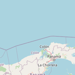
Map view of Altos de Campana National Park

Use this park location map to pinpoint Altos de Campana National Park in Panama, understand its exact geographic position, and read its mapped placement within the surrounding landscape more clearly.

Pigeon | © OpenStreetMap contributors

Location context for Altos de Campana National Park

Panamá Oeste Province
Park atlas

Trace the geographic distribution of national parks and compare protected landscapes near Altos de Campana National Park.

Explore Nearby National Parks and Protected Areas Surrounding Altos de Campana National Park

Browse national parks and protected areas located near Altos de Campana National Park, spanning diverse landscapes and crucial watershed zones within Panama's central geography. Compare their unique ecological features and observe patterns in regional conservation efforts; understand their broader roles within the Talamanca mountain range ecosystem.
National parkColón Province
About 51 km away#1 closest

Northeast

Soberanía National Park: Panama National Park Atlas, Geography, and Protected Landscape Details

Explore the mapped boundaries and regional geography of this national park.

Investigate Soberanía National Park, a designated national park situated in Panama's Colón Province. This entry offers detailed geographic context, focusing on its mapped protected area, landscape character, and role within regional conservation. Understand the spatial distribution and atlas significance of this protected land, essential for a structured geographic discovery of Panama's natural heritage.

Area
220 km²
Established
1980
IUCN
II
Relief
Lowland
National parkPanama
About 54 km away#2 closest

Northeast

Metropolitan Natural Park: Urban Protected Area and Forest Geography in Panama

Tracing the boundaries of a rare city-based wildlife refuge

Metropolitan Natural Park offers a significant study of urban conservation in Panama, protecting 265 hectares of Pacific tropical dry forest. Situated along the Panama Canal watershed, the terrain provides essential forest connectivity and diverse microhabitats, serving as a critical sanctuary within the dense metropolitan fabric of Panama City.

Area
2.65 km²
Established
1985
IUCN
II
Relief
Upland
Wildlife reservePanama City
About 54 km away#3 closest

Northeast

Metropolitan Natural Park: Protected Tropical Forest in Panama City

Mapping the Pacific watershed and urban wildlife corridors

Metropolitan Natural Park stands as a rare wildlife refuge, protecting a dense secondary tropical dry forest ecosystem inside the capital. The park boundary encompasses forested slopes and ridgelines that look out over the Panama Canal, providing a unique intersection of intact biodiversity and urban geography.

Area
2.65 km²
Established
1985
Relief
Lowland
Climate
Tropical
National parkPanama
About 72 km away#4 closest

West

Omar Torrijos "El Cope" National Park: Mapped Boundaries and Protected Landscape in Panama

Explore the geographic setting and natural terrain of this Panamanian national park.

Omar Torrijos "El Cope" National Park is a designated protected area offering rich opportunities for geographic discovery. Users can explore its mapped boundaries, understand its place within Panama's natural landscapes, and gain insight into the park's regional geographic context. This page provides a structured atlas-style view, highlighting the park's identity as a significant protected landform within Central America.

IUCN
II
Scope
Terrestrial
National parkPanamá Province
About 91 km away#5 closest

Northeast

Chagres National Park: National Park Protected Landscape Atlas

Discover geographic boundaries and natural terrain context.

Chagres National Park is a crucial protected area situated in Panamá Province, Panama. This page serves as an atlas-style gateway to understanding its specific geographic identity, mapped boundaries, and the surrounding natural terrain. It is designed for users seeking detailed insights into the park's protected landscape and its contribution to regional geography and conservation mapping efforts.

Area
1,290 km²
Established
1985
IUCN
II
Relief
Upland
National parkHerrera Province
About 94 km away#6 closest

Southwest

Sarigua National Park: A Protected National Park Landscape in Herrera Province

Explore mapped boundaries and regional geographic context.

Sarigua National Park represents a significant protected area within Herrera Province, Panama. This page details its identity as a national park, emphasizing its mapped geography and the regional context it inhabits. Users seeking to understand the specific protected landscape, its boundaries, and its place within the broader atlas of natural areas will find comprehensive discovery-oriented content.

IUCN
II
Relief
Lowland
Climate
Tropical
Access
Access unknown
Wildlife reserveLos Santos Province
About 120 km away#7 closest

South

Isla Iguana Wildlife Refuge: A Protected Island and Coral Reef Sanctuary in Los Santos Province

Mapping the terrestrial and marine boundaries of a key Panamanian wildlife refuge.

Isla Iguana Wildlife Refuge encompasses a unique blend of tropical dry forest and expansive coral reef systems. Located off the coast of the Los Santos Province, the refuge serves as an important Pacific habitat for nesting sea turtles and migratory whales. This detailed overview covers the island's layered coastal topography, reef structures, and its role as a critical protected area within the marine geography of Panama.

Area
0.53 km²
Established
1981
Relief
Lowland
Scope
Mixed
Wildlife reserveGuna Yala
About 148 km away#8 closest

Northeast

Nargana Wilderness Area: Protected Landscapes of the Guna Yala Caribbean Slope

A vertical transect of tropical rainforest and mountain terrain

The Nargana Wilderness Area represents a significant wildlife reserve in Panama, encompassing 954 square kilometres of diverse tropical ecosystems. Stretching from sea level to the San Blas ridge, the reserve showcases a continuous sequence of coastal lowlands and submontane habitats. This indigenous-governed region offers a unique geographic study of forest stratification and ecological connectivity along the Continental Divide, providing a protected mosaic of habitats that are essential to the broader Guna Yala landscape.

Area
954.14 km²
Established
1994
Relief
Mountain
Climate
Tropical

Common questions about visiting, size, designation, and location context for Altos de Campana National Park

Altos de Campana National Park FAQs for park facts, access, geography, and protected area context

Find quick answers about Altos de Campana National Park, including protected-area facts, park geography, trail and visitor context, and how the park fits into its surrounding country and regional landscape.
MoriAtlas Explorer

Continue Your Protected Areas Search Across the Global Atlas

Deepen your exploration by continuing the structured search for national parks and protected areas worldwide. Utilize the comprehensive filtering capabilities to compare different conservation landscapes and refine your understanding of global park geography. Discover more about the distribution and characteristics of protected natural areas.

Global natural geography