Mori Atlas logo
National parkPiedras Blancas National Park

Explore the mapped boundaries and regional geography of this national park in Puntarenas Province.

Piedras Blancas National Park: Protected Landscape Atlas and Geographic Context

Piedras Blancas National Park represents a significant protected natural landscape within Costa Rica's Puntarenas Province. As a designated national park, its mapped boundaries define an area critical for understanding regional geography and conservation efforts. This atlas entry provides essential context for exploring the park's terrain, protected status, and its position within the broader geographic tapestry of its region, offering a factual basis for landscape discovery.

Tropical RainforestNeotropical BiodiversityPacific CoastOsa Conservation AreaCosta RicaMountain Forest

Piedras Blancas National Park

National park

Park overview

Structured park overview, official facts, and landscape profile for Piedras Blancas National Park

Piedras Blancas National Park park facts, protected area profile, and essential visitor context
Review the core facts for Piedras Blancas National Park, including designation, size, terrain, visitor scale, habitats, and operating context in one park-focused overview.

About Piedras Blancas National Park

Piedras Blancas National Park occupies a significant position within Costa Rica's renowned system of protected areas, forming part of the Osa Conservation Area in the country's southern Pacific region. The park is located near the town of La Gamba in Puntarenas Province, protecting a landscape of exceptional ecological importance that encompasses both primary rainforest and coastal ecosystems along the Golfo Dulce. Thepark's establishment as a separate protected entity in 1999, after operating for eight years as the Esquinas Sector of Corcovado National Park, reflected the growing recognition of its distinct conservation value. The mountain forests within the park receive significant rainfall, supporting lush evergreen vegetation that represents some of the most intact forest cover in the region. The park's location adjacent to the Golfo Dulce places it within a biogeographically important zone where Pacific marine environments interface with terrestrial rainforest ecosystems. Conservation challenges in the decades following establishment included significant hunting pressure and habitat fragmentation, though increased ranger presence and land acquisition programs have substantially strengthened protection.

Quick facts and research context for Piedras Blancas National Park

Piedras Blancas National Park covers 34,642 acres (14,019 hectares) along the Pacific coast of southern Costa Rica in Puntarenas Province. The park was established on July 17, 1991 and is administered by Costa Rica's National System of Conservation Areas (SINAC) as part of the larger Osa Conservation Area. The terrain features rugged mountain slopes and watershed areas feeding into the Golfo Dulce, with dense evergreen tropical rainforest covering the landscape. The park was originally part of Corcovado National Park known as the Esquinas Sector before gaining separate status in 1999. Conservation partnerships involving the Costa Rican government, The Nature Conservancy, and private charitable organizations have enabled significant land acquisition to expand and consolidate the protected area.

Park context

Deeper park guide and search-rich context for Piedras Blancas National Park

Piedras Blancas National Park history, landscape, wildlife, and travel context
Explore Piedras Blancas National Park through its history, landscape character, ecosystems, wildlife, conservation priorities, cultural context, and seasonal travel timing in a structured park guide built for atlas discovery and search intent.

Why Piedras Blancas National Park stands out

Piedras Blancas is renowned for its exceptional biodiversity within the Osa Conservation Area, one of the most biologically intense regions in the world. The park protects significant populations of Neotropical predators including five feline species: jaguars, ocelots, margays, jaguarundis, and pumas, though these elusive animals remain difficult for visitors to observe. The mammal surveys conducted by Austrian researchers in 2003 and 2004 documented 96 species, with bats representing the richest group at 53 species. The amphibian and reptile diversity is equally impressive, with 37 amphibian species and 42 reptile species recorded in the Esquinas rainforest, including brightly colored species like red-eyed leaf frogs and poison-arrow frogs. The transition from a heavily logged landscape to a protected sanctuary represents one of the park's notable conservation success stories in Central America.

Piedras Blancas National Park history and protected-area timeline

The formal protection history of Piedras Blancas began in 1991 when the area was established as the Esquinas Sector of Corcovado National Park, reflecting the initial recognition of the forest's ecological significance within the broader Osa region. The park achieved independent status as a separate national park in 1999, distinguishing its conservation identity from the larger Corcovado protected area. Prior to and during the early years of protection, the forest faced severe threat from logging operations that endangered much of the vegetation cover through the mid-1990s. Conservation intervention intensified during the 2000s, with ranger numbers increasing from 6 to 16 between 2005 and 2007, significantly improving on-the-ground protection and reducing poaching. Parallel to government efforts, the Austrian charitable organization Regenwald der Osterreicher (Rainforest of the Austrians) launched fundraising and land purchase initiatives, acquiring 37 square kilometers of private land within the broader park area by 2008. Additional land purchases by the Costa Rican government, the hydroelectric company Tenaska (through carbon offset programs), The Nature Conservancy, and the Gordon and Betty Moore Foundation have expanded the total protected territory to more than 80 percent of the park's area.

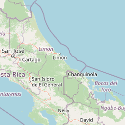
Piedras Blancas National Park landscape and geographic character

The physical geography of Piedras Blancas features rugged mountainous terrain carved by the watersheds of the Esquinas and Piedras Blancas rivers, which descend from the interior highlands toward the Golfo Dulce on the Pacific coast. The park's elevation gradient creates diverse microclimates and supports the dense evergreen forest that characterizes the landscape. The terrain includes steep slopes, forest-lined watercourses, and the transition zone where rainforest meets coastal mangrove systems near the gulf. The Golfo Dulce itself represents a distinctive marine feature, a tropical inlet that provides important habitat for marine species and contributes to the overall ecological complexity of the protected area. The combination of mountain forest and coastal wetland environments within a relatively compact protected area creates a landscape of considerable topographical and ecological diversity.

Piedras Blancas National Park ecosystems, habitats, and plant life

The ecological character of Piedras Blancas is defined by its position within the Osa Conservation Area, one of the most biodiversity-rich regions in the Americas. The dense evergreen forest that blankets the mountains and valleys supports exceptional species diversity across multiple taxonomic groups. The forest composition includes numerous rare tropical tree species that represent significant botanical value. The ecosystem supports complex food webs and habitat structures that sustain the documented 96 mammal species, 37 amphibian species, and 42 reptile species recorded within the park boundaries. The interaction between terrestrial forest ecosystems and the adjacent marine and mangrove environments of the Golfo Dulce creates additional ecological complexity and supports species that depend on multiple habitat types. The documented decline of the giant anteater from the park illustrates both the historical pressures on the ecosystem and the conservation challenges facing sensitive species.

Piedras Blancas National Park wildlife and species highlights

The mammalian fauna of Piedras Blancas ranks among the most diverse in Central America, with comprehensive surveys identifying 96 species including 14 carnivore species and 53 bat species. The feline community is particularly notable, with five species present: jaguars, ocelots, margays, jaguarundis, and pumas, though these secretive predators remain largely hidden from casual observation. Primate populations include white-faced capuchin monkeys, Central American squirrel monkeys, howler monkeys, and spider monkeys, with the latter species increasingly observed since 2006. The park supports populations of two-toed sloths, northern tamanduas, silky anteaters, and various opossum species including the Mexican mouse opossum, gray four-eyed opossum, and common opossum. Rodent diversity includes agoutis, pacas, and multiple species of mice, squirrels, and rats. The amphibian and reptile communities feature prominently colored species such as red-eyed leaf frogs and poison-arrow frogs, along with tree frogs, glass frogs, rain frogs, and cane toads. Reptile diversity encompasses basilisks, iguanas, anoles, geckos, and multiple snake species including the fer-de-lance, coral snakes, boa constrictors, and pit vipers. Spectacled caimans inhabit pond environments while American crocodiles can be observed in larger rivers and mangrove areas.

Piedras Blancas National Park conservation status and protection priorities

Piedras Blancas represents a significant conservation achievement in Costa Rica's protected area network, particularly given the severe logging pressures that threatened the forest through the mid-1990s. The transformation of a heavily exploited landscape into a protected sanctuary demonstrates the effectiveness of integrated conservation approaches combining government protection, NGO land acquisition, and private partnership. The expansion from initial park establishment to more than 80 percent protected territory through systematic land purchases by organizations including Regenwald der Osterreicher, The Nature Conservancy, and the Gordon and Betty Moore Foundation illustrates successful conservation financing models. The increase in ranger staffing from 6 to 16 personnel between 2005 and 2007 directly contributed to reduced poaching pressure and improved habitat protection. The park's integration into the Osa Conservation Area creates connectivity with adjacent protected lands including Corcovado National Park, supporting broader landscape-level conservation objectives for the region.

Piedras Blancas National Park cultural meaning and human context

The park exists within a landscape of small communities including La Gamba, which serves as the nearest settlement and provides access infrastructure for visitors. The Esquinas Lodge serves as a research and accommodation facility that has facilitated scientific study of the park's biodiversity while providing visitor services. Local communities have historical relationships with the forest landscape that predate formal protection, though the transition to national park status has necessarily reshaped land use patterns and resource access. The involvement of international organizations in land acquisition, particularly the Austrian charitable group Regenwald der Osterreicher, reflects the global interest in conserving this biologically significant region.

Top sights and standout views in Piedras Blancas National Park

The exceptional feline diversity featuring five Neotropical cat species, the remarkable bat fauna with 53 documented species representing the richest mammal group, the spectacular amphibian community including red-eyed leaf frogs and poison-arrow frogs, the transition from logging threat to successful conservation model, and the integration of mountain rainforest with coastal gulf ecosystems at the Golfo Dulce.

Best time to visit Piedras Blancas National Park

The optimal visiting period corresponds with the dry season, which typically runs from December through April, offering easier trail conditions and clearer weather for forest exploration. The wet season from May to November brings heavier rainfall that maintains the forest's lush appearance but can make trails more challenging. The monsoon season from May to November corresponds with the period of greatest amphibian activity, when frog calls create particularly memorable nocturnal soundscapes around the Esquinas Lodge. Wildlife observation is generally best during early morning hours when animals are most active, though the elusive large cats remain difficult to spot regardless of season due to their nocturnal and secretive nature.

Park location guide

Geography guide, regional context, and park location map for Piedras Blancas National Park

Piedras Blancas National Park park geography, regions, and map view in Costa Rica
Understand where Piedras Blancas National Park sits in Costa Rica through a broader geographic reading of the surrounding landscape, nearby location context, and its mapped position within the national park landscape.

How Piedras Blancas National Park fits into Costa Rica

Costa Rica is a Central American country with coastlines on both the Caribbean Sea and Pacific Ocean. It gained independence from Spain in 1821 and operates as a unitary presidential republic with no standing military. The economy has diversified from agriculture into finance, pharmaceuticals, and ecotourism.

Wider geography shaping Piedras Blancas National Park in Costa Rica

Costa Rica is located in Central America, bordered by Nicaragua to the north, the Caribbean Sea to the northeast, Panama to the southeast, and the Pacific Ocean to the southwest. It shares a maritime boundary with Ecuador. The terrain includes coastal plains, mountain ranges, and volcanic landscapes.

Map view of Piedras Blancas National Park

Use this park location map to pinpoint Piedras Blancas National Park in Costa Rica, understand its exact geographic position, and read its mapped placement within the surrounding landscape more clearly.

Pigeon | © OpenStreetMap contributors

Location context for Piedras Blancas National Park

Puntarenas Province
Park atlas

Understand the geographic context of adjacent protected areas and their conservation landscapes across Costa Rica's Southern Pacific region.

Explore Other National Parks and Protected Areas Near Piedras Blancas National Park
Explore other national parks and protected areas across Costa Rica's Osa Conservation Area and adjacent Southern Pacific coastal regions. This comparison offers valuable atlas context, highlighting shared conservation efforts, mapping regional biodiversity, and illustrating interconnected protected landscapes.
National parkCosta Rica

Corcovado National Park National Park: Costa Rica's Protected Landscape Geography and Map

Explore its mapped protected area boundaries and terrain.

Corcovado National Park offers a deep dive into its identity as a protected national park within Costa Rica. This atlas entry focuses on its specific geographic placement, the visual representation of its park boundaries on maps, and the character of its natural terrain. It provides essential structured data for understanding the park's role in the national protected area network and its unique position within the regional geography.

Area
424 km²
Established
1975
IUCN
II
Relief
Mixed relief
National parkCosta Rica

La Amistad International Park National Park: Mapped Protected Area in Costa Rica

Explore its geographic boundaries and landscape context.

La Amistad International Park represents a vital component of Costa Rica's protected land network. This detail provides an atlas-centric view, highlighting the park's mapped boundaries and its contribution to the regional geography. Understand the park's identity as a national park and explore its natural terrain context, crucial for any structured geographic discovery of protected areas within Central America.

Area
1,992 km²
Established
1988
IUCN
II
Relief
Mountain
National parkCartago Province

Chirripó National Park: A Protected Landscape within Cartago Province's Geography

Explore its mapped boundaries and natural terrain.

This page provides detailed geographic context for Chirripó National Park, a designated national park located in the Cartago Province of Costa Rica. It focuses on the park's protected landscape identity, its position within the regional geography, and its distinct mapped boundaries. Understanding Chirripó National Park through its geographic and atlas-centric attributes offers a foundational insight into its natural significance.

Area
508.49 km²
Established
1975
IUCN
II
Climate
Alpine
National parkCosta Rica

Los Quetzales National Park: Costa Rica National Park Landscape and Mapped Geography

Explore protected area boundaries and regional terrain context.

Los Quetzales National Park, a designated national park within Costa Rica, offers a focused entry point for exploring protected landscapes. This page provides detailed insight into the park's geographic setting, emphasizing its mapped boundaries and its role within the national atlas. Users can discover the specific landscape characteristics and regional terrain that define Los Quetzales National Park, enriching their understanding of Costa Rican protected areas.

Area
50 km²
Established
2006
IUCN
II
Relief
Mountain
National parkPuntarenas Province

Manuel Antonio National Park: Protected Landscape and Geographic Detail

Mapped boundaries and regional atlas context.

Delve into the protected landscape of Manuel Antonio National Park, a notable national park located in Puntarenas Province. This detail entry provides essential geographic context, focusing on mapped park boundaries and regional terrain. Understand its protected-area identity and its contribution to the natural atlas through detailed exploration tools designed for geographic discovery.

Area
275.87 km²
Established
1972
IUCN
II
Visitors
438.8K annual
National parkLimón Province

Cahuita National Park National Park: Geographic Atlas and Protected Landscape Identity

Explore mapped boundaries and regional context within Limón Province.

Gain an atlas perspective on Cahuita National Park, a designated national park situated in Limón Province, Costa Rica. This detailed entry focuses on its protected landscape character and geographic setting, offering insights into its mapped boundaries and its role within the region's natural geography. Understand the park's specific contribution to the protected area network through detailed geographic data.

Area
234.679 km²
Established
1982
IUCN
II
Relief
Lowland
National parkCosta Rica

Tapantí National Park: Costa Rica National Park Atlas and Mapped Landscape Exploration

Explore protected boundaries and natural terrain within its geographic setting.

Tapantí National Park is a designated national park in Costa Rica, offering specific insights into the country's protected natural landscapes. This page provides an atlas-style view of its geographic placement, the extent of its protected area, and the character of its natural terrain. Users can investigate the park's mapped context and understand its significance within the broader geography of Costa Rica, facilitating focused exploration of protected lands and regional landscape features.

Area
583.2 km²
Established
1982
IUCN
II
Relief
Mountain
Marine protected areaBocas del Toro Province

Isla Bastimentos National Marine Park: Marine Protected Area Geography and Atlas Context

Explore the protected landscape within Bocas del Toro Province.

Isla Bastimentos National Marine Park represents a critical marine protected area offering essential geographic data for atlas-based research. Situated in Panama's Bocas del Toro Province, this entity provides a focal point for understanding protected marine territories and their mapped extent. Discover the park's specific location within the province, contributing to a detailed regional geography and a broader understanding of conservation landscapes.

Area
132.26 km²
Established
1988
IUCN
II
Relief
Lowland

Common questions about visiting, size, designation, and location context for Piedras Blancas National Park

Piedras Blancas National Park FAQs for park facts, access, geography, and protected area context
Find quick answers about Piedras Blancas National Park, including protected-area facts, park geography, trail and visitor context, and how the park fits into its surrounding country and regional landscape.
MoriAtlas Explorer

Continue Your Protected Areas Search Across the Global Atlas

Deepen your exploration by continuing the structured search for national parks and protected areas worldwide. Utilize the comprehensive filtering capabilities to compare different conservation landscapes and refine your understanding of global park geography. Discover more about the distribution and characteristics of protected natural areas.

Global natural geography