Mori Atlas logo
National parkTapantí National Park

Trace the protected boundaries and natural terrain of Tapantí National Park within its regional geography.

Tapantí National Park: A National Park in Costa Rica for Geographic and Landscape Discovery

(Tapantí - Cerro de la Muerte Massif National Park)

Tapantí National Park stands as a significant protected area within Costa Rica, offering a unique lens for exploring the nation's geographic tapestry. This entry serves as a detailed atlas point for understanding the park's role as a national park, its mapped boundaries, and the natural landscapes it encompasses. Delve into the specific geography and protected land context that defines Tapantí National Park, providing a foundation for structured discovery of natural terrain and regional landscape characteristics.

cloud forestmontane forestTalamanca RangeCentral Americabiodiversity hotspotendemic species

Tapantí National Park

National park

Park overview

Structured park overview, official facts, and landscape profile for Tapantí National Park

Tapantí National Park park facts, protected area profile, and essential visitor context
Review the core facts for Tapantí National Park, including designation, size, terrain, visitor scale, habitats, and operating context in one park-focused overview.

About Tapantí National Park

Tapantí National Park occupies a remarkable position in Costa Rica's protected area network, guarding the northern slopes of the Talamanca Range, the highest mountain system in the country. The park's terrain is characterized by steep ridgelines, deep valleys, and numerous waterways that feed into the Orosí River system. This dramatic topography creates diverse microclimates and ecological zones within a relatively compact area, supporting transitions from pre-montane forest at lower elevations through lower montane rain forest to highest-elevation cloud forest habitats. The addition of the Cerro de la Muerte Massif in 2000 significantly expanded the park's ecological corridors, linking it with Los Quetzales National Park and creating a contiguous protected landscape that spans much of the Talamanca Range's western flank. The park's location near Cartago, one of Costa Rica's oldest cities, places it within the watershed that has historically supported agricultural communities in the fertile highland valleys.

Quick facts and research context for Tapantí National Park

Tapantí National Park covers 583.20 square kilometers along the Talamanca Range in Costa Rica's Central Conservation Area. The park sits at elevations ranging from 1,200 to 3,000 meters, protecting both pre-montane and lower montane rain forest ecosystems. It forms part of the La Amistad Biosphere Reserve, a UNESCO World Heritage Site, and contains a portion of the Turberas de Talamanca Ramsar wetland. The protected area is managed by Costa Rica's National System of Conservation Areas (SINAC).

Park context

Deeper park guide and search-rich context for Tapantí National Park

Tapantí National Park history, landscape, wildlife, and travel context
Explore Tapantí National Park through its history, landscape character, ecosystems, wildlife, conservation priorities, cultural context, and seasonal travel timing in a structured park guide built for atlas discovery and search intent.

Why Tapantí National Park stands out

Tapantí National Park is best known for its exceptional biodiversity and pristine cloud forest environments. The park protects critical habitat for approximately 45 mammal species and 400 bird species, including the endangered Baird's tapir and the iconic resplendent quetzal. Its montane forests support extraordinary orchid diversity, including three endemic Lepanthes species discovered in 2009 that are known only from this park. The area's Ramsar-designated peat bogs (Turberas de Talamanca) represent rare high-altitude wetland ecosystems.

Tapantí National Park history and protected-area timeline

Tapantí National Park was established on February 1, 1982, as part of Costa Rica's expanding national park system during a period of increasing environmental awareness in the country. The original designation protected the core cloud forest areas of the Tapantí region, recognizing the ecological significance of the Talamanca Range's montane forests. On January 14, 2000, the Cerro de la Muerte Massif was incorporated into the park, substantially increasing its area and ecological connectivity. The park's boundary with Los Quetzales National Park and the Los Santos Forest Reserve is partially defined by Route 2, the Inter-American Highway, creating both a management challenge and an important corridor for wildlife movement across what was once a more fragmented landscape. The Turberas de Talamanca wetland system within the park received Ramsar Convention designation in 2003, recognizing its international significance as a high-altitude peat bog ecosystem.

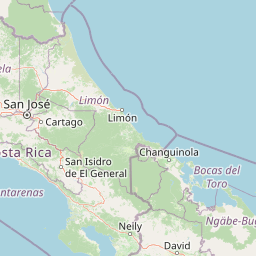
Tapantí National Park landscape and geographic character

The physical landscape of Tapantí National Park is dominated by the steep, rugged terrain of the Talamanca Range, with elevation changes of over 1,800 meters between the lowest valley floors and highest ridge crests. The park's forests are dissected by numerous streams and rivers that cascade down the mountain slopes, creating spectacular waterfalls visible from key visitor observation points. The vegetation creates a misty, atmospheric environment typical of cloud forests, where moisture-laden clouds settle on the forest canopy throughout much of the year. The geological foundation consists of ancient metamorphic rocks that have been uplifted through tectonic activity, creating the highland plateau and intervening valleys that characterize this section of the Cordillera Central. Higher elevations feature exposed rocky outcrops and more open páramo-like vegetation, while the middle elevations support the dense, species-rich cloud forest that gives the park its distinctive character.

Tapantí National Park ecosystems, habitats, and plant life

The ecological character of Tapantí National Park is defined by two primary forest types: pre-montane rain forest at lower elevations and lower montane rain forest in the higher regions. These cloud forest environments are characterized by constant moisture, frequent fog, and exceptionally high biodiversity. The canopy is typically covered in epiphytes, including numerous orchid species, bromeliads, and mosses that thrive in the humid atmosphere. The forest floor supports a dense understory of ferns, shrubs, and young trees, creating a challenging environment for visitors but an ideal habitat for countless species. The park's hydrological function is critical, with the peat bogs of the Turberas de Talamanca serving as natural water storage systems that regulate downstream water flow and filter sediments. These Ramsar-designated wetlands represent some of the highest-altitude peat bogs in Central America and provide habitat for specialized plant and animal species adapted to permanently saturated conditions.

Tapantí National Park wildlife and species highlights

Tapantí National Park supports an impressive mammalian fauna of approximately 45 species, with the large herbivorous Baird's tapir being one of the most notable and endangered inhabitants. The park's primate species include the white-faced capuchin monkey, while smaller mammals such as the kinkajou, paca, and agouti are commonly encountered. Predators present include the ocelot and jaguarundi, representing the park's top terrestrial predators. The bird population of around 400 species includes the spectacular resplendent quetzal, whose brilliant plumage makes it one of the most sought-after birds in Costa Rica. Other notable avifauna include sparrow hawks, emerald toucanets, and violaceous trogons. The park also supports 28 documented species of reptiles and amphibians, plus an extraordinarily diverse insect fauna that includes Thysania agrippina, the largest moth species in the Americas.

Tapantí National Park conservation status and protection priorities

Tapantí National Park plays a critical role in Costa Rica's conservation framework as a core component of the La Amistad Biosphere Reserve, which achieved UNESCO World Heritage status in 1983 and was extended in 1990. The park's Ramsar designation for the Turberas de Talamanca wetland in 2003 further elevates its international conservation profile, recognizing the importance of these high-altitude peat bogs as carbon stores and biodiversity habitats. The protected area serves as a biological corridor connecting Chirripó National Park with the broader Central Conservation Area, enabling wildlife movement across what would otherwise be fragmented habitats. The discovery of three new endemic orchid species in 2009 underscores the park's significance as a center of botanical endemism, with these miniature orchids known nowhere else on Earth.

Tapantí National Park cultural meaning and human context

While Tapantí National Park is primarily valued for its ecological significance, the Talamanca Range has historically been important to indigenous peoples, particularly the Cabécar indigenous group who maintain communities in the broader region. The park's proximity to Cartago places it within the historical heartland of Costa Rica, where the Spanish colonial capital was established in the XVI century. The mountainous terrain and forest resources have shaped regional land-use patterns over centuries, with traditional agricultural activities leaving an imprint on the surrounding landscape even as the core protected areas have been preserved.

Top sights and standout views in Tapantí National Park

The park's most distinctive features include its extensive cloud forest trail networks, the dramatic waterfalls visible from the visitor observatory, and the rare opportunity to observe resplendent quetzals in their natural habitat. The discovery of endemic orchid species has positioned Tapantí as a site of ongoing botanical significance, while the Ramsar-designated peat bogs offer unique wetland exploration opportunities rarely found in such high-altitude settings. The park's position along the Inter-American Highway provides relatively accessible mountain forest experiences for visitors traveling between Costa Rica's central valley and the southern regions.

Best time to visit Tapantí National Park

The most favorable period for visiting Tapantí National Park generally spans from December through April, which represents the dry season in Costa Rica's highlands. During these months, visitor access is typically easier and trail conditions are more favorable, though mountain mist and brief rain showers can still occur. The wet season from May through November brings higher precipitation and more challenging trail conditions, but also offers the characteristic cloud forest atmosphere at its most pronounced, with frequent mist creating the ethereal conditions the park is known for. Wildlife viewing opportunities remain consistent throughout the year, though bird activity may be more observable during the drier months when males are more visible as they move between feeding territories.

Park location guide

Geography guide, regional context, and park location map for Tapantí National Park

Tapantí National Park park geography, regions, and map view in Costa Rica
Understand where Tapantí National Park sits in Costa Rica through a broader geographic reading of the surrounding landscape, nearby location context, and its mapped position within the national park landscape.

How Tapantí National Park fits into Costa Rica

Costa Rica is a Central American country with coastlines on both the Caribbean Sea and Pacific Ocean. It gained independence from Spain in 1821 and operates as a unitary presidential republic with no standing military. The economy has diversified from agriculture into finance, pharmaceuticals, and ecotourism.

Wider geography shaping Tapantí National Park in Costa Rica

Costa Rica is located in Central America, bordered by Nicaragua to the north, the Caribbean Sea to the northeast, Panama to the southeast, and the Pacific Ocean to the southwest. It shares a maritime boundary with Ecuador. The terrain includes coastal plains, mountain ranges, and volcanic landscapes.

Map view of Tapantí National Park

Use this park location map to pinpoint Tapantí National Park in Costa Rica, understand its exact geographic position, and read its mapped placement within the surrounding landscape more clearly.

Pigeon | © OpenStreetMap contributors

Location context for Tapantí National Park

Central Conservation Area
Park atlas

Compare the diverse montane cloud forests and protected landscapes of the Talamanca Range.

Explore More National Parks and Protected Areas Surrounding Tapantí National Park, Costa Rica
Continue your atlas exploration beyond Tapantí National Park by browsing other national parks and protected areas in Costa Rica and its Central American region. Trace the geographic spread of montane cloud forests, compare diverse conservation landscapes, and understand regional protected area connectivity.
National parkCosta Rica

Los Quetzales National Park: Costa Rica National Park Landscape and Mapped Geography

Explore protected area boundaries and regional terrain context.

Los Quetzales National Park, a designated national park within Costa Rica, offers a focused entry point for exploring protected landscapes. This page provides detailed insight into the park's geographic setting, emphasizing its mapped boundaries and its role within the national atlas. Users can discover the specific landscape characteristics and regional terrain that define Los Quetzales National Park, enriching their understanding of Costa Rican protected areas.

Area
50 km²
Established
2006
IUCN
II
Relief
Mountain
National parkCartago Province

Irazú Volcano National Park: National Park Protected Area Atlas

Mapped Boundaries and Volcanic Terrain

Irazú Volcano National Park stands as a distinct protected area within the landscape of Cartago Province, Costa Rica. This page provides an atlas-centric view, detailing the park's mapped boundaries and its identity as a national park. Explore the volcanic geography and regional context, understanding its contribution to the protected lands of Central America.

Area
20 km²
Established
1955
IUCN
II
Relief
Mountain
National parkCosta Rica

Turrialba Volcano National Park: Mapped Geography and Protected Landscape Context in Costa Rica

Explore the protected area's natural terrain and regional atlas placement

Turrialba Volcano National Park is a key protected landscape in Costa Rica, offering distinct geographic features and environmental context for atlas exploration. This page details the park's mapped boundaries and its significance as a national park, providing a foundation for understanding its place within the country's diverse natural terrain. Discover the unique geographic identity of this protected area and its role in the regional landscape.

Area
16 km²
Established
1955
IUCN
II
Relief
Mountain
National parkLimón Province

Barbilla National Park: National Park Atlas Exploration and Geographic Context

Mapped protected landscape in Limón Province, Costa Rica

Barbilla National Park offers a focused view into Costa Rica's protected natural areas, specifically within the Limón Province. This entry provides an atlas-centric understanding of its geographic footprint and the character of its protected landscape. Explore the mapped boundaries and regional setting of this national park to enhance your structured geographic discovery.

Area
119 km²
Established
1982
IUCN
II
Relief
Mountain
National parkHeredia Province

Braulio Carrillo National Park: Costa Rica's Protected Landscape in Heredia Province

National Park Boundaries and Regional Geography Exploration

Braulio Carrillo National Park represents a vital protected area, offering deep insights into its geographic setting within Heredia Province. This entry provides a focused view on the park's mapped boundaries and its identity as a national park, contributing essential data for regional geography and landscape atlas exploration. Understand the character of its protected terrain and its place within the broader mapped context.

Area
475.8 km²
Established
1978
IUCN
II
Relief
Mountain
National parkCartago Province

Chirripó National Park: A Protected Landscape within Cartago Province's Geography

Explore its mapped boundaries and natural terrain.

This page provides detailed geographic context for Chirripó National Park, a designated national park located in the Cartago Province of Costa Rica. It focuses on the park's protected landscape identity, its position within the regional geography, and its distinct mapped boundaries. Understanding Chirripó National Park through its geographic and atlas-centric attributes offers a foundational insight into its natural significance.

Area
508.49 km²
Established
1975
IUCN
II
Climate
Alpine
National parkPuntarenas Province

Manuel Antonio National Park: Protected Landscape and Geographic Detail

Mapped boundaries and regional atlas context.

Delve into the protected landscape of Manuel Antonio National Park, a notable national park located in Puntarenas Province. This detail entry provides essential geographic context, focusing on mapped park boundaries and regional terrain. Understand its protected-area identity and its contribution to the natural atlas through detailed exploration tools designed for geographic discovery.

Area
275.87 km²
Established
1972
IUCN
II
Visitors
438.8K annual
National parkSan José Province

La Cangreja National Park: Costa Rican National Park with Distinct Protected Landscape Identity

Explore its mapped boundaries and regional geographic context in San José Province.

La Cangreja National Park serves as a key protected area within the geography of San José Province, Costa Rica. This page facilitates a deeper understanding of its specific landscape character and mapped terrain, crucial for users interested in the structured discovery of national parks and their geographic significance. Examine the park's identity as a protected national park and its placement within the broader atlas of natural landscapes.

Area
19 km²
Established
1987
IUCN
II
Relief
Mountain

Common questions about visiting, size, designation, and location context for Tapantí National Park

Tapantí National Park FAQs for park facts, access, geography, and protected area context
Find quick answers about Tapantí National Park, including protected-area facts, park geography, trail and visitor context, and how the park fits into its surrounding country and regional landscape.
MoriAtlas Explorer

Continue Your Protected Areas Search Across the Global Atlas

Deepen your exploration by continuing the structured search for national parks and protected areas worldwide. Utilize the comprehensive filtering capabilities to compare different conservation landscapes and refine your understanding of global park geography. Discover more about the distribution and characteristics of protected natural areas.

Global natural geography