Mori Atlas logo
National parkBarbilla National Park

Discover the mapped boundaries and regional context of this protected natural area in Limón Province.

Barbilla National Park: National Park Protected Landscape and Geographic Atlas

Barbilla National Park represents a significant protected natural landscape within Costa Rica's Limón Province. This dedicated page offers an atlas-focused exploration of its geographic identity, mapped park boundaries, and regional context. Understand its place as a national park within the broader natural geography of the area, providing structured data for landscape discovery and conservation mapping.

Tropical RainforestCaribbean LowlandsBig Cat HabitatBaird's TapirIndigenous TerritoryWatershed Protection

Barbilla National Park

National park

Park overview

Structured park overview, official facts, and landscape profile for Barbilla National Park

Barbilla National Park park facts, protected area profile, and essential visitor context
Review the core facts for Barbilla National Park, including designation, size, terrain, visitor scale, habitats, and operating context in one park-focused overview.

About Barbilla National Park

Barbilla National Park occupies a strategically important position on the eastern slopes of Costa Rica's Cordillera de Talamanca mountain range, where it protects a contiguous block of humid tropical forest that forms part of the larger La Amistad biosphere reserve complex. The park's terrain descends from the steep forested slopes of the Talamanca cordillera into lower elevation forest, creating a gradient of habitats that supports high biodiversity. Beyond its forest coverage, the protected area encompasses Laguna Ayil, a significant wetland waterbody, and Cerro Tigre, an important topographic feature within the park boundaries. The Dantas River, whose entire watershed falls within the park's boundaries, serves as the hydrological spine of the protected area and provides essential water resources for downstream communities and ecosystems. The park's location spanning two provinces, Cartago and Limón, reflects the ecological continuity of this Caribbean slope forest ecosystem. Access to the park remains challenging, with visitors arriving via an unpaved road extending approximately 17 kilometers from Siquirres, a journey taking roughly one hour. The park administrative facilities are situated outside the protected area in Brisas de Pacuarito, while the Barbilla Biological Station provides research infrastructure within the park boundaries. This relative inaccessibility has contributed to the park's ecological integrity by limiting development pressures and maintaining wilderness character.

Quick facts and research context for Barbilla National Park

Barbilla National Park covers 119 square kilometers (29,500 acres) of protected humid tropical forest in eastern Costa Rica, established in 1982 and managed by SINAC under IUCN Category II protection. The park protects the Dantas River watershed, a critical source of water for both wildlife and local communities in the region. Located on the Caribbean slope of the Cordillera de Talamanca, the terrain features rugged slopes descending from the mountain range into lowland forest. The park is notable for its small visitor numbers relative to other Costa Rican parks, which has helped maintain its ecological integrity. The Cabécar indigenous community maintains a significant presence in the area surrounding the park.

Park context

Deeper park guide and search-rich context for Barbilla National Park

Barbilla National Park history, landscape, wildlife, and travel context
Explore Barbilla National Park through its history, landscape character, ecosystems, wildlife, conservation priorities, cultural context, and seasonal travel timing in a structured park guide built for atlas discovery and search intent.

Why Barbilla National Park stands out

Barbilla National Park is best known for its well-preserved humid lowland tropical forest ecosystem and its role as a critical watershed protection area for the Dantas River basin. The park harbors rare and endangered megafauna including jaguars, ocelots, pumas, and Baird's tapir, making it significant for Neotropical predator conservation. The park also stands out for its indigenous cultural context, as it encompasses territory of the Cabécar people and sits adjacent to the Chirripó Indigenous Reserve. Combined with the presence of the Barbilla Biological Station for research, the park represents one of Costa Rica's most ecologically significant but least-disturbed protected areas on the Caribbean slope.

Barbilla National Park history and protected-area timeline

Barbilla National Park was established in 1982 as part of Costa Rica's expanding national park system during a period of increasing environmental awareness and protected area expansion. The creation of the park reflected growing recognition of the ecological importance of the Caribbean slope forests of the Cordillera de Talamanca and the need to protect watersheds critical for downstream communities. The park was incorporated into the Caribbean La Amistad Conservation Area, aligning it with the broader La Amistad International Park that spans the border with Panama. The decision to protect this area also acknowledged the presence of indigenous communities, particularly the Cabécar people, whose ancestral territories overlapped with the park boundaries. Over the subsequent decades, the park has been managed by the National System of Conservation Areas (SINAC), which coordinates conservation efforts across Costa Rica's protected areas. The establishment of the Barbilla Biological Station provided a research platform for scientific study of the park's ecosystems, though its remote location has limited extensive research compared to more accessible parks.

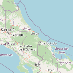
Barbilla National Park landscape and geographic character

The landscape of Barbilla National Park is characterized by humid tropical forest covering steep terrain on the Caribbean-facing slopes of the Cordillera de Talamanca. The terrain descends from higher elevations in the southern portions of the park, where the slopes of the main mountain range dominate, down to lower elevations in the northern sections. The Dantas River and its tributaries have carved valleys through the forest, creating the primary drainage system that defines the park's hydrology. Laguna Ayil represents a significant aquatic feature within the park, providing wetland habitat amid the surrounding forest. Cerro Tigre rises as a prominent topographic feature, offering varied microclimates and forest types across its slopes. The forest cover is dense and humid, typical of Caribbean slope tropical forest in Costa Rica, with high canopy and多层 vegetation structure. The trail system requires crossing the Dantas River, illustrating how the watercourse has shaped access and connectivity within the park. The overall visual character is one of unbroken tropical forest, largely free from the clearing or development that has altered much of Costa Rica's lowland Caribbean landscape.

Barbilla National Park ecosystems, habitats, and plant life

Barbilla National Park protects one of the most ecologically significant blocks of humid lowland tropical forest remaining on Costa Rica's Caribbean slope. The park's forest ecosystem supports high species diversity typical of Neotropical rainforests, with the humid conditions driven by moisture-laden Caribbean trade winds. The forest ranges from higher elevationcloud forestinfluenced areas on the lower slopes of the Cordillera down to lowland forest at the valley floors. The Dantas River watershed forms a functional ecological unit, with the river and its tributaries supporting aquatic and riparian habitats that interconnect with the surrounding forest. Laguna Ayil adds wetland habitat diversity to the protected area. The forest structure features multiple canopy layers, diverse epiphyte communities, and the complex species assemblages characteristic of intact tropical forest. The park's relative remoteness and low visitor pressure have allowed these ecosystems to remain in a relatively natural state compared to more accessible protected areas.

Barbilla National Park wildlife and species highlights

The wildlife of Barbilla National Park includes several rare and endangered megafauna species that find refuge in this relatively untouched forest. Jaguars, the largest cats in the Americas, are present in the park as apex predators maintaining ecological balance in the forest ecosystem. Ocelots and pumas also occur within the park, representing a suite of Neotropical felids that require extensive forest habitat and prey populations. Baird's tapir, a large herbivorous mammal listed as endangered, inhabits the forest and depends on the park's protected status for its continued survival in Costa Rica. These larger mammals indicate a functional ecosystem with sufficient prey base and habitat connectivity. The park's forest and wetland habitats also support diverse birdlife, smaller mammals, reptiles, and amphibians, though detailed species documentation remains limited compared to more studied parks. The presence of these flagship species, particularly the big cats and tapir, positions Barbilla as important for Neotropical mammal conservation.

Barbilla National Park conservation status and protection priorities

Barbilla National Park contributes significantly to Costa Rica's conservation estate by protecting a substantial block of intact humid tropical forest on the Caribbean slope. The park's protection of the entire Dantas River watershed provides essential ecosystem services, securing water quality and flow for downstream communities and agricultural areas in the region. The presence of endangered species including jaguars, pumas, ocelots, and Baird's tapir indicates the park's importance as a refuge for Neotropical wildlife in a region where habitat fragmentation has reduced forest connectivity. The park forms part of the larger La Amistad conservation complex, which includes international coordination with Panama for transboundary ecosystem protection. The park's classification as IUCN Category II reflects its primary objective of protecting natural ecosystems while allowing for limited sustainable visitor use. The relatively low visitation numbers, while limiting tourism revenue, have also reduced human impacts on the park's ecological processes.

Barbilla National Park cultural meaning and human context

Barbilla National Park holds significant cultural importance as the ancestral territory of the Cabécar people, who represent the second-largest indigenous group in Costa Rica. The park's establishment and ongoing management occur in the context of indigenous presence and traditional land use, with the Barbilla area having historical significance for Cabécar communities. The park is located adjacent to the Chirripó Indigenous Reserve, which encompasses territory of both Cabécar and other indigenous groups. The relationship between the park and indigenous communities involves complex considerations of territorial rights, traditional resource use, and conservation objectives. Access to the park passes through areas of indigenous farmland, illustrating the ongoing human presence in the landscape surrounding the protected area. The cultural context adds dimension to the park's conservation value, highlighting that protected area establishment in Costa Rica has intersected with indigenous territorial concerns.

Top sights and standout views in Barbilla National Park

Barbilla National Park stands out as one of Costa Rica's most ecologically significant yet least-visited protected areas, offering a wilderness experience in relatively unmodified tropical forest. The park provides opportunities to encounter endangered megafauna including jaguars, Baird's tapir, and other Neotropical cats in their natural habitat. The Dantas River and its protected watershed represent critical ecosystem services for the region, while Laguna Ayil adds wetland habitat diversity to the forest ecosystem. The presence of the Cabécar indigenous community and proximity to the Chirripó Indigenous Reserve provides cultural context uncommon in most of Costa Rica's national parks. The Barbilla Biological Station supports ongoing ecological research in this remote corner of Costa Rica's Caribbean slope.

Best time to visit Barbilla National Park

The optimal time to visit Barbilla National Park aligns with Costa Rica's dry season, typically running from December through April, when precipitation is reduced and trail conditions are more favorable for exploration. During these months, wildlife viewing opportunities may improve as animals concentrate around remaining water sources and forest canopy becomes less dense. The park's humid tropical climate means that rainfall occurs throughout the year, but the dry season offers more predictable conditions for visitors willing to venture to this remote location. Visitors should prepare for challenging access conditions, including the long unpaved road requiring a high-clearance vehicle and potentially difficult river crossings depending on recent rainfall. The park's low visitation numbers mean that facilities and services are limited compared to more accessible parks, requiring self-sufficiency in planning.

Park location guide

Geography guide, regional context, and park location map for Barbilla National Park

Barbilla National Park park geography, regions, and map view in Costa Rica
Understand where Barbilla National Park sits in Costa Rica through a broader geographic reading of the surrounding landscape, nearby location context, and its mapped position within the national park landscape.

How Barbilla National Park fits into Costa Rica

Costa Rica is a Central American country with coastlines on both the Caribbean Sea and Pacific Ocean. It gained independence from Spain in 1821 and operates as a unitary presidential republic with no standing military. The economy has diversified from agriculture into finance, pharmaceuticals, and ecotourism.

Wider geography shaping Barbilla National Park in Costa Rica

Costa Rica is located in Central America, bordered by Nicaragua to the north, the Caribbean Sea to the northeast, Panama to the southeast, and the Pacific Ocean to the southwest. It shares a maritime boundary with Ecuador. The terrain includes coastal plains, mountain ranges, and volcanic landscapes.

Map view of Barbilla National Park

Use this park location map to pinpoint Barbilla National Park in Costa Rica, understand its exact geographic position, and read its mapped placement within the surrounding landscape more clearly.

Pigeon | © OpenStreetMap contributors

Location context for Barbilla National Park

Cartago ProvinceLimón Province
Park atlas

Compare Protected Areas and Trace Regional Park Geography Near Barbilla National Park

Explore Other National Parks and Protected Areas Near Barbilla National Park
Continue your exploration beyond Barbilla National Park by discovering other national parks and protected areas across Costa Rica's Caribbean slope. Compare additional protected landscapes, trace regional park geography, and gain context on the diverse ecosystems found near Barbilla National Park.
National parkCosta Rica

Turrialba Volcano National Park: Mapped Geography and Protected Landscape Context in Costa Rica

Explore the protected area's natural terrain and regional atlas placement

Turrialba Volcano National Park is a key protected landscape in Costa Rica, offering distinct geographic features and environmental context for atlas exploration. This page details the park's mapped boundaries and its significance as a national park, providing a foundation for understanding its place within the country's diverse natural terrain. Discover the unique geographic identity of this protected area and its role in the regional landscape.

Area
16 km²
Established
1955
IUCN
II
Relief
Mountain
National parkCosta Rica

Tapantí National Park: Costa Rica National Park Atlas and Mapped Landscape Exploration

Explore protected boundaries and natural terrain within its geographic setting.

Tapantí National Park is a designated national park in Costa Rica, offering specific insights into the country's protected natural landscapes. This page provides an atlas-style view of its geographic placement, the extent of its protected area, and the character of its natural terrain. Users can investigate the park's mapped context and understand its significance within the broader geography of Costa Rica, facilitating focused exploration of protected lands and regional landscape features.

Area
583.2 km²
Established
1982
IUCN
II
Relief
Mountain
National parkCartago Province

Irazú Volcano National Park: National Park Protected Area Atlas

Mapped Boundaries and Volcanic Terrain

Irazú Volcano National Park stands as a distinct protected area within the landscape of Cartago Province, Costa Rica. This page provides an atlas-centric view, detailing the park's mapped boundaries and its identity as a national park. Explore the volcanic geography and regional context, understanding its contribution to the protected lands of Central America.

Area
20 km²
Established
1955
IUCN
II
Relief
Mountain
National parkCartago Province

Chirripó National Park: A Protected Landscape within Cartago Province's Geography

Explore its mapped boundaries and natural terrain.

This page provides detailed geographic context for Chirripó National Park, a designated national park located in the Cartago Province of Costa Rica. It focuses on the park's protected landscape identity, its position within the regional geography, and its distinct mapped boundaries. Understanding Chirripó National Park through its geographic and atlas-centric attributes offers a foundational insight into its natural significance.

Area
508.49 km²
Established
1975
IUCN
II
Climate
Alpine
National parkHeredia Province

Braulio Carrillo National Park: Costa Rica's Protected Landscape in Heredia Province

National Park Boundaries and Regional Geography Exploration

Braulio Carrillo National Park represents a vital protected area, offering deep insights into its geographic setting within Heredia Province. This entry provides a focused view on the park's mapped boundaries and its identity as a national park, contributing essential data for regional geography and landscape atlas exploration. Understand the character of its protected terrain and its place within the broader mapped context.

Area
475.8 km²
Established
1978
IUCN
II
Relief
Mountain
National parkCosta Rica

Los Quetzales National Park: Costa Rica National Park Landscape and Mapped Geography

Explore protected area boundaries and regional terrain context.

Los Quetzales National Park, a designated national park within Costa Rica, offers a focused entry point for exploring protected landscapes. This page provides detailed insight into the park's geographic setting, emphasizing its mapped boundaries and its role within the national atlas. Users can discover the specific landscape characteristics and regional terrain that define Los Quetzales National Park, enriching their understanding of Costa Rican protected areas.

Area
50 km²
Established
2006
IUCN
II
Relief
Mountain
National parkLimón Province

Tortuguero National Park: Protected Landscape and Regional Geographic Context

National Park mapped in Limón Province, Costa Rica.

Delve into Tortuguero National Park, a significant national park situated in Limón Province, Costa Rica. This entry offers detailed insights into its protected area status, mapped geographic extent, and its role within the regional natural landscape context. Ideal for users seeking a structured atlas view of protected lands and their geographical distribution, providing foundational data for understanding this specific conservation landscape.

Area
312 km²
Established
1975
IUCN
II
Visitors
10K annual
National parkLimón Province

Cahuita National Park National Park: Geographic Atlas and Protected Landscape Identity

Explore mapped boundaries and regional context within Limón Province.

Gain an atlas perspective on Cahuita National Park, a designated national park situated in Limón Province, Costa Rica. This detailed entry focuses on its protected landscape character and geographic setting, offering insights into its mapped boundaries and its role within the region's natural geography. Understand the park's specific contribution to the protected area network through detailed geographic data.

Area
234.679 km²
Established
1982
IUCN
II
Relief
Lowland

Common questions about visiting, size, designation, and location context for Barbilla National Park

Barbilla National Park FAQs for park facts, access, geography, and protected area context
Find quick answers about Barbilla National Park, including protected-area facts, park geography, trail and visitor context, and how the park fits into its surrounding country and regional landscape.
MoriAtlas Explorer

Continue Your Protected Areas Search Across the Global Atlas

Deepen your exploration by continuing the structured search for national parks and protected areas worldwide. Utilize the comprehensive filtering capabilities to compare different conservation landscapes and refine your understanding of global park geography. Discover more about the distribution and characteristics of protected natural areas.

Global natural geography