Mori Atlas logo
National parkBraulio Carrillo National Park

Discover mapped boundaries and regional context within Heredia Province's protected terrain.

Braulio Carrillo National Park: National Park Geography and Protected Landscape Atlas

Braulio Carrillo National Park stands as a significant protected landscape within Costa Rica's Heredia Province. This page offers a detailed geographic perspective, focusing on the park's mapped boundaries, its role as a national park, and the surrounding natural terrain. Explore how Braulio Carrillo National Park fits into the regional geography, providing a crucial piece of the protected areas atlas.

Cloud ForestVolcanic LandscapeBiodiversity hotspotPrimary ForestMountain ParksProtected Watershed

Braulio Carrillo National Park

National park

Park overview

Structured park overview, official facts, and landscape profile for Braulio Carrillo National Park

Braulio Carrillo National Park park facts, protected area profile, and essential visitor context
Review the core facts for Braulio Carrillo National Park, including designation, size, terrain, visitor scale, habitats, and operating context in one park-focused overview.

About Braulio Carrillo National Park

Braulio Carrillo National Park represents one of Costa Rica's most significant protected areas, encompassing a substantial portion of the Central American volcanic backbone within its borders. The park straddles the boundary between the Central Valley and the Caribbean lowlands, creating a unique ecological corridor that connects highland cloud forest environments with lowland tropical rainforest habitats. This geographic positioning has resulted in extraordinary species diversity, with the park containing portions of two major WWF ecoregions: Talamancan montane forests at higher elevations and Isthmian-Atlantic moist forests in the lower reaches. The Limon Highway, a major transportation corridor constructed during the mid-20th century, passes directly through the park and was the catalyst for the protected area's establishment, as environmental advocates successfully argued for conservation measures to prevent uncontrolled development along this route. Today, visitors can access the park from both the highway itself and from the Barva canton to the north, though the infrastructure remains limited compared to more heavily visited Costa Rican destinations.

Quick facts and research context for Braulio Carrillo National Park

Braulio Carrillo National Park occupies a strategic position along the volcanic Cordillera Central in central Costa Rica, roughly between San José and Puerto Limón. The park encompasses three main sectors named Zurquí, Quebrada Gonzales, and Barva, each offering distinct landscape characteristics. Its elevation ranges span nearly 3,000 meters, creating diversehabitat zones that support over 90 percent primary forest cover. The park protects critical watersheds including the Sarapiquí River basin and contains notable geological features such as Barva Volcano, several dormant volcanic peaks, and three crater lakes known as Barva, Danta, and Copey. The protected area was formally established in 1978 and is managed by Costa Rica's National System of Conservation Areas as part of the Central Conservation Area.

Park context

Deeper park guide and search-rich context for Braulio Carrillo National Park

Braulio Carrillo National Park history, landscape, wildlife, and travel context
Explore Braulio Carrillo National Park through its history, landscape character, ecosystems, wildlife, conservation priorities, cultural context, and seasonal travel timing in a structured park guide built for atlas discovery and search intent.

Why Braulio Carrillo National Park stands out

Braulio Carrillo is best known for its extraordinary biodiversity and the protection of transition zones between cloud forest and tropical rainforest ecosystems. The park harbors over 600 tree species, more than 530 bird species, and 135 mammal species, making it one of the most biodiverse areas in Costa Rica. Its volcanic landscape features Barva Volcano and several dormant peaks including Cerro Chompipe, Cerro Cacho Negro, and Cerros las Tres Marias. The park is also notable for the Súcio River, whose mineral-stained waters create a distinctive visual contrast against the surrounding green landscapes. Unlike many Costa Rican national parks that see heavy visitor traffic, Braulio Carrillo remains relatively undeveloped with minimal infrastructure, preserving a wilder character that appeals to experienced hikers and nature enthusiasts seeking more remote exploration opportunities.

Braulio Carrillo National Park history and protected-area timeline

The establishment of Braulio Carrillo National Park in 1978 represents a significant chapter in Costa Rica's conservation history, emerging from a period of rapid infrastructure development in the 1970s. The catalyst for protection was the construction of the Limon Highway, a major road project that would connect the capital city of San José to the Caribbean cargo port of Puerto Limón, dramatically improving transportation between the Central Valley and the coast. Environmental lobbyists and conservation advocates successfully negotiated with the government to preserve the natural areas flanking this new highway corridor, resulting in the park's creation as a buffer against development pressures. The park was named in honor of Braulio Carrillo, a former Costa Rican president whose administration during the mid-19th century had played a foundational role in the nation's early agricultural economy and, most notably, had overseen construction of the first road linking San José to the Caribbean coast. This historical connection to Costa Rica's early infrastructure development adds cultural significance to the park's identity.

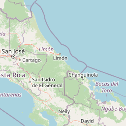
Braulio Carrillo National Park landscape and geographic character

The physical landscape of Braulio Carrillo National Park is defined by its position along the volcanic Cordillera Central, the chain of volcanoes and mountainous terrain that runs through the heart of Costa Rica. The park encompasses dramatic topographic variation, with elevations ranging from near sea level in the lower reaches to approximately 3,000 meters at the highest points, creating diverse terrain across its extent. Barva Volcano serves as a prominent geological anchor within the park, while several other volcanic peaks including Cerro Chompipe, Cerro Cacho Negro, and Cerros las Tres Marias remain dormant but contribute to the rugged mountain scenery. Three crater lakes dot the Barva sector, named Barva, Danta, and Copey, each formed within volcanic calderas and providing distinctive water features amid the forested landscape. The park is dissected by several significant waterways including the Sarapiquí River, which forms a major watershed within the protected area, along with the Hondura River, Patria River, and the visually striking Súcio River whose waters carry mineral deposits that give it a distinctive colored appearance.

Braulio Carrillo National Park ecosystems, habitats, and plant life

The ecological character of Braulio Carrillo National Park is defined by the exceptional diversity of habitats contained within its boundaries, resulting from the dramatic elevation range and geographic positioning between Costa Rica's Central Valley and Caribbean lowlands. Over 90 percent of the park's area remains covered in primary forest, representing some of the most intact woodland in Costa Rica. The protected area encompasses two distinct WWF ecoregions: Talamancan montane forests dominate the higher elevations where cloud forest conditions prevail, while Isthmian-Atlantic moist forests characterize the lower elevation zones. This habitat gradient supports remarkable plant diversity with over 600 tree species catalogued within the park boundaries. The combination of primary forest protection, watershed preservation, and the altitudinal range has made Braulio Carrillo one of the most biodiverse protected areas in Costa Rica, serving as a critical refuge for species adapted to both cloud forest and tropical rainforest conditions.

Braulio Carrillo National Park wildlife and species highlights

Braulio Carrillo National Park supports an impressive array of wildlife, with over 530 bird species, 135 mammal species, and numerous reptile and amphibian populations documented within its boundaries. The diverse avifauna includes several notable species such as the solitary eagle, the distinctive bare-necked umbrellabird, and numerous hummingbird species that thrive in the park's varied habitats. The mammalian fauna includes the venomous bushmaster snake, one of the largest venomous snakes in the Americas, which inhabits the forest understory. The area near Barva is particularly known for the elusive frog species Pristimantis altae, a specialized inhabitant of the cloud forest environment. The rivers and waterways within the park support aquatic ecosystems and provide drinking water access for wildlife throughout the protected area. The combination of primary forest habitat, structural complexity from the volcanic terrain, and the protection of watershed areas has created conditions that support these significant wildlife populations.

Braulio Carrillo National Park conservation status and protection priorities

Braulio Carrillo National Park plays a critical role in Costa Rica's conservation framework as part of the Central Conservation Area, a coordinated system of protected lands that preserve the nation's most significant natural environments. The park's establishment in 1978 represented an early success in balancing infrastructure development with environmental protection, demonstrating that conservation measures could be integrated into national planning decisions. The protection of the Sarapiquí River watershed and other water systems within the park provides downstream benefits for communities and agricultural lands beyond the protected boundaries. The high percentage of primary forest cover, exceeding 90 percent of the park's extent, makes this area particularly valuable for biodiversity conservation in a country where deforestation has historically been a significant concern. The diverse ecoregions represented within the park, from montane cloud forest to lowland rainforest, create a comprehensive conservation unit that protects ecological processes across environmental gradients.

Braulio Carrillo National Park cultural meaning and human context

The cultural context of Braulio Carrillo National Park is rooted in Costa Rica's 19th-century development history, as the protected area bears the name of Braulio Carrillo, a president whose administration helped shape the nation's early economic trajectory. President Braulio Carrillo's government during the 1840s prioritized agricultural development and, most relevant to the park's identity, oversaw construction of the first road connecting San José to the Caribbean coast. This pioneering infrastructure project established the corridor that would eventually become the route of the modern Limon Highway, the same transportation corridor that prompted the park's establishment over a century later. The park exists within a landscape that has been influenced by human activity for generations, as the surrounding regions include agricultural lands and communities that interact with the protected area. The naming itself reflects Costa Rica's practice of honoring historical figures through protected area designations, connecting contemporary conservation efforts to the nation's broader historical narrative.

Top sights and standout views in Braulio Carrillo National Park

The standout features of Braulio Carrillo National Park include its remarkable biodiversity with over 600 tree species and 530 bird species, its volcanic landscape featuring Barva Volcano and three crater lakes, and the protection of critical watershed areas including the Sarapiquí River basin. The park offers relatively undeveloped wilderness compared to more accessible Costa Rican destinations, with over 90 percent primary forest cover and limited visitor infrastructure creating a more authentic exploration experience. The Súcio River provides a visually distinctive natural feature with its mineral-colored waters, while the multiple volcanic peaks create varied topography for hiking and scenic viewing. The three main sectors of Zurquí, Quebrada Gonzales, and Barva each offer distinct environments and trail opportunities, from challenging multi-day routes connecting to the La Selva Protected Zone to shorter paths with panoramic views.

Best time to visit Braulio Carrillo National Park

The optimal time to visit Braulio Carrillo National Park depends on the type of experience sought, with Costa Rica's dry season from December through April generally offering more comfortable conditions for hiking and outdoor exploration. During these months, rainfall is reduced and trail conditions tend to be more stable, though the park's higher elevation zones can still experience cloud forest conditions with persistent moisture. The wet season from May through November brings more frequent rainfall, which maintains the lush cloud forest environment and creates dramatic waterfalls and full rivers, though trails can become slippery and more challenging to navigate. Wildlife viewing opportunities exist year-round, though bird activity may be more observable during the dry season when canopy density decreases slightly. Visitors should note that the park's infrastructure is limited compared to more heavily visited Costa Rican parks, so self-sufficiency in supplies and preparation is recommended regardless of when they choose to visit.

Park location guide

Geography guide, regional context, and park location map for Braulio Carrillo National Park

Braulio Carrillo National Park park geography, regions, and map view in Costa Rica
Understand where Braulio Carrillo National Park sits in Costa Rica through a broader geographic reading of the surrounding landscape, nearby location context, and its mapped position within the national park landscape.

How Braulio Carrillo National Park fits into Costa Rica

Costa Rica is a Central American country with coastlines on both the Caribbean Sea and Pacific Ocean. It gained independence from Spain in 1821 and operates as a unitary presidential republic with no standing military. The economy has diversified from agriculture into finance, pharmaceuticals, and ecotourism.

Wider geography shaping Braulio Carrillo National Park in Costa Rica

Costa Rica is located in Central America, bordered by Nicaragua to the north, the Caribbean Sea to the northeast, Panama to the southeast, and the Pacific Ocean to the southwest. It shares a maritime boundary with Ecuador. The terrain includes coastal plains, mountain ranges, and volcanic landscapes.

Map view of Braulio Carrillo National Park

Use this park location map to pinpoint Braulio Carrillo National Park in Costa Rica, understand its exact geographic position, and read its mapped placement within the surrounding landscape more clearly.

Pigeon | © OpenStreetMap contributors

Location context for Braulio Carrillo National Park

Cartago ProvinceHeredia ProvinceLimón ProvinceSan José Province
Park atlas

Browse the connected protected landscapes and regional park geography near Braulio Carrillo National Park.

Discover Other National Parks and Protected Areas Near Braulio Carrillo National Park
Explore additional national parks and protected areas in Costa Rica that share geographic proximity, ecological features, or volcanic landscapes with Braulio Carrillo National Park. Comparing these conservation landscapes provides a deeper understanding of regional biodiversity, the extent of cloud forests, and the broader protected area network.
National parkCartago Province

Irazú Volcano National Park: National Park Protected Area Atlas

Mapped Boundaries and Volcanic Terrain

Irazú Volcano National Park stands as a distinct protected area within the landscape of Cartago Province, Costa Rica. This page provides an atlas-centric view, detailing the park's mapped boundaries and its identity as a national park. Explore the volcanic geography and regional context, understanding its contribution to the protected lands of Central America.

Area
20 km²
Established
1955
IUCN
II
Relief
Mountain
National parkCosta Rica

Turrialba Volcano National Park: Mapped Geography and Protected Landscape Context in Costa Rica

Explore the protected area's natural terrain and regional atlas placement

Turrialba Volcano National Park is a key protected landscape in Costa Rica, offering distinct geographic features and environmental context for atlas exploration. This page details the park's mapped boundaries and its significance as a national park, providing a foundation for understanding its place within the country's diverse natural terrain. Discover the unique geographic identity of this protected area and its role in the regional landscape.

Area
16 km²
Established
1955
IUCN
II
Relief
Mountain
National parkAlajuela Province

Poás Volcano National Park: National Park Protected Landscape in Alajuela Province

Mapped park boundaries and regional terrain context.

Poás Volcano National Park represents a vital protected landscape within Costa Rica's Alajuela Province. This detail page offers an atlas-centric view, emphasizing the park's geographic identity, its specific mapped boundaries, and its significance as a national park. Explore the natural terrain and understand the regional context of this protected area, ideal for geographic discovery and landscape exploration.

Area
65 km²
Established
1971
IUCN
II
Relief
Mountain
National parkAlajuela Province

Juan Castro Blanco National Park: National Park Boundaries and Alajuela Province Geography

Explore the protected landscape within north-central Costa Rica.

Juan Castro Blanco National Park offers a distinct protected landscape for geographic study within Alajuela Province. This national park serves as a key entity for exploring mapped boundaries, understanding local terrain, and situating its protected area within the broader atlas of Costa Rica. Delve into the specific geographic context and natural landscape features that define this important park.

Area
145 km²
Established
1992
IUCN
II
Relief
Mountain
National parkCosta Rica

Tapantí National Park: Costa Rica National Park Atlas and Mapped Landscape Exploration

Explore protected boundaries and natural terrain within its geographic setting.

Tapantí National Park is a designated national park in Costa Rica, offering specific insights into the country's protected natural landscapes. This page provides an atlas-style view of its geographic placement, the extent of its protected area, and the character of its natural terrain. Users can investigate the park's mapped context and understand its significance within the broader geography of Costa Rica, facilitating focused exploration of protected lands and regional landscape features.

Area
583.2 km²
Established
1982
IUCN
II
Relief
Mountain
National parkCosta Rica

Los Quetzales National Park: Costa Rica National Park Landscape and Mapped Geography

Explore protected area boundaries and regional terrain context.

Los Quetzales National Park, a designated national park within Costa Rica, offers a focused entry point for exploring protected landscapes. This page provides detailed insight into the park's geographic setting, emphasizing its mapped boundaries and its role within the national atlas. Users can discover the specific landscape characteristics and regional terrain that define Los Quetzales National Park, enriching their understanding of Costa Rican protected areas.

Area
50 km²
Established
2006
IUCN
II
Relief
Mountain
National parkLimón Province

Barbilla National Park: National Park Atlas Exploration and Geographic Context

Mapped protected landscape in Limón Province, Costa Rica

Barbilla National Park offers a focused view into Costa Rica's protected natural areas, specifically within the Limón Province. This entry provides an atlas-centric understanding of its geographic footprint and the character of its protected landscape. Explore the mapped boundaries and regional setting of this national park to enhance your structured geographic discovery.

Area
119 km²
Established
1982
IUCN
II
Relief
Mountain
National parkSan José Province

La Cangreja National Park: Costa Rican National Park with Distinct Protected Landscape Identity

Explore its mapped boundaries and regional geographic context in San José Province.

La Cangreja National Park serves as a key protected area within the geography of San José Province, Costa Rica. This page facilitates a deeper understanding of its specific landscape character and mapped terrain, crucial for users interested in the structured discovery of national parks and their geographic significance. Examine the park's identity as a protected national park and its placement within the broader atlas of natural landscapes.

Area
19 km²
Established
1987
IUCN
II
Relief
Mountain

Common questions about visiting, size, designation, and location context for Braulio Carrillo National Park

Braulio Carrillo National Park FAQs for park facts, access, geography, and protected area context
Find quick answers about Braulio Carrillo National Park, including protected-area facts, park geography, trail and visitor context, and how the park fits into its surrounding country and regional landscape.
MoriAtlas Explorer

Continue Your Protected Areas Search Across the Global Atlas

Deepen your exploration by continuing the structured search for national parks and protected areas worldwide. Utilize the comprehensive filtering capabilities to compare different conservation landscapes and refine your understanding of global park geography. Discover more about the distribution and characteristics of protected natural areas.

Global natural geography