Mori Atlas logo
National parkMariala National Park

Discover the mapped terrain and protected landscape of this significant semi-arid region.

Mariala National Park: Queensland's First Mulga Lands National Park Atlas

Mariala National Park represents a pivotal conservation achievement in Queensland, Australia, safeguarding the distinctive semi-arid landscapes of the Mulga Lands bioregion. This national park protects vast areas of mulga woodland, saltbush plains, and crucial river catchments west of Brisbane, offering a unique glimpse into inland Australia's natural heritage. Users can explore its mapped boundaries, understand its regional geographic context within Queensland, and appreciate its importance as a protected landscape.

Mulga LandsQueensland National ParksSemi-arid WildernessBirdwatchingRemote OutbackConservation Significance

Mariala National Park

National park

Park overview

Structured park overview, official facts, and landscape profile for Mariala National Park

Mariala National Park park facts, protected area profile, and essential visitor context
Review the core facts for Mariala National Park, including designation, size, terrain, visitor scale, habitats, and operating context in one park-focused overview.

About Mariala National Park

Mariala National Park protects a representative sample of the Mulga Lands, one of Australia's key arid and semi-arid bioregions. The Mulga Lands are characterized by dense woodlands of Acacia aneura (mulga) interspersed with saltbush and bluebush plains, spinifex grasslands, and drainage systems that feed into ephemeral river systems. This landscape supports a distinctive suite of flora and fauna adapted to the region's variable rainfall and extreme temperatures. The park's location within the catchments of the Bulloo, Paroo and Warrego rivers connects it to broader drainage systems that flow into Lake Eyre, one of Australia's most significant inland lake systems. The remote nature of the park, situated far from major population centers, contributes to its ecological integrity and the preservation of relatively unmodified habitats.

Quick facts and research context for Mariala National Park

Mariala National Park occupies 269.2 km² in South West Queensland within the Mulga Lands bioregion. The area was part of the Ambathala pastoral holding from 1875 until the early 1980s, when it was set aside as a scientific reserve in 1982, making it the first protected area to conserve Queensland's Mulga Lands. The park was formally declared a national park a decade later in 1992 and is managed by the Queensland Parks and Wildlife Service. Six rare or threatened species have been recorded within the park, including Major Mitchell's cockatoo and the square-tailed kite.

Park context

Deeper park guide and search-rich context for Mariala National Park

Mariala National Park history, landscape, wildlife, and travel context
Explore Mariala National Park through its history, landscape character, ecosystems, wildlife, conservation priorities, cultural context, and seasonal travel timing in a structured park guide built for atlas discovery and search intent.

Why Mariala National Park stands out

Mariala National Park is best known for its role as the first protected area to preserve Queensland's Mulga Lands bioregion, representing a significant conservation milestone for this distinctive semi-arid landscape. The park protects extensive mulga woodland communities that characterize much of inland Queensland's pastoral zone, as well as supporting populations of rare and threatened bird species. The transition from working pastoral station to scientific reserve to national park illustrates the evolution of conservation thinking in Queensland's arid interior.

Mariala National Park history and protected-area timeline

The land that now comprises Mariala National Park was part of the Ambathala pastoral holding, which operated as a sheep and cattle station from 1875 until the early 1980s. The conversion of this pastoral property to protected status reflects broader changes in Australian land management thinking during the late twentieth century. In 1982, the area was declared a scientific reserve, making it the first protected area established specifically to preserve the Mulga Lands bioregion of Queensland. This designation acknowledged the ecological significance of mulga woodland communities and the need to protect representative examples of this largely unmodified landscape. A decade after its establishment as a scientific reserve, the area was formally declared a national park in 1992, providing it with the highest level of protection under Queensland's national park framework. Management of the park rests with the Queensland Parks and Wildlife Service.

Mariala National Park landscape and geographic character

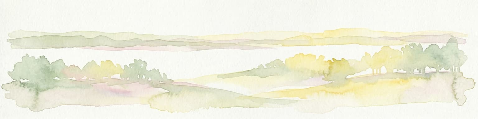
The landscape of Mariala National Park is典型 of the Mulga Lands bioregion, featuring extensive gently undulating plains dominated by dense mulga woodland. The terrain is characterized by flat to low-relief topography with occasional rises and dune formations. The drainage systems feeding into the Bulloo, Paroo and Warrego rivers create linear corridors of vegetation that contrast with the surrounding woodland plains. The region's soils are typically neutral to alkaline red earths and sands that support the distinctive mulga communities. This semi-arid landscape experiences high summer temperatures and variable winter rainfall, with vegetation patterns reflecting the complex interaction of soil type, moisture availability and fire history.

Mariala National Park ecosystems, habitats, and plant life

The Mulga Lands bioregion supports a distinctive ecological community adapted to Australia's arid interior. Mariala National Park protects representative examples of mulga woodland, which forms dense stands of the deeply rooted Acacia aneura across much of inland Queensland. These woodlands provide habitat for a range of vertebrate species and form the structural backbone of the ecosystem. The park also incorporates saltbush and bluebush plains that add diversity to the vegetation structure. The water catchment areas within the park, feeding the Bulloo, Paroo and Warrego river systems, create important riparian zones that support additional species and provide ecological connectivity to broader landscape processes.

Mariala National Park wildlife and species highlights

Mariala National Park supports at least six rare or threatened species, highlighting its conservation significance beyond just protecting representative vegetation communities. Major Mitchell's cockatoo (Lophochroa leadbeateri), one of Australia's most distinctive large parrots, occurs in the park's mulga woodlands. The square-tailed kite (Lophochetus isurus), a medium-sized raptor with distinctive flight characteristics, has also been recorded within the park. These species represent the birdlife component of the park's biodiversity, with the mulga woodland providing nesting and foraging habitat. The park's position in the Mulga Lands places it within a region that supports both temperate and tropical wildlife elements, reflecting the biogeographic complexity of Australia's arid zones.

Mariala National Park conservation status and protection priorities

Mariala National Park represents a conservation milestone as the first protected area established to preserve Queensland's Mulga Lands bioregion. Prior to its 1982 declaration as a scientific reserve, the extensive mulga woodlands of inland Queensland remained largely unprotected despite their ecological significance. The park protects representative examples of this bioregion's characteristic vegetation communities, including mulga woodlands and associated drainage systems. The presence of six rare or threatened species, including listed birds such as Major Mitchell's cockatoo and square-tailed kite, underscores the park's importance for biodiversity conservation in a region where extensive pastoral development has modified much of the landscape.

Mariala National Park cultural meaning and human context

The Mariala area has a pastoral history dating back to the 1870s, with the Ambathala station operating from 1875 until the early 1980s. This pastoral heritage is part of the broader story of European settlement in South West Queensland, where large pastoral holdings transformed the semi-arid rangelands into sheep and cattle grazing country. The conversion of this pastoral property to protected status reflects changing attitudes toward land management and the recognition that representative examples of Australia's bioregions require formal protection.

Top sights and standout views in Mariala National Park

Mariala National Park offers visitors the opportunity to experience one of Queensland's least-modified arid landscapes, with extensive mulga woodlands, saltbush plains and the ecological corridors created by the park's river catchments. The park provides habitat for rare bird species including Major Mitchell's cockatoo and square-tailed kite in a setting that remains largely undeveloped. As the first protected area for Queensland's Mulga Lands, the park represents an important conservation achievement and protects landscapes that have survived largely intact despite surrounding pastoral development. The remote location near Adavale offers a genuine wilderness experience far from the more visited parks of coastal Queensland.

Best time to visit Mariala National Park

The cooler months from April to September generally offer more comfortable conditions for exploring Mariala National Park, with milder daytime temperatures making outdoor activities more pleasant. Summer months in South West Queensland can bring extreme heat, which limits outdoor activity and increases the importance of carrying adequate water and sun protection. The semi-arid environment means that rainfall is infrequent but can occur at any time of year, and the park's ephemeral water systems may respond to rainfall events with increased bird activity and vegetation response. Visitors to this remote park should be prepared for self-sufficiency, as facilities are limited in the Mulga Lands region.

Park location guide

Geography guide, regional context, and park location map for Mariala National Park

Mariala National Park park geography, regions, and map view in Australia
Understand where Mariala National Park sits in Australia through a broader geographic reading of the surrounding landscape, nearby location context, and its mapped position within the national park landscape.

How Mariala National Park fits into Australia

Australia is a constitutional monarchy and federal parliamentary democracy comprising six states and ten territories. With a population of nearly 28 million, it is one of the world's most urbanised countries, with most people concentrated on the eastern seaboard. The country has a high Human Development Index and is known for its cultural diversity, ancient Aboriginal heritage, and unique wildlife.

Wider geography shaping Mariala National Park in Australia

Australia occupies the entire Australian continent, the island of Tasmania, and numerous smaller islands. It is the world's flattest and driest inhabited continent, featuring vast deserts in the interior (the Outback), tropical rainforests along the eastern coast, and a coastline bordering the Indian and Pacific Oceans.

Map view of Mariala National Park

Use this park location map to pinpoint Mariala National Park in Australia, understand its exact geographic position, and read its mapped placement within the surrounding landscape more clearly.

Pigeon | © OpenStreetMap contributors

Location context for Mariala National Park

QueenslandShire of Quilpie
Park atlas

Explore the Surrounding Semi-arid Landscapes and Compare Other National Parks in Remote Outback Queensland

Discover More Protected Areas Near Mariala National Park, Queensland's Mulga Lands Gem
After exploring Mariala National Park, continue your geographic journey through Queensland's vast Mulga Lands to browse a curated list of nearby protected areas and similar conservation landscapes. Compare regional park characteristics, conservation priorities, and the spread of Australia's unique arid zone ecosystems, enriching your understanding of the protected terrain.
National parkQueensland

Tregole National Park: Queensland National Park with Significant Ooline Woodlands

Explore unique semi-arid protected landscape and Ooline tree stands.

Tregole National Park in Queensland, Australia, is a protected natural area celebrated for its remarkable Ooline tree concentrations. This park offers a rare look at pure Ooline stands within a hot, dry inland climate, showcasing a significant example of semi-arid ecosystems. Its landscape represents the meeting point of brigalow and mulga biospheres, providing valuable context for understanding Australia's diverse protected areas and geographic regions within the MoriAtlas framework.

Area
75.79 km²
Established
1995
IUCN
II
National parkQueensland

Chesterton Range National Park: Queensland National Park with Mapped Brigalow Belt Landscapes

Explore unique semi-arid woodlands and regional watershed geography.

Chesterton Range National Park offers a rich exploration of protected landscape identity within South West Queensland. This national park is crucial for conserving Brigalow Belt ecosystems, featuring diverse semi-arid woodlands across its ridgelines and valleys. Its role in protecting the headwaters for major waterways like the Warrego River and preserving habitats for threatened species makes it a significant site for understanding regional geography and conservation efforts in Australia. The park provides valuable insights into the mapped terrain and ecological importance of these unique natural landscapes.

Area
309.8 km²
Established
1992
IUCN
II
National parkQueensland

Lake Bindegolly National Park: A Mapped Protected Wetland Sanctuary in Queensland

Discover its rare flora and vital bird habitat in the Mulga Lands.

Lake Bindegolly National Park is a significant protected natural area situated in the Mulga Lands of Queensland, Australia. This national park preserves a unique three-lake system, essential for rare plant conservation and recognized internationally as an Important Bird Area. The transient wetlands within the park attract a remarkable diversity of bird species, especially waterfowl, making it a key destination for understanding inland Australian geography and the importance of protected landscapes.

Area
140 km²
Established
1991
IUCN
II
Relief
Lowland
National parkQueensland

Lochern National Park: Queensland's Outback River Channel Protected Landscape

Mapped boundaries and unique riparian ecosystems in Central West Queensland.

Lochern National Park protects a crucial segment of the Thomson River system, presenting an unexpected wetland environment within the arid interior of Queensland. This national park is celebrated for its network of channels and lagoons, which offer vital refuges for wildlife, particularly waterbirds, in a region where surface water is otherwise scarce. The landscape is characterized by the interplay between these riverine features and the dominant mulga and gidgee woodlands, creating a visually distinctive and ecologically important protected area.

Area
239.93 km²
Established
1994
IUCN
II
National parkQueensland

Currawinya National Park: Queensland's Ramsar Wetland and Mulga Lands National Park

Discover its arid landscape and protected area identity.

Currawinya National Park is a major protected area in Queensland, Australia, recognized for its significant Ramsar-listed wetland system, including Lakes Numalla and Wyara. These ephemeral lakes are vital drought refuges for waterbirds across inland Australia and represent a unique ecological feature within the park's expansive mulga lands landscape. The park also champions conservation initiatives, notably a large predator-exclusion enclosure for the greater bilby, showcasing its commitment to arid-zone biodiversity and landscape preservation.

Area
1,513 km²
Established
1991
IUCN
II
National parkQueensland

Thrushton National Park: Queensland's Mulga Lands National Park and Protected Landscape

Explore the semi-arid terrain and mapped conservation boundaries.

Thrushton National Park represents a crucial protected landscape within Queensland's Mulga Lands, preserving vast expanses of dense mulga scrub, spinifex sandplains, and dry woodlands. As a National Park, it offers a unique window into the semi-arid ecology of inland Australia, characterized by its subtly undulating terrain and sandy soils. This atlas-focused exploration highlights the park's distinctive vegetation communities and its regional geographic significance, providing a factual base for understanding this vital conservation area.

Area
256.52 km²
Established
1990
IUCN
II
National parkMaranoa Region

Carnarvon National Park: Mapped Geography and Protected Landscape Identity

Explore the sandstone gorges and ancient sites of Queensland's natural heritage.

Carnarvon National Park represents a significant protected area within the Maranoa Region of Queensland, Australia. This national park encompasses a vast expanse of approximately 2,980 square kilometers, primarily celebrated for its dramatic sandstone gorges, particularly Carnarvon Gorge, and its globally significant Aboriginal rock art sites. Positioned across the Great Dividing Range, the park's landscape features a compelling mix of deep valleys, sandy plains, and basalt-capped tablelands, offering rich cartographic and geographic context. Its designation as a national park underscores its importance for preserving these unique natural and cultural landscapes for atlas-based discovery.

Area
2,980 km²
Established
1932
IUCN
II
National parkAustralia

Culgoa National Park: Iconic Coolabah Woodlands and River Floodplain Landscapes of Australia

Explore mapped boundaries and regional geography in this New South Wales protected area.

Culgoa National Park is a premier example of a preserved semi-arid outback landscape in Australia, celebrated for its extensive and intact coolabah woodlands. This national park protects vital river floodplains and a chain of permanent waterholes along the Culgoa River, contributing significantly to the biodiversity of the Darling River catchment. Understanding its geographic setting and the mapped distribution of its unique vegetation communities offers deep insight into Australia's natural heritage.

Area
352.39 km²
Established
1996
IUCN
II

Common questions about visiting, size, designation, and location context for Mariala National Park

Mariala National Park FAQs for park facts, access, geography, and protected area context
Find quick answers about Mariala National Park, including protected-area facts, park geography, trail and visitor context, and how the park fits into its surrounding country and regional landscape.
MoriAtlas Explorer

Continue Your Protected Areas Search Across the Global Atlas

Deepen your exploration by continuing the structured search for national parks and protected areas worldwide. Utilize the comprehensive filtering capabilities to compare different conservation landscapes and refine your understanding of global park geography. Discover more about the distribution and characteristics of protected natural areas.

Global natural geography