Mori Atlas logo
National parkCulgoa National Park

Discover the remote outback landscapes and mapped boundaries of this vital protected area in New South Wales.

Culgoa National Park: Explore Australia's Largest Intact Coolabah Woodlands and River Floodplain Ecosystems

Culgoa National Park in Australia offers an unparalleled exploration of a vast, intact semi-arid landscape dominated by its iconic coolabah woodlands. This protected national park, situated in New South Wales, preserves extensive river floodplains along the Culgoa River, creating a unique mosaic of waterholes and wetlands. The park's significance lies in its commitment to safeguarding the largest remaining examples of coolabah woodland ecosystems, providing critical context for the region's natural geography and mapped terrain.

coolabah woodlandsriver floodplainsoutback landscapebirdwatchingsemi-arid ecosystemsDarling River catchment

Culgoa National Park

National park

Park overview

Structured park overview, official facts, and landscape profile for Culgoa National Park

Culgoa National Park park facts, protected area profile, and essential visitor context
Review the core facts for Culgoa National Park, including designation, size, terrain, visitor scale, habitats, and operating context in one park-focused overview.

About Culgoa National Park

Culgoa National Park represents a remarkable conservation achievement in one of Australia's most remote and sparsely populated regions. The park protects a living example of the floodplain ecosystems that once characterized much of the Darling River catchment before extensive agricultural development altered the landscape. The Culgoa River, a tributary of the Darling River system, flows through the park carrying seasonal flows that nourish the floodplain and refill the chain of permanent waterholes that sustain wildlife through the dry periods. The park's establishment in 1996 recognized the ecological significance of these floodplain woodlands and the biodiversity they support, while also preserving cultural connections to the Aboriginal people who have lived in this landscape for thousands of years and the colonial pastoralists who shaped its more recent history. Visitors to the park experience a landscape that remains close to its natural state, with the sounds of birdsong, the rustle of wind through the coolabah leaves, and the subtle movement of wildlife through the timbered plains.

Quick facts and research context for Culgoa National Park

Culgoa National Park occupies a significant stretch of the Culgoa River floodplain system in far northwestern New South Wales. The nearest town is Brewarrina, located 120 kilometres to the south. Established in April 1996 under the management of the NSW National Parks and Wildlife Service, the park protects a representative sample of the Darling River catchment ecosystem. The landscape is characterized by river red gum forests lining the permanent waterholes, interspersed with vast coolabah woodlands that dominate the floodplain zones. Over 150 bird species have been recorded within the park boundaries, including ten honeyeater species and six woodswallow species, making it a significant destination for ornithological study and birdwatching.

Park context

Deeper park guide and search-rich context for Culgoa National Park

Culgoa National Park history, landscape, wildlife, and travel context
Explore Culgoa National Park through its history, landscape character, ecosystems, wildlife, conservation priorities, cultural context, and seasonal travel timing in a structured park guide built for atlas discovery and search intent.

Why Culgoa National Park stands out

Culgoa National Park is most distinguished by its extraordinary coolabah woodlands, which form the most extensive and intact example of this ecosystem type in all of New South Wales. These distinctive trees, with their characteristic dark, deeply fissured bark and crooked forms, create a quintessential Australian outback visual identity across the park's floodplains. The park also protects significant stands of river red gums along the Culgoa River corridor, providing crucial habitat for aquatic and riparian wildlife. The combination of permanent waterholes, flowing river channels, and extensive floodplain wetlands makes this one of the most ecologically important semi-arid protected areas in the Murray-Darling Basin system.

Culgoa National Park history and protected-area timeline

The lands within Culgoa National Park have a deep human history spanning both Aboriginal occupation and colonial pastoral use. For thousands of years, Aboriginal people lived in this floodplain environment, drawing on the river's resources and the surrounding woodlands for food, shelter, and cultural practices. During the colonial era, the region was taken up for pastoral grazing, and the area became part of the pastoral industry that defined much of inland New South Wales. The remnants of this pastoral era, including stockyards, homestead foundations, and other structures, remain visible throughout the park today, providing tangible evidence of this more recent chapter in the landscape's history. The park was formally established in April 1996 as part of the expansion of New South Wales' national park system, recognizing both the ecological significance of the floodplain ecosystems and the cultural importance of the area. Management of the park falls to the NSW National Parks and Wildlife Service, which works to protect the natural values while allowing visitors to experience this distinctive outback landscape.

Culgoa National Park landscape and geographic character

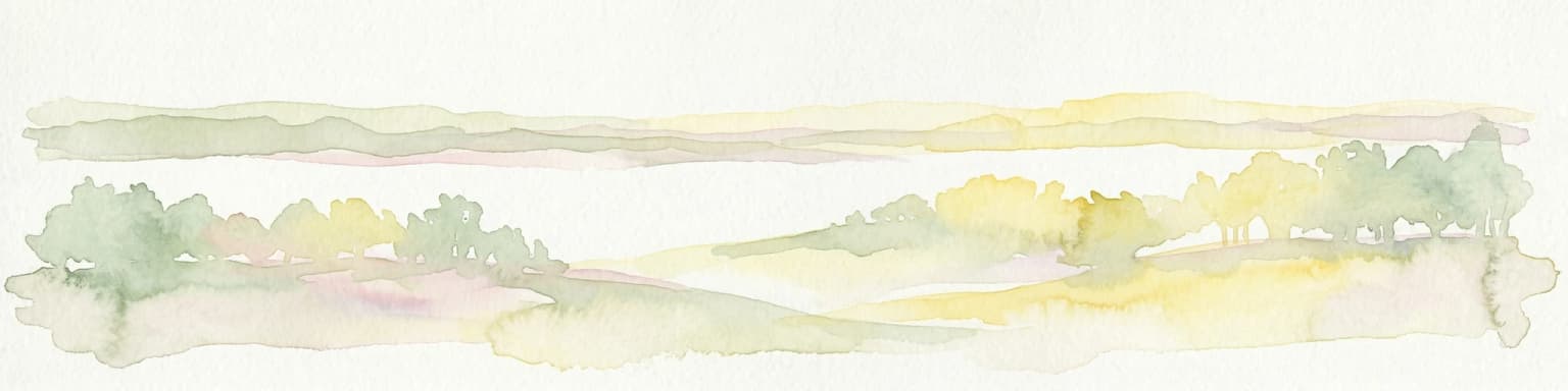
The physical landscape of Culgoa National Park is defined by the floodplain of the Culgoa River and the distinctive vegetation communities it supports. The river itself flows through the park in a generally southerly direction, creating a chain of permanent waterholes that are critical refuges for wildlife during dry periods. Between these waterholes, the river may shrink to isolated pools or disappear entirely during drought conditions, revealing the sandy and muddy riverbed. The floodplain on either side of the river extends outward, creating flat to gently undulating terrain covered in the park's signature coolabah woodlands. These trees grow in dense stands across the floodplain, their dark bark contrasting sharply with the pale trunks of the river red gums that line the watercourse. The overall effect is a landscape of extraordinary visual distinction, with the silver-grey canopy of the coolabah creating a undulating sea across the flat terrain, punctuated by the darker green of the river corridors. The surrounding terrain is generally flat, reflecting the ancient, heavily weathered landscape of the interior.

Culgoa National Park ecosystems, habitats, and plant life

The ecological character of Culgoa National Park is defined by its floodplain ecosystems and the vegetation communities adapted to the variable water regimes of the semi-arid interior. The coolabah woodlands represent the dominant vegetation type, forming dense stands across the floodplain that create a habitat structure unlike anywhere else in New South Wales. These trees are perfectly adapted to the floodplain environment, capable of withstanding both drought and inundation. The river red gum forests that line the waterholes provide a different habitat structure, with their tall straight trunks and more open canopy creating conditions suitable for different wildlife communities. The park sits within the broader context of the Darling River catchment, one of Australia's most important river systems, and the floodplain wetlands it protects represent some of the most intact examples of this ecosystem type remaining in the region. The seasonal patterns of the river, with periods of flow and drying, drive ecological processes throughout the park.

Culgoa National Park wildlife and species highlights

Culgoa National Park supports an impressive diversity of wildlife, particularly avifauna, with over 150 bird species recorded within its boundaries. The bird communities are particularly diverse and include ten species of honeyeaters, which feed on nectar from the park's flowering trees, and six species of woodswallows, which are characteristic birds of the Australian interior. The permanent waterholes along the Culgoa River provide critical habitat for waterbirds, including ducks, grebes, and herons that depend on reliable water sources. The woodlands and forests support a range of mammals, including the common brushtail possum, which shelters in the hollows of river red gums, and the little pied bat, a small insectivorous bat species endemic to Australia. The dense coolabah woodlands provide sheltered habitat for various reptiles and invertebrates, while the river itself supports fish and other aquatic organisms. The combination of permanent water, diverse vegetation structure, and relative remoteness from heavy human disturbance makes this an important refuge for wildlife in the semi-arid zone.

Culgoa National Park conservation status and protection priorities

The conservation significance of Culgoa National Park stems from its protection of one of the most extensive and intact examples of coolabah floodplain woodland remaining in New South Wales. This ecosystem type has been significantly reduced across its former range by agricultural development, water extraction, and vegetation clearing, making the protected stands within the park increasingly valuable. The park also protects a functioning floodplain ecosystem within the Darling River catchment, an system that has experienced substantial modification elsewhere in its extent. By preserving the natural flow patterns, waterhole habitats, and floodplain vegetation communities, the park maintains ecological processes that support both common and threatened species. The location along the Queensland border also means the park contributes to a network of protected areas that span the state boundary, supporting landscape-scale conservation across the floodplain system.

Culgoa National Park cultural meaning and human context

The cultural landscape of Culgoa National Park holds significance for both Aboriginal communities and the broader history of colonial pastoral development in inland Australia. The park lies within Country that has been inhabited by Aboriginal people for thousands of years, and the floodplain environment provided reliable resources for those who knew how to read its seasonal patterns. The park's establishment recognized the ongoing connection between Aboriginal people and this landscape. Following European colonization, the region was taken up for pastoral runs, and the pastoral industry became the dominant human presence in the area. The remnants of this pastoral era, including stone foundations, stockyards, and other structures, can be found throughout the park and serve as physical reminders of this period. The Aboriginal people who worked as pastoralists on these runs following colonization left their own cultural imprint on the landscape, blending traditional knowledge with new land uses.

Top sights and standout views in Culgoa National Park

The coolabah woodlands of Culgoa National Park represent its most distinctive feature, with the park protecting the largest and most intact examples of this ecosystem in New South Wales. The chain of waterholes along the Culgoa River provides scenic focal points throughout the park, particularly where the tall river red gums create cathedral-like passages along the water's edge. Birdwatchers will find exceptional opportunities to observe diverse avifauna, with over 150 species including numerous honeyeaters and woodswallows. The sense of remoteness and the feeling of being in true outback country is a highlight for visitors seeking natural landscapes relatively unchanged by modern development. The historical remnants of the pastoral era add cultural depth to the natural experience, connecting visitors to the human history that shaped this landscape.

Best time to visit Culgoa National Park

The best time to visit Culgoa National Park depends on what visitors hope to experience, but generally the cooler months from autumn through to spring offer the most comfortable conditions for exploring the park. Winter nights can be cold, but daytime temperatures are mild and pleasant for walking and wildlife observation. Spring brings flowering of many trees and shrubs, attracting birdlife to the nectar sources and creating vibrant colour throughout the woodlands. Summer heat can be intense in this semi-arid region, but the early morning and late afternoon hours remain suitable for activities, and the waterholes provide focal points for wildlife at these times. The park can be accessed year-round, though visitors should be aware that road conditions may vary with seasonal weather and that the remote location requires self-sufficiency in terms of supplies and vehicle preparation.

Park location guide

Geography guide, regional context, and park location map for Culgoa National Park

Culgoa National Park park geography, regions, and map view in Australia
Understand where Culgoa National Park sits in Australia through a broader geographic reading of the surrounding landscape, nearby location context, and its mapped position within the national park landscape.

How Culgoa National Park fits into Australia

Australia is a constitutional monarchy and federal parliamentary democracy comprising six states and ten territories. With a population of nearly 28 million, it is one of the world's most urbanised countries, with most people concentrated on the eastern seaboard. The country has a high Human Development Index and is known for its cultural diversity, ancient Aboriginal heritage, and unique wildlife.

Wider geography shaping Culgoa National Park in Australia

Australia occupies the entire Australian continent, the island of Tasmania, and numerous smaller islands. It is the world's flattest and driest inhabited continent, featuring vast deserts in the interior (the Outback), tropical rainforests along the eastern coast, and a coastline bordering the Indian and Pacific Oceans.

Map view of Culgoa National Park

Use this park location map to pinpoint Culgoa National Park in Australia, understand its exact geographic position, and read its mapped placement within the surrounding landscape more clearly.

Pigeon | © OpenStreetMap contributors

Location context for Culgoa National Park

New South Wales
Park atlas

Explore the geographic context of national parks near Culgoa National Park, comparing coolabah woodlands and semi-arid floodplains across the region.

Discover National Parks and Protected Areas Near Culgoa, Tracing the Outback Landscapes of New South Wales
You can browse additional national parks and protected areas within the New South Wales outback, tracing geographic connections and comparing unique ecosystems to Culgoa National Park. Exploring these regional park lists offers a deeper understanding of Australia's semi-arid landscapes, floodplain habitats, and vital coolabah woodlands within their broader conservation context.
National parkQueensland

Thrushton National Park: Queensland's Mulga Lands National Park and Protected Landscape

Explore the semi-arid terrain and mapped conservation boundaries.

Thrushton National Park represents a crucial protected landscape within Queensland's Mulga Lands, preserving vast expanses of dense mulga scrub, spinifex sandplains, and dry woodlands. As a National Park, it offers a unique window into the semi-arid ecology of inland Australia, characterized by its subtly undulating terrain and sandy soils. This atlas-focused exploration highlights the park's distinctive vegetation communities and its regional geographic significance, providing a factual base for understanding this vital conservation area.

Area
256.52 km²
Established
1990
IUCN
II
National parkNew South Wales

Toorale National Park: Inland Floodplain and Wetland Protected Area in New South Wales

Discover its unique geography at the Darling and Warrego River confluence.

Toorale National Park is a critical protected area in the arid interior of New South Wales, Australia, recognized for its expansive inland floodplain and a significant wetland system formed by historic water management. Situated at the convergence of the Darling and Warrego Rivers, the park's terrain is predominantly flat, characterized by riparian floodplains and occasional low ridges. This landscape supports diverse vegetation communities, including river red gum forests and extensive chenopod shrublands, offering a unique insight into inland Australian geography and conservation values. Explore the mapped boundaries and natural context of this important national park.

Area
308.66 km²
Established
2010
IUCN
II
National parkQueensland

Currawinya National Park: Queensland's Ramsar Wetland and Mulga Lands National Park

Discover its arid landscape and protected area identity.

Currawinya National Park is a major protected area in Queensland, Australia, recognized for its significant Ramsar-listed wetland system, including Lakes Numalla and Wyara. These ephemeral lakes are vital drought refuges for waterbirds across inland Australia and represent a unique ecological feature within the park's expansive mulga lands landscape. The park also champions conservation initiatives, notably a large predator-exclusion enclosure for the greater bilby, showcasing its commitment to arid-zone biodiversity and landscape preservation.

Area
1,513 km²
Established
1991
IUCN
II
National parkQueensland

Tregole National Park: Queensland National Park with Significant Ooline Woodlands

Explore unique semi-arid protected landscape and Ooline tree stands.

Tregole National Park in Queensland, Australia, is a protected natural area celebrated for its remarkable Ooline tree concentrations. This park offers a rare look at pure Ooline stands within a hot, dry inland climate, showcasing a significant example of semi-arid ecosystems. Its landscape represents the meeting point of brigalow and mulga biospheres, providing valuable context for understanding Australia's diverse protected areas and geographic regions within the MoriAtlas framework.

Area
75.79 km²
Established
1995
IUCN
II
National parkQueensland

Lake Bindegolly National Park: A Mapped Protected Wetland Sanctuary in Queensland

Discover its rare flora and vital bird habitat in the Mulga Lands.

Lake Bindegolly National Park is a significant protected natural area situated in the Mulga Lands of Queensland, Australia. This national park preserves a unique three-lake system, essential for rare plant conservation and recognized internationally as an Important Bird Area. The transient wetlands within the park attract a remarkable diversity of bird species, especially waterfowl, making it a key destination for understanding inland Australian geography and the importance of protected landscapes.

Area
140 km²
Established
1991
IUCN
II
Relief
Lowland
National parkQueensland

Chesterton Range National Park: Queensland National Park with Mapped Brigalow Belt Landscapes

Explore unique semi-arid woodlands and regional watershed geography.

Chesterton Range National Park offers a rich exploration of protected landscape identity within South West Queensland. This national park is crucial for conserving Brigalow Belt ecosystems, featuring diverse semi-arid woodlands across its ridgelines and valleys. Its role in protecting the headwaters for major waterways like the Warrego River and preserving habitats for threatened species makes it a significant site for understanding regional geography and conservation efforts in Australia. The park provides valuable insights into the mapped terrain and ecological importance of these unique natural landscapes.

Area
309.8 km²
Established
1992
IUCN
II
National parkNew South Wales

Mount Kaputar National Park: New South Wales Volcanic National Park Atlas

Explore mapped volcanic terrain and ecological diversity.

Mount Kaputar National Park offers a compelling study in protected landscape geology and ecology. Situated in New South Wales, this national park preserves the significant geological features of ancient volcanic remnants, including prominent plugs and lava terraces. Its high-elevation position supports a variety of ecosystems, making it a critical area for understanding inland Australia's natural geography and protected land patterns. Browse its mapped boundaries and discover the unique character of this volcanic wilderness.

Area
502.25 km²
Established
1959
IUCN
II
National parkNew South Wales

Garrawilla National Park: New South Wales Protected Woodland Ecosystems & Regional Geography

Explore mapped boundaries and native vegetation in this inland Australian national park.

Garrawilla National Park represents a significant protected landscape in New South Wales, Australia, dedicated to conserving semi-arid woodland terrain and characteristic native grass communities. Established to safeguard these vital ecosystems, the park offers insights into the natural heritage of the Central West region's geography. Users can explore its specific geographic footprint and understand its contribution to the preservation of inland Australian vegetation, providing a clear picture of its protected area identity.

Area
9.37 km²
Established
2005
IUCN
II

Common questions about visiting, size, designation, and location context for Culgoa National Park

Culgoa National Park FAQs for park facts, access, geography, and protected area context
Find quick answers about Culgoa National Park, including protected-area facts, park geography, trail and visitor context, and how the park fits into its surrounding country and regional landscape.
MoriAtlas Explorer

Continue Your Protected Areas Search Across the Global Atlas

Deepen your exploration by continuing the structured search for national parks and protected areas worldwide. Utilize the comprehensive filtering capabilities to compare different conservation landscapes and refine your understanding of global park geography. Discover more about the distribution and characteristics of protected natural areas.

Global natural geography