Mori Atlas logo
National parkGarrawilla National Park

Discover the semi-arid terrain and dry sclerophyll forest ecosystems of this New South Wales national park.

Garrawilla National Park: New South Wales Protected Woodland Landscape & Map Context

Garrawilla National Park is a key protected area within New South Wales, Australia, offering a focused exploration of semi-arid woodland ecosystems. This national park preserves essential native vegetation communities and provides a crucial habitat within the Central West region's geographic context. Use MoriAtlas to understand its mapped boundaries, regional landscape character, and its role in the broader conservation network of inland Australia.

New South Wales national parkssemi-arid woodlanddry sclerophyll forestCentral West NSWIUCN Category IIprotected area

Garrawilla National Park

National park

Park overview

Structured park overview, official facts, and landscape profile for Garrawilla National Park

Garrawilla National Park park facts, protected area profile, and essential visitor context
Review the core facts for Garrawilla National Park, including designation, size, terrain, visitor scale, habitats, and operating context in one park-focused overview.

About Garrawilla National Park

Garrawilla National Park represents a significant addition to New South Wales protected areas, established in 2005 to preserve semi-arid woodland ecosystems in the state's Central West region. The park sits on the northern side of the Oxley Highway, a major regional road connecting inland communities, positioned roughly midway between Coonabarabran and Mullaley. This location places the park within a landscape characterized by rolling plains and low ridges typical of the northwestern slopes region of NSW. The 937-hectare reserve forms part of a network of protected areas that help maintain biodiversity connections across an agricultural landscape that has seen extensive vegetation clearance for cropping and grazing. The park's establishment reflected growing recognition during the early 2000s of the importance of protecting remaining native vegetation remnants in regions where development pressure had reduced traditional habitat areas. Management by the NSW National Parks and Wildlife Service ensures ongoing protection of the park's natural values while providing limited opportunities for outdoor recreation and environmental education.

Quick facts and research context for Garrawilla National Park

Garrawilla National Park is located in New South Wales, Australia, approximately halfway between Coonabarabran and Mullaley along the Oxley Highway. The park covers 937 hectares and was formally established in December 2005 as a Category II protected area under IUCN classification. The terrain consists of semi-arid woodland and dry sclerophyll forest communities typical of inland northwestern NSW. The area is managed by the NSW National Parks and Wildlife Service, which oversees conservation and visitor management for the reserve.

Park context

Deeper park guide and search-rich context for Garrawilla National Park

Garrawilla National Park history, landscape, wildlife, and travel context
Explore Garrawilla National Park through its history, landscape character, ecosystems, wildlife, conservation priorities, cultural context, and seasonal travel timing in a structured park guide built for atlas discovery and search intent.

Why Garrawilla National Park stands out

Garrawilla National Park is known primarily as a small but meaningful conservation reserve protecting semi-arid woodland ecosystems in inland New South Wales. The park preserves native vegetation communities typical of the Central West region, including dry sclerophyll forest and native grass communities that have been impacted by agricultural development in the surrounding landscape. While not a high-profile tourist destination, the park serves as an important habitat area for native wildlife and contributes to regional biodiversity conservation in a landscape where native vegetation remnants are often highly fragmented.

Garrawilla National Park history and protected-area timeline

Garrawilla National Park was created in December 2005 as part of a broader expansion of New South Wales national park network during the early 2000s. The establishment of this protected area reflected ongoing efforts to improve conservation representation across different vegetation types and geographic regions of the state. The park was formally declared under the National Parks and Wildlife Act, receiving Category II protected area status under the International Union for Conservation of Nature classification system. The timing of its creation coincided with increased government investment in protected area expansion during the early-to-mid 2000s, when several new national parks were declared across New South Wales to address gaps in the conservation reserve system. The park was named using a local geographic name that reflects the area's heritage and regional identity.

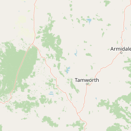
Garrawilla National Park landscape and geographic character

The landscape of Garrawilla National Park consists of semi-arid woodland terrain typical of northwestern New South Wales. The terrain features gentle undulating plains with scattered rocky outcrops and low ridgelines that characterize the Central West region's topography. The vegetation is dominated by dry sclerophyll forest communities, with eucalypt woodland over native grasses forming the primary vegetation structure. The landscape reflects the broader semi-arid to temperate transition zone that spans across inland New South Wales, where average rainfall supports woodland rather than closed forest. The park's position on the northern side of the Oxley Highway places it in a landscape where cleared agricultural land alternates with remaining patches of native vegetation, making protected reserves like Garrawilla important stepping stones for wildlife movement.

Garrawilla National Park ecosystems, habitats, and plant life

The nature of Garrawilla National Park centers on semi-arid woodland ecosystems typical of the Central West region. The park preserves dry sclerophyll forest communities dominated by various eucalypt species adapted to the relatively low rainfall and seasonal temperature variations of inland NSW. These woodland communities provide habitat for a range of native species adapted to semi-arid conditions, including various woodland birds, reptiles, and small mammals. The native grass understory supports invertebrate communities that form the base of the food web for many vertebrate species. The park contributes to regional biodiversity conservation by protecting a representative example of vegetation communities that have been extensively cleared across the surrounding agricultural landscape.

Garrawilla National Park wildlife and species highlights

Garrawilla National Park provides habitat for wildlife species adapted to semi-arid woodland environments in inland New South Wales. The eucalypt woodland communities support populations of woodland bird species, including various honeyeaters, parrots, and cockatoos that are characteristic of the Central West region. Reptiles including skinks, geckoes, and dragons are found throughout the woodland areas, basking on rocky outcrops and fallen timber. Small mammals such as possums, gliders, and small marsupials utilize the hollow-bearing trees and ground cover vegetation that the park protects. The native grass and shrub understory provides foraging habitat for various insects and other invertebrates that support the broader food web.

Garrawilla National Park conservation status and protection priorities

Garrawilla National Park serves an important conservation function within the fragmented agricultural landscape of northwestern New South Wales. The 937-hectare reserve protects representative examples of semi-arid woodland ecosystems that have been extensively cleared for agricultural development across the surrounding region. By preserving remaining native vegetation communities, the park helps maintain habitat for species that depend on woodland environments and contributes to regional biodiversity conservation. The protected area forms part of a network of reserves that support wildlife corridors across an otherwise heavily cleared landscape. Conservation management focuses on maintaining the integrity of native vegetation communities, managing feral animal and weed impacts, and protecting water quality in any drainage lines within the reserve.

Garrawilla National Park cultural meaning and human context

Garrawilla National Park is situated within the traditional Country of Aboriginal peoples who have inhabited the Central West region of New South Wales for tens of thousands of years. The local Aboriginal communities maintained connection to the land through seasonal movement and resource management practices that shaped the landscape prior to European settlement. The Oxley Highway corridor has historical significance as a route explored by early European colonists penetrating inland New South Wales during the nineteenth century. The area's European settlement history involved agricultural development that cleared much of the original woodland vegetation, making protected areas like Garrawilla important for preserving both natural and cultural values.

Top sights and standout views in Garrawilla National Park

Garrawilla National Park offers visitors the opportunity to experience semi-arid woodland landscapes in a relatively accessible location along the Oxley Highway. The park provides a quiet natural environment away from more heavily visited destinations, appealing to those interested in observing native Australian woodland ecosystems. The dry sclerophyll forest communities support birdlife viewing opportunities, with various woodland species present throughout the year. The relatively small size of the park makes it suitable for short visits or as a stop along a journey through the Central West region.

Best time to visit Garrawilla National Park

Garrawilla National Park can be visited year-round, though spring and autumn typically offer the most comfortable conditions for outdoor exploration. Summer months can bring high temperatures typical of inland New South Wales, while winter may offer cooler but potentially pleasant conditions for walking. The park's compact size allows for visits at any time of day, though early morning offers the best wildlife viewing opportunities when animals are most active. Visitors should note that the park is a relatively modest conservation reserve rather than a major tourist destination, and facilities are likely limited to basic amenities.

Park location guide

Geography guide, regional context, and park location map for Garrawilla National Park

Garrawilla National Park park geography, regions, and map view in Australia
Understand where Garrawilla National Park sits in Australia through a broader geographic reading of the surrounding landscape, nearby location context, and its mapped position within the national park landscape.

How Garrawilla National Park fits into Australia

Australia is a constitutional monarchy and federal parliamentary democracy comprising six states and ten territories. With a population of nearly 28 million, it is one of the world's most urbanised countries, with most people concentrated on the eastern seaboard. The country has a high Human Development Index and is known for its cultural diversity, ancient Aboriginal heritage, and unique wildlife.

Wider geography shaping Garrawilla National Park in Australia

Australia occupies the entire Australian continent, the island of Tasmania, and numerous smaller islands. It is the world's flattest and driest inhabited continent, featuring vast deserts in the interior (the Outback), tropical rainforests along the eastern coast, and a coastline bordering the Indian and Pacific Oceans.

Map view of Garrawilla National Park

Use this park location map to pinpoint Garrawilla National Park in Australia, understand its exact geographic position, and read its mapped placement within the surrounding landscape more clearly.

Pigeon | © OpenStreetMap contributors

Location context for Garrawilla National Park

New South Wales
Park atlas

Map the regional spread of protected areas and conservation landscapes surrounding Garrawilla National Park in inland New South Wales.

Continue Your Discovery: Explore Other National Parks and Protected Areas Near Garrawilla National Park, New South Wales
After exploring Garrawilla National Park, discover a curated list of other national parks and protected areas across New South Wales. This broader view allows for geographic comparison, helping you trace regional woodland ecosystems and understand the interconnectedness of conservation efforts in Australia's Central West.
National parkNew South Wales

Coolah Tops National Park: Protected Landscape and Geographic Identity on the Liverpool Range

Explore New South Wales's elevated wilderness, waterfalls, and unique forests.

Coolah Tops National Park preserves a distinctive highland environment on the Liverpool Range, offering a protected wilderness experience within New South Wales. This national park is defined by its plateau landscape, featuring steep escarpments, numerous waterfalls, and dense eucalyptus forests. Its geographic position provides a striking contrast to the lower Liverpool Plains, showcasing unique flora and significant habitat for species like the greater glider, making it a vital area for regional landscape and protected-area exploration.

Established
1996
IUCN
II
National parkNew South Wales

Mount Kaputar National Park: New South Wales Volcanic National Park Atlas

Explore mapped volcanic terrain and ecological diversity.

Mount Kaputar National Park offers a compelling study in protected landscape geology and ecology. Situated in New South Wales, this national park preserves the significant geological features of ancient volcanic remnants, including prominent plugs and lava terraces. Its high-elevation position supports a variety of ecosystems, making it a critical area for understanding inland Australia's natural geography and protected land patterns. Browse its mapped boundaries and discover the unique character of this volcanic wilderness.

Area
502.25 km²
Established
1959
IUCN
II
National parkNew South Wales

Goulburn River National Park: New South Wales National Park with River Ecosystems and Heritage

Explore mapped protected lands and regional geography.

Goulburn River National Park offers a significant protected landscape within New South Wales, Australia, celebrated for its expansive Goulburn River frontage and diverse natural terrain. This national park is pivotal for understanding regional geography, featuring sandstone geological formations and serving as a critical habitat for endangered species, including the regent honeyeater. Its extensive river corridor also protects numerous Aboriginal heritage sites, contributing a rich layer of cultural significance to its conservation value. MoriAtlas helps users explore the mapped boundaries and environmental context of this vital protected area.

Area
722.96 km²
Established
1983
IUCN
II
National parkNew South Wales

Ben Halls Gap National Park: Ancient Eucalyptus Forest Protected Landscape in New South Wales

Explore mapped boundaries of old-growth woodland terrain.

Ben Halls Gap National Park represents an ecologically vital strict nature reserve within New South Wales, Australia. It is distinguished by its extensive ancient eucalyptus forests, which are among the most ecologically significant old-growth woodland environments in eastern Australia. Managed primarily for conservation and research, the park's rugged terrain provides a critical habitat refuge and a key reference ecosystem for understanding undisturbed woodland dynamics and biodiversity.

Area
30.18 km²
Established
1995
IUCN
Ia
Scope
Terrestrial
National parkNew South Wales

Barrington Tops National Park: A Protected National Park in New South Wales

Explore ancient Gondwana rainforests and dramatic volcanic terrain.

Barrington Tops National Park represents a significant protected landscape in New South Wales, Australia, offering a deep dive into diverse ecosystems. Its unique altitudinal vegetation gradient supports the southernmost subtropical rainforests in Australia and showcases geological formations dating back millions of years. This park is crucial for understanding Australia's natural heritage, providing a rich context for landscape exploration and the study of ancient flora within a mapped geographic setting.

Area
765.12 km²
Established
1969
IUCN
Ib
National parkNew South Wales

Mummel Gulf National Park: New South Wales Protected Area & Mapped Gorge Landscape

Rugged escarpment terrain with diverse forest ecosystems.

Mummel Gulf National Park is a protected area in New South Wales, Australia, renowned for its dramatic V-shaped gorge carved by the Mummel River, reaching depths over 400 metres. This rugged escarpment landscape hosts a variety of vegetation communities, including tall open eucalypt, wet sclerophyll, snow gum forests, and subtropical rainforest patches. The park's geography is central to its ecological significance, providing habitat for numerous species and showcasing a distinct natural terrain within the New England region, ideal for geographic exploration.

Area
122 km²
Established
1999
IUCN
II
National parkAustralia

Belford National Park: Strict Nature Reserve and Endangered Forest Landscape in Australia

Mapped boundaries and ecological context for a vital protected area.

Belford National Park, located in Australia's Hunter Valley, functions as a strict nature reserve focused on preserving the endangered Central Hunter Ironbark-Spotted Gum-Grey Box Forest. This protected area, though modest in size, is crucial for safeguarding vulnerable wildlife species and maintaining a significant example of a rare ecological community. Its clearly defined mapped boundaries highlight its role as a dedicated conservation landscape, offering essential habitat and serving as a reference point for the region's natural geography and biodiversity.

Area
2.88 km²
Established
2003
IUCN
Ia
National parkNew South Wales

Yengo National Park: Protected Landscape Identity and Geographic Context

Explore its mapped terrain and wilderness character.

Yengo National Park in New South Wales, Australia, is a vast protected area known for its remote wilderness character and significant geographical landmarks such as Mount Yengo. As a vital part of the Greater Blue Mountains World Heritage Site, the park showcases rugged mountainous terrain and diverse natural landscapes. This entry focuses on its atlas-value, detailing the park's mapped boundaries, regional geography, and its identity as a significant protected landscape for nature exploration.

Area
1,543.28 km²
Established
1988
IUCN
Ib

Common questions about visiting, size, designation, and location context for Garrawilla National Park

Garrawilla National Park FAQs for park facts, access, geography, and protected area context
Find quick answers about Garrawilla National Park, including protected-area facts, park geography, trail and visitor context, and how the park fits into its surrounding country and regional landscape.
MoriAtlas Explorer

Continue Your Protected Areas Search Across the Global Atlas

Deepen your exploration by continuing the structured search for national parks and protected areas worldwide. Utilize the comprehensive filtering capabilities to compare different conservation landscapes and refine your understanding of global park geography. Discover more about the distribution and characteristics of protected natural areas.

Global natural geography