Mori Atlas logo
National parkYengo National Park

Explore the mapped geography and natural terrain of this key protected area within the Blue Mountains.

Yengo National Park: A Wilderness Refuge and Protected Landscape in New South Wales

Yengo National Park in New South Wales, Australia, represents a vast protected wilderness area and a critical component of the Greater Blue Mountains World Heritage Site. Situated within the mountainous terrain of the Great Dividing Range, the park's landscape is defined by peaks like Mount Yengo, rugged valleys, and diverse ecosystems. This page offers an atlas-focused view, detailing the park's geographic boundaries, natural terrain, and its significance as a protected natural landscape for discovery.

Wilderness AreaGreater Blue Mountains World HeritageNew South Wales National ParksAustralian BushlandMountain ConservationWildlife Habitat

Yengo National Park

National park

Park overview

Structured park overview, official facts, and landscape profile for Yengo National Park

Yengo National Park park facts, protected area profile, and essential visitor context
Review the core facts for Yengo National Park, including designation, size, terrain, visitor scale, habitats, and operating context in one park-focused overview.

About Yengo National Park

Yengo National Park occupies a substantial tract of wilderness in the Lower Hunter region of New South Wales, situated approximately 213 kilometres by road northwest of Sydney. The park encompasses 154,328 hectares of mountainous terrain within the Great Dividing Range, characterised by rugged ridges, forested valleys, and the Macdonald River system flowing through its interior. The landscape reflects the geological diversity of the region, with the park serving as a critical conservation corridor within the broader Greater Blue Mountains Area network of eight protected areas. Yengo was formally established as a national park on 11 March 1988, receiving IUCN Category Ib designation as a wilderness area, reflecting its high level of protection and minimal infrastructure. The park is bounded by the small settlements of Bucketty and Broke to the east, Wollombi Brook to the north, the Putty Road and Mellong Range to the west, and connects to Parr State Conservation Area and Dharug National Park to the south. Access is primarily via Yengo Creek Road off the historic Great North Road near the village of Laguna.

Quick facts and research context for Yengo National Park

Yengo National Park spans 154,328 hectares in northern New South Wales, making it one of the larger protected areas in the Greater Blue Mountains World Heritage Site. The park was established on 11 March 1988 and is managed by the NSW National Parks and Wildlife Service. It sits at an average elevation of 309 metres within the Great Dividing Range, approximately 40 kilometres south of Cessnock and 91 kilometres southwest of Newcastle. The park contains over 50 mammal species and more than 200 bird species, highlighting its ecological significance.

Park context

Deeper park guide and search-rich context for Yengo National Park

Yengo National Park history, landscape, wildlife, and travel context
Explore Yengo National Park through its history, landscape character, ecosystems, wildlife, conservation priorities, cultural context, and seasonal travel timing in a structured park guide built for atlas discovery and search intent.

Why Yengo National Park stands out

Yengo National Park is best known for its wilderness character and role as the most north-easterly protected area within the Greater Blue Mountains World Heritage Site. The park features Mount Yengo (Big Yengo), a 668-metre mountain that serves as a significant geographical landmark. Its biodiversity is notable, with over 50 mammal species including koalas, wallaroos, wombats, and gliding possums, alongside more than 200 bird species. The 2019-2020 Gospers Mountain Fire burned nearly the entire park, making it Australia's largest single-ignition bushfire and highlighting the area's ecological vulnerability and resilience.

Yengo National Park history and protected-area timeline

Yengo National Park's modern management history began in 1993 when the NSW National Parks and Wildlife Service established a depot at Bucketty to manage the newly declared protected area. A helipad, informally known as 'Bucketty International,' was constructed to support park operations and emergency response. Following severe bushfires in the area, a fire tower was built in 1995 to improve fire detection capabilities across the park's challenging terrain. In 1999, the NPWS acquired additional Crown land that had previously separated the Bucketty settlement from the national park, expanding the protected area and incorporating significant cultural sites including the Convict Wall and a community amphitheatre. The Bucketty community, which had long maintained a connection to the landscape, approached the NPWS seeking recognition of their custodianship, leading to the development of a Memorandum of Understanding in 2000 for joint management of the area. This partnership represents an important model of collaborative land management between government agencies and local communities. The summer of 2019-2020 brought catastrophic fire to the park when the Gospers Mountain Fire engulfed nearly the entire national park, representing the largest bushfire from a single ignition point in Australia's recorded history.

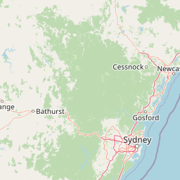
Yengo National Park landscape and geographic character

The terrain of Yengo National Park is defined by its position within the Great Dividing Range, featuring mountainous and forested landscapes characteristic of the Blue Mountains region. Mount Yengo, also known as Big Yengo, rises to 668 metres and serves as the park's most prominent physical feature, visible from surrounding areas and providing sweeping views across the protected landscape. The park's average elevation is 309 metres, with the terrain descending through ridges and valleys toward the Macdonald River, which flows from the northwest toward its confluence with the Hawkesbury River in the southeast. The landscape includes the Mellong Range along the western boundary, with the park also bordered by Wollombi Brook to the north and Webbs Creek, Mogo Creek, and the Hawkesbury River along its southern edge. The terrain supports diverse vegetation communities typical of the region, ranging from ridgeline forests to valley floor ecosystems.

Yengo National Park ecosystems, habitats, and plant life

Yengo National Park supports significant biodiversity within its 154,328-hectare expanse, reflecting the ecological richness of the Greater Blue Mountains region. The park contains diverse habitats ranging from moist eucalypt forests on the ridgelines to more open woodland communities in the valley areas. The Macdonald River system provides aquatic habitat and serves as a corridor for wildlife movement through the park. Vegetation communities include various eucalypt species, paperbarks, and river oak along watercourses, with heath and rocky outcrop vegetation occurring on steeper terrain. The park's wilderness designation and relatively limited development have helped preserve these ecological communities, though the 2019-2020 bushfires caused extensive impacts across nearly the entire park area.

Yengo National Park wildlife and species highlights

The wildlife population of Yengo National Park demonstrates significant diversity, with the park supporting over 50 mammal species and more than 200 bird species. Notable marsupial residents include common wombats that inhabit burrow systems throughout the park, wallaroos that occupy rocky terrain and ridgeline areas, and koalas that are present in suitable eucalypt forest habitat. The gliding possums, including sugar gliders and greater gliders, utilise the arboreal canopy and represent an interesting component of the nocturnal fauna. Birdlife is particularly diverse, with over 200 species recorded including various honeyeaters, parrots, cockatoos, and raptors. The combination of forested habitat, watercourse corridors, and varied terrain creates suitable conditions for this bird diversity. The park's position within the Greater Blue Mountains World Heritage Area contributes to its significance as a wildlife refuge in the regional context.

Yengo National Park conservation status and protection priorities

Yengo National Park holds significant conservation value through its inclusion in the Greater Blue Mountains Area World Heritage Site, inscribed by UNESCO in 2000. As the most north-easterly of the eight protected areas that comprise this World Heritage listing, Yengo plays an important role in the ecological connectivity of the region. The park's IUCN Category Ib classification as a wilderness area reflects its high protection status and the minimal development within its boundaries. The 2019-2020 Gospers Mountain Fire, which burned nearly the entire park, underscored both the vulnerability of these ecosystems and their capacity for recovery. Conservation management focuses on fire management, invasive species control, and habitat maintenance, with the NSW National Parks and Wildlife Service working to restore fire-affected areas and protect remaining biodiversity. The park also contributes to the conservation of water quality in the Macdonald River and Hawkesbury River systems.

Yengo National Park cultural meaning and human context

Yengo National Park contains elements of cultural significance, particularly through the historical connection of the Bucketty community to the area. The community's relationship with the landscape predates national park declaration, and their ongoing custodianship is recognised through the 2000 Memorandum of Understanding with the NSW National Parks and Wildlife Service for joint management of the site. The park landscape would have been utilised by Aboriginal peoples historically, as evidenced by the presence of the Convict Wall, a historical site within the area acquired in 1999. The name Yengo derives from the local Aboriginal word for the mountain, reflecting the indigenous heritage of the place. The historic Great North Road passes near the park, connecting the area to early colonial infrastructure and settlement patterns in the Sydney to Hunter region.

Top sights and standout views in Yengo National Park

Yengo National Park stands out as a wilderness refuge within the Greater Blue Mountains World Heritage Area, offering a remote and undeveloped nature experience in close proximity to the Sydney region. The iconic Mount Yengo provides a notable destination for visitors, with its 668-metre summit offering panoramic views across the mountainous terrain. The park's biodiversity is exceptional, supporting over 50 mammal species and 200 bird species within its 154,328-hectare expanse. The 2019-2020 Gospers Mountain Fire, while devastating, created landscape-scale ecological disturbance that has become a significant case study in fire ecology and post-fire recovery. The partnership between the Bucketty community and park management represents a notable model of collaborative conservation.

Best time to visit Yengo National Park

Yengo National Park can be visited throughout the year, though autumn and spring typically offer the most comfortable conditions for exploring the park's trail network and natural features. Summer months can bring high temperatures and elevated fire risk, while winter may see cold conditions at higher elevations. The park's recovery from the 2019-2020 bushfires continues to influence vegetation regrowth and habitat conditions, creating a dynamic landscape that visitors may find of interest. Those planning visits should check current conditions and any park closures with the NSW National Parks and Wildlife Service, as fire impacts and recovery work may affect access to certain areas.

Park location guide

Geography guide, regional context, and park location map for Yengo National Park

Yengo National Park park geography, regions, and map view in Australia
Understand where Yengo National Park sits in Australia through a broader geographic reading of the surrounding landscape, nearby location context, and its mapped position within the national park landscape.

How Yengo National Park fits into Australia

Australia is a constitutional monarchy and federal parliamentary democracy comprising six states and ten territories. With a population of nearly 28 million, it is one of the world's most urbanised countries, with most people concentrated on the eastern seaboard. The country has a high Human Development Index and is known for its cultural diversity, ancient Aboriginal heritage, and unique wildlife.

Wider geography shaping Yengo National Park in Australia

Australia occupies the entire Australian continent, the island of Tasmania, and numerous smaller islands. It is the world's flattest and driest inhabited continent, featuring vast deserts in the interior (the Outback), tropical rainforests along the eastern coast, and a coastline bordering the Indian and Pacific Oceans.

Map view of Yengo National Park

Use this park location map to pinpoint Yengo National Park in Australia, understand its exact geographic position, and read its mapped placement within the surrounding landscape more clearly.

Pigeon | © OpenStreetMap contributors

Location context for Yengo National Park

New South Wales
Park atlas

Compare Yengo National Park with nearby conservation landscapes and trace protected areas across the greater Blue Mountains region.

Explore Other National Parks and Protected Areas Near Yengo National Park, Mapping the Surrounding Regional Geography
Browse national parks and protected areas geographically close to Yengo National Park, including significant wilderness zones and mountain conservation landscapes. Deepen your understanding of regional park geography and ecological connectivity by comparing their terrain, protected status, and conservation values.
National parkNew South Wales

Wollemi National Park: Mapping Australia's Protected Natural Landscape in New South Wales

Detailed geographic context and protected area exploration.

Wollemi National Park is a critical component of New South Wales' protected natural areas, offering rich opportunities for geographic discovery. This national park provides a distinct focus for understanding the mapped terrain and regional landscape context of Australia. Explore its position within New South Wales, uncovering the details that define its unique protected status and natural geography for dedicated atlas exploration.

Area
5,017.03 km²
Established
1979
IUCN
Ib
Relief
Mountain
National parkNew South Wales

Watagans National Park: National Park Protected Landscape in New South Wales

Explore its mapped boundaries and regional geography.

Watagans National Park stands as a key protected area within New South Wales, Australia. This detail page focuses on its specific role as a national park, offering insights into its mapped geographic boundaries and its place within the regional landscape. Understand the protected natural identity of Watagans National Park through a structured, atlas-informed lens.

Area
77.51 km²
Established
1999
IUCN
II
Climate
Temperate
National parkAustralia

Cattai National Park: Australia's Premier Colonial Heritage Protected Landscape

Mapped riverfront geography and historical Australian park context.

Cattai National Park represents a vital entry in Australia's atlas of protected areas, offering unparalleled insight into the nation's early colonial history alongside its natural riverine landscapes. The park's designation as a national park highlights its importance in preserving not only the unique geography of the Hawkesbury River floodplain but also significant historical sites like the Hope Farm Mill, Australia's oldest industrial site. Exploring Cattai National Park allows for a deep dive into mapped protected boundaries and the layered cultural and natural terrain of the Sydney region.

Area
4.24 km²
Established
1992
IUCN
II
Access
Easy access
National parkSydney

Marramarra National Park: Sydney's Protected Landscape and National Park Atlas

Explore mapped boundaries and regional geography near Sydney.

Marramarra National Park stands as a key protected natural landscape near Sydney, Australia. This entry facilitates detailed atlas exploration, focusing on its geographic setting and identity as a national park. Understand the park's mapped borders, its regional context within the Sydney area, and the unique natural landscape it preserves. MoriAtlas provides structured data to comprehend Marramarra National Park's place in the Australian protected areas network and its distinct geographic characteristics.

Area
117.85 km²
Established
1979
IUCN
II
Relief
Upland
National parkNew South Wales

Werakata National Park: Protected Area Exploration and Eucalypt Forest Atlas

Mapping New South Wales' unique spotted gum-ironbark woodlands.

Werakata National Park is a significant protected area in New South Wales, Australia, dedicated to conserving the valuable spotted gum-ironbark vegetation communities of the Lower Hunter Region. This national park offers insight into the region's natural landscape, featuring undulating terrain with eucalypt forests and woodlands that are crucial for threatened species and avian biodiversity. Its distinct geographic character and mapped boundaries provide a clear focus for atlas-driven discovery of protected lands and their ecological significance.

Area
33.37 km²
Established
1999
IUCN
II
Relief
Lowland
National parkAustralia

Scheyville National Park: An Australian National Park's Mapped Protected Landscape and Regional Geography

Explore the protected boundaries and natural terrain of this park.

Scheyville National Park represents a vital protected area within Australia, offering a unique lens for geographic exploration. As a national park, its boundaries and landscape characteristics are essential for understanding its place in the regional geography. This content facilitates structured discovery of its natural terrain and mapped extent, providing foundational context for atlas-based learning about Australia's protected lands.

Area
9.2 km²
Established
1996
IUCN
V
Relief
Upland
National parkNew South Wales

Brisbane Water National Park: A Protected Landscape in New South Wales' Sydney Basin Bioregion

Explore mapped terrain, endangered ecosystems, and coastal waterway geography.

Brisbane Water National Park, located in New South Wales, Australia, is a vital protected area safeguarding critical ecosystems within the Sydney Basin bioregion. This national park features a diverse landscape encompassing rugged escarpments, fertile valleys, and important coastal waterways. Its protected status makes it a crucial conservation refuge, offering insights into unique natural terrain and regional geography for those seeking detailed, map-centric exploration.

Area
115.06 km²
Established
1959
IUCN
II
Relief
Mixed relief
National parkAustralia

Belford National Park: Strict Nature Reserve and Endangered Forest Landscape in Australia

Mapped boundaries and ecological context for a vital protected area.

Belford National Park, located in Australia's Hunter Valley, functions as a strict nature reserve focused on preserving the endangered Central Hunter Ironbark-Spotted Gum-Grey Box Forest. This protected area, though modest in size, is crucial for safeguarding vulnerable wildlife species and maintaining a significant example of a rare ecological community. Its clearly defined mapped boundaries highlight its role as a dedicated conservation landscape, offering essential habitat and serving as a reference point for the region's natural geography and biodiversity.

Area
2.88 km²
Established
2003
IUCN
Ia
Access
Highly restricted

Common questions about visiting, size, designation, and location context for Yengo National Park

Yengo National Park FAQs for park facts, access, geography, and protected area context
Find quick answers about Yengo National Park, including protected-area facts, park geography, trail and visitor context, and how the park fits into its surrounding country and regional landscape.
MoriAtlas Explorer

Continue Your Protected Areas Search Across the Global Atlas

Deepen your exploration by continuing the structured search for national parks and protected areas worldwide. Utilize the comprehensive filtering capabilities to compare different conservation landscapes and refine your understanding of global park geography. Discover more about the distribution and characteristics of protected natural areas.

Global natural geography