Mori Atlas logo
National parkBelford National Park

Discover the mapped boundaries and ecological significance of this vital protected area in New South Wales.

Belford National Park: Strict Nature Reserve and Endangered Forest Landscape in Australia

Belford National Park stands as a crucial protected landscape within Australia's Hunter Valley region, safeguarding a significant remnant of the endangered Central Hunter Ironbark-Spotted Gum-Grey Box Forest. As a strict nature reserve, its primary purpose is the preservation of ecological integrity, providing refuge for vulnerable wildlife species and representing a vital ecological community that has largely disappeared from the surrounding agricultural lands. This park offers a window into the region's natural heritage, with clear, mapped boundaries defining its role in conservation and providing essential habitat within a broader geographical context.

strict nature reservedry sclerophyll forestvulnerable speciesendangered ecological communityHunter ValleyNew South Wales

Belford National Park

National park

Park overview

Structured park overview, official facts, and landscape profile for Belford National Park

Belford National Park park facts, protected area profile, and essential visitor context
Review the core facts for Belford National Park, including designation, size, terrain, visitor scale, habitats, and operating context in one park-focused overview.

About Belford National Park

Belford National Park occupies a discrete remnant of native forest within an otherwise heavily cleared agricultural landscape in the Hunter Valley. The park's isolation, surrounded by farmland and bounded by the New England Highway to the south, creates a conservation island that provides critical habitat for a range of threatened species. The transition from State Forest to National Park status in 2003 reflected a shift in management priorities toward biodiversity conservation rather than timber production. Despite its small size, the park contains a remarkable concentration of vulnerable species, a testament to the ecological quality of the remaining forest community. The fully fenced boundary helps protect the interior from livestock intrusion and maintains the integrity of the forest ecosystem. Management focuses on maintaining ecological processes and protecting the endangered forest community and its associated wildlife, with public access restricted to preserve the strict nature reserve character.

Quick facts and research context for Belford National Park

Belford National Park is located in the traditional country of the Wonnarua people and is managed by the NSW National Parks and Wildlife Service. The park is fully fenced and contains no visitor facilities, with bushwalking along the Perimeter Fire Trail being the only permitted activity. The protected area supports remarkable biodiversity despite its small size, including eight species listed as vulnerable under Commonwealth legislation. The park was created through the regional forest agreement process and represents a conservation outcome from the sustainable management of native forests in the Lower North East region of New South Wales.

Park context

Deeper park guide and search-rich context for Belford National Park

Belford National Park history, landscape, wildlife, and travel context
Explore Belford National Park through its history, landscape character, ecosystems, wildlife, conservation priorities, cultural context, and seasonal travel timing in a structured park guide built for atlas discovery and search intent.

Why Belford National Park stands out

Belford National Park is best known for its protection of the Central Hunter Ironbark-Spotted Gum-Grey Box Forest, an endangered ecological community that exists in relatively few remaining stands across the Hunter Valley region. The park serves as a refuge for eight vulnerable wildlife species, including the powerful owl, spotted-tailed quoll, squirrel glider, and several bat species. As a strict nature reserve with limited public access, it represents a conservation-focused approach that prioritizes ecological integrity over recreational use. The park also protects the vulnerable slaty red gum tree, adding botanical significance to its already notable fauna values.

Belford National Park history and protected-area timeline

The land that now comprises Belford National Park was originally part of Belford State Forest, managed for timber production and other forest uses under the NSW Forestry Commission. Following the completion of the Lower North East Regional Forest Agreement in 2000, the area was identified for protection as a national park. This regional agreement represented a comprehensive planning process that examined the conservation values, wood supply needs, and community interests across the forested areas of the Lower North East region of New South Wales. The park was formally declared in January 2003, marking the culmination of efforts to protect the significant biodiversity values of the remaining forest patches in the Hunter Valley. The traditional owners of the land are the Wonnarua people, whose connection to the landscape predates European settlement by many thousands of years.

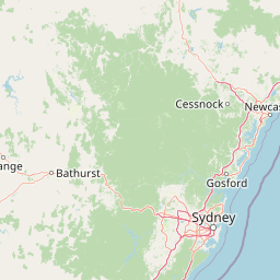
Belford National Park landscape and geographic character

The park consists of gently undulating terrain covered by a dry sclerophyll forest community characteristic of the Hunter Valley lowlands. The Central Hunter Ironbark-Spotted Gum-Grey Box Forest dominates the vegetation, with ironbark, spotted gum, and grey box trees forming the canopy layer. The forest structure includes a diverse understory of shrubs and grasses adapted to the relatively fertile soils and seasonal rainfall patterns of the region. The park is bounded by cleared agricultural land, with the New England Highway providing a major road boundary to the south. Kirkton Road passes through the park but remains outside the protected area boundary. The fully fenced perimeter defines a clear boundary between the protected forest and the surrounding rural landscape.

Belford National Park ecosystems, habitats, and plant life

The Central Hunter Ironbark-Spotted Gum-Grey Box Forest represented by Belford National Park is listed as an endangered ecological community, reflecting the extensive clearing of this forest type across its former range. This vegetation community supports a distinctive suite of species adapted to the specific conditions of the Hunter Valley. The vulnerable slaty red gum occurs within the park, adding to the botanical significance of the area. The forest provides important habitat structure through its mix of canopy species, hollow-bearing trees, and ground layer vegetation. Despite the park's small size, the intact forest community supports significant biodiversity, with the isolation from other forest patches making this area particularly important as a stepping-stone habitat in a fragmented landscape.

Belford National Park wildlife and species highlights

Belford National Park supports impressive wildlife diversity relative to its small area, with 19 mammal species, 49 bird species, 4 reptile species, and 4 amphibian species recorded within its boundaries. Eight of these species are listed as vulnerable, including the powerful owl, a large raptor that depends on hollow-bearing trees for nesting. The spotted-tailed quoll, Australia's largest remaining marsupial carnivore, utilizes the forest for foraging. Several bat species are protected, including the eastern bent-wing bat, eastern freetail-bat, and large-footed myotis, all of which rely on tree hollows or old buildings for roosting sites. The squirrel glider and grey-crowned babbler represent arboreal and ground-dwelling mammals and birds respectively that depend on the forest's structure. The speckled warbler occupies the understory and ground layers, while the park also supports populations of invasive species including foxes, rabbits, cats, and black rats that pose ongoing threats to native wildlife.

Belford National Park conservation status and protection priorities

The park's designation as an IUCN Category Ia strict nature reserve reflects its primary purpose of biodiversity conservation. Protection of the endangered Central Hunter Ironbark-Spotted Gum-Grey Box Forest community is a central conservation objective, as this vegetation type has been significantly reduced by clearing for agriculture and development across its former range. The vulnerable species list within the park includes both fauna and flora, demonstrating the ecological significance of maintaining this forest remnant. Management activities focus on controlling invasive plant and animal species that threaten native biodiversity, and maintaining the fence boundary to prevent livestock from entering the reserve. The park contributes to the conservation network in the Hunter Valley, providing habitat for species that require large territories or that move between forest patches across the fragmented landscape.

Belford National Park cultural meaning and human context

Belford National Park lies within the traditional country of the Wonnarua people, the Aboriginal inhabitants of the Hunter Valley region prior to European settlement. The Wonnarua have maintained connections to this landscape over thousands of years, and the park forms part of their cultural heritage. European settlement of the Hunter Valley brought dramatic changes to the landscape, with extensive clearing of native forest for agriculture and pastoral use. The reservation of this forest remnant as a national park in 2003 represents a continuation of efforts to preserve some of the original character of the landscape while acknowledging the cultural values associated with the land.

Top sights and standout views in Belford National Park

The combination of strict nature reserve protection, endangered forest community, and multiple vulnerable species makes Belford National Park a significant conservation area despite its modest size. The powerful owl and spotted-tailed quoll represent apex predators that require substantial habitat areas and are indicators of ecosystem health. The forest supports a diverse bat fauna, with three vulnerable species relying on the hollow-bearing trees and roosting sites within the park. The endangered vegetation community represents what remains of a once extensive forest type that dominated the Hunter Valley lowlands. The park provides a reference site for understanding the pre-clearing biodiversity of the region.

Best time to visit Belford National Park

The cooler months from late autumn through winter into early spring typically offer the most comfortable conditions for walking in the park, with milder daytime temperatures and reduced heat stress. Wildlife viewing may be more productive during these periods as animals are more active during cooler parts of the day. The park has no visitor facilities, so visitors should be self-sufficient and prepared for remote conditions. As a strict nature reserve, access is limited to walking on designated tracks, and visitors should contact the NSW National Parks and Wildlife Service for current conditions and any access restrictions that may apply.

Park location guide

Geography guide, regional context, and park location map for Belford National Park

Belford National Park park geography, regions, and map view in Australia
Understand where Belford National Park sits in Australia through a broader geographic reading of the surrounding landscape, nearby location context, and its mapped position within the national park landscape.

How Belford National Park fits into Australia

Australia is a constitutional monarchy and federal parliamentary democracy comprising six states and ten territories. With a population of nearly 28 million, it is one of the world's most urbanised countries, with most people concentrated on the eastern seaboard. The country has a high Human Development Index and is known for its cultural diversity, ancient Aboriginal heritage, and unique wildlife.

Wider geography shaping Belford National Park in Australia

Australia occupies the entire Australian continent, the island of Tasmania, and numerous smaller islands. It is the world's flattest and driest inhabited continent, featuring vast deserts in the interior (the Outback), tropical rainforests along the eastern coast, and a coastline bordering the Indian and Pacific Oceans.

Map view of Belford National Park

Use this park location map to pinpoint Belford National Park in Australia, understand its exact geographic position, and read its mapped placement within the surrounding landscape more clearly.

Pigeon | © OpenStreetMap contributors

Location context for Belford National Park

New South Wales
Park atlas

Compare national parks and protected areas within the Hunter Valley's conservation landscape.

Compare National Parks: Discover Protected Areas Adjacent to Belford National Park
After viewing Belford National Park, expand your atlas by exploring other national parks and protected areas throughout the Hunter Valley region of New South Wales. Compare the geographic spread of conservation landscapes, understand varied protected area classifications, and trace their broader regional ecological context.
National parkNew South Wales

Werakata National Park: Protected Area Exploration and Eucalypt Forest Atlas

Mapping New South Wales' unique spotted gum-ironbark woodlands.

Werakata National Park is a significant protected area in New South Wales, Australia, dedicated to conserving the valuable spotted gum-ironbark vegetation communities of the Lower Hunter Region. This national park offers insight into the region's natural landscape, featuring undulating terrain with eucalypt forests and woodlands that are crucial for threatened species and avian biodiversity. Its distinct geographic character and mapped boundaries provide a clear focus for atlas-driven discovery of protected lands and their ecological significance.

Area
33.37 km²
Established
1999
IUCN
II
National parkNew South Wales

Yengo National Park: Protected Landscape Identity and Geographic Context

Explore its mapped terrain and wilderness character.

Yengo National Park in New South Wales, Australia, is a vast protected area known for its remote wilderness character and significant geographical landmarks such as Mount Yengo. As a vital part of the Greater Blue Mountains World Heritage Site, the park showcases rugged mountainous terrain and diverse natural landscapes. This entry focuses on its atlas-value, detailing the park's mapped boundaries, regional geography, and its identity as a significant protected landscape for nature exploration.

Area
1,543.28 km²
Established
1988
IUCN
Ib
National parkNew South Wales

Barrington Tops National Park: A Protected National Park in New South Wales

Explore ancient Gondwana rainforests and dramatic volcanic terrain.

Barrington Tops National Park represents a significant protected landscape in New South Wales, Australia, offering a deep dive into diverse ecosystems. Its unique altitudinal vegetation gradient supports the southernmost subtropical rainforests in Australia and showcases geological formations dating back millions of years. This park is crucial for understanding Australia's natural heritage, providing a rich context for landscape exploration and the study of ancient flora within a mapped geographic setting.

Area
765.12 km²
Established
1969
IUCN
Ib
National parkNew South Wales

Wyrrabalong National Park National Park: Protected Littoral Rainforest and Coastal Geography

Explore mapped terrain and vital bird habitats in New South Wales.

Wyrrabalong National Park on New South Wales' Central Coast is an essential protected landscape, noted for safeguarding the last significant coastal littoral rainforest of its kind. This park entry details the mapped geography across its peninsula, island, and beachfront sections, revealing a compact yet ecologically rich environment. It highlights the park's importance as part of an Important Bird Area, supporting significant waterbird and woodland bird populations within its protected boundaries, offering a unique glimpse into a vanishing coastal ecosystem.

Area
6.2 km²
Established
1991
IUCN
II
National parkNew South Wales

Brisbane Water National Park: A Protected Landscape in New South Wales' Sydney Basin Bioregion

Explore mapped terrain, endangered ecosystems, and coastal waterway geography.

Brisbane Water National Park, located in New South Wales, Australia, is a vital protected area safeguarding critical ecosystems within the Sydney Basin bioregion. This national park features a diverse landscape encompassing rugged escarpments, fertile valleys, and important coastal waterways. Its protected status makes it a crucial conservation refuge, offering insights into unique natural terrain and regional geography for those seeking detailed, map-centric exploration.

Area
115.06 km²
Established
1959
IUCN
II
National parkNew South Wales

Bouddi National Park: Coastal National Park with Temperate Rainforest & Marine Atlas

Discover unique sandstone landscapes and protected marine geography in New South Wales.

Bouddi National Park in New South Wales stands out for its rare mix of coastal headlands, ancient temperate rainforests, and a comprehensive marine protected area. Its landscape is defined by dramatic Hawkesbury sandstone geology, featuring spectacular tessellated pavements and laterite plateaus. The park's protected marine zone significantly enhances local biodiversity, making it a key area for understanding coastal and oceanic protected landscapes within the Australian atlas.

Area
15.32 km²
Established
1967
IUCN
II
Relief
Lowland
National parkAustralia

Cattai National Park: Australia's Premier Colonial Heritage Protected Landscape

Mapped riverfront geography and historical Australian park context.

Cattai National Park represents a vital entry in Australia's atlas of protected areas, offering unparalleled insight into the nation's early colonial history alongside its natural riverine landscapes. The park's designation as a national park highlights its importance in preserving not only the unique geography of the Hawkesbury River floodplain but also significant historical sites like the Hope Farm Mill, Australia's oldest industrial site. Exploring Cattai National Park allows for a deep dive into mapped protected boundaries and the layered cultural and natural terrain of the Sydney region.

Area
4.24 km²
Established
1992
IUCN
II
National parkNew South Wales

Ben Halls Gap National Park: Ancient Eucalyptus Forest Protected Landscape in New South Wales

Explore mapped boundaries of old-growth woodland terrain.

Ben Halls Gap National Park represents an ecologically vital strict nature reserve within New South Wales, Australia. It is distinguished by its extensive ancient eucalyptus forests, which are among the most ecologically significant old-growth woodland environments in eastern Australia. Managed primarily for conservation and research, the park's rugged terrain provides a critical habitat refuge and a key reference ecosystem for understanding undisturbed woodland dynamics and biodiversity.

Area
30.18 km²
Established
1995
IUCN
Ia
Scope
Terrestrial

Common questions about visiting, size, designation, and location context for Belford National Park

Belford National Park FAQs for park facts, access, geography, and protected area context
Find quick answers about Belford National Park, including protected-area facts, park geography, trail and visitor context, and how the park fits into its surrounding country and regional landscape.
MoriAtlas Explorer

Continue Your Protected Areas Search Across the Global Atlas

Deepen your exploration by continuing the structured search for national parks and protected areas worldwide. Utilize the comprehensive filtering capabilities to compare different conservation landscapes and refine your understanding of global park geography. Discover more about the distribution and characteristics of protected natural areas.

Global natural geography