Mori Atlas logo
National parkWyrrabalong National Park

Discover the last significant littoral rainforest and mapped terrain on New South Wales' Central Coast.

Wyrrabalong National Park National Park: Coastal Protected Landscape and Map Exploration

Wyrrabalong National Park represents a vital protected area on the Central Coast of New South Wales, Australia, preserving a rare strip of coastal littoral rainforest. This detailed atlas entry explores the park's distinct sections, including peninsula areas, island habitats within Tuggerah Lake, and coastal stretches. Understand its geographic context within New South Wales and appreciate the unique ecosystems protected by its mapped boundaries, highlighting its significance as a key habitat for diverse bird populations.

Coastal National ParkLittoral RainforestCentral Coast NSWImportant Bird AreaWetland HabitatIsland Ecosystems

Wyrrabalong National Park

National park

Park overview

Structured park overview, official facts, and landscape profile for Wyrrabalong National Park

Wyrrabalong National Park park facts, protected area profile, and essential visitor context
Review the core facts for Wyrrabalong National Park, including designation, size, terrain, visitor scale, habitats, and operating context in one park-focused overview.

About Wyrrabalong National Park

Wyrrabalong National Park represents a significant conservation achievement for the Central Coast region, protecting a coastal landscape that might otherwise have been lost to development. The park's two sections work together to preserve a corridor of natural coastline stretching from the northern shores of Tuggerah Lake down to the southern beaches near Forresters Beach. The coastal rainforest within the park is particularly noteworthy, representing what was once a common feature of the Central Coast but which has been largely cleared for urban development over the past two centuries. This remaining pocket of littoral rainforest provides habitat for numerous species and serves as a living demonstration of the region's pre-development natural character. The park's islands, particularly Terilbah and Pelican Islands within Tuggerah Lake, add further ecological value by providing protected breeding and resting sites for waterbirds. Managed by the NSW National Parks and Wildlife Service, the park provides opportunities for the public to experience this rare coastal environment while ensuring its long-term preservation.

Quick facts and research context for Wyrrabalong National Park

Wyrrabalong National Park is located in the Central Coast region of New South Wales, Australia, with the nearest major centre being Gosford. The park covers 620 hectares and was established in May 1991 under the management of the NSW National Parks and Wildlife Service. The terrain is predominantly low-lying coastal landscape with an average elevation of approximately 8 metres above sea level. The park is notable for containing the last significant coastal rainforest remnant on the Central Coast, making it a critical conservation site for this increasingly rare habitat type.

Park context

Deeper park guide and search-rich context for Wyrrabalong National Park

Wyrrabalong National Park history, landscape, wildlife, and travel context
Explore Wyrrabalong National Park through its history, landscape character, ecosystems, wildlife, conservation priorities, cultural context, and seasonal travel timing in a structured park guide built for atlas discovery and search intent.

Why Wyrrabalong National Park stands out

Wyrrabalong National Park is best known for protecting the last significant coastal littoral rainforest remaining on the Central Coast of New South Wales. This rainforest type, characterized by species such as melaleuca and livistona palms, represents a vanishing ecosystem that once covered much of the region's shoreline. The park is also renowned as part of the Tuggerah Important Bird Area, supporting significant populations of waterbirds and woodland birds. Its coastal location, encompassing both mainland peninsula areas and islands within Tuggerah Lake, provides diverse habitats within a relatively compact area.

Wyrrabalong National Park history and protected-area timeline

The land now comprising Wyrrabalong National Park has a human history extending back thousands of years, originally inhabited by the indigenous Darkinjung people in the southern section and the Awabakal people in the northern section. These Aboriginal peoples maintained a connection to this coastal landscape long before European contact. European discovery of the Tuggerah Lakes region occurred in 1796 during the early colonial period, when Governor of Tasmania David Collins, who had arrived with the First Fleet, was searching for an escaped convict named Mary Morgan who was reportedly living with local Aboriginal people north of the Hawkesbury River. The park was formally established in May 1991, representing a relatively recent addition to New South Wales's protected area network. This establishment came after decades of increasing recognition of the ecological value of the remaining coastal rainforest and the need to protect what little remained of this once-extensive habitat type.

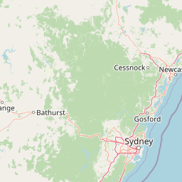
Wyrrabalong National Park landscape and geographic character

The landscape of Wyrrabalong National Park is defined by its coastal setting on the Central Coast of New South Wales. The terrain is predominantly low-lying, with an average elevation of approximately 8 metres, reflecting its position along a coastal plain that borders the Tasman Sea. The northern section occupies a peninsula position between The Entrance and Norah Head, projecting into the waters of Tuggerah Lake and the Pacific Ocean. This section includes the islands of Terilbah and Pelican, which rise subtly from the lake waters. The southern section follows the coastline south from Shelly Beach to Forresters Beach, encompassing coastal slopes and headlands. The vegetation through much of the park is characterized by the coastal rainforest that gives the park its ecological distinction, with a canopy dominated by melaleuca species and the distinctive fan palms of Livistona australis.

Wyrrabalong National Park ecosystems, habitats, and plant life

The ecological character of Wyrrabalong National Park centres on its coastal rainforest, which represents the last significant example of this habitat type on the Central Coast. This littoral rainforest ecosystem develops in the humid zone immediately adjacent to the coast, where salt-laden winds and sandy soils create challenging conditions for many plant species. The canopy includes Melaleuca quinquenervia (paperbark tree) and Livistona australis (Australian fan palm), while the understory supports a diverse community of moisture-loving plants. The park's position within the broader Tuggerah Lakes system adds wetland and aquatic habitats to the mix, particularly in the northern section where the park boundaries incorporate parts of the lake itself. These wetlands provide critical feeding and breeding habitat for waterbirds, while the woodland areas support a different suite of bird species. The combination of rainforest, woodland, and wetland within a single protected area creates a surprisingly diverse ecological mosaic.

Wyrrabalong National Park wildlife and species highlights

Wyrrabalong National Park supports notable wildlife populations, particularly birds, as recognised by its inclusion in the Tuggerah Important Bird Area designated by BirdLife International. The wetlands and waterways of the park provide essential habitat for various waterbird species, including numerous species that depend on coastal lake environments for feeding and breeding. The woodland areas within the park support populations of woodland birds, contributing to the bird diversity that earned the area its Important Bird Area status. While the Wikipedia source does not provide detailed species lists, the designation indicates the presence of bird communities of sufficient significance to warrant international conservation recognition. The coastal rainforest and surrounding vegetation also provide habitat for various terrestrial species, though the detailed fauna inventory would require more comprehensive source material.

Wyrrabalong National Park conservation status and protection priorities

Wyrrabalong National Park holds particular conservation significance for several reasons. Most importantly, it contains the last significant coastal littoral rainforest remaining on the Central Coast, representing a habitat type that has been dramatically reduced by coastal development over the past two centuries. This remaining rainforest patch serves as a genetic reservoir and biodiversity refuge for species that once inhabited the extensive coastal forests that formerly lined this coastline. The park's designation as part of the Tuggerah Important Bird Area further underscores its conservation value, recognising the area's international significance for bird populations. The protection of this coastal landscape also preserves ecological processes that would be lost with further development, including coastal nutrient cycles, sediment dynamics, and the natural buffering functions that intact coastal ecosystems provide.

Wyrrabalong National Park cultural meaning and human context

The lands now within Wyrrabalong National Park have historical significance as the traditional Country of indigenous Australian peoples. The Darkinjung people occupied the southern portion of what is now the park, while the Awabakal people inhabited the northern section around Tuggerah Lake. These Aboriginal communities maintained deep connections to the coastal environment, drawing on its resources and incorporating it into their cultural practices and spiritual understanding. European colonial exploration of the area began in the late 18th century, with the discovery of Tuggerah Lakes in 1796 during a search for an escaped convict. The park's establishment in 1991 represents a more recent chapter, though one that acknowledges the long human history of this landscape.

Top sights and standout views in Wyrrabalong National Park

Wyrrabalong National Park stands out for protecting the last significant coastal rainforest on the Central Coast, a vanishing habitat of considerable ecological importance. The park's diverse landscape, combining coastal peninsula, islands within Tuggerah Lake, and beachfront sections, creates a compact but varied protected area. The Important Bird Area designation recognises the site's value for waterbird and woodland bird populations. Located on the Central Coast within relatively easy reach of Sydney, the park provides accessible wilderness experience while protecting ecosystems that have largely disappeared from this heavily developed region. The melaleuca and fan palm dominated coastal rainforest represents a distinctive Australian vegetation type that visitors can explore within this protected landscape.

Best time to visit Wyrrabalong National Park

Wyrrabalong National Park can be visited throughout the year, though the warmer months from spring through autumn typically offer the most comfortable conditions for outdoor exploration. Summer temperatures on the Central Coast average between 20 and 25 degrees Celsius, though the park has recorded temperatures up to 42.4 degrees Celsius during heatwaves. Winter temperatures range from 10 to 17 degrees Celsius, with occasional cold spells bringing temperatures down to around 3.4 degrees Celsius. The relatively mild climate allows for year-round visitation, though the coastal environment can be affected by wind and occasional storms during the winter months.

Park location guide

Geography guide, regional context, and park location map for Wyrrabalong National Park

Wyrrabalong National Park park geography, regions, and map view in Australia
Understand where Wyrrabalong National Park sits in Australia through a broader geographic reading of the surrounding landscape, nearby location context, and its mapped position within the national park landscape.

How Wyrrabalong National Park fits into Australia

Australia is a constitutional monarchy and federal parliamentary democracy comprising six states and ten territories. With a population of nearly 28 million, it is one of the world's most urbanised countries, with most people concentrated on the eastern seaboard. The country has a high Human Development Index and is known for its cultural diversity, ancient Aboriginal heritage, and unique wildlife.

Wider geography shaping Wyrrabalong National Park in Australia

Australia occupies the entire Australian continent, the island of Tasmania, and numerous smaller islands. It is the world's flattest and driest inhabited continent, featuring vast deserts in the interior (the Outback), tropical rainforests along the eastern coast, and a coastline bordering the Indian and Pacific Oceans.

Map view of Wyrrabalong National Park

Use this park location map to pinpoint Wyrrabalong National Park in Australia, understand its exact geographic position, and read its mapped placement within the surrounding landscape more clearly.

Pigeon | © OpenStreetMap contributors

Location context for Wyrrabalong National Park

New South Wales
Park atlas

Explore the regional geography of Australia's Central Coast, comparing nearby national parks and their distinct protected landscapes.

Discover Nearby National Parks and Coastal Protected Areas Beyond Wyrrabalong National Park
After exploring Wyrrabalong National Park's unique coastal rainforest and wetland habitats, discover other national parks and protected areas in the surrounding Central Coast region of New South Wales. This geographic view enables direct comparison of diverse protected landscapes and ongoing conservation efforts across Australia's significant eastern coastline.
National parkNew South Wales

Bouddi National Park: Coastal National Park with Temperate Rainforest & Marine Atlas

Discover unique sandstone landscapes and protected marine geography in New South Wales.

Bouddi National Park in New South Wales stands out for its rare mix of coastal headlands, ancient temperate rainforests, and a comprehensive marine protected area. Its landscape is defined by dramatic Hawkesbury sandstone geology, featuring spectacular tessellated pavements and laterite plateaus. The park's protected marine zone significantly enhances local biodiversity, making it a key area for understanding coastal and oceanic protected landscapes within the Australian atlas.

Area
15.32 km²
Established
1967
IUCN
II
Relief
Lowland
National parkNew South Wales

Brisbane Water National Park: A Protected Landscape in New South Wales' Sydney Basin Bioregion

Explore mapped terrain, endangered ecosystems, and coastal waterway geography.

Brisbane Water National Park, located in New South Wales, Australia, is a vital protected area safeguarding critical ecosystems within the Sydney Basin bioregion. This national park features a diverse landscape encompassing rugged escarpments, fertile valleys, and important coastal waterways. Its protected status makes it a crucial conservation refuge, offering insights into unique natural terrain and regional geography for those seeking detailed, map-centric exploration.

Area
115.06 km²
Established
1959
IUCN
II
National parkNew South Wales

Werakata National Park: Protected Area Exploration and Eucalypt Forest Atlas

Mapping New South Wales' unique spotted gum-ironbark woodlands.

Werakata National Park is a significant protected area in New South Wales, Australia, dedicated to conserving the valuable spotted gum-ironbark vegetation communities of the Lower Hunter Region. This national park offers insight into the region's natural landscape, featuring undulating terrain with eucalypt forests and woodlands that are crucial for threatened species and avian biodiversity. Its distinct geographic character and mapped boundaries provide a clear focus for atlas-driven discovery of protected lands and their ecological significance.

Area
33.37 km²
Established
1999
IUCN
II
National parkNew South Wales

Sydney Harbour National Park: A Distinctive Coastal Protected Landscape in New South Wales

Explore its mapped geography and unique heritage sites.

Sydney Harbour National Park represents an extraordinary protected area in New South Wales, Australia, celebrated for its integration of natural coastal terrain with significant historical sites. This national park offers a unique opportunity for atlas-based exploration of its mapped boundaries, dramatic sandstone headlands, and sheltered harbour locations. Discover the distinctive blend of natural landscape and heritage fortifications that define this metropolitan park, providing a rich geographic context for understanding urban protected areas.

Area
3.92 km²
Established
1975
IUCN
II
National parkAustralia

Cattai National Park: Australia's Premier Colonial Heritage Protected Landscape

Mapped riverfront geography and historical Australian park context.

Cattai National Park represents a vital entry in Australia's atlas of protected areas, offering unparalleled insight into the nation's early colonial history alongside its natural riverine landscapes. The park's designation as a national park highlights its importance in preserving not only the unique geography of the Hawkesbury River floodplain but also significant historical sites like the Hope Farm Mill, Australia's oldest industrial site. Exploring Cattai National Park allows for a deep dive into mapped protected boundaries and the layered cultural and natural terrain of the Sydney region.

Area
4.24 km²
Established
1992
IUCN
II
National parkAustralia

Belford National Park: Strict Nature Reserve and Endangered Forest Landscape in Australia

Mapped boundaries and ecological context for a vital protected area.

Belford National Park, located in Australia's Hunter Valley, functions as a strict nature reserve focused on preserving the endangered Central Hunter Ironbark-Spotted Gum-Grey Box Forest. This protected area, though modest in size, is crucial for safeguarding vulnerable wildlife species and maintaining a significant example of a rare ecological community. Its clearly defined mapped boundaries highlight its role as a dedicated conservation landscape, offering essential habitat and serving as a reference point for the region's natural geography and biodiversity.

Area
2.88 km²
Established
2003
IUCN
Ia
National parkNew South Wales

Yengo National Park: Protected Landscape Identity and Geographic Context

Explore its mapped terrain and wilderness character.

Yengo National Park in New South Wales, Australia, is a vast protected area known for its remote wilderness character and significant geographical landmarks such as Mount Yengo. As a vital part of the Greater Blue Mountains World Heritage Site, the park showcases rugged mountainous terrain and diverse natural landscapes. This entry focuses on its atlas-value, detailing the park's mapped boundaries, regional geography, and its identity as a significant protected landscape for nature exploration.

Area
1,543.28 km²
Established
1988
IUCN
Ib
National parkNew South Wales

Georges River National Park: Protected Landscape and Geographic Context in New South Wales

Mapped terrain, sandstone woodlands, and key wetland habitats.

Georges River National Park, located within New South Wales, Australia, serves as a crucial protected natural area. Its 514 hectares encompass diverse terrain shaped by the Georges River, featuring significant mangrove swamps, salt marshes, and exposed sandstone woodlands characteristic of the Sydney region. This park's atlas value lies in its role preserving vital ecosystems, supporting a notable array of vertebrate and bird species, and showcasing unique natural landscapes easily explored through mapped terrain and geographic context.

Area
5.14 km²
Established
1992
IUCN
II
Relief
Lowland

Common questions about visiting, size, designation, and location context for Wyrrabalong National Park

Wyrrabalong National Park FAQs for park facts, access, geography, and protected area context
Find quick answers about Wyrrabalong National Park, including protected-area facts, park geography, trail and visitor context, and how the park fits into its surrounding country and regional landscape.
MoriAtlas Explorer

Continue Your Protected Areas Search Across the Global Atlas

Deepen your exploration by continuing the structured search for national parks and protected areas worldwide. Utilize the comprehensive filtering capabilities to compare different conservation landscapes and refine your understanding of global park geography. Discover more about the distribution and characteristics of protected natural areas.

Global natural geography