Mori Atlas logo
National parkBrisbane Water National Park

Discover the mapped boundaries, rugged escarpments, and diverse ecosystems of this vital national park.

Brisbane Water National Park: Protected Landscape and Geographic Context in New South Wales

Brisbane Water National Park represents a significant protected area on Australia's Central Coast, offering a rich tapestry of landscapes within New South Wales. This page details the park's geographic identity, focusing on its mapped terrain, including rugged escarpments, fertile valleys, and vital coastal waterways. Understanding its position within the Sydney Basin bioregion and its role as a conservation refuge provides essential context for exploring this unique natural environment.

national parkNew South WalesCentral Coastendangered ecosystemsBlue Gum High Forestcoastal waterways

Brisbane Water National Park

National park

Park overview

Structured park overview, official facts, and landscape profile for Brisbane Water National Park

Brisbane Water National Park park facts, protected area profile, and essential visitor context
Review the core facts for Brisbane Water National Park, including designation, size, terrain, visitor scale, habitats, and operating context in one park-focused overview.

About Brisbane Water National Park

Brisbane Water National Park occupies a strategic position on the Central Coast of New South Wales, protecting a system of interconnected waterways and forested landscapes that form part of the Hawkesbury River basin. The park's boundaries are defined by the Hawkesbury River to the south, the Pacific Highway and M1 Motorway corridors to the west, Peats Ridge Road to the north, and Brisbane Water together with urban areas to the east. The Hawkesbury River Railway Bridge and Central Coast Highway traverse through sections of the park, creating complex management boundaries within the protected area. The park is described in management documents as a living space for plant and animal communities to adapt and migrate in the face of climate change, with its size and configuration allowing for biological adjustment along northwestern and southern directions. Beyond its ecological function, the park extends the representation of rock art from the Sydney Basin within the national park system and protects a range of Aboriginal heritage sites. The underlying geology consists mainly of the Hawksbury series of cross bedded quartz sandstone, conglomerates, and grey and red shales, which influence the soils and vegetation patterns found throughout the park.

Quick facts and research context for Brisbane Water National Park

Brisbane Water National Park covers approximately 115 square kilometres on the Central Coast of New South Wales. The park protects significant waterways of the lower Hawkesbury River, Broken Bay and Brisbane Water estuaries. It is home to the Darkinjung people and contains important Aboriginal heritage sites including rock art representations. The park features 20 distinct vegetation communities, all of which are listed as endangered under NSW legislation, with five classified as critically endangered at the federal level. The park supports more than 260 fauna species and over 800 plant species, including numerous threatened species.

Park context

Deeper park guide and search-rich context for Brisbane Water National Park

Brisbane Water National Park history, landscape, wildlife, and travel context
Explore Brisbane Water National Park through its history, landscape character, ecosystems, wildlife, conservation priorities, cultural context, and seasonal travel timing in a structured park guide built for atlas discovery and search intent.

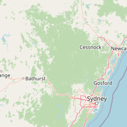
Why Brisbane Water National Park stands out

Brisbane Water National Park is best known for protecting some of the most critically endangered vegetation communities in the Sydney Basin bioregion, including the Blue Gum High Forest, littoral rainforest, and Western Sydney Dry Rainforest. The park provides essential habitat for several endangered species including the swift parrot, regent honeyeater, koala, spotted-tailed quoll and giant burrowing frog. Its location on the Central Coast, accessible from Sydney, makes it significant as a conservation refuge near a major population centre. The park also contains Pindar Cave, a notable walking destination accessible via the Central Coast railway line, and forms part of the Great North Walk trail linking Sydney to Newcastle.

Brisbane Water National Park history and protected-area timeline

Brisbane Water National Park was established in September 1959, making it one of the earlier national park designations in the Central Coast region. The park was created to protect the significant waterways of the lower Hawkesbury River, Broken Bay and Brisbane Water systems. The areas surrounding the national park on the plateaus were among the earliest settled lands in the region, which meant that the land reserved for the park was limited to remnant areas on the plateau and catchment areas of Mooney Mooney, Patonga and Mullet Creeks. These areas remained relatively inaccessible for settlement, which contributed to their preservation as protected land. The park falls within the traditional territory of the Darkinjung people, whose connection to the landscape predates European settlement by thousands of years. Management of the park is overseen by the NSW National Parks and Wildlife Service, operating under the Office of Environment and Heritage.

Brisbane Water National Park landscape and geographic character

The landscape of Brisbane Water National Park is characterized by fertile valleys running along the northern side of the Hawkesbury River, extending toward Brisbane Water and the Pacific Ocean. The park includes rugged escarpment sections above the Wondabyne railway station area, where Pindar Cave is located on the escarpment face. Coastal elements include Lion Island and Spectacle Island near the Pacific Ocean entrance to the waterways. The park encompasses the Brisbane Water estuary and Mooney Mooney Creek, creating a complex system of waterways, foreshores and forested slopes. The underlying geological substrate of Hawksbury sandstone, conglomerates and shales creates varied terrain with sandstone cliff formations, creek valleys and ridge systems. The park sits at the interface between coastal and Sydney Basin bioregional environments, producing a landscape of mixed topography and ecological character.

Brisbane Water National Park ecosystems, habitats, and plant life

The ecological character of Brisbane Water National Park is defined by a remarkable diversity of vegetation communities within a relatively limited area. Twenty distinct vegetation communities are represented in the park, all of which are considered endangered under the NSW Threatened Species Conservation Act 1995, and five are listed as critically endangered under the federal Environment Protection and Biodiversity Conservation Act 1999. These critically endangered communities include Blue Gum High Forest in the Sydney Basin Bioregion, Littoral Rainforest in the NSW North Coast, Lowland Rainforest in the NSW North Coast and Sydney Basin Bioregions, Shale Sandstone Transition Forest, and Western Sydney Dry Rainforest. The park supports approximately 814 plant species, with ten considered rare and several others uncommon or restricted in distribution. The main vegetation types include low-open forests, low-open woodland, and open woodland with either dry or moist understorey, while rainforest communities occur in sheltered valley sections and along streams. This diversity reflects variations in geology, soils, hydrology, aspect and fire history across the park.

Brisbane Water National Park wildlife and species highlights

Brisbane Water National Park supports a significant collection of wildlife despite its proximity to urban areas. In total, 261 species of fauna have been recorded in the park, all protected under the National Parks and Wildlife Act 1974. The mammal population includes 26 native species, while 30 frog species representing nine of Australia's 27 genera have been documented. Fifty reptile species, representing roughly one third of the continent's reptile genera, are found within the park. Over 150 bird species have been recorded, including several considered rare in the Sydney bioregion due to widespread habitat loss. Notable bird species include the endangered swift parrot, which migrates through the park between March and October, the critically endangered regent honeyeater, yellow-tailed black cockatoo, glossy black cockatoo, powerful owl and Australian masked owl. Mammal species of conservation significance include the koala, spotted-tailed quoll, long-nosed potoroo, grey-headed flying fox, large-eared pied bat and New Holland mouse. The park also provides habitat for the green sea turtle in its coastal waters.

Brisbane Water National Park conservation status and protection priorities

Brisbane Water National Park represents a critical conservation asset in the Sydney region due to the concentration of endangered and critically endangered ecological communities it protects. All twenty vegetation communities present in the park are listed as endangered under state legislation, with five classified as critically endangered at the federal level, reflecting the exceptional ecological significance of this landscape. The park provides essential habitat for numerous threatened species, serving as a refuge where vulnerable populations can persist away from the impacts of urban development. The park functions as a biological adjustment corridor, allowing plant and animal communities to adapt and migrate in response to climate change. However, the park faces significant conservation challenges including invasive feral animals such as foxes, wild dogs and cats originating from nearby urban areas, invasive weeds that spread through creek lines, and pressure from development on its boundaries. Management focuses on weed control, pest management, and fire regime planning to maintain ecosystem health.

Brisbane Water National Park cultural meaning and human context

Brisbane Water National Park lies within the traditional Country of the Darkinjung people, who have maintained connection to this landscape for thousands of years. The park contains a range of Aboriginal heritage sites, with rock art representations extending the known examples from the Sydney Basin within the national park system. The landscape has cultural significance beyond archaeological sites, with the waterways and valleys forming part of ongoing traditional knowledge and connection to Country. The park's establishment in 1959 came after the surrounding plateaus were among the earliest areas settled by European colonists, meaning the protected areas remained as remnant patches on the plateau and in creek catchments that were less accessible for development.

Top sights and standout views in Brisbane Water National Park

Brisbane Water National Park offers several notable features that distinguish it within the Central Coast region. Pindar Cave provides an accessible walking destination reached via Wondabyne railway station, a request-stop on the Central Coast line, making it one of the more readily accessible natural attractions in the park. The Great North Walk, a long-distance trail connecting Sydney to Newcastle, passes through the park and offers extended hiking opportunities. The park includes island environments at Lion Island and Spectacle Island, adding coastal character to the protected area. The concentration of critically endangered ecological communities, particularly the Blue Gum High Forest, represents conservation significance rarely matched in near-urban protected areas. The mix of forest, woodland, rainforest and waterways creates diverse habitats supporting over 260 wildlife species.

Best time to visit Brisbane Water National Park

The park can be visited throughout the year, with spring and autumn typically offering comfortable conditions for walking and exploring the various trails. The park's location on the Central Coast means summers can be warm while winters are mild but may see more frequent rain. The varied terrain from valley floors to escarpment slopes offers different experiences depending on season and recent weather conditions. Visitors interested in wildlife viewing may find different species active during different seasons, with migratory birds such as the swift parrot present from March through October.

Park location guide

Geography guide, regional context, and park location map for Brisbane Water National Park

Brisbane Water National Park park geography, regions, and map view in Australia
Understand where Brisbane Water National Park sits in Australia through a broader geographic reading of the surrounding landscape, nearby location context, and its mapped position within the national park landscape.

How Brisbane Water National Park fits into Australia

Australia is a constitutional monarchy and federal parliamentary democracy comprising six states and ten territories. With a population of nearly 28 million, it is one of the world's most urbanised countries, with most people concentrated on the eastern seaboard. The country has a high Human Development Index and is known for its cultural diversity, ancient Aboriginal heritage, and unique wildlife.

Wider geography shaping Brisbane Water National Park in Australia

Australia occupies the entire Australian continent, the island of Tasmania, and numerous smaller islands. It is the world's flattest and driest inhabited continent, featuring vast deserts in the interior (the Outback), tropical rainforests along the eastern coast, and a coastline bordering the Indian and Pacific Oceans.

Map view of Brisbane Water National Park

Use this park location map to pinpoint Brisbane Water National Park in Australia, understand its exact geographic position, and read its mapped placement within the surrounding landscape more clearly.

Pigeon | © OpenStreetMap contributors

Location context for Brisbane Water National Park

New South Wales
Park atlas

Trace the Regional Geography of Protected Landscapes Surrounding Brisbane Water National Park on the Central Coast

Explore Nearby National Parks and Protected Areas Beyond Brisbane Water National Park
After exploring Brisbane Water National Park, continue comparing other national parks and protected areas within its immediate vicinity and the broader Central Coast region of New South Wales. This atlas view offers crucial geographic context, revealing the protected landscape patterns and conservation efforts across similar coastal and estuarine environments.
National parkNew South Wales

Bouddi National Park: Coastal National Park with Temperate Rainforest & Marine Atlas

Discover unique sandstone landscapes and protected marine geography in New South Wales.

Bouddi National Park in New South Wales stands out for its rare mix of coastal headlands, ancient temperate rainforests, and a comprehensive marine protected area. Its landscape is defined by dramatic Hawkesbury sandstone geology, featuring spectacular tessellated pavements and laterite plateaus. The park's protected marine zone significantly enhances local biodiversity, making it a key area for understanding coastal and oceanic protected landscapes within the Australian atlas.

Area
15.32 km²
Established
1967
IUCN
II
Relief
Lowland
National parkNew South Wales

Wyrrabalong National Park National Park: Protected Littoral Rainforest and Coastal Geography

Explore mapped terrain and vital bird habitats in New South Wales.

Wyrrabalong National Park on New South Wales' Central Coast is an essential protected landscape, noted for safeguarding the last significant coastal littoral rainforest of its kind. This park entry details the mapped geography across its peninsula, island, and beachfront sections, revealing a compact yet ecologically rich environment. It highlights the park's importance as part of an Important Bird Area, supporting significant waterbird and woodland bird populations within its protected boundaries, offering a unique glimpse into a vanishing coastal ecosystem.

Area
6.2 km²
Established
1991
IUCN
II
National parkAustralia

Cattai National Park: Australia's Premier Colonial Heritage Protected Landscape

Mapped riverfront geography and historical Australian park context.

Cattai National Park represents a vital entry in Australia's atlas of protected areas, offering unparalleled insight into the nation's early colonial history alongside its natural riverine landscapes. The park's designation as a national park highlights its importance in preserving not only the unique geography of the Hawkesbury River floodplain but also significant historical sites like the Hope Farm Mill, Australia's oldest industrial site. Exploring Cattai National Park allows for a deep dive into mapped protected boundaries and the layered cultural and natural terrain of the Sydney region.

Area
4.24 km²
Established
1992
IUCN
II
National parkNew South Wales

Sydney Harbour National Park: A Distinctive Coastal Protected Landscape in New South Wales

Explore its mapped geography and unique heritage sites.

Sydney Harbour National Park represents an extraordinary protected area in New South Wales, Australia, celebrated for its integration of natural coastal terrain with significant historical sites. This national park offers a unique opportunity for atlas-based exploration of its mapped boundaries, dramatic sandstone headlands, and sheltered harbour locations. Discover the distinctive blend of natural landscape and heritage fortifications that define this metropolitan park, providing a rich geographic context for understanding urban protected areas.

Area
3.92 km²
Established
1975
IUCN
II
National parkNew South Wales

Georges River National Park: Protected Landscape and Geographic Context in New South Wales

Mapped terrain, sandstone woodlands, and key wetland habitats.

Georges River National Park, located within New South Wales, Australia, serves as a crucial protected natural area. Its 514 hectares encompass diverse terrain shaped by the Georges River, featuring significant mangrove swamps, salt marshes, and exposed sandstone woodlands characteristic of the Sydney region. This park's atlas value lies in its role preserving vital ecosystems, supporting a notable array of vertebrate and bird species, and showcasing unique natural landscapes easily explored through mapped terrain and geographic context.

Area
5.14 km²
Established
1992
IUCN
II
Relief
Lowland
National parkNew South Wales

Yengo National Park: Protected Landscape Identity and Geographic Context

Explore its mapped terrain and wilderness character.

Yengo National Park in New South Wales, Australia, is a vast protected area known for its remote wilderness character and significant geographical landmarks such as Mount Yengo. As a vital part of the Greater Blue Mountains World Heritage Site, the park showcases rugged mountainous terrain and diverse natural landscapes. This entry focuses on its atlas-value, detailing the park's mapped boundaries, regional geography, and its identity as a significant protected landscape for nature exploration.

Area
1,543.28 km²
Established
1988
IUCN
Ib
National parkNew South Wales

Werakata National Park: Protected Area Exploration and Eucalypt Forest Atlas

Mapping New South Wales' unique spotted gum-ironbark woodlands.

Werakata National Park is a significant protected area in New South Wales, Australia, dedicated to conserving the valuable spotted gum-ironbark vegetation communities of the Lower Hunter Region. This national park offers insight into the region's natural landscape, featuring undulating terrain with eucalypt forests and woodlands that are crucial for threatened species and avian biodiversity. Its distinct geographic character and mapped boundaries provide a clear focus for atlas-driven discovery of protected lands and their ecological significance.

Area
33.37 km²
Established
1999
IUCN
II
National parkNew South Wales

Georges River Koala National Park: A Protected Landscape for Critical Koala Habitat in New South Wales

Mapped geography and unique wildlife sanctuary.

Georges River Koala National Park represents a key protected area within New South Wales, specifically designated for safeguarding critical koala populations. This national park offers an invaluable insight into the region's undulating woodland terrain and the Georges River corridor's role in providing essential habitat. Understand the park's landscape character, its mapped boundaries, and its importance as a sanctuary for chlamydia-free koala colonies.

Area
18.3 km²
Established
2023
IUCN
II
Relief
Lowland

Common questions about visiting, size, designation, and location context for Brisbane Water National Park

Brisbane Water National Park FAQs for park facts, access, geography, and protected area context
Find quick answers about Brisbane Water National Park, including protected-area facts, park geography, trail and visitor context, and how the park fits into its surrounding country and regional landscape.
MoriAtlas Explorer

Continue Your Protected Areas Search Across the Global Atlas

Deepen your exploration by continuing the structured search for national parks and protected areas worldwide. Utilize the comprehensive filtering capabilities to compare different conservation landscapes and refine your understanding of global park geography. Discover more about the distribution and characteristics of protected natural areas.

Global natural geography