Mori Atlas logo
National parkCoolah Tops National Park

Discover the plateau's waterfalls, forests, and unique greater glider habitat within this New South Wales national park.

Coolah Tops National Park: Protected Landscape and Geographic Context in New South Wales

Coolah Tops National Park represents a crucial protected landscape on the Liverpool Range in New South Wales, Australia. This national park offers an elevated wilderness experience characterized by dramatic escarpments, cascading waterfalls, and extensive forested slopes that contrast with the surrounding Liverpool Plains. Its geographic setting on a dissected plateau provides sweeping panoramic views and a unique highland environment, making it a key destination for understanding regional conservation and mapped natural terrain.

Greater glider habitatEucalyptus forestWaterfallsLiverpool RangePlateau landscapeNew South Wales national parks

Coolah Tops National Park

National park

Park overview

Structured park overview, official facts, and landscape profile for Coolah Tops National Park

Coolah Tops National Park park facts, protected area profile, and essential visitor context
Review the core facts for Coolah Tops National Park, including designation, size, terrain, visitor scale, habitats, and operating context in one park-focused overview.

About Coolah Tops National Park

Coolah Tops National Park occupies a distinctive position within New South Wales' protected area network as an elevated forest reserve on the Liverpool Range, a north-south trending mountain formation that separates the slopes of the Northern Tablelands from the expansive Liverpool Plains agricultural region. The park's landscape is characterized by a dissected plateau surface cut by deep valleys and gullies, with the most dramatic topographic features being the steep escarpments and cliffs that drop away from the plateau rim toward the surrounding plains. The area receives sufficient altitude and precipitation to support moist eucalypt forest communities that differ markedly from the more arid woodlands found at lower elevations in the surrounding region. Waterfalls are a defining feature of the park, with several streams descending abruptly from the plateau, creating cascading falls that are particularly impressive following periods of rainfall. The park provides a relatively accessible wilderness experience in an area of New South Wales that lacks extensive public protected lands, making it an important recreational and conservation asset for the broader region.

Quick facts and research context for Coolah Tops National Park

Coolah Tops National Park covers an elevated plateau area in the Liverpool Range of New South Wales, rising above the surrounding pastoral lands of the Liverpool Plains. The park protects important catchments for both the Talbragar River and the Coolaburragundy River, with waterfalls plunging from the plateau edges creating scenic focal points throughout the reserve. The area features distinctive vegetation communities including open forests dominated by snow gums and areas of giant grass trees, providing habitat for gliders, wallabies, and birds of prey. The park was formally established in 1996 and operates under a statutory plan of management adopted in 2003, with recreational use centered on camping and bushwalking along established tracks.

Park context

Deeper park guide and search-rich context for Coolah Tops National Park

Coolah Tops National Park history, landscape, wildlife, and travel context
Explore Coolah Tops National Park through its history, landscape character, ecosystems, wildlife, conservation priorities, cultural context, and seasonal travel timing in a structured park guide built for atlas discovery and search intent.

Why Coolah Tops National Park stands out

Coolah Tops is particularly renowned for its significant greater glider population, which represents one of the largest concentrations of this marsupial species anywhere in Australia. The park's snow gum forests and giant grass tree woodlands create a distinctive visual character, while the dramatic waterfalls that plunge from the plateau edges provide the landscape with a dramatic vertical dimension uncommon in the region's more subdued terrain. The panoramic views from various lookouts across the Liverpool Plains below offer a striking contrast between the elevated forested plateau and the vast agricultural lowlands, making the park a significant scenic destination within inland New South Wales.

Coolah Tops National Park history and protected-area timeline

Coolah Tops National Park was established on 5 July 1996, representing the formal protection of an area that had previously existed as state forest or informal conservation land. The creation of the park reflected growing recognition of the ecological values of the Liverpool Range uplands, particularly the significant populations of greater gliders and other arboreal marsupials that depended on the mature forest habitats found in the area. Management of the park falls to the New South Wales National Parks and Wildlife Service, which operates under the framework of the National Parks and Wildlife Act. A statutory plan of management was adopted for the park in 2003, providing a governance framework for conservation activities, visitor use, and ongoing management of the park's natural and cultural values.

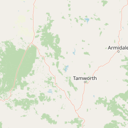
Coolah Tops National Park landscape and geographic character

The physical landscape of Coolah Tops is defined by its position on the Liverpool Range, a mountainous ridge that rises abruptly from the surrounding plains to create a distinctive highland environment. The park encompasses a plateau surface that has been deeply dissected by watercourses, resulting in a landscape of steep valleys, cascading waterfalls, and rugged escarpments. The plateau surface itself is relatively undulating, with exposed sandstone and granite outcrops visible in several locations. From the higher points of the park, particularly the prominent lookouts, visitors are rewarded with extensive views across the Liverpool Plains stretching away to the west, providing dramatic contrast between the forested upland and the agricultural lowlands. The waterfalls that characterize the park, including those along Coolah Creek and other tributaries, descend from the plateau edge in dramatic fashion, marking the location of ancient geological boundaries where hard caprock gives way to more easily eroded underlying formations.

Coolah Tops National Park ecosystems, habitats, and plant life

The ecological character of Coolah Tops is defined by moist eucalypt forests adapted to the cooler, higher-elevation conditions of the Liverpool Range. Snow gums dominate much of the taller forest, with their distinctive smooth bark and twisted forms creating a recognizable visual character across the park. Giant grass trees, with their remarkable upright flower spikes emerging from clumps of wiry leaves, add a distinctive element to the park's vegetation, particularly in more open forest areas. These vegetation communities support a diverse fauna community, with the park's older growth trees providing essential hollows for arboreal species. The forest structure includes both tall closed canopy sections and more open woodland areas, creating a heterogeneous habitat mosaic that supports different species assemblages across the park's elevation range.

Coolah Tops National Park wildlife and species highlights

Coolah Tops National Park is notable for supporting one of the largest populations of greater gliders in Australia, a fact that represents the park's most significant wildlife significance. These large marsupials rely on hollow-bearing trees for shelter and feed on eucalyptus leaves and sap, requiring extensive areas of suitable forest habitat. The park's open forests and woodland areas also provide habitat for various wallaby species, which graze on the forest floor and shelter in denser vegetation patches. The tall trees and open forest structure create ideal conditions for birds of prey, with eagles and owls among the notable avian inhabitants. The combination of mature trees with hollows, diverse forest layers, and proximity to watercourses creates a habitat that supports a relatively rich wildlife community despite the park's inland position.

Coolah Tops National Park conservation status and protection priorities

The conservation significance of Coolah Tops derives from several factors that combine to make the park an important protected area within New South Wales. The presence of one of the largest greater glider populations in Australia gives the park particular importance for the conservation of this species, which has faced population declines across much of its range due to habitat loss and fragmentation. The park protects catchments for the Talbragar River and Coolaburragundy River, contributing to water quality and ecosystem health downstream. The elevation and inland position of the park means it protects forest communities that differ from the more widespread coastal and tableland ecosystems, representing a distinct ecological community within the regional landscape. The formal protection under IUCN Category II reflects the park's primary purpose of ecosystem conservation and nature-based recreation.

Coolah Tops National Park cultural meaning and human context

While the Wikipedia source provides limited specific information regarding Indigenous cultural connections to the Coolah Tops area, the broader Liverpool Range region has historical significance in the cultural landscape of Aboriginal people of New South Wales. The elevated plateau and surrounding plains would have provided resources for traditional land use over extensive time periods, though specific cultural heritage information for the park area is not detailed in the available source material.

Top sights and standout views in Coolah Tops National Park

Coolah Tops National Park offers a distinctive elevated wilderness experience within inland New South Wales, combining significant forest ecosystems with dramatic scenery and important wildlife habitat. The greater glider population represents a major conservation asset, while the plateau waterfalls and panoramic views across the Liverpool Plains provide memorable natural scenery. The park's relatively remote location ensures a wilderness character that differs from more heavily visited coastal reserves, with camping and walking tracks offering access to the plateau interior and its various scenic attractions.

Best time to visit Coolah Tops National Park

The park can be visited throughout the year, though the cooler months from autumn through spring typically offer the most comfortable conditions for walking and outdoor activities. The forest environment is at its most vibrant during winter and early spring when moisture levels support active growth, and the absence of summer's heat makes the elevated plateau more pleasant for exploration. Waterfall flows are most impressive following periods of rainfall, which can occur throughout the year but tends to be more consistent during the cooler months. Summer temperatures on the exposed plateau can be high, and visitors should be prepared for rapid weather changes given the elevated and exposed nature of the landscape.

Park location guide

Geography guide, regional context, and park location map for Coolah Tops National Park

Coolah Tops National Park park geography, regions, and map view in Australia
Understand where Coolah Tops National Park sits in Australia through a broader geographic reading of the surrounding landscape, nearby location context, and its mapped position within the national park landscape.

How Coolah Tops National Park fits into Australia

Australia is a constitutional monarchy and federal parliamentary democracy comprising six states and ten territories. With a population of nearly 28 million, it is one of the world's most urbanised countries, with most people concentrated on the eastern seaboard. The country has a high Human Development Index and is known for its cultural diversity, ancient Aboriginal heritage, and unique wildlife.

Wider geography shaping Coolah Tops National Park in Australia

Australia occupies the entire Australian continent, the island of Tasmania, and numerous smaller islands. It is the world's flattest and driest inhabited continent, featuring vast deserts in the interior (the Outback), tropical rainforests along the eastern coast, and a coastline bordering the Indian and Pacific Oceans.

Map view of Coolah Tops National Park

Use this park location map to pinpoint Coolah Tops National Park in Australia, understand its exact geographic position, and read its mapped placement within the surrounding landscape more clearly.

Pigeon | © OpenStreetMap contributors

Location context for Coolah Tops National Park

New South Wales
Park atlas

Discover adjacent protected landscapes and trace geographic connections beyond Coolah Tops' unique plateau environment.

Explore Related National Parks and Protected Areas Near Coolah Tops National Park
After exploring Coolah Tops National Park, continue your discovery of national parks and protected areas throughout New South Wales. Compare diverse regional landscapes, conservation priorities, and geographic features to gain broader context on Australia's inland protected lands.
National parkNew South Wales

Towarri National Park: A Mapped Protected Area within New South Wales Geography

Explore its geographic boundaries and landscape context.

Towarri National Park serves as a vital protected area, offering distinct insights into the regional geography of New South Wales. This entry focuses on its mapped boundaries and protected landscape characteristics, providing a structured point for atlas-based discovery and geographic understanding of this Australian national park. Examine its unique position within the broader natural terrain.

Area
36.39 km²
Established
1998
IUCN
II
Access
Access unknown
National parkNew South Wales

Goulburn River National Park: New South Wales National Park with River Ecosystems and Heritage

Explore mapped protected lands and regional geography.

Goulburn River National Park offers a significant protected landscape within New South Wales, Australia, celebrated for its expansive Goulburn River frontage and diverse natural terrain. This national park is pivotal for understanding regional geography, featuring sandstone geological formations and serving as a critical habitat for endangered species, including the regent honeyeater. Its extensive river corridor also protects numerous Aboriginal heritage sites, contributing a rich layer of cultural significance to its conservation value. MoriAtlas helps users explore the mapped boundaries and environmental context of this vital protected area.

Area
722.96 km²
Established
1983
IUCN
II
Relief
Mixed relief
National parkNew South Wales

Garrawilla National Park: New South Wales Protected Woodland Ecosystems & Regional Geography

Explore mapped boundaries and native vegetation in this inland Australian national park.

Garrawilla National Park represents a significant protected landscape in New South Wales, Australia, dedicated to conserving semi-arid woodland terrain and characteristic native grass communities. Established to safeguard these vital ecosystems, the park offers insights into the natural heritage of the Central West region's geography. Users can explore its specific geographic footprint and understand its contribution to the preservation of inland Australian vegetation, providing a clear picture of its protected area identity.

Area
9.37 km²
Established
2005
IUCN
II
Scope
Terrestrial
National parkAustralia

Yarrobil National Park: Australia's Protected Landscape for Geographic Discovery

Explore its national park designation and mapped regional context.

Yarrobil National Park stands as a distinct protected landscape within Australia, identified as a national park. Its geographic significance lies in its contribution to the nation's atlas of conservation areas. This page focuses on providing a clear understanding of the park's identity, its environmental setting, and how its mapped boundaries fit into the broader regional geography of Australia, enabling structured exploration for enthusiasts of protected areas and natural landscapes.

Area
13.22 km²
Established
2005
IUCN
II
Relief
Upland
National parkNew South Wales

Ben Halls Gap National Park: Ancient Eucalyptus Forest Protected Landscape in New South Wales

Explore mapped boundaries of old-growth woodland terrain.

Ben Halls Gap National Park represents an ecologically vital strict nature reserve within New South Wales, Australia. It is distinguished by its extensive ancient eucalyptus forests, which are among the most ecologically significant old-growth woodland environments in eastern Australia. Managed primarily for conservation and research, the park's rugged terrain provides a critical habitat refuge and a key reference ecosystem for understanding undisturbed woodland dynamics and biodiversity.

Area
30.18 km²
Established
1995
IUCN
Ia
Scope
Terrestrial
National parkNew South Wales

Mount Royal National Park: A National Park in New South Wales for Geographic Discovery

Explore its protected boundaries and landscape context.

Mount Royal National Park is a key protected area in New South Wales, offering an opportunity to delve into its specific geographic identity and mapped landscape features. As a national park, it provides structured data for understanding protected lands within Australia. This detailed entry supports exploration of the park's unique regional context and its contribution to the broader atlas of natural landscapes.

Area
69 km²
Established
1997
IUCN
II
Relief
Mountain
National parkNew South Wales

Wollemi National Park: Mapping Australia's Protected Natural Landscape in New South Wales

Detailed geographic context and protected area exploration.

Wollemi National Park is a critical component of New South Wales' protected natural areas, offering rich opportunities for geographic discovery. This national park provides a distinct focus for understanding the mapped terrain and regional landscape context of Australia. Explore its position within New South Wales, uncovering the details that define its unique protected status and natural geography for dedicated atlas exploration.

Area
5,017.03 km²
Established
1979
IUCN
Ib
Relief
Mountain
Watercolor illustration of a river flowing through hills with distant mountains and pink trees
National parkNew South Wales

Barrington Tops National Park: A Protected National Park in New South Wales

Explore ancient Gondwana rainforests and dramatic volcanic terrain.

Barrington Tops National Park represents a significant protected landscape in New South Wales, Australia, offering a deep dive into diverse ecosystems. Its unique altitudinal vegetation gradient supports the southernmost subtropical rainforests in Australia and showcases geological formations dating back millions of years. This park is crucial for understanding Australia's natural heritage, providing a rich context for landscape exploration and the study of ancient flora within a mapped geographic setting.

Area
765.12 km²
Established
1969
IUCN
Ib
Relief
Mountain

Common questions about visiting, size, designation, and location context for Coolah Tops National Park

Coolah Tops National Park FAQs for park facts, access, geography, and protected area context
Find quick answers about Coolah Tops National Park, including protected-area facts, park geography, trail and visitor context, and how the park fits into its surrounding country and regional landscape.
MoriAtlas Explorer

Continue Your Protected Areas Search Across the Global Atlas

Deepen your exploration by continuing the structured search for national parks and protected areas worldwide. Utilize the comprehensive filtering capabilities to compare different conservation landscapes and refine your understanding of global park geography. Discover more about the distribution and characteristics of protected natural areas.

Global natural geography