Mori Atlas logo
National parkChesterton Range National Park

Discover unique Brigalow Belt ecosystems and critical watershed geography in South West Queensland.

Chesterton Range National Park: Queensland Protected Landscape & National Park Atlas

Chesterton Range National Park represents a vital protected area within Queensland's Brigalow Belt South bioregion, offering a unique glimpse into semi-arid woodlands, ridgelines, and valleys that sustain critical waterways. As a designated National Park, it serves as a refuge for diverse landscapes and thirteen rare or threatened species, showcasing the importance of mapped protected areas for regional biodiversity and natural terrain context. Explore the park's significant role in watershed conservation and its ecological value within eastern Australia's transformed natural environments.

National ParkQueenslandBrigalow BeltSemi-arid WoodlandThreatened SpeciesRiparian Corridors

Chesterton Range National Park

National park

Park overview

Structured park overview, official facts, and landscape profile for Chesterton Range National Park

Chesterton Range National Park park facts, protected area profile, and essential visitor context
Review the core facts for Chesterton Range National Park, including designation, size, terrain, visitor scale, habitats, and operating context in one park-focused overview.

About Chesterton Range National Park

Chesterton Range National Park represents an important conservation enclave in South West Queensland, protecting a landscape that embodies the character of the inland Brigalow Belt. The park's terrain features rolling ridges and valleys that channel water into three major catchment systems, creating riparian corridors through otherwise semi-arid woodland. The Brigalow Belt South bioregion was once dominated by dense brigalow (Acacia harpophylla) woodlands, though extensive clearing for agriculture has reduced this ecosystem to fragmented remnants, many occurring within protected areas like Chesterton Range. The park's establishment in 1992 reflected Queensland's growing commitment to preserving representative examples of the state's bioregions, with Chesterton Range selected for its combination of intact vegetation communities, watercourse protection, and significant biodiversity values. The presence of a historic homestead, abandoned in 1937, marks the end of pastoral use in this area and the transition toward conservation management.

Quick facts and research context for Chesterton Range National Park

Chesterton Range National Park is located in South West Queensland, Australia, near the small town of Morven. The park covers 309.8 square kilometres of semi-arid terrain within the Brigalow Belt South bioregion, with an average elevation of 544 metres. It was established in 1992 under IUCN Category II for national park protection. The park lies within the catchments of the Warrego River, Wallam Creek, and Maranoa River, and is bordered to the north and west by Orkadilla State Forest. A historic two-room homestead remains on the site, marking the location of a pastoral operation abandoned in 1937.

Park context

Deeper park guide and search-rich context for Chesterton Range National Park

Chesterton Range National Park history, landscape, wildlife, and travel context
Explore Chesterton Range National Park through its history, landscape character, ecosystems, wildlife, conservation priorities, cultural context, and seasonal travel timing in a structured park guide built for atlas discovery and search intent.

Why Chesterton Range National Park stands out

Chesterton Range National Park is particularly known for its conservation of Brigalow Belt ecosystems, which have been significantly reduced across Queensland due to agricultural development. The park protects critical habitat for thirteen rare or threatened species, including the vulnerable yakka skink, woma python, red goshawk, grey falcon, and koala. The combination of ridgeland and valley terrain supporting semi-arid woodland communities makes this park significant for preserving biodiversity in a region where much of the original vegetation has been cleared for grazing.

Chesterton Range National Park history and protected-area timeline

The land now comprising Chesterton Range National Park was historically used for pastoral grazing, with a small homestead constructed to support livestock operations. The pastoral holding was abandoned in 1937, marking the end of active grazing use in the area. Following decades of minimal development, the Queensland government established the area as a national park in 1992, recognizing its ecological significance within the Brigalow Belt South bioregion and its role in protecting headwater catchments for the Warrego River, Maranoa River, and their tributaries. The park was designated under IUCN Category II, reflecting its primary purpose of ecosystem conservation and biodiversity protection. Management responsibility was assigned to the Queensland Parks and Wildlife Service, which continues to oversee the park's protection and visitor management.

Chesterton Range National Park landscape and geographic character

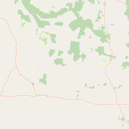
The landscape of Chesterton Range National Park is defined by its position within the Brigalow Belt South bioregion, characterised by undulating terrain with an average elevation of 544 metres. The park encompasses ridgelines and valleys that form the headwaters for three significant waterways: the Warrego River, Wallam Creek, and the Maranoa River. These watercourses and their associated riparian zones create diversity within the broader semi-arid woodland landscape. The park is bordered to the north and west by Orkadilla State Forest, extending the protected corridor through this portion of South West Queensland. The vegetation transitions from open woodlands on the ridges to denser stands in the valley floors and along watercourses, reflecting the subtle but meaningful variation in moisture availability across the terrain.

Chesterton Range National Park ecosystems, habitats, and plant life

Chesterton Range National Park protects representative examples of Brigalow Belt South bioregion ecosystems, which support distinctive semi-arid woodland communities. The vegetation is characterised by brigalow (Acacia harpophylla) dominant woodlands, transitioning through various associations across the elevation gradient from ridge to valley. These woodlands provide critical habitat structure for numerous species, with the combination of mature trees, fallen timber, and rock outcrops supporting diverse invertebrate and vertebrate communities. The water catchments flowing through the park, including the Warrego River, Wallam Creek, and Maranoa River, create riparian zones that provide more mesic environments within the broader dry landscape, supporting different plant and animal communities and serving as wildlife corridors.

Chesterton Range National Park wildlife and species highlights

The national park supports significant biodiversity, with thirteen rare or threatened species recorded within its boundaries. The vulnerable yakka skink (Egernia rugosa) inhabits the park, a reptile species that depends on fallen timber and rock crevices in woodland environments. The woma python (Aspidites ramsayi), also listed as vulnerable in some contexts, occurs in the park's semi-arid habitats. Raptor species include the red goshawk (Erythrotriorchis radiatus) and grey falcon (Falco hypoleucos), both rare birds of prey that utilise the woodland and open terrain for hunting. The koala (Phascolarctos cinereus) is present in the park, representing populations in the western extent of the species' Queensland range. These species collectively demonstrate the park's importance as a refuge for fauna in a region where much of the original habitat has been modified.

Chesterton Range National Park conservation status and protection priorities

Chesterton Range National Park plays a vital role in conserving the Brigalow Belt South bioregion, one of Australia's most threatened bioregions due to extensive agricultural conversion. The park protects critical habitat for thirteen listed threatened species, demonstrating its significance beyond merely representing vegetation types. The protection of headwater catchments for the Warrego River, Wallam Creek, and Maranoa River adds watershed protection to the park's conservation values, maintaining water quality and ecological function downstream. The park forms part of a broader conservation network in South West Queensland, connected to Orkadilla State Forest to the north and west, creating a larger protected landscape that supports wildlife movement and population viability. The presence of species like the yakka skink and woma python, which are vulnerable to habitat loss and fragmentation, underscores why protected areas like Chesterton Range are essential for regional biodiversity persistence.

Chesterton Range National Park cultural meaning and human context

The park contains evidence of historic pastoral use, most notably a small two-room homestead that marks the location of a grazing operation abandoned in 1937. This structural remnant provides a tangible link to the region's pastoral history, which shaped much of the Queensland interior before conservation values led to the establishment of protected areas. The area's indigenous cultural context is less explicitly documented in available sources, though the broader Brigalow Belt region contains evidence of Aboriginal occupation and traditional land use spanning millennia.

Top sights and standout views in Chesterton Range National Park

The park's conservation significance centres on its role as a refuge for thirteen rare or threatened species within the Brigalow Belt South, a bioregion that has lost extensive areas to clearing. The vulnerable yakka skink and woma python represent priority conservation targets, while birds of prey including the red goshawk and grey falcon demonstrate the park's importance for raptors. The historic homestead, abandoned in 1937, offers a tangible connection to the land's pastoral past. The protection of headwater catchments for three major waterways adds watershed value to the park's biodiversity significance.

Best time to visit Chesterton Range National Park

The optimal time to visit Chesterton Range National Park aligns with Queensland's cooler, drier months from autumn through early spring. Winter months (June to August) typically offer mild daytime temperatures and low humidity, making outdoor exploration comfortable. Spring brings warmer conditions and potential for wildflower displays in the woodland areas. Summer months can bring intense heat to the inland region, making outdoor activities less comfortable and increasing fire risk. Visitors should check current conditions and advisories before planning trips, as access and conditions may vary seasonally.

Park location guide

Geography guide, regional context, and park location map for Chesterton Range National Park

Chesterton Range National Park park geography, regions, and map view in Australia
Understand where Chesterton Range National Park sits in Australia through a broader geographic reading of the surrounding landscape, nearby location context, and its mapped position within the national park landscape.

How Chesterton Range National Park fits into Australia

Australia is a constitutional monarchy and federal parliamentary democracy comprising six states and ten territories. With a population of nearly 28 million, it is one of the world's most urbanised countries, with most people concentrated on the eastern seaboard. The country has a high Human Development Index and is known for its cultural diversity, ancient Aboriginal heritage, and unique wildlife.

Wider geography shaping Chesterton Range National Park in Australia

Australia occupies the entire Australian continent, the island of Tasmania, and numerous smaller islands. It is the world's flattest and driest inhabited continent, featuring vast deserts in the interior (the Outback), tropical rainforests along the eastern coast, and a coastline bordering the Indian and Pacific Oceans.

Map view of Chesterton Range National Park

Use this park location map to pinpoint Chesterton Range National Park in Australia, understand its exact geographic position, and read its mapped placement within the surrounding landscape more clearly.

Pigeon | © OpenStreetMap contributors

Location context for Chesterton Range National Park

Queensland
Park atlas

Explore the diverse protected landscapes, semi-arid woodlands, and regional park geography surrounding Chesterton Range National Park in Queensland, Australia.

Discover Other National Parks and Protected Areas Near Chesterton Range
After exploring Chesterton Range National Park, continue your journey by browsing other national parks and protected areas across Queensland's Brigalow Belt bioregion. This geographic view allows for detailed comparison of conservation efforts, unique ecosystems, and regional terrain found throughout adjacent protected landscapes.
National parkQueensland

Tregole National Park: Queensland National Park with Significant Ooline Woodlands

Explore unique semi-arid protected landscape and Ooline tree stands.

Tregole National Park in Queensland, Australia, is a protected natural area celebrated for its remarkable Ooline tree concentrations. This park offers a rare look at pure Ooline stands within a hot, dry inland climate, showcasing a significant example of semi-arid ecosystems. Its landscape represents the meeting point of brigalow and mulga biospheres, providing valuable context for understanding Australia's diverse protected areas and geographic regions within the MoriAtlas framework.

Area
75.79 km²
Established
1995
IUCN
II
National parkMaranoa Region

Carnarvon National Park: Mapped Geography and Protected Landscape Identity

Explore the sandstone gorges and ancient sites of Queensland's natural heritage.

Carnarvon National Park represents a significant protected area within the Maranoa Region of Queensland, Australia. This national park encompasses a vast expanse of approximately 2,980 square kilometers, primarily celebrated for its dramatic sandstone gorges, particularly Carnarvon Gorge, and its globally significant Aboriginal rock art sites. Positioned across the Great Dividing Range, the park's landscape features a compelling mix of deep valleys, sandy plains, and basalt-capped tablelands, offering rich cartographic and geographic context. Its designation as a national park underscores its importance for preserving these unique natural and cultural landscapes for atlas-based discovery.

Area
2,980 km²
Established
1932
IUCN
II
National parkQueensland

Thrushton National Park: Queensland's Mulga Lands National Park and Protected Landscape

Explore the semi-arid terrain and mapped conservation boundaries.

Thrushton National Park represents a crucial protected landscape within Queensland's Mulga Lands, preserving vast expanses of dense mulga scrub, spinifex sandplains, and dry woodlands. As a National Park, it offers a unique window into the semi-arid ecology of inland Australia, characterized by its subtly undulating terrain and sandy soils. This atlas-focused exploration highlights the park's distinctive vegetation communities and its regional geographic significance, providing a factual base for understanding this vital conservation area.

Area
256.52 km²
Established
1990
IUCN
II
National parkQueensland

Expedition National Park: A Dramatic Sandstone Mountain Landscape in Central Queensland

Explore protected areas, mapped ridgelines, and Robinson Gorge geography.

Expedition National Park represents a significant protected landscape in Queensland, distinguished by the striking Expedition Range. This mountainous terrain, characterized by rugged sandstone cliffs, deep gorges like Robinson Gorge, and dry eucalyptus forests, offers a unique geographic contrast to the surrounding plains. As a national park, it plays a crucial role in conserving biodiversity within the Brigalow Belt bioregion, providing an essential reference point for understanding regional protected areas and natural terrain.

Area
1,080 km²
Established
1991
IUCN
II
National parkQueensland

Mariala National Park: Queensland's Premier Mulga Lands Protected Landscape

Explore mapped terrain and regional geography.

Mariala National Park stands as a landmark designation, preserving the extensive mulga woodlands and semi-arid plains characteristic of Queensland's Mulga Lands bioregion. As the first protected area of its kind, it offers a profound insight into the ecological distinctiveness of inland Australia. This park provides a unique opportunity to explore a largely unmodified landscape, understand its role in conserving rare bird habitats, and appreciate its geographic significance within the broader Queensland atlas.

Area
269.2 km²
Established
1992
IUCN
II
National parkQueensland

Palmgrove National Park: Queensland's Remote Protected Landscape for Scientific Conservation

Rugged sandstone terrain and unique eucalypt woodlands define this park.

Palmgrove National Park is a significant scientific reserve in south-central Queensland, Australia, characterized by its dissected sandstone terrain and dry eucalypt woodlands. Designated as a strict nature reserve, its primary value lies in protecting vulnerable species and threatened ecosystems, notably serving as a crucial breeding habitat for the black-breasted buttonquail. The park's isolated geography and limited public access underscore its importance as a sanctuary for avian conservation and ecological research within Australia's protected areas network.

Area
256 km²
Established
1991
IUCN
Ia
National parkAustralia

Culgoa National Park: Iconic Coolabah Woodlands and River Floodplain Landscapes of Australia

Explore mapped boundaries and regional geography in this New South Wales protected area.

Culgoa National Park is a premier example of a preserved semi-arid outback landscape in Australia, celebrated for its extensive and intact coolabah woodlands. This national park protects vital river floodplains and a chain of permanent waterholes along the Culgoa River, contributing significantly to the biodiversity of the Darling River catchment. Understanding its geographic setting and the mapped distribution of its unique vegetation communities offers deep insight into Australia's natural heritage.

Area
352.39 km²
Established
1996
IUCN
II
National parkQueensland

Taunton National Park: Queensland's Vital National Park and Endangered Species Refuge

Mapped brigalow landscapes and semi-arid woodland terrain.

Taunton National Park in Central Queensland is a protected area of immense conservation value, serving as the last known natural habitat for the endangered bridled nail-tail wallaby. This national park protects representative ecosystems of the Northern Brigalow Belt, featuring distinct brigalow vegetation communities and poplar box woodlands across its cracking clay and texture-contrast soils. Understand the park's geographic setting, its mapped terrain, and the critical role it plays in preserving Australia's unique marsupial populations and diverse flora within the wider regional context.

Area
116 km²
Established
1986
IUCN
II

Common questions about visiting, size, designation, and location context for Chesterton Range National Park

Chesterton Range National Park FAQs for park facts, access, geography, and protected area context
Find quick answers about Chesterton Range National Park, including protected-area facts, park geography, trail and visitor context, and how the park fits into its surrounding country and regional landscape.
MoriAtlas Explorer

Continue Your Protected Areas Search Across the Global Atlas

Deepen your exploration by continuing the structured search for national parks and protected areas worldwide. Utilize the comprehensive filtering capabilities to compare different conservation landscapes and refine your understanding of global park geography. Discover more about the distribution and characteristics of protected natural areas.

Global natural geography