Mori Atlas logo
National parkSouss-Massa National Park

Discover the unique geography, mapped boundaries, and critical ecosystems of this vital national park.

Souss-Massa National Park: Morocco's Coastal Protected Landscape and Atlas Map

(Parc National de Souss-Massa)

Souss-Massa National Park represents a significant protected coastal territory along Morocco's Atlantic shore, spanning diverse terrains from sand dunes to wetlands and steppe. This detailed page provides an atlas-level view of the park's geographic scope, its precisely mapped boundaries, and the unique natural landscapes it preserves. Understand the park's importance as a critical habitat and conservation area within the broader Moroccan geography.

Coastal WetlandsBird ConservationIUCN Category IIRamsar SiteNorth African WildlifeEndangered Species

Souss-Massa National Park

National park

Park overview

Structured park overview, official facts, and landscape profile for Souss-Massa National Park

Souss-Massa National Park park facts, protected area profile, and essential visitor context
Review the core facts for Souss-Massa National Park, including designation, size, terrain, visitor scale, habitats, and operating context in one park-focused overview.

About Souss-Massa National Park

Souss-Massa National Park protects a distinctive coastal ecosystem along Morocco's southwestern Atlantic shore in the Souss-Massa region. The park's creation in 1991 reflected growing recognition of the area's ecological importance, particularly its role as a sanctuary for endangered species and migratory bird populations. The park's geography is defined by its river estuaries and coastal landforms, with the Oued Souss marking the northern limit, the perennial Oued Massa providing a central water corridor, and the landscape descending toward the Atlantic beaches at the southern end near Aglou. The steppe environment, characterized by graminoid vegetation and scattered shrub coverage, supports both resident and migratory bird populations. The wetlands and estuaries provide critical habitat for waterbirds throughout the year, while the coastal cliffs serve as nesting sites for the park's internationally important ibis colonies. Beyond its ecological function, the park offers educational infrastructure including a visitor centre at Oued Massa and nature trails along the Oued Souss, enabling public engagement with this significant conservation landscape.

Quick facts and research context for Souss-Massa National Park

Souss-Massa National Park covers 33,800 hectares along Morocco's Atlantic coast in the Souss-Massa region, approximately midway between Agadir and Sidi Ifni. The park was established in 1991 and holds Ramsar Wetland status since 2005. Its landscape consists of grazed steppe, sand dunes, beach corridors, and wetland estuaries with predominantly sandy soils. The park forms part of a larger 63,800-hectare Important Bird Area recognized by BirdLife International. It serves as the primary stronghold for the northern bald ibis in Morocco, hosting three of the four national colonies and representing 95% of the world's wild breeding population of this critically endangered species.

Park context

Deeper park guide and search-rich context for Souss-Massa National Park

Souss-Massa National Park history, landscape, wildlife, and travel context
Explore Souss-Massa National Park through its history, landscape character, ecosystems, wildlife, conservation priorities, cultural context, and seasonal travel timing in a structured park guide built for atlas discovery and search intent.

Why Souss-Massa National Park stands out

Souss-Massa National Park is internationally significant for its role as the primary refuge for the northern bald ibis, hosting approximately 95% of the world's truly wild breeding population across three colonies within the park plus a fourth at nearby Tamri. The park supports unique breeding populations of birds found nowhere else in Morocco, including the marbled duck and glossy ibis. It also maintains captive breeding programs for four threatened North African ungulates: the scimitar oryx, addax, dama gazelle, and dorcas gazelle. Additionally, the park is undertaking reintroduction efforts for the North African ostrich, a species now extinct north of the Sahara Desert.

Souss-Massa National Park history and protected-area timeline

Souss-Massa National Park was established in 1991 as part of Morocco's expanding network of protected areas during the late twentieth century. The park's designation reflected increasing scientific understanding of the region's importance for endangered species, particularly the northern bald ibis whose global population had declined dramatically by the late twentieth century. The identification of the Souss-Massa coastline as a critical stronghold for this species influenced the park's boundaries and conservation priorities. In 2005, the park's wetland components received formal recognition under the Ramsar Convention, designating the Zones humides de Souss-Massa as a site of international importance for waterbird conservation. The park has also engaged in international cooperation, receiving technical support from Teide National Park in Tenerife, Spain, reflecting collaborative conservation efforts within the Canary Islands ecoregion. Captive breeding and reintroduction programs for North African ungulates and the North African ostrich represent ongoing conservation initiatives within the park's history.

Souss-Massa National Park landscape and geographic character

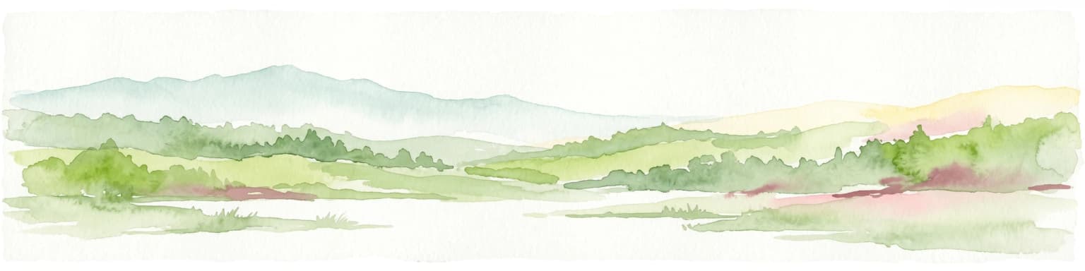
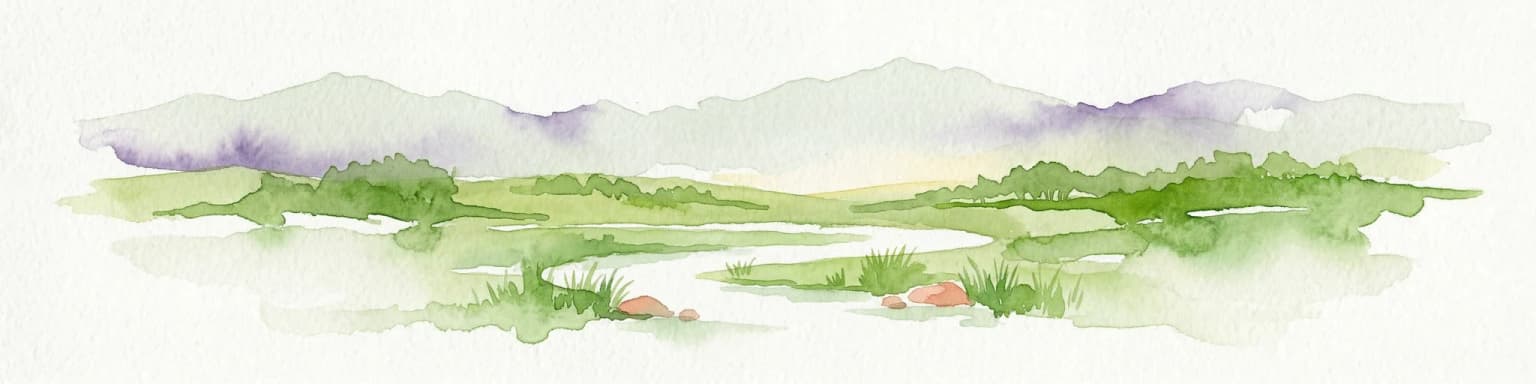
The physical landscape of Souss-Massa National Park comprises a coastal plain and shoreline environment along the Atlantic Ocean in southern Morocco. The terrain is predominantly flat to gently undulating, characterized by a matrix of grazed steppe vegetation interspersed with sand dunes along the beach zones. The park's three major watercourses the Oued Souss, Oued Massa, and their associated estuaries create linear wetland corridors that dissect the coastal plain. The Oued Massa maintains surface water throughout the year, providing a permanent aquatic habitat within the otherwise semi-arid landscape. Soils throughout the park are primarily sandy, with localized rockier exposures in certain areas. The coastline features beach segments and coastal cliffs that serve as nesting habitat for colonial bird species. The landscape extends southward beyond the formal park boundary to include approximately 30,000 hectares near Aglou that function as feeding territory for the northern bald ibis.

Souss-Massa National Park ecosystems, habitats, and plant life

The ecological character of Souss-Massa centers on its coastal steppe and wetland habitats that support exceptional bird diversity. The estuarine environments of the Oued Souss and Oued Massa provide year-round water and feeding resources for waterbirds, creating a critical refuge in the semi-arid coastal zone. The coastal steppe habitat, while modified by grazing, maintains sufficient vegetation structure to support ground-nesting birds and feeding ibis populations. The park's designation as part of a larger Important Bird Area reflects its significance for maintaining populations of multiple bird species, including breeding, wintering, and migratory populations. The wetland habitats support globally threatened species including the marbled duck, which breeds exclusively at Oued Massa within Morocco, and the glossy ibis, representing the species' only known breeding site in the country.

Souss-Massa National Park wildlife and species highlights

The wildlife of Souss-Massa National Park is defined by its exceptional bird populations, particularly the northern bald ibis which represents the park's primary conservation significance. Three colonial populations of this critically endangered species nest on coastal cliffs within the park, and together with the nearby Tamri population, these colonies support approximately 95% of the world's truly wild northern bald ibis breeding population. The coastal steppes and agricultural fields surrounding the cliff colonies provide essential foraging habitat. Beyond the ibis, the park supports breeding populations of marbled ducks at the Oued Massa, the only known breeding site for this globally threatened species in Morocco. The glossy ibis also breeds at Oued Massa, representing a unique national breeding record. Wintering species include European spoonbill and Audouin's gull, while the estuaries serve as important migration staging areas for waders and gulls. The park also maintains captive breeding facilities for four threatened North African ungulates: scimitar oryx, addax, dana gazelle, and dorcas gazelle, kept in separate enclosures within the park boundaries. Reintroduction efforts for the North African ostrich, extinct in the wild north of the Sahara, are also underway.

Souss-Massa National Park conservation status and protection priorities

Souss-Massa National Park holds exceptional conservation significance as the primary habitat for the northern bald ibis, one of the world's most endangered bird species. The park's three breeding colonies, combined with the adjacent Tamri population, support approximately 95% of the global wild breeding population, making this coastal area globally critical for species survival. The Ramsar designation of the park's wetland components in 2005 acknowledges the international importance of these habitats for waterbird conservation. The Important Bird Area designation by BirdLife International further reinforces the site's significance for maintaining significant populations of multiple bird species. Conservation challenges include population pressure from expanding human settlement around Aglou and development proposals in sensitive coastal areas, though a major hotel development at Tifnit has been suspended. The park's captive breeding programs for North African ungulates and ostrich reintroduction efforts represent active conservation interventions targeting species affected by hunting and habitat loss across the region.

Souss-Massa National Park cultural meaning and human context

The Souss-Massa region has a long human presence along Morocco's Atlantic coast, with traditional land use patterns including pastoral grazing and small-scale agriculture that have shaped the contemporary landscape. The park encompasses estuarine environments that have historically supported local fishing communities, and the coastal zone around Aglou and Tifnit represents areas of ongoing human settlement and activity. The presence of the northern bald ibis in this landscape reflects a long co-existence between local communities and wildlife, though the species has faced pressures from hunting and habitat modification. The park's infrastructure, including the visitor centre and eco-museum at Sidi Birzarn, provides educational context for visitors about the region's natural heritage and conservation values.

Top sights and standout views in Souss-Massa National Park

The northern bald ibis colonies represent the park's most globally significant wildlife feature, with coastal cliff nesting sites visible from designated viewing areas. The visitor centre at Oued Massa provides orientation and educational resources about the park's ecology and conservation programs. The nature trail along Oued Souss offers access to wetland environments and bird observation opportunities. Year-round water in the Oued Massa supports breeding waterbirds including marbled ducks and glossy ibis. The captive breeding enclosures for scimitar oryx, addax, and gazelle species provide opportunities to observe North African ungulates in a protected setting. The coastal dunes and beaches at the southern end of the park provide contrasting landscape scenery.

Best time to visit Souss-Massa National Park

The park supports year-round wildlife viewing, though different seasons offer distinct experiences. The wet winter months from November through March bring wintering species including European spoonbill and Audouin's gull, while migratory waders and gulls use the estuaries during passage periods. The breeding season for the northern bald ibis occurs in spring and early summer, when colonies are active and chicks are raised. The resident bird species, including various larks and warblers, are observable throughout the year. The Oued Massa holds water throughout all seasons, providing consistent habitat for waterbirds. Summer months coincide with peak visitor activity in the broader Agadir region, though the park's wetland habitats remain viable destinations year-round due to the perennial river flow.

Park location guide

Geography guide, regional context, and park location map for Souss-Massa National Park

Souss-Massa National Park park geography, regions, and map view in Morocco
Understand where Souss-Massa National Park sits in Morocco through a broader geographic reading of the surrounding landscape, nearby location context, and its mapped position within the national park landscape.

How Souss-Massa National Park fits into Morocco

Morocco is a North African country bordering the Mediterranean Sea to the north and Atlantic Ocean to the west. It borders Algeria to the east and the disputed Western Sahara territory to the south. The country operates as a parliamentary constitutional monarchy under King Mohammed VI, with Arabic and Tamazight as official languages. Morocco has a population of approximately 37 million and covers an area of about 446,550 km².

Wider geography shaping Souss-Massa National Park in Morocco

Morocco occupies the northwestern corner of Africa, bordering the Mediterranean Sea to the north and Atlantic Ocean to the west. The country shares borders with Algeria to the east and the disputed Western Sahara territory to the south. The terrain is diverse, featuring the Atlas Mountains in the central and southern regions, Rif Mountains in the north, and plains along the coastal areas. The country also claims Spanish exclaves of Ceuta and Melilla.

Map view of Souss-Massa National Park

Use this park location map to pinpoint Souss-Massa National Park in Morocco, understand its exact geographic position, and read its mapped placement within the surrounding landscape more clearly.

Pigeon | © OpenStreetMap contributors
Park atlas

Compare additional protected areas across Morocco, exploring coastal landscapes and regional conservation zones beyond Souss-Massa National Park.

Discover Other National Parks Near Souss-Massa, Morocco, for Broader Coastal Conservation Exploration
Continue your exploration of protected areas beyond Souss-Massa National Park, discovering other significant conservation zones across the Moroccan Atlantic coast and its diverse ecosystems. This allows for a deeper understanding of regional protected-landscape patterns, comparing coastal wetlands, steppe, and riverine habitats with similar features.
National parkMorocco

Toubkal National Park: Morocco's Key Protected National Park for Geographic Exploration

Mapped boundaries and regional landscape context within Morocco.

Toubkal National Park stands as a significant protected area within Morocco, offering a lens through which to explore its diverse natural geography and protected landscapes. This national park designation signifies its importance for understanding the country's conservation efforts and its mapped territorial integrity. Users can discover the park's unique geographic attributes and its role within the larger atlas of Moroccan protected lands, providing foundational context for further geographic discovery.

Area
380 km²
Established
1942
IUCN
II
Relief
Mountain
Watercolor painting depicting mountains, a body of water, and vegetation
National parkLaâyoune-Sakia El Hamra

Khenifiss National Park: A Protected Landscape within Laâyoune-Sakia El Hamra Region

Explore its mapped protected area and regional geography.

Khenifiss National Park offers a distinct entry into protected landscape exploration within the Laâyoune-Sakia El Hamra region. This park detail page provides core geographic context, focusing on its mapped boundaries and its significance as a protected natural area. Dive into the structured data that defines Khenifiss National Park, facilitating a deeper atlas-based understanding of its landscape and regional distribution.

Area
1,850 km²
Established
2006
IUCN
II
Relief
Lowland
Watercolor painting of a landscape with grassy areas, a winding river, and mountains under a light sky
National parkCanary Islands

Timanfaya National Park: Dramatic Volcanic Landscape in the Canary Islands

Explore Spain's unique geological national park.

Timanfaya National Park offers an extraordinary exploration of volcanic terrain, a protected area that defines geological conservation in the Canary Islands. Its landscape, shaped by powerful eruptions, features vast lava fields, striking volcanic cones, and visible geothermal activity. As Spain's only purely geological national park, Timanfaya provides a unique context for understanding volcanic processes and appreciating the raw beauty of its protected natural environment, serving as a key landmark within the archipelago's geography.

Area
51.07 km²
Established
1974
IUCN
II
Relief
Mountain
National parkMorocco

Haut Atlas Oriental National Park: National Park Mapping and Protected Landscape Identity

Explore its mapped geography and regional atlas context.

Delve into the specifics of Haut Atlas Oriental National Park, a designated national park in Morocco. This page serves as a detailed atlas entry, focusing on the park's protected landscape characteristics, its defined geographic boundaries, and its significance within the national park system. Understand the terrain and regional context that shape this important natural area for focused discovery.

Area
490 km²
IUCN
II
Relief
Mountain
Climate
Alpine
National parkMorocco

Khenifra National Park: National Park Atlas and Mapped Protected Landscape

Geographic context and protected area mapping for Morocco.

Explore the atlas perspective of Khenifra National Park, a designated national park in Morocco. This page provides detailed geographic context, focusing on its mapped protected landscape and its role within the country's network of conservation areas. Understand the park's terrain and regional setting through structured geographic data.

Area
842 km²
Established
2008
Relief
Mountain
Climate
Mediterranean
National parkMorocco

Ifrane National Park: Protected Landscape and Geographic Context in Morocco

National park boundaries and mapped terrain.

Investigate Ifrane National Park, a designated national park in Morocco, and its contribution to the country's protected lands. This profile details its geographic location, providing context for its mapped presence and the natural landscapes it encompasses. Delve into the atlas-relevant features that define this protected area, focusing on its geographic identity within Morocco's natural heritage.

Area
500 km²
Established
2004
IUCN
II
Relief
Mountain
National parkTaza Province

Tazekka National Park: Protected Landscape and Geographic Context in Taza Province

Discover its national park status and mapped terrain.

Tazekka National Park serves as a vital protected area within the geographic framework of Taza Province, Morocco. This national park offers a distinct landscape for exploration, allowing users to investigate its mapped boundaries and regional natural features. Understand the park's role in the local geography and its contribution to Morocco's atlas of protected lands. Its specific terrain and setting make it a key point for structured geographic discovery.

Area
120 km²
Established
1950
IUCN
II
Relief
Mountain
Watercolor illustration of a mountainous landscape with green and purple hues, featuring rolling hills, distant mountains, and a light sky.
National parkTenerife

Teide National Park: Spain's Highest Peak and Distinctive Volcanic Landscape

Explore protected volcanic terrain and mapped geography on Tenerife.

Teide National Park protects the highest point in Spain, Mount Teide, within a spectacular caldera and surrounding volcanic terrain on Tenerife. This national park offers a unique landscape for geographic discovery, showcasing dramatic lava flows, volcanic cones, and endemic flora. Its protected boundaries define a significant area of natural interest, making it a key landmark for atlas exploration of island geography and protected lands.

Area
189.9 km²
Established
1954
IUCN
II
Visitors
4.5M annual

Common questions about visiting, size, designation, and location context for Souss-Massa National Park

Souss-Massa National Park FAQs for park facts, access, geography, and protected area context
Find quick answers about Souss-Massa National Park, including protected-area facts, park geography, trail and visitor context, and how the park fits into its surrounding country and regional landscape.
MoriAtlas Explorer

Continue Your Protected Areas Search Across the Global Atlas

Deepen your exploration by continuing the structured search for national parks and protected areas worldwide. Utilize the comprehensive filtering capabilities to compare different conservation landscapes and refine your understanding of global park geography. Discover more about the distribution and characteristics of protected natural areas.

Global natural geography