Mori Atlas logo
National parkGarajonay National Park

Discover the unique geography and mapped landscape of Spain's iconic protected area.

Garajonay National Park: Ancient Laurisilva Forest and Volcanic Terrain in the Canary Islands

(Parque nacional de Garajonay)

Garajonay National Park, a vital national park on Spain's La Gomera island, protects an exceptional remnant of Europe's ancient laurisilva forest. Situated in the highlands, this UNESCO World Heritage Site showcases dramatic volcanic formations and a persistent cloud forest ecosystem. The park's mapped terrain offers a unique glimpse into island geography and the evolution of unique natural landscapes.

Laurisilva ForestVolcanic LandscapesUNESCO World Heritage SiteIsland ConservationEndemic SpeciesCanary Islands

Garajonay National Park

National park

Park overview

Structured park overview, official facts, and landscape profile for Garajonay National Park

Garajonay National Park park facts, protected area profile, and essential visitor context
Review the core facts for Garajonay National Park, including designation, size, terrain, visitor scale, habitats, and operating context in one park-focused overview.

About Garajonay National Park

Garajonay National Park represents one of the Canary Islands' most significant natural treasures, protecting a mountain environment of extraordinary ecological importance on the island of La Gomera. The park occupies the island's central highlands and extends into each of its six municipalities, covering roughly ten percent of La Gomera's total surface area. Its landscape is fundamentally shaped by volcanic geology—basaltic materials from ancient lava flows and pyroclastic deposits form the foundation upon which the forest has developed. The most striking topographic features are the Roques, massive volcanic plugs and eroded remnants that rise dramatically from the forested slopes. Several of these formations held sacred significance for the Guanche inhabitants, the indigenous people of the Canary Islands, and served as refuges during periods of conflict. The park's name derives from both the highest peak and a romantic Guanche legend of the lovers Gara and Jonay, whose tragic story evokes themes of forbidden love across island boundaries. The national park was created in 1981 as the fourth and youngest of the Canary Islands' national parks, later gaining international recognition through its UNESCO World Heritage status and its inclusion in the island's biosphere reserve designation. The human relationship with this landscape extends back centuries, though no permanent settlements exist within the park boundaries today.

Quick facts and research context for Garajonay National Park

Garajonay National Park covers approximately 40 square kilometres spanning all six municipalities of La Gomera in the Canary Islands. The park's elevation ranges from 650 metres at El Cedro to 1,487 metres at the Garajonay summit. It protects the best-preserved laurisilva forest in the Macaronesian region, with roughly 50 tree species contributing to the canopy. The park was designated a UNESCO World Heritage Site in 1986 and became part of the island's Biosphere Reserve in 2012. Approximately 450,000 visitors explore the park annually, primarily along its network of 18 marked hiking trails.

Park context

Deeper park guide and search-rich context for Garajonay National Park

Garajonay National Park history, landscape, wildlife, and travel context
Explore Garajonay National Park through its history, landscape character, ecosystems, wildlife, conservation priorities, cultural context, and seasonal travel timing in a structured park guide built for atlas discovery and search intent.

Why Garajonay National Park stands out

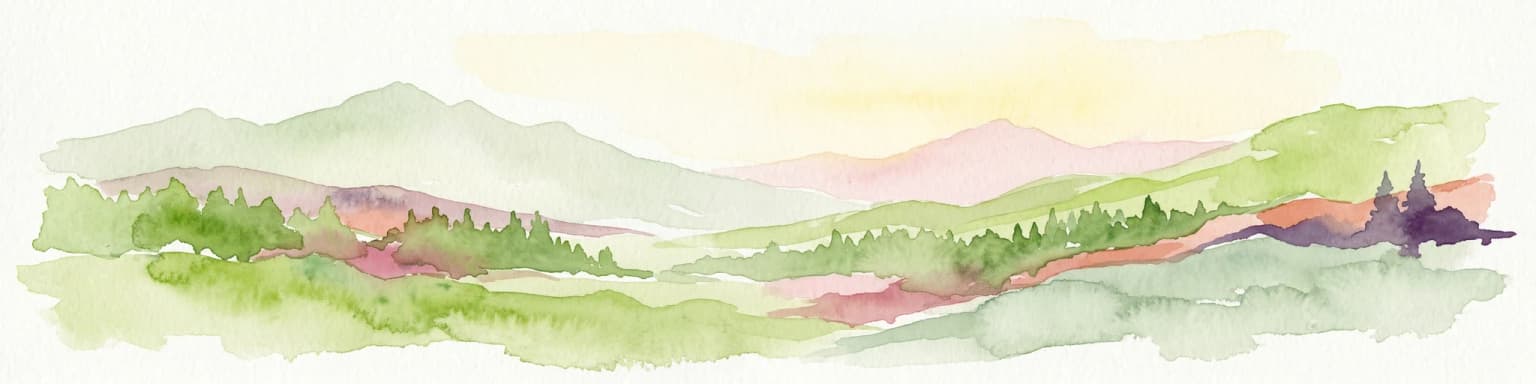
Garajonay is best known for its extraordinary laurisilva forest, one of the last surviving examples of the subtropical laurel forests that covered much of southern Europe millions of years ago. The park's fog-drenched slopes support a complex vertical structure of broad-leaved evergreen trees, with species like Canary laurel, Til, and Vinátigo forming a dense canopy. The forest's understory thrives with ferns, mosses, and lichens, creating an almost enchanted atmosphere that inspired the park's "Enchanted Forest" area. The park is also famous for its two endemic pigeons, the laurel pigeon and Bolle's pigeon, considered among the rarest columbiformes in Europe. The dramatic volcanic rock formations, particularly Roque de Agando and Roque de La Zarcita, add another dimension to the park's identity.

Garajonay National Park history and protected-area timeline

Garajonay National Park was established on March 25, 1981, becoming the fourth and currently youngest national park in the Canary Islands. The designation came after decades of growing recognition that the laurisilva forest represented an irreplaceable ecological treasure requiring formal protection. In 1986, the park received international recognition when UNESCO inscribed it on the World Heritage List, citing its outstanding universal value as a natural site meeting criteria for both cultural landscape qualities (criterion vii) and ecological processes (criterion ix). The inscription acknowledged the park as the finest example of laurisilva in the Macaronesian region and one of the few remaining tracts of this forest type globally. A significant challenge came in August 2012 when a wildfire swept across La Gomera, penetrating the park and burning approximately 747 hectares—about 18 percent of the park's total area. The fire prompted extensive restoration efforts and renewed attention to fire prevention in the protected area. In 2012, the park gained additional recognition as part of a broader designation when the entire island of La Gomera was declared a Biosphere Reserve by UNESCO, reflecting the integration of conservation with sustainable development on the island.

Garajonay National Park landscape and geographic character

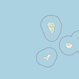
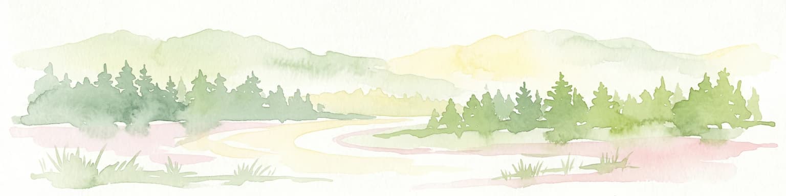
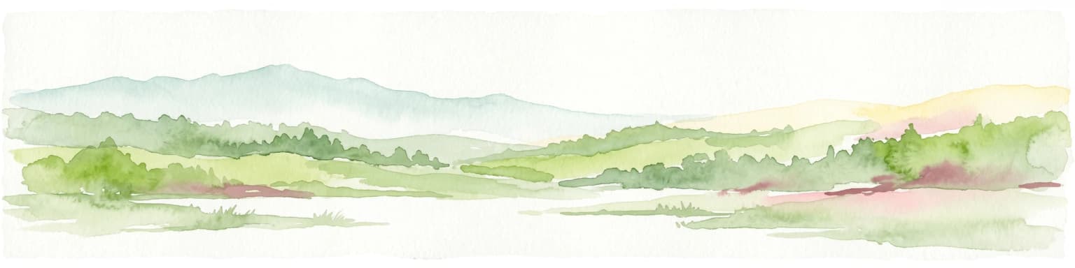
The landscape of Garajonay National Park is defined by the interaction between volcanic geology and the persistent moisture that wraps the island's highlands. The terrain consists primarily of basaltic materials—hard volcanic rock formed from ancient lava flows and explosive eruptions—which has been deeply carved by erosion over millions of years. The most distinctive features are the Roques, imposing rock formations that stand as vertical sentinels above the forested slopes. Roque de Agando, with its layered columns and steep faces, exemplifies the dramatic volcanic remnants that characterize the park. The park encompasses a plateau zone ranging from 790 to 1,400 metres in altitude, with the summit of Garajonay reaching 1,487 metres. This elevation range places much of the park within the cloud zone, where moisture-laden trade winds condense as mist or fog for much of the year. The resulting "sea of clouds" sustains the laurisilva ecosystem and creates an atmospheric landscape often shrouded in ethereal mist. Valleys cutting through the park contain the most luxuriant forest growth, where protection from wind and abundant moisture create ideal conditions for the densest vegetation.

Garajonay National Park ecosystems, habitats, and plant life

The nature of Garajonay is defined by its laurisilva forest, considered the best example of this forest type remaining in the world. Laurisilva is a humid subtropical evergreen forest characterized by broad-leaved trees with leathery, dark green leaves adapted to the constantly moist environment. The forest here developed from Tertiary-era woodlands that once covered much of southern Europe but survived in Macaronesia as climate conditions changed. The park's laurisilva displays distinct variations across its elevation range. Valley laurisilva occurs in the most protected north-facing ravines, where the largest laurel trees grow in a true subtropical rainforest setting. Slope laurisilva occupies higher, more exposed positions where the forest loses some of its more delicate species. At higher elevations and on drier southern slopes, the vegetation transitions to fayal-brezal, a more open forest dominated by faya (a heather relative) and Erica arborea, which here reaches among the largest sizes recorded for this species worldwide. The forest supports an extraordinary density of epiphytic vegetation—mosses, liverworts, ferns, and lichens coating tree trunks and branches—reflecting the consistently high humidity. Rocky outcrops within the park harbor specialized flora, including approximately 120 endemic plant species, some found nowhere else on Earth.

Garajonay National Park wildlife and species highlights

Garajonay National Park supports remarkable biodiversity despite its relatively small area, with approximately 1,000 invertebrate species and 30 vertebrate species documented. The park's global significance for birds makes it an Important Bird Area recognized by BirdLife International. Most notable are two endemic pigeon species that represent some of the rarest birds in Europe. The laurel pigeon, locally known as paloma turqué, and Bolle's pigeon both depend on the laurisilva forest for nesting and feeding, making Garajonay one of the best places in the world to observe these species. Reptiles include two endemic species—the Gomeran lizard and Gomeran skink—representing the island's ancient isolation and evolutionary divergence. The stripeless tree frog represents the amphibian community, while several bat species contribute to the nocturnal fauna. The invertebrate community is exceptionally rich, with numerous endemic insects, mollusks, and other creatures adapted to specific microhabitats within the forest. This invertebrate diversity remains poorly studied relative to the vertebrates and represents an ongoing frontier for biological discovery.

Garajonay National Park conservation status and protection priorities

Garajonay represents one of the most important conservation sites in Europe and the Macaronesian region, protecting the world's best example of laurisilva forest. The forest type once dominated much of southern Europe during the Tertiary period but now survives only in fragments on the Azores, Madeira, and the Canary Islands, making Garajonay's preservation crucial for global biodiversity. The park's UNESCO World Heritage designation recognizes its outstanding universal value both as a landscape of exceptional natural beauty and as a living example of ecological processes that shaped European forests millions of years ago. The 2012 wildfire that burned 18 percent of the park highlighted both the vulnerability of this ecosystem and the challenges of conservation in a changing climate. Restoration efforts have focused on replanting native species and preventing invasive species from colonizing burned areas. As part of La Gomera's Biosphere Reserve designation, the park also serves as a core area within a broader conservation framework that integrates sustainable development for the island's human communities.

Garajonay National Park cultural meaning and human context

The cultural identity of Garajonay extends beyond its ecological significance to encompass the Guanche heritage of La Gomera, the indigenous people who inhabited the Canary Islands before Spanish conquest. Several rock formations within the park, particularly the Roques, held sacred significance for the Guanche and served as sanctuaries and refuges during periods of inter-tribal conflict. The legend of Gara and Jonay, for whom both the highest peak and the park are named, represents one of the most enduring cultural narratives associated with the landscape. This Guanche tale of star-crossed lovers—one a princess of Agulo on La Gomera, the other the son of a king from Tenerife—echoes universal themes of Romeo and Juliet and has been depicted in wooden sculptures placed within the park. The name "Garajonay" itself derives from this legend, combining the names of the two lovers. The park contains a Guanche sanctuary at its summit, demonstrating the continued cultural resonance of this landscape for the island's heritage.

Top sights and standout views in Garajonay National Park

Garajonay National Park offers several standout features that distinguish it among Europe's protected areas. The laurisilva forest itself is the primary highlight—a living relic of Tertiary-era Europe preserved in extraordinary completeness. The Enchanted Forest area provides visitors with an immersive experience among moss-draped trees and misty ravines. The volcanic Roques, particularly Roque de Agando and Roque de La Zarcita, create dramatic focal points against the forest backdrop. The park's trail network of 18 footpaths allows exploration from gentle forest walks to more challenging summit routes. The endemic birdlife, especially the two rare pigeon species, draws ornithologists and nature enthusiasts seeking close encounters with Europe's most restricted avian species. The persistent cloud cover creates an atmospheric quality unlike typical Mediterranean landscapes, with the "sea of clouds" phenomenon offering a distinctive visual experience.

Best time to visit Garajonay National Park

Garajonay can be visited year-round, though the experience varies substantially with seasons. The summer months of July and August bring the highest visitor numbers but also the risk of extreme heat and the lingering scars of the 2012 fire. Spring and autumn generally offer the most pleasant conditions for hiking, with moderate temperatures and the forest at its most verdant. Winter brings cooler temperatures and increased rainfall, which sustains the moisture that feeds the laurisilva but can make some trails muddy and slippery. The persistent cloud cover and mist that characterize the park occur throughout the year but are particularly prevalent during the winter and spring months, creating the atmospheric conditions that sustain the forest. Regardless of season, visitors should be prepared for rapid weather changes and the possibility of rain, as the cloud zone experiences precipitation far more frequently than the coastal areas of the island.

Park location guide

Geography guide, regional context, and park location map for Garajonay National Park

Garajonay National Park park geography, regions, and map view in Spain
Understand where Garajonay National Park sits in Spain through a broader geographic reading of the surrounding landscape, nearby location context, and its mapped position within the national park landscape.

How Garajonay National Park fits into Spain

Spain, officially the Kingdom of Spain, is a unitary parliamentary constitutional monarchy located in Southern and Western Europe. The country occupies most of the Iberian Peninsula and includes territories in the Mediterranean and Atlantic. With a population of approximately 49.6 million and an area of 506,030 km², Spain is a major European economy and cultural force. Its capital is Madrid, and the country is known for its diverse landscapes ranging from mountainous regions to coastal areas.

Wider geography shaping Garajonay National Park in Spain

Spain occupies the Iberian Peninsula in Southern and Western Europe. Peninsular Spain is bordered to the north by France, Andorra, and the Bay of Biscay; to the east and south by the Mediterranean Sea and Gibraltar; and to the west by Portugal and the Atlantic Ocean. The territory includes the Canary Islands in the Atlantic Ocean, the Balearic Islands in the Mediterranean Sea, and the autonomous cities of Ceuta and Melilla in mainland Africa. Spain features diverse terrain including the Pyrenees in the northeast, the Sierra Nevada in the south, and the Meseta Central plateau.

Map view of Garajonay National Park

Use this park location map to pinpoint Garajonay National Park in Spain, understand its exact geographic position, and read its mapped placement within the surrounding landscape more clearly.

Pigeon | © OpenStreetMap contributors

Location context for Garajonay National Park

Canary Islands
Park atlas

Compare similar island conservation landscapes and regional protected areas in the Canary Islands.

Discover Other National Parks and Protected Areas Near Garajonay National Park
After exploring Garajonay National Park's ancient laurisilva forests and volcanic Roques, delve into an expanded atlas view of other protected areas, including similar island ecosystems and diverse conservation landscapes. This geographic comparison provides context for the unique natural heritage of the Canary Islands, allowing for deeper exploration of regional park geography.
Watercolor illustration of a mountainous landscape with green and purple hues, featuring rolling hills, distant mountains, and a light sky.
National parkTenerife

Teide National Park: Spain's Highest Peak and Distinctive Volcanic Landscape

Explore protected volcanic terrain and mapped geography on Tenerife.

Teide National Park protects the highest point in Spain, Mount Teide, within a spectacular caldera and surrounding volcanic terrain on Tenerife. This national park offers a unique landscape for geographic discovery, showcasing dramatic lava flows, volcanic cones, and endemic flora. Its protected boundaries define a significant area of natural interest, making it a key landmark for atlas exploration of island geography and protected lands.

Area
189.9 km²
Established
1954
IUCN
II
Visitors
4.5M annual
Watercolor illustration showing a mountainous landscape with green forests, a winding river, and distant hills
National parkLa Palma

Caldera de Taburiente National Park: A Volcanic Caldera Landscape on La Palma

Explore protected boundaries and unique mapped terrain.

Delve into Caldera de Taburiente National Park, a protected area defined by its immense volcanic caldera on the island of La Palma. This page serves as a geographic anchor for understanding the park's dramatic cliffs, ravine systems, and endemic forests. Utilize MoriAtlas to explore its mapped landscape, analyze its protected boundaries, and grasp its significance within the broader atlas of Spain's natural territories, focusing on its extraordinary geological formations and volcanic terrain.

Area
46.9 km²
Established
1954
IUCN
II
Visitors
389K annual
Watercolor painting of a landscape with grassy areas, a winding river, and mountains under a light sky
National parkCanary Islands

Timanfaya National Park: Dramatic Volcanic Landscape in the Canary Islands

Explore Spain's unique geological national park.

Timanfaya National Park offers an extraordinary exploration of volcanic terrain, a protected area that defines geological conservation in the Canary Islands. Its landscape, shaped by powerful eruptions, features vast lava fields, striking volcanic cones, and visible geothermal activity. As Spain's only purely geological national park, Timanfaya provides a unique context for understanding volcanic processes and appreciating the raw beauty of its protected natural environment, serving as a key landmark within the archipelago's geography.

Area
51.07 km²
Established
1974
IUCN
II
Relief
Mountain
Protected landscapeAlentejo Litoral

Southwest Alentejo and Vicentine Coast Natural Park: A Protected Landscape in Alentejo Litoral

Explore its mapped boundaries and regional geographic context.

This detail page offers a deep dive into the Southwest Alentejo and Vicentine Coast Natural Park, a protected landscape situated in Portugal's Alentejo Litoral region. Understand the park's identity as a protected area through its geographic features and mapped extent. MoriAtlas facilitates a structured understanding of this natural landscape, enabling focused discovery of its protected boundaries and regional geographical significance.

Area
895.7 km²
Established
1988
IUCN
V
Visitors
12.7K annual
Protected landscapeAlgarve

Ria Formosa Natural Park Protected Landscape: Algarve Regional Geography

Explore mapped protected landscapes and regional geographic context.

Examine Ria Formosa Natural Park, a protected landscape that defines a significant portion of the Algarve's natural heritage. This atlas-focused exploration details the park's geographic features, its protected status, and its position within the wider regional geography. Understand the mapped extent of this protected landscape and its contribution to the natural context of southern Portugal.

Area
179.01 km²
Established
1978
IUCN
V
Relief
Lowland
Protected landscapePortugal

Arrábida Natural Park: Protected Landscape Atlas and Geographic Context in Portugal

Mapped boundaries of this key Portuguese protected area.

Arrábida Natural Park is presented here as a significant protected landscape, offering rich details for geographic exploration and atlas-based research. Users can investigate its specific mapped boundaries, understand its environmental setting within Portugal, and utilize this data for comparative analysis of protected areas. This resource focuses on the park's inherent geographic identity and its role as a defined natural landscape.

Area
176.41 km²
Established
1976
IUCN
V
Visitors
23.1K annual
Watercolor illustration showing a river flowing through a valley with hills and vegetation
Protected landscapeBeja District

Guadiana Valley Natural Park: Protected Landscape Discovery in Beja District

Explore its mapped geography and protected land context.

Guadiana Valley Natural Park is identified as a protected landscape, providing a specific focus for geographic study and map-based exploration. This entry details the park's unique protected-area status and its contextual placement within the expansive Beja District of southern Portugal. Understand the mapped boundaries and landscape features that define this area, serving as a key point for regional geographic understanding on MoriAtlas.

Area
697 km²
Established
1995
IUCN
V
Visitors
749 annual
Watercolor painting showing rolling coastal hills with green vegetation, a body of water, and distant mountains under a light sky
Protected landscapeLisbon District

Sintra-Cascais Natural Park: Mapped Protected Landscape in Lisbon District, Portugal

Explore Atlantic coast geography and historic palatial terrain.

The Sintra-Cascais Natural Park is a designated protected landscape in Portugal's Lisbon District, renowned for its fusion of natural beauty and historical architecture. This page offers an atlas-style exploration of its mapped boundaries, showcasing the unique Serra de Sintra mountain range meeting the Atlantic coast. Discover the protected area's geographic features, from its lush forested slopes crowned with iconic palaces to the dramatic cliffs and beaches of Cabo da Roca, providing essential context for understanding this distinctive Portuguese natural landscape.

Area
144.51 km²
Established
1981
IUCN
V
Visitors
43.5K annual

Common questions about visiting, size, designation, and location context for Garajonay National Park

Garajonay National Park FAQs for park facts, access, geography, and protected area context
Find quick answers about Garajonay National Park, including protected-area facts, park geography, trail and visitor context, and how the park fits into its surrounding country and regional landscape.
MoriAtlas Explorer

Continue Your Protected Areas Search Across the Global Atlas

Deepen your exploration by continuing the structured search for national parks and protected areas worldwide. Utilize the comprehensive filtering capabilities to compare different conservation landscapes and refine your understanding of global park geography. Discover more about the distribution and characteristics of protected natural areas.

Global natural geography