Mori Atlas logo
National parkBanc d'Arguin National Park

Understanding the mapped boundaries and regional geography of this national park in Mauritania.

Banc d'Arguin National Park: Protected Landscape Atlas and Geographic Context in Mauritania

(Parc National du Banc d'Arguin)

Banc d'Arguin National Park represents a significant protected area within Mauritania's vast geographic expanse. This page delves into the park's specific mapped boundaries and its role as a designated national park, offering users a detailed view of its landscape context. Explore how this protected land fits into the broader regional geography of Northwest Africa and the Sahara Desert.

Bird MigrationCoastal WetlandsMarine Protected AreaUNESCO World Heritage SiteRamsar SiteMigratory Birds

Banc d'Arguin National Park

National park

Park overview

Structured park overview, official facts, and landscape profile for Banc d'Arguin National Park

Banc d'Arguin National Park park facts, protected area profile, and essential visitor context
Review the core facts for Banc d'Arguin National Park, including designation, size, terrain, visitor scale, habitats, and operating context in one park-focused overview.

About Banc d'Arguin National Park

Banc d'Arguin National Park protects a remarkable coastal ecosystem along Mauritania's Atlantic shoreline. The park's geography centers on an extensive shallow bay dotted with sand banks and islands, historically the delta of the now-dry Tamanrasset River. The intertidal mudflats extend for kilometers offshore, creating a vast feeding ground for waterbirds and supporting rich marine biodiversity. This coastal zone, known as the Sub-Canarian Zone, benefits from moderating influences of oceanic trade winds originating from the Canary Islands, producing a humid but temperate climate despite the Saharan proximity. The park's designation as a World Heritage Site recognizes its outstanding universal value as a natural ecosystem of global significance, particularly for migratory bird populations. The surrounding waters constitute one of Western Africa's most productive fisheries, supporting both local communities and regional economies. The park's management balances conservation of this critical habitat with the sustainable activities of the Imraguen people, who have inhabited the region for centuries and maintain a subsistence fishing economy using traditional methods.

Quick facts and research context for Banc d'Arguin National Park

Banc d'Arguin National Park occupies a 12,000 square kilometer stretch of Mauritania's Atlantic coast between Nouakchott and Nouadhibou. The park was established in 1976 and holds dual international designations as a UNESCO World Heritage Site (since 1989) and a Ramsar Wetland (since 1982). It is classified as an Important Bird Area by BirdLife International due to its exceptional concentrations of migratory waterbirds. The park contains several islands including Tidra, Nair, Kijji, and Arguim, with the surrounding waters representing some of the richest fishing grounds in Western Africa. A small community of approximately 500 Imraguen people inhabit seven villages within the park boundaries, maintaining traditional fishing practices.

Park context

Deeper park guide and search-rich context for Banc d'Arguin National Park

Banc d'Arguin National Park history, landscape, wildlife, and travel context
Explore Banc d'Arguin National Park through its history, landscape character, ecosystems, wildlife, conservation priorities, cultural context, and seasonal travel timing in a structured park guide built for atlas discovery and search intent.

Why Banc d'Arguin National Park stands out

Banc d'Arguin is renowned as one of the world's most important staging and wintering grounds for migratory shorebirds. The park hosts spectacular concentrations of waders, with individual species counts reaching extraordinary levels: over one million dunlin, 500,000 bar-tailed godwits, 366,000 red knot, and 250,000 curlew sandpiper have been recorded in a single season. The breeding bird colonies represent the largest in West Africa, with 25,000 to 40,000 pairs across 15 species. The park is particularly famous for its greater flamingo populations reaching 96,000 individuals, as well as colonies of white pelicans and multiple tern species. The adjacent marine environment contains some of the most pristine seagrass beds on Earth and supports diverse marine mammals including endangered Mediterranean monk seals and Atlantic humpback dolphins.

Banc d'Arguin National Park history and protected-area timeline

The Banc d'Arguin region possesses a long and contested colonial history reflecting its strategic coastal position and abundant fisheries. Portuguese explorers established the first European installation south of Cape Bojador at Arguin in 1455, using the site for trade in gold and, increasingly, slaves with up to 1,000 enslaved people exported annually by the mid-fifteenth century. The territory subsequently changed hands repeatedly among Portugal, the Dutch Empire, France, and Brandenburg-Prussia between 1445 and 1728, with each power seeking control of the lucrative coastal trade in gum arabic and other commodities. The park's establishment in 1976 represented Mauritania's commitment to protecting both the natural resources and the valuable fisheries that contribute significantly to the national economy. The area achieved international recognition through its designation as a Ramsar Wetland in 1982 and as a UNESCO World Heritage Site in 1989. The tragic shipwreck of the French frigate Méduse in 1816 near these waters inspired Théodore Géricault's famous painting The Raft of the Medusa, adding cultural significance to the coastal landscape.

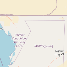
Banc d'Arguin National Park landscape and geographic character

The Banc d'Arguin landscape is defined by its extensive coastal and marine environments rather than terrestrial terrain. The park encompasses vast mudflats that stretch kilometers from the shoreline, interrupted by chain-like sand banks and islands including Tidra, Nair, Kijji, and Arguim. Tidra Island marks the southern boundary of the park and sits at the heart of the intertidal system, surrounded by vast mudflats that create a distinctive homoclinal ramp profile. The Ras Nouadhibou peninsula (formerly Cap Blanc) forms a 50-kilometer by 13-kilometer landform extending into the Atlantic, with Dakhlet Nouadhibou (Lévrier Bay) representing one of West Africa's largest natural harbors. The underlying geology features a flat-topped platform with extensive carbonate deposits in waters less than 10 meters deep, covered by mixed carbonate-siliciclastic sediments dominated by barnacle and mollusc remains. The southern Golfe d'Arguin describes a gradual ramp profile with expansive intertidal plains, while the Arguin and Timiris Mud Wedges represent significant sediment deposits formed over the past 9,000 years.

Banc d'Arguin National Park ecosystems, habitats, and plant life

The ecological character of Banc d'Arguin centers on its intertidal mudflat system, which represents one of the most pristine coastal wetland ecosystems along the East Atlantic Flyway. The park's vast tidal flats support extensive seagrass beds among the least disturbed on Earth, creating a rich feeding and nursery habitat for fish and invertebrates. The shallow coastal waters and sand banks provide ideal conditions for waterbird concentrations, with the mild coastal climate and absence of significant human disturbance making the area exceptionally attractive for migrating and breeding species. The park sits at the intersection of Palaearctic and Afrotropical biogeographic realms, resulting in remarkable species diversity with at least 108 bird species recorded. The marine environment supports productive fisheries that represent an important food source for West Africa, while the coastal dunes and adjacent lands feature sparse vegetation including tamarisk, dwarf acacias, and various grasses in more protected areas.

Banc d'Arguin National Park wildlife and species highlights

Banc d'Arguin hosts one of the world's most diverse communities of nesting piscivorous birds, with the breeding waterbird colonies representing the largest in West Africa. Over two million migratory waders winter in the park annually, including spectacular concentrations of greater flamingos (up to 96,000), dunlin (over one million), bar-tailed godwits (500,000), red knot (366,000), curlew sandpipers (250,000), and many other species. The breeding populations include white pelicans, reed cormorants, multiple tern species (gull-billed, Caspian, West African crested, and common), grey herons, Eurasian spoonbills, and western reef herons. Marine mammals are well-represented with year-round populations of endangered Mediterranean monk seals, Atlantic humpback dolphins, and bottlenose dolphins, while orcas, pilot whales, Risso's dolphins, fin whales, and various baleen whales including humpback and blue whales have been recorded in the surrounding waters. The park also supports the rare false shark ray, known only from this region.

Banc d'Arguin National Park conservation status and protection priorities

Banc d'Arguin National Park represents a critical conservation priority at both regional and global scales. The park's designation as a World Heritage Site and Ramsar Wetland reflects its outstanding universal value as a migration corridor supporting millions of birds from across the globe. The intertidal ecosystem remains one of the most pristine along the East Atlantic Flyway, with human impact minimal compared to other coastal wetland systems. Conservation challenges include emerging pressure from international shark and ray fisheries, with locals increasingly targeting these species despite regulations. The park employs a management approach that permits traditional subsistence fishing by the Imraguen community using primitive techniques, with motor boats prohibited within park boundaries. The park's ecological integrity depends on maintaining the delicate balance between conservation objectives and the sustainable livelihoods of local communities who have inhabited this coastline for generations.

Banc d'Arguin National Park cultural meaning and human context

The human presence within Banc d'Arguin National Park centers on the Imraguen people, an indigenous community of approximately 500 individuals living in seven villages scattered throughout the park. The Imraguen maintain a traditional subsistence economy based on fishing using methods passed down through generations, representing one of the last fishing communities practicing such artisanal techniques in the region. Their economy relies on the rich coastal waters that the park protects, with fish forming the staple of their diet and providing income through local sales. The relationship between the Imraguen and the park's ecosystem represents a model of human dependency on preserved natural resources, where traditional practices have coexisted with the environmental conditions for centuries. Archaeological evidence of intense prehistoric use exists in the form of shell middens extending several kilometers and reaching tens of meters in height, demonstrating long-term human interaction with this coastal landscape.

Top sights and standout views in Banc d'Arguin National Park

Banc d'Arguin National Park stands as one of the most important bird habitats in the world, with the spectacle of over two million migratory waders concentrated across its mudflats representing an extraordinary natural phenomenon. The breeding colonies of waterbirds, particularly the vast flocks of greater flamingos and the diverse tern populations nesting on the sand banks, constitute a remarkable wildlife spectacle. The park's pristine seagrass beds and rich fishing waters support an exceptional marine ecosystem including endangered Mediterranean monk seals and diverse cetaceans. The historical significance of the coast, from Portuguese colonial trading posts to the site of the Méduse shipwreck, adds cultural depth to the natural landscape. The presence of the Imraguen community maintaining traditional fishing practices offers a living example of human-nature interaction within a protected area.

Best time to visit Banc d'Arguin National Park

The optimal period for visiting Banc d'Arguin coincides with the boreal winter months when migratory birds are present in their highest concentrations. The park's location on the East Atlantic Flyway means that waders from northern Europe, Siberia, and Greenland arrive in large numbers during the Northern Hemisphere autumn, with peak concentrations typically occurring between October and March. The climate during this period offers comfortable conditions with moderate temperatures ranging from mean minima around 16°C to maxima near 28°C. The summer months from July to September bring the brief rainy season, with minimal precipitation averaging less than 30mm annually in the coastal zone. Year-round visitors can appreciate the park's wildlife, though the breeding season from spring through early summer offers the opportunity to observe nesting colonies of pelicans, terns, and flamingos in full activity.

Park location guide

Geography guide, regional context, and park location map for Banc d'Arguin National Park

Banc d'Arguin National Park park geography, regions, and map view in Mauritania
Understand where Banc d'Arguin National Park sits in Mauritania through a broader geographic reading of the surrounding landscape, nearby location context, and its mapped position within the national park landscape.

How Banc d'Arguin National Park fits into Mauritania

Mauritania is a Northwest African country covering approximately 1,030,000 km², making it the 11th-largest in Africa and 28th-largest globally. About 90% of its territory lies in the Sahara desert, with most of its population of roughly 5.5 million living in the southern region. The country achieved independence from France in 1960 and is officially an Islamic republic with Arabic as the official language.

Wider geography shaping Banc d'Arguin National Park in Mauritania

Mauritania is located in Northwest Africa along the Atlantic Ocean coast to the west. It borders Western Sahara to the north and northwest, Algeria to the northeast, Mali to the east and southeast, and Senegal to the southwest. The landscape is predominantly desert, with the Sahara covering about 90% of the territory. The southern region is more temperate and supports most of the population.

Map view of Banc d'Arguin National Park

Use this park location map to pinpoint Banc d'Arguin National Park in Mauritania, understand its exact geographic position, and read its mapped placement within the surrounding landscape more clearly.

Pigeon | © OpenStreetMap contributors
Park atlas

Compare marine protected landscapes and wetland ecosystems across the wider West African coast.

Explore other Coastal National Parks and Protected Areas near Banc d'Arguin National Park
After reviewing Banc d'Arguin National Park, discover other significant coastal protected areas and migratory bird habitats across the West African region. Explore these diverse marine landscapes and wetland ecosystems to trace connected conservation efforts and understand regional park geography.
National parkMauritania

Diawling National Park: National Park Protected Landscape in Mauritania

Explore mapped boundaries and regional geographic context.

Diawling National Park represents a significant protected area within the vast geographic scope of Mauritania, a nation characterized by its extensive Sahara Desert territory. As a designated national park, it provides crucial context for understanding the distribution of conservation landscapes and their specific mapped boundaries in arid Northwest Africa. This entry supports detailed atlas exploration by highlighting the park's unique role and regional geographic setting.

Area
156 km²
Established
1991
IUCN
II
Relief
Lowland
National parkSenegal

Saloum Delta National Park: Detailed Map Exploration of Senegal's Protected Landscape

Explore the mapped boundaries and regional terrain of this national park.

Saloum Delta National Park, a designated national park in Senegal, serves as a key entity for understanding protected landscapes in West Africa. This entry focuses on its geographic specificities, providing mapped context and details about its natural terrain. Users can explore the park's boundaries and regional landscape character, contributing to a richer atlas-based discovery of Senegal's conservation areas and natural geography.

Area
760 km²
Established
1976
Relief
Lowland
Climate
Tropical
Watercolor illustration of a river flowing through a landscape with trees, grassy areas, and distant hills under a soft sky
National parkCentral River Division

River Gambia National Park: National Park Geography and Protected Landscape Atlas

Discover mapped boundaries within Central River Division.

River Gambia National Park represents a key protected area within the Central River Division, offering specific geographic insights for atlas exploration. This page details the park's mapped boundaries and its role as a national park, providing a factual basis for understanding its landscape context and regional importance. Explore the geographic features that define this protected natural area.

Area
5.85 km²
Established
1978
IUCN
II
Relief
Lowland
National parkGambia

Niumi National Park: Gambia's Extensive Mangrove Forest and Coastal Wetland Protected Area

Explore the mapped boundaries and unique delta geography of this important national park.

Niumi National Park, situated in The Gambia, is a crucial protected coastal area celebrated for its vast Rhizophora mangrove forests and diverse wetland ecosystems. As a designated national park and Ramsar site, it serves as a critical habitat for numerous migratory bird species, particularly terns, and supports vulnerable marine life. Its landscape is characterized by tidal channels, brackish lagoons, and intertidal mudflats, creating a dynamic and ecologically significant protected zone that is a focal point for understanding West African coastal geography and conservation.

Area
49.4 km²
Established
1987
IUCN
II
Relief
Lowland
Wildlife reserveGambia

Bao Bolong Wetland Reserve: West African Wildlife Reserve with Extensive Mangrove Ecosystems

Explore mapped terrain and crucial protected wetland boundaries.

Bao Bolong Wetland Reserve in Gambia is a significant protected area renowned for its ecological importance as a Ramsar wetland and Important Bird Area. This wildlife reserve features the tallest mangrove trees in the Senegambia region, transitioning through salt marshes to savanna, all centered around the Bao Bolong tributary's estuary. Its complex hydrological network and diverse habitats support 268 bird species and are crucial for the endangered West African manatee, offering a rich landscape for geographic and protected-area discovery.

Area
220 km²
Established
1996
IUCN
VI
Relief
Lowland
National parkGambia

Tanbi Wetland Complex National Park: A Mapped Protected Area in The Gambia

Explore its protected boundaries and regional landscape.

Delve into the geographic identity of Tanbi Wetland Complex National Park, a designated protected area within The Gambia. This page provides essential atlas-level information, focusing on its mapped natural landscape and its role as a significant national park. Understand the park's protected status and its geographical context along the Gambia River, offering a clear entry point for conservation landscape discovery.

Area
45 km²
Established
2001
IUCN
II
Relief
Lowland
National parkGambia

Kiang West National Park: National Park Detail and Protected Landscape Geography

Explore mapped boundaries and regional context in The Gambia.

Kiang West National Park serves as a crucial point for understanding protected natural areas within The Gambia, West Africa. This national park's identity is rooted in its geographic setting along the Gambia River, offering a distinct landscape context and mapped territory. Users can explore its boundaries and place within the nation's conservation network, contributing to a structured understanding of regional geography and protected lands.

Area
115 km²
Established
1987
IUCN
II
Relief
Lowland
Nature reserveGambia

Abuko Nature Reserve: A Protected Nature Reserve in Gambia's Landscape

Explore its mapped boundaries and geographic context.

Abuko Nature Reserve is a protected natural area situated in Gambia, offering a distinct focus for understanding protected landscapes. This entry provides essential details for atlas-based discovery, highlighting the reserve's mapped boundaries and its role within the regional geography. Examine Abuko Nature Reserve to gain clarity on its protected status and its contribution to the mapped natural terrain of West Africa.

Area
1.07 km²
Established
1968
IUCN
IV
Relief
Lowland

Common questions about visiting, size, designation, and location context for Banc d'Arguin National Park

Banc d'Arguin National Park FAQs for park facts, access, geography, and protected area context
Find quick answers about Banc d'Arguin National Park, including protected-area facts, park geography, trail and visitor context, and how the park fits into its surrounding country and regional landscape.
MoriAtlas Explorer

Continue Your Protected Areas Search Across the Global Atlas

Deepen your exploration by continuing the structured search for national parks and protected areas worldwide. Utilize the comprehensive filtering capabilities to compare different conservation landscapes and refine your understanding of global park geography. Discover more about the distribution and characteristics of protected natural areas.

Global natural geography