Mori Atlas logo
Protected landscapeSouthwest Alentejo and Vicentine Coast Natural Park

Discover the mapped boundaries and regional setting of this key Portuguese protected area.

Southwest Alentejo and Vicentine Coast Natural Park: Protected Landscape and Geographic Context

(Parque Natural do Sudoeste Alentejano e Costa Vicentina)

Southwest Alentejo and Vicentine Coast Natural Park represents a significant protected landscape within the Alentejo Litoral region of Portugal. This page provides an atlas-style exploration of its geographic scope, allowing users to understand its mapped boundaries and its place within the broader natural terrain of southern Portugal. Engage with structured data that highlights the park's identity as a protected area and its contribution to the regional geography.

Coastal protected areaMediterranean landscapeHiking trailsEndemic speciesBird habitatMarine protected area

Southwest Alentejo and Vicentine Coast Natural Park

Protected landscape

Park overview

Structured park overview, official facts, and landscape profile for Southwest Alentejo and Vicentine Coast Natural Park

Southwest Alentejo and Vicentine Coast Natural Park park facts, protected area profile, and essential visitor context
Review the core facts for Southwest Alentejo and Vicentine Coast Natural Park, including designation, size, terrain, visitor scale, habitats, and operating context in one park-focused overview.

About Southwest Alentejo and Vicentine Coast Natural Park

Southwest Alentejo and Vicentine Coast Natural Park protects one of Europe's most significant remaining stretches of wild coastline. The landscape is defined by towering sea cliffs, hidden coves, and long sandy beaches that have remained largely undeveloped despite growing pressure from tourism and agriculture in the region. The park's interior features rolling terrain characterized by Mediterranean scrubland, evergreen woodlands, and agricultural fields that have shaped the cultural landscape for centuries. The marine component of the park encompasses important coastal waters that support diverse marine ecosystems and contribute to the overall ecological integrity of the protected area. The region has historically supported fishing communities and traditional agriculture, and the park's management seeks to balance conservation with the economic needs of local populations. Recent decades have brought significant challenges, including the expansion of intensive greenhouse agriculture that has raised concerns about water resources, habitat degradation, and labor practices.

Quick facts and research context for Southwest Alentejo and Vicentine Coast Natural Park

Located in the Alentejo Litoral and Barlavento Algarvio regions of Portugal, this natural park covers 895.7 square kilometers including both land and marine areas. It holds IUCN Category V status as a protected landscape and seascape, managed by the ICNF (Institute for Nature Conservation and Forests). The park features over 12 endemic plant species and serves as an important habitat for nesting bird populations. The area is crossed by the Rota Vicentina, an extensive network of hiking and cycling trails, including the 226.5-kilometer Fishermen's Trail along the coast and the 263-kilometer Historical Way through rural landscapes.

Park context

Deeper park guide and search-rich context for Southwest Alentejo and Vicentine Coast Natural Park

Southwest Alentejo and Vicentine Coast Natural Park history, landscape, wildlife, and travel context
Explore Southwest Alentejo and Vicentine Coast Natural Park through its history, landscape character, ecosystems, wildlife, conservation priorities, cultural context, and seasonal travel timing in a structured park guide built for atlas discovery and search intent.

Why Southwest Alentejo and Vicentine Coast Natural Park stands out

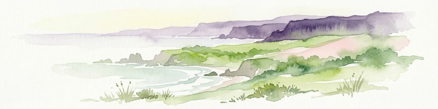
The park is best known for its dramatic and unspoiled coastal landscapes, representing one of the last wild coastlines in Europe. The Rota Vicentina trail network, particularly the Fishermen's Trail along the dramatic cliff-backed shoreline, has become internationally recognized for hiking, earning quality certifications from the European Ramblers' Association. The park's exceptional biodiversity, including numerous endemic plant species and significant bird nesting colonies, combined with its pristine marine environments, make it a conservation priority for Portugal and the broader Iberian Peninsula.

Southwest Alentejo and Vicentine Coast Natural Park history and protected-area timeline

The park was officially established on July 7, 1988, through Portuguese legislation aimed at protecting the outstanding natural values of the southwestern coast while promoting sustainable development in the region. The creation of the park represented recognition that this coastal stretch represented one of Portugal's most ecologically significant and visually spectacular landscapes, worthy of formal protection. The park's establishment came during a period of growing environmental awareness in Portugal and reflected the country's commitment to preserving its natural heritage. Since its creation, the park has faced evolving challenges, particularly the rapid expansion of intensive agriculture in the surrounding region, which has created tension between conservation goals and economic development pressures.

Southwest Alentejo and Vicentine Coast Natural Park landscape and geographic character

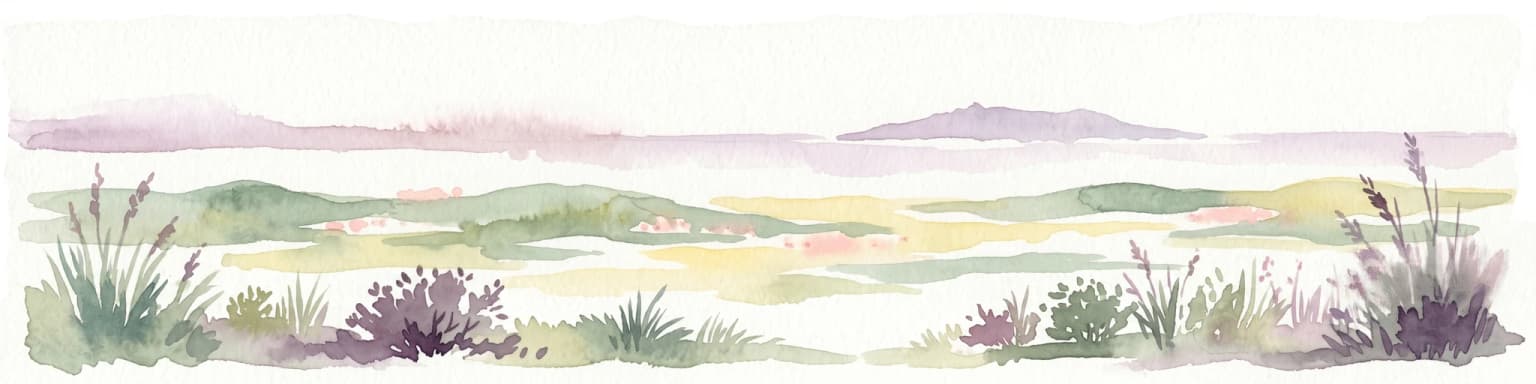
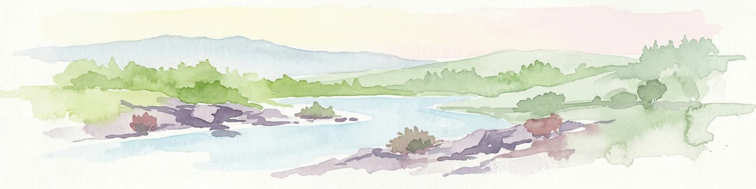
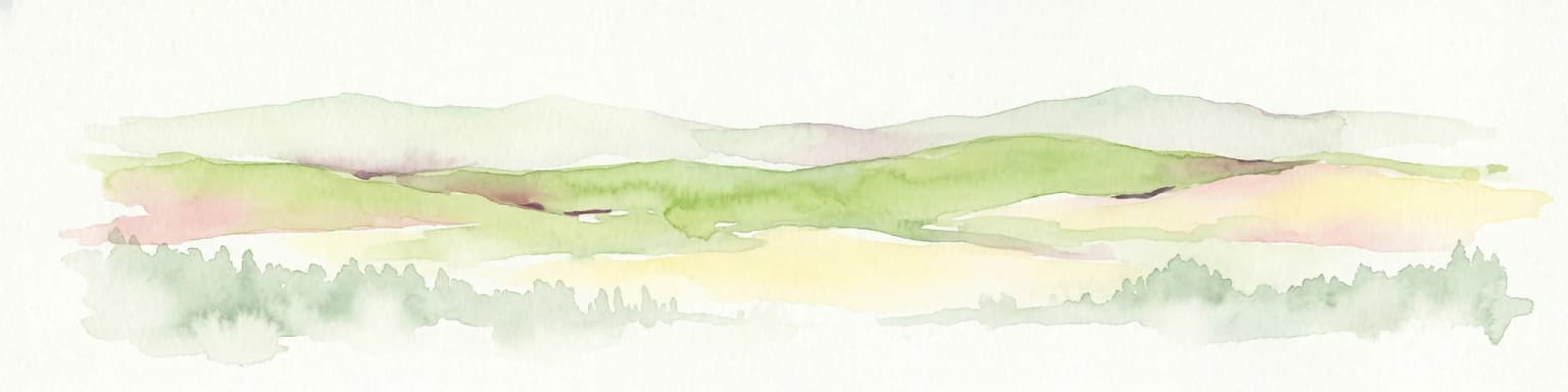
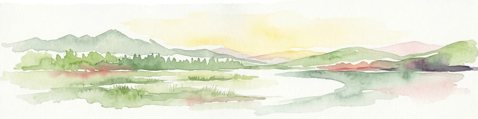
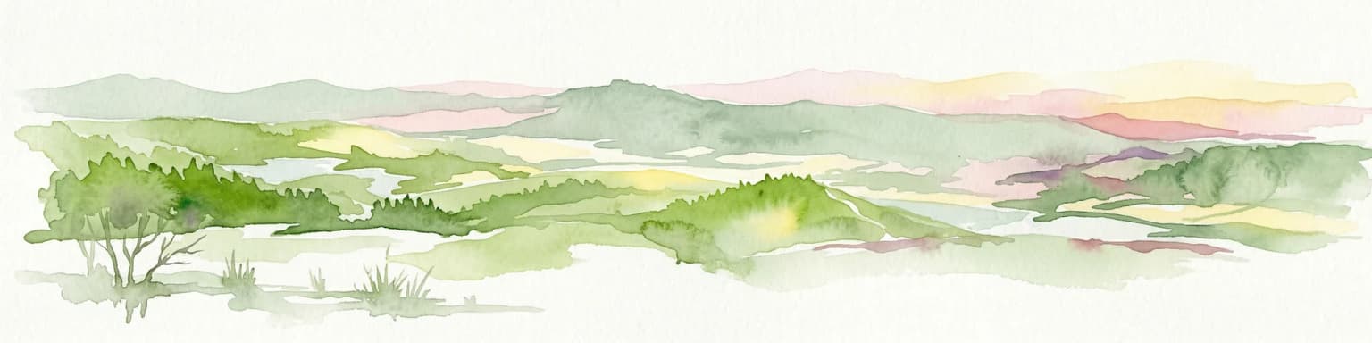
The park showcases a dramatic and varied coastal landscape characterized by steep limestone and shale cliffs that rise abruptly from the Atlantic Ocean, reaching heights that create spectacular vistas along the shoreline. Between the cliffs lie numerous small coves and beaches, some accessible only by foot, that represent some of the most unspoiled coastal stretches in Europe. The inland areas feature a landscape of gentle hills and valleys covered in Mediterranean vegetation, with areas of more intensive agriculture interspersed among natural habitats. The terrain transitions from the more rugged coastal zones to the agricultural lowlands of the Alentejo region, creating a landscape of contrast between the wild shoreline and the cultivated interior.

Southwest Alentejo and Vicentine Coast Natural Park ecosystems, habitats, and plant life

The park supports exceptional biodiversity reflecting its position at the transition between Mediterranean and Atlantic climatic zones. Over 12 endemic plant species are found within the park's boundaries, representing species found nowhere else on Earth. The vegetation includes diverse Mediterranean scrub communities, Cork oak woodlands, and areas of more specialized habitats supporting rare plant species. The marine environment within the park's boundaries protects important coastal ecosystems that contribute to the overall biodiversity of this section of the Atlantic coastline. The combination of terrestrial and marine protection creates a comprehensive conservation approach that recognizes the interconnectedness of coastal and inland ecosystems.

Southwest Alentejo and Vicentine Coast Natural Park wildlife and species highlights

The park provides critical habitat for significant bird populations, with several important nesting sites for seabirds and raptors along the cliff-lined coast. The dramatic cliffs serve as nesting grounds for various species that depend on the remote coastal locations for breeding. The diverse habitats throughout the park support a range of terrestrial bird species, while the surrounding waters provide feeding grounds for marine birds. The marine component of the park supports populations of marine mammals and other sea life that depend on the healthy coastal ecosystems.

Southwest Alentejo and Vicentine Coast Natural Park conservation status and protection priorities

As one of the last strongholds of wild European coast, the park represents a conservation priority of national and European significance. The protected landscape designation acknowledges both the natural values and the cultural landscape that has evolved over centuries. However, the park faces ongoing conservation challenges from the expansion of intensive agriculture in the surrounding region, particularly the rapid growth of greenhouse operations that strain water resources and fragment natural habitats. The park's management must navigate these pressures while maintaining the ecological integrity that makes the area significant. The marine portion of the park provides protection for coastal waters that would otherwise face increasing pressure from development and exploitation.

Southwest Alentejo and Vicentine Coast Natural Park cultural meaning and human context

The park exists within a region shaped by centuries of human activity, where fishing communities have historically depended on the rich marine resources of the coast. Traditional agriculture, including cork oak forestry and small-scale farming, has created the cultural landscape that characterizes the park's interior. The Rota Vicentina trail network, which includes both the coastal Fishermen's Trail and the inland Historical Way, reflects the historical paths and routes that connected communities throughout the region. These trails now provide opportunities for visitors to experience the landscapes that have supported human communities for generations.

Top sights and standout views in Southwest Alentejo and Vicentine Coast Natural Park

The Rota Vicentina trail network stands as the park's signature feature, offering over 400 kilometers of marked trails that traverse the most spectacular coastal and rural landscapes. The Fishermen's Trail follows the cliff-top coastline for 226.5 kilometers, providing hikers with continuous views of the dramatic Atlantic shoreline. The Historical Way extends 263 kilometers through the agricultural interior, passing through traditional villages and historic landscapes. Both trails have received quality certification from the European Ramblers' Association. The park's beaches, many accessible only by trail, represent some of Europe's most secluded and unspoiled coastal destinations. The endemic plant species and bird nesting sites provide exceptional opportunities for nature observation in a relatively unmodified landscape.

Best time to visit Southwest Alentejo and Vicentine Coast Natural Park

The park can be visited year-round, though spring and autumn offer the most comfortable conditions for hiking the Rota Vicentina trails. Summer months bring warm temperatures and peak visitor numbers, with the coastal trails offering refreshing sea breezes. Winter sees fewer visitors and the landscape takes on a different character with occasional rain transforming the vegetation. The shoulder seasons provide ideal conditions for long-distance hiking, with moderate temperatures and smaller crowds on the trails. The park's wildlife viewing opportunities vary seasonally, with bird activity most prominent during the spring breeding season.

Park location guide

Geography guide, regional context, and park location map for Southwest Alentejo and Vicentine Coast Natural Park

Southwest Alentejo and Vicentine Coast Natural Park park geography, regions, and map view in Portugal
Understand where Southwest Alentejo and Vicentine Coast Natural Park sits in Portugal through a broader geographic reading of the surrounding landscape, nearby location context, and its mapped position within the national park landscape.

How Southwest Alentejo and Vicentine Coast Natural Park fits into Portugal

Portugal is a developed European country on the western Iberian Peninsula. It features a coastline along the Atlantic Ocean, includes the autonomous regions of the Azores and Madeira, and is known for its maritime history during the Age of Discovery. The country has a population of over 10.7 million and operates as a semi-presidential republic with Portuguese as its official language.

Wider geography shaping Southwest Alentejo and Vicentine Coast Natural Park in Portugal

Portugal occupies the western portion of the Iberian Peninsula in Southwestern Europe. The mainland borders Spain to the north and east, while the autonomous regions of Madeira and the Azores are situated in the Atlantic Ocean. The country includes Cabo da Roca, the westernmost point in continental Europe. The terrain varies from plains in the south to mountainous regions in the north.

Map view of Southwest Alentejo and Vicentine Coast Natural Park

Use this park location map to pinpoint Southwest Alentejo and Vicentine Coast Natural Park in Portugal, understand its exact geographic position, and read its mapped placement within the surrounding landscape more clearly.

Pigeon | © OpenStreetMap contributors

Location context for Southwest Alentejo and Vicentine Coast Natural Park

Alentejo Litoral
Park atlas

Explore the regional geography and connected protected landscapes surrounding Southwest Alentejo and Vicentine Coast Natural Park for expanded park comparison.

Explore Other Protected Areas and National Parks Near Southwest Alentejo and Vicentine Coast Natural Park
Discover national parks and protected areas geographically connected to Southwest Alentejo and Vicentine Coast Natural Park, covering similar coastal landscapes or adjacent inland territories. Gain valuable geographic context by comparing their conservation profiles, tracing ecological links, and understanding the wider protected-area patterns across the Iberian Peninsula.
Protected landscapeAlgarve

Ria Formosa Natural Park Protected Landscape: Algarve Regional Geography

Explore mapped protected landscapes and regional geographic context.

Examine Ria Formosa Natural Park, a protected landscape that defines a significant portion of the Algarve's natural heritage. This atlas-focused exploration details the park's geographic features, its protected status, and its position within the wider regional geography. Understand the mapped extent of this protected landscape and its contribution to the natural context of southern Portugal.

Area
179.01 km²
Established
1978
IUCN
V
Relief
Lowland
Watercolor illustration showing a river flowing through a valley with hills and vegetation
Protected landscapeBeja District

Guadiana Valley Natural Park: Protected Landscape Discovery in Beja District

Explore its mapped geography and protected land context.

Guadiana Valley Natural Park is identified as a protected landscape, providing a specific focus for geographic study and map-based exploration. This entry details the park's unique protected-area status and its contextual placement within the expansive Beja District of southern Portugal. Understand the mapped boundaries and landscape features that define this area, serving as a key point for regional geographic understanding on MoriAtlas.

Area
697 km²
Established
1995
IUCN
V
Visitors
749 annual
Protected landscapePortugal

Arrábida Natural Park: Protected Landscape Atlas and Geographic Context in Portugal

Mapped boundaries of this key Portuguese protected area.

Arrábida Natural Park is presented here as a significant protected landscape, offering rich details for geographic exploration and atlas-based research. Users can investigate its specific mapped boundaries, understand its environmental setting within Portugal, and utilize this data for comparative analysis of protected areas. This resource focuses on the park's inherent geographic identity and its role as a defined natural landscape.

Area
176.41 km²
Established
1976
IUCN
V
Visitors
23.1K annual
Watercolor painting showing rolling coastal hills with green vegetation, a body of water, and distant mountains under a light sky
Protected landscapeLisbon District

Sintra-Cascais Natural Park: Mapped Protected Landscape in Lisbon District, Portugal

Explore Atlantic coast geography and historic palatial terrain.

The Sintra-Cascais Natural Park is a designated protected landscape in Portugal's Lisbon District, renowned for its fusion of natural beauty and historical architecture. This page offers an atlas-style exploration of its mapped boundaries, showcasing the unique Serra de Sintra mountain range meeting the Atlantic coast. Discover the protected area's geographic features, from its lush forested slopes crowned with iconic palaces to the dramatic cliffs and beaches of Cabo da Roca, providing essential context for understanding this distinctive Portuguese natural landscape.

Area
144.51 km²
Established
1981
IUCN
V
Visitors
43.5K annual
National parkHuelva

Doñana National Park National Park: Mapped Geography and Protected Landscape Context

Explore Huelva's key protected area and its regional geographic setting.

Delve into the structured geographic data and mapped boundaries of Doñana National Park. This entry highlights its identity as a national park within the Huelva region, providing essential context for understanding its protected landscape. MoriAtlas offers this detail to facilitate a clear, atlas-driven exploration of its natural terrain and its place in the broader geographic framework of Spain.

Area
543 km²
Established
1969
IUCN
II
Visitors
376.3K annual
Watercolor illustration of a landscape with rolling hills, a body of water, and vegetation
Protected landscapePortugal

Aire and Candeeiros Ranges Natural Park: Protected Landscape and Regional Geographic Context

Explore the mapped boundaries and natural landscape of this Portuguese protected area.

Understand the Aire and Candeeiros Ranges Natural Park as a key protected landscape in Portugal. This page offers detailed geographic information, focusing on the park's mapped boundaries and its intrinsic connection to the surrounding regional geography. It serves as a portal for atlas exploration, providing structured data for users interested in the specific protected area and its landscape characteristics within the Iberian Peninsula.

Area
383.93 km²
Established
1979
IUCN
V
Visitors
31.9K annual
Watercolor illustration of a landscape with green hills, scattered trees, and distant mountains under a pink and yellow sky
Protected landscapePortalegre District

Serra de São Mamede Natural Park: A Protected Landscape Defined by Ecological Transition

Explore the unique mountain terrain and ecosystems of Portalegre District.

Delve into the geographic and ecological identity of Serra de São Mamede Natural Park, a significant protected landscape situated in Portugal's Portalegre District. This area is renowned for its dramatic quartzite ridges and its role as a crucial meeting point for Atlantic and Mediterranean plant communities, offering a unique atlas perspective on regional biodiversity. Examining its mapped boundaries and diverse terrain provides essential context for understanding its ecological importance and its distinct position within the Alentejo region's geography.

Area
560.6 km²
Established
1989
IUCN
V
Visitors
4.5K annual
Watercolor illustration of a landscape with green mountains, a body of water, and colorful wildflowers in the foreground
Nature reservePortugal

Serra da Estrela Natural Park: Glacial Terrain and Highest Peaks in Portugal

Explore the dramatic geography of this nature reserve.

Serra da Estrela Natural Park is a significant protected landscape in Portugal, celebrated for containing the nation's highest peak and exceptional Quaternary glacial formations. The park's terrain includes dramatic valleys carved by ice, numerous glacial lakes, and a stark alpine plateau around Torre. This nature reserve preserves a unique environment shaped by both geological history and traditional pastoralism, offering rich mapped context for understanding Portugal's mountainous geography and protected areas.

Area
891.32 km²
Established
1976
IUCN
V
Visitors
7.6K annual

Common questions about visiting, size, designation, and location context for Southwest Alentejo and Vicentine Coast Natural Park

Southwest Alentejo and Vicentine Coast Natural Park FAQs for park facts, access, geography, and protected area context
Find quick answers about Southwest Alentejo and Vicentine Coast Natural Park, including protected-area facts, park geography, trail and visitor context, and how the park fits into its surrounding country and regional landscape.
MoriAtlas Explorer

Continue Your Protected Areas Search Across the Global Atlas

Deepen your exploration by continuing the structured search for national parks and protected areas worldwide. Utilize the comprehensive filtering capabilities to compare different conservation landscapes and refine your understanding of global park geography. Discover more about the distribution and characteristics of protected natural areas.

Global natural geography