Mori Atlas logo
Protected landscapeSerra de São Mamede Natural Park

Mapping Portugal's unique mountain terrain and ecological transition zone within Portalegre District.

Serra de São Mamede Natural Park: Protected Landscape Discovery and Geographic Context

(Parque Natural da Serra de São Mamede)

Serra de São Mamede Natural Park represents a vital protected landscape in Portugal's Portalegre District, showcasing a rare convergence of Atlantic and Mediterranean ecosystems atop the country's highest mountain range south of the Tagus River. This atlas-driven exploration of the park reveals its distinctive quartzite ridges, diverse woodlands, and significant role as a biodiversity hotspot. Understanding Serra de São Mamede Natural Park through its mapped boundaries and surrounding geography offers critical insight into its ecological significance and its place within the broader Alentejo landscape.

Mountain Protected AreaMediterranean ForestAtlantic-Mediterranean TransitionCork Oak WoodlandIberian Lynx HabitatBird Migration Route
Stylized illustration of green mountains, a river, and forested valleys under a partly cloudy sky

Serra de São Mamede Natural Park

Protected landscape

Park overview

Structured park overview, official facts, and landscape profile for Serra de São Mamede Natural Park

Serra de São Mamede Natural Park park facts, protected area profile, and essential visitor context
Review the core facts for Serra de São Mamede Natural Park, including designation, size, terrain, visitor scale, habitats, and operating context in one park-focused overview.

About Serra de São Mamede Natural Park

Serra de São Mamede Natural Park occupies a distinctive place among Portugal's protected areas as the country's highest mountainous landscape south of the Tagus River. The park protects a complex system of quartzite ridges and valleys that create dramatic changes in elevation, from the gentle 300-meter southern foothills to peaks exceeding 1,000 meters in the central and northern sections. This topographic variation, combined with the interaction between Atlantic and Mediterranean climatic influences, produces a remarkable diversity of habitats within a relatively compact area.

The park's establishment in 1989 marked an important moment in Portuguese conservation history, recognizing not only the natural value of the mountain range but also its role in preserving traditional agricultural systems that were beginning to decline by the late nineteenth century. The transition from the rolling plains of traditional Alentejo landscape to the mountainous terrain creates a striking visual boundary that defines much of the park's character.

Agriculture remains the dominant economic activity within the park boundaries, with the northern highlands characterized by small to medium-sized properties with diverse land use including oak woodlands, chestnut groves, cork oak forests, olive groves, and pine plantations. The southern portions transition to larger estates practicing extensive dryland agriculture, often combined with cork oak and holm oak silvopastoral systems. This traditional land use pattern has shaped the current landscape and contributed to the maintenance of biodiversity through the creation of heterogeneous habitat mosaics.

Quick facts and research context for Serra de São Mamede Natural Park

The park is located in Portalegre District in northeastern Portugal, spanning the municipalities of Portalegre, Castelo de Vide, Marvão, and Arronches. It was established on April 14, 1989, and is classified as an IUCN Category V protected landscape. The maximum elevation reaches 1,025 meters, making it the highest mountain range in Portugal south of the Tagus River. The park features a complex topography with gentle undulating terrain in the south at 300-400 meters altitude, transitioning through the Portalegre plateau at 400-500 meters, and rising to over 800 meters in the northern and central quartzite-dominated ridges. Managed by ICNF (Instituto da Conservação da Natureza e da Biodiversidade), the park receives approximately 4,500 visitors annually and serves as a critical habitat for species at the southern and southwestern limits of their European distribution.

Park context

Deeper park guide and search-rich context for Serra de São Mamede Natural Park

Serra de São Mamede Natural Park history, landscape, wildlife, and travel context
Explore Serra de São Mamede Natural Park through its history, landscape character, ecosystems, wildlife, conservation priorities, cultural context, and seasonal travel timing in a structured park guide built for atlas discovery and search intent.

Why Serra de São Mamede Natural Park stands out

Serra de São Mamede Natural Park is best known for its remarkable ecological transition zone where Atlantic and Mediterranean ecosystems meet, creating unusual vegetation patterns within Portugal. The park preserves one of the largest populations of the critically endangered Iberian lynx, as well as a small but significant presence of Iberian wolves. It features Portugal's most extensive cork oak forests alongside Pyrenean oak woodlands at higher elevations. The mountain range serves as a critical migratory bird corridor between Europe and Africa, with approximately 150 bird species documented, including Bonelli's eagle, Griffon vulture, and Black vulture. The park also contains the Cova da Moura former lead mine, which hosts one of Europe's most important bat colonies.

Wide landscape view from a high vantage point showing rolling hills, forests, a small lake, and a winding road under a clear blue sky
Panoramic view from the Alto da Serra de São Mamede viewpoint in Serra de São Mamede Natural Park, Portugal

Serra de São Mamede Natural Park history and protected-area timeline

Serra de São Mamede Natural Park was formally established on April 14, 1989, as part of Portugal's expansion of its protected areas network during the late 1980s. The creation of the park coincided with broader recognition of the mountain range's significant natural and landscape heritage, as well as the need to address the degradation of traditional agricultural systems that had been underway since the late nineteenth century.

The decline of traditional farming practices in the mountain areas, accelerated by cereal cultivation campaigns during that period, led to landscape changes that prompted conservation concern. The establishment of the protected area aimed to support the restoration and maintenance of these traditional systems while preserving the ecological values they had helped sustain.

The park is managed by ICNF (Instituto da Conservação da Natureza e da Biodiversidade), the national nature conservation authority, which oversees both the natural resource protection and the sustainable development aspects of the management approach appropriate to an IUCN Category V protected landscape. This category reflects the park's designation as a protected seascape that maintains harmonious traditional landscape character while enabling ongoing human activities.

Serra de São Mamede Natural Park landscape and geographic character

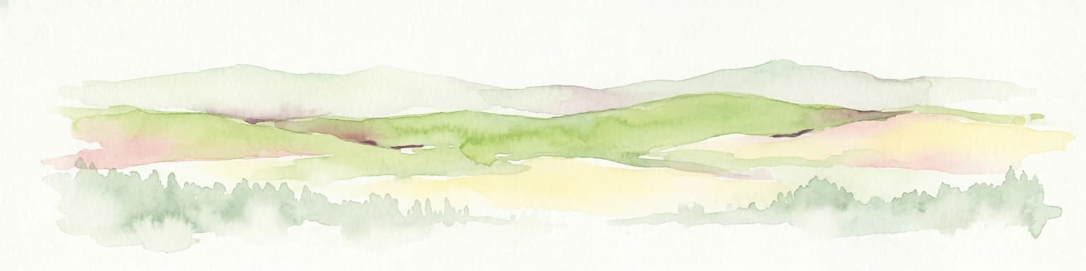
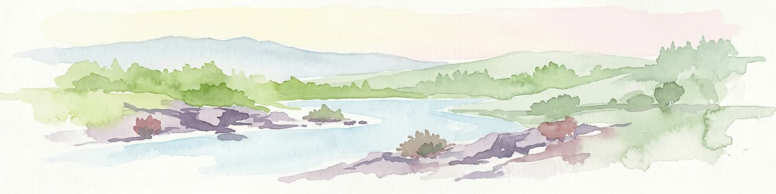
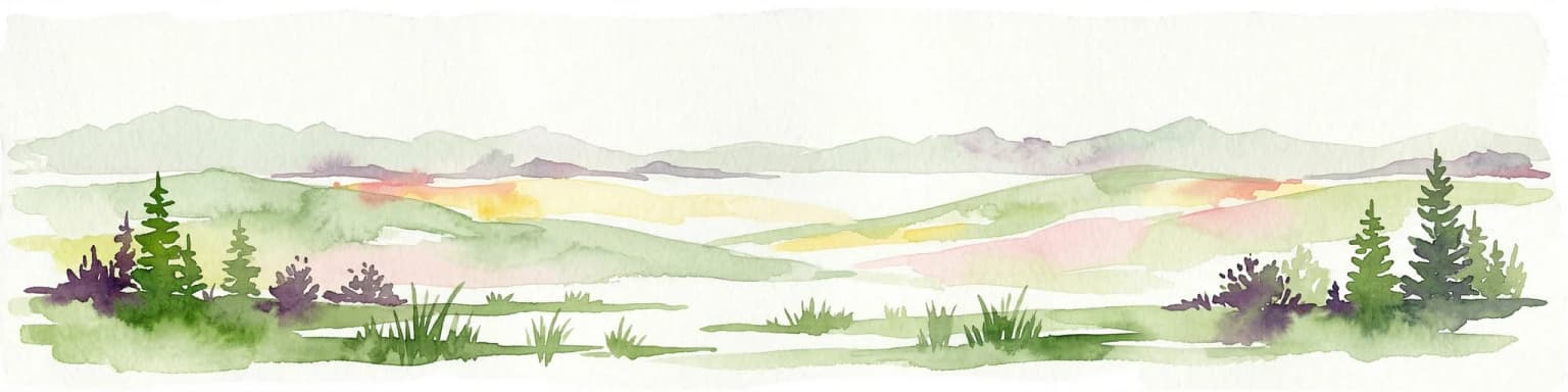
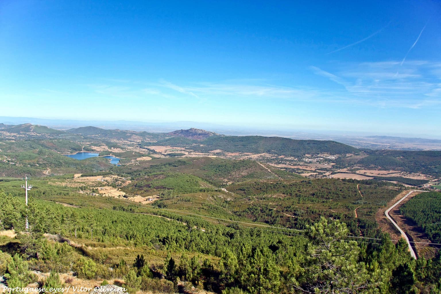
The landscape of Serra de São Mamede Natural Park is defined by a series of northwest-southeast oriented quartzite ridges that create a distinctive mountainous terrain rising abruptly from the surrounding Alentejo plains. The southern portion of the park features gentle, undulating relief with elevations between 300 and 400 meters, presenting a more accessible terrain that transitions smoothly into the surrounding lowland agricultural landscape. The Portalegre plateau, situated at 400 to 500 meters altitude, forms a kind of step that rises from the southern zone and creates a visible topographic transition.

The core mountain area, occupying the northern and central portions of the park, features elevations consistently above 800 meters and is characterized by prominent quartzite crests and steep-sided valleys. This more rugged terrain supports different vegetation communities and creates the conditions for the occurrence of cooler, wetter microclimates that allow species at the edge of their distribution to persist. The highest points reach approximately 1,025 meters, providing expansive views across the Alentejo plains and into Spain beyond.

The combination of elevation, aspect, and substrate creates a complex landscape where northern-facing slopes support Atlantic-influenced vegetation communities while southern slopes display more Mediterranean character, all within close proximity to one another. This environmental heterogeneity is a defining feature of the park's physical geography.

Serra de São Mamede Natural Park ecosystems, habitats, and plant life

The ecological character of Serra de São Mamede Natural Park is defined by the convergence of three major biogeographic influences: Mediterranean, Atlantic, and in some cases even central European elements. This convergence makes the park exceptionally species-rich for its size, with over 800 plant species documented within its boundaries. The position of the range at the southern limit of Portugal for some Atlantic species and at the southwestern European limit for certain other taxa gives the area particular conservation significance.

The park supports extensive cork oak woodlands, which represent one of the most important Mediterranean forest types in Portugal. These evergreen oak forests provide habitat for numerous species and are economically significant through sustainable cork harvesting. At higher elevations, particularly on cooler north-facing slopes, Pyrenean oak (known locally as carvalho-negral) forms extensive woodland that represents the southern limit of this species' range in Portugal. Holm oak occurs on drier sites, while sweet chestnut dominates at the highest elevations.

The park also contains significant areas of planted forest, including maritime pine and eucalypt, reflecting historical forestry decisions that have modified some portions of the original vegetation cover. The interaction between these planted areas and the remaining natural and semi-natural vegetation creates a complex habitat mosaic.

Serra de São Mamede Natural Park wildlife and species highlights

The fauna of Serra de São Mamede Natural Park reflects the ecological diversity of the vegetation communities and the park's position along important biogeographic boundaries. The park supports populations of two of Europe's most endangered carnivores: the Iberian lynx, which occurs primarily in the northern portions of the park, and the Iberian wolf, present in small numbers throughout the area. These apex predators depend on healthy prey populations and extensive habitat connectivity.

The park is particularly significant for birdlife, with approximately 150 species documented and roughly 40 of these nesting within the park boundaries. The mountainous terrain and its position along the Iberian Peninsula's main migratory flyway make it important for both breeding and passage migrants. Notable species include Bonelli's eagle, Griffon vulture, Black vulture, Eagle owl, Short-toed eagle, and Sparrowhawk. The diverse bird community includes both Mediterranean and Atlantic species, reflecting the habitat diversity of the park.

Smaller mammals are well represented, with European otter occurring along watercourses and Cabrera's vole in appropriate grassland habitats. Common species include badger, weasel, polecat, genet, wildcat, red fox, wild boar, and red deer. The former lead mine at Cova da Moura supports important bat colonies, considered among the most significant in Europe, while the limestone caves in the area provide roosting sites for numerous species. The reptile and amphibian fauna includes species such as Schreiber's green lizard, Iberian midwife toad, Bosca's newt, and European pond turtle.

Serra de São Mamede Natural Park conservation status and protection priorities

Serra de São Mamede Natural Park plays a critical role in Portuguese and European conservation as a protected area encompassing significant populations of endangered species and important biogeographic communities. The presence of breeding Iberian lynx, one of the world's most endangered cat species, gives the park global conservation significance. The species has benefited from targeted conservation efforts across the Iberian Peninsula, and the park's rocky terrain and dense vegetation provide suitable habitat.

The protection of the park also preserves important ecosystem services for the surrounding region, including watershed protection, soil conservation, and carbon storage. The cork oak woodlands, in particular, represent a traditional land use system that is both economically viable and ecologically valuable, demonstrating how sustainable human activities can maintain high biodiversity.

The park's classification as an IUCN Category V protected landscape reflects a management approach that balances conservation objectives with the continuation of traditional land uses. This approach recognizes that the landscape character and many of the species present are dependent on ongoing agricultural activities, rather than strict wilderness preservation. The maintenance of these traditional systems, combined with specific protection measures for key species and habitats, addresses both cultural and ecological conservation goals.

Serra de São Mamede Natural Park cultural meaning and human context

The landscape of Serra de São Mamede Natural Park reflects centuries of interaction between human communities and the mountainous terrain. The agricultural patterns visible throughout the park represent traditional land use systems that have shaped both the vegetation and the physical landscape. The northern highland areas feature a complex pattern of small to medium properties with diverse uses, while the southern portions are characterized by larger estates practicing extensive dryland agriculture.

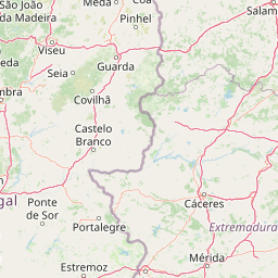
The park encompasses four municipalities that share this mountainous landscape: Portalegre, Castelo de Vide, Marvão, and Arronches. Each of these towns has historical significance and includes heritage structures that reflect the region's rural character. The traditional buildings, stone walls, and agricultural infrastructure contribute to the landscape character that the park designation aims to protect.

The traditional silvopastoral systems, particularly the cork oak montados and the chestnut groves, represent cultural landscape forms that have been maintained through generations. These systems are not merely historical remnants but continue to function as productive land uses that shape both the ecology and the cultural identity of the region.

Top sights and standout views in Serra de São Mamede Natural Park

Serra de São Mamede Natural Park offers visitors the opportunity to experience Portugal's highest mountain landscape south of the Tagus River, with dramatic quartzite ridges, diverse woodlands, and panoramic views across the Alentejo plains. The park's ecological significance centers on its role as a convergence zone for Atlantic and Mediterranean ecosystems, creating unusual species assemblages within Portuguese context. The presence of Iberian lynx and wolf provides exceptional wildlife watching opportunities for patient observers, while the bird-rich environment attracts ornithologists throughout the year. The extensive cork oak forests represent both ecological importance and the continuation of traditional sustainable land use. The notable bat colonies at Cova da Moura constitute one of Europe's most significant underground bat habitats, though access may be restricted. The park's position along migratory routes means that seasonal bird watching opportunities vary throughout the year, with different species present during breeding and passage periods.

Best time to visit Serra de São Mamede Natural Park

The best time to visit Serra de São Mamede Natural Park depends on specific interests, though spring and early summer offer particularly favorable conditions for experiencing the park's ecological character. During April through June, the park's diverse vegetation is at its most vibrant, wildflowers are abundant, and breeding bird activity provides excellent wildlife observation opportunities. The moderate temperatures of spring make hiking and outdoor exploration comfortable, and the landscapes retain moisture from winter rains.

Autumn also offers rewarding conditions, particularly for bird watching during the migration period when numerous species pass through the area. The fall colors of the deciduous oak woodlands add visual interest to the landscape, and the quieter visitor season allows for more immersive nature experiences. Summer months can be very hot in the lower elevations, though the higher terrain provides some relief. Winter brings cooler conditions and the potential for snow on the highest peaks, creating dramatic winter landscapes but potentially limiting some access routes.

Park location guide

Geography guide, regional context, and park location map for Serra de São Mamede Natural Park

Serra de São Mamede Natural Park park geography, regions, and map view in Portugal
Understand where Serra de São Mamede Natural Park sits in Portugal through a broader geographic reading of the surrounding landscape, nearby location context, and its mapped position within the national park landscape.

How Serra de São Mamede Natural Park fits into Portugal

Portugal is a developed European country on the western Iberian Peninsula. It features a coastline along the Atlantic Ocean, includes the autonomous regions of the Azores and Madeira, and is known for its maritime history during the Age of Discovery. The country has a population of over 10.7 million and operates as a semi-presidential republic with Portuguese as its official language.

Wider geography shaping Serra de São Mamede Natural Park in Portugal

Portugal occupies the western portion of the Iberian Peninsula in Southwestern Europe. The mainland borders Spain to the north and east, while the autonomous regions of Madeira and the Azores are situated in the Atlantic Ocean. The country includes Cabo da Roca, the westernmost point in continental Europe. The terrain varies from plains in the south to mountainous regions in the north.

Map view of Serra de São Mamede Natural Park

Use this park location map to pinpoint Serra de São Mamede Natural Park in Portugal, understand its exact geographic position, and read its mapped placement within the surrounding landscape more clearly.

Pigeon | © OpenStreetMap contributors

Location context for Serra de São Mamede Natural Park

Portalegre District

Explore key imagery that reveals the park's distinctive Atlantic-Mediterranean transition, rugged quartzite ridges, and varied forest habitats.

Serra de São Mamede Natural Park Photos: Visualizing Portugal's Diverse Mountain Landscapes
Browse a curated collection of photos and images to visually understand Serra de São Mamede Natural Park's varied landscapes, ecological transition zones, and defining protected-area characteristics. These visuals provide essential insight into the park's unique mountain terrain, diverse habitats, and the distinct scenery that sets it apart within the Alentejo region of Portugal.

Wide landscape view from a high vantage point showing rolling hills, forests, a small lake, and a winding road under a clear blue sky

Landscape view of Serra de São Mamede Natural Park with rolling hills, a lake in the distance, and green vegetation with yellow flowers under a blue sky with scattered clouds

Park atlas

Compare protected areas, regional geography, and the diverse landscapes surrounding Serra de São Mamede Natural Park.

Discover Other Protected Areas & National Parks Near Serra de São Mamede Natural Park
Beyond Serra de São Mamede Natural Park, discover other protected areas, regional parks, and diverse landscapes within Portugal's Alentejo region and adjacent territories. This geographic view enables structured comparison of unique protected landscapes, tracing environmental transitions, and understanding wider conservation efforts.
Watercolor illustration of a landscape with green mountains, a body of water, and colorful wildflowers in the foreground
Nature reservePortugal

Serra da Estrela Natural Park: Glacial Terrain and Highest Peaks in Portugal

Explore the dramatic geography of this nature reserve.

Serra da Estrela Natural Park is a significant protected landscape in Portugal, celebrated for containing the nation's highest peak and exceptional Quaternary glacial formations. The park's terrain includes dramatic valleys carved by ice, numerous glacial lakes, and a stark alpine plateau around Torre. This nature reserve preserves a unique environment shaped by both geological history and traditional pastoralism, offering rich mapped context for understanding Portugal's mountainous geography and protected areas.

Area
891.32 km²
Established
1976
IUCN
V
Visitors
7.6K annual
Watercolor illustration of a landscape with rolling hills, a body of water, and vegetation
Protected landscapePortugal

Aire and Candeeiros Ranges Natural Park: Protected Landscape and Regional Geographic Context

Explore the mapped boundaries and natural landscape of this Portuguese protected area.

Understand the Aire and Candeeiros Ranges Natural Park as a key protected landscape in Portugal. This page offers detailed geographic information, focusing on the park's mapped boundaries and its intrinsic connection to the surrounding regional geography. It serves as a portal for atlas exploration, providing structured data for users interested in the specific protected area and its landscape characteristics within the Iberian Peninsula.

Area
383.93 km²
Established
1979
IUCN
V
Visitors
31.9K annual
National park

Monfragüe National Park: Protected Landscape Atlas of Spanish Raptor Colonies

Explore mapped terrain and regional geography within this Spanish National Park.

As a national park in Spain's Extremadura region, Monfragüe National Park offers a distinct protected landscape shaped by the Tagus River and dramatic limestone cliffs. It is globally recognized for its exceptional birdlife, especially its large griffon vulture colonies and populations of Spanish imperial eagles, making it a significant site for ecological study and atlas-based exploration of protected areas. The park's landscape, characterized by Mediterranean woodlands and rugged terrain, provides crucial habitat and a unique geographic context for understanding Iberian Peninsula conservation.

Scope
Terrestrial
Watercolor illustration of rolling green hills, a winding river, and a distant horizon with a soft sun
National parkExtremadura

Monfragüe National Park: Dramatic Cliffs, Raptor Haven, and Extremadura's Protected Landscape

Discover its mapped terrain and unique geography in Spain.

Monfragüe National Park, situated in Extremadura, Spain, offers a compelling study in protected landscape geography. The park's identity is shaped by its formidable cliffs and river valleys carved by the Tagus, providing critical nesting grounds for European raptors. This MoriAtlas entry details the park's mapped boundaries and its significance as a vital protected area within the region. Users can explore the specific natural terrain and regional context that establish Monfragüe as a unique protected territory.

Area
179 km²
Established
2007
IUCN
II
Visitors
331.8K annual
Protected landscapePortugal

Arrábida Natural Park: Protected Landscape Atlas and Geographic Context in Portugal

Mapped boundaries of this key Portuguese protected area.

Arrábida Natural Park is presented here as a significant protected landscape, offering rich details for geographic exploration and atlas-based research. Users can investigate its specific mapped boundaries, understand its environmental setting within Portugal, and utilize this data for comparative analysis of protected areas. This resource focuses on the park's inherent geographic identity and its role as a defined natural landscape.

Area
176.41 km²
Established
1976
IUCN
V
Visitors
23.1K annual
Watercolor illustration showing a river flowing through a valley with hills and vegetation
Protected landscapeBeja District

Guadiana Valley Natural Park: Protected Landscape Discovery in Beja District

Explore its mapped geography and protected land context.

Guadiana Valley Natural Park is identified as a protected landscape, providing a specific focus for geographic study and map-based exploration. This entry details the park's unique protected-area status and its contextual placement within the expansive Beja District of southern Portugal. Understand the mapped boundaries and landscape features that define this area, serving as a key point for regional geographic understanding on MoriAtlas.

Area
697 km²
Established
1995
IUCN
V
Visitors
749 annual
Watercolor painting showing rolling coastal hills with green vegetation, a body of water, and distant mountains under a light sky
Protected landscapeLisbon District

Sintra-Cascais Natural Park: Mapped Protected Landscape in Lisbon District, Portugal

Explore Atlantic coast geography and historic palatial terrain.

The Sintra-Cascais Natural Park is a designated protected landscape in Portugal's Lisbon District, renowned for its fusion of natural beauty and historical architecture. This page offers an atlas-style exploration of its mapped boundaries, showcasing the unique Serra de Sintra mountain range meeting the Atlantic coast. Discover the protected area's geographic features, from its lush forested slopes crowned with iconic palaces to the dramatic cliffs and beaches of Cabo da Roca, providing essential context for understanding this distinctive Portuguese natural landscape.

Area
144.51 km²
Established
1981
IUCN
V
Visitors
43.5K annual
Watercolor landscape illustration featuring mountains, forests, fields, and trees
Protected areaNorte Region

Alvão Natural Park: Protected Area Discovery and Regional Geographic Context

Explore its mapped boundaries and landscape within the Norte Region.

Alvão Natural Park is recognized as a protected area offering unique opportunities for geographic study and atlas exploration. This detail page provides an in-depth look at its protected landscape, mapping its precise boundaries and situating it within the diverse geography of Portugal's Norte Region. Understand the park's intrinsic value as a mapped natural area and discover its contribution to the regional conservation landscape.

Area
72.03 km²
Established
1983
IUCN
V
Visitors
29.6K annual

Common questions about visiting, size, designation, and location context for Serra de São Mamede Natural Park

Serra de São Mamede Natural Park FAQs for park facts, access, geography, and protected area context
Find quick answers about Serra de São Mamede Natural Park, including protected-area facts, park geography, trail and visitor context, and how the park fits into its surrounding country and regional landscape.
MoriAtlas Explorer

Continue Your Protected Areas Search Across the Global Atlas

Deepen your exploration by continuing the structured search for national parks and protected areas worldwide. Utilize the comprehensive filtering capabilities to compare different conservation landscapes and refine your understanding of global park geography. Discover more about the distribution and characteristics of protected natural areas.

Global natural geography