Mori Atlas logo
National parkMonfragüe National Park

Discover the mapped terrain and unique avian geography of this Spanish National Park.

Monfragüe National Park: A Protected Landscape of Dramatic Cliffs and Raptor Dominance in Extremadura

(Parque Nacional de Monfragüe)

Monfragüe National Park represents a vital protected landscape in the heart of Spain's Extremadura region. Defined by the powerful carving action of the Tagus River through a prominent mountain ridge, its geography features towering cliffs and dramatic river valleys. This protected area is internationally recognized for hosting one of Europe's most significant populations of birds of prey, utilizing its steep rock faces as critical nesting sites. Through MoriAtlas, users can explore the precise mapped boundaries and the unique landscape context that make Monfragüe National Park a cornerstone of regional geography and conservation.

National ParkSpainExtremaduraBirdwatchingRaptorsMediterranean Ecosystem
Illustration of a river flowing through a mountainous landscape with a bridge and green trees

Monfragüe National Park

National park

Park overview

Structured park overview, official facts, and landscape profile for Monfragüe National Park

Monfragüe National Park park facts, protected area profile, and essential visitor context
Review the core facts for Monfragüe National Park, including designation, size, terrain, visitor scale, habitats, and operating context in one park-focused overview.

About Monfragüe National Park

Monfragüe National Park protects a distinctive Mediterranean landscape in the heart of the Iberian Peninsula. The terrain is characterized by a long mountainous ridge carved by the Tagus River, creating a dramatic west-facing cliff known as Peña Falcon, or Falcon Rock, which serves as the primary nesting habitat for the park's spectacular raptor populations. The eastern side of the park is dominated by the ruins of Monfragüe Castle, a medieval fortress with origins dating back to the ninth century, its current remains reflecting multiple restorations carried out after military conquests during the twelfth and fifteenth centuries.

The park's ecosystem represents a well-preserved example of Mediterranean forest and scrubland, combining dense shrub communities with pockets of oak woodland and the characteristic dehesas—open oak savannahs that have been shaped by centuries of traditional pastoral use. The Tagus and Tiétar rivers, both flowing through the park, provide essential water resources and create riparian corridors that support additional habitat diversity. The park encompasses terrain that ranges from rocky cliff faces to gentle slopes, with traditional low-intensity farming practices maintaining the cultural landscape that has shaped this region.

The park's biodiversity extends far beyond its famous raptors. Over 200 species of vertebrates breed, winter, or pass through the park during migration. The surrounding dehesas, which extend beyond the protected area boundaries, provide crucial foraging grounds for the bird populations, demonstrating the importance of landscape-scale conservation in this region.

Quick facts and research context for Monfragüe National Park

Monfragüe National Park is located in the province of Cáceres, Extremadura, western Spain, at elevations between 250 and 750 meters above sea level. The park covers approximately 17,852 to 18,118 hectares along the valleys of the Tagus and Tiétar rivers. It was declared a national park in 2007, having previously held natural park status since 1979 and Special Protection Area designation since 1988. The park was recognized as a UNESCO Biosphere Reserve in 2003 and was designated a dark-sky preserve in 2016. The only village within the park boundaries is Villareal de San Carlos, with a population of approximately 28 residents.

Park context

Deeper park guide and search-rich context for Monfragüe National Park

Monfragüe National Park history, landscape, wildlife, and travel context
Explore Monfragüe National Park through its history, landscape character, ecosystems, wildlife, conservation priorities, cultural context, and seasonal travel timing in a structured park guide built for atlas discovery and search intent.

Why Monfragüe National Park stands out

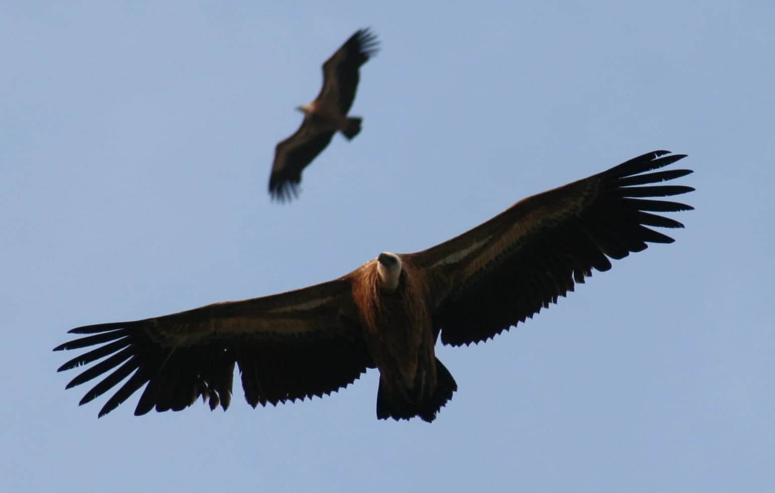
Monfragüe is world-renowned among birdwatchers as one of Europe's most exceptional raptor habitats. The park hosts the world's largest colony of cinereous vultures, with over 300 breeding pairs, and maintains the highest concentration of Spanish imperial eagles on the continent, with more than 10 breeding pairs. The griffon vulture population exceeds 600 pairs, and the cliffs serve as nesting grounds for Egyptian vultures, golden eagles, and Bonelli's eagles. The dramatic rock face known as Peña Falcon draws wildlife photographers from across Europe and the Americas, while observation blinds along the river provide visitors with exceptional viewing opportunities of these magnificent birds in flight.

Panoramic view showing a river winding through mountainous terrain with scattered structures including Monfragüe Castle in the foreground
Panoramic landscape view of Monfragüe National Park featuring the Tagus River and surrounding mountains

Monfragüe National Park history and protected-area timeline

The history of Monfragüe spans millennia, with evidence of human presence dating to prehistoric times. The name Monfragüe derives from the Latin Monsfragorum, meaning "lush mountain," reflecting the area's dense vegetation. The mountains contain numerous caves with prehistoric rock art from the Copper Age, Bronze Age, and Iron Age, with the Cueva del Castillo on the south face of the Sierra de las Corchuelas being a notable example. Pre-Roman remains found around the park include warrior steles and the Treasury of Serradilla, evidence of a hierarchical agricultural society.

During the Roman period, the area lay close to the Via de la Plata, and remains of Roman roads, bridges, and watchtowers can still be found. The ninth-century castle of Monfragüe was built with five towers and two walls, with what remains today showing restorations from the twelfth and fifteenth centuries. In 1450, the Cardinal's Bridge was constructed from granite, facilitating travel between Plasencia and Trujillo and becoming the primary Tagus crossing in Extremadura, though the dangerous area became notorious for banditry.

The eighteenth century brought significant upheaval: the Spanish War of Succession led to the disappearance of the village of Monfragüe, while Carlos III founded Villareal de San Carlos as a planned settlement. The Spanish War of Independence destroyed the castle, bridge, and other structures. The twentieth century saw dam construction in 1966 and 1969 that irreversibly altered the Tagus riverbanks. Conservationist Jesus Garzón arrived in 1968 and championed protection, leading to the park's 1979 declaration as a natural park. Decades of advocacy culminated in national park status in 2007, with the intervening years bringing Special Protection Area designation in 1988 and UNESCO Biosphere Reserve recognition in 2003.

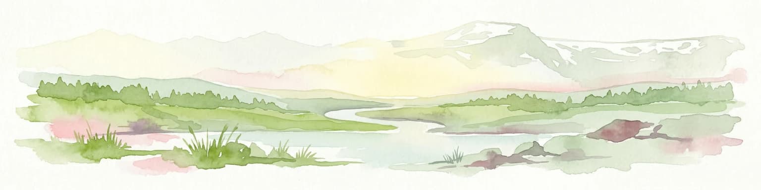
Monfragüe National Park landscape and geographic character

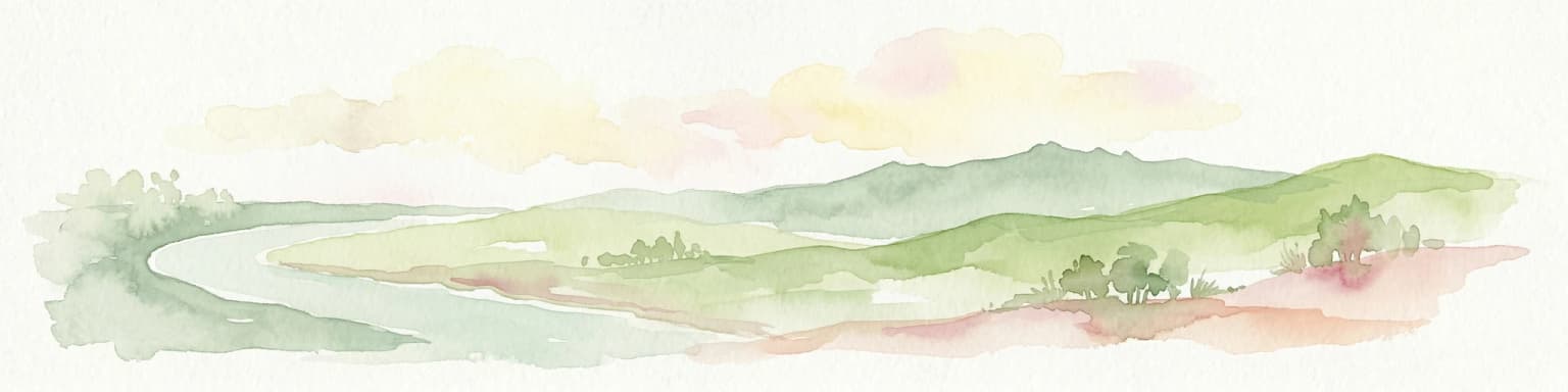
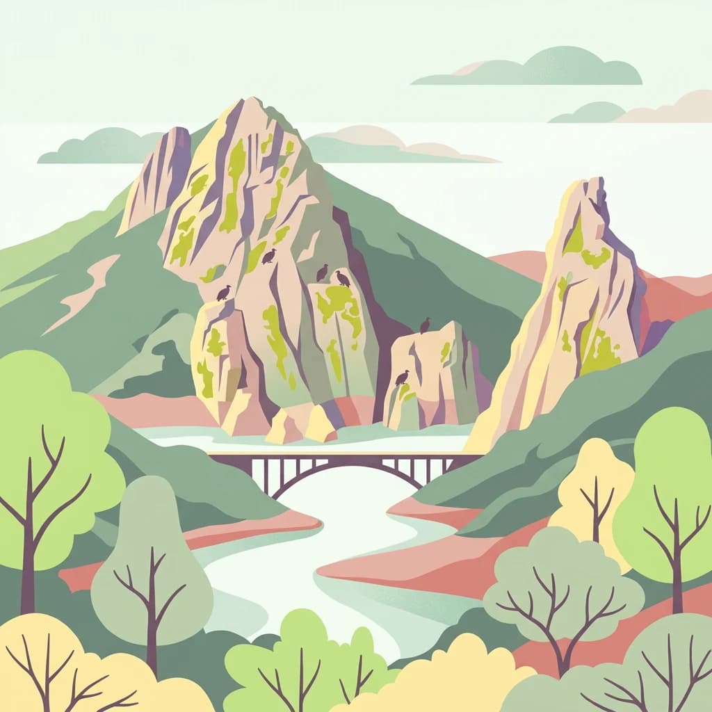
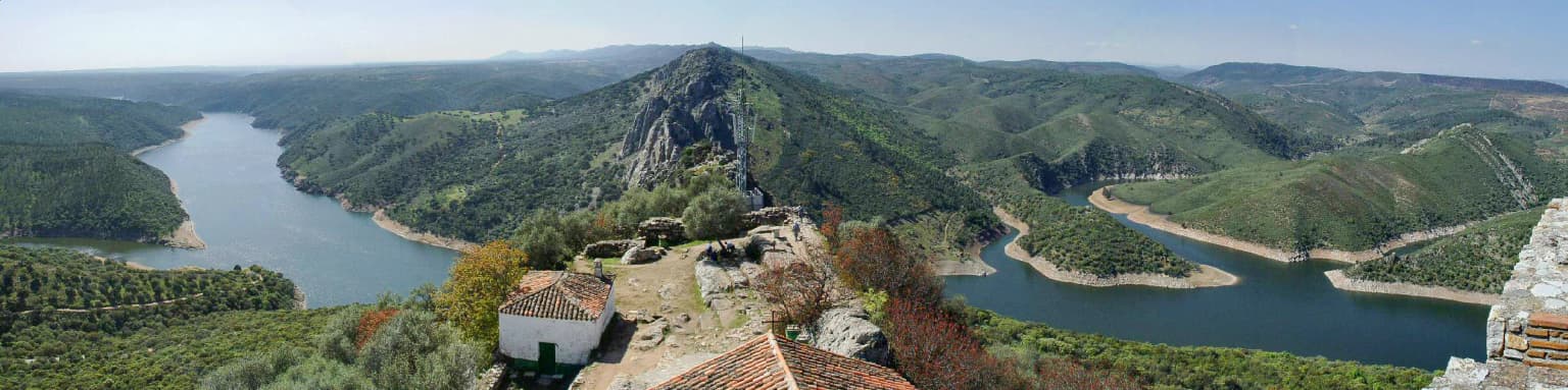
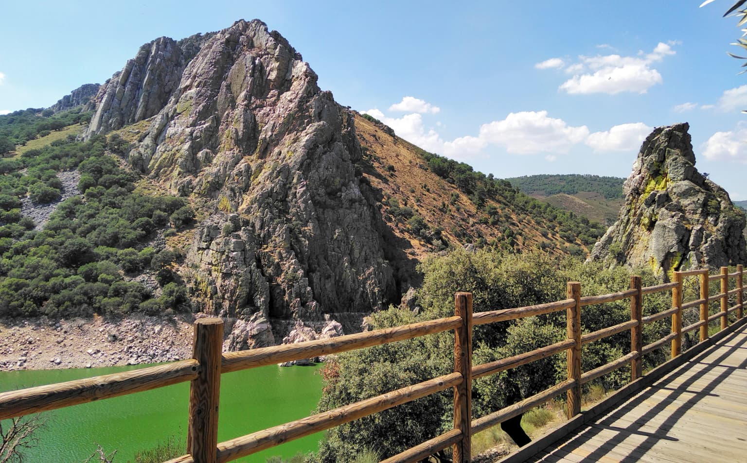
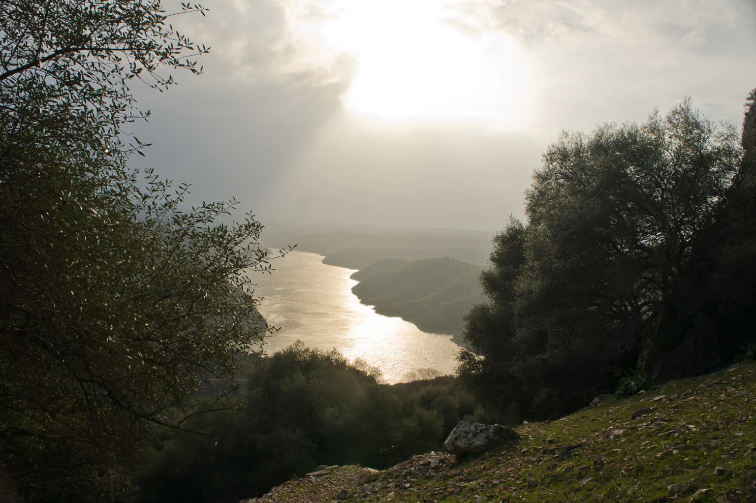
The landscape of Monfragüe National Park is defined by the dramatic interplay of river and mountain. The Tagus River has cut a deep valley through a long east-west running ridge, creating the park's most striking feature—the towering cliff of Peña Falcon on the western side, where griffon vultures and other raptors nest in ledges and crevices. On the opposite bank, the Castle of Monfragüe sits atop aprominent knoll, its ruined towers silhouetted against the sky.

The terrain ranges from sheer rock faces and crags to more gentle slopes covered in Mediterranean scrub. The park encompasses the confluence area where the Tiétar River enters from the northeast and joins the Tagus east of Peña Falcon. Rocky outcrops and cliffs are interspersed with areas of denser vegetation, while the dehesa oak woodlands create a more open landscape. The only settlement within the park is Villareal de San Carlos, a small village that serves as the primary access point for visitors.

Wooden railing of a viewpoint overlooking a green river with rocky mountains in the background under a partly cloudy sky
Viewpoint of Mirador del Salto del Gitano overlooking the Tagus River in Monfragüe National Park

Monfragüe National Park ecosystems, habitats, and plant life

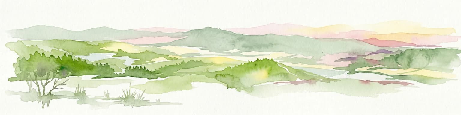
Monfragüe's natural environment represents one of the best-preserved examples of Mediterranean ecosystem in Spain. The predominant habitats include extensive dense scrubland with characteristic Mediterranean shrubs, small oak woodlands, and the iconic dehesas—open savannah-like woodlands of evergreen oak that have been shaped by traditional agropastoral practices. These dehesas represent a cultural landscape that supports exceptionally high biodiversity.

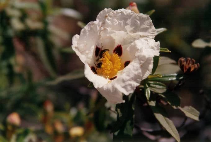
The park's vegetation includes evergreen oaks (Quercus ilex), cork oaks, and downy oaks in the dehesa areas, while the scrub layer features rockrose (Cistus species), heathers, and strawberry trees. Rocky areas support junipers and terebinth trees, and the riparian zones along the Tagus and Tiétar contain alders and nettle trees. The region represents a transitional zone between more humid Atlantic-influenced forests and the drier Mediterranean interior, creating a complex mosaic of habitats.

However, the park has suffered environmental damage. In the 1960s and 1970s, the Tagus was dammed, altering its course through the park. Between 1968 and 1970, extensive reforestation with non-native eucalyptus and pine was carried out, particularly in the Sierra de Miravete, causing irreversible changes to large areas of Mediterranean forest. Efforts to eradicate these invasive species continue, as commercial forestry is prohibited within Spanish national parks.

Two large birds with outstretched wings flying against a clear blue sky
Griffon vultures in flight over Monfragüe National Park, Spain

Monfragüe National Park wildlife and species highlights

Monfragüe hosts one of Europe's most significant raptor populations, with more than 15 regular breeding species of birds of prey. The park contains the world's largest colony of cinereous vultures (Aegypius monachus), with over 280-300 breeding pairs, and supports the continent's highest concentration of Spanish imperial eagles (Aquila adalberti), with more than 10 breeding pairs. Griffon vultures (Gyps fulvus) number over 500-600 pairs, while Egyptian vultures, golden eagles, and Bonelli's eagles also nest here.

The crags and cliffs along the river provide critical nesting habitat for black storks and Eurasian eagle owls, and the park supports a high density of Iberian magpies. Monfragüe is one of the few European locations where white-rumped swifts breed. The mammalian fauna includes the Iberian lynx, which was reintroduced and has successfully established populations, as well as deer and wild boar. Smaller mammals such as foxes, wildcats, genets, badgers, and otters are also present.

Large rocky cliff formation beside a calm water reservoir with green vegetation in the foreground
Rock formation and reservoir at Salto del Gitano, Monfragüe National Park

Monfragüe National Park conservation status and protection priorities

Monfragüe's conservation significance is recognized at multiple levels. The park was designated a Special Protection Area (ZEPA) in 1988 under European Union law, protecting critical bird habitats and extending beyond the national park boundaries into the surrounding dehesas that provide essential foraging territory. In 2003, UNESCO recognized Monfragüe as a Biosphere Reserve, acknowledging its role in conserving Mediterranean ecosystems while maintaining sustainable traditional land uses.

The park's designation as a national park in 2007 provided the highest level of protection within Spain's protected area system. Monfragüe also holds designation as a Zone of Special Conservation (ZEC), contributing to the European Union's Natura 2000 network. In 2016, the area received recognition as a dark-sky preserve, acknowledging the quality of its nocturnal skies. The park represents a conservation success story, having progressed from a natural park to national park status through decades of advocacy, though challenges remain in restoring areas damaged by historical reforestation with non-native species.

Monfragüe National Park cultural meaning and human context

The cultural landscape of Monfragüe reflects centuries of human interaction with the land. The dehesas represent a traditional agropastoral system that has shaped both the landscape and the local economy, with evergreen oaks providing grazing for livestock while maintaining biodiversity. The region's strategic location near the Via de la Plata Roman route left lasting archaeological traces, while the medieval castle reflects the area's importance as a frontier zone during Christian reconquest.

The village of Villareal de San Carlos was founded in the eighteenth century by Carlos III as part of efforts to populate and develop the region, though its small size reflects the challenges of survival in this rugged terrain. The park contains evidence of prehistoric human occupation through cave paintings and archaeological remains, demonstrating the long continuity of human presence in this landscape.

White flower with yellow center and dark spots, bee on center, green leaves, blurred background foliage
White flowering rockrose (Cistus ladanifer) with a bee in Monfragüe National Park

Top sights and standout views in Monfragüe National Park

Monfragüe stands as one of Europe's premier birdwatching destinations, with its dramatic cliffs hosting the world's largest cinereous vulture colony and the highest concentration of Spanish imperial eagles. The park offers exceptional opportunities to observe griffon vultures, Egyptian vultures, golden eagles, and Bonelli's eagles soaring above the Tagus valley, while the observation blinds provide controlled viewing opportunities. The ruins of Monfragüe Castle provide a historic counterpoint to the natural landscape, and the area's designation as a dark-sky preserve adds nocturnal appeal for visitors interested in astronomy.

Sunlight reflecting on the Tagus River in Monfragüe National Park, with trees and grassy terrain visible
Sunlit Tagus River flowing through Monfragüe National Park with surrounding trees and grassy hills

Best time to visit Monfragüe National Park

The optimal time to visit Monfragüe depends on visitor interests, though spring and early summer offer the best conditions for birdwatching, with breeding activity at its peak and species most visibly active around the cliff nests. Autumn brings migration, while winter allows easier observation of vultures as they congregate at feeding sites. The Mediterranean climate means summers can be very hot, though early mornings and evenings remain pleasant. The park can be visited year-round, with each season offering distinct advantages for different activities.

Park location guide

Geography guide, regional context, and park location map for Monfragüe National Park

Monfragüe National Park park geography, regions, and map view in Spain
Understand where Monfragüe National Park sits in Spain through a broader geographic reading of the surrounding landscape, nearby location context, and its mapped position within the national park landscape.

How Monfragüe National Park fits into Spain

Spain, officially the Kingdom of Spain, is a unitary parliamentary constitutional monarchy located in Southern and Western Europe. The country occupies most of the Iberian Peninsula and includes territories in the Mediterranean and Atlantic. With a population of approximately 49.6 million and an area of 506,030 km², Spain is a major European economy and cultural force. Its capital is Madrid, and the country is known for its diverse landscapes ranging from mountainous regions to coastal areas.

Wider geography shaping Monfragüe National Park in Spain

Spain occupies the Iberian Peninsula in Southern and Western Europe. Peninsular Spain is bordered to the north by France, Andorra, and the Bay of Biscay; to the east and south by the Mediterranean Sea and Gibraltar; and to the west by Portugal and the Atlantic Ocean. The territory includes the Canary Islands in the Atlantic Ocean, the Balearic Islands in the Mediterranean Sea, and the autonomous cities of Ceuta and Melilla in mainland Africa. Spain features diverse terrain including the Pyrenees in the northeast, the Sierra Nevada in the south, and the Meseta Central plateau.

Map view of Monfragüe National Park

Use this park location map to pinpoint Monfragüe National Park in Spain, understand its exact geographic position, and read its mapped placement within the surrounding landscape more clearly.

Pigeon | © OpenStreetMap contributors

Location context for Monfragüe National Park

Cáceres ProvinceExtremadura

Explore the dramatic cliffs, river valleys, and Mediterranean dehesas that define Monfragüe's unique protected-area scenery and raptor habitats.

Monfragüe National Park Photos: Visual Guide to Spain's Premier Raptor Landscapes
Browse a comprehensive visual gallery of Monfragüe National Park, featuring imagery of its iconic Tagus River gorge, Peña Falcon cliffs, and extensive oak woodlands. These photographs provide essential context for understanding the park's distinct terrain, diverse Mediterranean ecosystem, and its world-renowned environment for birds of prey.

Panoramic view showing a river winding through mountainous terrain with scattered structures including Monfragüe Castle in the foreground

Panoramic view of Salto del Gitano cliff face with a wooden walkway, body of water, and rocky terrain surrounded by vegetation

Wooden railing of a viewpoint overlooking a green river with rocky mountains in the background under a partly cloudy sky

Two large birds with outstretched wings flying against a clear blue sky

Large rocky cliff formation beside a calm water reservoir with green vegetation in the foreground

A wide river flowing through a mountainous valley with a long bridge spanning the water, surrounded by dense green hills and forests

White flower with yellow center and dark spots, bee on center, green leaves, blurred background foliage

Sunlight reflecting on the Tagus River in Monfragüe National Park, with trees and grassy terrain visible

Close-up of a bee on a purple flower with green leaves in Monfragüe National Park.

Cinereous vultures perched on rocky cliff with forested background

Ruins of Monfragüe Castle overlooking the Tajo River with forested hills and rocky terrain

Open grassy field with scattered holm oak trees and grazing animals under a partly cloudy sky

Two deer standing in a dry grassy landscape with sparse bushes and a tree.

Griffon vultures perched on rocky cliffs in a natural landscape

Stone bridge with multiple arches spanning a body of water, with hills and a building in the background

Park atlas

Trace the Regional Spread of Protected Landscapes and Park Geography Across Extremadura

Discover More National Parks and Protected Areas Near Monfragüe National Park and Extremadura
Browse other national parks and protected areas across Extremadura and western Spain, extending your geographic discovery beyond Monfragüe National Park's unique river valleys. Compare diverse Mediterranean ecosystems, map the regional spread of conservation landscapes, and trace how adjacent protected areas connect to broader natural patterns.
National park

Monfragüe National Park: Protected Landscape Atlas of Spanish Raptor Colonies

Explore mapped terrain and regional geography within this Spanish National Park.

As a national park in Spain's Extremadura region, Monfragüe National Park offers a distinct protected landscape shaped by the Tagus River and dramatic limestone cliffs. It is globally recognized for its exceptional birdlife, especially its large griffon vulture colonies and populations of Spanish imperial eagles, making it a significant site for ecological study and atlas-based exploration of protected areas. The park's landscape, characterized by Mediterranean woodlands and rugged terrain, provides crucial habitat and a unique geographic context for understanding Iberian Peninsula conservation.

Scope
Terrestrial
Watercolor illustration of a landscape with green hills, scattered trees, and distant mountains under a pink and yellow sky
Protected landscapePortalegre District

Serra de São Mamede Natural Park: A Protected Landscape Defined by Ecological Transition

Explore the unique mountain terrain and ecosystems of Portalegre District.

Delve into the geographic and ecological identity of Serra de São Mamede Natural Park, a significant protected landscape situated in Portugal's Portalegre District. This area is renowned for its dramatic quartzite ridges and its role as a crucial meeting point for Atlantic and Mediterranean plant communities, offering a unique atlas perspective on regional biodiversity. Examining its mapped boundaries and diverse terrain provides essential context for understanding its ecological importance and its distinct position within the Alentejo region's geography.

Area
560.6 km²
Established
1989
IUCN
V
Visitors
4.5K annual
Watercolor painting showing green fields, scattered trees, and distant mountains under a light sky
National parkToledo Province

Cabañeros National Park: Spain's Premier Iberian Oak Woodland Protected Landscape

Mapped Geography of Montes de Toledo Protected Area

Cabañeros National Park is celebrated as the most extensive and well-conserved example of Iberian Mediterranean forest in Spain. Situated within the Montes de Toledo, the park features a remarkable dichotomy between its unique raña flatlands and mountainous sierras, harboring ancient oak woodlands and significant biodiversity. This national park serves as a crucial component of the region's geographic context and a prime destination for atlas-based discovery of protected landscapes.

Area
409 km²
Established
1995
IUCN
II
Visitors
104.6K annual
Watercolor illustration of a landscape with green mountains, a body of water, and colorful wildflowers in the foreground
Nature reservePortugal

Serra da Estrela Natural Park: Glacial Terrain and Highest Peaks in Portugal

Explore the dramatic geography of this nature reserve.

Serra da Estrela Natural Park is a significant protected landscape in Portugal, celebrated for containing the nation's highest peak and exceptional Quaternary glacial formations. The park's terrain includes dramatic valleys carved by ice, numerous glacial lakes, and a stark alpine plateau around Torre. This nature reserve preserves a unique environment shaped by both geological history and traditional pastoralism, offering rich mapped context for understanding Portugal's mountainous geography and protected areas.

Area
891.32 km²
Established
1976
IUCN
V
Visitors
7.6K annual
Watercolor illustration depicting a mountain range, river, and green vegetation under a light sky
National park

Sierra de Guadarrama National Park: Protected Area Landscape and Geographic Context

Explore diverse high Mediterranean mountain terrain and ecosystems.

Sierra de Guadarrama National Park is a significant protected national park in central Spain, characterized by its extensive granite landscapes and eleven distinct ecosystems. This park protects crucial high Mediterranean mountain environments, ancient pine forests, and dramatic glacial formations. Its geographic position within the Sistema Central makes it essential for understanding the regional geography and mapped terrain of the Iberian Peninsula, offering a unique look at a vital protected landscape.

Area
339.6 km²
Established
2013
IUCN
II
Visitors
3M annual
Watercolor illustration showing a wetland landscape with grasses, a body of water, and distant hills
National park

Tablas de Daimiel National Park: Spain's Inland Wetland National Park and Protected Area

Explore mapped boundaries and regional geographic context.

Tablas de Daimiel National Park represents one of the last remaining examples of floodplain wetland systems in Spain's interior. Located in Castilla-La Mancha, this protected area showcases a unique confluence of fresh and brackish waters, supporting a rich mosaic of emergent vegetation and serving as a critical habitat for migratory birds. Use MoriAtlas to explore its precise geographic setting, mapped terrain, and its role as a vital conservation landscape within the Iberian Peninsula.

Area
30.3 km²
Established
1973
IUCN
II
Relief
Lowland
Watercolor landscape illustration featuring mountains, forests, fields, and trees
Protected areaNorte Region

Alvão Natural Park: Protected Area Discovery and Regional Geographic Context

Explore its mapped boundaries and landscape within the Norte Region.

Alvão Natural Park is recognized as a protected area offering unique opportunities for geographic study and atlas exploration. This detail page provides an in-depth look at its protected landscape, mapping its precise boundaries and situating it within the diverse geography of Portugal's Norte Region. Understand the park's intrinsic value as a mapped natural area and discover its contribution to the regional conservation landscape.

Area
72.03 km²
Established
1983
IUCN
V
Visitors
29.6K annual
Watercolor illustration of a landscape with rolling hills, a body of water, and vegetation
Protected landscapePortugal

Aire and Candeeiros Ranges Natural Park: Protected Landscape and Regional Geographic Context

Explore the mapped boundaries and natural landscape of this Portuguese protected area.

Understand the Aire and Candeeiros Ranges Natural Park as a key protected landscape in Portugal. This page offers detailed geographic information, focusing on the park's mapped boundaries and its intrinsic connection to the surrounding regional geography. It serves as a portal for atlas exploration, providing structured data for users interested in the specific protected area and its landscape characteristics within the Iberian Peninsula.

Area
383.93 km²
Established
1979
IUCN
V
Visitors
31.9K annual

Common questions about visiting, size, designation, and location context for Monfragüe National Park

Monfragüe National Park FAQs for park facts, access, geography, and protected area context
Find quick answers about Monfragüe National Park, including protected-area facts, park geography, trail and visitor context, and how the park fits into its surrounding country and regional landscape.
MoriAtlas Explorer

Continue Your Protected Areas Search Across the Global Atlas

Deepen your exploration by continuing the structured search for national parks and protected areas worldwide. Utilize the comprehensive filtering capabilities to compare different conservation landscapes and refine your understanding of global park geography. Discover more about the distribution and characteristics of protected natural areas.

Global natural geography