Mori Atlas logo
National parkTablas de Daimiel National Park

Discover the mapped geography and ecological significance of this vital Spanish wetland.

Tablas de Daimiel National Park: Spain's Unique Inland Wetland Protected Landscape

(Parque Nacional de las Tablas de Daimiel)

Tablas de Daimiel National Park stands as a rare example of an inland floodplain wetland ecosystem, uniquely situated on the arid La Mancha plain in Castilla-La Mancha, Spain. This national park, covering approximately 3,030 hectares, is characterized by the confluence of the Guadiana and Gigüela rivers, creating a dynamic landscape where fresh and brackish waters merge. Explore its mapped boundaries and understand the critical geographic context that supports exceptional biodiversity and serves as a vital stopover for migratory birds.

WetlandNational ParkBirdwatchingRamsar SiteBiosphere ReserveMediterranean Ecosystem
Wooden dock extending into calm water surrounded by tall grasses with a small boat and mountains in the background.

Tablas de Daimiel National Park

National park

Park overview

Structured park overview, official facts, and landscape profile for Tablas de Daimiel National Park

Tablas de Daimiel National Park park facts, protected area profile, and essential visitor context
Review the core facts for Tablas de Daimiel National Park, including designation, size, terrain, visitor scale, habitats, and operating context in one park-focused overview.

About Tablas de Daimiel National Park

Tablas de Daimiel National Park occupies a remarkable position in Spain's protected area network as the smallest national park but one of the most ecologically significant. Located on the essentially arid La Mancha plain in southern Castilla-La Mancha, the park protects a wetland ecosystem that has survived against considerable odds in an environment where water is historically scarce. The park's territory encompasses parts of both Daimiel and Villarrubia de los Ojos municipalities, and ongoing expansion efforts aim to incorporate neighboring dryland farming areas to improve the wetland's overall ecological condition.

The wetland functions as a natural floodplain where seasonal inundation historically occurred both through river flooding and groundwater discharge from the underlying aquifer system. This combination of surface water and groundwater fed a complex mosaic of shallow marshes, reed beds, permanent pools, and seasonal flooded areas that supported extraordinary biodiversity. The park's surface covers just over 19 square kilometers, with the highest levels of inundation reaching approximately 17 square kilometers in optimal conditions. The seasonal nature of the water regime created a dynamic landscape where different habitats cycled through wet and dry phases, supporting different ecological communities at various times of year.

What makes Tablas de Daimiel particularly special is its hydrological complexity. The park receives water from two rivers that differ substantially in character. The Guadiana brings fresh water that originates from the Ojos del Guadiana, powerful springs fed by Aquifer 23 that emerge approximately 14 kilometers north of the park. In contrast, the Gigüela carries brackish water with higher salinity, the result of its passage through mineral-rich terrain upstream. This mixture of fresh and brackish waters created uniquely diverse conditions that supported plant and animal communities found nowhere else in Spain, with species adapted to each water type coexisting in close proximity.

Quick facts and research context for Tablas de Daimiel National Park

Tablas de Daimiel National Park spans 3,030 hectares along the Guadiana and Gigüela river confluence in Castilla-La Mancha, Spain. Established in 1973, it is the smallest of Spain's fifteen national parks and represents the last remaining floodplain wetland ecosystem in the arid central Iberian Peninsula. The park features a unique hydrological system where fresh water from the Guadiana meets brackish water from the Gigüela, creating distinctive ecological conditions. It holds multiple international protections including Ramsar wetland status (1982), Biosphere Reserve designation within Mancha Húmeda, and Special Protection Area (ZEPA) status for birds. The park lies within Daimiel and Villarrubia de los Ojos municipalities and has historically served as an important waterfowl hunting ground since at least the 14th century.

Park context

Deeper park guide and search-rich context for Tablas de Daimiel National Park

Tablas de Daimiel National Park history, landscape, wildlife, and travel context
Explore Tablas de Daimiel National Park through its history, landscape character, ecosystems, wildlife, conservation priorities, cultural context, and seasonal travel timing in a structured park guide built for atlas discovery and search intent.

Why Tablas de Daimiel National Park stands out

Tablas de Daimiel is best known as one of Spain's most important inland wetland ecosystems and a crucial stopover for migratory birds across the Iberian Peninsula. The park protects the last remaining example of the traditional "tablas fluviales" floodplain wetland system, a rare landscape formed when rivers overflow in their middle stretches across nearly flat terrain with limited slope. Its exceptional ecological significance derives from the convergence of two rivers with different salinity levels, fresh water from the Guadiana aquifer and brackish water from the Gigüela, creating habitat diversity that supports unusual plant and animal communities. The park is renowned for its significant populations of ducks, geese, herons, egrets, and grebes, with over 200 species of birds recorded. The extensive beds of great fen-sedge (Cladium mariscus) represent one of the largest remaining formations of this species in Western Europe. The park's vulnerability to water scarcity and its ongoing battle against aquifer overexploitation have also made it a symbol of wetland conservation challenges in Mediterranean Europe.

Wooden boardwalk with railings extending over a calm body of water surrounded by tall reeds and distant trees under a clear sky
Wooden boardwalk extending over calm water in Tablas de Daimiel National Park

Tablas de Daimiel National Park history and protected-area timeline

The history of Tablas de Daimiel as a protected space stretches back centuries, with the site's ecological value recognized long before formal conservation measures existed. As early as 1325, the infante Don Juan Manuel documented the exceptional qualities of the Gigüela riverbanks for falconry in his hunting treatise "Libro de la caza," demonstrating the long-standing appreciation for the area's wildlife. In 1575, King Philip II ordered the compilation of the Topographic Relations of Philip II, which explicitly commanded that the Tablas be well maintained, marking one of the earliest official recognitions of the need to protect this wetland.

The water resources of the area historically supported not only hunting but also fishing and milling operations, establishing a human relationship with the wetland that continued for generations. The ecosystem's value for waterfowl hunting persisted into the twentieth century, providing informal protection even as broader political currents favored wetland drainage. In the 1950s, the Spanish government promoted land reclamation projects across La Mancha aimed at reducing wetland areas for agricultural development. Despite this official policy, the area maintained some protection, with General Prim hunting there in 1870 and King Alfonso XII in 1875. In 1966, the Tablas became a National Hunting Reserve, providing formal if limited protection.

The modern conservation movement for the park emerged in the 1960s when the International Union for the Conservation of Nature and Natural Resources launched the MAR Project to conserve and manage wetlands globally. This initiative identified the Tablas de Daimiel as a site of international importance and recommended its protection. Following intense public debate about drainage proposals and growing scientific concern about the wetland's fate, the Spanish government created the national park in 1973 within an initial area of 1,820 hectares. The park was expanded in 1980 to 1,928 hectares and again in 2014 to its current 3,030 hectares. International recognition followed rapidly, with UNESCO including Las Tablas in the Mancha Húmeda Biosphere Reserve in 1980 and the Ramsar Convention listing the wetland in 1982. The park received Special Protection Area status for birds in 1987 under the European Union's Birds Directive.

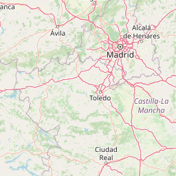
Tablas de Daimiel National Park landscape and geographic character

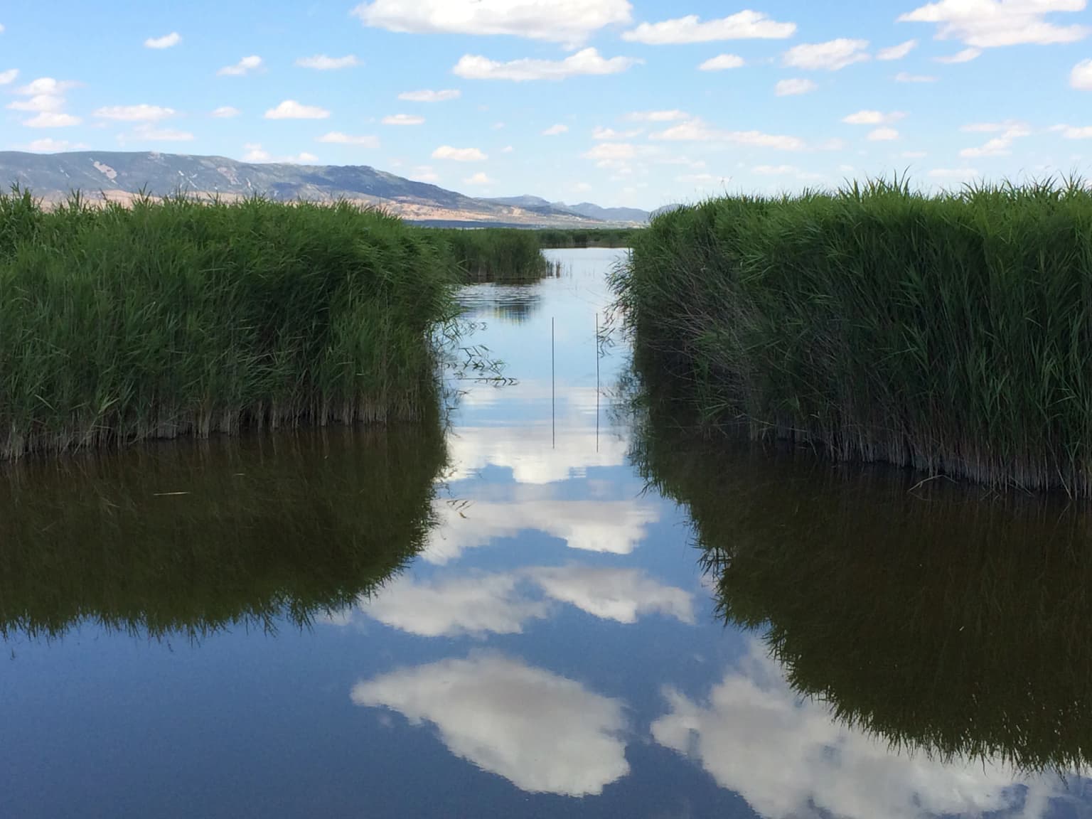
The landscape of Tablas de Daimiel represents a unique wetland formation in the context of the Spanish interior. The park sits on the nearly flat La Mancha plain, a predominantly agricultural landscape where the sudden appearance of wetlands at the river confluence creates a striking contrast with the surrounding dry farmland. The terrain is essentially flat, with minimal elevation changes that allow rivers to spread across wide floodplains during periods of high water. This flatness, combined with the semi-endorreic nature of the drainage basin (where water flows inland without reaching the sea), creates the conditions for the distinctive "tablas" formation where rivers spread into extensive shallow sheets of water.

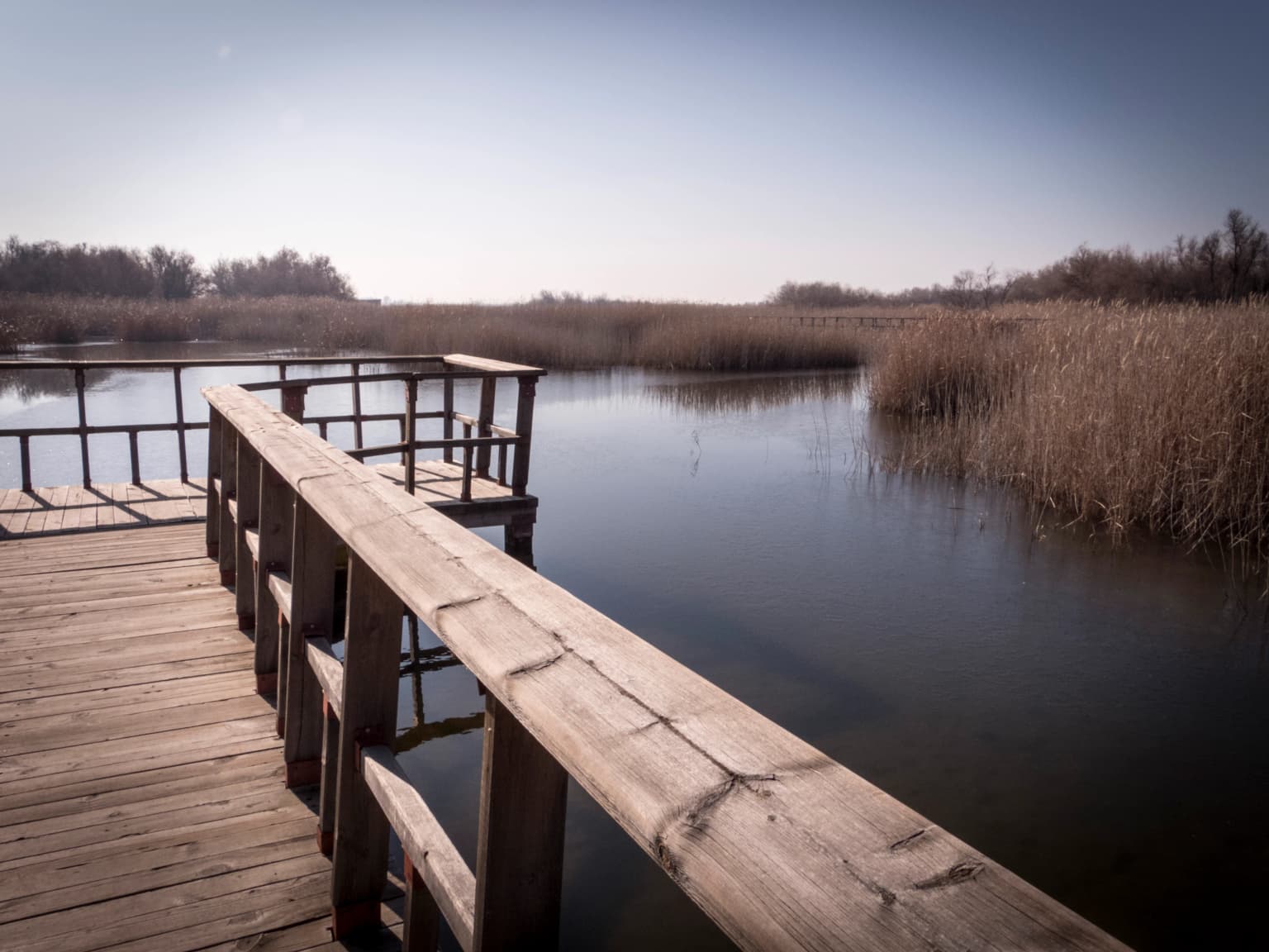
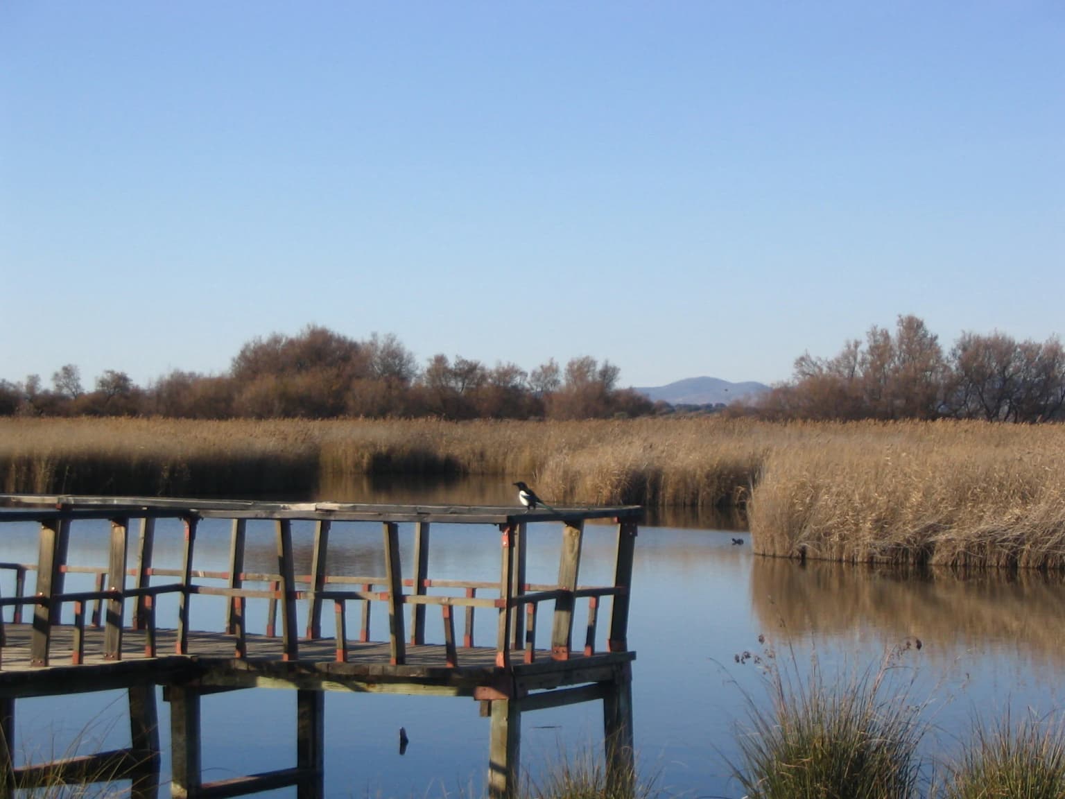
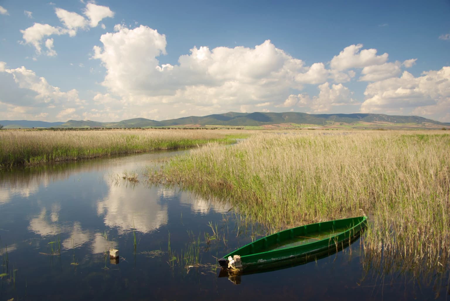
The park's visual character is dominated by water and emergent vegetation rather than by the woody vegetation typical of many forests. Reed beds of common reed (Phragmites australis) create dense stands in areas with persistent shallow water, while the great fen-sedge (Cladium mariscus) dominates in areas with more permanent inundation and slightly higher salinity. Areas of open water alternate with zones of emergent vegetation, creating a mosaic that changes with the seasons and the water level. The few trees present are limited to tamarisk (Tamarix gallica) that tolerate the combination of salinity and periodic flooding. Throughout the park, wooden boardwalks and observation platforms provide access for visitors while minimizing disturbance to the sensitive wetland habitats.

A girl in a red jacket and green beanie using binoculars to look out of a wooden shelter window
A girl using binoculars to observe birds from a shelter in Tablas de Daimiel National Park

Tablas de Daimiel National Park ecosystems, habitats, and plant life

The ecological character of Tablas de Daimiel centers on the unusual combination of fresh and brackish waters that creates a distinctive wetland environment in Spain's interior. The park represents one of the most important aquatic ecosystems in the Iberian Peninsula and was probably the main inland wetland before the widespread drainage of similar systems across La Mancha. The mixing zone where the fresh waters of the Guadiana meet the saltier waters of the Gigüela supports plant and animal communities found in few other locations, with species requiring different water chemistries existing in close association.

The vegetation patterns reflect this hydrological complexity. In areas influenced by fresh water from the Guadiana, common reed forms extensive stands that provide crucial habitat for breeding birds and shelter for fish and amphibians. In areas affected by the brackish waters of the Gigüela, the great fen-sedge predominates, forming what was once one of the most extensive zones of this species in Western Europe. The shallower areas support communities of bulrushes, rushes, and other emergent plants adapted to variable water depths and durations of inundation. Particularly distinctive are the charophyte meadows that form almost continuous carpets on the submerged lake beds, composed of species of the genus Chara that thrive in calcium-rich waters.

The ecological value of the park is significantly enhanced by its position along major bird migration routes. The wetland serves as a crucial staging area where migratory waterfowl can rest and feed during their journeys between breeding grounds in northern Europe and wintering areas in Africa. The combination of abundant food resources, secure resting areas, and the central geographic position of the park along the Iberian Peninsula makes it one of the most important bird habitats in Spain.

Wooden pier leading into calm water surrounded by tall reeds and wetland vegetation under a clear blue sky
Wooden pier extending into wetlands at Tablas de Daimiel National Park

Tablas de Daimiel National Park wildlife and species highlights

The wildlife of Tablas de Daimiel reflects the park's position as one of Spain's most important wetland bird habitats. During migration periods, the park hosts extraordinary concentrations of waterfowl including various species of ducks such as the red-crested pochard, northern shoveler, wigeon, northern pintail, and common teal. Geese also pass through the area, adding to the spectacle of migratory bird movements. Herons and egrets are particularly well represented, with the purple heron, grey heron, little egret, and black-crowned night heron all common visitors or residents. The great bittern, a secretive wetland bird, also breeds in the reed beds.

Beyond birds, the park supports a range of other wildlife. The European freshwater crayfish was historically abundant and economically important to local families but has been drastically reduced by habitat degradation and the introduction of the northern pike predator. Native fish species including the barbel, common carp, and chub are now endangered in the park's waters. Amphibians such as the European tree frog, Perez's frog, and common toad breed in the wetland during spring and summer, while the grass snake and water snake hunt in the shallows. Mammals include the European polecat, red fox, European otter, and water vole, with species like European rabbits, Cape hares, least weasels, and wild boars found in the surrounding areas.

Calm water channels flanked by tall green reeds reflecting clouds under a clear blue sky
Water channels and reed beds reflecting the sky in Tablas de Daimiel National Park

Tablas de Daimiel National Park conservation status and protection priorities

Tablas de Daimiel faces severe conservation challenges centered on water scarcity caused by overexploitation of the underlying aquifer system. The park's existence depends on a delicate balance between water inputs from rivers, springs, and groundwater discharge, and outputs through evaporation, transpiration, and water extraction. For decades, agricultural expansion in the surrounding region has placed enormous pressure on Aquifer 23, the main groundwater source that historically fed the Ojos del Guadiana springs and maintained wet conditions throughout the park. The transformation of approximately 100,000 hectares from rain-fed agriculture to irrigation has far exceeded the renewable water capacity of the aquifer system.

The consequences have been devastating. The Ojos del Guadiana, which once flowed at 8-9 cubic meters per second year-round, went dry in 1982 and have not recovered. The Guadiana-Azuer river, which once contributed substantial flows to the wetland, was effectively cut off from the park when the Puerto de Vallehermoso dam was completed in 1988, remaining dry for 22 years. The Gigüela became the sole natural water source, but its waters are partially diverted upstream for irrigation and artificial hunting lagoons, leaving only a fraction to reach the park. In the worst years, less than 2% of the park's potential 1,734 hectares of inundable area held water.

Conservation responses have included water transfers from the Tagus River, the Special Upper Guadiana Plan with its water banking system, and the acquisition of farmland surrounding the park to retire water rights. Peat fires in 2009 added to the crisis by burning underground organic matter that had accumulated over thousands of years, threatening the physical structure of the wetland. UNESCO considered removing the park's Biosphere Reserve status, and the European Union opened proceedings against Spain. Some recovery occurred after heavy rains in 2009-2010 and improved water management, but the situation remained fragile with alarming declines recorded in 2022-2023 when less than 7% of the wetland held water.

Tablas de Daimiel National Park cultural meaning and human context

The cultural context of Tablas de Daimiel is deeply rooted in the human history of La Mancha, one of Spain's most distinctive cultural regions. The wetland has been intertwined with local communities for centuries, serving not only as a hunting ground but also as a source of fish, water power for mills, and other resources that supported the regional economy. The park's name itself refers to the "tablas" or wooden tables that once characterized the landscape, though these have been largely replaced by modern boardwalks. The area's significance as a hunting ground attracted nobility, including visits by General Prim in 1870 and King Alfonso XII in 1875.

The scientific appreciation of the park's ecological value emerged in the mid-twentieth century, notably through the work of Félix Rodríguez de la Fuente and his team, who produced television documentaries about the wetland in the 1970s that brought national attention to its unique character. This scientific advocacy helped build public support for protection at a time when drainage projects threatened the ecosystem. The park also sits within the broader cultural landscape of Don Quixote country, with the windmills of La Mancha visible from certain viewpoints and the flat agricultural plains forming part of the iconic Manchegan landscape that inspired Cervantes' masterpiece.

Wooden observation deck extending over calm water with tall reeds and trees in the background under a clear blue sky.
Wooden observation deck overlooking a calm water body in Tablas de Daimiel National Park.

Top sights and standout views in Tablas de Daimiel National Park

Tablas de Daimiel stands out as a remarkable wetland in an unexpected setting—the arid heart of Spain's Castilla-La Mancha region. Its very existence as a thriving wetland surrounded by dry farmland makes it a striking anomaly and a testament to the complex hydrology that once characterized this region. The park protects one of the last remaining examples of the traditional floodplain wetlands that once covered much of the La Mancha plain, representing an ecosystem type that has been almost entirely lost to agricultural development. The combination of fresh and brackish waters creates unique ecological conditions that support exceptional biodiversity, particularly of waterbirds.

The park's international significance is underscored by its multiple designations: Ramsar Wetland, Biosphere Reserve core area, and Special Protection Area for birds. It serves as a crucial waypoint for migratory birds traversing the Iberian Peninsula, with tens of thousands of waterfowl using the area annually. The great fen-sedge formations represent some of the most extensive remaining in Western Europe. The park's ongoing struggle against water scarcity and its partial recovery after crisis periods provide valuable lessons about wetland conservation and the challenges of balancing human water needs with environmental requirements.

Green boat floating on calm water with tall reeds and mountains in background under partly cloudy sky
Green boat floating in calm waters surrounded by tall reeds in Tablas de Daimiel National Park

Best time to visit Tablas de Daimiel National Park

The best time to visit Tablas de Daimiel depends on what visitors hope to experience, though certain seasons offer particular advantages. Late winter and early spring typically bring the highest water levels as winter rains refill the aquifer and raise river flows, creating optimal conditions for observing the wetland at its most expansive. This period also coincides with the peak of bird migration, when large numbers of waterfowl pass through the area on their journey north to breeding grounds. The spectacle of thousands of ducks, geese, and swans concentrated in the wetland is particularly impressive during these months.

Autumn represents another excellent visiting season, as migratory birds return south and again concentrate in significant numbers. The summer months tend to bring lower water levels and reduced bird activity, though the park remains accessible and the warmer weather allows for comfortable exploration of the trails and observation points. Summer visits may offer a different experience, with more open water persisting in the deeper channels and the opportunity to see breeding species that remain year-round. Given the park's ongoing conservation challenges and vulnerability to drought, the actual conditions encountered can vary substantially from year to year depending on rainfall patterns and water management decisions.

Park location guide

Geography guide, regional context, and park location map for Tablas de Daimiel National Park

Tablas de Daimiel National Park park geography, regions, and map view in Spain
Understand where Tablas de Daimiel National Park sits in Spain through a broader geographic reading of the surrounding landscape, nearby location context, and its mapped position within the national park landscape.

How Tablas de Daimiel National Park fits into Spain

Spain, officially the Kingdom of Spain, is a unitary parliamentary constitutional monarchy located in Southern and Western Europe. The country occupies most of the Iberian Peninsula and includes territories in the Mediterranean and Atlantic. With a population of approximately 49.6 million and an area of 506,030 km², Spain is a major European economy and cultural force. Its capital is Madrid, and the country is known for its diverse landscapes ranging from mountainous regions to coastal areas.

Wider geography shaping Tablas de Daimiel National Park in Spain

Spain occupies the Iberian Peninsula in Southern and Western Europe. Peninsular Spain is bordered to the north by France, Andorra, and the Bay of Biscay; to the east and south by the Mediterranean Sea and Gibraltar; and to the west by Portugal and the Atlantic Ocean. The territory includes the Canary Islands in the Atlantic Ocean, the Balearic Islands in the Mediterranean Sea, and the autonomous cities of Ceuta and Melilla in mainland Africa. Spain features diverse terrain including the Pyrenees in the northeast, the Sierra Nevada in the south, and the Meseta Central plateau.

Map view of Tablas de Daimiel National Park

Use this park location map to pinpoint Tablas de Daimiel National Park in Spain, understand its exact geographic position, and read its mapped placement within the surrounding landscape more clearly.

Pigeon | © OpenStreetMap contributors

Location context for Tablas de Daimiel National Park

Castilla-La ManchaCiudad Real

Explore visual references detailing the unique wetland landscapes, diverse habitats, and protected-area character of this Spanish site.

Tablas de Daimiel National Park Photos: Explore Wetland Landscapes and Migratory Bird Habitats
Explore imagery showcasing the distinctive wetland landscapes, unique hydrological formations, and critical bird habitats that define Tablas de Daimiel National Park's protected environment. These visual references provide direct insight into the park's flat terrain, river confluence, and characteristic emergent vegetation, revealing its vital ecosystem in central Spain.

Wooden boardwalk with railings extending over a calm body of water surrounded by tall reeds and distant trees under a clear sky

Close-up of Juncus acutus plant with brown seed clusters among tall grasses in a wetland area

A girl in a red jacket and green beanie using binoculars to look out of a wooden shelter window

Wooden pier leading into calm water surrounded by tall reeds and wetland vegetation under a clear blue sky

Calm water channels flanked by tall green reeds reflecting clouds under a clear blue sky

Wooden boardwalk bridge curving over a calm body of water with reeds and trees under a partly cloudy sky

Wooden observation deck extending over calm water with tall reeds and trees in the background under a clear blue sky.

Green boat floating on calm water with tall reeds and mountains in background under partly cloudy sky

Stone mill building with multiple arches reflected in still water, with bare trees and bushes nearby

Green boat floating on calm water surrounded by tall reeds and vegetation in a wetland landscape

Wide view of a wetland area with calm water, reeds, and grassy fields under a clear sky with distant mountains

Wooden boardwalk extending over calm water in a misty wetland with reeds and trees in the background.

Stone mill building with arched openings and tiled roof surrounded by grassy field in Tablas de Daimiel National Park

Two mallard ducks swimming in water, one male with green head and yellow beak, one female with brown mottled plumage

Two ducks swimming in calm water with tall reeds along the shore under a clear sky

Dry, charred terrain with smoke rising from a peat fire, sparse vegetation, and leafless trees in the background

Park atlas

Discover the wider wetland geography and diverse protected landscapes of central Spain and Castilla-La Mancha.

Explore More National Parks and Protected Areas Near Tablas de Daimiel National Park
Discover other national parks and protected areas within the regional context of Tablas de Daimiel National Park, including significant wetland ecosystems and diverse conservation landscapes. Compare adjacent protected areas, trace ecological connections, and map the broader spread of Spain's interior natural heritage through structured geographic context.
Watercolor painting showing green fields, scattered trees, and distant mountains under a light sky
National parkToledo Province

Cabañeros National Park: Spain's Premier Iberian Oak Woodland Protected Landscape

Mapped Geography of Montes de Toledo Protected Area

Cabañeros National Park is celebrated as the most extensive and well-conserved example of Iberian Mediterranean forest in Spain. Situated within the Montes de Toledo, the park features a remarkable dichotomy between its unique raña flatlands and mountainous sierras, harboring ancient oak woodlands and significant biodiversity. This national park serves as a crucial component of the region's geographic context and a prime destination for atlas-based discovery of protected landscapes.

Area
409 km²
Established
1995
IUCN
II
Visitors
104.6K annual
Watercolor illustration depicting a mountain range, river, and green vegetation under a light sky
National park

Sierra de Guadarrama National Park: Protected Area Landscape and Geographic Context

Explore diverse high Mediterranean mountain terrain and ecosystems.

Sierra de Guadarrama National Park is a significant protected national park in central Spain, characterized by its extensive granite landscapes and eleven distinct ecosystems. This park protects crucial high Mediterranean mountain environments, ancient pine forests, and dramatic glacial formations. Its geographic position within the Sistema Central makes it essential for understanding the regional geography and mapped terrain of the Iberian Peninsula, offering a unique look at a vital protected landscape.

Area
339.6 km²
Established
2013
IUCN
II
Visitors
3M annual
National park

Monfragüe National Park: Protected Landscape Atlas of Spanish Raptor Colonies

Explore mapped terrain and regional geography within this Spanish National Park.

As a national park in Spain's Extremadura region, Monfragüe National Park offers a distinct protected landscape shaped by the Tagus River and dramatic limestone cliffs. It is globally recognized for its exceptional birdlife, especially its large griffon vulture colonies and populations of Spanish imperial eagles, making it a significant site for ecological study and atlas-based exploration of protected areas. The park's landscape, characterized by Mediterranean woodlands and rugged terrain, provides crucial habitat and a unique geographic context for understanding Iberian Peninsula conservation.

Scope
Terrestrial
Watercolor illustration of rolling green hills, a winding river, and a distant horizon with a soft sun
National parkExtremadura

Monfragüe National Park: Dramatic Cliffs, Raptor Haven, and Extremadura's Protected Landscape

Discover its mapped terrain and unique geography in Spain.

Monfragüe National Park, situated in Extremadura, Spain, offers a compelling study in protected landscape geography. The park's identity is shaped by its formidable cliffs and river valleys carved by the Tagus, providing critical nesting grounds for European raptors. This MoriAtlas entry details the park's mapped boundaries and its significance as a vital protected area within the region. Users can explore the specific natural terrain and regional context that establish Monfragüe as a unique protected territory.

Area
179 km²
Established
2007
IUCN
II
Visitors
331.8K annual
National parkAndalusia

Sierra Nevada National Park: Protected Alpine Terrain and Geographic Context in Andalusia

Explore Spain's highest mountain range mapped across Andalusia's atlas.

Sierra Nevada National Park offers a profound exploration of Spain's highest alpine environments and a significant entry in the regional geography atlas. This protected area showcases classic glacial landforms, U-shaped valleys, and numerous high-mountain lakes, alongside a remarkable abundance of endemic plant species thriving in its unique microclimates. Understanding its mapped boundaries reveals a landscape vital for both biodiversity and watershed, situated prominently within the broader geographic context of Andalusia.

Area
858.83 km²
Established
1999
IUCN
II
Relief
Mountain
National park

Sierra de las Nieves National Park: Ancient Fir Forests and Karst Geography in Andalusia

Mapped protected landscape and unique geologic features

Sierra de las Nieves National Park stands as a remarkable protected area in Andalusia, Spain, celebrated for its world-leading Spanish fir forests and intricate karst topography. This national park showcases significant geological diversity, from towering limestone formations and deep caves to the striking red peridotite mountains of Sierra Bermeja. Its elevation, reaching Pico Torrecilla at 1,919 meters, offers a unique alpine landscape context within southern Europe, mapped for detailed geographic discovery and protected area exploration.

Area
939.3 km²
Established
1989
IUCN
II
Visitors
100K annual
Watercolor illustration of a landscape with green hills, scattered trees, and distant mountains under a pink and yellow sky
Protected landscapePortalegre District

Serra de São Mamede Natural Park: A Protected Landscape Defined by Ecological Transition

Explore the unique mountain terrain and ecosystems of Portalegre District.

Delve into the geographic and ecological identity of Serra de São Mamede Natural Park, a significant protected landscape situated in Portugal's Portalegre District. This area is renowned for its dramatic quartzite ridges and its role as a crucial meeting point for Atlantic and Mediterranean plant communities, offering a unique atlas perspective on regional biodiversity. Examining its mapped boundaries and diverse terrain provides essential context for understanding its ecological importance and its distinct position within the Alentejo region's geography.

Area
560.6 km²
Established
1989
IUCN
V
Visitors
4.5K annual
National parkHuelva

Doñana National Park National Park: Mapped Geography and Protected Landscape Context

Explore Huelva's key protected area and its regional geographic setting.

Delve into the structured geographic data and mapped boundaries of Doñana National Park. This entry highlights its identity as a national park within the Huelva region, providing essential context for understanding its protected landscape. MoriAtlas offers this detail to facilitate a clear, atlas-driven exploration of its natural terrain and its place in the broader geographic framework of Spain.

Area
543 km²
Established
1969
IUCN
II
Visitors
376.3K annual

Common questions about visiting, size, designation, and location context for Tablas de Daimiel National Park

Tablas de Daimiel National Park FAQs for park facts, access, geography, and protected area context
Find quick answers about Tablas de Daimiel National Park, including protected-area facts, park geography, trail and visitor context, and how the park fits into its surrounding country and regional landscape.
MoriAtlas Explorer

Continue Your Protected Areas Search Across the Global Atlas

Deepen your exploration by continuing the structured search for national parks and protected areas worldwide. Utilize the comprehensive filtering capabilities to compare different conservation landscapes and refine your understanding of global park geography. Discover more about the distribution and characteristics of protected natural areas.

Global natural geography