Mori Atlas logo
National parkSierra de las Nieves National Park

Discover its mapped boundaries, unique geological formations, and endemic species within Andalusia's Serranía de Ronda.

Sierra de las Nieves National Park: A Protected Landscape of Ancient Forests and Karst Geography

(Parque Nacional de la Sierra de las Nieves)

Sierra de las Nieves National Park represents a significant protected natural area situated in the mountainous heart of Andalusia, Spain. This national park is distinguished by its dramatic topography, including some of western Andalusia's highest peaks, and extraordinary geological diversity encompassing extensive karst landscapes with deep caves and limestone cliffs. Its most profound characteristic is the presence of the world's largest and most vital stands of Spanish fir (Abies pinsapo), a relict conifer species of immense botanical importance, carpeting its rugged terrain.

Spanish fir forestsMediterranean mountainsKarst landscapeUNESCO Biosphere ReserveEndemic speciesHighmountain hiking

Sierra de las Nieves National Park

National park

Park overview

Structured park overview, official facts, and landscape profile for Sierra de las Nieves National Park

Sierra de las Nieves National Park park facts, protected area profile, and essential visitor context
Review the core facts for Sierra de las Nieves National Park, including designation, size, terrain, visitor scale, habitats, and operating context in one park-focused overview.

About Sierra de las Nieves National Park

Sierra de las Nieves National Park protects a mountainous landscape of outstanding ecological and geological significance in the heart of the Serranía de Ronda in southern Spain. Located behind the Costa del Sol resort area and accessible via roads from Ronda, Marbella, and the inland villages of Tolox, Yunquera, and El Burgo, this park represents a remarkable transition from the Mediterranean coastal zone to the high mountain environments of the Betic Cordillera. The park's identity is defined primarily by its Spanish fir forests, which are not only botanically remarkable as Tertiary-era relicts but also ecologically vital, supporting unique communities of plants and animals adapted to these cool, moist mountain habitats. Beyond the firs, the park encompasses a complex mosaic of Mediterranean woodland, including holm oak forests, pine plantations, and the distinctive high mountain oak formations of quejigos, as well as juniper heaths and riparian galleries along the mountain streams. The geological foundation of the park is extraordinarily diverse, with the contact zone between the Betic, Penibetic, and Gibraltar Field units producing a remarkable variety of rock types—limestones, dolomites, peridotites, and metamorphic schists—each giving rise to distinct landscape characters and supporting specialized plant communities.

Quick facts and research context for Sierra de las Nieves National Park

Sierra de las Nieves National Park is located in the Province of Málaga, Andalusia, approximately 15 kilometers inland from the Costa del Sol resort area near Marbella. The park was established as a natural park in 1995 and upgraded to national park status in 2021 through royal assent to the Sierra de las Nieves National Park Act. It forms part of the Sierra de las Nieves Biosphere Reserve, designated by UNESCO in 1995, and the Intercontinental Mediterranean Biosphere Reserve established in 2006 encompassing protected areas of both Spain and Morocco. The park encompasses approximately 22,980 hectares of mountainous terrain and receives around 100,000 visitors annually. Pico Torrecilla at 1,919 meters is the highest peak in western Andalusia.

Park context

Deeper park guide and search-rich context for Sierra de las Nieves National Park

Sierra de las Nieves National Park history, landscape, wildlife, and travel context
Explore Sierra de las Nieves National Park through its history, landscape character, ecosystems, wildlife, conservation priorities, cultural context, and seasonal travel timing in a structured park guide built for atlas discovery and search intent.

Why Sierra de las Nieves National Park stands out

Sierra de las Nieves is best known for its exceptional Spanish fir (Abies pinsapo) forests, which represent the largest concentration of this globally endangered conifer species anywhere in the world. These forests cover nearly 2,000 hectares within the park and constitute a botanical relic from the Tertiary period, having survived as isolated populations in the high mountains of southern Spain. The park also features one of Europe's most significant cave systems, including the GESM shaft which descends 1,098 meters, making it the deepest vertical shaft in Andalusia and among the deepest in continental Europe. The geological complexity, with its white limestone Sierras, red Sierra Bermeja peridotite formations, and brown metamorphic Sierras, creates an extraordinary diversity of landscapes within a relatively compact area.

Sierra de las Nieves National Park history and protected-area timeline

The Sierra de las Nieves area has been protected in various forms for decades before achieving full national park status. The territory was originally designated as a Natural Park and later became part of the Sierra de las Nieves Biosphere Reserve, recognized by UNESCO in 1995. The conversion from Natural Park to National Park was proposed by the Council of Ministers to Parliament in 2019, responding to the ecological significance of the area and the need for enhanced protection. On July 1, 2021, King Felipe VI gave royal assent to the Sierra de las Nieves National Park Act, formally declaring it as Spain's 20th national park. The name "Sierra de las Nieves" (Mountain Range of the Snows) derives from the traditional practice of harvesting and storing snow in deep pits called neveros during winter months, which was then distributed to villages throughout the province during the summer—a practice that paradoxically contributed to significant deterioration of the mountain oak forests through historical charcoal production and grazing pressures.

Sierra de las Nieves National Park landscape and geographic character

The landscape of Sierra de las Nieves is defined by dramatic topographic and geological diversity. The park is centered on a series of mountain ranges rising sharply from the surrounding terrain, with Pico Torrecilla at 1,919 meters standing as the highest point in western Andalusia. The limestone and dolomite formations of the Sierra de las Nieves proper, known as the "white Sierras," feature steep slopes, deep ravines, and extensive karst topography including caves, sinkholes (simas), collapsed depressions (dolines), and dry valleys (poljes). The Sierra Bermeja, or "red Sierras," consists of distinctive peridotite and serpentine rocks that weather to produce striking reddish-brown coloration and extremely steep, rocky terrain with minimal soil cover. The surrounding metamorphic "brown Sierras" contain schists, gneisses, and slates. Throughout the park, visitors encounter deep vertical shafts carved into the limestone, with the GESM shaft reaching over 1,098 meters in depth—visible from certain viewpoints as a remarkable vertical chasm descending into the mountain. The landscape also includes the Pinsapar de Caucón, a particularly impressive stand of Spanish fir clinging to steep slopes, and dramatic viewpoints such as the Mirador Ceballos overlooking the Tajo de la Caína cliff formation.

Sierra de las Nieves National Park ecosystems, habitats, and plant life

The ecological character of Sierra de las Nieves is defined by the extraordinary Spanish fir (Abies pinsapo), a conifer endemic to the high mountains of Málaga and Cádiz provinces that survived as a relict from the Tertiary period when such forests were widespread across southern Europe. These forests, covering approximately 2,000 hectares within the park, represent the largest and most significant population of this species globally. The vegetation follows a clear altitudinal pattern: Mediterranean shrubland and Aleppo pine dominate the lower slopes, while holm oak and maritime pine occur in the mid-montane zone, with the Spanish fir occupying the cooler, more humid north-facing slopes and ravines. At the highest elevations, the deciduous oak forests (quejigos) and juniper heaths create a distinctive high-mountain landscape. The peridotite terrain of Sierra Bermeja supports specialized flora adapted to the serpentine soils, including numerous endemic species found nowhere else on Earth. The diversity of habitats—from karst grasslands to steep pine forests, from riparian galleries to high-altitude heath—supports remarkable plant richness, with sixteen taxa catalogued as threatened under the Andalusian Endangered Species Catalogue, including the Spanish fir, high-mountain oak, and the tobacco plant Atropa baetica.

Sierra de las Nieves National Park wildlife and species highlights

The diverse habitats of Sierra de las Nieves support a rich fauna typical of Mediterranean and high-mountain environments. Among the mammals, the Spanish ibex (Capra pyrenaica hispanica) is particularly emblematic, with populations обитающие in the rocky cliffs and steep slopes. Roe deer, stone marten, genet, mongoose, and European otter are also present, with otters found in all the major rivers and streams. The avifauna includes impressive birds of prey such as the golden eagle, Bonelli's eagle, short-toed eagle, eagle owl, and peregrine falcon, all breeding in the park's cliffs and forests. High-mountain and forest-dwelling passerines are well-represented, including the redstart, ring ouzel, rock thrush, and northern wheatear. Reptiles include the Lataste's viper and most of Andalusia's snake species, while the most notable amphibian is the long-snouted salamander subspecies. The native freshwater crayfish (Austropotamobius pallipes) survives in some of the mountain streams, representing one of the last remaining populations in Andalusia. The park's position in the Betic region also means it lies on important migration routes for birds moving between Europe and Africa.

Sierra de las Nieves National Park conservation status and protection priorities

Sierra de las Nieves holds multiple conservation designations reflecting its exceptional ecological value. As a National Park, it receives the highest level of protection in Spain, while its status as a UNESCO Biosphere Reserve since 1995 recognizes both its ecological significance and the importance of sustainable use by local communities. The park's designation as part of the Intercontinental Mediterranean Biosphere Reserve in 2006 links it with protected areas across the Strait of Gibraltar in Morocco. The most significant conservation concern has been the Spanish fir, which faced severe decline from historic logging, forest fires, and grazing pressure. A Pinsapo Recovery Plan was initiated in the mid-20th century and culminated in 2011 with formal approval, focusing on protecting and improving existing populations and restoring habitat in areas where the species had been lost to fire. Threats remain significant, including climate change impacts on habitat suitability, recurring forest fires that have destroyed entire fir stands, overgrazing pressure that prevents natural regeneration, and fungal diseases and insects that have caused extensive damage. Despite these challenges, the ecological balance of the Spanish fir populations is now considered stable.

Sierra de las Nieves National Park cultural meaning and human context

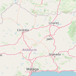
The Sierra de las Nieves region encompasses a number of traditional mountain villages whose communities have long maintained connections to this landscape. The park extends across or borders municipalities including El Burgo, Istán, Monda, Parauta, Ronda, Tolox, Yunquera, and others in the surrounding peripheral protection zone such as Benahavís, Ojén, Guaro, Casabonela, and Alozaina. These towns preserve historical heritage and distinctive local traditions, including festivals such as the Polvos and Rabbit Festival in Parauta, the Tolox Rocket Festival (Cohetá), the Alozaina Flour Carnival, the Seven Branches Soup festival in El Burgo, and Corpus Christi celebrations in Yunquera. The name of the park itself reflects the historical snow-harvesting industry (neveros) that once operated in these mountains, with snow pits used to store winter snow for summer distribution to lowland villages—a practice that shaped both the landscape and the regional economy before modern refrigeration. The historical pressure from charcoal production for the silver mines of Ronda and sustained grazing has profoundly influenced the composition and structure of the park's forests, particularly the high-mountain oak formations.

Top sights and standout views in Sierra de las Nieves National Park

The defining highlight of Sierra de las Nieves is undoubtedly the Spanish fir forests, representing a globally unique conservation asset as the world's largest populations of this Tertiary-era relict conifer. The cave systems, particularly the extraordinary vertical shaft of GESM descending over a kilometer into the earth, rank among the most impressive speleological features in Europe. The viewpoint at Mirador Ceballos offers spectacular vistas over the Tajo de la Caína cliffs and the Pinsapar de Caucón below. The ascent to Pico Torrecilla, the highest peak in western Andalusia, provides hikers with access to dramatic alpine landscapes rarely found this far south in Europe. The geological diversity—white limestone karst, red peridotite mountains, and brown metamorphic ridges—creates a visually striking landscape that changes character dramatically across the park. The park's position within a UNESCO Biosphere Reserve and its upgrade to national park status in 2021 reflect its recognized importance for both biodiversity conservation and sustainable regional development.

Best time to visit Sierra de las Nieves National Park

The Sierra de las Nieves can be visited year-round, though the experience varies significantly with the seasons. Spring and early summer (April through June) offer pleasant temperatures, wildflower displays in the meadows, and the opportunity to see wildlife active after the winter months. The Spanish fir forests are particularly atmospheric in spring when moisture persists in the canopy. Autumn (September and October) brings cooler temperatures and the changing colors of the deciduous oaks in the high mountain zones, though rainfall begins to increase. Summer can be hot in the lower elevations but provides the warmest conditions for hiking at altitude, though water sources along trails are scarce and must be planned for. Winter snow occasionally caps Pico Torrecilla and the higher ridges, creating dramatic alpine scenery but potentially limiting some access routes. The park's Mediterranean climate means most precipitation falls between October and March, with summer months receiving minimal rainfall. Visitors interested in the cave systems should note that some deep shafts require specific technical knowledge and equipment.

Park location guide

Geography guide, regional context, and park location map for Sierra de las Nieves National Park

Sierra de las Nieves National Park park geography, regions, and map view in Spain
Understand where Sierra de las Nieves National Park sits in Spain through a broader geographic reading of the surrounding landscape, nearby location context, and its mapped position within the national park landscape.

How Sierra de las Nieves National Park fits into Spain

Spain, officially the Kingdom of Spain, is a unitary parliamentary constitutional monarchy located in Southern and Western Europe. The country occupies most of the Iberian Peninsula and includes territories in the Mediterranean and Atlantic. With a population of approximately 49.6 million and an area of 506,030 km², Spain is a major European economy and cultural force. Its capital is Madrid, and the country is known for its diverse landscapes ranging from mountainous regions to coastal areas.

Wider geography shaping Sierra de las Nieves National Park in Spain

Spain occupies the Iberian Peninsula in Southern and Western Europe. Peninsular Spain is bordered to the north by France, Andorra, and the Bay of Biscay; to the east and south by the Mediterranean Sea and Gibraltar; and to the west by Portugal and the Atlantic Ocean. The territory includes the Canary Islands in the Atlantic Ocean, the Balearic Islands in the Mediterranean Sea, and the autonomous cities of Ceuta and Melilla in mainland Africa. Spain features diverse terrain including the Pyrenees in the northeast, the Sierra Nevada in the south, and the Meseta Central plateau.

Map view of Sierra de las Nieves National Park

Use this park location map to pinpoint Sierra de las Nieves National Park in Spain, understand its exact geographic position, and read its mapped placement within the surrounding landscape more clearly.

Pigeon | © OpenStreetMap contributors

Location context for Sierra de las Nieves National Park

Province of Málaga
Park atlas

Explore Surrounding Mountain Ranges and Connected Conservation Landscapes of Andalusia, Spain

Discover Other National Parks and Protected Areas Near Sierra de las Nieves National Park
Continue your park exploration by tracing the mapped geography of protected areas adjacent to Sierra de las Nieves National Park, encompassing diverse Mediterranean mountain and karst landscapes throughout southern Spain. Compare regional protected landscapes, identify other significant natural features, and understand the broader conservation context of Andalusia's Betic Cordillera.
National parkHuelva

Doñana National Park National Park: Mapped Geography and Protected Landscape Context

Explore Huelva's key protected area and its regional geographic setting.

Delve into the structured geographic data and mapped boundaries of Doñana National Park. This entry highlights its identity as a national park within the Huelva region, providing essential context for understanding its protected landscape. MoriAtlas offers this detail to facilitate a clear, atlas-driven exploration of its natural terrain and its place in the broader geographic framework of Spain.

Area
543 km²
Established
1969
IUCN
II
Visitors
376.3K annual
National parkAndalusia

Sierra Nevada National Park: Protected Alpine Terrain and Geographic Context in Andalusia

Explore Spain's highest mountain range mapped across Andalusia's atlas.

Sierra Nevada National Park offers a profound exploration of Spain's highest alpine environments and a significant entry in the regional geography atlas. This protected area showcases classic glacial landforms, U-shaped valleys, and numerous high-mountain lakes, alongside a remarkable abundance of endemic plant species thriving in its unique microclimates. Understanding its mapped boundaries reveals a landscape vital for both biodiversity and watershed, situated prominently within the broader geographic context of Andalusia.

Area
858.83 km²
Established
1999
IUCN
II
Relief
Mountain
Protected landscapeAlgarve

Ria Formosa Natural Park Protected Landscape: Algarve Regional Geography

Explore mapped protected landscapes and regional geographic context.

Examine Ria Formosa Natural Park, a protected landscape that defines a significant portion of the Algarve's natural heritage. This atlas-focused exploration details the park's geographic features, its protected status, and its position within the wider regional geography. Understand the mapped extent of this protected landscape and its contribution to the natural context of southern Portugal.

Area
179.01 km²
Established
1978
IUCN
V
Relief
Lowland
Watercolor illustration showing a river flowing through a valley with hills and vegetation
Protected landscapeBeja District

Guadiana Valley Natural Park: Protected Landscape Discovery in Beja District

Explore its mapped geography and protected land context.

Guadiana Valley Natural Park is identified as a protected landscape, providing a specific focus for geographic study and map-based exploration. This entry details the park's unique protected-area status and its contextual placement within the expansive Beja District of southern Portugal. Understand the mapped boundaries and landscape features that define this area, serving as a key point for regional geographic understanding on MoriAtlas.

Area
697 km²
Established
1995
IUCN
V
Visitors
749 annual
Watercolor illustration showing a wetland landscape with grasses, a body of water, and distant hills
National park

Tablas de Daimiel National Park: Spain's Inland Wetland National Park and Protected Area

Explore mapped boundaries and regional geographic context.

Tablas de Daimiel National Park represents one of the last remaining examples of floodplain wetland systems in Spain's interior. Located in Castilla-La Mancha, this protected area showcases a unique confluence of fresh and brackish waters, supporting a rich mosaic of emergent vegetation and serving as a critical habitat for migratory birds. Use MoriAtlas to explore its precise geographic setting, mapped terrain, and its role as a vital conservation landscape within the Iberian Peninsula.

Area
30.3 km²
Established
1973
IUCN
II
Relief
Lowland
Watercolor painting showing green fields, scattered trees, and distant mountains under a light sky
National parkToledo Province

Cabañeros National Park: Spain's Premier Iberian Oak Woodland Protected Landscape

Mapped Geography of Montes de Toledo Protected Area

Cabañeros National Park is celebrated as the most extensive and well-conserved example of Iberian Mediterranean forest in Spain. Situated within the Montes de Toledo, the park features a remarkable dichotomy between its unique raña flatlands and mountainous sierras, harboring ancient oak woodlands and significant biodiversity. This national park serves as a crucial component of the region's geographic context and a prime destination for atlas-based discovery of protected landscapes.

Area
409 km²
Established
1995
IUCN
II
Visitors
104.6K annual
Protected landscapeAlentejo Litoral

Southwest Alentejo and Vicentine Coast Natural Park: A Protected Landscape in Alentejo Litoral

Explore its mapped boundaries and regional geographic context.

This detail page offers a deep dive into the Southwest Alentejo and Vicentine Coast Natural Park, a protected landscape situated in Portugal's Alentejo Litoral region. Understand the park's identity as a protected area through its geographic features and mapped extent. MoriAtlas facilitates a structured understanding of this natural landscape, enabling focused discovery of its protected boundaries and regional geographical significance.

Area
895.7 km²
Established
1988
IUCN
V
Visitors
12.7K annual
Watercolor illustration of a landscape with green hills, scattered trees, and distant mountains under a pink and yellow sky
Protected landscapePortalegre District

Serra de São Mamede Natural Park: A Protected Landscape Defined by Ecological Transition

Explore the unique mountain terrain and ecosystems of Portalegre District.

Delve into the geographic and ecological identity of Serra de São Mamede Natural Park, a significant protected landscape situated in Portugal's Portalegre District. This area is renowned for its dramatic quartzite ridges and its role as a crucial meeting point for Atlantic and Mediterranean plant communities, offering a unique atlas perspective on regional biodiversity. Examining its mapped boundaries and diverse terrain provides essential context for understanding its ecological importance and its distinct position within the Alentejo region's geography.

Area
560.6 km²
Established
1989
IUCN
V
Visitors
4.5K annual

Common questions about visiting, size, designation, and location context for Sierra de las Nieves National Park

Sierra de las Nieves National Park FAQs for park facts, access, geography, and protected area context
Find quick answers about Sierra de las Nieves National Park, including protected-area facts, park geography, trail and visitor context, and how the park fits into its surrounding country and regional landscape.
MoriAtlas Explorer

Continue Your Protected Areas Search Across the Global Atlas

Deepen your exploration by continuing the structured search for national parks and protected areas worldwide. Utilize the comprehensive filtering capabilities to compare different conservation landscapes and refine your understanding of global park geography. Discover more about the distribution and characteristics of protected natural areas.

Global natural geography