Mori Atlas logo
National parkSierra de Guadarrama National Park

Discover the geographic context and diverse ecosystems of this Iberian Peninsula national park.

Sierra de Guadarrama National Park: A Mapped Protected Landscape of High Mediterranean Mountains

(Parque Nacional de la Sierra de Guadarrama)

Sierra de Guadarrama National Park, designated in 2013, represents a vital protected landscape in central Spain, spanning the granite peaks and forested slopes of the Sistema Central mountain range. This national park encompasses approximately 34,000 hectares, safeguarding eleven distinct ecosystems, including the rare high Mediterranean mountain environments. Explore its mapped boundaries, understand its role as a critical watershed feeding the Tagus and Duero basins, and discover the varied terrain from glacial cirques to ancient pine forests.

Mountain ParksPine ForestsGlacial LagoonsIberian WildlifeGranite LandscapesHigh Mediterranean Mountain

Sierra de Guadarrama National Park

National park

Park overview

Structured park overview, official facts, and landscape profile for Sierra de Guadarrama National Park

Sierra de Guadarrama National Park park facts, protected area profile, and essential visitor context
Review the core facts for Sierra de Guadarrama National Park, including designation, size, terrain, visitor scale, habitats, and operating context in one park-focused overview.

About Sierra de Guadarrama National Park

Sierra de Guadarrama National Park protects the granite mountain range that rises as a natural barrier between the northern and southern mesetas of central Spain. The park, established in 2013, encompasses approximately 34,000 hectares across twenty-eight municipalities in the Community of Madrid and the provinces of Segovia and Ávila. The Sierra de Guadarrama extends roughly 80 kilometers in a southwest-northeast direction, with widths not exceeding 20 kilometers, and forms part of the eastern section of the Sistema Central cordillera. The range serves as a critical hydrological divide, with rivers flowing to both the Tagus basin to the southeast and the Duero basin to the northwest. The park's ecological significance is extraordinary, protecting eleven different ecosystems including the only Iberian examples of high Mediterranean mountain, a unique environment where Mediterranean and alpine species coexist. The landscape ranges from the summit of Peñalara at 2,428 meters down through forests of Scots pine and oak to the lower slopes, with dramatic geological features including glacial cirques, granite peaks, and the distinctive rock formations of La Pedriza.

Quick facts and research context for Sierra de Guadarrama National Park

Located in central Spain, the Sierra de Guadarrama National Park covers roughly 34,000 hectares across the Community of Madrid and Castile and León provinces of Segovia and Ávila. The park was established in 2013, making it one of Spain's newest national parks. The range reaches 2,428 meters at Peñalara peak and forms part of the Sistema Central, the mountain chain dividing the Iberian Peninsula's northern and southern plateaus. The protected area encompasses eleven different ecosystems, representing a remarkable ecological diversity that includes high Mediterranean mountain environments found nowhere else on the Iberian Peninsula. The park's fauna represents 45% of Spain's total wildlife and 18% of European fauna.

Park context

Deeper park guide and search-rich context for Sierra de Guadarrama National Park

Sierra de Guadarrama National Park history, landscape, wildlife, and travel context
Explore Sierra de Guadarrama National Park through its history, landscape character, ecosystems, wildlife, conservation priorities, cultural context, and seasonal travel timing in a structured park guide built for atlas discovery and search intent.

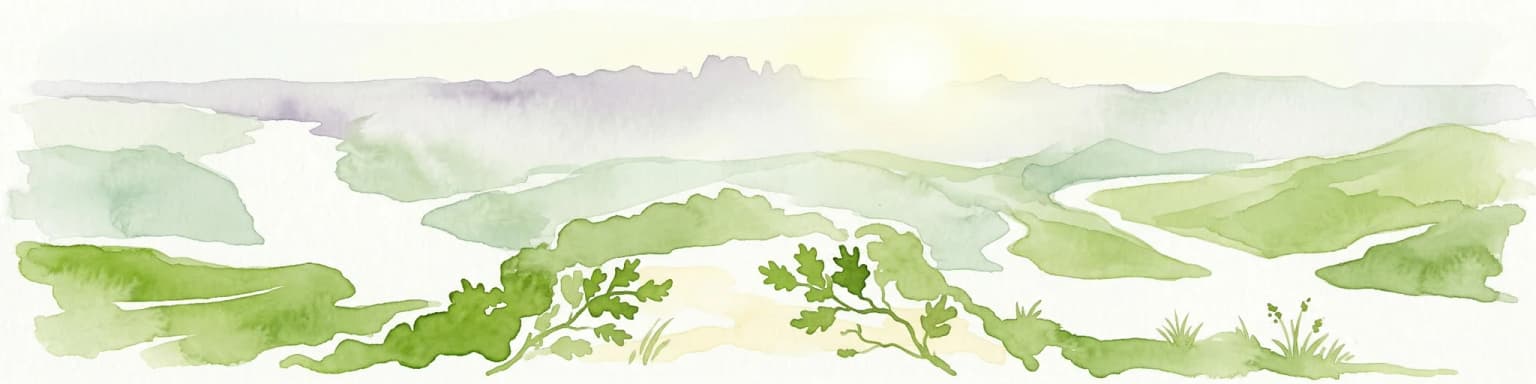
Why Sierra de Guadarrama National Park stands out

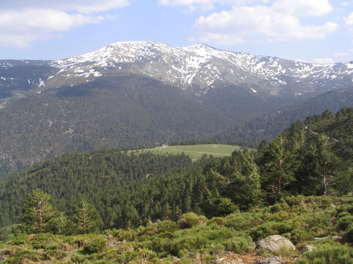
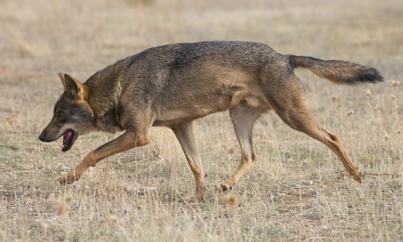
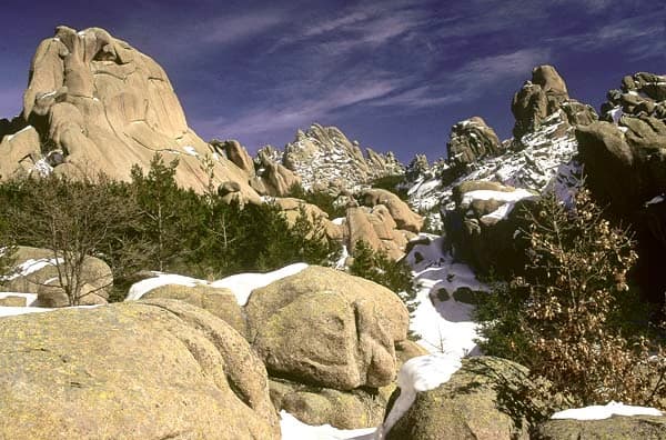
The Sierra de Guadarrama is best known for its remarkable ecological diversity spanning eleven distinct ecosystems, including the unique high Mediterranean mountain environment found only in this part of the Iberian Peninsula. The park contains some of Spain's finest natural forests of Scots pine, particularly the renowned Valsaín pine forest, one of the few state-owned mountain forests in the country with continuous management since the 18th century. The dramatic glacial landscape around Peñalara features spectacular cirques and lagoons, including the Laguna Grande de Peñalara, while La Pedriza showcases extraordinary granite rock formations. The park also harbors significant populations of endangered species including the Spanish imperial eagle, black vulture, and the recently returned Iberian wolf, which has recolonized the area after a 70-year absence.

Overview image of Sierra de Guadarrama National Park showing what the park is best known for
Visual overview of what makes Sierra de Guadarrama National Park a notable national park destination.

Sierra de Guadarrama National Park history and protected-area timeline

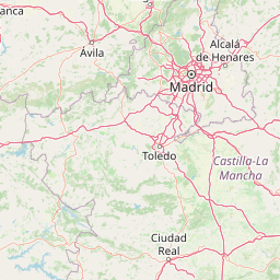
The protection of Sierra de Guadarrama has been sought since the 1920s, when the Peñalara Mountain Climbing Society first proposed declaring the range a national park. This early initiative was abandoned due to the turbulent political changes of the Second Republic and remained completely stalled during the Franco dictatorship. The project was revived at the end of the 20th century when, in 1998, the Ministry of Environment commissioned a feasibility study. During the planning process, various areas received alternative protection: El Escorial became a World Heritage Site in 1984, the Peñalara Natural Park was designated in 1990 (including wetland areas designated as a Ramsar site in 2006), and the upper Manzanares River basin was created as a regional park and biosphere reserve in the 1980s and 1992 respectively. The national park designation faced significant delays, particularly in Castile and León where concerns about restricting development on attractive land near Madrid slowed progress. The park was finally declared on June 26, 2013, with Law 7/2013 published in the Official State Bulletin, establishing the current 33,960-hectare protected area.

Sierra de Guadarrama National Park landscape and geographic character

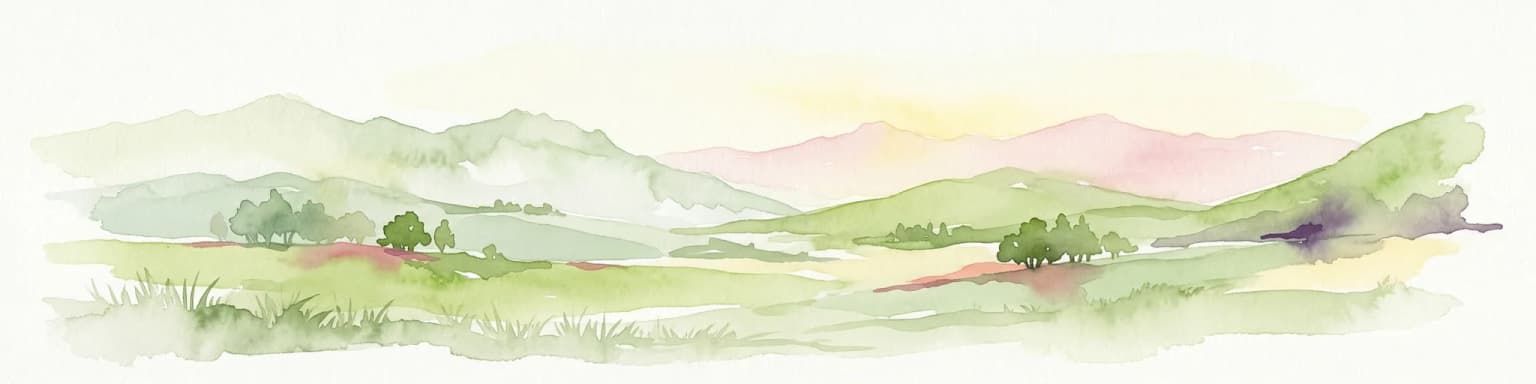
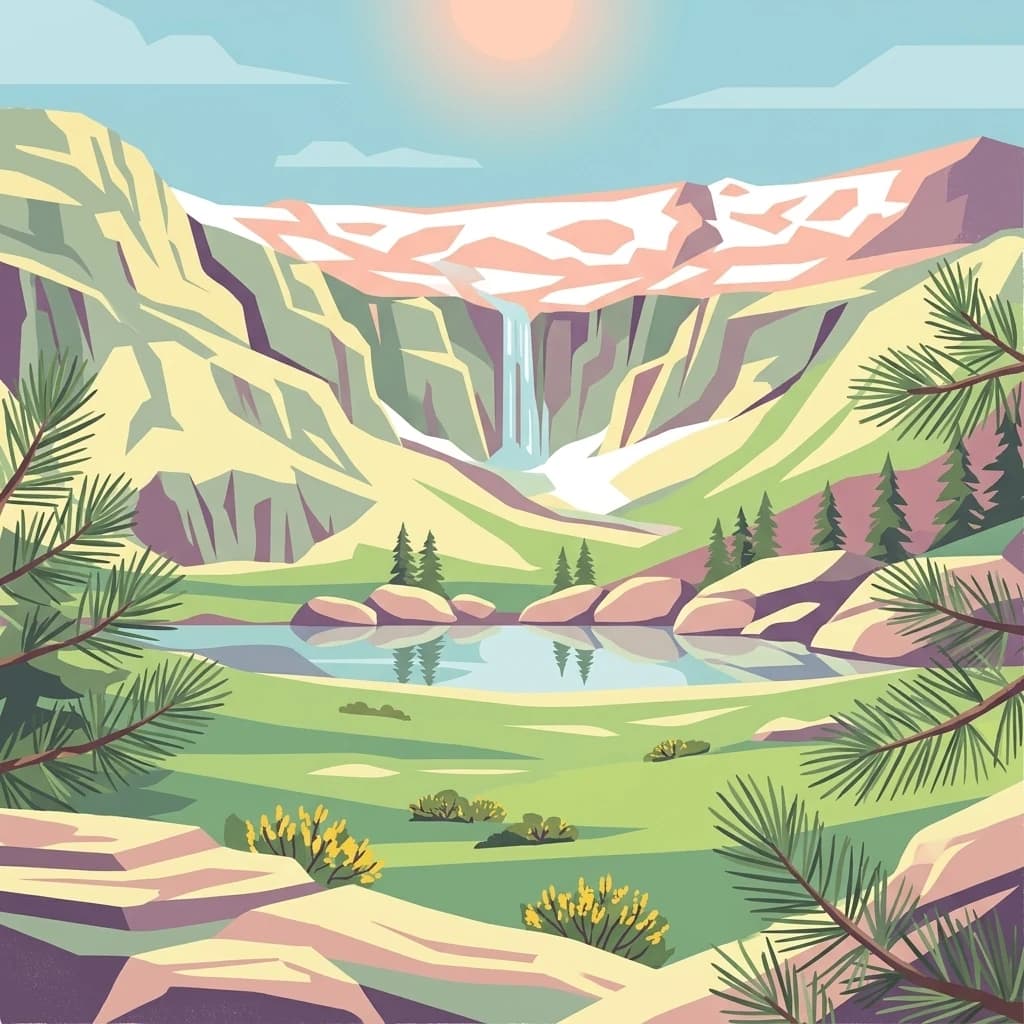
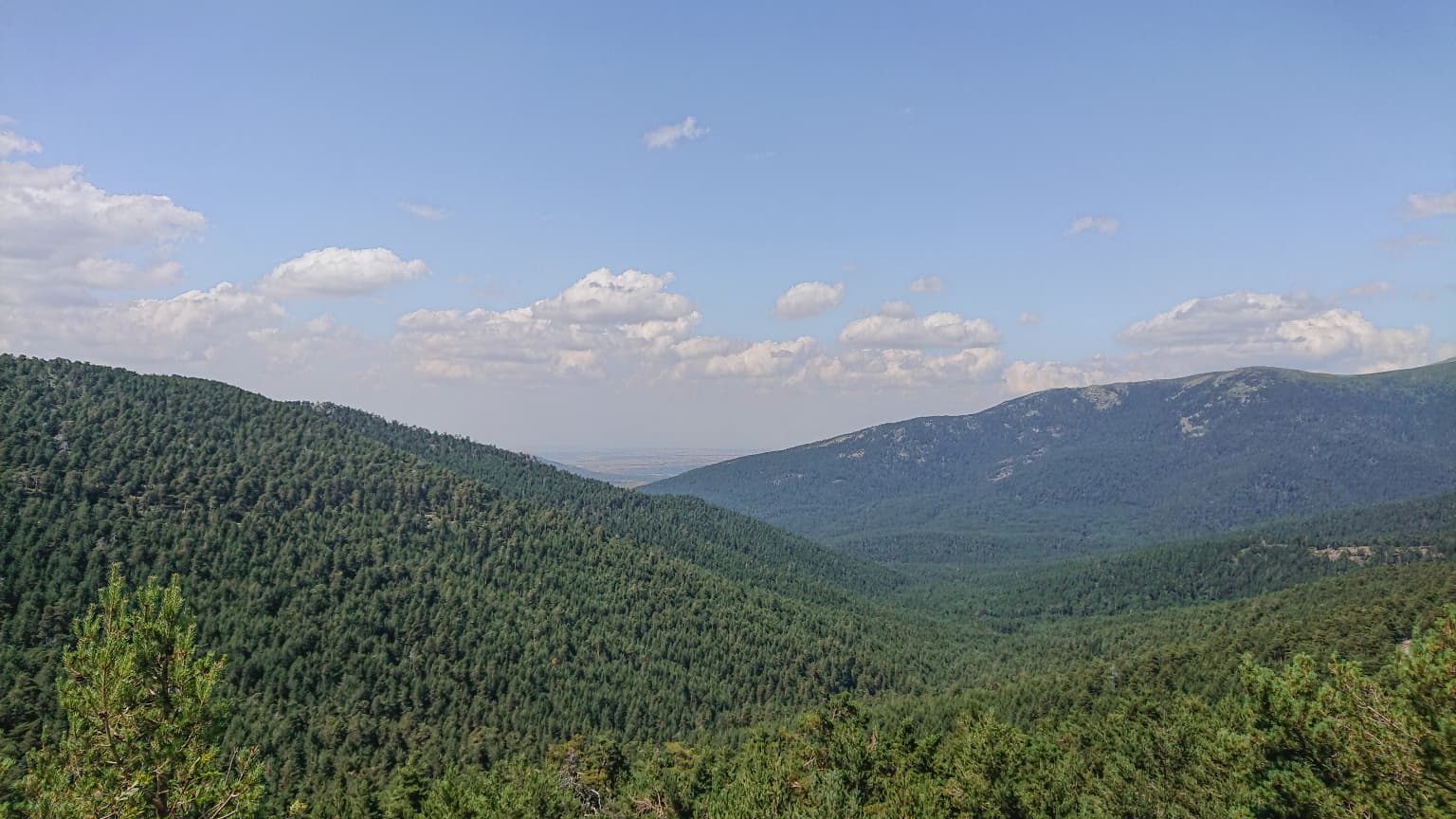
The Sierra de Guadarrama presents a landscape of considerable variety defined by its granite geology formed during the Hercynian orogeny and later reshaped by Alpine mountain-building. The range rises from base elevations of 900-1200 meters on its southeastern face and 1100-1200 meters on the northwestern side, with the main peaks featuring an average prominence of 1000 meters. The park encompasses several distinct mountain groups: the Cuerda Larga runs for 16 kilometers along the Madrid side of the range, featuring peaks such as the Cabezas de Hierro at 2383 meters; the Sierra de la Morcuera reaches 1862 meters at Pico Perdiguera; and the Montes Carpetanos form the northern alignment between Peñalara and Puerto de Somosierra. The landscape features dramatic glacial features including the cirques and lagoons around Peñalara, among the southernmost glacial formations in Europe. La Pedriza displays remarkable granite rock formations with curious shapes, while the valleys such as the Lozoya Valley offer classic mountain scenery. The rivers crossing the park include the Guadarrama, Manzanares, and Lozoya flowing to the Tagus, and the Duratón, Cega, Pirón, Eresma, Moros, and Voltoya feeding the Duero system.

Iberian ibex standing on a rocky outcrop with green vegetation and mountainous landscape in background
Iberian ibex resting on rocky outcrop with mountainous landscape in background

Sierra de Guadarrama National Park ecosystems, habitats, and plant life

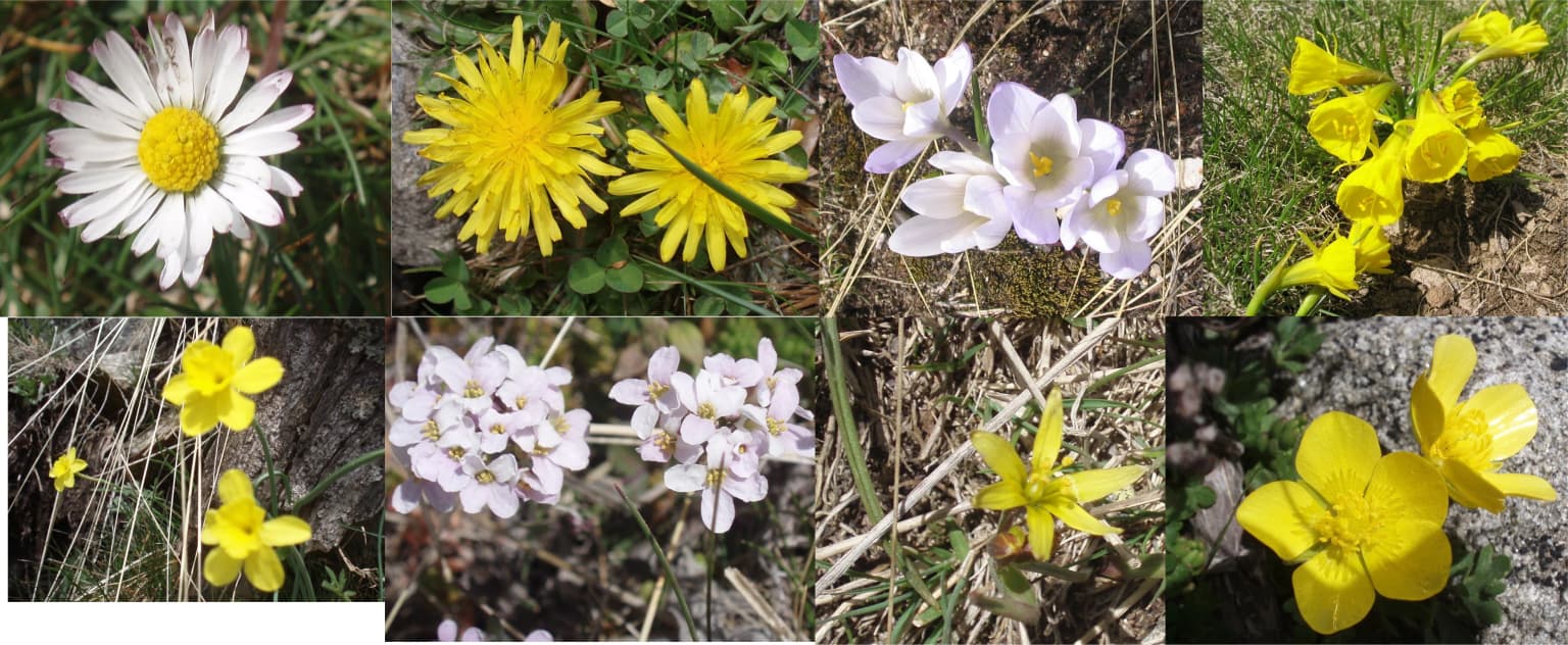
The Sierra de Guadarrama supports an exceptional diversity of ecosystems, with the park protecting eleven distinct environments including the unique high Mediterranean mountain ecosystem found only in this part of the Iberian Peninsula. The vegetation displays clear altitudinal zonation: above 2000 meters, high mountain grasslands and shrubs predominate; between 1400 and 2000 meters lie the magnificent Scots pine forests, among Spain's finest natural examples including the Valsaín forest in Segovia and the Belge Society pines in Rascafría; and below 1400 meters, oak forests of Quercus pyrenaica dominate, with the western sections transitioning to stone pine, oak, and evergreen oak as elevations and precipitation decrease. The park contains more than 1,500 native plant species and thirty different vegetation types. This remarkable ecological variety arises from the range's position at the confluence of Mediterranean and alpine biogeographical influences, creating conditions where species from both climatic zones intermingle in ways found nowhere else on the Iberian Peninsula.

Snow-capped mountain peak and glacial cirque reflecting in a calm mountain lake under clear blue sky
Glacial cirque and Peñalara Peak reflecting in a mountain lake under clear blue sky

Sierra de Guadarrama National Park wildlife and species highlights

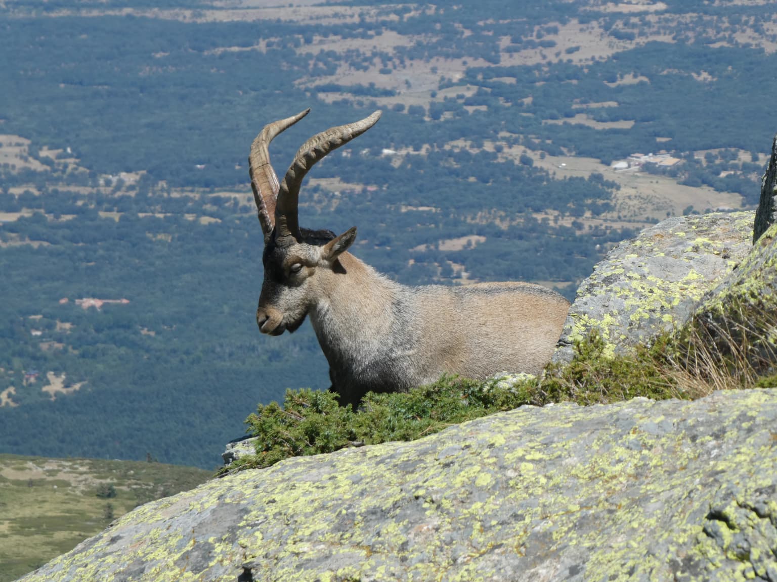
The wildlife of Sierra de Guadarrama is extraordinarily rich, with the species present representing 45% of Spain's total fauna and 18% of European fauna. The park hosts more than 1,280 animal species, including thirteen classified as endangered. Large mammals include red deer, roe deer, fallow deer, wild boar, Iberian wolf (recently returned after a 70-year absence), wild goats (Iberian ibex), badgers, various mustelids, wild cats, foxes, and hares. The avian population is particularly significant, with great raptors including the Spanish imperial eagle and the Eurasian black vulture, alongside golden eagles, booted eagles, and eagle owls. Waterfowl inhabit the reservoirs, while migratory species such as cranes spend summers in the range before heading to North Africa in winter. The park also supports endemic invertebrate species, most notably the Graellsia isabelae butterfly, named after Queen Isabella II. The recent return of the wolf pack after decades of absence marks a significant ecological milestone for the park's predator-prey dynamics.

Iberian wolf (Canis lupus signatus) running on dry grass
Iberian wolf running through a grassy field

Sierra de Guadarrama National Park conservation status and protection priorities

The Sierra de Guadarrama National Park represents a crucial conservation achievement for Spain's natural heritage, protecting an extraordinary diversity of ecosystems that include the only high Mediterranean mountain environments found on the Iberian Peninsula. The park's designation in 2013 came despite criticism from environmental organizations who argued that the final protection levels were weaker than existing protections under the Peñalara Natural Park designation, particularly in the Community of Madrid portion. The park forms part of a broader network of protected areas including the Peñalara Natural Park with its Ramsar-listed wetlands, the Regional Park of the Upper Manzanares Basin (a UNESCO biosphere reserve), and the Sierra Norte de Guadarrama Natural Park in Castile and León. The protection framework includes Special Protection Area status for birds (ZEPA) and Zone of Special Conservation (ZEC) designations. Key conservation challenges include managing urban development pressure from the Madrid metropolitan area, fire risk during dry summers, and balancing traditional land uses including livestock grazing with ecological preservation objectives.

Sierra de Guadarrama National Park cultural meaning and human context

The Sierra de Guadarrama has been intimately connected with Madrid's cultural and educational development since the late 19th century, when the Institution Libre de Ensino initiated the first systematic natural history excursions in Spain, viewing the mountains as both an educational resource and recreational asset for city dwellers. During the Middle Ages, the range was known as the Sierra del Dragón (Dragon's Range), likely referring to the silhouette of Siete Picos (Seven Peaks) which resembles a dragon's spine, a name used by figures such as Archbishop Rodrigo Jiménez de Rada and Alfonso X the Wise. The name Guadarrama itself derives from the Arabic Uad-al-rámel meaning 'river of sand,' though it may have reinterpreted a Latin Aquae dirrama meaning 'watershed,' reflecting the range's role as the divide between the Tagus and Duero basins. The range supports traditional uses including extensive livestock grazing producing the certified 'Carne de la Sierra de Guadarrama' beef, and historical logging operations in the Valsaín forest which supplied wood to regional sawmills and even exported to Germany.

Large rocky formations with patches of snow under a clear blue sky, surrounded by sparse vegetation in a mountainous area
Winter landscape of La Pedriza rock formations in Sierra de Guadarrama National Park

Top sights and standout views in Sierra de Guadarrama National Park

The Sierra de Guadarrama offers exceptional highlights including Peñalara's glacial cirques and lagoons, particularly the Laguna Grande de Peñalara among Europe's southernmost glacial lakes; the extraordinary granite landscapes of La Pedriza with its famed El Yelmo peak; some of Spain's finest natural Scots pine forests in Valsaín and Rascafría; the return of the Iberian wolf after 70 years; populations of Spanish imperial eagle and black vulture; and the dramatic Cuerda Larga ridge with peaks exceeding 2300 meters. The park's ecological significance as the only location protecting high Mediterranean mountain ecosystems on the Iberian Peninsula makes it uniquely important for conservation.

Panoramic view of forested mountain ranges with scattered clouds in the sky
Panoramic view of forested mountains in Guadarrama National Park

Best time to visit Sierra de Guadarrama National Park

The Sierra de Guadarrama can be visited year-round, with each season offering distinct experiences. Summer and early autumn provide the most reliable conditions for hiking, with warm temperatures at lower elevations and comfortable conditions in the high mountains. Winter transforms the landscape dramatically, with snow covering the peaks above 2000 meters and excellent skiing at the three ski resorts (Navacerrada, Valdesquí, and Navafría Nordic center), though high-elevation trails require mountaineering equipment. Spring brings lush vegetation and flowing waterfalls as snowmelt feeds the mountain streams and lagoons. The clearest skies and best visibility typically occur in autumn, while winter offers dramatic vistas of snow-dusted peaks but requires careful preparation for cold and variable mountain weather. The proximity to Madrid means weekends can be very busy, so visiting on weekdays provides a more peaceful experience.

Park location guide

Geography guide, regional context, and park location map for Sierra de Guadarrama National Park

Sierra de Guadarrama National Park park geography, regions, and map view in Spain
Understand where Sierra de Guadarrama National Park sits in Spain through a broader geographic reading of the surrounding landscape, nearby location context, and its mapped position within the national park landscape.

How Sierra de Guadarrama National Park fits into Spain

Spain, officially the Kingdom of Spain, is a unitary parliamentary constitutional monarchy located in Southern and Western Europe. The country occupies most of the Iberian Peninsula and includes territories in the Mediterranean and Atlantic. With a population of approximately 49.6 million and an area of 506,030 km², Spain is a major European economy and cultural force. Its capital is Madrid, and the country is known for its diverse landscapes ranging from mountainous regions to coastal areas.

Wider geography shaping Sierra de Guadarrama National Park in Spain

Spain occupies the Iberian Peninsula in Southern and Western Europe. Peninsular Spain is bordered to the north by France, Andorra, and the Bay of Biscay; to the east and south by the Mediterranean Sea and Gibraltar; and to the west by Portugal and the Atlantic Ocean. The territory includes the Canary Islands in the Atlantic Ocean, the Balearic Islands in the Mediterranean Sea, and the autonomous cities of Ceuta and Melilla in mainland Africa. Spain features diverse terrain including the Pyrenees in the northeast, the Sierra Nevada in the south, and the Meseta Central plateau.

Map view of Sierra de Guadarrama National Park

Use this park location map to pinpoint Sierra de Guadarrama National Park in Spain, understand its exact geographic position, and read its mapped placement within the surrounding landscape more clearly.

Pigeon | © OpenStreetMap contributors

Location context for Sierra de Guadarrama National Park

Castile and LeónCommunity of Madrid

Discover the visual identity of Spain's high Mediterranean mountain environments, glacial cirques, and extensive pine forests.

Sierra de Guadarrama National Park Photos: Explore Mountain Landscapes and Protected Area Scenery
Visually explore the diverse landscapes of Sierra de Guadarrama National Park through this curated image gallery. Observe the dramatic granite peaks, pristine glacial lagoons, and expansive Scots pine forests that define its unique high Mediterranean mountain ecosystems. These images provide essential context for understanding the park's ecological significance and the varied terrain of central Spain.

Snow-capped mountain peaks with dense pine forests in the foreground under a partly cloudy sky

Iberian ibex standing on a rocky outcrop with green vegetation and mountainous landscape in background

Snow-capped mountain peak and glacial cirque reflecting in a calm mountain lake under clear blue sky

Iberian wolf (Canis lupus signatus) running on dry grass

Rugged rocky landscape with large boulders and sparse vegetation under clear blue sky

Large rocky formations with patches of snow under a clear blue sky, surrounded by sparse vegetation in a mountainous area

Panoramic view of forested mountain ranges with scattered clouds in the sky

Black vulture with brown feathers and hooked beak standing on grass next to a deceased animal

Collage of diverse wildflowers including daisies, yellow blooms, and white flowers in natural setting

Tall pine trees in a forest with green undergrowth and sunlight filtering through the canopy

Yellow sign with dark border displaying 'Zona de Reserva' text and 'Sierra de Guadarrama Parque Nacional' with a mountain range illustration

Mountain range with labeled peaks including Peñalara, Circo de Peñalara, Risco de los Claveles, Risco de los Pájaros, and Hermana Mayor under a partly cloudy sky

Rocky mountain peaks with green vegetation, a hiker with red backpack on a rocky outcrop, and a winding trail in the background

Snow-covered mountain slopes with ski trails and a distant peak under a clear blue sky

Panoramic view of Puerto de Navacerrada mountain pass showing buildings, roads, and mountainous landscape with green vegetation.

Park atlas

Explore the geographic spread of protected areas surrounding Sierra de Guadarrama National Park, comparing mountain landscapes and diverse Iberian ecosystems.

Compare National Parks Near Sierra de Guadarrama, Discovering Central Spain's Protected Landscapes
After viewing Sierra de Guadarrama National Park, explore other protected areas in central Spain, discovering comparable mountain ranges, diverse pine forests, and unique high Mediterranean ecosystems. Compare these conservation landscapes to understand the regional spread of protected geography and its significance within the Iberian Peninsula.
Watercolor painting showing green fields, scattered trees, and distant mountains under a light sky
National parkToledo Province

Cabañeros National Park: Spain's Premier Iberian Oak Woodland Protected Landscape

Mapped Geography of Montes de Toledo Protected Area

Cabañeros National Park is celebrated as the most extensive and well-conserved example of Iberian Mediterranean forest in Spain. Situated within the Montes de Toledo, the park features a remarkable dichotomy between its unique raña flatlands and mountainous sierras, harboring ancient oak woodlands and significant biodiversity. This national park serves as a crucial component of the region's geographic context and a prime destination for atlas-based discovery of protected landscapes.

Area
409 km²
Established
1995
IUCN
II
Visitors
104.6K annual
Watercolor illustration showing a wetland landscape with grasses, a body of water, and distant hills
National park

Tablas de Daimiel National Park: Spain's Inland Wetland National Park and Protected Area

Explore mapped boundaries and regional geographic context.

Tablas de Daimiel National Park represents one of the last remaining examples of floodplain wetland systems in Spain's interior. Located in Castilla-La Mancha, this protected area showcases a unique confluence of fresh and brackish waters, supporting a rich mosaic of emergent vegetation and serving as a critical habitat for migratory birds. Use MoriAtlas to explore its precise geographic setting, mapped terrain, and its role as a vital conservation landscape within the Iberian Peninsula.

Area
30.3 km²
Established
1973
IUCN
II
Relief
Lowland
National park

Monfragüe National Park: Protected Landscape Atlas of Spanish Raptor Colonies

Explore mapped terrain and regional geography within this Spanish National Park.

As a national park in Spain's Extremadura region, Monfragüe National Park offers a distinct protected landscape shaped by the Tagus River and dramatic limestone cliffs. It is globally recognized for its exceptional birdlife, especially its large griffon vulture colonies and populations of Spanish imperial eagles, making it a significant site for ecological study and atlas-based exploration of protected areas. The park's landscape, characterized by Mediterranean woodlands and rugged terrain, provides crucial habitat and a unique geographic context for understanding Iberian Peninsula conservation.

Scope
Terrestrial
Watercolor illustration of rolling green hills, a winding river, and a distant horizon with a soft sun
National parkExtremadura

Monfragüe National Park: Dramatic Cliffs, Raptor Haven, and Extremadura's Protected Landscape

Discover its mapped terrain and unique geography in Spain.

Monfragüe National Park, situated in Extremadura, Spain, offers a compelling study in protected landscape geography. The park's identity is shaped by its formidable cliffs and river valleys carved by the Tagus, providing critical nesting grounds for European raptors. This MoriAtlas entry details the park's mapped boundaries and its significance as a vital protected area within the region. Users can explore the specific natural terrain and regional context that establish Monfragüe as a unique protected territory.

Area
179 km²
Established
2007
IUCN
II
Visitors
331.8K annual
Protected landscapeBragança District

Montesinho Natural Park: Protected Landscape in Bragança District, Portugal

Explore mapped boundaries and regional landscape context.

Montesinho Natural Park is designated as a protected landscape in northeastern Portugal, located within the administrative region of Bragança District. This page serves as an entry point to understanding the park's protected area characteristics, its mapped geographic footprint, and its role in the broader natural landscape of the Trás-os-Montes region. Discover the atlas value of this significant protected territory and its relation to surrounding geography.

Area
742.25 km²
Established
1979
IUCN
V
Relief
Mountain
National park

Picos de Europa National Park: Dramatic Limestone Peaks and Protected Landscape Atlas

Explore Spain's historic national park and UNESCO Biosphere Reserve.

Picos de Europa National Park offers an unparalleled exploration of dramatic limestone peaks, deep glacial valleys, and extensive Atlantic forests. As Spain's oldest national park and a UNESCO Biosphere Reserve, it presents a remarkable study in karst landscape evolution and biodiversity conservation. This protected area, spanning significant territory across northern Spain, provides a rich geographic context for understanding regional natural heritage and mapped natural features.

Area
671.27 km²
Established
1918
IUCN
II
Relief
Mountain
Watercolor illustration of a landscape with green mountains, a body of water, and colorful wildflowers in the foreground
Nature reservePortugal

Serra da Estrela Natural Park: Glacial Terrain and Highest Peaks in Portugal

Explore the dramatic geography of this nature reserve.

Serra da Estrela Natural Park is a significant protected landscape in Portugal, celebrated for containing the nation's highest peak and exceptional Quaternary glacial formations. The park's terrain includes dramatic valleys carved by ice, numerous glacial lakes, and a stark alpine plateau around Torre. This nature reserve preserves a unique environment shaped by both geological history and traditional pastoralism, offering rich mapped context for understanding Portugal's mountainous geography and protected areas.

Area
891.32 km²
Established
1976
IUCN
V
Visitors
7.6K annual
Watercolor landscape illustration featuring mountains, forests, fields, and trees
Protected areaNorte Region

Alvão Natural Park: Protected Area Discovery and Regional Geographic Context

Explore its mapped boundaries and landscape within the Norte Region.

Alvão Natural Park is recognized as a protected area offering unique opportunities for geographic study and atlas exploration. This detail page provides an in-depth look at its protected landscape, mapping its precise boundaries and situating it within the diverse geography of Portugal's Norte Region. Understand the park's intrinsic value as a mapped natural area and discover its contribution to the regional conservation landscape.

Area
72.03 km²
Established
1983
IUCN
V
Visitors
29.6K annual

Common questions about visiting, size, designation, and location context for Sierra de Guadarrama National Park

Sierra de Guadarrama National Park FAQs for park facts, access, geography, and protected area context
Find quick answers about Sierra de Guadarrama National Park, including protected-area facts, park geography, trail and visitor context, and how the park fits into its surrounding country and regional landscape.
MoriAtlas Explorer

Continue Your Protected Areas Search Across the Global Atlas

Deepen your exploration by continuing the structured search for national parks and protected areas worldwide. Utilize the comprehensive filtering capabilities to compare different conservation landscapes and refine your understanding of global park geography. Discover more about the distribution and characteristics of protected natural areas.

Global natural geography