Mori Atlas logo
National parkPicos de Europa National Park

Discover the dramatic limestone peaks, glacial valleys, and rich Atlantic forest landscape.

Picos de Europa National Park: Spain's Oldest National Park and UNESCO Biosphere Reserve

(Parque Nacional de Picos de Europa)

Picos de Europa National Park, established in 1918, represents one of Spain's most significant protected areas, spanning approximately 671 square kilometers across Asturias, Cantabria, and Castile and León. This UNESCO Biosphere Reserve is characterized by its extraordinary limestone mountain scenery, with towering peaks, deep ravines like the Cares Gorge, and iconic glacial features such as the Lakes of Covadonga. The park protects a vital European Atlantic forest ecosystem and provides a crucial habitat for endangered species, offering a profound insight into regional geography and natural landscape preservation.

National ParkMountain LandscapeLimestone PeaksAtlantic ForestGlacial ValleysBiosphere Reserve

Picos de Europa National Park

National park

Park overview

Structured park overview, official facts, and landscape profile for Picos de Europa National Park

Picos de Europa National Park park facts, protected area profile, and essential visitor context
Review the core facts for Picos de Europa National Park, including designation, size, terrain, visitor scale, habitats, and operating context in one park-focused overview.

About Picos de Europa National Park

Picos de Europa National Park occupies a remarkable position in northern Spain, where the Cantabrian Mountains rise abruptly from the Bay of Biscay to form one of the most spectacular alpine landscapes in Western Europe. The park's name, meaning "Peaks of Europe," reflects the imposing nature of these limestone massifs that form a natural barrier between the Atlantic coast and the interior plateau. The geology of the region is dominated by Paleozoic limestone that has been sculpted by glacial erosion over thousands of years, creating a dramatic landscape of U-shaped valleys, cirques, moraines, and the distinctive jagged peaks that define the Picos de Europa skyline. Three distinct massifs—the Western, Central, and Eastern—each offer different terrain and character, with the Central Massif containing the highest peaks including Torre de Cerredo, the park's summit. The park's position at the crossroads of Atlantic and Mediterranean climatic influences creates exceptional ecological diversity, with the Spanish Wikipedia noting it contains 82% of all amphibian species found in the Iberian Peninsula, 63% of reptiles, 72% of breeding bird species, and 88% of terrestrial mammals. This extraordinary biodiversity, combined with the dramatic scenery and the park's status as Spain's oldest protected area, makes Picos de Europa a cornerstone of European conservation.

Quick facts and research context for Picos de Europa National Park

Picos de Europa National Park covers 67,127 hectares across Asturias, Cantabria, and Castile and León in northern Spain. Established in 1918 as Spain's first national park, it was originally called Parque Nacional de la Montaña de Covadonga and covered just 169 square kilometers around the Lakes of Covadonga. The park was significantly expanded in 1995 and again in 2014 to reach its present size. The highest point is Torre de Cerredo at 2,648 meters above sea level, while the lowest point lies at 75 meters along the Deva River. The park is home to approximately 4,600 residents across 11 municipalities and receives nearly 2 million visitors annually, making it the third most-visited national park in Spain.

Park context

Deeper park guide and search-rich context for Picos de Europa National Park

Picos de Europa National Park history, landscape, wildlife, and travel context
Explore Picos de Europa National Park through its history, landscape character, ecosystems, wildlife, conservation priorities, cultural context, and seasonal travel timing in a structured park guide built for atlas discovery and search intent.

Why Picos de Europa National Park stands out

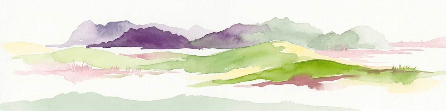
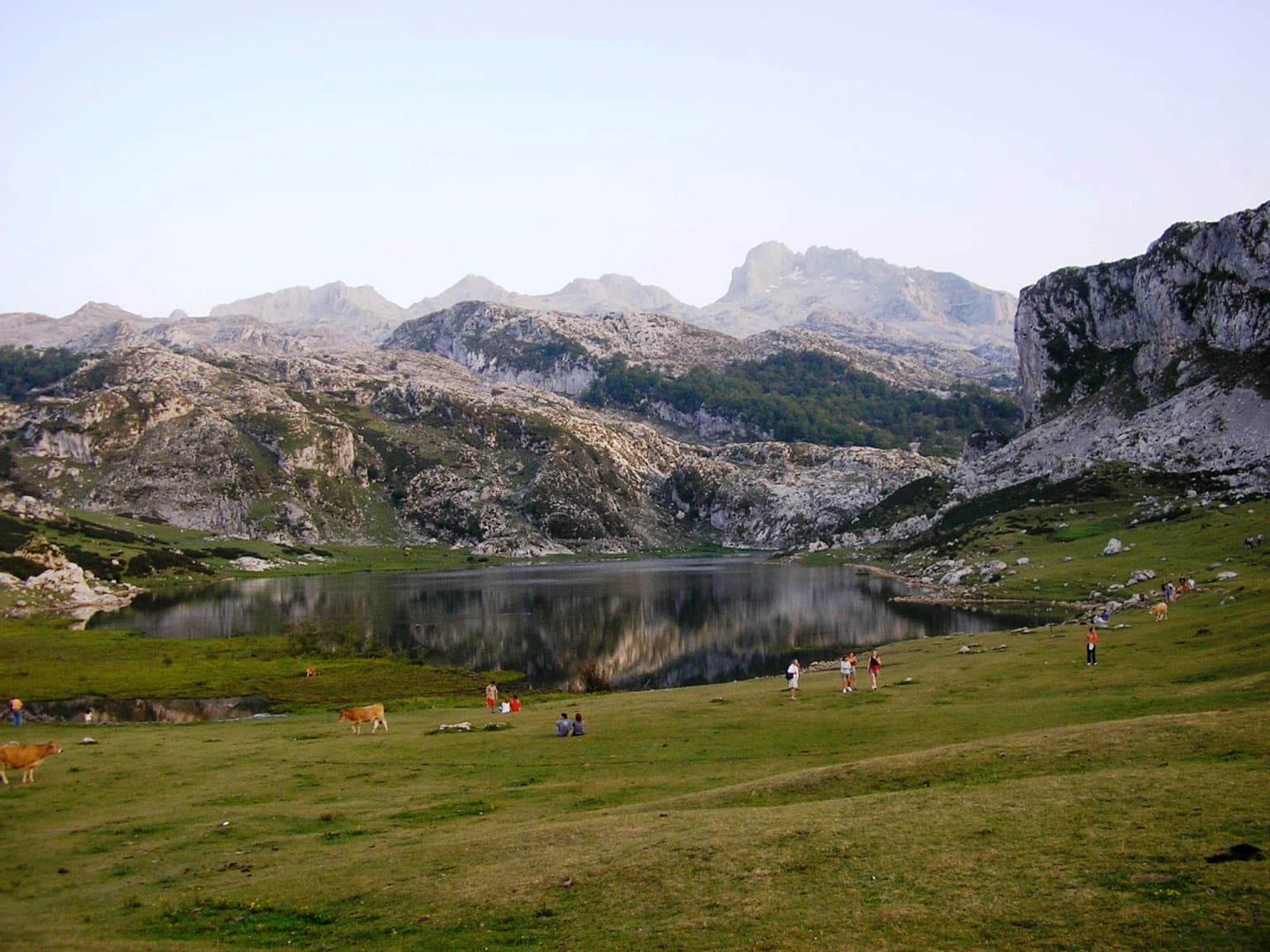
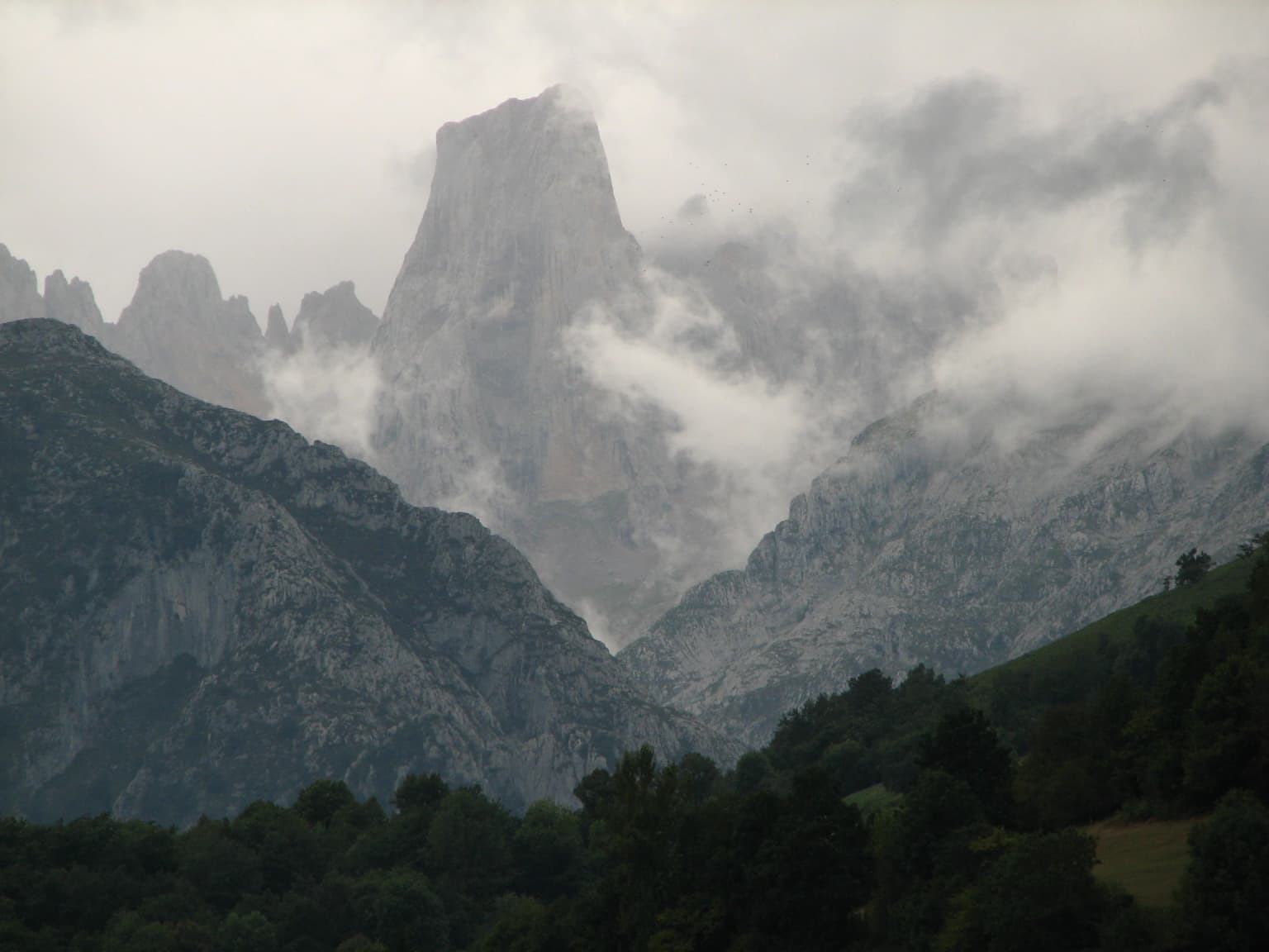
Picos de Europa is best known for its spectacular limestone mountain scenery, with dramatic peaks like the iconic Naranjo de Bulnes (Picu Urriellu) rising steeply above deep glacial valleys. The park protects some of the finest Atlantic forest in Europe, with extensive beech woods and the unique Monte Corona forest containing Europe's only native til trees. It is also famous for its population of Cantabrian chamois, the most representative animal of the park, which can be seen grazing on mountain slopes throughout the area. The Lakes of Covadonga, with their glacial origins and striking mountain backdrop, represent one of the most photographed sites in the Cantabrian Mountains.

Picos de Europa National Park history and protected-area timeline

Picos de Europa became Spain's first national park on July 22, 1918, when King Alfonso XIII signed the declaration creating what was initially called the Parque Nacional de la Montaña de Covadonga. The initiative came from Pedro Pidal, 1st Marquess of Villaviciosa de Asturias, who had been inspired by his visit to Yellowstone National Park in the United States. The original park covered 169.25 square kilometers centered on the Lakes of Covadonga, a sacred site in Spanish history where the Christian resistance against the Moorish conquest was said to have begun in the 8th century. On May 30, 1995, the park was substantially expanded to 646.60 square kilometers, and a further expansion on December 3, 2014, brought the total area to 671.27 square kilometers. In July 2003, UNESCO approved Biosphere Reserve status for the park, and it was inscribed as a UNESCO World Heritage Site in 2007 under the natural criterion (ix), with extensions added in 2011 and 2017. The park is notable for being part of a broader initiative to create a "Gran Cantábrica" super-reserve integrating several biosphere reserves in the Cantabrian Mountains.

Picos de Europa National Park landscape and geographic character

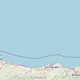
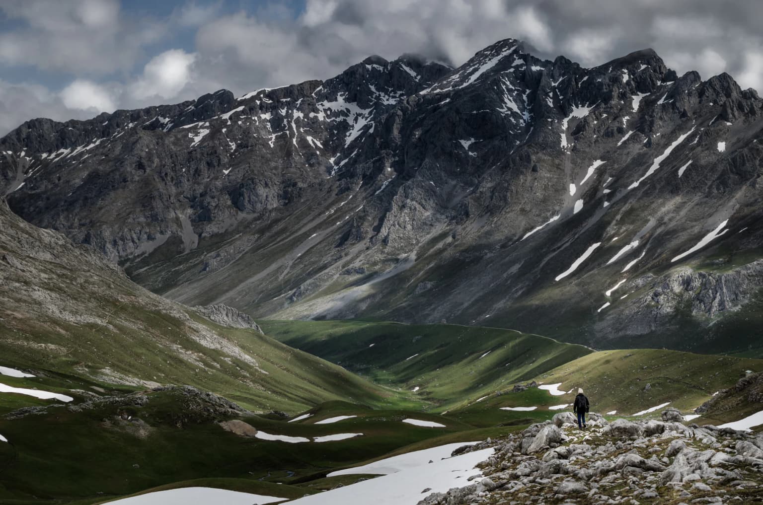
The landscape of Picos de Europa National Park is defined by its dramatic limestone formations, the largest karstic landscape in Atlantic Europe. The park encompasses three distinct massifs—the Western, Central, and Eastern—each characterized by steep rock faces, vertical cliffs, and some of the deepest sinkholes in the world. Glacial erosion has left a legacy of U-shaped valleys, cirques carved into the mountainsides, and terminal moraines marking the extent of ancient ice sheets. The most spectacular ravines include the Desfiladero de los Beyos and the Garganta del Cares, both among the most impressive gorges in Spain, where vertical walls rise hundreds of meters above rushing rivers. The park contains several glacial lakes, most famously the Lakes of Covadonga (Lago Enol and Lago Ercina), which sit in classic glacial cirques surrounded by towering peaks. The vertical relief is extraordinary—Torre de Cerredo rises to 2,648 meters while the Deva River valley dips to just 75 meters, creating a diversity of habitats from subalpine meadows to riverine forests within a relatively compact area. The northern slopes drop precipitously toward the sea in barely 10 kilometers, while the southern flanks descend more gradually toward the Castile and León plateau.

Picos de Europa National Park ecosystems, habitats, and plant life

The ecological richness of Picos de Europa stems from its position at the intersection of Atlantic and Mediterranean biogeographical zones, combined with the remarkable diversity of habitats created by its dramatic topography and elevation range. The park contains outstanding examples of Atlantic deciduous forest, with extensive beech (Fagus sylvatica) woodlands and Cantabrian Holm Oak (Quercus ilex subsp. rotundifolia) forests in the lower elevations. A particularly notable feature is Monte Corona in the Posada de Valdeón valley, which contains Europe's only native forest of til trees (Tilia), with the only other similar forests found in Japan. The variety of lithologies and the coexistence of temperate oceanic and sub-Mediterranean macrobioclimates create extraordinary plant diversity, with species representing Eurosiberian, Mediterranean, boreo-alpine, Atlantic-Macaronésian, and Mediterranean-Iranian distributions found within the park's boundaries. High mountain flora includes numerous endemic species adapted to the harsh alpine conditions, while the blend of ancient and modern forest types creates a complex mosaic of habitats supporting exceptional biodiversity.

Picos de Europa National Park wildlife and species highlights

Picos de Europa supports one of the most remarkable concentrations of wildlife in Europe, with the park containing representatives of virtually all Cantabrian fauna. The Cantabrian chamois (Rupicapra pyrenaica parva), known locally as rebeco, is the most emblematic animal of the park and appears in numerous sculptures throughout the area. The park is one of the last strongholds of the critically important Cantabrian brown bear (Ursus arctos arctos) and the Iberian wolf (Canis lupus signatus), two of Spain's most endangered carnivores. The bearded vulture (Gypaetus barbatus), once nearly extinct in the region, has been making a encouraging recovery with increasing sightings each year. The Cantabrian capercaillie (Tetrao urogallus cantabricus) inhabits the dense Beech forests, while the Spanish ibex (Capra pyrenaica victoriae) has been successfully reintroduced to the park. The extraordinary biodiversity statistics are striking—the park contains 82% of all Iberian Peninsula amphibians, 63% of reptiles, 72% of Spain's breeding bird species, and 88% of terrestrial mammals. This wealth of wildlife is supported by the traditional agro-pastoral landscape created by centuries of human activity, which has maintained a mosaic of forest, scrub, and grassland ideal for many species.

Picos de Europa National Park conservation status and protection priorities

Picos de Europa holds multiple protected area designations reflecting its exceptional conservation significance. As Spain's first national park, it carries historical importance in the country's environmental protection framework, and its UNESCO Biosphere Reserve status since 2003 recognizes its role in sustainable development and biodiversity conservation. The park is also designated as a Special Protection Area for Birds (ZEPA) and a Site of Community Importance (LIC) under the European Union's Natura 2000 network. The park protects some of the last remaining Atlantic forest in Europe and provides crucial habitat for endangered species including the Cantabrian brown bear, Iberian wolf, and bearded vulture. However, the park has faced management challenges, including controversy over hunting and fishing activities permitted in the Castile and León sector, which remains unique in Europe for allowing these practices within a national park. The lack of an approved Management and Use Plan (PRUG), with a previous plan suspended by Spain's Supreme Court, represents an ongoing governance concern for this iconic protected area.

Picos de Europa National Park cultural meaning and human context

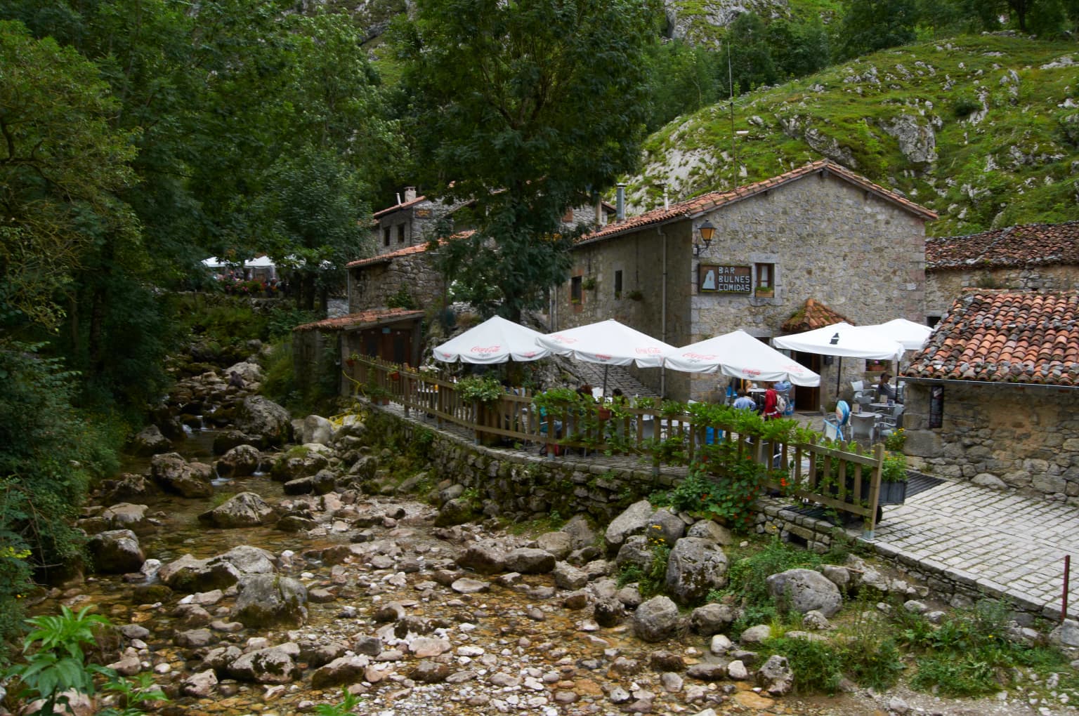
The landscape of Picos de Europa has been shaped by centuries of human activity, with the region holding deep historical and cultural significance in Asturias and Cantabria. The area is famous for Covadonga, the site where according to legend, the Christian leader Don Pelayo led the resistance against the Moorish invasion in the 8th century, a pivotal event in the Reconquista. The Santa Cueva de Covadonga, a sacred cave shrine, and the Basilica of Santa María la Real de Covadonga built above it remain important pilgrimage sites. The traditional pastoral economy has left its mark on the landscape through the network of "Reales Cañadas"—ancient transhumant routes used by shepherds moving their flocks between summer and winter pastures. Roman roads and medieval pathways cross the park, adding historical depth to the hiking experience. The park contains a rich ethnographic heritage including Romanesque and Baroque churches, traditional mills, blacksmiths, medieval towers, and traditional villages where local customs and gastronomy continue to reflect the region's rural heritage.

Top sights and standout views in Picos de Europa National Park

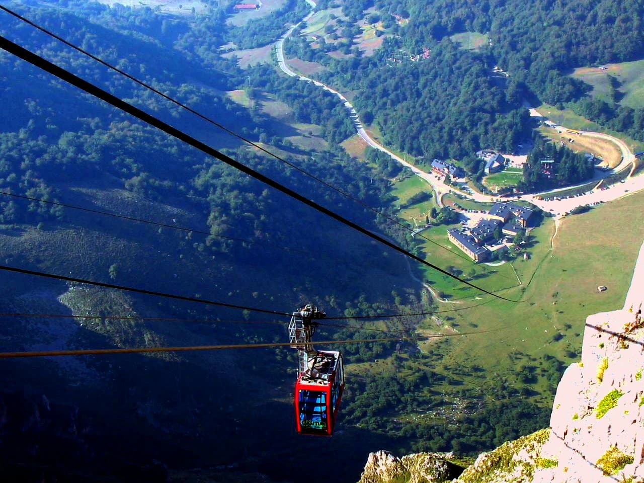
Picos de Europa offers exceptional diversity within a relatively compact area, from the dramatic limestone peaks of the Central Massif to the lush Atlantic forests of the valleys. The Lakes of Covadonga provide one of the most iconic views in Spain, with the twin glacial lakes set against a backdrop of sheer rock walls. The Naranjo de Bulnes (Picu Urriellu), a massive limestone tower rising vertically from the surrounding terrain, is one of the most famous peaks in Spain and a major challenge for climbers. The Cares Gorge (Garganta del Cares) offers one of the most spectacular ravine walks in Europe, with the path carved into vertical cliffs high above the river. The cable car at Fuente Dé provides dramatic access to high mountain terrain, ascending 753 meters in just four minutes to a viewpoint overlooking the Central Massif. The network of over 30 marked trails, including the historic GR-1 long-distance path, offers options for all abilities, from gentle valley walks to challenging high-mountain routes. The Cantabrian chamois can be observed throughout the park, particularly in the higher terrain, while lucky visitors may spot the bearded vulture soaring on thermal currents above the cliffs.

Best time to visit Picos de Europa National Park

The Picos de Europa can be visited year-round, though each season offers a distinctly different experience. Summer (June to September) brings the most stable weather and longest days, making it the peak season for hiking and mountaineering, though the park is also most crowded during July and August. Spring and autumn offer fewer visitors and the opportunity to experience the park in more tranquil conditions, with spring bringing wildflower displays in the meadows and autumn painting the beech forests in golden hues. Winter transforms the landscape into a stark alpine environment, with snow covering the higher peaks and frozen lakes, though access to some areas may be limited by winter conditions. The climate varies dramatically between the northern and southern aspects of the park due to the elevation range, with the northern slopes experiencing wetter conditions influenced by Atlantic weather systems. The lowest temperature ever recorded in Spain, -35.8°C, was registered in Vega de Liordes in January 2021, demonstrating the extreme conditions that can occur in the high mountains during winter.

Park location guide

Geography guide, regional context, and park location map for Picos de Europa National Park

Picos de Europa National Park park geography, regions, and map view in Spain
Understand where Picos de Europa National Park sits in Spain through a broader geographic reading of the surrounding landscape, nearby location context, and its mapped position within the national park landscape.

How Picos de Europa National Park fits into Spain

Spain, officially the Kingdom of Spain, is a unitary parliamentary constitutional monarchy located in Southern and Western Europe. The country occupies most of the Iberian Peninsula and includes territories in the Mediterranean and Atlantic. With a population of approximately 49.6 million and an area of 506,030 km², Spain is a major European economy and cultural force. Its capital is Madrid, and the country is known for its diverse landscapes ranging from mountainous regions to coastal areas.

Wider geography shaping Picos de Europa National Park in Spain

Spain occupies the Iberian Peninsula in Southern and Western Europe. Peninsular Spain is bordered to the north by France, Andorra, and the Bay of Biscay; to the east and south by the Mediterranean Sea and Gibraltar; and to the west by Portugal and the Atlantic Ocean. The territory includes the Canary Islands in the Atlantic Ocean, the Balearic Islands in the Mediterranean Sea, and the autonomous cities of Ceuta and Melilla in mainland Africa. Spain features diverse terrain including the Pyrenees in the northeast, the Sierra Nevada in the south, and the Meseta Central plateau.

Map view of Picos de Europa National Park

Use this park location map to pinpoint Picos de Europa National Park in Spain, understand its exact geographic position, and read its mapped placement within the surrounding landscape more clearly.

Pigeon | © OpenStreetMap contributors

Location context for Picos de Europa National Park

AsturiasCantabriaCastile and León
Park atlas

Compare national parks and protected landscapes across the Cantabrian Mountains, expanding your geographic discovery beyond Picos de Europa National Park.

Discover More National Parks and Protected Areas Near Picos de Europa National Park
Discover other national parks and protected areas near Picos de Europa National Park, exploring the diverse limestone peaks, Atlantic forests, and glacial valleys of the Cantabrian Mountains. Comparing these regional protected landscapes provides essential atlas context, tracing shared geological formations, unique ecosystems, and broader conservation efforts across northern Spain.
Protected landscapeBragança District

Montesinho Natural Park: Protected Landscape in Bragança District, Portugal

Explore mapped boundaries and regional landscape context.

Montesinho Natural Park is designated as a protected landscape in northeastern Portugal, located within the administrative region of Bragança District. This page serves as an entry point to understanding the park's protected area characteristics, its mapped geographic footprint, and its role in the broader natural landscape of the Trás-os-Montes region. Discover the atlas value of this significant protected territory and its relation to surrounding geography.

Area
742.25 km²
Established
1979
IUCN
V
Relief
Mountain
Watercolor illustration depicting a mountain range, river, and green vegetation under a light sky
National park

Sierra de Guadarrama National Park: Protected Area Landscape and Geographic Context

Explore diverse high Mediterranean mountain terrain and ecosystems.

Sierra de Guadarrama National Park is a significant protected national park in central Spain, characterized by its extensive granite landscapes and eleven distinct ecosystems. This park protects crucial high Mediterranean mountain environments, ancient pine forests, and dramatic glacial formations. Its geographic position within the Sistema Central makes it essential for understanding the regional geography and mapped terrain of the Iberian Peninsula, offering a unique look at a vital protected landscape.

Area
339.6 km²
Established
2013
IUCN
II
Visitors
3M annual
National park

Peneda-Gerês National Park: A Distinct Protected Landscape in Northern Portugal

Granite peaks, glacial valleys, and cultural heritage mapped.

Peneda-Gerês National Park represents a cornerstone of protected landscapes in Portugal, celebrated for its rugged granite mountains and deep glacial valleys sculpted over millennia. This national park showcases a rare ecological transition zone with unique endemic species and features dramatic waterfalls and pristine river systems. The park's rich cultural tapestry, interwoven with its natural environment, offers a compelling subject for atlas-based geographic discovery and landscape exploration.

Area
695.93 km²
Established
1971
IUCN
II
Visitors
92.8K annual
Watercolor landscape illustration featuring mountains, forests, fields, and trees
Protected areaNorte Region

Alvão Natural Park: Protected Area Discovery and Regional Geographic Context

Explore its mapped boundaries and landscape within the Norte Region.

Alvão Natural Park is recognized as a protected area offering unique opportunities for geographic study and atlas exploration. This detail page provides an in-depth look at its protected landscape, mapping its precise boundaries and situating it within the diverse geography of Portugal's Norte Region. Understand the park's intrinsic value as a mapped natural area and discover its contribution to the regional conservation landscape.

Area
72.03 km²
Established
1983
IUCN
V
Visitors
29.6K annual
Watercolor illustration of rolling green hills and distant purple mountains under a light sky
National parkGalicia

Atlantic Islands of Galicia National Park: Protected Archipelagos & Galician Coastline Geography

Explore mapped island ecosystems and protected marine areas.

Uncover the protected landscape of the Atlantic Islands of Galicia National Park, Spain's only national park in Pontevedra province. This atlas entry details the four distinct archipelagos, Cíes, Ons, Sálvora, and Cortegada, across the Rías Baixas. Discover the unique sea-land protected area, its rare bay laurel forests, significant seabird colonies, and the broader regional geography of Galicia.

Area
84.8 km²
Established
2002
IUCN
II
Visitors
472.3K annual
Protected landscapeEsposende

Northern Littoral Natural Park Protected Landscape: Geographic Discovery and Atlas Context

Mapped protected areas and regional landscape discovery near Esposende.

Uncover the geographic identity of Northern Littoral Natural Park, a key protected landscape situated near Esposende. This MoriAtlas entry focuses on its mapped boundaries and regional significance, providing a factual basis for understanding its role within Portugal's network of protected areas. Explore the park's natural terrain and its context within the broader geography of the Norte region for comprehensive atlas-based discovery.

Area
87.62 km²
Established
1987
IUCN
V
Relief
Lowland
Watercolor illustration of a landscape with green mountains, a body of water, and colorful wildflowers in the foreground
Nature reservePortugal

Serra da Estrela Natural Park: Glacial Terrain and Highest Peaks in Portugal

Explore the dramatic geography of this nature reserve.

Serra da Estrela Natural Park is a significant protected landscape in Portugal, celebrated for containing the nation's highest peak and exceptional Quaternary glacial formations. The park's terrain includes dramatic valleys carved by ice, numerous glacial lakes, and a stark alpine plateau around Torre. This nature reserve preserves a unique environment shaped by both geological history and traditional pastoralism, offering rich mapped context for understanding Portugal's mountainous geography and protected areas.

Area
891.32 km²
Established
1976
IUCN
V
Visitors
7.6K annual
National parkHautes-Pyrénées

Pyrénées National Park: Protected Landscape & Transboundary Protected Area Atlas

Discover Hautes-Pyrénées' dramatic glacial terrain and alpine environments.

Pyrénées National Park is a significant protected area in France's Hautes-Pyrénées department, renowned for its dramatic glacial cirques, high-altitude lakes, and extensive mountain landscapes. Established as a national park, it offers rich geographic context for atlas exploration, showcasing millions of years of geological formation shaped by tectonic uplift and glacial carving. This park is also notable for its transboundary conservation efforts with Spain, contributing to a broader protected region. Explore its unique terrain, from towering limestone formations to alpine meadows, and understand its place within the Pyrenean mountain range.

Area
458 km²
Established
1967
IUCN
II
Relief
Mountain

Common questions about visiting, size, designation, and location context for Picos de Europa National Park

Picos de Europa National Park FAQs for park facts, access, geography, and protected area context
Find quick answers about Picos de Europa National Park, including protected-area facts, park geography, trail and visitor context, and how the park fits into its surrounding country and regional landscape.
MoriAtlas Explorer

Continue Your Protected Areas Search Across the Global Atlas

Deepen your exploration by continuing the structured search for national parks and protected areas worldwide. Utilize the comprehensive filtering capabilities to compare different conservation landscapes and refine your understanding of global park geography. Discover more about the distribution and characteristics of protected natural areas.

Global natural geography