Mori Atlas logo
National parkAtlantic Islands of Galicia National Park

Discover the unique archipelagos and coastal geography of this Galician National Park.

Atlantic Islands of Galicia National Park: Protected Landscape & Mapped Ecosystem Atlas

(Parque Nacional Marítimo-Terrestre de las Islas Atlánticas de Galicia)

The Atlantic Islands of Galicia National Park stands as a vital protected landscape, safeguarding four distinct archipelagos within the Rías Baixas estuarine system of Spain's northwestern coast. This unique sea-land national park offers rich opportunities for atlas exploration, revealing mapped island ecosystems, critical seabird habitats, and rare bay laurel forests. Navigate the geographic context of these islands within Galicia and understand their ecological significance as a Ramsar Wetland site.

coastal islandsmarine protected areaAtlantic archipelagoseabird coloniescetaceanslaurel forest
Watercolor painting showing a coastal scene with a pier extending into water, sailboat, trees, and distant islands under a partly cloudy sky

Atlantic Islands of Galicia National Park

National park

Park overview

Structured park overview, official facts, and landscape profile for Atlantic Islands of Galicia National Park

Atlantic Islands of Galicia National Park park facts, protected area profile, and essential visitor context
Review the core facts for Atlantic Islands of Galicia National Park, including designation, size, terrain, visitor scale, habitats, and operating context in one park-focused overview.

About Atlantic Islands of Galicia National Park

The Atlantic Islands of Galicia National Park represents Spain's only maritime-terrestrial national park and one of the few protected areas in Europe where marine and island ecosystems are managed as an integrated unit. The park's four archipelagos are positioned along the Galician coast at the mouths of major rías—estuaries that define this section of the Atlantic shoreline. The islands emerge from the continental platform and present varied geological character: the Cíes, Ons, and Sálvora archipelagos feature granitic formations dating to the Palaeozoic era, while Cortegada's composition is predominantly metamorphic shale and paragneiss with migmatic granite. These islands have supported human communities for millennia, with archaeological evidence of Iron Age occupation and Roman-era ceramics. During the Middle Ages, monastic orders controlled the islands before they passed to church ownership and later to noble families. The islands also served as bases for raiders and pirates, and Cíes remained inhabited until the eighteenth century when pirate attacks forced abandonment. Today, only Ons retains a permanent residential population. The park's designation as a Ramsar site in 2021 acknowledges its wetlands and marine ecosystems of international significance, adding to its protection status under Spanish national park legislation.

Quick facts and research context for Atlantic Islands of Galicia National Park

The park covers 8,480 hectares distributed across four archipelagos in the Rías Baixas region of Galicia. The Cíes Islands form the largest archipelago with 433 hectares of land and reach 197 meters elevation at their highest point. Ons Island maintains a small permanent population of approximately 63 residents. The park hosts the largest European shag colony in Europe and supports populations representing 7-15% of the global yellow-legged gull. Marine waters shelter species including common bottlenose dolphins, harbour porpoises, and seasonal visits from multiple sea turtle species. The park received 472,274 visitors in 2019, making it the tenth most visited national park in Spain.

Park context

Deeper park guide and search-rich context for Atlantic Islands of Galicia National Park

Atlantic Islands of Galicia National Park history, landscape, wildlife, and travel context
Explore Atlantic Islands of Galicia National Park through its history, landscape character, ecosystems, wildlife, conservation priorities, cultural context, and seasonal travel timing in a structured park guide built for atlas discovery and search intent.

Why Atlantic Islands of Galicia National Park stands out

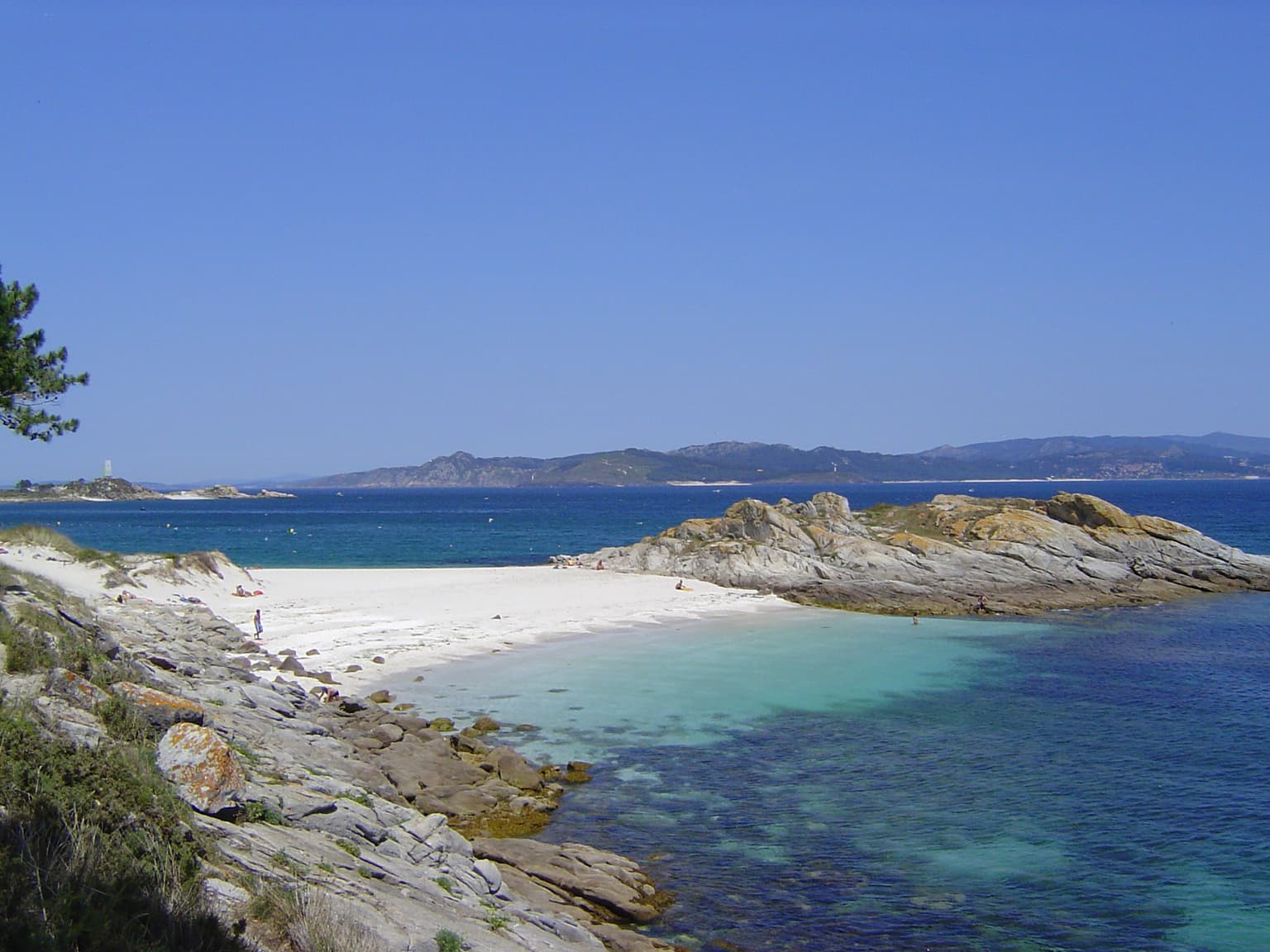
The Atlantic Islands of Galicia is especially known for its remarkable seabird colonies and marine biodiversity. The park supports the largest European shag colony in Europe, with 78% of the Spanish population and 1-3% of the global population nesting here. The yellow-legged gull population represents 7-15% of the worldwide population and a third of Spain's total. The marine environment hosts twenty-seven cetacean species, with the common bottlenose dolphin being most abundant. Cortegada Island contains one of Europe's largest bay laurel forests, a rare Mediterranean-type ecosystem. The Cíes Islands' Rodas beach was rated by The Guardian as the world's best beach, and the archipelago receives the highest visitor numbers within the park.

White sand beach with turquoise water, rocky coastline, and distant islands under clear blue sky
Praia dos Viños beach on Monteagudo Island, Atlantic Islands of Galicia National Park

Atlantic Islands of Galicia National Park history and protected-area timeline

The Atlantic Islands of Galicia passed through multiple historical phases before achieving national park status. Human presence dates to the Iron Age, with Roman ceramics subsequently found across several islands. During the Medieval period, various monastic orders occupied the islands before they became church property and were subsequently gauged—a form of feudal tenure—to local nobles. The islands also served strategic purposes as bases for raiders conducting coastal attacks. More recently, the Cíes Islands remained inhabited until the eighteenth century when pirate activity forced residents to abandon them. Ons Island retains a small permanent community of about 63 people to this day. The modern protection movement began in 1980 when the Cíes Islands were declared a natural park and designated as a Special Protection Area for birds. Full national park status followed on June 13, 2002, making it the thirteenth Spanish national park. Just six months after establishment, the catastrophic Prestige oil spill in November 2002 impacted all the islands except Cortegada, causing significant environmental damage from which some elements, particularly lichen communities and European shag reproductive success, have not fully recovered two decades later. Future expansion of the park to include the Lobeiras and Sisargas islands has been discussed but not implemented.

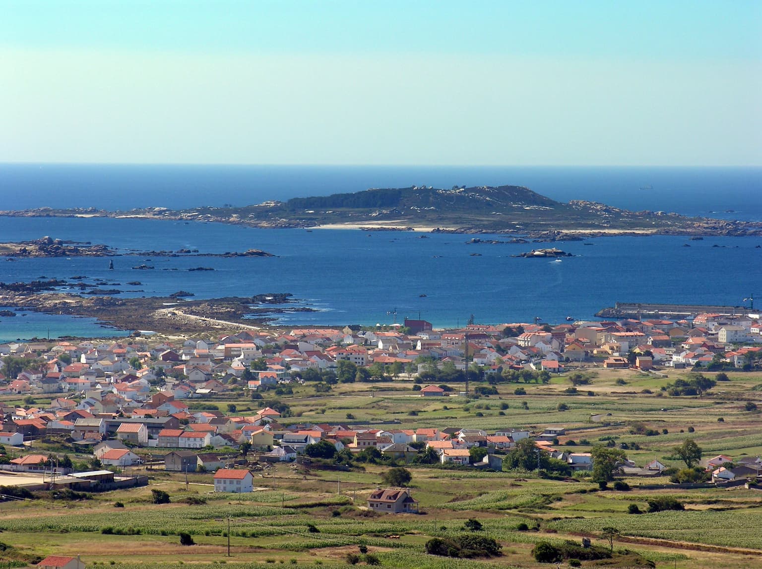
Atlantic Islands of Galicia National Park landscape and geographic character

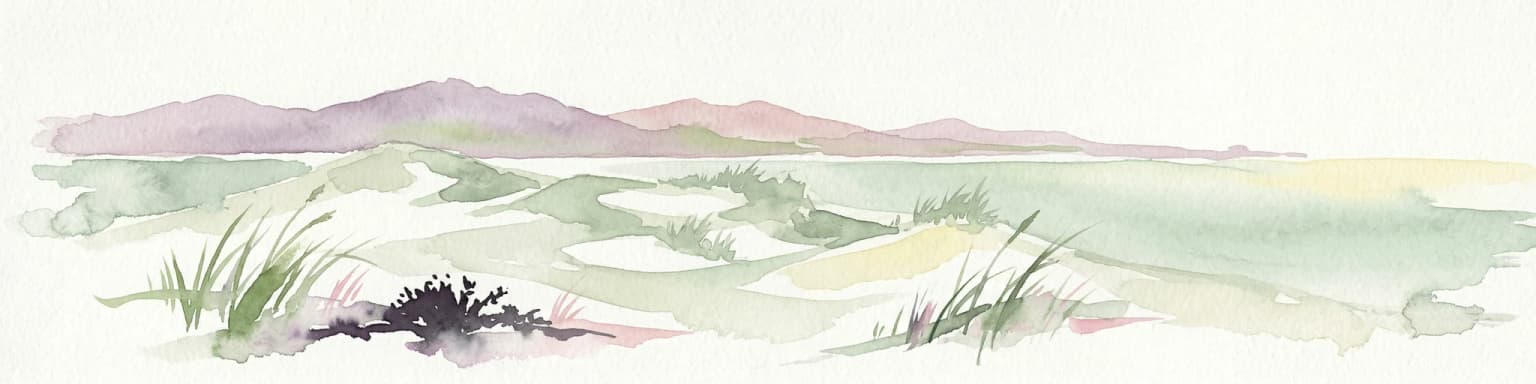
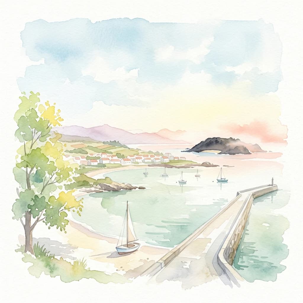
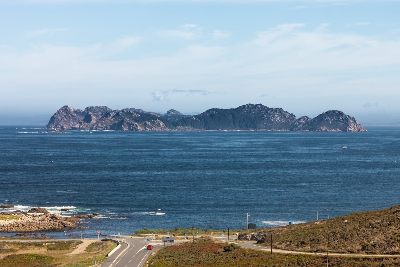
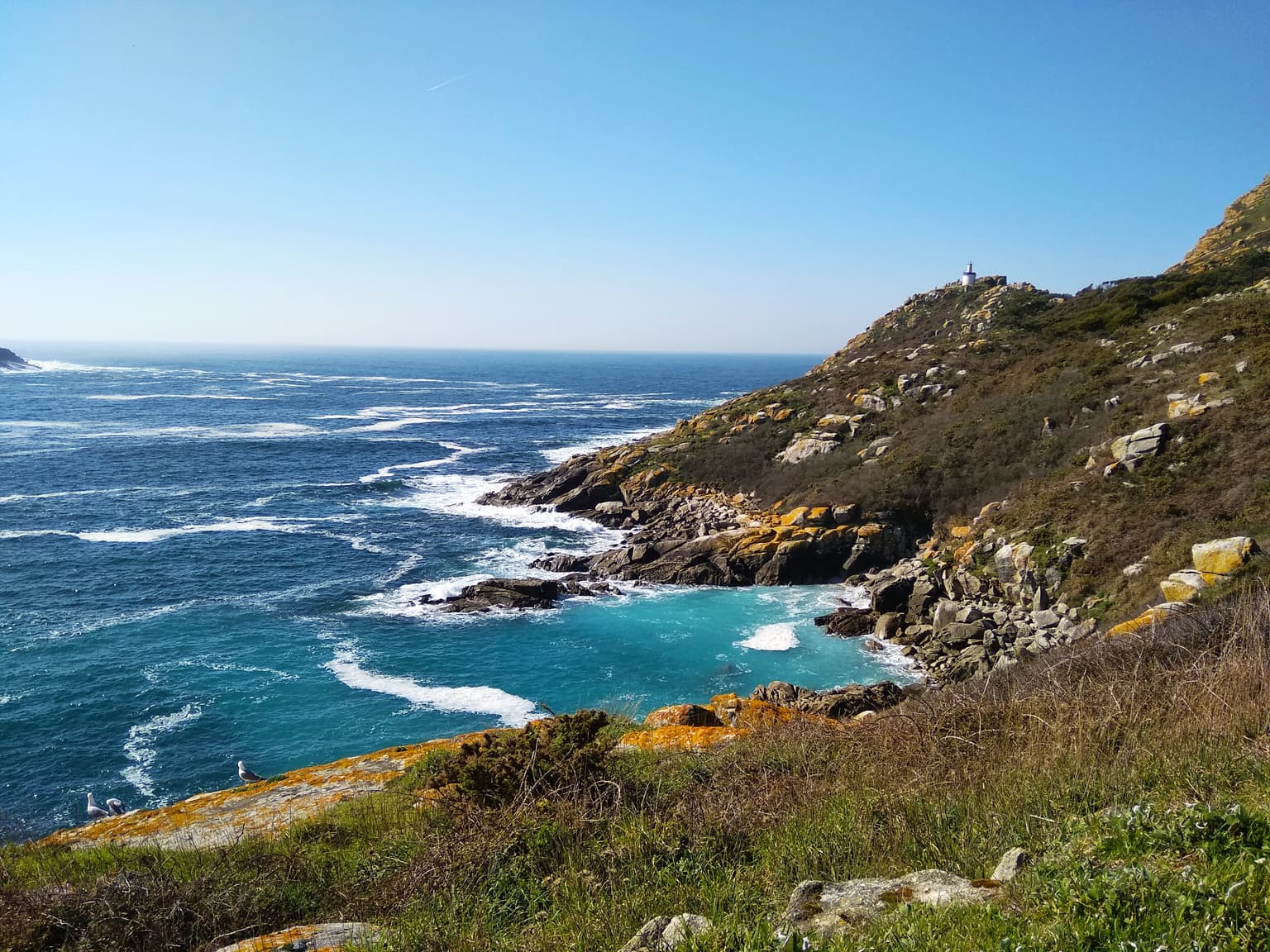
The Atlantic Islands of Galicia present a distinctive Atlantic island landscape characterized by granite headlands, sheltered coves, and steep coastal cliffs. The Cíes Islands, forming the park's largest archipelago, consist of three main islands—Monteagudo, Montefaro, and San Martiño—that surround the entrance of the Ría de Vigo. The highest elevation reaches 197 meters on Cíes, providing panoramic views across the ría and out to the Atlantic. The Ons archipelago, positioned at the entrance of the Ría de Pontevedra, combines the main Ons Island with Onza and several smaller rocky outcrops, reaching 119 meters elevation. Sálvora lies at the mouth of the Ría de Arousa with more modest 73-meter elevations. Cortegada, the smallest archipelago in both land area and elevation at 19 meters, sits within the inner estuary of the Ría de Arousa. The islands display characteristic Atlantic coastal vegetation, with maritime influences shaping plant communities across exposed cliffs and more sheltered interior slopes. Beaches such as the famed Rodas on Cíes combine white sand with clear waters typical of this exposed Atlantic setting.

Coastal landscape showing blue ocean, distant rocky islands, a winding road, and dry grassy terrain under a partly cloudy sky
Panoramic coastal view of the Atlantic Islands from Cabo Silleiro in Galicia, Spain

Atlantic Islands of Galicia National Park ecosystems, habitats, and plant life

The Atlantic Islands of Galicia supports a remarkable convergence of terrestrial and marine ecosystems within a relatively compact protected area. The terrestrial component centers on Cortegada Island, which contains one of Europe's largest and most significant bay laurel forests—a relict Mediterranean-type woodland that survives in the oceanic climate of Galicia's coast. This evergreen forest type, characterized by species such as laurel, represents a ecosystem with limited distribution in Europe. The surrounding marine environment supports over 200 seaweed species and diverse invertebrate communities including shellfish, corals, and anemones. The islands occupy a strategic position along migratory bird routes and support breeding populations of international importance. The climate across the islands varies somewhat, with Cíes receiving approximately 1,000 mm annual precipitation while Ons and Sálvora experience wetter conditions at 1,500 mm. Cortegada, nestled within the estuarine environment, receives the highest rainfall at around 2,000 mm annually. Average temperatures range from 13-15°C with limited seasonal variation, reflecting the moderating influence of the Atlantic Ocean.

Rocky coastal landscape with turquoise ocean waters, white surf, and green vegetation on a sunny day
Coastal landscape of Cíes Islands with turquoise waters and rocky shoreline under clear blue sky

Atlantic Islands of Galicia National Park wildlife and species highlights

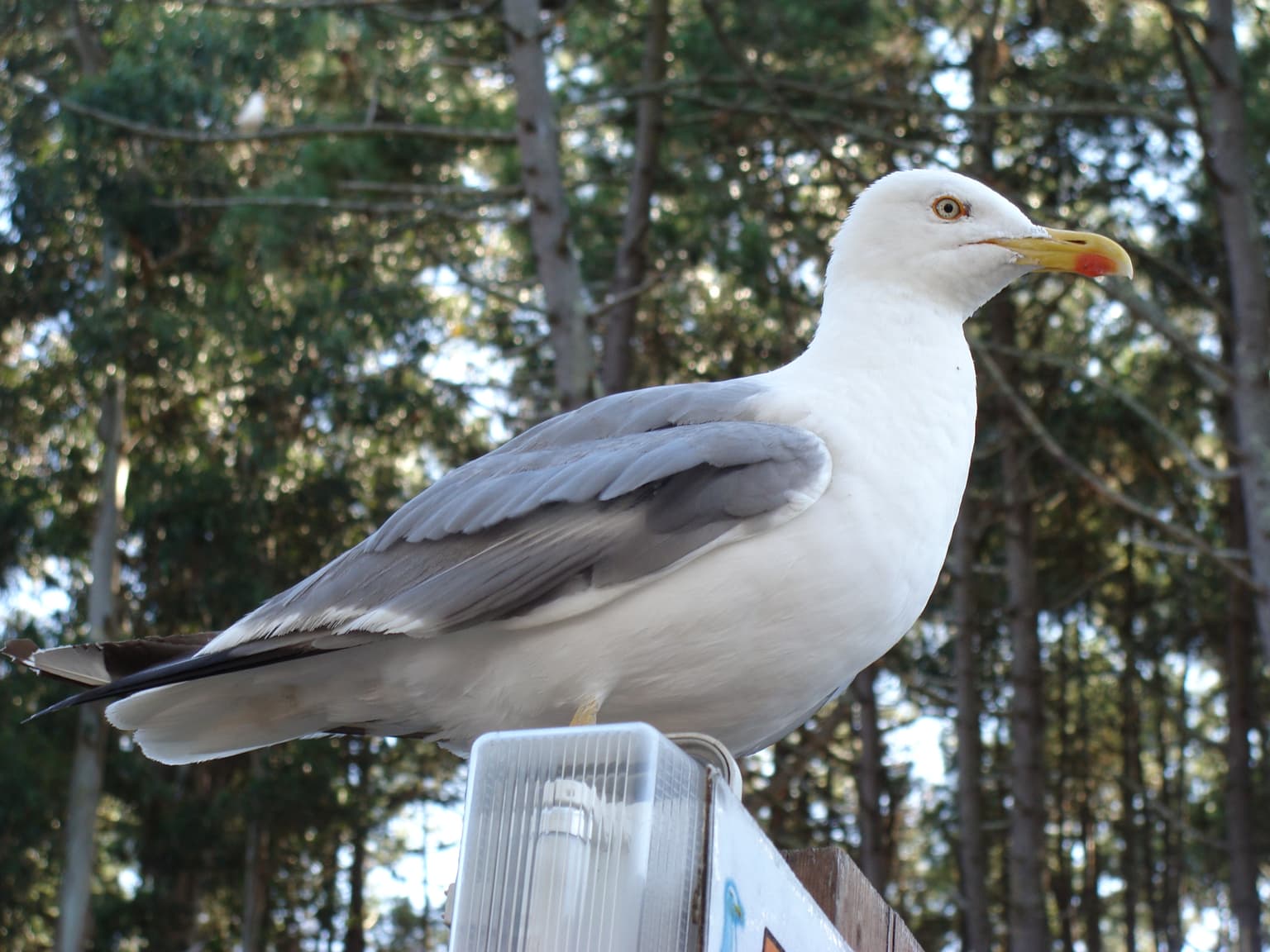
The wildlife of the Atlantic Islands of Galicia spans marine mammals, seabirds, and limited terrestrial fauna, with the park's significance lying particularly in its seabird colonies and cetacean populations. Among breeding birds, the European shag holds particular importance—the park hosts the largest colony in Europe, representing 78% of Spain's population and 1-3% of the global population, leading to its classification as Vulnerable in the Spanish and Galician Catalogues of Endangered Species. The European storm-petrel nests in significant numbers, potentially representing 1% of Spain's Atlantic population. Overwintering populations include the endangered Balearic shearwater and Eurasian curlew. The yellow-legged gull is exceptionally abundant, with the park supporting 7-15% of the global population and about a third of Spain's total. Marine mammals feature prominently: twenty-seven species of cetaceans and pinnipeds have been recorded, with common bottlenose dolphins most frequently encountered, followed by harbour porpoises, long-finned pilot whales, and short-beaked common dolphins. Sea turtles visit regularly, with loggerhead turtles most common and green sea turtles, Kemp's ridley, hawksbill, and leatherback turtles also recorded. Terrestrial wildlife is more limited due to the islands' small size and isolation, with introduced rabbit populations abundant and otters recently recolonizing the islands.

Yellow-legged Gull (Larus michahellis) standing on a signpost with trees in the background
Yellow-legged Gull perched on a signpost in Atlantic Islands of Galicia National Park

Atlantic Islands of Galicia National Park conservation status and protection priorities

The Atlantic Islands of Galicia holds significant conservation value as Spain's only maritime-terrestrial national park and as a Ramsar-designated wetland site of international importance. The park's conservation significance derives from multiple factors: the presence of Europe's largest European shag colony, substantial proportions of global and national yellow-legged gull populations, and one of Europe's largest bay laurel forests on Cortegada Island. The marine environment, with over 200 seaweed species and twenty-seven cetacean species, represents a biodiversity hotspot in the Atlantic. However, the park has faced significant conservation challenges. The 2002 Prestige oil spill severely impacted all but Cortegada Island, and two decades later, biodiversity has not recovered to pre-spill levels—lichen communities were eliminated and remain only partially restored, while European shag reproductive success has dropped by more than half. Historical deforestation from fires and agricultural practices led to reforestation with non-native eucalypts and acacias in the 1970s-80s, and the park has been engaged in a two-decade program to replace these with native species including arbutus, pine, and birch. The park operates under visitor authorization systems to limit daily impact and maintain ecological integrity.

Atlantic Islands of Galicia National Park cultural meaning and human context

The Atlantic Islands of Galicia contain evidence of long human engagement with the island landscape. Archaeological traces date to the Iron Age, with subsequent Roman-era ceramics documenting continuous human presence. During the Medieval period, monastic orders occupied the islands, establishing spiritual and administrative control before the islands passed to church ownership and feudal tenure under local nobles. The islands served strategic functions in the medieval and early modern periods as bases for raiding activities against the coast. Ons Island maintains the longest continuous habitation, still supporting a small permanent community of approximately 63 residents who represent the living cultural heritage of these islands. The Cíes Islands were inhabited until the eighteenth century when pirate activity forced abandonment. The park encompasses areas within four municipalities—Vigo, Bueu, Ribeira, and Villagarcía de Arousa—each with historical connections to the islands. The ancient village on Sálvora preserves traditional structures reflecting historical settlement patterns.

Concrete pier extending into blue sea with sailboats docked, sandy beach, and tree on left under clear blue sky
Pier and Dornas Beach on Ons Island, Atlantic Islands of Galicia National Park

Top sights and standout views in Atlantic Islands of Galicia National Park

The Atlantic Islands of Galicia combines exceptional natural value with unique island landscapes and cultural heritage. The park offers access to what many consider Europe's finest beach at Rodas on Cíes, recognized internationally for its scenic quality. The largest European shag colony on the continent provides remarkable birdwatching opportunities, while twenty-seven cetacean species in surrounding waters make marine mammal observation a major attraction. One of Europe's largest bay laurel forests on Cortegada represents a rare and significant ecosystem. The integration of marine and terrestrial protection within a single national park creates a distinctive conservation model in the Spanish protected area system. The park's Ramsar designation acknowledges its wetland values, while its position in the Rías Baixas connects visitors to the broader Galician coastal landscape and maritime traditions.

Coastal landscape showing Sálvora Island in the distance, with Aguiño village and surrounding fields in the foreground, overlooking the sea under a clear sky
Sálvora Island and Aguiño village viewed from the mainland, Atlantic Islands of Galicia National Park

Best time to visit Atlantic Islands of Galicia National Park

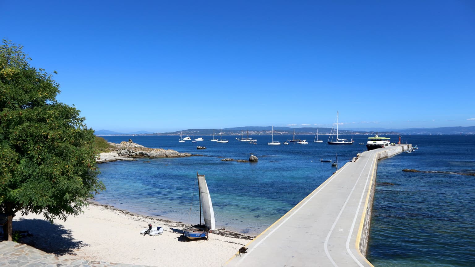
The Atlantic Islands of Galicia can be visited throughout the year, though the summer months from June to September see the highest visitor numbers and represent the peak season for beach activities and boat access. During summer, daily boat services operate from multiple ports including Vigo, Baiona, Cangas, Portonovo, Sanxenxo, Bueu, and Marín, though all visitors require prior authorization from the Galician Government. The islands experience a sub-humid Mediterranean climate of Atlantic tendency, with precipitation concentrated in the winter months and relatively dry summers. Summer temperatures range from 13-25°C, making outdoor activities comfortable. For wildlife observation, spring and autumn offer good conditions for seabird activity and migratory species, while winter brings fewer visitors but potentially rougher sea conditions affecting boat access. The marine environment is accessible year-round, though cetacean tours operate more frequently during the warmer months when sea conditions are calmer.

Park location guide

Geography guide, regional context, and park location map for Atlantic Islands of Galicia National Park

Atlantic Islands of Galicia National Park park geography, regions, and map view in Spain
Understand where Atlantic Islands of Galicia National Park sits in Spain through a broader geographic reading of the surrounding landscape, nearby location context, and its mapped position within the national park landscape.

How Atlantic Islands of Galicia National Park fits into Spain

Spain, officially the Kingdom of Spain, is a unitary parliamentary constitutional monarchy located in Southern and Western Europe. The country occupies most of the Iberian Peninsula and includes territories in the Mediterranean and Atlantic. With a population of approximately 49.6 million and an area of 506,030 km², Spain is a major European economy and cultural force. Its capital is Madrid, and the country is known for its diverse landscapes ranging from mountainous regions to coastal areas.

Wider geography shaping Atlantic Islands of Galicia National Park in Spain

Spain occupies the Iberian Peninsula in Southern and Western Europe. Peninsular Spain is bordered to the north by France, Andorra, and the Bay of Biscay; to the east and south by the Mediterranean Sea and Gibraltar; and to the west by Portugal and the Atlantic Ocean. The territory includes the Canary Islands in the Atlantic Ocean, the Balearic Islands in the Mediterranean Sea, and the autonomous cities of Ceuta and Melilla in mainland Africa. Spain features diverse terrain including the Pyrenees in the northeast, the Sierra Nevada in the south, and the Meseta Central plateau.

Map view of Atlantic Islands of Galicia National Park

Use this park location map to pinpoint Atlantic Islands of Galicia National Park in Spain, understand its exact geographic position, and read its mapped placement within the surrounding landscape more clearly.

Pigeon | © OpenStreetMap contributors

Location context for Atlantic Islands of Galicia National Park

Galicia

Mapped Visuals of Galicia's Atlantic Archipelagos, Marine Protected Habitats, and Island Terrain

Visual Exploration: Atlantic Islands of Galicia National Park Landscapes and Protected Area Scenery
Browse a curated collection of imagery to understand the diverse coastal and marine landscapes of Atlantic Islands of Galicia National Park, featuring its granite headlands, white sand beaches, and unique island ecosystems. Such visual content offers clear insights into the park's protected terrain, seabird colony habitats, and the distinct environment of Spain's Atlantic archipelagos.

White sand beach with turquoise water, rocky coastline, and distant islands under clear blue sky

Two dark-colored cormorants with yellow beaks standing on a rocky outcrop by the ocean

Coastal landscape showing blue ocean, distant rocky islands, a winding road, and dry grassy terrain under a partly cloudy sky

Rocky coastal landscape with turquoise ocean waters, white surf, and green vegetation on a sunny day

Yellow-legged Gull (Larus michahellis) standing on a signpost with trees in the background

A person standing on a grassy path leading to a coastal bay with rocky cliffs and blue water.

Concrete pier extending into blue sea with sailboats docked, sandy beach, and tree on left under clear blue sky

Coastal landscape showing Sálvora Island in the distance, with Aguiño village and surrounding fields in the foreground, overlooking the sea under a clear sky

Coastal landscape showing Ons Island and Onza Island partially obscured by fog, with the sea in the foreground and a clear blue sky

Close-up of white berries on a green shrub with needle-like leaves

Body of blue water with a small red boat, yellow buoys, forested shoreline with pine trees, and mountains in the background under a partly cloudy sky

White cross on rocky terrain with misty sea and hills in background

Panoramic coastal view showing the Cíes Islands in the distance with green hills and blue water in the foreground

Rocky coastal cliffs and islands at sunset, with the sea extending to the horizon under a partly cloudy sky

Tents arranged in a forested campsite with wooden fencing, surrounded by tall pine trees and a coastal view in the background

Stone houses and rocky terrain with green vegetation under clear blue sky

Park atlas

Map the regional protected areas, tracing diverse coastal and island conservation landscapes across northwestern Spain's Galicia.

Explore Related National Parks and Protected Areas Near Atlantic Islands of Galicia National Park
Continue your exploration beyond Atlantic Islands of Galicia National Park by browsing other national parks and protected areas across the distinct Atlantic coastal geography of Galicia. Compare these diverse conservation landscapes, from island ecosystems to broader coastal reserves, to understand the full spread of protected territories in northwestern Spain.
Protected landscapeEsposende

Northern Littoral Natural Park Protected Landscape: Geographic Discovery and Atlas Context

Mapped protected areas and regional landscape discovery near Esposende.

Uncover the geographic identity of Northern Littoral Natural Park, a key protected landscape situated near Esposende. This MoriAtlas entry focuses on its mapped boundaries and regional significance, providing a factual basis for understanding its role within Portugal's network of protected areas. Explore the park's natural terrain and its context within the broader geography of the Norte region for comprehensive atlas-based discovery.

Area
87.62 km²
Established
1987
IUCN
V
Relief
Lowland
National park

Peneda-Gerês National Park: A Distinct Protected Landscape in Northern Portugal

Granite peaks, glacial valleys, and cultural heritage mapped.

Peneda-Gerês National Park represents a cornerstone of protected landscapes in Portugal, celebrated for its rugged granite mountains and deep glacial valleys sculpted over millennia. This national park showcases a rare ecological transition zone with unique endemic species and features dramatic waterfalls and pristine river systems. The park's rich cultural tapestry, interwoven with its natural environment, offers a compelling subject for atlas-based geographic discovery and landscape exploration.

Area
695.93 km²
Established
1971
IUCN
II
Visitors
92.8K annual
Watercolor landscape illustration featuring mountains, forests, fields, and trees
Protected areaNorte Region

Alvão Natural Park: Protected Area Discovery and Regional Geographic Context

Explore its mapped boundaries and landscape within the Norte Region.

Alvão Natural Park is recognized as a protected area offering unique opportunities for geographic study and atlas exploration. This detail page provides an in-depth look at its protected landscape, mapping its precise boundaries and situating it within the diverse geography of Portugal's Norte Region. Understand the park's intrinsic value as a mapped natural area and discover its contribution to the regional conservation landscape.

Area
72.03 km²
Established
1983
IUCN
V
Visitors
29.6K annual
Protected landscapeBragança District

Montesinho Natural Park: Protected Landscape in Bragança District, Portugal

Explore mapped boundaries and regional landscape context.

Montesinho Natural Park is designated as a protected landscape in northeastern Portugal, located within the administrative region of Bragança District. This page serves as an entry point to understanding the park's protected area characteristics, its mapped geographic footprint, and its role in the broader natural landscape of the Trás-os-Montes region. Discover the atlas value of this significant protected territory and its relation to surrounding geography.

Area
742.25 km²
Established
1979
IUCN
V
Relief
Mountain
Watercolor illustration of a landscape with green mountains, a body of water, and colorful wildflowers in the foreground
Nature reservePortugal

Serra da Estrela Natural Park: Glacial Terrain and Highest Peaks in Portugal

Explore the dramatic geography of this nature reserve.

Serra da Estrela Natural Park is a significant protected landscape in Portugal, celebrated for containing the nation's highest peak and exceptional Quaternary glacial formations. The park's terrain includes dramatic valleys carved by ice, numerous glacial lakes, and a stark alpine plateau around Torre. This nature reserve preserves a unique environment shaped by both geological history and traditional pastoralism, offering rich mapped context for understanding Portugal's mountainous geography and protected areas.

Area
891.32 km²
Established
1976
IUCN
V
Visitors
7.6K annual
Watercolor illustration of a landscape with rolling hills, a body of water, and vegetation
Protected landscapePortugal

Aire and Candeeiros Ranges Natural Park: Protected Landscape and Regional Geographic Context

Explore the mapped boundaries and natural landscape of this Portuguese protected area.

Understand the Aire and Candeeiros Ranges Natural Park as a key protected landscape in Portugal. This page offers detailed geographic information, focusing on the park's mapped boundaries and its intrinsic connection to the surrounding regional geography. It serves as a portal for atlas exploration, providing structured data for users interested in the specific protected area and its landscape characteristics within the Iberian Peninsula.

Area
383.93 km²
Established
1979
IUCN
V
Visitors
31.9K annual
National park

Picos de Europa National Park: Dramatic Limestone Peaks and Protected Landscape Atlas

Explore Spain's historic national park and UNESCO Biosphere Reserve.

Picos de Europa National Park offers an unparalleled exploration of dramatic limestone peaks, deep glacial valleys, and extensive Atlantic forests. As Spain's oldest national park and a UNESCO Biosphere Reserve, it presents a remarkable study in karst landscape evolution and biodiversity conservation. This protected area, spanning significant territory across northern Spain, provides a rich geographic context for understanding regional natural heritage and mapped natural features.

Area
671.27 km²
Established
1918
IUCN
II
Relief
Mountain
Watercolor illustration of a landscape with green hills, scattered trees, and distant mountains under a pink and yellow sky
Protected landscapePortalegre District

Serra de São Mamede Natural Park: A Protected Landscape Defined by Ecological Transition

Explore the unique mountain terrain and ecosystems of Portalegre District.

Delve into the geographic and ecological identity of Serra de São Mamede Natural Park, a significant protected landscape situated in Portugal's Portalegre District. This area is renowned for its dramatic quartzite ridges and its role as a crucial meeting point for Atlantic and Mediterranean plant communities, offering a unique atlas perspective on regional biodiversity. Examining its mapped boundaries and diverse terrain provides essential context for understanding its ecological importance and its distinct position within the Alentejo region's geography.

Area
560.6 km²
Established
1989
IUCN
V
Visitors
4.5K annual

Common questions about visiting, size, designation, and location context for Atlantic Islands of Galicia National Park

Atlantic Islands of Galicia National Park FAQs for park facts, access, geography, and protected area context
Find quick answers about Atlantic Islands of Galicia National Park, including protected-area facts, park geography, trail and visitor context, and how the park fits into its surrounding country and regional landscape.
MoriAtlas Explorer

Continue Your Protected Areas Search Across the Global Atlas

Deepen your exploration by continuing the structured search for national parks and protected areas worldwide. Utilize the comprehensive filtering capabilities to compare different conservation landscapes and refine your understanding of global park geography. Discover more about the distribution and characteristics of protected natural areas.

Global natural geography