Mori Atlas logo
National parkSouth Penghu Marine National Park

Discover distinct basalt landforms, vibrant coral reefs, and mapped marine geography within this protected Taiwanese national park.

South Penghu Marine National Park: Taiwan's Volcanic Island Protected Landscape and Marine Atlas

South Penghu Marine National Park offers a unique glimpse into Taiwan's dramatic volcanic geography and rich marine ecosystems. This protected national park encompasses four main islands and surrounding waters, celebrated for its striking columnar basalt formations, intricate sea caves like the Blue Cave, and thriving coral reefs influenced by the Kuroshio Current. Its designation as a marine germplasm bank highlights its significance for preserving Penghu's biodiversity, presenting a distinctive mapped landscape for atlas exploration.

Marine National ParkCoral ReefsBasalt LandformsVolcanic IslandsPenghu IslandsTaiwan

South Penghu Marine National Park

National park

Park overview

Structured park overview, official facts, and landscape profile for South Penghu Marine National Park

South Penghu Marine National Park park facts, protected area profile, and essential visitor context
Review the core facts for South Penghu Marine National Park, including designation, size, terrain, visitor scale, habitats, and operating context in one park-focused overview.

About South Penghu Marine National Park

South Penghu Marine National Park represents Taiwan's commitment to marine conservation in its offshore archipelago. Located in the southern portion of the Penghu Islands, also known as the Pescadores, the park was formally established in 2014 following recognition of the area's exceptional marine biodiversity and geological significance. The park encompasses four primary islands and their surrounding waters, creating a comprehensive marine protected area that extends far beyond the terrestrial land areas. The islands themselves are characterized by volcanic basalt geology, with the notable columnar basalt formations representing a distinctive geological feature that attracts scientific interest and visual admiration. The surrounding marine environment is influenced by the warm Kuroshio Current, which brings tropical marine species and supports the coral reef ecosystems that make this area biologically significant. Historically, these islands supported substantial human populations engaged in fishing and agriculture, but economic pressures and limited transportation have led to population decline, leaving behind abandoned structures that now form part of the park's cultural landscape. The establishment of the marine park was motivated in part by a 2008 cold weather event that caused significant marine mortality in northern Penghu, highlighting the need for conservation areas that could serve as marine biodiversity reservoirs.

Quick facts and research context for South Penghu Marine National Park

South Penghu Marine National Park is located in Wangan Township of Penghu County, Taiwan, approximately 358 square kilometers in total area with about 355 square kilometers of marine waters and only 3.7 square kilometers of land. The park was formally established on June 8, 2014 and opened in October of that year. The islands feature columnar basalt geological formations, a lighthouse on Dongjiyu, and the Blue Cave sea cave on Xijiyu. Marine biodiversity includes 254 recorded fish species with 28 newly discovered species, 154 coral species, and seasonal visits from migratory terns and populations of dolphins and smaller whale species.

Park context

Deeper park guide and search-rich context for South Penghu Marine National Park

South Penghu Marine National Park history, landscape, wildlife, and travel context
Explore South Penghu Marine National Park through its history, landscape character, ecosystems, wildlife, conservation priorities, cultural context, and seasonal travel timing in a structured park guide built for atlas discovery and search intent.

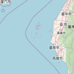
Why South Penghu Marine National Park stands out

South Penghu Marine National Park is best known for its dramatic volcanic basalt landscapes featuring columnar jointing, its thriving coral reef ecosystems in the path of the Kuroshio Current, and its designation as a marine germplasm bank for Penghu's marine biodiversity. The park protects significant coral reef areas with 154 coral species and 254 fish species, including many newly discovered species. The islands showcase remarkable geological features including sea caves like the Blue Cave and distinctive basalt formations that create a rugged yet beautiful island landscape. The park also preserves the cultural heritage of formerly inhabited islands with abandoned houses, temples, and traditional stone walls built to protect crops from strong winds.

South Penghu Marine National Park history and protected-area timeline

The South Penghu islands once supported thriving communities of thousands of residents who engaged primarily in fishing and limited agriculture. However, the remote location of these islands, combined with limited transportation connections and few economic opportunities, has led to a steady population decline over the decades. Today, only approximately 50 people remain permanent residents on these islands. The establishment of the South Penghu Marine National Park was influenced by a significant environmental event in 2008 when cold weather conditions in the northern Penghu Islands caused massive marine life mortality. The southern islands, situated at a lower latitude and therefore experiencing warmer conditions, were less affected and demonstrated greater resilience. This event highlighted the ecological importance of the southern islands as potential marine biodiversity reservoirs, leading to the concept of establishing the area as a marine germplasm bank for Penghu. Prior to the national park designation, the Penghu Columnar Basalt Nature Reserve Nanhai was established in 2008, covering Dongjiyu, Xijiyu, and several smaller islands. The South Penghu Marine National Park was officially established on June 8, 2014 and formally opened on October 18, 2014, creating Taiwan's newest marine protected area at that time.

South Penghu Marine National Park landscape and geographic character

The landscape of South Penghu Marine National Park is defined by volcanic basalt formations that create a rugged and visually striking island environment. The columnar basalt features are particularly notable, with characteristic hexagonal or polygonal column formations that result from the cooling of basaltic lava. These geological formations create dramatic cliff faces, sea stacks, and coastal features that characterize the islands' shorelines. Sea caves are another significant landscape feature, with the Blue Cave on Xijiyu being particularly notable. The Blue Cave is a sea cave formed through wave erosion and represents an iconic geological feature of the park. The terrestrial landscape includes small islets, rocky shores, and limited vegetation typical of small islands exposed to marine conditions. Human-modified landscapes include abandoned residential structures, temples, and distinctive stone walls known as cai zhai that were built to protect vegetable gardens from the strong winds that sweep across these exposed islands. A lighthouse on Dongjiyu serves as both a navigation aid and a landmark feature. The marine landscape encompasses shallow reef systems, underwater terrain features, and the open waters surrounding the islands.

South Penghu Marine National Park ecosystems, habitats, and plant life

The marine environment of South Penghu Marine National Park is characterized by coral reef ecosystems that thrive in the warm waters influenced by the Kuroshio Current. This northward-flowing warm current brings tropical marine species and provides the thermal conditions that support diverse coral communities. The park has documented 154 coral species, representing a significant biodiversity resource for Taiwan. These coral communities provide habitat and food sources for numerous marine animals, contributing to the overall ecological richness of the area. Fish diversity is exceptionally high, with 254 species recorded including 28 newly discovered species that may represent undescribed taxa. The marine ecosystem also supports aquatic plants that contribute to habitat complexity and primary productivity. The islands themselves provide habitat for migratory bird species, particularly terns that visit seasonally. The combination of terrestrial and marine habitats creates an ecological system that supports both resident and transient species.

South Penghu Marine National Park wildlife and species highlights

The marine wildlife of South Penghu Marine National Park is characterized by exceptional fish diversity and coral reef communities. The 254 recorded fish species include numerous reef-associated species that rely on coral habitat for food and shelter, with 28 of these species representing newly discovered records for Taiwan. Coral communities support complex food webs and include 154 documented coral species representing various taxonomic groups. Marine mammals have shown evidence of recovery in recent years, with small numbers of dolphins and smaller whale species returning to the waters around the islands. The recovery of these marine mammals represents a positive indicator of ecosystem health, though larger baleen whales remain rare or locally extinct. Gray whale fossils discovered in the area represent the first records of that species from Taiwanese waters, indicating historical presence of large whales in the region. Migratory birds, particularly various tern species, use the islands as seasonal nesting and resting sites. The marine ecosystem also includes various invertebrate groups and other fauna that contribute to the overall biodiversity.

South Penghu Marine National Park conservation status and protection priorities

South Penghu Marine National Park was established with the explicit goal of protecting marine biodiversity and creating what has been described as a marine germplasm bank for Penghu's marine life. The park's establishment was motivated by recognition of the area's ecological significance and its demonstrated resilience during the 2008 cold weather event that devastated marine life in northern Penghu. Conservation efforts include coral reef monitoring and management programs conducted by the Marine National Park Headquarters in collaboration with other organizations. A specific focus has been placed on controlling crown-of-thorns starfish populations, as these coral predators can cause significant damage to reef communities when their populations explode. Removal programs have been conducted since 2010, and monitoring has shown no large populations of these starfish in 2014 and 2015, though the reasons for this absence remain unclear. Fishing restrictions apply in certain areas of the park to protect marine resources and promote sustainability. These restrictions have generated some concern among local fishermen, though the Marine National Park Headquarters emphasizes that sustainable fishing practices will benefit long-term fish populations.

South Penghu Marine National Park cultural meaning and human context

The South Penghu islands carry a cultural heritage reflecting centuries of human habitation and traditional livelihoods. Historically, the islands supported substantial populations engaged primarily in fishing and small-scale agriculture, with thousands of residents across the islands in past decades. The landscape bears evidence of this human presence through abandoned houses, temples, and agricultural structures. Traditional building practices incorporated local basalt stone, and residents constructed distinctive wind-protection walls called cai zhai around their vegetable gardens to shield crops from the strong seasonal winds that characterize these exposed islands. A lighthouse on Dongjiyu represents both navigation infrastructure and human modification of the landscape. The islands' cultural landscape reflects a lifestyle adapted to the challenges of remote island living, including limited resources, isolation, and exposure to marine weather patterns. The decline of permanent populations to approximately 50 residents has created a park that preserves both natural and cultural landscapes, with abandoned structures adding historical depth to the visitor experience.

Top sights and standout views in South Penghu Marine National Park

South Penghu Marine National Park offers distinctive highlights including the iconic columnar basalt formations that create dramatic coastal scenery, the famous Blue Cave sea cave on Xijiyu, and diverse coral reef ecosystems supporting 154 coral species and 254 fish species. The park provides rare opportunities to explore a relatively new marine protected area with limited human impact. The cultural landscape of abandoned houses and traditional stone structures adds a historical dimension to the natural environment. The return of dolphins and small whales to the surrounding waters represents a conservation success story. The lighthouse on Dongjiyu serves as a photogenic landmark, while the overall sense of remoteness and wild island character distinguishes this marine park from more accessible protected areas.

Best time to visit South Penghu Marine National Park

The best time to visit South Penghu Marine National Park would typically align with Taiwan's warmer months from late spring through early fall when marine conditions are most favorable for underwater activities and island exploration. The Kuroshio Current brings warmer waters during these seasons, supporting better conditions for coral reef viewing and marine wildlife observation. Weather conditions in Penghu generally feature strong winds during certain seasons, which can affect ferry services and outdoor activities. Winter months may bring cooler conditions and less predictable weather, though the park remains accessible. The summer months tend to offer the most stable conditions for visiting the islands and experiencing both the terrestrial and marine environments of the park. Visitors should check ferry schedules as boat access to the islands may be weather-dependent throughout the year.

Park location guide

Geography guide, regional context, and park location map for South Penghu Marine National Park

South Penghu Marine National Park park geography, regions, and map view in Taiwan
Understand where South Penghu Marine National Park sits in Taiwan through a broader geographic reading of the surrounding landscape, nearby location context, and its mapped position within the national park landscape.

How South Penghu Marine National Park fits into Taiwan

Taiwan is an island nation in East Asia situated between the East China Sea and South China Sea. With a population of approximately 23.3 million people, it is one of the most densely populated countries in the world. The island features mountain ranges dominating its eastern region and densely populated plains in the west, where major cities including Taipei and New Taipei City are located.

Wider geography shaping South Penghu Marine National Park in Taiwan

Taiwan is located in the western Pacific Ocean, bordered by the East China Sea to the northwest and the South China Sea to the southwest. The People's Republic of China lies to the northwest across the Taiwan Strait, Japan is to the northeast, and the Philippines are to the south. The main island features mountain ranges dominating the eastern two-thirds of the territory, with plains concentrated in the western third where the majority of the population resides.

Map view of South Penghu Marine National Park

Use this park location map to pinpoint South Penghu Marine National Park in Taiwan, understand its exact geographic position, and read its mapped placement within the surrounding landscape more clearly.

Pigeon | © OpenStreetMap contributors

Location context for South Penghu Marine National Park

PenghuWang'an Township
Park atlas

Explore the regional geography of other protected areas, comparing their features across the Penghu Islands.

Discover Other Protected Areas and National Parks Near South Penghu Marine National Park
Browse other national parks and protected areas with similar marine or island characteristics, extending your exploration beyond South Penghu Marine National Park into nearby geographic regions. Comparing these conservation landscapes provides valuable atlas context for understanding the broader protected-area network and distinct ecological features across the Penghu Islands region.
National parkNantou County

Yushan National Park: Explore Taiwan's Highest Mountain and Alpine Protected Terrain

Mapped geography and dramatic peaks within Nantou County.

Yushan National Park is a crucial protected area in Taiwan, renowned for encompassing the island's highest mountain and a significant portion of the Central Mountain Range. This national park's dramatic geography spans over 103,000 hectares, with two-thirds of its territory lying above 2,000 meters. Its vertical ecological zones, from subtropical forests to alpine environments, offer a rich tapestry of landscapes ideal for atlas-style exploration of protected terrain and mountain peak geography.

Area
1,031.21 km²
Established
1985
IUCN
II
National parkTaiwan

Yangmingshan National Park: Volcanic Terrain and Geothermal Features Atlas

Explore Taiwan's protected national park geography and mapped landscapes.

Yangmingshan National Park presents a striking example of volcanic geography, characterized by its rugged mountain terrain, active craters like Xiaoyoukeng, and ubiquitous geothermal features such as hot springs and sulfur deposits. As a protected national park within Taiwan, its landscape offers a rich context for understanding volcanic processes and alpine ecosystems. MoriAtlas provides detailed map exploration of Yangmingshan National Park, highlighting its unique geological formations and protected boundaries for an in-depth geographic discovery experience.

Area
113 km²
Established
1985
IUCN
II
National parkTaiwan

Dongsha Atoll National Park: Taiwan's South China Sea Protected Coral Atoll Landscape

Explore mapped marine geography and vital seagrass ecosystems.

Dongsha Atoll National Park is a protected coral atoll in Taiwan, situated in the northern South China Sea. This national park is distinguished by its circular atoll structure, encompassing extensive shallow reef systems and vital seagrass beds. Its marine geography is central to its identity, supporting diverse aquatic life and serving as a crucial protected landscape for regional ecological connectivity. Users can delve into the mapped context and distinct protected-area characteristics of this unique atoll.

Area
3,537 km²
Established
2007
IUCN
II
National parkOkinawa Prefecture

Iriomote-Ishigaki National Park: Subtropical Island Geography and Protected Landscape Atlas

Explore the unique terrain and mapped boundaries of this national park.

Dive into the geography of Iriomote-Ishigaki National Park, a protected national park situated in Japan's Okinawa Prefecture. This page provides a detailed atlas view of its characteristic subtropical island terrain, including extensive mangrove forests, distinct limestone karst features, and surrounding marine protected areas. Understand the park's unique landscape and its significance within the broader regional geography for comprehensive exploration.

Area
1,221.5 km²
Established
1972
IUCN
II
Protected landscapeFujian

Wuyi Mountains Protected Landscape: A Geographic Atlas of Subtropical Forests and Danxia Terrain

Mapped boundaries, regional geography, and ancient landscape context.

The Wuyi Mountains in Fujian, China, are a crucial protected landscape, recognized for their exceptional subtropical forest biodiversity and iconic Danxia landforms. This destination offers a detailed exploration of its mapped geography, including the striking red sandstone cliffs, meandering river valleys, and significant cave systems. Understand the park's protected boundaries and its role as a vital natural and cultural heritage site within China's regional geography, perfect for atlas-based discovery.

Area
999.75 km²
Established
1999
IUCN
II
National parkAbra

Cassamata Hill National Park: Philippine National Park with Hilltop Views of Abra Valley

Mapped geography of the Abra River valley and surrounding mountain ranges.

Cassamata Hill National Park is a protected landscape in Abra, Philippines, notable for its summit viewpoints that capture the expansive Abra River valley and the imposing Cordillera Central and Ilocos mountain ranges. Visitors can explore the mapped terrain from this elevated vantage point, offering a comprehensive view of the regional geography, including the distinctive silhouette of Mount Banti Goolong, also known as the Sleeping Beauty. This national park provides crucial insight into the protected area's context within the broader Cordillera region.

Area
0.57 km²
Established
1974
IUCN
V
National parkIlocos Sur

Northern Luzon Heroes Hill National Park: Coastal Mountain Geography and Protected Landscape Identity

Discover the mapped terrain and forest boundaries of this Philippine national park.

Northern Luzon Heroes Hill National Park offers a detailed look at a unique protected landscape in the Philippines' Ilocos Sur region. Its dramatic coastal mountain geography, characterized by steep forested slopes and ravines, stands apart from the typical flat terrain of the area. This national park serves as a significant mapped natural area, preserving vital forest cover and providing insights into the region's ecological context and landscape diversity.

Area
13.16 km²
Established
1963
IUCN
V
National parkNueva Vizcaya

Bangan Hill National Park: A Protected Landscape within Nueva Vizcaya's Geography

Explore its mapped terrain and cultural significance.

Bangan Hill National Park is a crucial protected area nestled in Nueva Vizcaya, Philippines. This page details its specific geography, including its role as a distinct hill within the broader Cagayan Valley landscape. Users can explore the park's mapped boundaries, understand its role as a national park, and discover the surrounding mountain context of the Caraballo and Cordillera Central ranges. It offers a unique perspective on the region's natural and historical significance, serving as a focal point for protected landscape exploration.

Area
0.139 km²
Established
1995
IUCN
II

Common questions about visiting, size, designation, and location context for South Penghu Marine National Park

South Penghu Marine National Park FAQs for park facts, access, geography, and protected area context
Find quick answers about South Penghu Marine National Park, including protected-area facts, park geography, trail and visitor context, and how the park fits into its surrounding country and regional landscape.
MoriAtlas Explorer

Continue Your Protected Areas Search Across the Global Atlas

Deepen your exploration by continuing the structured search for national parks and protected areas worldwide. Utilize the comprehensive filtering capabilities to compare different conservation landscapes and refine your understanding of global park geography. Discover more about the distribution and characteristics of protected natural areas.

Global natural geography